
I looked up, but I didn’t like what my eyes saw. The hill seemed to stretch on for eternity. Hundreds of feet in the air the trail weaved a serpentine path up the hill, and dozens of tired people littered its path (unfortunately sometimes literally), bestowed in bright colors of neon green and pink, ostensibly to try and ward off hunters. Or maybe to make it easier to find their bodies in the woods after they passed out from exhaustion, I’m not sure. One might have called it a stairway to heaven, except it was going to feel like hell. Gravity pulled me downwards while my insatiable curiosity for the spectacles that lied at the top of that hill pulled me upward. Such is hiking; moments of physical discomfort, boredom, and sometimes terror, all endured so one can satisfy curiosity and enjoy the natural rewards of a trail in an organic way that merely driving to a scenic spot could never provide.
This was the ascent to Blood Mountain, the highest point along the Appalachian Trail in Georgia. Saying it is one of Georgia’s most popular trails seems to be a bit of an understatement, much like saying the Beatles were a fairly popular rock group. I don’t know the numbers but I do know that I’ve done a fair amount of hiking in Georgia and other locations throughout southern Appalachia, and I’ve never seen more people on a hike longer than your 1-2 mile leg stretchers.
I had asked a north Georgia hiking group what they thought the single best trail in Georgia was, and the overwhelming response, more than any other trail combined, was Blood Mountain. I knew little about the place at the time but began to do my research. The idea of hiking here was intriguing, if only because the name sounded entirely badass, which naturally is a key component of my trail rating system. (Where did I hike this weekend? Just a little place called……BLOOD MOUNTAIN.) Since I usually travel a more easterly route through northern Georgia, I hadn’t yet been able to sample what this trail has to offer. Despite my curiosity about this hike it wasn’t my first choice to visit that afternoon. I would have liked to explore the Three Forks area including Long Creek falls, but the sunny weather wasn’t conducive to that type of hike, and one can only deal with the day they have. So Blood Mountain it was.
Having passed the trailhead on a busy weekend before (I was unable to do this hike that weekend due to a hip ailment), I knew that finding parking mid-day along US 19 in the Chattahoochee National Forest was going to be a challenge. I was ready for it, though the spot I found along the main road was rather unsettling. My Rav4 ended up parked at such a steep angle, leaning to the passenger side, that I was afraid to shift weight or slam the doors for fear of the vehicle tipping. I was well aware that my pack was still heavily overloaded for the trail I was about to do, but could do little about it since I was happy just to safely extricate my bag from the vehicle at all. I set off to start the trail which began few hundred yards from my parking spot. It was then that I realized my camera was still in the vehicle; having taken note of a few parking spots closer to the trailhead, and with far less vehicle-tipping potential, I used the opportunity to move my Rav4, called Garth, closer to the trailhead, where I began my hike from the Byron Reece Trailhead.
Owing to its location along the Appalachian Trail and with various interconnecting trail systems in the area, there are multiple ways to get to Blood Mountain. Still, by far the most easy and consequently most frequently used was the route I was taking from the Herbert Reece Trailhead at Neels Gap, where a .7 mile trail connects you with the Appalachian Trail at Flatrock Gap before it makes it ascent west (technically south on the AT) up Blood Mountain. Also connecting at Flatrock Gap is the Freeman Loop, which diverges from the AT after its course on Blood Mountain, allowing hikers to take a 6 mile loop. While I had considered taking this route, as loop hikes are generally more enjoyable than repeating trail segments, I ended up deciding that extra mileage wasn’t a worthwhile undertaking given the heavy sunshine and only patchy fall color present in the area. Instead I opted for an out and back to the Blood Mountain summit, which would result in a course of about 4.3 miles and 1400 feet elevation gain.
I started the hike behind several large groups of people, and I had to go in turbo mode on my legs when the situation presented itself to get ahead of them along the trail. Finally there was just me and another young gentleman pacing well ahead of his group. I talked to him for a moment and he indicated that his group wasn’t sure what they were doing, but that they liked waterfall trails. I had to break the bad news to him that to my knowledge there were no waterfalls along this trail, but that it’s known as one of the absolute best views in Georgia.
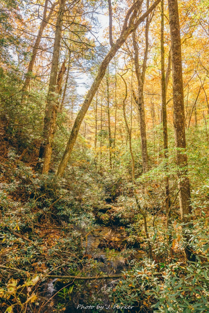
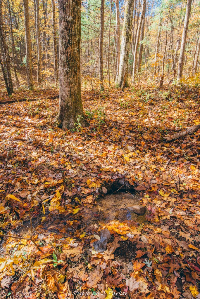
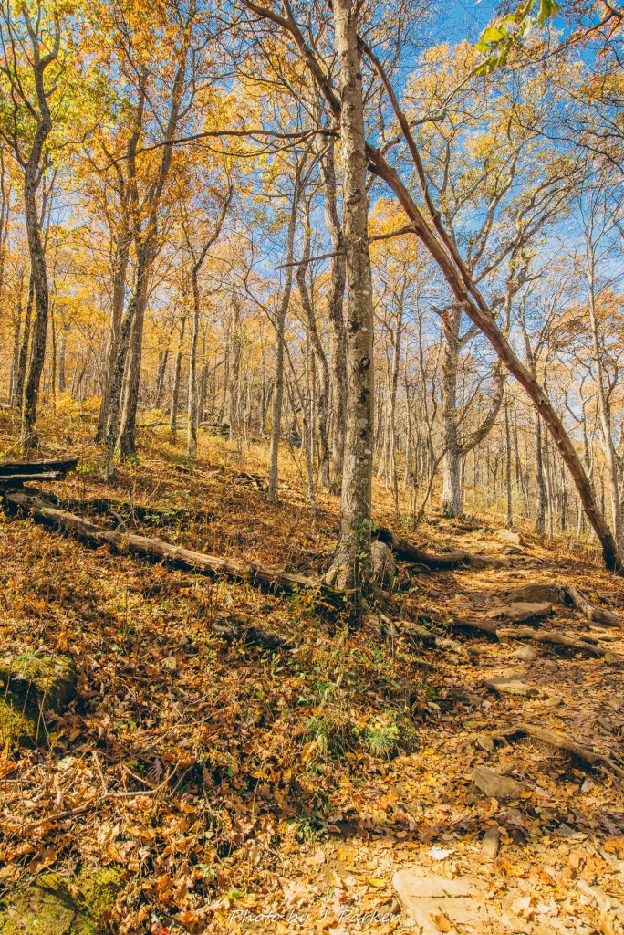
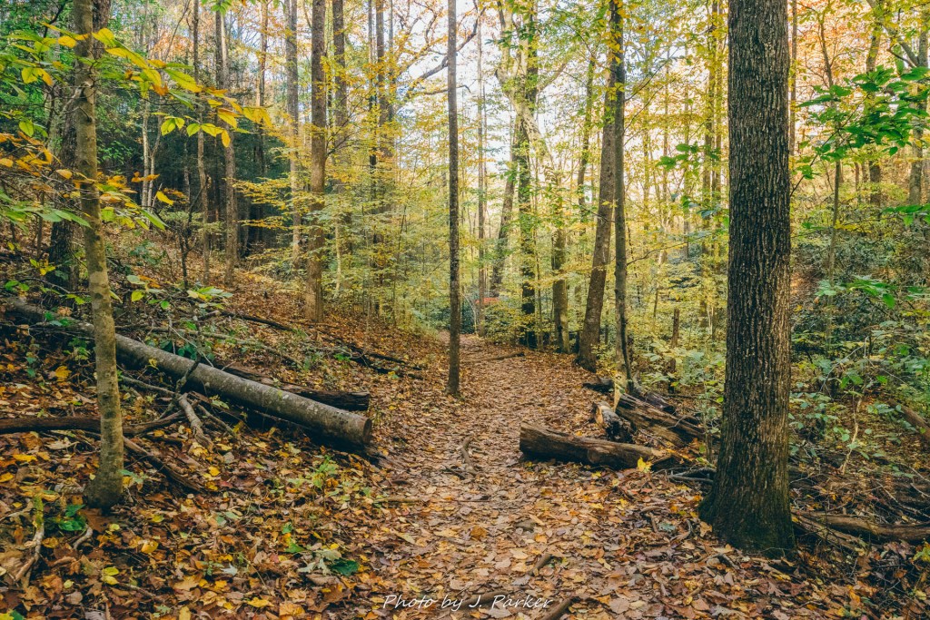
The early stage of the trail crossed several small creeks, each but a minor speed bump as one could rock hop without getting their feet wet. Other shallow creeks with some small, low-flow waterfalls ran in the distance, close enough to provide ambience to the trail while far enough away to be difficult to photograph. One particular stream along the trail piqued my interest, for it arose in a small, roughly foot-wide spring right along the trail. In my home state of Florida, springs hold our fascination like waterfalls do in mountainous areas, so I tend to take note of mountain springs when I come across them. All too frequently they are enclosed in a pipe and/or concrete encasement. As I stepped past the small, natural spring below, I thought not just of the pool and stream I could see before me, but also the path that water would take. Water from Blood Mountain quickly joins the infant Chattahoochee River, which joins with the Flint River to form the Apalachicola River. That river, which historically divided East and West Florida, is an intensely biologically diverse area with surprisingly rugged terrain that is home to some Florida natural locations I hold very dear. Blood Mountain in fact is the tallest area which ultimately drains to Florida. I imagined the mighty river this water would become part of, eventually emptying into the Gulf of Mexico 500 miles away. It signified the beginning of a journey to me, but to others, it was just a wet hole in the ground to be paid no mind as they stepped over it on their punishing course up Georgia’s sixth tallest peak.
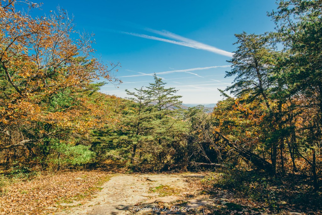
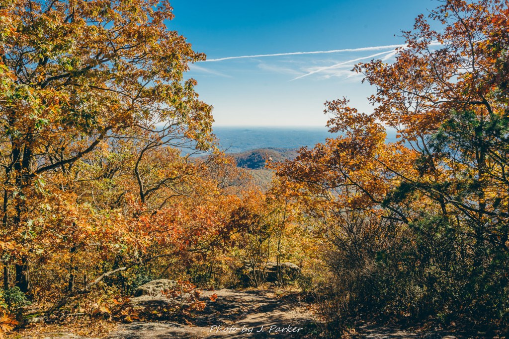
My legs paced furiously to ensure I remained ahead of the noisy horde behind me, and it wasn’t long before I reached an expanse of flat rock with just the smallest hint of a view, the first along the trail. I walked forward to take in the open air and blue sky, though any views of opposing ridgelines were obstructed by trees which still bore most of their leaves. Assessing the minimal view was a lot easier than ascertaining where I was supposed to go next. Four trails intersected here: the connector trail I had come up, the Appalachian Trail going East and West from here, and the backside of the Freeman Loop. I only saw three, and I was concerned that I would take the wrong trail, or that I may not have been in the area I thought I was. Luckily, at that point a group of hikers came down from the path that looked most promising, and they confirmed that it was the way to Blood Mountain. I started up the path still feeling a little unease, knowing that I could be taking the backside of the Freeman Loop, which technically took me to Blood Mountain but which would add 1.7 miles to my route. My concerns were finally abated when I saw a group of hikers traveling down a path to my left so narrow it was easy to miss as it joined the others along the flat rock. I was on the right path after all.
So far the trail had only contained moderate inclines and obstacles, and though my pack was heavy I was in pretty good spirits. I was on the Appalachian Trail for maybe a half mile before I rounded a corner and came face to face with a towering ridgeline, stretching for hundreds of feet high above me, the top hidden behind golden-leafed trees which obscured it from view. It’s very common to come across these ridgelines on mountain trails that usually weave between them en route to their destinations. It’s less common for a trail to ascend one, at least without taking a very indirect path. I was shocked to see shades of neon pink and green and emerging from between those golden tree tops above, which brought to my attention the faint path they were following which snaked its way back and forth over rocky outcroppings until it lead to where I was standing. That was the point at which I realized this trail just got real.
I had already tackled the endless stairs of Amicalola Falls that morning. My legs were no longer the virginal sources of power they had been at the beginning of the day. They were off to the side smoking a cigarette, contemplating the dire stuff they’d seen. And I was about to ask them to embark on another great crusade, one which didn’t have the decency to hide its impending brutality. A slew of tired, lifeless faces coming downhill confirmed the terrible nature of what I was about to experience. I had known this moment was coming. The numbers didn’t lie, doing some 800 feet of elevation at Amicalola Falls and then about 1400 at Blood Mountain was a tall order (no pun intended) after driving up from work the evening before. But to see the bulk of that 1400 feet laid out before me in plain sight was ominous. Trails are supposed to have the common courtesy of spacing out their elevation gains, or at least hiding it from view. But Blood Mountain is a honey badger. It could care less about your feelings. Happy hiking!
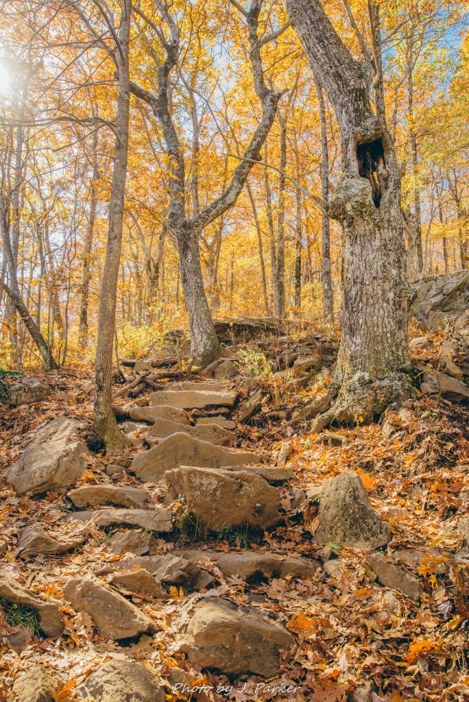
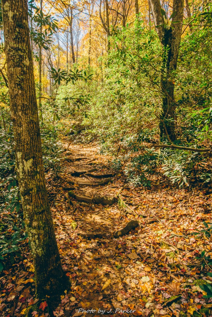
I began to work my way up, inch by laborious inch. As if the elevation gain wasn’t enough, the trail also threw in rocky, narrow pathways, forcing you to concentrate on your every step for fear of turning an ankle. The slender trail added difficulty to the task pf passing hikers coming the opposite direction, which was a frequent occurrence on this busy fall weekend. Nearly every group I passed had at least one dog, and I could only imagine their disgust at seeing somebody hiking the trail without the compulsory canine. Rarely have I made slower pace on a trail, and I cursed my all-too heavy pack as a tripod, taken along on the offchance that moving water would be found, dangled from the pack (I would discover another unintended consequence of taking my tripod in this hike the next day). I was exasperated when I reached an exceptionally rocky portion of the trail which required a great amount of communication between hikers to pass each other as we worked opposite ways along the trail (I go to the woods to avoid having to communicate with people, darnit). I gritted my teeth in anticipation of the continuing climb, and was pleasantly surprised to find the trail unexpectedly return to a relatively moderate grade. Blood Mountain had shown some mercy after all.
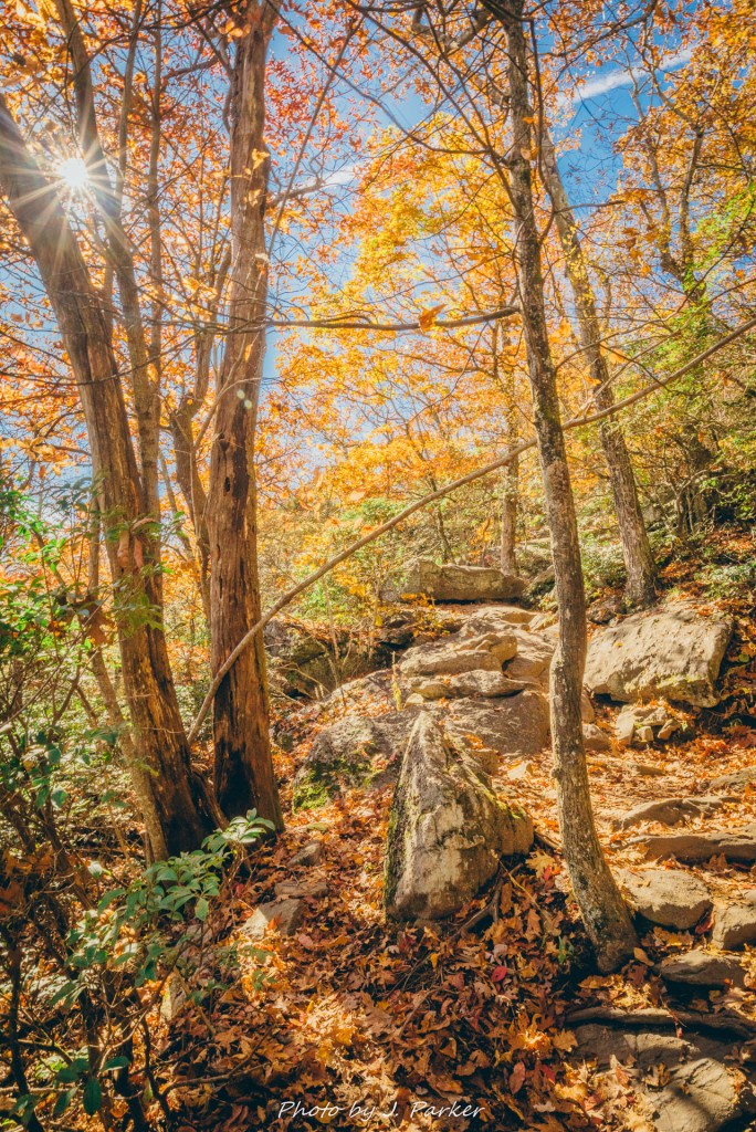
I’ve done trails with far more elevation gain overall, like Table Rock in South Carolina. I’ve done rockier trails, like the Cedar Run Trail in Shenandoah National Park. I’ve done more steep elevation gains like Chimney Tops in the Great Smoky Mountains National Park. I’ve done the Wright Creek Nature Trail, which is neither steep, long, nor rocky, but is simply a horrible trail. By the numbers, nothing at Blood Mountain comes close to some of those other hikes. But those trails were better paced, and psychologically, having that steep, rocky climb laid out in plain view before you gave that ascent up Blood Mountain a special type of torture. Amazingly, it’s a torture that an immense amount of casual and non-hikers enjoy. I was excited to put it behind me, for I knew something special had to be waiting at the top to make it worth it. That restored a little bit of spring to my step.
Not long after the ascension I reached the first wide, flat rock along the mountaintop, with a faint view towards the south through the trees. Dozens of people were spread out along the rock, no doubt enjoying satisfaction at having survived the incline as well. A young woman, naturally with dog, told me there was a good view from the rock some thirty yards below. I thanked her for the suggestion, but the rock was currently occupied, and I knew waiting for it when it still offered only partial views wasn’t worthwhile, for there were certainly better views ahead. The dog never gave a recommendation one way or another.
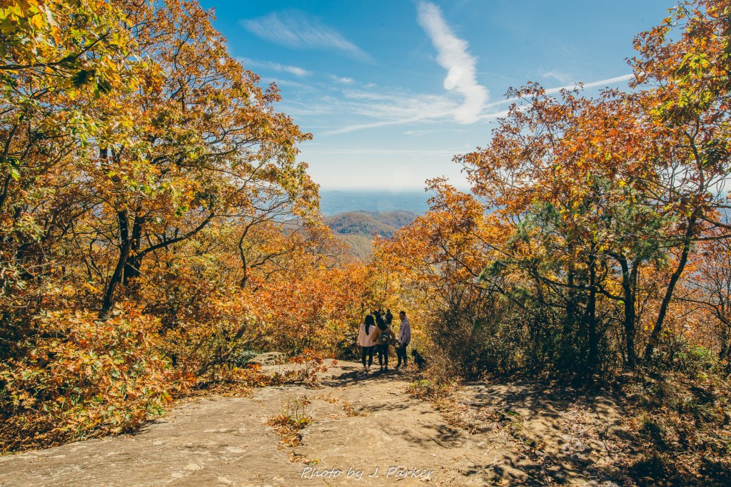
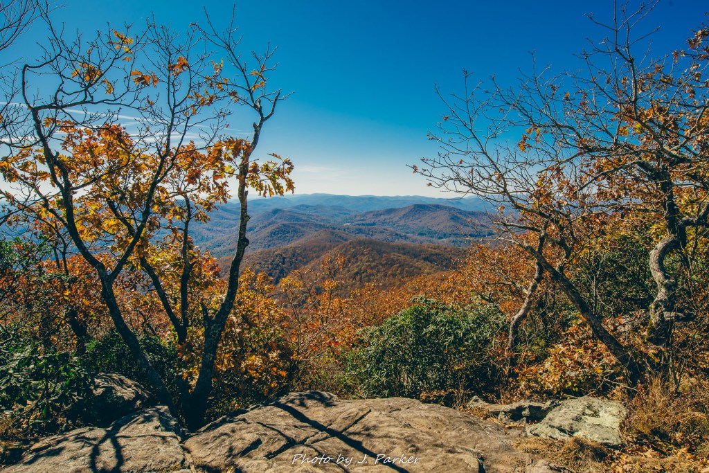
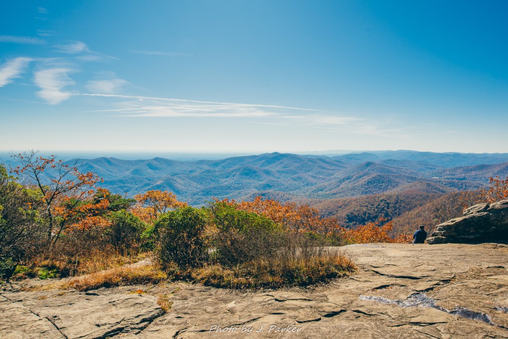
I had no reason to stop for long here, and I pushed forward in out of eagerness for what lied ahead. I anticipated having to travel another half mile or so to get to Blood Mountain’s prime vistas, and was pleasantly surprised to find another rock slab just a short distance up the trail, again with hordes of people and canines sprawled across its surface enjoying the view. And wow….what a view it was. This time there were no trees arching over the top of the rock, obstructing the view. Suddenly I couldn’t remember how heavy my pack was. I couldn’t remember how tired my legs were as they slogged up the 700 stairs of Amicalola Falls and then tackled the unrelenting ascent of Blood Mountain. I couldn’t remember politics, or the fact that the Miami Dolphins had yet to win a game this season. All I could feel was magic at having a sea of mountains and clouds stretched out before me.
There is no way to quantify what makes some mountain views good while others are great, magical experiences. Perhaps science could quantify it if they weren’t having to waste energy on proving that the Earth isn’t flat, vaccinations are good, and climate change is real, boomer. I do know that large rock slabs where one can move about freely definitely enhances the experience, but that doesn’t ensure a transcendent experience. Blood Mountain was proving amazing just in this one view, with the only detractors being the direction of the view (facing south into the sun) and the large population inhabiting the rock. Much to my surprise, the latter problem disappeared as I moved further up the mountain. I was floored to find another rock slab some twenty yards away with similar stunning views but without the crush of people. I felt almost giddy at finding a private, quiet view on a trail teeming with hundreds, if not thousands of people that day.
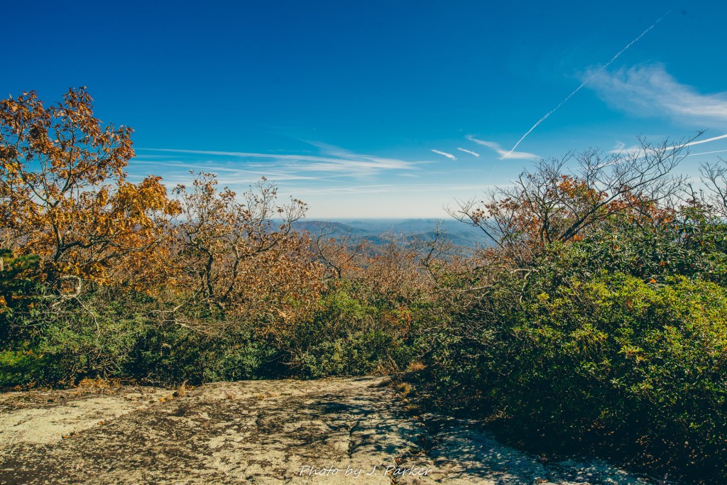
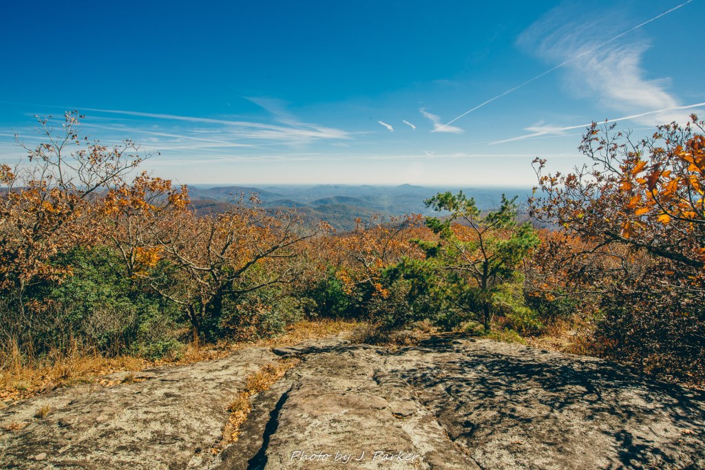
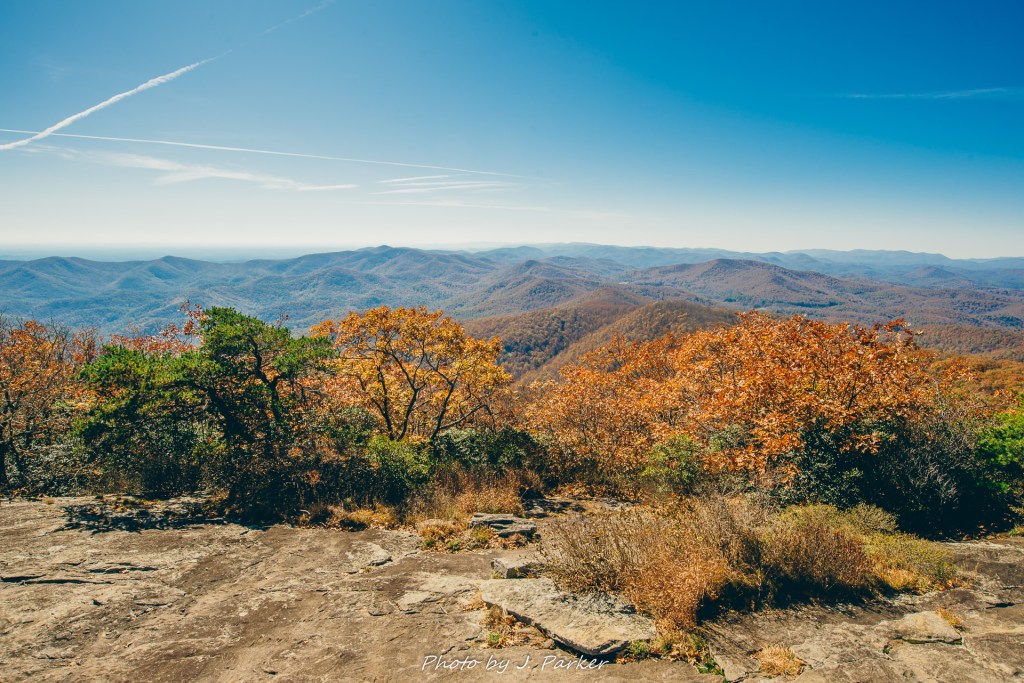
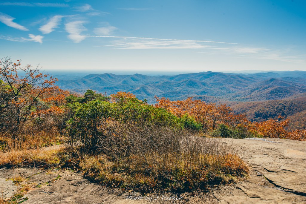
From there, I cut across the trail and went slightly uphill to get a view from the opposite side of the mountain. And this was the point at which I was really blown away. Though this rock slab was not empty, the few that were there were spread lightly across its expansive face, which stretched some 60 yards long and at least 20 yards wide, well large enough to explore without worrying about encroaching upon other people or having them inhibit your views and photographs.
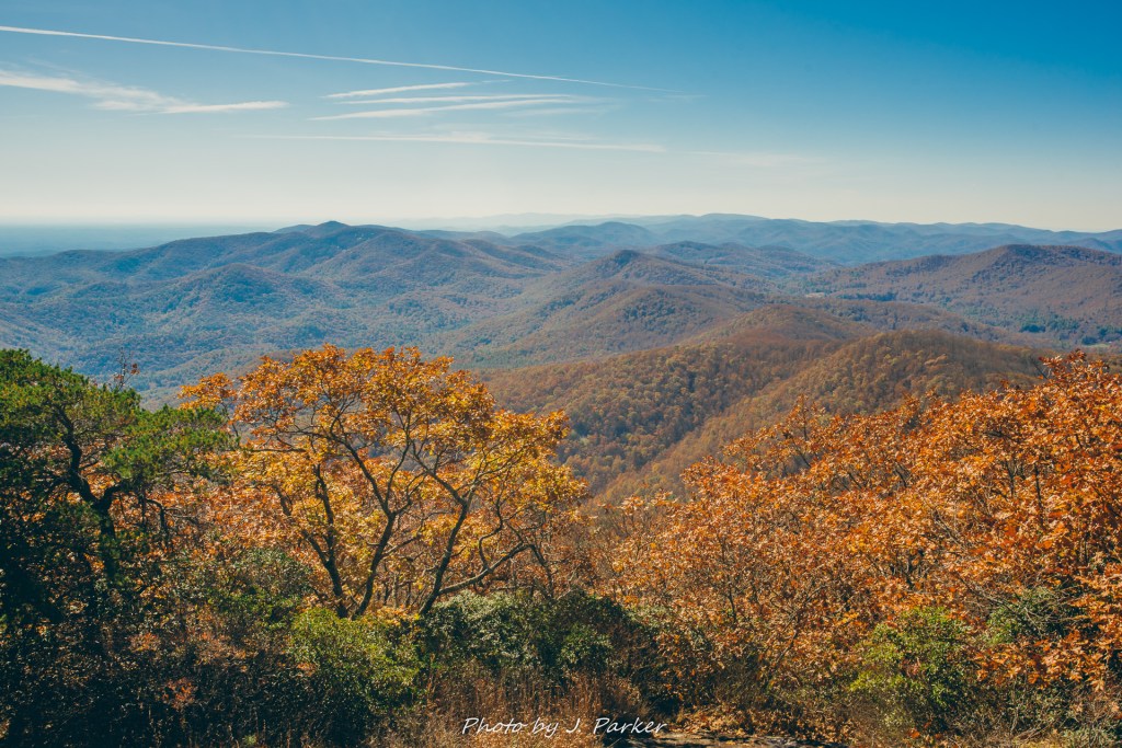
As I moved freely across the rocky expanses near Blood Mountain’s summit it became clear to me that while there was an immense amount of people visiting that day, almost all of them were stopping at the first real overlook. This left the rest of the mountain as quiet as one could ever imagine for it being one of Georgia’s premier hikes.
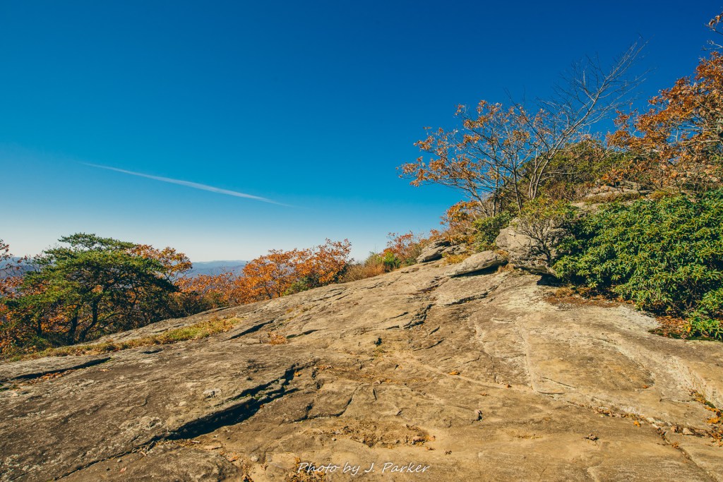
This being the Appalachian Trail, there is a large shelter once one reaches the actual summit of the mountain. This is also where the flood of views finally ends, as the Appalachian Trail immediately drops elevation into a thick forest on the back side. Beside the shelter is a large rock one can ascend for a final good view. There was a small, quiet crowd there, and I briefly talked to a middle aged couple about locations in the area, including Brasstown Bald. The gentleman was excited to share a view he had found of the aforementioned Bald, Georgia’s highest point, and he directed me to a small opening in the trees where you could see the distinctive tower for the Brasstown Bald visitor’s center. He handed me a small set of binoculars so I could see it close up. I couldn’t find it in the binoculars, but not wanting to hurt the nice gentleman’s feelings I pretended like I did and acted impressed. He explained to me that it was a great place to visit, but “you won’t have time to get there today”. Ha….we’ll see about that. I consider that a challenge.
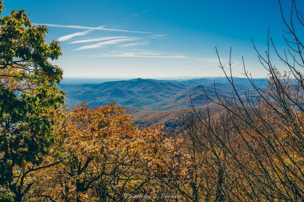
The shelter was my turnaround point, and I slowly walked back along Blood Mountain’s open rock faces, attempting to photograph every view I could in hopes of capturing some of the mountain’s magic. I’ve been places with expansive open rock faces, but none in combination with such a majestic view.
On the return trip I reached the partially obstructed rock slab which had been filled with people as I first passed. This time the rock was almost empty, and I did check out the rock which been recommended to me on my first go through. Much as I had suspected, there was nothing in this view that compared to those found closer to the summit.
“It’s as hard going down as it is going up,” say people who are wrong. There is no comparison to the energy required to go up hill, but going downhill can have its challenges and provide a strain to different parts of the body. In particular, one must concentrate on footing a lot more on the way down, especially on rocky surfaces that provide an excellent opportunity to turn one’s ankle (my wife rarely fails to take advantage of this opportunity). I had some concern about successfully navigating Blood Mountain’s extended rocky downhill, but I quickly found myself through that section of trail which had given me so much agony on the way up.

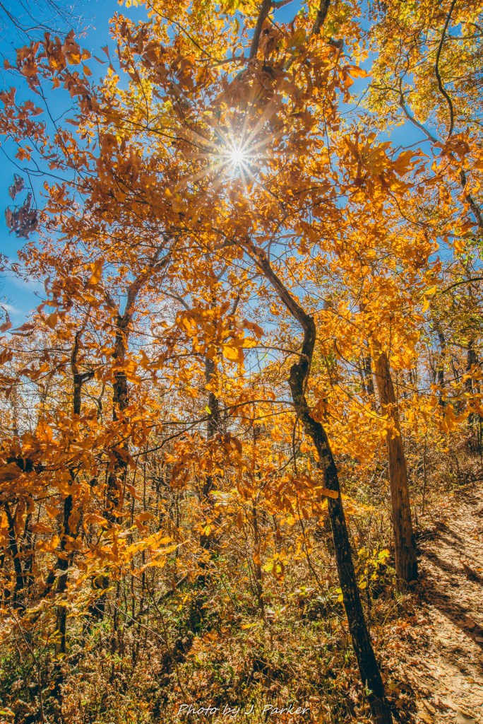
My concern on the way down was staying in front of a group of bros who always seemed to be nipping at my heels. I try to stay in front of other hikers so I can get my trail shots without people in them. Their loudness also gave my extra incentive to stay ahead. Though it wasn’t exceptionally late in the day, it was getting late enough that sunlight no longer penetrated into the valley. I was hoping to use this to get some woods shots with even light, with bonus points for fall color, but I encountered few scenes of note on my way down. For all the awesomeness of Blood Mountain, a fall color bonanza this first weekend of November it was not.
As I completed by Blood Mountain journey there was little doubt as to what my next stop would be. I generally prefer to end days taking in a nice creek or waterfall view, but there was little of note in the immediate vicinity which I hadn’t taken in on a previous trip. I instead opted to get up high once again. In fact, I’d go to the highest point of Georgia: Brasstown Bald. It had looked so spectacular in the binoculars earlier, after all.
As for Blood Mountain, while I certainly envisioned visiting creeks and waterfalls bathed in fall color on this trip, I can’t say I was disappointed that circumstances lead me here. In Georgia, a state with a lot of “good” hikes, this is a great hike. Though I’ve enjoyed other Georgia hikes like Cloudland Canyon, Tallulah Gorge, and Panther Creek Falls, Blood Mountain is easily the best hike I’ve done in the Peach State. I can understand why so many people in Georgia rate it so highly, and though some will have trouble enjoying a trail that is so filled with people, there is a reason why they all flock to this one. This mountain has a quality that must be experienced to be believed.

Makes me feel like I’m in the adventure! I love Jason Parker’s detailed, vivid writing style, and photos are amazing!
LikeLike