Georgia’s Tallest Waterfall…Maybe?
My legs screamed in protest. My lungs strained, for Floridians are neither well versed in cold air or the concept of going uphill. My pack felt heavy. It didn’t just feel heavy. It was heavy. An obsessive planner, I made sure my pack was stocked with every lens, drink, snack, and backup camera I might need on a long foray out into the wilderness. Except I wasn’t going to the wilderness this morning, I was going to one of Georgia’s busiest state parks. I guess it was comforting to know that if I wanted to down five yellow Gatorades in a row I would have ample supply. My body shuddered at every step I took up the long stairway I had foolishly and needlessly embarked on. In my head, one phrase rang out repeatedly. Cloudland Canyon. Cloudland Canyon. Cloudland Canyon.
Cloudland Canyon.
That phrase always rings in my head when my body begins reaching the point of exhaustion while hiking uphill, something for which adequate training in Florida is hard to come by (going uphill that is. We need little training at being exhausted). It was at Cloudland Canyon, another Georgia state park, where in 2015 I found myself bent over a log, trying to regain energy after having nearly passed out halfway up a neverending staircase (something that Georgia state parks seem to specialize in). Rushing up after work in the evening, staying in a hotel in north Georgia and getting minimal rest and even less nourishment before embarking on a strenuous trail in sweltering heat, it was little wonder I had trouble that day. And yet, four years later I had placed myself in similar circumstances, having again rushed up after work with little food or sleep to tackle a state park in Georgia with an end succession of stairs. But there were some key differences. This time it wasn’t sweltering, it was downright freezing. Literally. And I wasn’t going to pass out, nor even come close. Not this time. But tired I was. And it was all for a stupid view I could have driven to.
My day started out rather inauspiciously. Having intended to set out before dawn, I woke up to sunlight streaming into my hotel room, a pretty sure giveaway that I had missed dawn. I had in fact set an alarm, but I neglected to notice it was a Monday-Friday alarm. It did not ring that Saturday morning. I setout quickly to reach Amicalola Falls State Park, my first visit of a planned four day excursion to southern Appalachia. Amicalola Falls is one of those places that as a nature lover you’re supposed to visit, for it has something like the tallest waterfall in Georgia, the tallest east of the Mississippii, or maybe neither of those things, for nobody quite agrees on how these things are calculated. Let’s just agree that it is tall, handsome, its grandmother is proud of it, and move on. As I sped along the backroads with my Rav4 named Garth set to sport mode I imagined the park filling with sunlight that I had intended to beat by arriving much earlier than I now would.
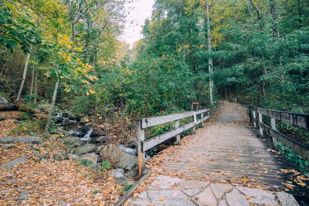
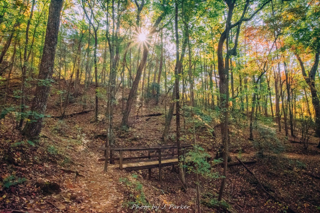
I pulled into the parking area and immediately grabbed my overstuffed camera bag to set off on the Creek Trail, a trail I suspect was named by the Florida State Park system as it scarcely follows the creek. But I can’t complain, for I knew from my research that the trail didn’t see the creek very much. I was taking it because it provided the easiest hike to the base of the falls, which I believed would be more fulfilling than parking right on top of the falls.
It was a cold morning, literally freezing in fact, and my lungs got heavy from the frigid air every time I worked my way uphill, which the creek trail did at a moderate pace. It seemed to be no time at all before I reached the end of the creek trail and my first point of interest, the reflecting pool poised to highlight the beauty of the falls.
Though I was in a hurry to reach an up close view of the falls before sunlight cast uneven light on its flow, I paused for a moment to observe the view from the reflecting pool. The view was lovely, but I did harbor some disappointment that fall colors, while present, weren’t more prevalent. I hadn’t been certain I would visit Amicalola Falls, at least not on this trip, but opted to start my adventuring here after seeing pictures which implied it had far more fall color than was actually present in real life.
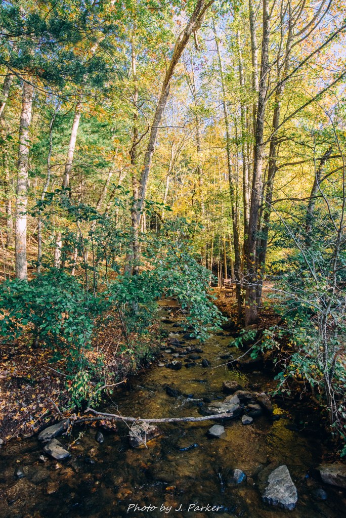
From the reflecting pool I hooked up with the Base-of-the-Falls trail, where I would start the approach to the falls itself while also obtaining better views of the tumbling creek in the process.
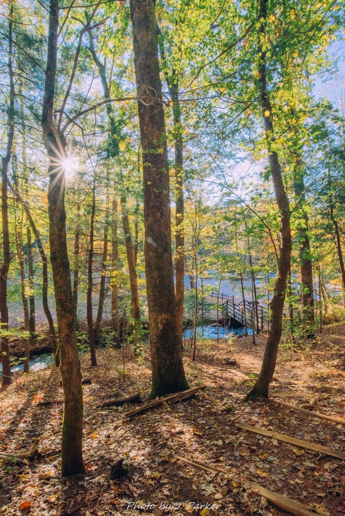
The Base-of-the-Falls Trail had a steady, moderate incline, but the increasing scenery provided ample distraction to the point where I barely noticed I was going uphill. I wasn’t on the trail long before I found a spot to setup a tripod shot, my first of the trip. I feel like its important to get that first “real” shot on any trip in order to establish some positive momentum. But even though I got a nice shot, I wasn’t feeling much momentum. I had been hoping to find more color in the trees, and maybe a cloud or two to dilute the oppressively shining sun, neither of which I had. Undiluted sunlight casts uneven light on waterfalls and woods scenes, making photography in those areas all but impossible while also some of the ambience and life from the scenes in person as well.
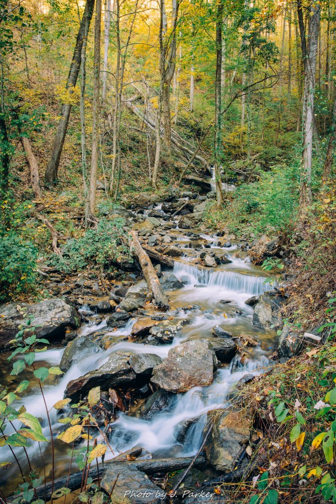
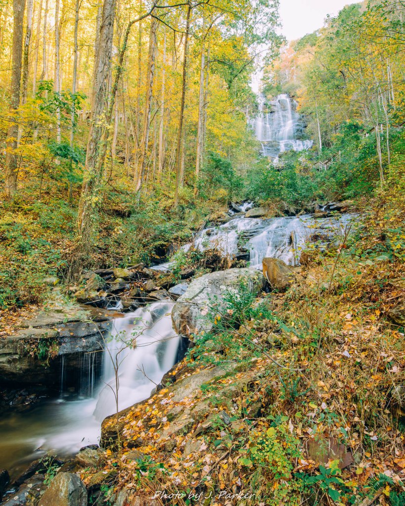
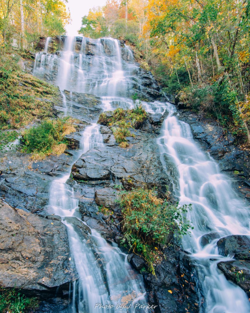
The current trail section was much more interesting than the creek trail in that it provided nice interaction with the creek in addition to sporadic views of the falls themselves. It wasn’t long before a reached my first unobstructed view of the falls, and miraculously the sun hadn’t yet blasted the fall with uneven light. Happy with my temporary good fortune, I was able to setup a tripod shot with an encompassing view of the falls, something I wasn’t sure was even possible to obtain.
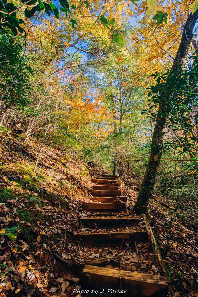
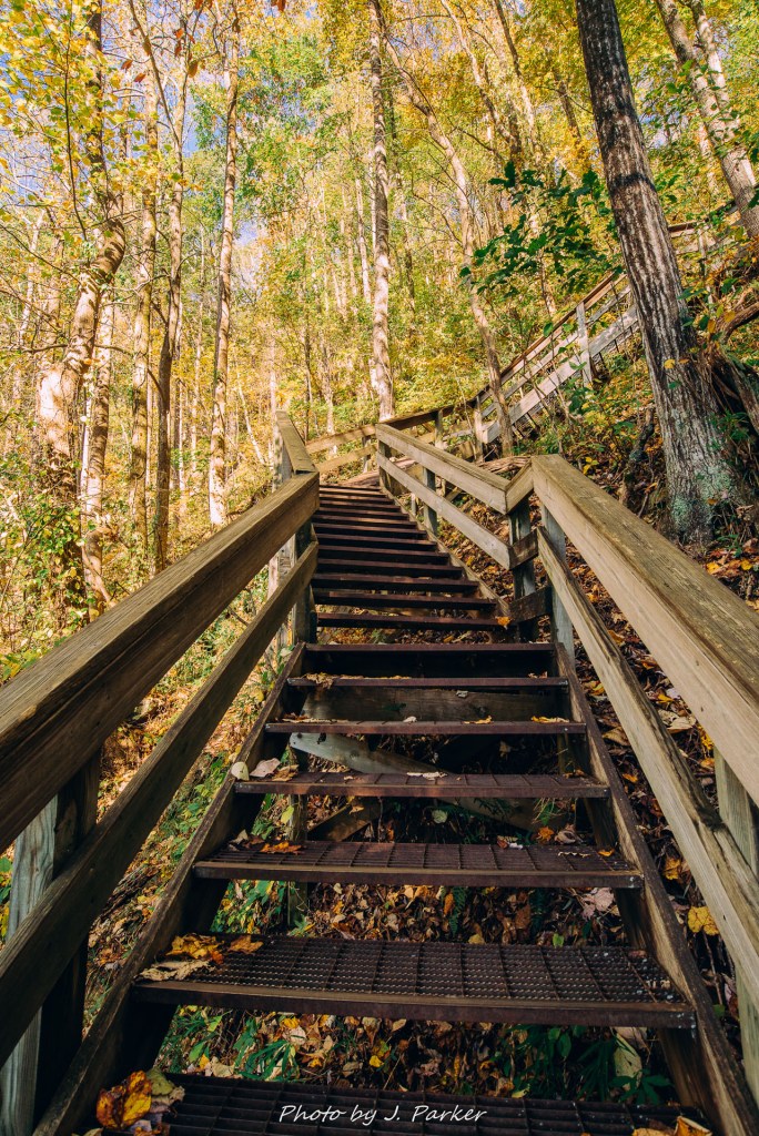
I packed up my tripod and advanced further along the trail, where I shortly reached a stairway with a sign that warned of a strenuous number of steps ahead. Amicalola Falls is infamous for the strain of its stairs, but I almost laughed when I saw the number of stairs listed at 125. This was far less than the aforementioned Cloudland Canyon, which has 600 stairs, and Tallulah Gorge, another Georgia state park which I had conquered in 2017 despite having been largely immobile for five months prior due to a hip injury. I think I take almost 125 stairs just getting to my desk at work. I paused a few more times to get some shots of the boardwalk with the falls in the background, a type of shot which I have an inexplicable fondness for.
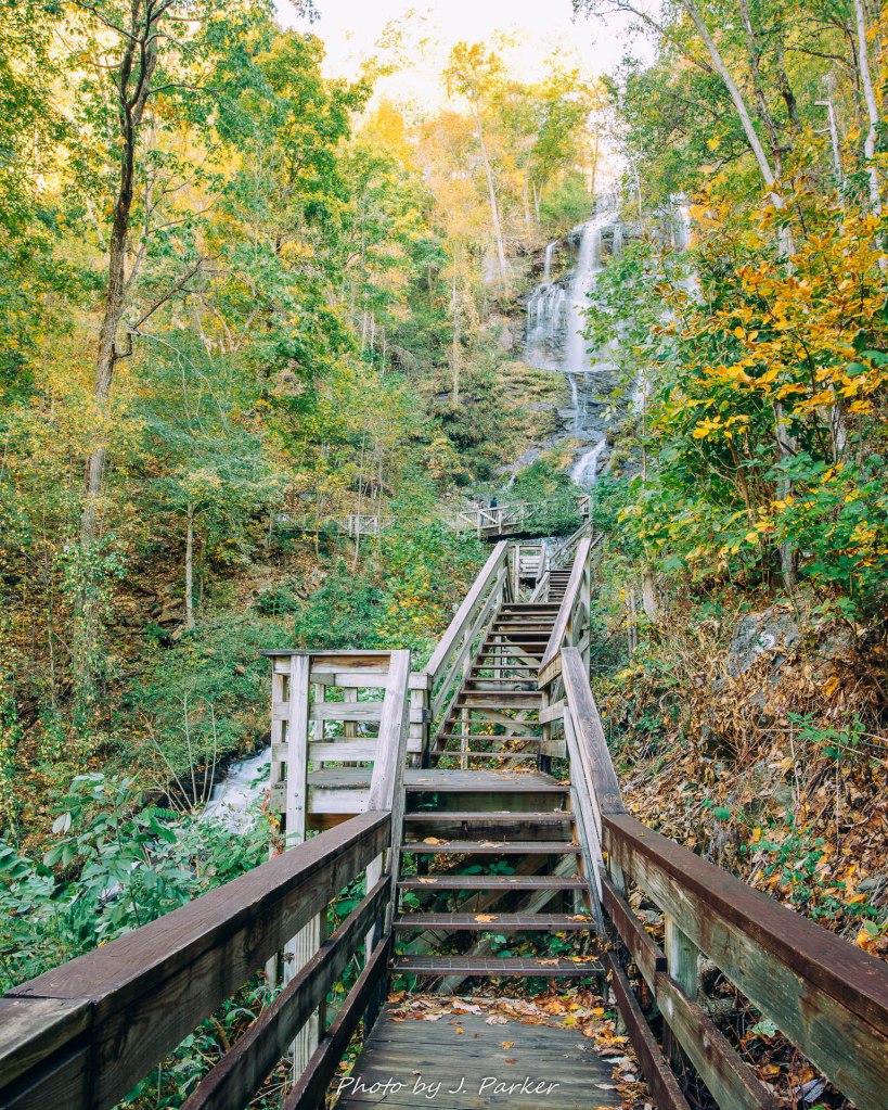
The 125 stairs lead me to the primary view of the falls as the boardwalk crosses just in front of the main cascade. Not only is this the prime view, I would argue that it, along with the scenes from the approach trail I had just taken, provide the only essential views in the park. From here, one gets an up close view of the majestically tall main cascade, one that’s very invigorating in person somewhat less so for pictures, as its impossible the cascade in its entirety from this spot. Nevertheless, its the most common area to photograph the falls from (though many people do great “fine art” shots of portions of waterfalls, I myself don’t really enjoy photographing that way. I like to capture the place as a whole). At this point, the park was starting to get a lot more busy with people of all ages, and it was no sure bet I’d be able to get a workable tripod shot from here. Still, I hoped for the best as I setup my tripod on metal grating which scarcely allowed purchase for its legs and reverberated with every step taken. I held my breath as I continuously pressed the shutter on my camera, hoping to get just one long exposure out of the bunch that wasn’t ruined by footsteps.
My main purpose in visiting Amicalola Falls was to get a view and a few time exposures of these famed falls, and I had accomplished that. I could have quit while I was ahead, for I wasn’t prepared to hike the 9 mile approach trail to the start of the Appalachian Trail at Springer Mountain, despite the fact that my overladen camera bag would suggest otherwise. I knew from experience that views from the top of a waterfall are seldom satisfactory to me, for I much prefer a view from the bottom where you see the falls in their entirely and appreciate the movement of water as it flows to you. There wasn’t much to be gained by continuing to the top of the falls except the satisfaction of curiosity and knowing for a fact that you weren’t missing out on anything before you left the park. Satisfying that curiosity may have been sensible on its own, but that could have been easily addressed by simply driving to the top of the falls.
Still unsure of myself, I asked a couple coming down the stairs if the view from the top was really worth it. Not only did they say it was, they said it was the best part of the park. My instinct, crafted by visits to dozens of waterfalls, told me otherwise, but I determined to trudge onward, right past the sign warning of 425 steps ahead. 425 was a number far more concerning than what I had seen earlier. By the end of my journey, I would feel every single last one of those 425 steps, plus the 125 I had already taken.
I must confess that I haven’t been in prime hiking shape since the summer, when my wife and I trained for months to be ready for over a week of hiking centered around the Smoky Mountains. Physically prepared we were, but we were less prepared for the summer thunderstorms that greeted us practically every day of our trip, and robbed us of pleasant afternoons spent around Smoky Mountain streams and old growth forest. Hikes that I had been anticipating for years were marred by deluges, and we had to call off our planned hike to Mt. Leconte, pretty much the signature hike of the Smokies, due to severe storms that downed trees and peppered the mountains with high winds and buckets of rain. Our troubles peaked on the last day of our trip, when another severe storm struck as we were on the far end of a 9 mile round trip hike. What started as moderately heavy rain ended in a storm which pelted our ridgeline with bolts of lightning, one of which struck a group of people less than a mile away. I was pissed, and I got lazy out of protest, because…take that nature. I’m fat now. Somehow that makes sense.
I was only partway up the 425 steps before I realized that I had made a mistake, that the reward of being at the top of the waterfall wasn’t worth the energy I would expend to get there. But hiking is its own type of crusade. Nobody wants to end a war before its won because then everyone will have died in vain. No, the more tired you get, the more you stubbornly insist on making that fatigue mean something.
Cloudland Canyon. Cloudland Canyon.
Though it’s not my usual practice I stopped several times on the way up to regain energy in my exhausted legs and provide some respite to my cold-air blasted lungs. There was a point at which I could have only had some twenty stairs to go, with some flat stretches mixed in, and I still couldn’t fathom tackling them without taking a moment’s pause to recharge. I had brief conversations with others who were simultaneously making the uphill trek, many of them locals, or at least more frequent visitors to the area, who all had the similar view that the fall colors were very disappointing. They confirmed what my untrained eyes had already observed.
Cloudland Canyon. Cloudland Canyon.
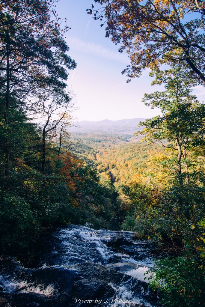
I staggered up the last step and walked over to the bridge spanning the the upper falls, hoping to get the view that I had been told was the best part. An…what a stupid view it was. You could scarcely see the waterfall, for the creek hit a near vertical shelf some twenty feet from the walkway and disappeared out of view. Looking southward towards the Georgia foothills (and into the sun) revealed a single uninspiring valley and ridgeline. This is what I had exhausted myself for; a mountain view uninspiring even to a Floridian, and one in which I could have driven to.
I would have stormed off in anger right then to put this embarrassment behind me and move on, but I wasn’t able to.
I was tired.
While scores of happy people who had no doubt driven to the falls and apparently not seen a fraction of the mountain views I’ve seen gleefully looked out on the view, foolishly enjoying this spectacle I had deemed subpar, I sat myself on the pavement to regain some energy. At least that allowed me more time to enjoy the view?
Unlike Cloudland Canyon I was never in any danger of passing out. A crusader I am, but I always could have turned back had I really started to become overly fatigued. Loss of consciousness wasn’t a problem, but loss of energy was. I had just spent my legs on an exhausting set of stairs which offered no payoff. This was my very first stop of an action-filled four days, and I had already forced upon my legs a sense of fatigue from which they wouldn’t have adequate time, nourishment, or sleep to recover from. I was going to feel the steps of Amicalola Falls State Park in every other stop of the trip.
Though this was a low point in terms of happiness, it was the technical high point of the trail. All that was left for me was to work my way downhill, which I would do on a different trail than I had used before. This trail, part of the Appalachian Approach Trail, did offer one more open view before leaving the high ground. Except for a short, switchback-filled stretch right before reaching the parking area again, little of this trail was single-track, and there was very little of note on to be found on its path, especially since the sun was out in full force.
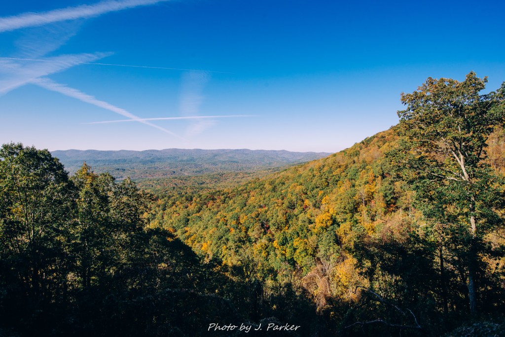
Finishing my explorations at Amicalola Falls brought to the forefront my need to make a decision on where I would visit next Several things had become clear. For one, high caliber fall color wasn’t going to be found in the immediate area. It wasn’t that the area was before or after peak as much as it was a weird combination of some trees having lost the bulk of their leaves while others had still yet to turn. At any rate I knew I was unlikely to find something worth visiting for the fall color alone in this general area. The unblemished sunlight, so beautiful when one is in an open space to enjoy it, would make any kind of water or woods-based hike disappointing.
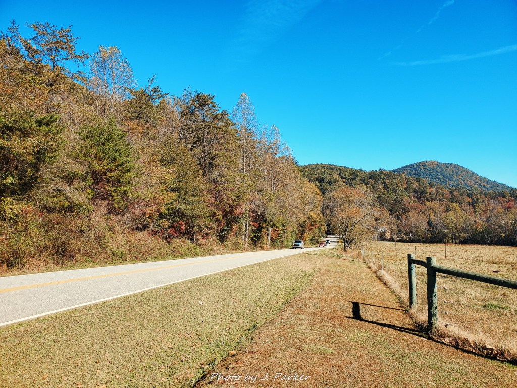
With those things in mid, I set off on more country roads to find the trailhead for Blood Mountain, one of Georgia’s most popular hikes. I stopped several times to take snaphots of the countryside, for pastoral scenes of rolling hills aren’t something we in Florida get to see much of. I even came across the unexpected treat of finding a small local restaurant tucked away on US 19, where I enjoyed excellent trout and even better service (I had told them I was in a hurry). Though I rarely stop during the day for refreshment when the days are shorter in the cold months, it was good that I did this time, for after the energy I wasted at Amicalola Falls I would need every ounce for the challenging hike up Blood Mountain.
