I eased off my break and attempted to get to my gas pedal as quick as possible. I was on an incline and had to be sure I didn’t roll back too far, lest I roll into the vehicle behind me. I hoped that they noted the Florida license plate on my vehicle and allocated me a little extra space than they would usually provide. I needed it. I wasn’t sure how people managed this in the mountains. Do they keep one foot on the break and hit the gas with the other foot? I wasn’t sure. But I would have ample time to try out any method I could conceive of, for I was stuck in traffic roughly half a mile long leading up to Brasstown Bald, Georgia’s highest point. (I guess that would mean I was also stuck in Georgia’s highest traffic jam, for whatever that’s worth).
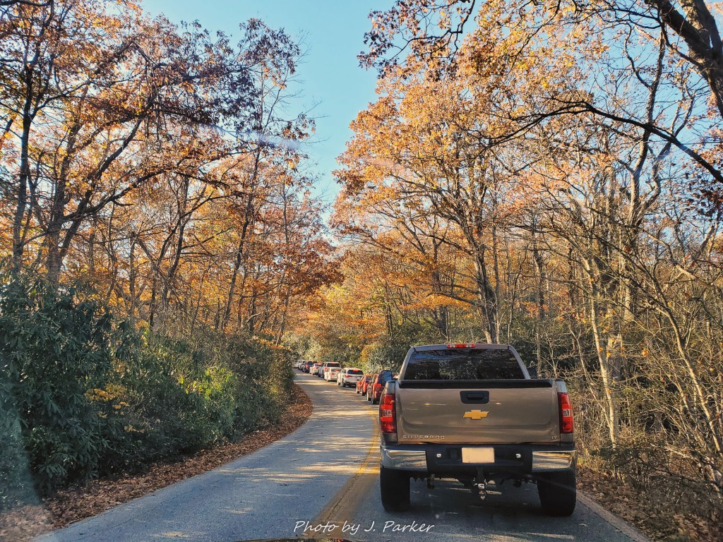
There were some positives. The road between Blood Mountain, my previous stop, and Brasstown Bald offered increasing levels of fall-color-infused beauty, right at the point where I was starting to wonder if I would find a real fall at all this year. There was a fall to be enjoyed, I just had to get out of this stupid traffic jam. I could only imagine what was happening at the top as I saw several vehicles coming down every minute. Were those vehicles turned away for lack of parking, never having gotten to enjoy the bald? Was every vehicle coming down leaving a solitary parking space for the next vehicle in line to fill? I had to speculate as I slowly waited my turn in line, inching forward ten feet at a time. I didn’t have much of an alternative. If I had been extremely determined to leave I may have been able to get my vehicle turned around on the narrow, wooded road with no shoulders. But I wasn’t extremely determined, for there wasn’t much else I could reach before dark anyway.
As a child, before the advent of internet-based maps and routing services, I used to be obsessed with road atlases. I loved tracing the path of major highways from state to state, and I would imagine trips between major cities and follow the highways as they marked their way past urban areas and natural points of interest. I tried to envision what the views from the road would look like along the way. I also liked to look at each state’s page, which included their capital city, largest city, and their highest point. Georgia was on the way to just about anywhere north of Florida, and thus I was quite familiar with Georgia’s information. It’s highest point was Brasstown Bald.
“Brasstown Bald! What a stupid name!” thought my juvenile brain. I had no idea what a mountain bald was. Many people still don’t.
Here I was, some 25 years after I got my first road atlas, about to visit that stupidly named place for the first time. Assuming I could ever get through this traffic jam straight out of a disaster movie.
Ten feet forward….ten feet forward…..
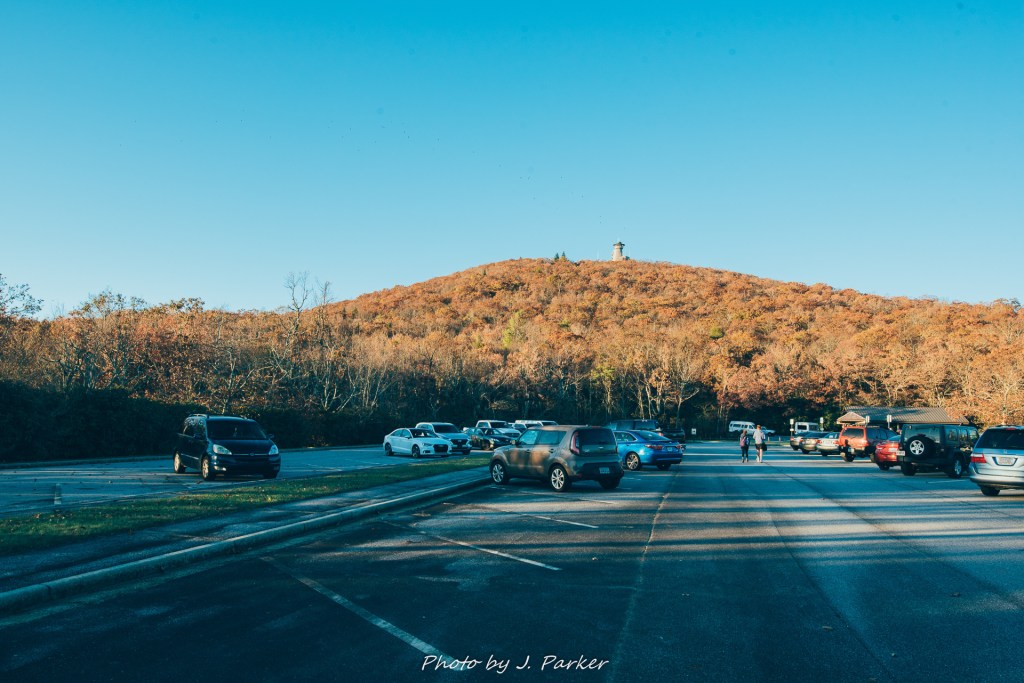
I finally had a view of the parking area and was able to clearly see the source of the traffic problem, which was…..nothing. There was absolutely no reason for there to have been a traffic jam, certainly not one stretching half a mile back from the parking area, which I could now see was well stocked with dozens of empty parking spaces. FML. The only explanation I could see was that people were confused by the empty guard shack at the top. Each vehicle in succession seemed to stop and wait for a non-existent attendant, in apparent disbelief that there was nobody available to take their money. I lost half an hour of my life to a traffic jam that had no reason to even exist. Am I sure that I actually left Florida?
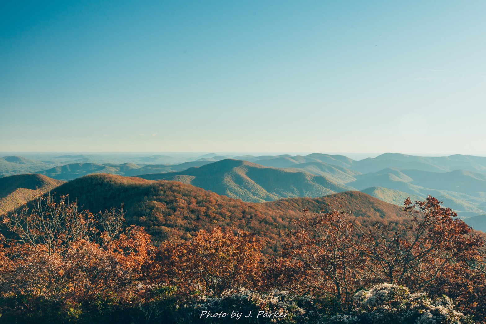
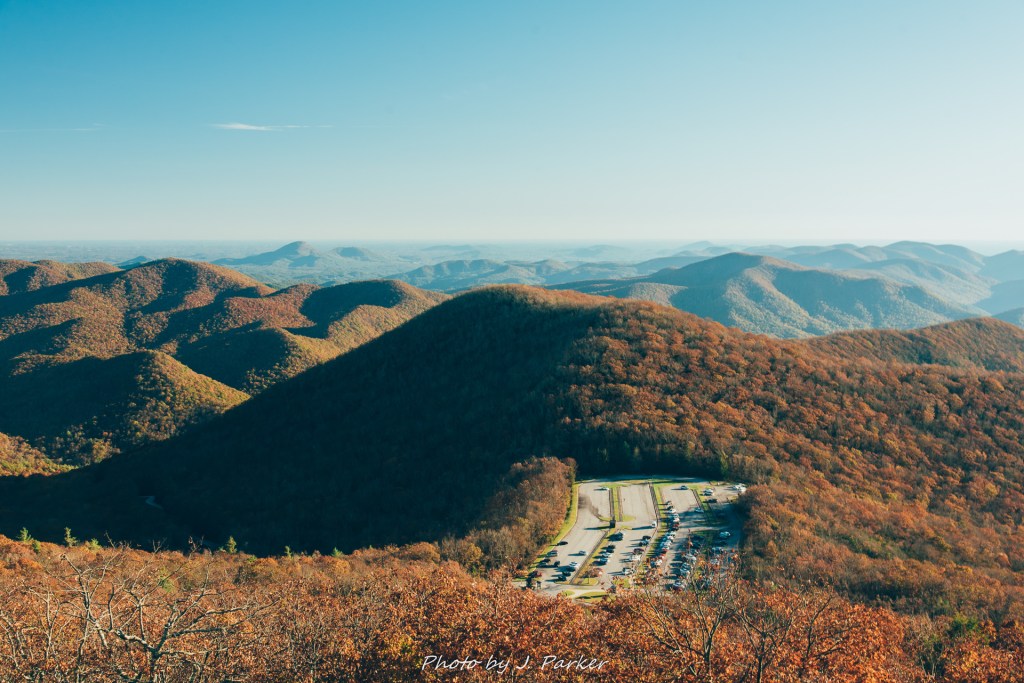
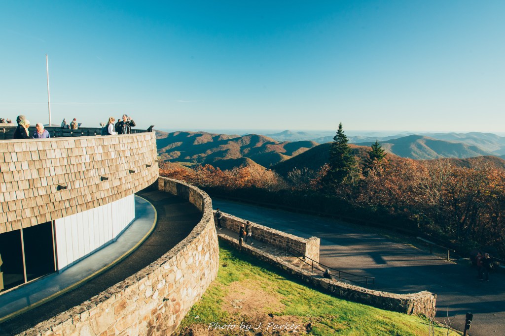
Brasstown Bald is definitely a tourist spot. To an avid hiker like myself, used to accessing spots in a more organic way, places like Brasstown Bald just don’t really register on our list of natural spots. But with that said, it’s something that someone who makes occasional visits to north Georgia should really take in at some point. The views ARE fantastic, and there is a joy to gaining perspective on all the various peaks that can be found in the area. It allows you to appreciate those legitimate hikes and visits you’ve taken even more.
There is a bus that shuttles visitors the roughly half mile from the (half-empty) parking area to the center at the top, but that bus had stopped running by the time I got there. I probably wouldn’t have taken it anyway. The ironic thing about places like Brasstown Bald or Clingman’s Dome in the Smokies is that, illegitimate as they may seem, they often contain an uphill climb whose strain is no doubt legitimate. Steep, paved pathways lack the visual spectacle that a natural pathway would provide, while a hard surface lessens the chance of a misstep but does nothing to ease the strain of going uphill. In fact, they are usually paved because they are exceptionally steep, and the powers that be want to make these locations accessible to those who wouldn’t be able to navigate a steep, natural-surfaced pathway. The journey is often part of the fun, but not at these observation tower-type attractions, where you just want to get the walk over with and get to the goods.
I was but one of many taking the switchbacking pathway up to the top, and there was an odd feeling sharing a communal feeling of exhaustion with the masses as we all worked uphill….slowly. I felt smug, for at least I had the alibi that I had done the stairs at Amicalola State Park and the journey up Blood Mountain already that day. It’s only natural that I would be tired. What excuse did these peasants around me have? What fools they were with their tiredness. Partway up a group of young women started walking backwards to switch the strain on their bodies. Such is life on those paved pathways. You just wouldn’t understand unless you’d been there.
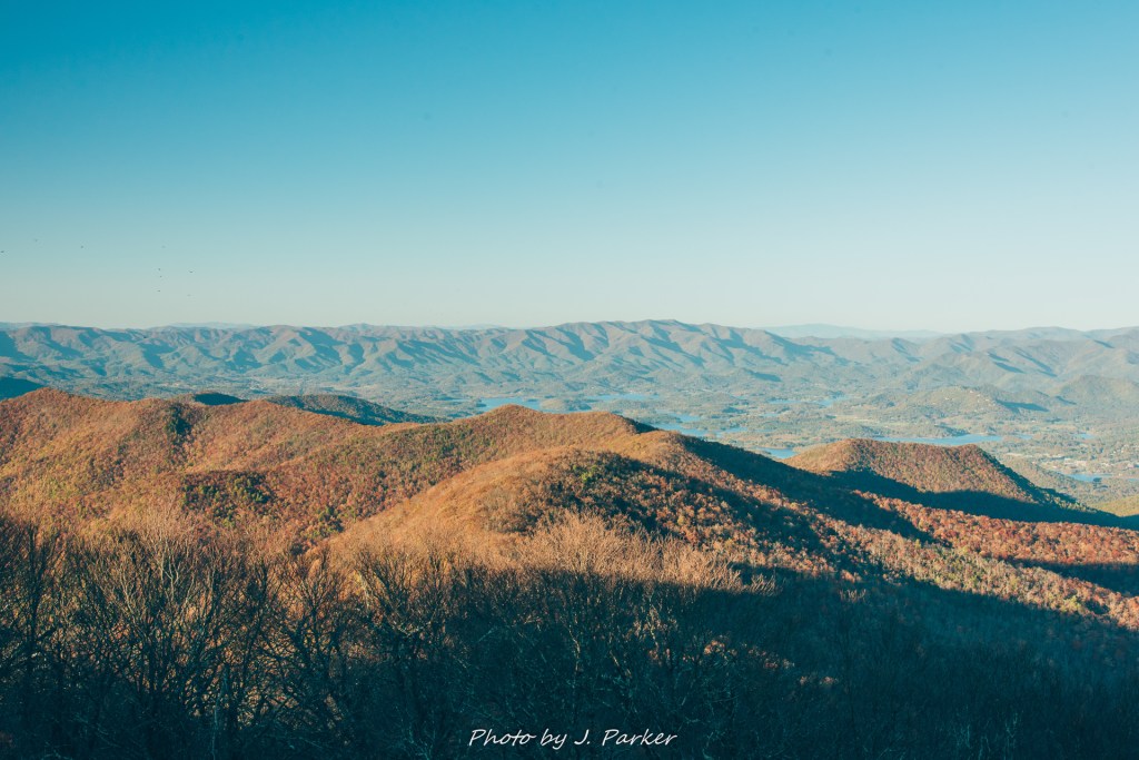
While its natural to expect the highest point in any state to have excellent views, I’ve found that highest view doesn’t always equal best view. I could think back to recent experience at Shenandoah National Park, where a trip up Hawksbill Mountain, that park’s highest point, offered inferior and, by comparison, uninspiring views to those of other places in the park like Mary’s Rock, or even just Skyline Drive. Luckily, the views at Brasstown Bald not only met expectations, they exceeded them. In every direction they were absolutely breathtaking. Quality of a mountain view is as much about the ridgelines that fill that view than just the height itself. Brasstown Bald has the benefit of interesting ridgelines and peaks in every direction. It was fun picking out the location of previous hikes I’ve done in the area, like Cowrock Mountain from last September or Blood Mountain from several hours earlier. I could even see the Smoky Mountains far in the distance, several ridgelines back from my current location. Everything was very easy to locate thanks to the informational signs they had for every direction.
Being that this was a very simple, straightfoward place to visit, there isn’t much of a story to tell beyond the traffic on the way there. Instead, the pictures will have to tell the story.
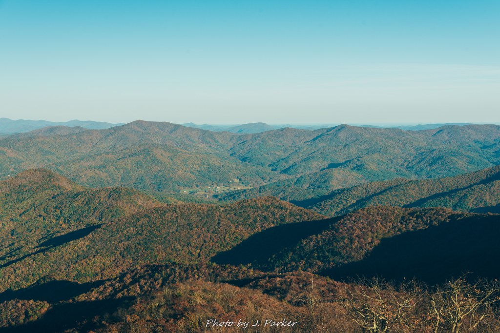
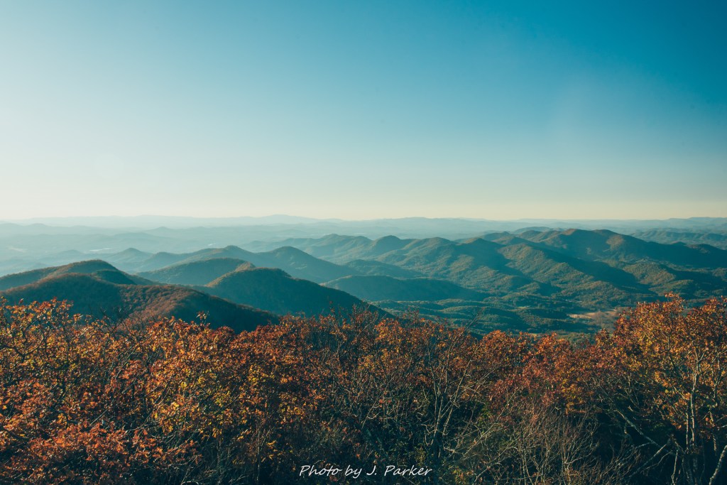

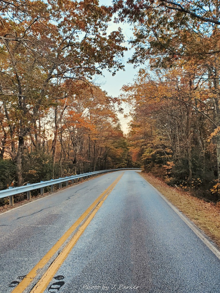
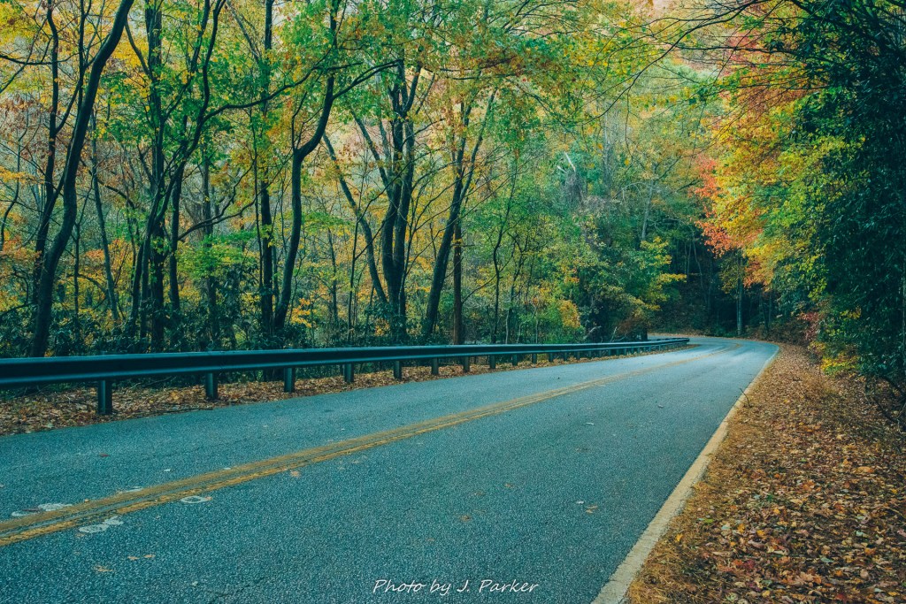
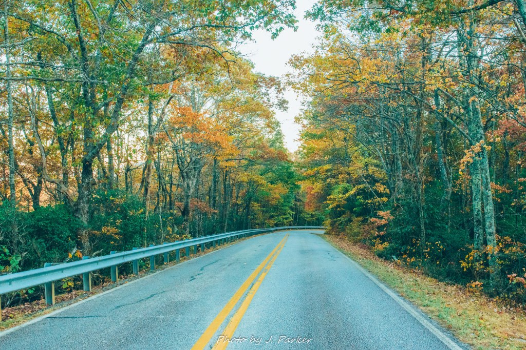
Brasstown Bald was my last stop of the day. There wasn’t going to be enough time to get anywhere meaningful before dark and I was yearning to get to my hotel about an hour away in Blue Ridge, where I could get more substantial rest and replenishment than my frantic drive up after work allowed me. Before I left the park, however, I made a point to get a few shots of the beautiful steep and winding road up to the bald, as it had the best color I had yet found during my trip.