
North Carolina is a long state (500 miles long to be exact). I’ve been blessed to explore many different wonderful parts of it. Linville Gorge, the Great Smoky Mountains, the Black Mountains, the Roan Highlands. When I think of the best places I’ve been able to visit in this country, many of my favorites are in this state. It’s wild to think that a state that reaches the Atlantic shore also contains the mysterious and dramatic peak of Mt. Mitchell, the tallest in the eastern United States. On this cold fall day I was a long way from the Black Mountains, and ever further from the coast (which I’ve yet to explore). In fact, I was in about the farthest corner of the Tar Heel State which you could find.
The extreme west portion of North Carolina is a rather isolated place. Owing to great ridge lines, lakes like Fontana Lake and Hiawassee Lake, and the significant rise Great Smokies, few roads of any significance travel north-south here. It’s the type of area that doesn’t seem to be on the way to many places except for a handful of east-west travelers. It was curiosity about dipping my toes into this region of Carolina, rather than the allure of any actual location there, that drove me to explore the Panther Top Tower in the Nantahala National Forest. Now, it does bear mentioning that I really wasn’t all that far from the corner of Tennessee that I would spend the rest of this day in, but I do have an affinity for doing things in different states and incorporating them into my trip plans. But I do feel like the part of Tennessee that lies across the border doesn’t have the same isolation I at least perceived. Places like the Ocoee River and Chihowee Recreation area draw in people from nearby urban centers like Chattanooga. There’s less reason for them to go further east into this area across the state line.
Panther Top wasn’t an exceptionally exciting visit, but with a cloudless sky in an area where I wasn’t well versed in many open vista hikes, there weren’t any exceptionally exciting visits available, at least until the sun started to get at a manageable angle. Panther Top allowed me to get up above this area and get a bird’s eye view of the surrounding countryside, something I did have some curiosity about as the overall contours of this area are something I haven’t been able to observe. This knob is only 2,293 feet high, which is rather miniscule in comparison to places such as Brasstown Bald and the crest of the Smokies, areas which in the grand scheme of things aren’t hugely far away. But the peak here is prominent in comparison to the land around it, and a lookout tower, the westernmost in the state, enhances that even further.
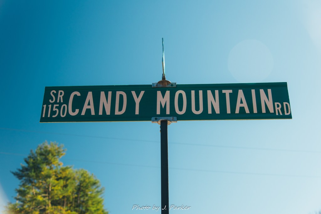
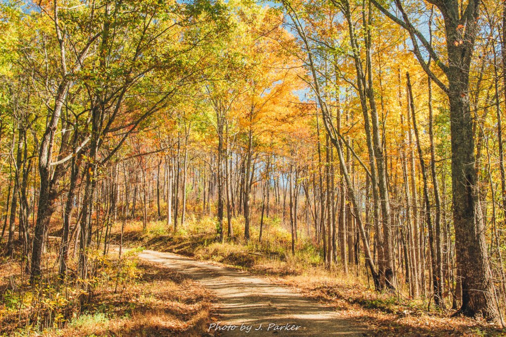
I drove here from troublesome Turtletown Falls in Tennessee. It was a rather pleasant drive down quintessential country roads with subtle (though not overwhelming) shades of fall color. It appeared almost as if a painting, and I lament that as a still photographer I don’t always have the ability to stop on the road and capture a frame which encapsulates the feeling of a quaint country journey. The one time I did stop wasn’t to capture the beauty of the road at all, but rather just to take a picture of a sign for “Candy Mountain Rd.”, which reminded me of a viral video from my last year of college, one that was actually kind of annoying to watch but which still sticks in my brain almost a dozen years later.
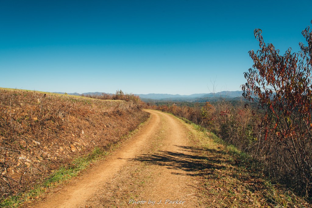
Pretty soon I was off the paved roads and onto dirt forest service roads. I cursed myself a little bit for not double checking the quality of the roads before planning this stop, as I had visions of getting stuck in a difficult situation as I had been several times before on roads that were beyond my difficult level. For the most part my fears were unfounded. Thought he road did get somewhat steep, narrow, and winding, it was actually rather fun to navigate, and I could not have gone more than two miles or so on dirt before reaching what I had labeled as the trailhead. Parking was somewhat minimal but that wasn’t much of issue, for there was nobody parked before I arrived. I was somewhat surprised to see the gate on the forest road which lead to the tower was open, though there were clear signs stating that there was no parking past that point. At any rate, the small road which served as the trail for the tower was much more steep and narrow than I was comfortable driving.
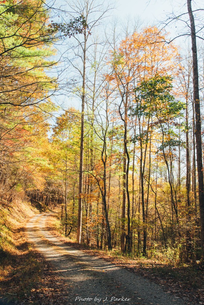
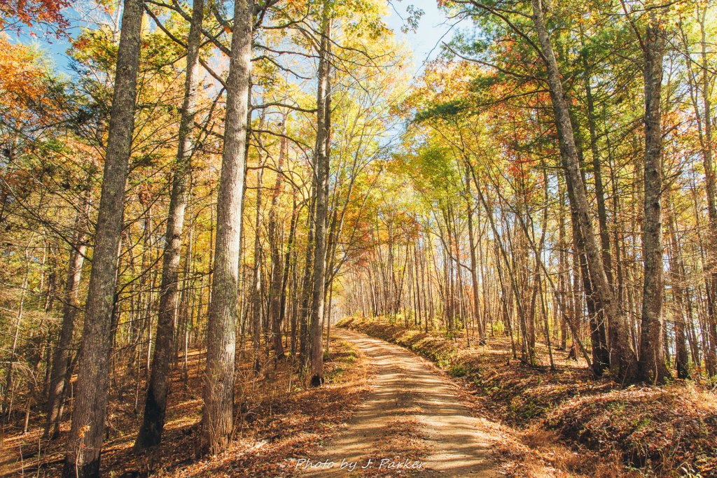
From the trailhead it was a relatively short journey of .7 miles to reach the clearing with the tower at the top of the mountain. Though I wouldn’t have enjoyed driving this section, for walking purposes the trail maintained a very moderate, easy grade as it worked its way through the forest. I was able to make quick pace on the smooth surface, but the lack of variety on the way to the top did make the journey feel longer.
My ascent up the trail was greeted by the pleasant sounds of nature. My feet on the dirt. Gun shots. Wind rustling through the trees. Gun shots. Small animals rustling in the brush. And gun shots. So many gun shots. Nothing but gunshots. Drowning out all other sounds. Gun shots. There’s a shooting range just downhill of this place. It gets LOUD. Though the sounds of bullets piercing the air interrupted what would have been a peaceful walk in the woods, I felt comforted to know that I would be so protected should any dangerous situations arise.
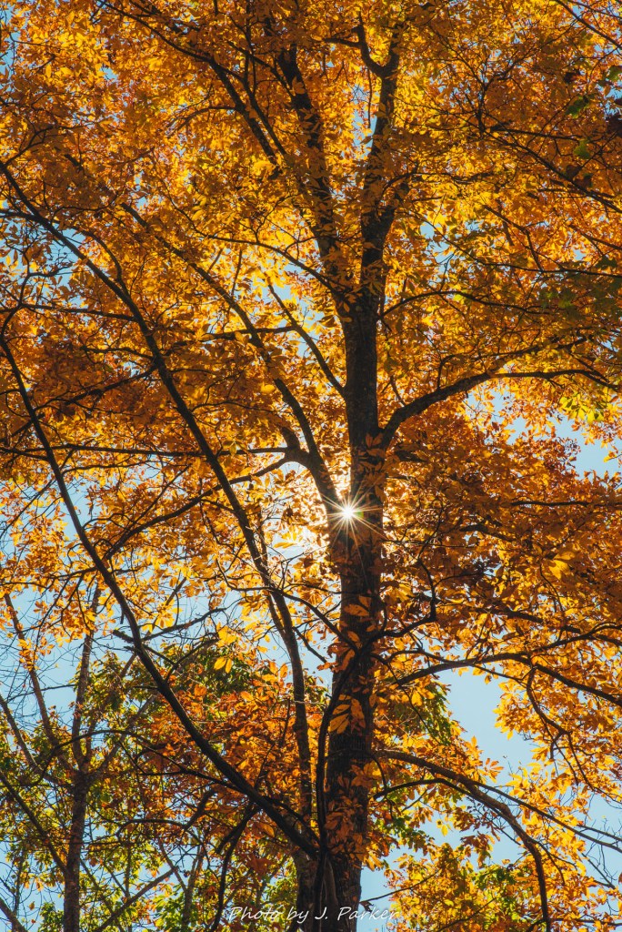
I passed on older couple heading in the opposite direction. We chatted for a moment as I attempted to frame the sun just right as it came through the trees. They commented that the fall color along the trail just wasn’t any good. I merely nodded and didn’t say anything as they went on their way, for I was almost embarrassed that it was pretty much the best fall color I had seen in my day and a half since heading up north from Florida. Plus there was no reason to contradict them and potentially cause a conflict, as they were probably packing heat on this cold day. I wouldn’t have describe it quite as harshly as they would have, but they weren’t entirely wrong. I was happy to find something superior to what I had personally witnessed this year, but it still wasn’t all that good. I made the best of it, and fall was in the air almost as much as the bullets were.
I could tell I was getting close. The sound of bullets faded away to almost a dull roar. I was rounding a bend as the canopy gave way to unblemished blue skies. And then another bend. And then another bend. Was I stuck in a whirlpool? How is this even physically possible? It seemed like quite a circuitous route around the top, but eventually I reached a clearing with the distinctive lookout standing proudly on top. Also scattered across the bald rested several parked vehicles who proudly laughed in the face of the no parking sign and lived to tell about it. If anyone had a problem with it in this remote location, I’m sure they had a gun to protect themselves. One of the vehicles was an old Ford, and I can only assume that being a Ford it had broken down on top of the mountain and they were unable to move it.
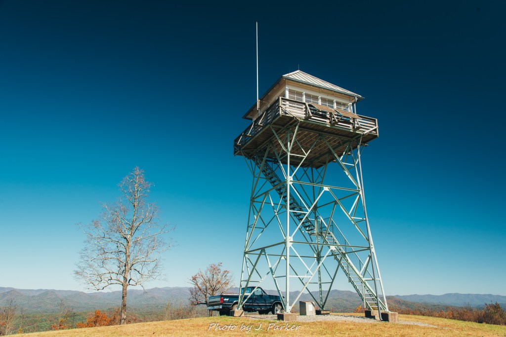
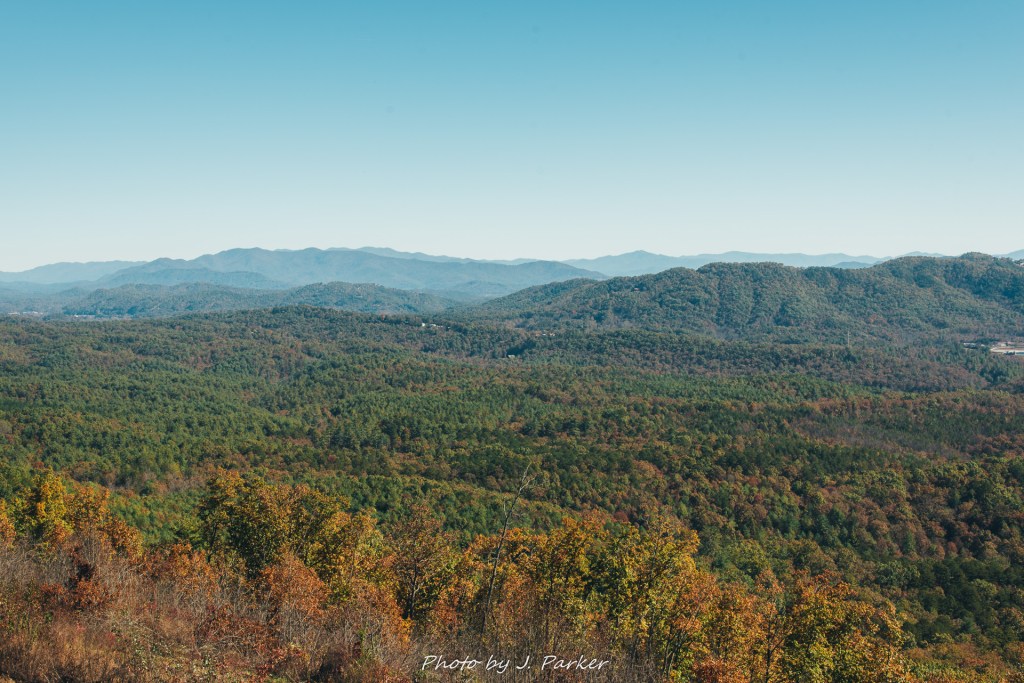
I eagerly headed towards the stairs and began my ascent. I’m not one prone to vertigo, but the steep, narrow pathway filled me with a little unease until I reached the top. Though in other areas I lamented the overwhelming sunshine, I have to admit it was relaxing and refreshing to bask in the blue sky high above the world below, gazing to other peaks which were perhaps not colorful, but whose varying shades of red, brown, green and yellow at least provided a sense of the season. When one experiences open air in the blue sky on a mountain it is a liberating experience, as the rays of sunshine seem to peel away layers of stress while also providing a lasting sunburn to ensure the moment lasts longer.
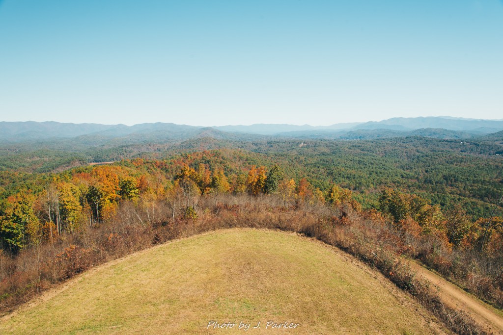
Being up high was invigorating, though perhaps the views weren’t quite as impressive as what I had hoped. The surrounding ridgelines, which have the ability to greatly enhance the spectacle, simply didn’t have a wow factor. Panther Top was prominent compared to the surrounding terrain, but it didn’t feel to be dramatically higher. No doubt my views on the views from Panther Top were impacted by my having visited Blood Mountain and Brasstown Bald, two places noted for their stellar views, one being the highest point along the Appalachian Trail in Georgia, the other being the literal highest point in Georgia. It’s unfair to compare unassuming Panther Top with these beasts, but that’s the way it goes. But I did hear far less gunshots at Brasstown Bald, so point for Panther Top. Speaking of Brasstown Bald, it’s clearly visible from here, so if you want to get a view of a place with a better view, Panther Top is right for you.
It’s a wonderful thing that so much of southern Appalachia is preserved where one can enjoy completely natural looking views. I’ve come to realize that the Blue Ridge Parkway is almost like a roughly 450 mile long National Park, for one can look out from the parkway in so many places and and see staggering scenes that appear almost untouched by man. The Linville Gorge, one of North Carolina’s greatest wonders and with multiple staggering viewpoints, is a federally protected wilderness. The expansive size of Great Smoky Mountains National Park, when combined with the density of peaks found there, means you’ll scarcely have a view in the park that isn’t filled with forested Smoky Mountains. Though Panther Top was in a national forest, one could see a different view of Appalachia. Below me existed small towns, factories, shooting ranges, commerce and industry. Though Panther Top didn’t provide me with amazing views, it did allow me to connect and appreciate this area, a place where you could watch rural Appalachia live and breath. I satisfied my goal of connecting with this unfamiliar area.
A ranger, who I later found was serving his last day in the tower, was present, and we had casual small talk as I ventured around the corners of the tower, taking in every angle. The walkway is narrow, and does not circle all the way around the top as it is cut off by the stairs. I was surprised to find myself cornered by a rather curious bee. To some this might be a trivial matter, but I’m allergic and maintain an irrational fear and strong avoidance practices. The ranger commented that the bees come out as it warms during the day. I actually thought the day was too cold for the stinging insects to be found. Since I didn’t know the insects would be out, I neglected to bring a gun for protection. Fortunately the bee found a more compelling subject to investigate, for I’m really not that interesting a subject.
I did not spend long at the top, for it did not take much time to digest the views available. From there it was another .7 miles down to my car, and I was again comforted by the sounds of liberty and the constitution as my path edged close to the shooting range downhill. I was neither amazed by Panther Top nor disappointed. It was a rather average place to visit that fit the bill for what I was looking for as this fall morning turned to afternoon in western North Carolina. Nearing my car, I noticed a vehicle pulled rather close to mine, though the narrow parking area left so little room for a second vehicle that his truck was parked at nearly a 45-degree angle. Where at first something had seemed impossible, nature found a way. It was a rather risky parking job, and not one a Floridian like myself would ever undertake, but I would never dare criticize the man who saw what he wanted and found a way to make it happen. Besides, he probably had a gun.
