
“No longer Bono”. That’s what the text said which I sent to my wife as a frantically setup my tripod on a rock. Thankfully it did not send as I attached a picture to it in an area where I had limited reception, for I certainly would have simply gotten back a quizzical response which, while chasing pictures in the last few fleeting glimpses of light before dark, I would not have had time to answer. What I was trying to say in my own obtuse way was that Bono may not have found what he was looking for, but I finally had as my second full day in the mountains ended on the colorful banks of Goforth Creek, a tributary of the Ocoee River in southeast Tennessee.
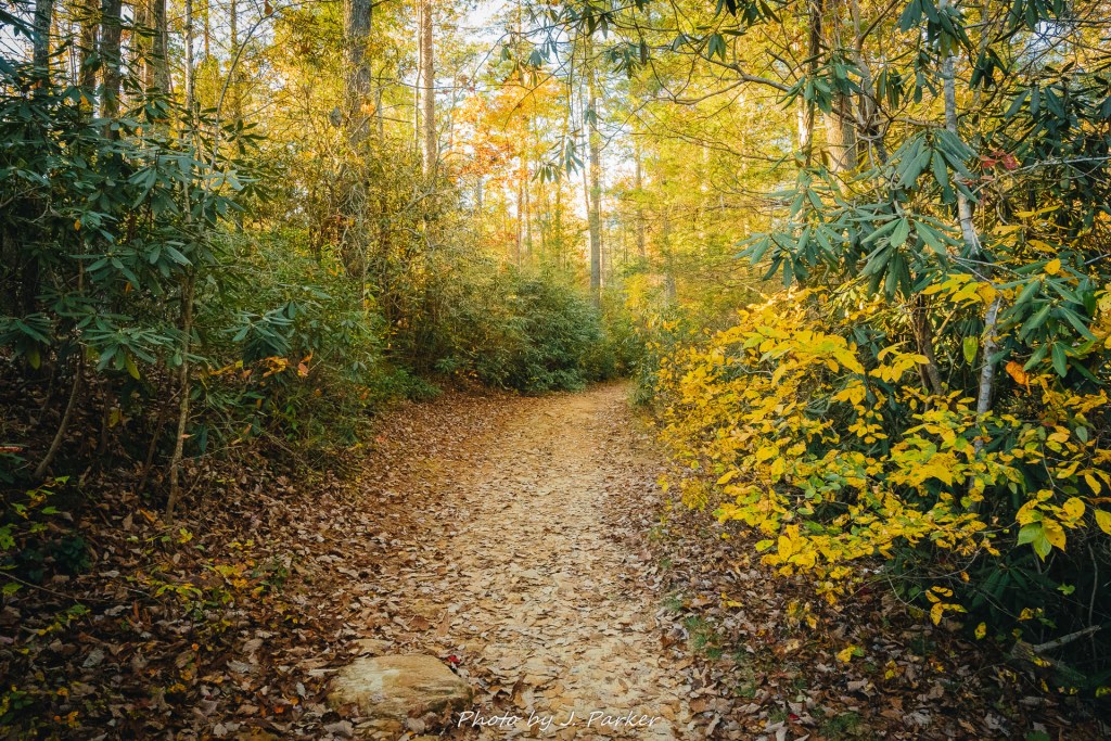
I had spent the morning and early afternoon visting the four mile trail along Turtletown Creek and then seeing the lookout at Panther Top just a few miles inside the North Carolina border. For some, this would be a day unto itself, but I had a lot more exploring to do, with the hope of finding some good moving water to shoot before dark. Though I was certain what I wanted to accomplish, I was far less certain where I should go to obtain it. As I had completed my journey at Panther Top earlier I was filled with a bit of regret as far as the choices I had made for this trip, apparently picking the wrong time, the wrong area, or both, to accomplish my goals. Fall color just wasn’t peaking, and what’s worse there just weren’t a lot of hikes where I was at that would take advantage of open blue sky. I considered heading back down to north Georgia, where I had a good sample of hikes leading to overlooks but would lose a lot of daylight driving and also not likely find moving water before dark. Alternately I though of heading north and then east along the Cherohala Skyway, whose eastern stretches I had traversed during the summer and which would likely provide some nice color and/or nice vistas. The problem was that outside of Bald River Falls I had done little prepping for being in this area, and it would also entail doing a massive loop that would take me all the way to places like Franklin, NC and involve an insane amount of drive time. This was a fantasy with no basis in reality, but one considers a lot of things in desperation.
The simplest answer was just to continue exploring the area I was already in, for as much as the area wasn’t really conducive to shooting in bright sunlight, it was at least an area I had researched a lot, and was pretty sure that I could find a good scene to shot at in the waning hours of daylight. My research indicated GoForth Creek, a spot located right along US 64 in the Ocoee River gorge, would be a good place for this. Being located right along the road, this meant I could easily pair it with a more substantial hike. I made an educated guess that the later afternoon would provide usable light at a somewhat nearby waterfall, Benton Falls, which I imagined would be shielded by nearby ridgelines as the sun got lower.
“The Ocoee River has some of the best fall color I’ve seen”, said the photographer I spontaneously hiked with at Turtletown Creek that morning. If I still was uncertain, I figured God had put that phrase in my brain for a reason, and I plunged forward on my new quest to explore the Ocoee River, with the ultimate goal of getting to the two spots I had mentioned before dark.
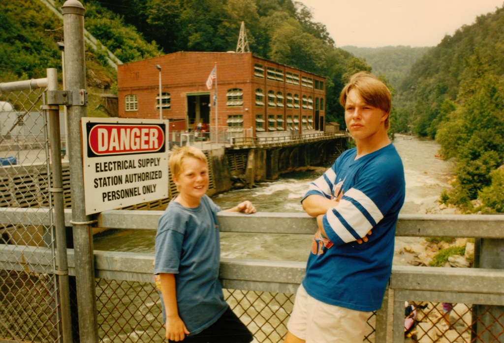
The Ocoee River, lying just southwest of the Turtletown Creek area I had hiked that morning and also in the Cherokee National Forest, is a popular river for whitewater rafting. I was able to experience this firsthand as a young teenager, when my sister’s travel softball team was in the area for two major tournaments. During the break between tournaments a large group took this rather interesting excursion, and I really enjoyed the experience, though as an adult I certainly opt to experience nature and the rivers a bit different (white water tubing!). After we rafted the river, we drove down US 64, which hugs the river throughout the gorge, traveling upriver till we reached the location which served as the home for the rafting competition in the 1996 Atlanta Olympics. As this was in 1997, the Olympics were still a very recent memory! This made a good location for competition as a series of three dams control flow on the Ocoee, thus they were able to create whatever conditions they needed on the river at the time simply by releasing the appropriate amount of water (as an adult, I tend to shy away from artificially maintained environments, but I knew little better as a kid). On our return trip we stopped by a roadside creek with waterfalls, something I found enchanting coming from Florida. As I grew older and became an educated nature enthusiast who wanted to assign labels to everything I always wondered about that little creek, halfway worried that maybe I had just imagined the whole thing and it never actually existed. I was pleased to be able to attach the name of Goforth Creek to this location while doing my research.
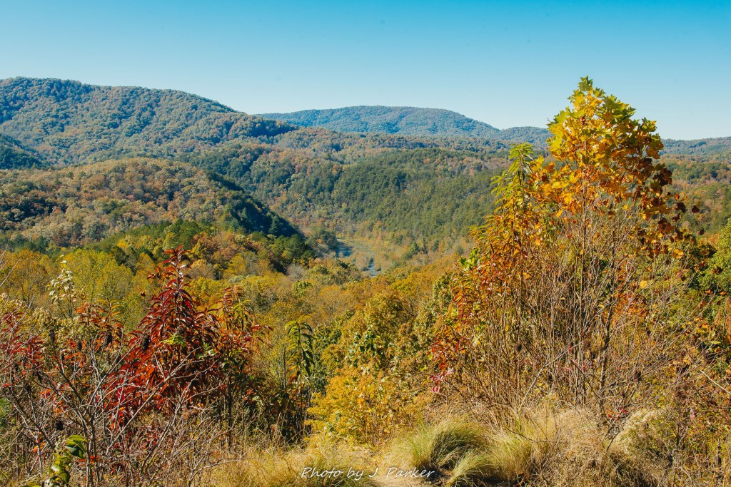
On this day I approached the Ocoee River gorge area from the east in the area of Ducktown, from which the road takes a plunge into the gorge. With this being both a national forest area with numerous trails plunging into the woods from the roadway as an area with frequent river access, I knew there would be frequent pulloffs, and I had the goal of checking out any that might look interesting. I was rewarded right away when not far out of Ducktown I came across a pleasant view from the Brush Creek Trailhead, where one could see across the gorge to opposing ridgelines with the river winding far below, almost out of sight. It wasn’t a postcard view, but it was enjoyable to take in under the beaming blue sky.
For the most part my stops along the actual Ocoee River were less successful. The river’s flow through the gorge is entirely controlled by dam, and on this day very little water could be found in the river. Devoid of a natural level of water, the artificially maintained river seemed to have all the scenic appeal of an amusement park pond which was drained and undergoing maintenance. I experienced a mix of disappointment and relief and discovering this, for while I would naturally have liked to experience beautiful river scenes, I was relieved of the burden to stop and photograph all the locations along the river. I had a suspicion that time would run a little short on me this afternoon. Though the river itself was a bit of a disappointment, I enjoyed the serpentine drive along US 64 as it followed the river, frequently under the shadow of dramatic rock faces and colorful trees.
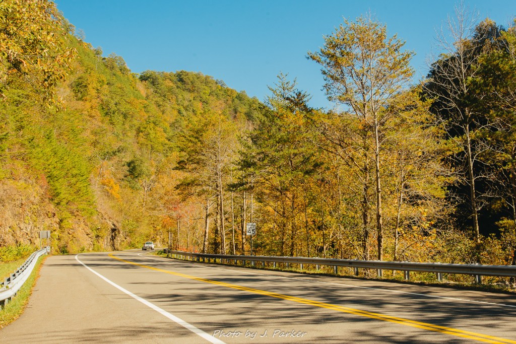
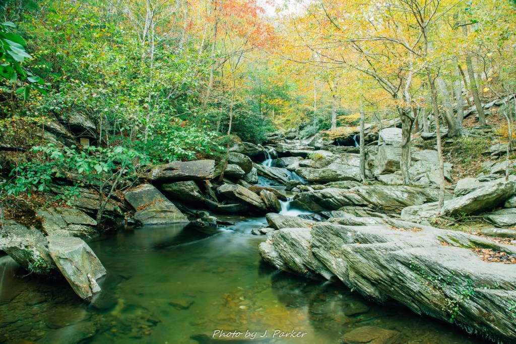
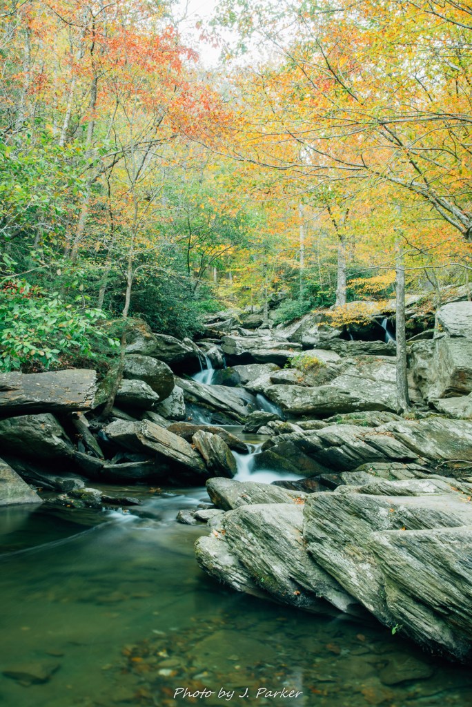
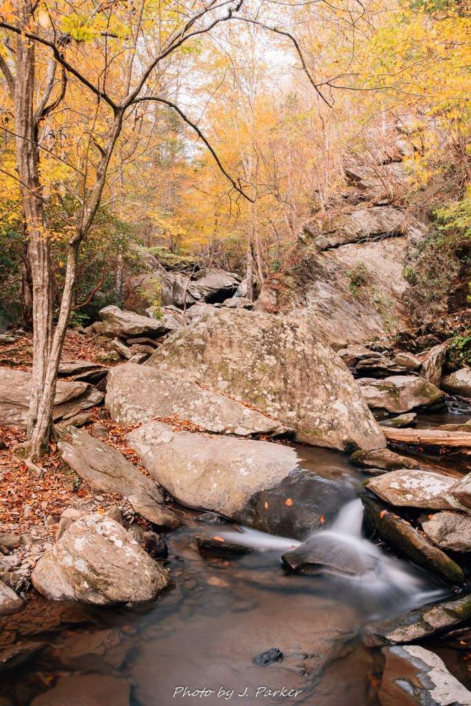
I did find one stop along the river which seemed very promising when I located the narrow pull-off for GoForth Creek. It took little to verify in person that this small waterway, with a series of small, accessible cascades right along US 64, matched what I had read, and that little time was all I spent at this juncture, for with heavy sunlight still streaming in through the trees it would be several hours before I could really photograph here. I would go forth into parts lesser known to me, knowing this creekbed would be there to greet me on the return trip as long as there was time.
I had never heard of the Chihowee Reservation before I started planning this trip, and even after doing my research I still knew far less about this large area than I normally would prospective spots, for I knew I wouldn’t have time to fully immerse myself in its vast interconnected trail system which stretches through highlands north of the Ocoee River. For me, it was simply a launching point for Benton Falls, which seemed to come up frequently when researching the area. I ended up being quite surprised to find Chihowee to be teeming with people and places, far from the backwater I envisioned.
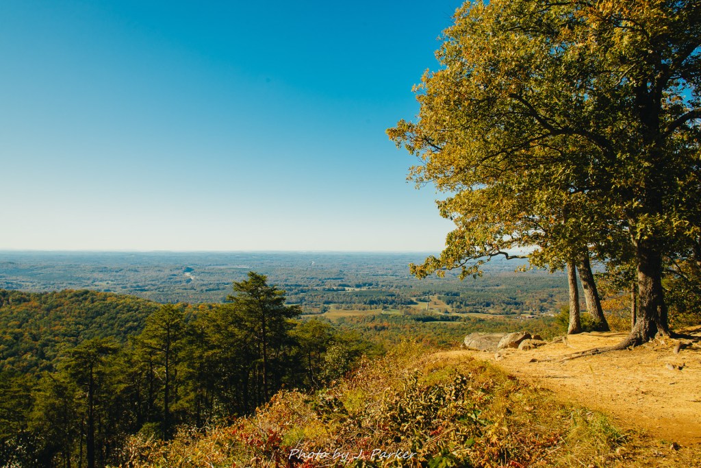
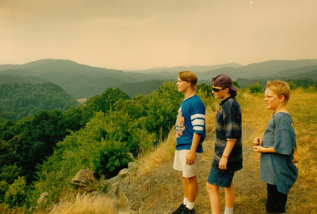
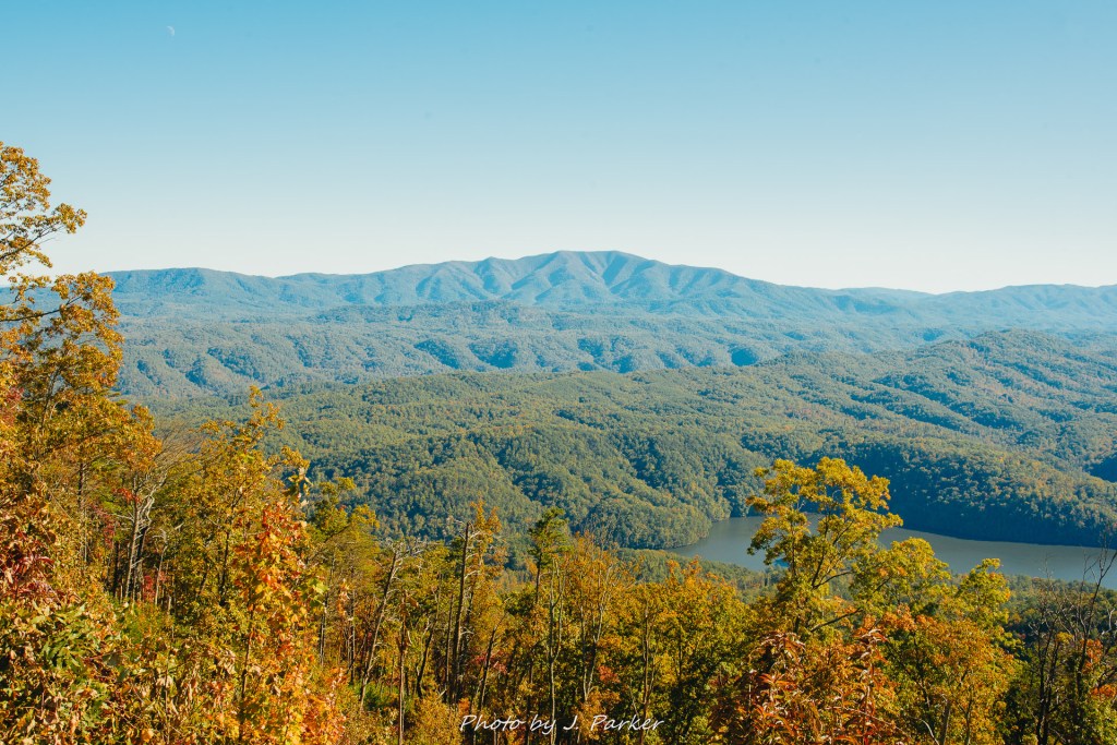
When I first turned into Chihowee the road promised a steep grade, not unexpected with the sharp ridgeline I had seen before turning in. I grew excited as I saw signs mile markers for several overlooks along the roughly 7 miles to Benton falls. The first few overlooks were relatively modest, offering rather plain (but elevated) views of a rather flat section of Tennessee. Rounding a corner to a staggering view towards the south, I quickly parked and got out of my car. I let out an audible wow while taking in the view, and someone nearby said it must have been my first time there. I confirmed, then asked what interesting mountain I was seeing. I was told it was Big Frog Mountain, and that made me pleased, for as a child I had wondered what peak loomed over the area and found the name Big Frog Mountain on the road atlas. I had always imagined I had picked the name out just for its silliness, but I was correct after all.
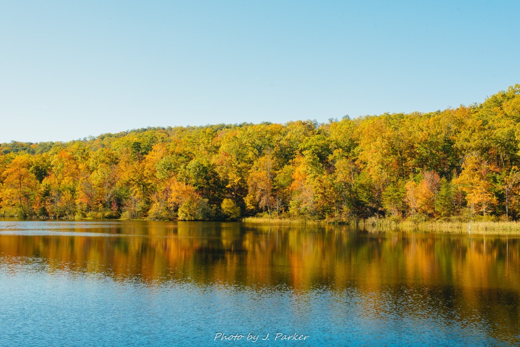
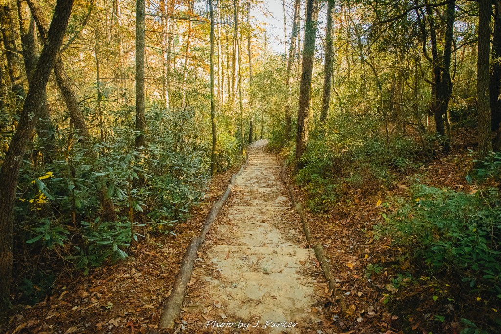
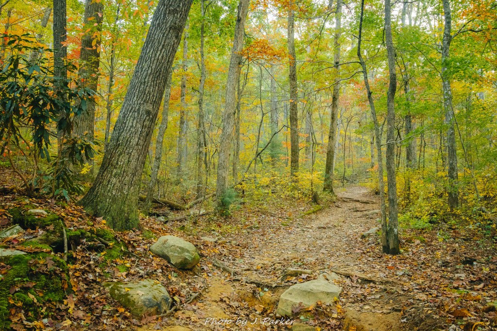
I finally reached the trailhead for Benton Falls, where I started my roughly three mile hike by leaving a paved parking lot and heading by an artificially created lake before plunging into the woods. I was somewhat surprised to find a forest of a completely different character than I had come across in many Appalachian locations. The soil was of a sandy character that remind me more of my home state of Florida than Appalachia, and the woods were composed of more small trees than normal.
Though the brush was thin and had an unexpected character, there were still patches of fall color to take in, with a character unlike other places I had seen just owing to the different type of foliage.
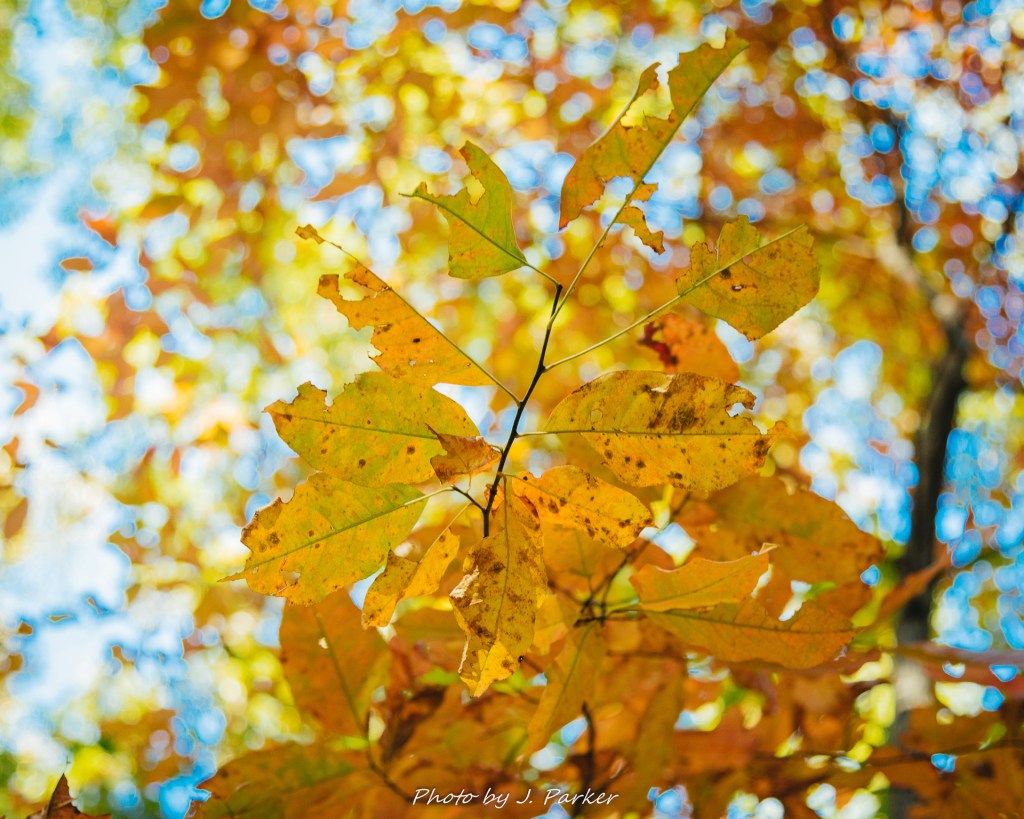
The sunlight had softened somewhat, providing a nice illumination for the tree tops to display their red and gold colors.
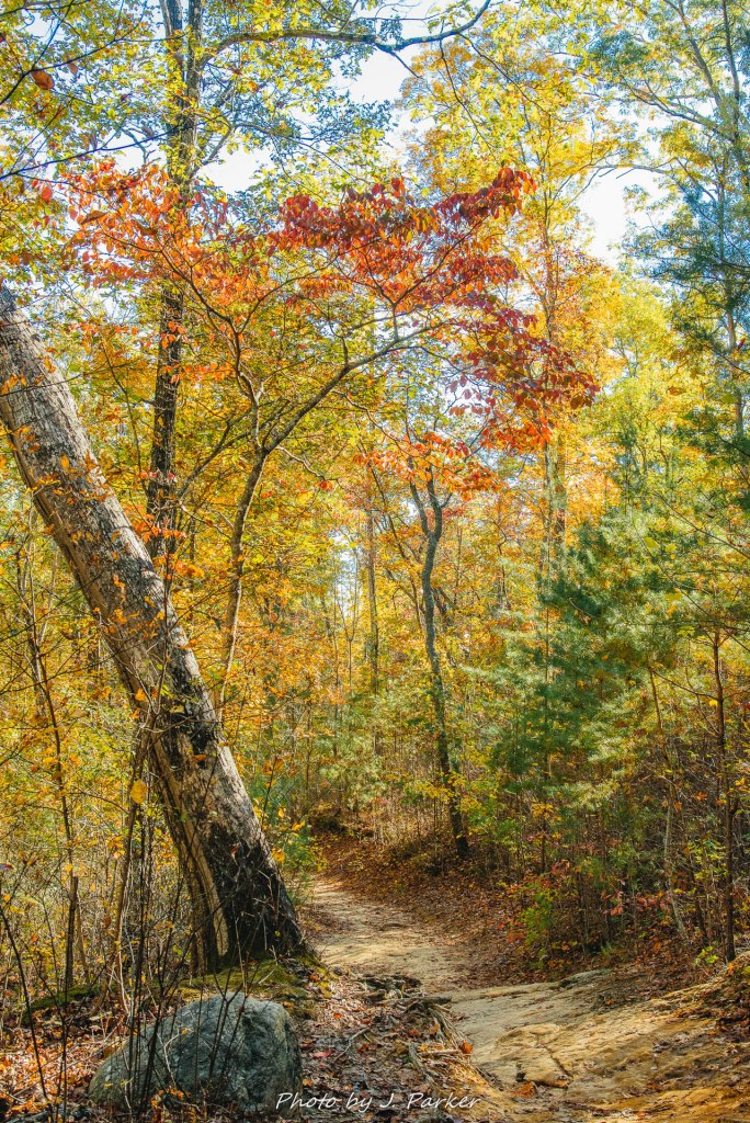
Despite the patches of color, it was a rather featureless, repetitive journey out to Benton Falls. It was only a mile and a half journey, but it could not go by fast enough. Scores of people and dogs along the trail let me know I was unlikely to enjoy the falls with anything less than a small crowd.
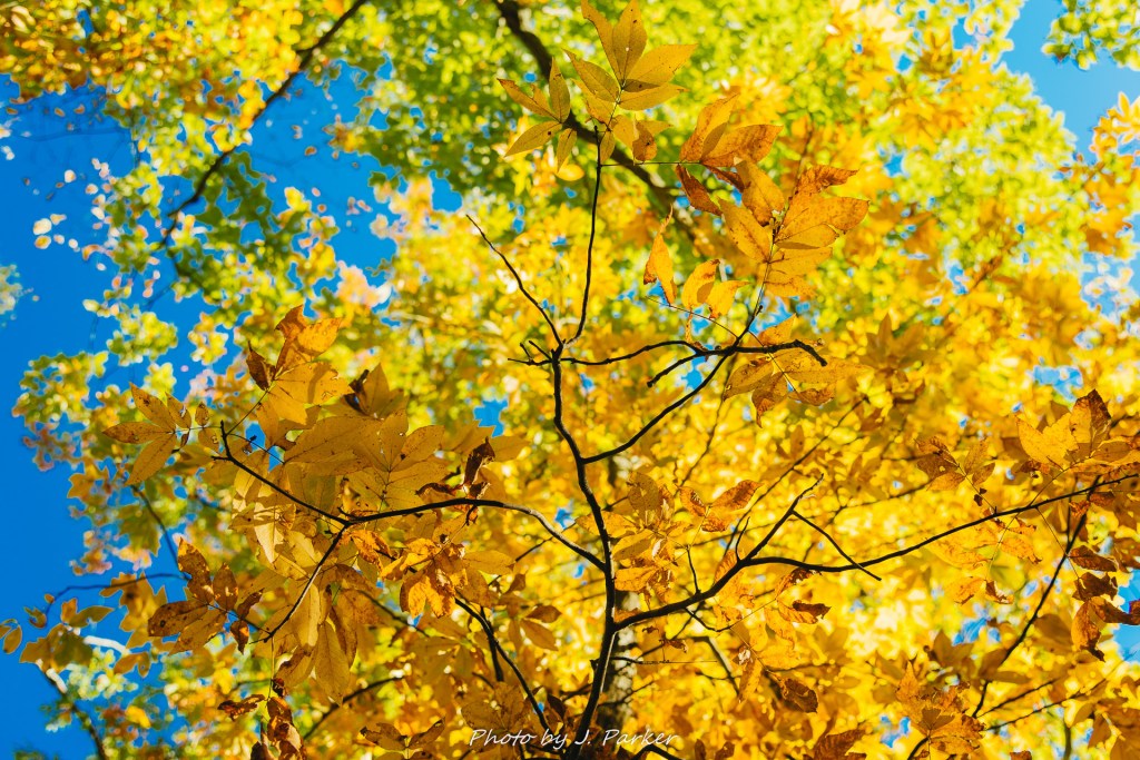
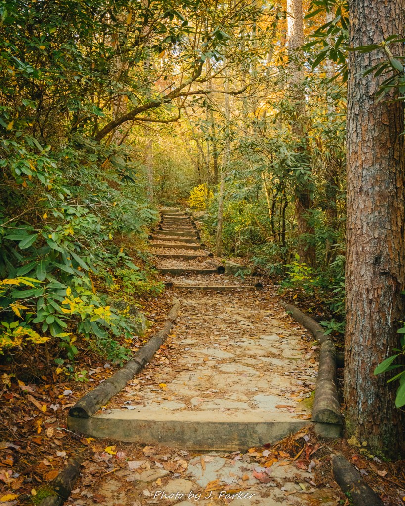
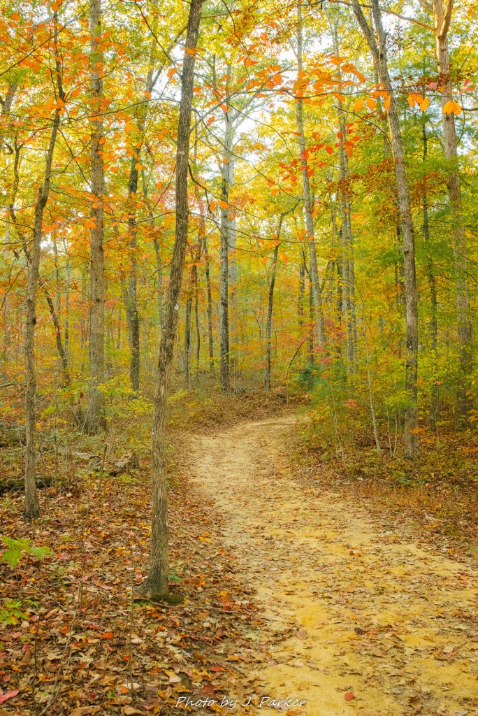
After walking the same dull pathway for eternity things seemed to slowly change. Lush foliage and the occasional faint sound of running water to my left keyed me in that we were getting close to the fall, and none too soon. Finally, a path to my left dropped down to creek level, navigating a gradual stairway outlined with logs. Other than the fall itself, of course, this was the most scenic part of my journey, as the yellow treetops glistened with the softer afternoon sunlight, providing soft illumination for the pleasant pathway below.
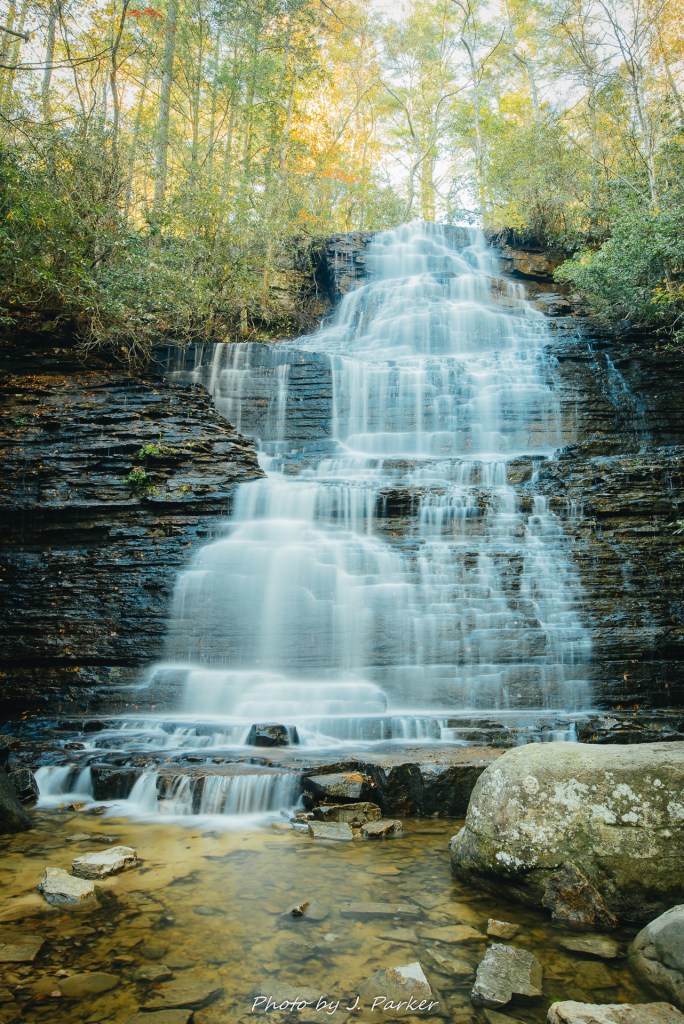
The falls themselves did not disappoint. Just as I had hoped, the falls created their own significant depression from the surrounding trees, and the tall, thick brush immediately around the falls kept the sunlight at bay. I snapped a quick cell pic and sent it to my wife with the caption “finally”, as after two days of searching I was finally getting my first crack at a real waterfall shot in good light (Amicalola from the day before is so large it precludes normal photography). That is, of course, if I could find an angle that didn’t include the dozen people and three to four dogs scattered around the fall. What was doubly concerning was not just people around the plunge pool, but those who were also taking a short path which inexplicably lead to the slick top of the falls. I worried that somebody would lose their footing at the top, with their falling body creating an unsightly blur on my long exposure, not to mention the ensuing rescue operations which would surely not make allowance for photographers having a bad day. Thankfully for the pictures’ sake, nobody fell into one of my shots, and though my frames were occasionally interrupted by moving people and, more commonly, dogs taking a dip in the surely freezing water, I was able to get satisfactory shots of the fall, which provided a scenic image despite not having much seasonal color to be framed.
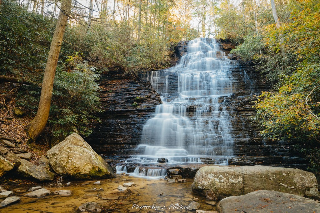
I found the creek bed flowing away from Benton Falls to be quite scenic – far more scenic, in fact, than much else I had seen at Chihowee. Sadly, there wasn’t much opportunity to catch more than a fleeting glance, for at least the trail around Benton Falls itself seemed graded to get as many non-hikers to the waterfall, not to provide the most scenic experience available. I know little of the trails at the reservation besides the one to Benton Falls, and I am certain there are more rustic, natural trails available. But I wouldn’t have time to seek them out before dark.
Walking the stairway trail to the falls was an even more scenic experience on the way up, as the gold in the trees was even more distinct.
I found the walk back to be a more enjoyable experience, as the light brought out the best in the relatively thin trees. It was still took more time than I would have liked, though I myself can take some of the blame for that, as I was very involved watching my phone count down the plays in the Dolphins-Jets game, as the Dolphins had yet to win a game this year but were in the midst of sealing their very first while also taking down a bitter rival and a despised former coach.
I was excited to see the forest gradually get thicker again as I approached the parking area and the artificial lake. Save for the area around the falls, the woods here were the most beautiful found along the trail. I couldn’t pause too long to enjoy them, however, as light was getting dim, and I hurried my pace in anticipation of returning to GoForth creek before dark.
I sped back towards GoForth Creek as quick as winding roads, other vehicles, and traffic laws would allow. As I edged my vehicle into the narrow pulloff the light was already fast fading. I hopped out of my Rav4 Garth, tripod and camera in hand, as fast as possible, hoping to shoot long exposures as quickly as my local sheriff Grady Judd shoots alleged criminals.
I would have loved to have more time shooting GoForth creek, and had I know the Benton Falls trail was going to have so many uninspiring sections I may not have made the side trek. Though I was not sure of the caliber of the pathway, nor of its ease of creek access farther from the road, there was a path that lead some distance along the creek that I could have explored. But there was no time to ponder these things, much as there was little time to send actually descriptive texts.
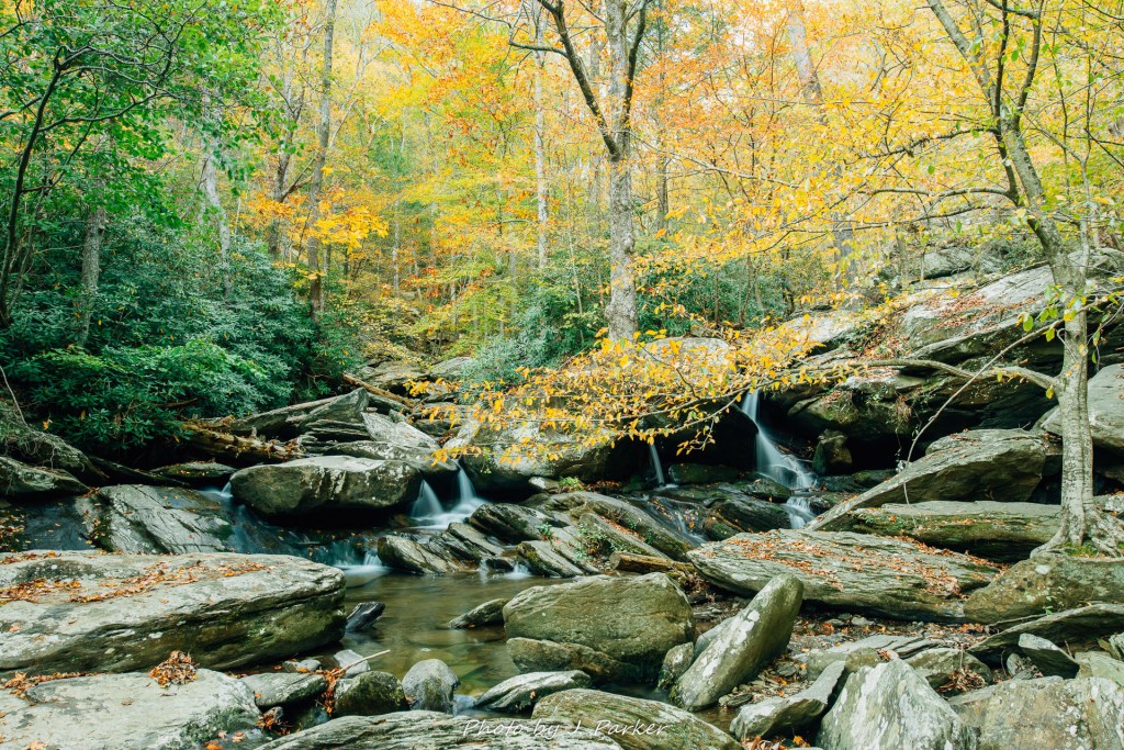
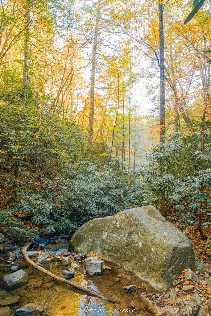
As beautiful as the creek and the orange and yellow trees surrounding it were (some of the most unified fall color I came across during my entire trip), it wasn’t the easiest creek to frame. The same multitude of rocks which made the creek a joy to experience and explore on foot provided a chaotic scene which tended to overwhelm the beauty of the fall foliage. I had to climb a short but rather steep embankment, tripod in hand, to try to access a section of creek which provided a more flat, easily framed scene.
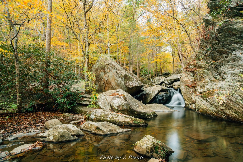
It is fortunate that I found such a satisfactory scene, for my ability to follow the creek along the bank I had chosen was ending. I had not enough daylight to work my way around to the other side. So I had to be content with this fleeting glimpse of Goforth Creek, and have satisfaction knowing that I still accomplished a good deal that afternoon.
I had ended the day with a lot of positive momentum, and I still had a day and a half to spend in southern Appalachia, confined to north Georgia for the rest of the trip. It had taken almost two days to cast off, but I no longer had to wear the stigma of being the lead singer of an Irish alternative rock band. I had finally found what I was looking for. Perhaps the best part of all was that I had visited two different stops without breaking another tripod, a personal best.

Pictures are stunning! Wow!!
LikeLiked by 1 person