
I felt like I had been lied to, though that wasn’t entirely true. Nobody had specifically told me there wasn’t a huge ass waterfall at the end of the High Shoals Falls Trail (huge is one of my favorite waterfall types on the ass spectrum, falling just behind giant ass). But nobody had told me there was either. Now, I knew of the existence of both falls along the trail. The trail here is simple enough, with about a 1.3 mile one way trek, crossing an unbridged creek along the way, reaching the two waterfalls in quick succession at the end, I remembered the general outline without having to review trail notes before beginning. I just had no idea how absolutely large the namesake waterfall along this trail was, a theme that would be repeated throughout this autumn Monday in the woods of the Chattahoochee National Forest.
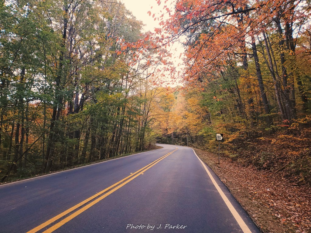
Having been delayed the previous morning by a significant buildup of ice on my vehicle, and the day before that having set my alarm clock wrong, I was pleased to leave my hotel in Blue Ridge just after dawn with my sights set on the remote trailhead a ways north of Helen. This was roughly an hour’s drive from where I was staying, and I was able to take that at a more leisurely pace than the past two days thanks to being granted the belated gift of a cloudy day. My drive started out on the significant conduit of US 76, which cuts a wide four lane path through north Georgia, but the roads got progressively more rustic as I got closer to my destination. This culminated in a dirt road which would make up roughly the last mile and a half of my journey, which also featured an unbridged creek crossing before I would reach the trailhead. I was enjoy the fullness of color around me, echoing the shades I had seen two days ago around Brasstown Bald in the same general area, when I reached the turnoff for the narrow forest road.
I knew I would have to undertake the creek crossing, and I also knew the creek was running a little high. I wasn’t overly concerned, for I had crossed a creek with my vehicle at Turtletown Falls the day before. Still, I was a little surprised when I came across the wide pool of water covering the road almost immediately after turning off the highway. I sort of imagined there would be some sort of buffer, like you’d drive a while on the narrow, steep forest road before crossing the creek but nope, its right there front and center to weed out the unworthy without haste. Just in the event that something bad might happen, I hopped out of the car and snapped a quick pick of the creek, shooting if off to my wife before taking the plunge.
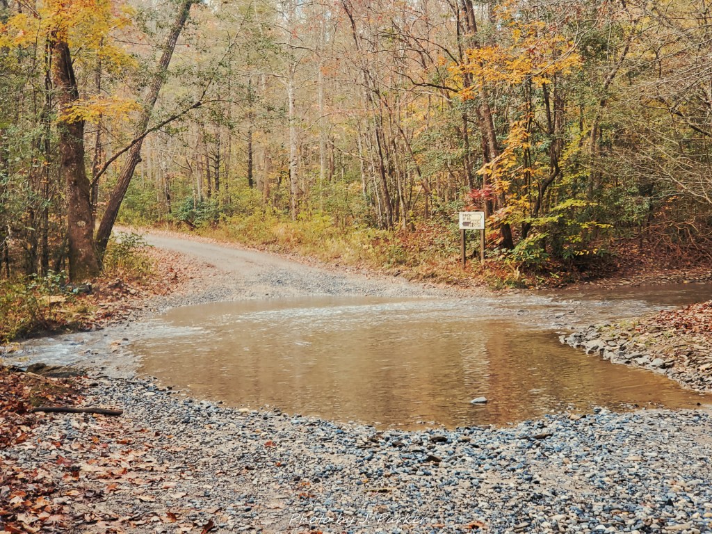
Fortunately the creek crossing proved no great challenge for Garth Vader, my two wheel drive Rav4, and soon I was zooming up the ridgeline at a sporty pace on this small forest road. Typically mountain forest roads give me some reservation, but on this cloudy, cold Monday the woods were quiet, and it was quite fun navigating this narrow (but not uncomfortably so) corridor through the colorful woods. I was quite thankful, however, that I never tried this one on a busy weekend, as the potential was there for some hair-raising situations passing other vehicles, which I’ve experienced in other nearby locations. Despite its remote location, High Shoals isn’t exactly out of the public eye. It regularly features on “list” sites, and countless Youtube vloggers undertake the short hike. I could imagine that small road getting quite busy, and I was fairly shocked to find very limited parking. That’s not an issue when you’re the first one there, was I was on this day.
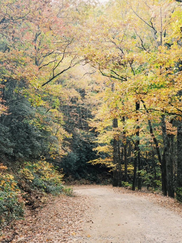
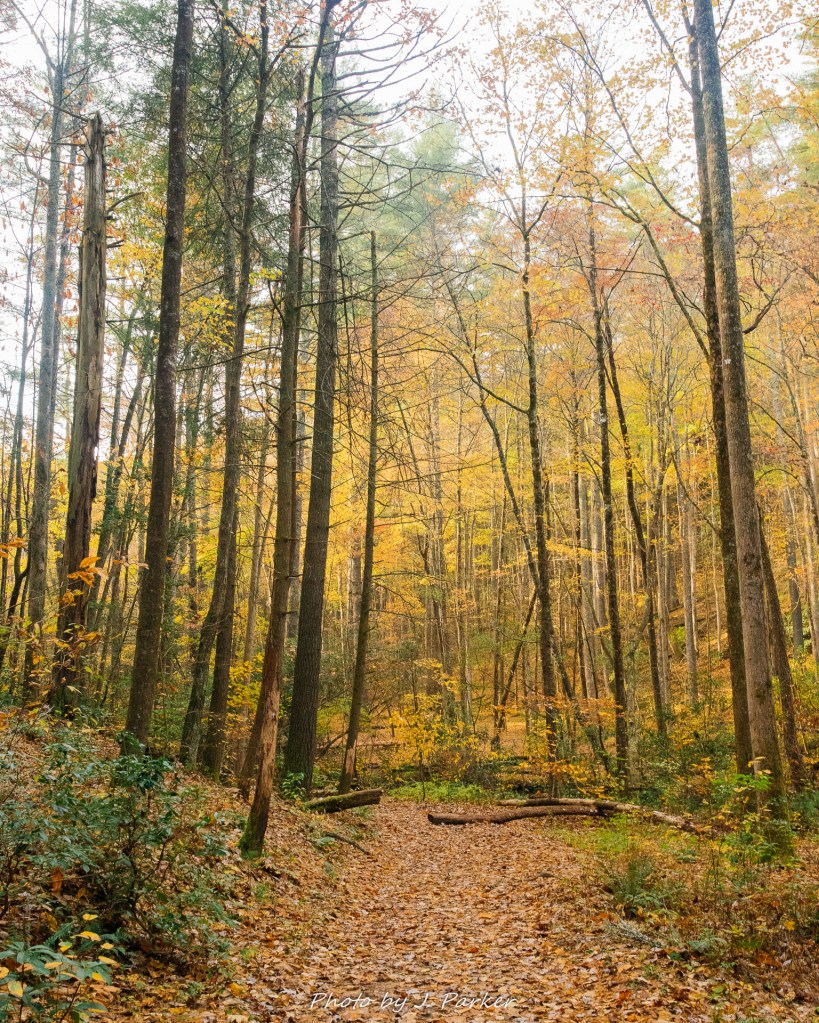
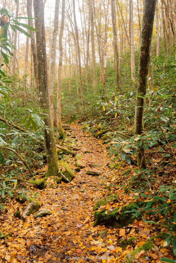
I felt a little bit of nerves as I started along the path which worked its way steadily downhill towards the creek and two falls, covered by lovely orange and yellow foliage. Conditions were great, and for once a trail seemed to offer almost as much color as the road to it. Would I be able to deliver? It’s both frustrating yet refreshing when conditions limit your photography, because any success that arises out of less than ideal conditions is a “win”. Plus, bad conditions tend to eliminate a lot of potential shots, thus narrowing your focus and sometimes forcing your angles. When conditions are good, options are endless, which in itself can actually be quite daunting, especially when you combine that with the pressure arising from the need to maximize your good fortune at having rare ideal conditions. These thoughts were on my mind, as well as the thought that every step I took downhill would be one I would have to take back up, for the High Shoals Trail is one of those that’s entirely downhill from the trailhead, which means you have to go up on the way back. Fortunately, the drop is only about 600 feet.
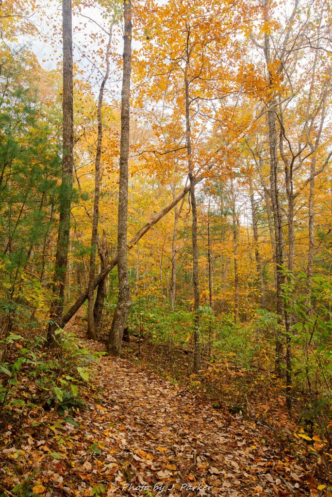
After a few gradual switchbacks the trail leveled out, shortly reaching a clearing which seemed to be ideal for camping. It was a soothing area to walk through this autumn day, as the flat, open understory allowed the colorful canopies of the trees to show well. On the other side of the clearing was an onstable, the unbridged flow of High Shoals Creek.
It was well over a year before that I had started really researching north Georgia locations in depth for prospective trips, and I had learned that the trail bridge over the creek was destroyed in a storm. I had hoped that something would have changed in the meantime, but much to my chagrin I found out the night before that the bridge was still out. I would have to cross on foot, and worse, the creek was at somewhat of an elevated level, so it may be more of a challenge than normal.
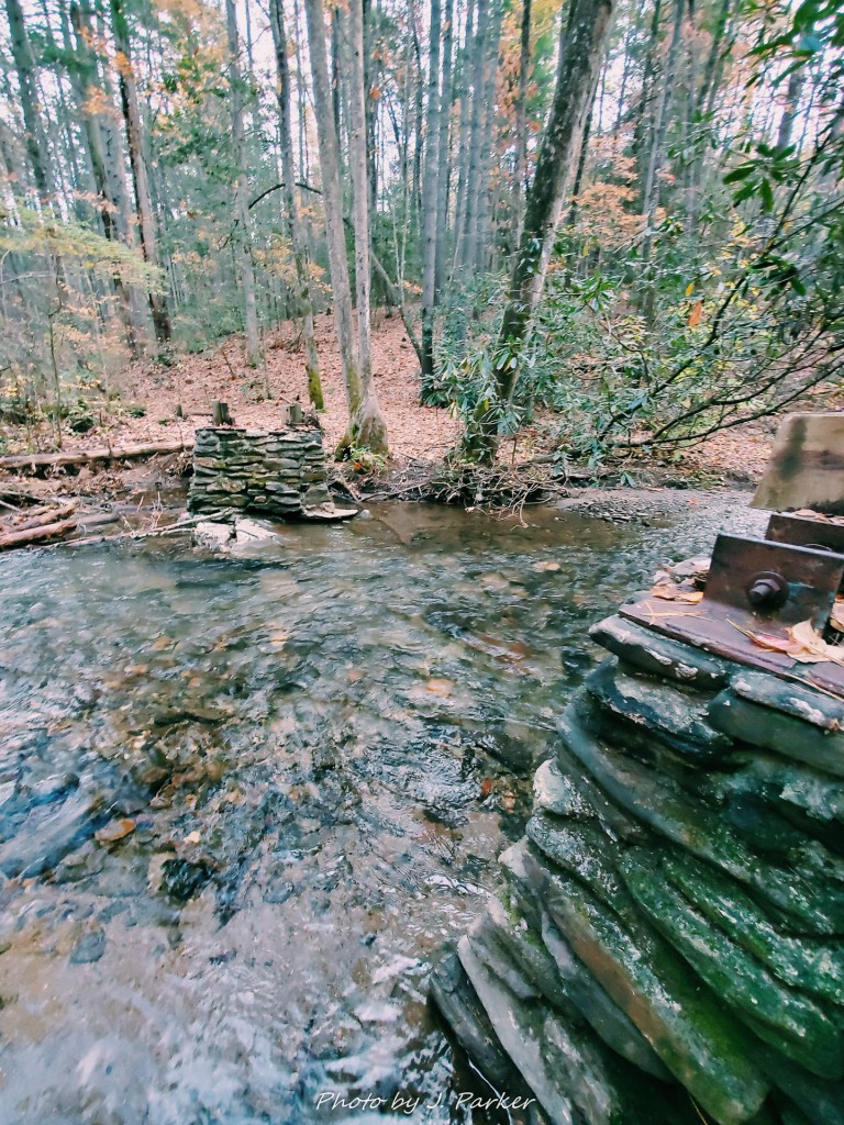
I surveyed the creek, and luckily it didn’t seem like it would prove an insurmountable challenge. I had chosen to take my waterproof camera bag on the hike to protect my equipment, phone and keys in the event of a misstep, and taking the dry bag also relieved me of the duty of taking excess weight off my primary camera bag, something I had still forgotten to do. And the plus side of having broken my lightweight tripod the day before, relegating me to using my heavier tripod with a leg stuck extended, was that my tripod would now double as a great walking stick. I wasn’t worried about safely getting across the creek, I was worried about wet feet on this frigid morning that was just a few degrees above freezing. I had a change of shoes and clothes in the car, so with a grimace I plunged my feet into the water and walked across, taking care to avoid slick, flat rocks as I reached the other bank almost before the water had time to reach my socks. I would have to repeat this crossing on the way back, and I found returning to be slightly more challenging just because of the angle of the opposite shore.
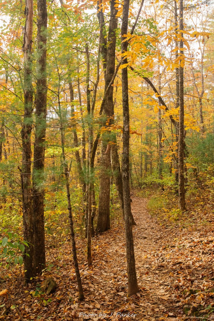
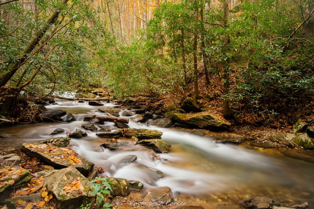
The remainder of the trail generally follows the path of the creek, containing that type of “wet” vegetation that you come to expect around creeks in southern Appalachia. It’s not too long after crossing the creek that one comes to the obvious side trail for Blue Hole Falls, the first of the two falls. As I stepped onto the wooden observation platform, taking care not to slip on the smooth and wet wooden planks, I came across a familiar sight. The bottom tier of the falls plunging into an aqua pool below is an iconic image for the trail and the area at large. Only on this day the usually placid-looking fall was somewhat of a raging torrent, which did even seem to be possible to have been birthed by the same shallow creek I had crossed just moments before. A solitary vibrant-colored sweatshirt was draped over the railing on the platform. With no other person in sight, I can only presume the owner drowned in the creek and the body was never found.
On warmer days you may see people swimming in the colorful plunge pool, as even though there is an observation deck it is quite easy to get down to the smooth rocks at creek level. There were no swimmers on this autumn day, for not only was it cold, the high flow of the water may have made swimming unsafe. The creek wastes little time before beginning another series of cascades on the other side of the plunge pool. I opted against climbing the wet rocks at creek level for the optimal angle, as the flow rate was neither ideal for safety nor for long exposures. I spent a few minutes framing the fall from the platform before advancing on to the next fall, which I presumed would be more of the same.
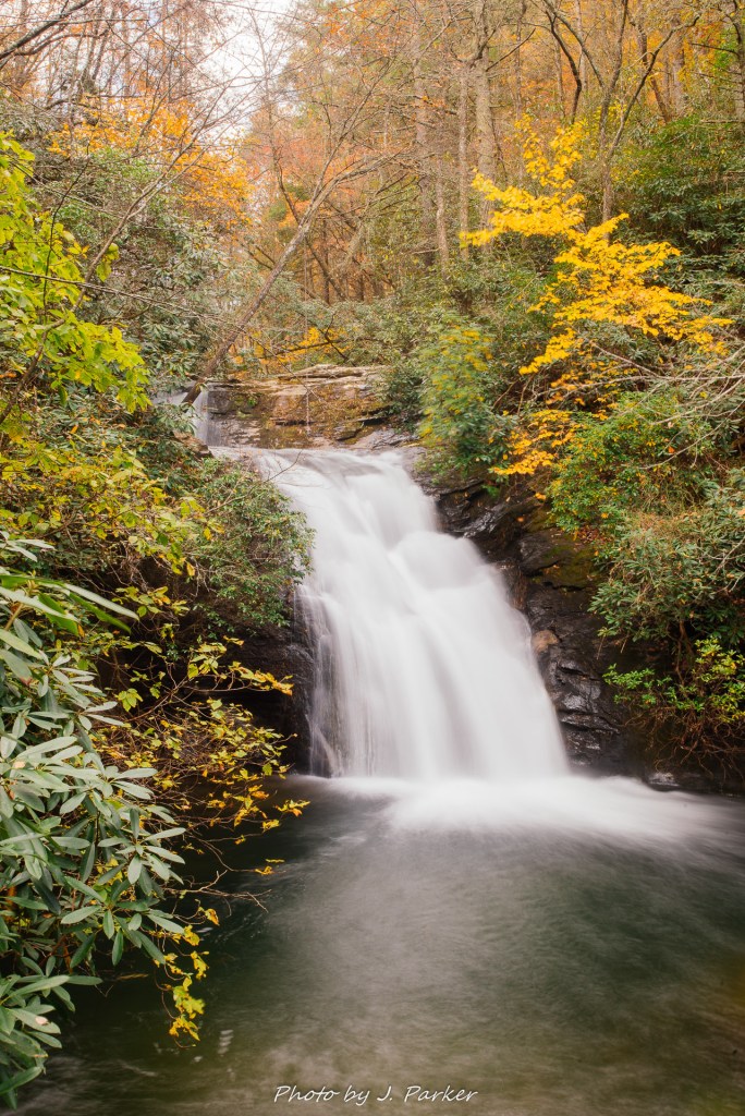
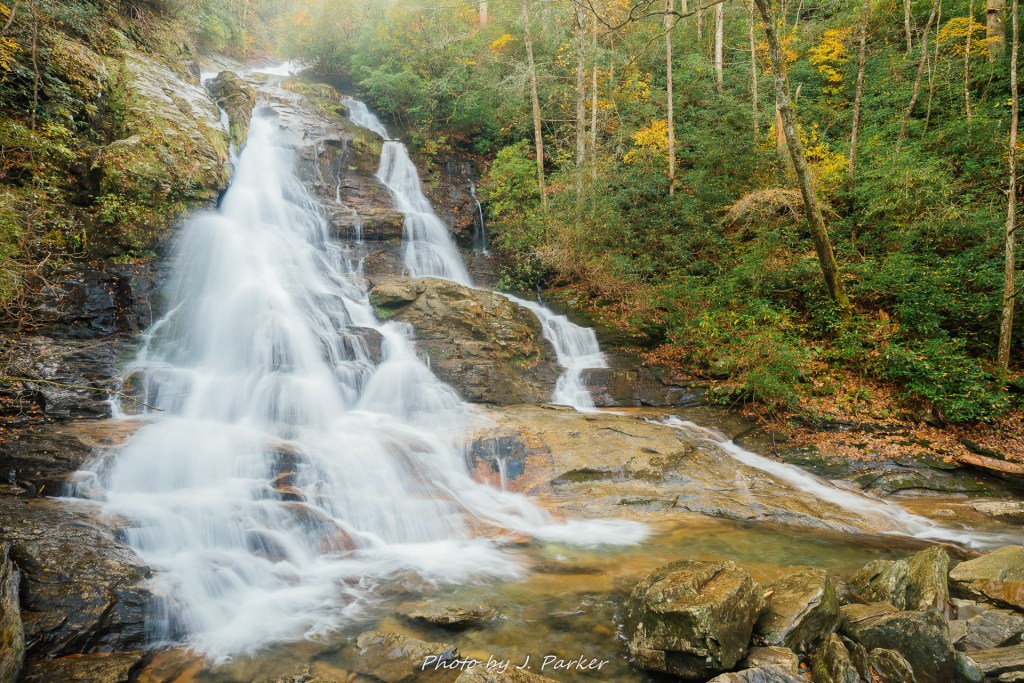
The trail began descending pretty steadily as it took a less direct path to the namesake falls. I wasn’t surprised at the descent, but it lasted a lot longer than I anticipated. I found out why upon reaching the viewing platform, which gazed out at something far different than the little set of tiers I had seen earlier. High Shoals isn’t the largest fall I had come across that trip, nor would it be the largest or even second largest I would see this same day. What took me aback was that I was caught completely off guard by its large size, for I thought it would be of similar stature to Blue Hole Falls. It was only then that I realized that my entire conception of the hike was based on that trademark image of Blue Hole Falls which is so prevalent and identifiable.
Once again, the flow of water over the fall was a raging torrent, which was too strong to provide for the idea shot. Being such a large fall, however, it suffered less than the usually placid Blue Hole Falls, and the sheer power of the fall certainly added to its majesty in person. This is one of those falls which a picture, assuming you actually find one of High Shoals Falls and not Blue Hole in the first place, really does not convey the size very well.
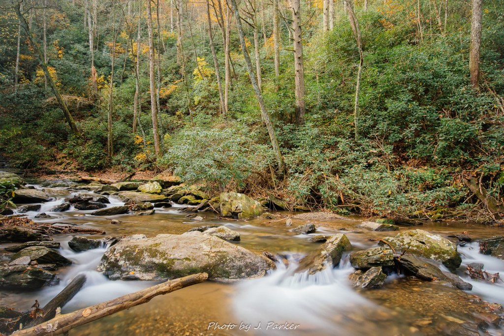
There was limited benefit to going out on the wet rocks to get a slightly better angle of this raging fall, but I did step off trail and past the rocks to chase some intriguing creek views I saw were accessible past the falls. Waterfalls are iconic and they are fun to “collect” photographs of as a rite of passage, but personally I enjoy photographing a nice small cascade or set of rapids than I do the big falls. Waterfalls typically lend themselves to a couple obvious angles that most photographers get, while in other cases there are photographers that combine a great composition skill with a comfort level moving around wet, dangerous rocks that I just don’t have coming from Florida. Being local to falls and thus being able to plan visits around optimal water and light levels also benefits some photographers. Thus I rarely feel like I’m going to outshoot a local at a waterfall, at least one in the public eye. But creek shots are unique and feel more expressive to create. As a photographer, you are always going to photograph a waterfall along a trail if conditions allow, but rarely will photographers always photograph the same unlabeled rapids and water features.
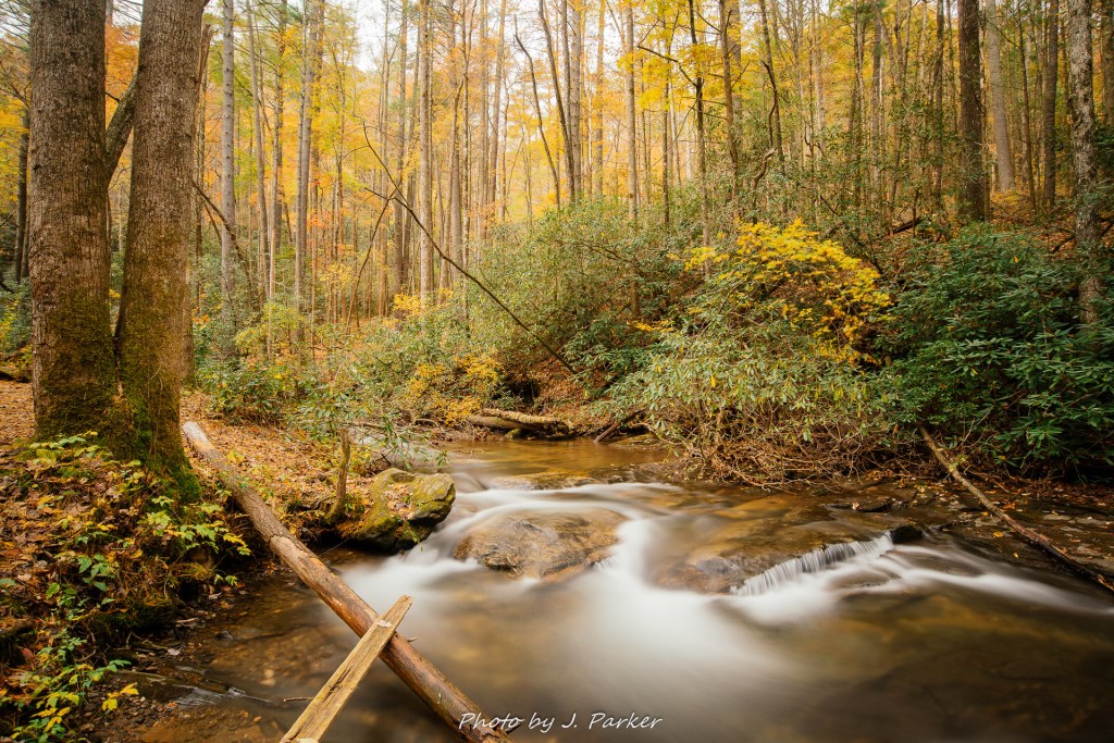
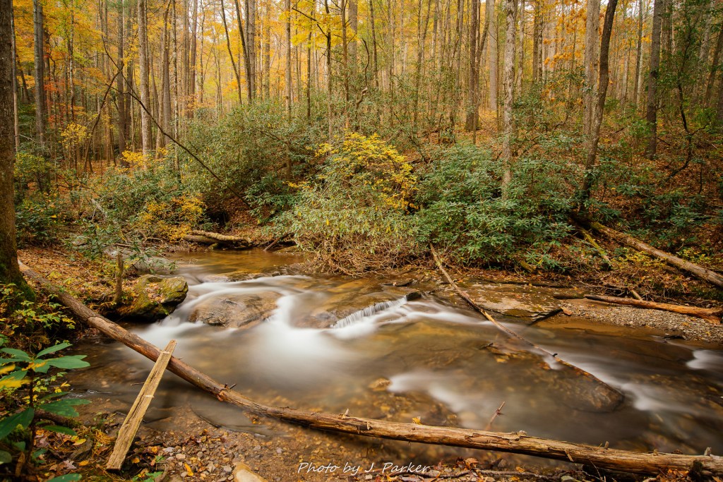
High Shoals creek seemed to be calling my name, which was weird, because I don’t remember telling it my name. I followed the faint path, not worn enough to be called a trail, for a hundred yards or so, looking forward to every view I would get when I turned around to look upstream.
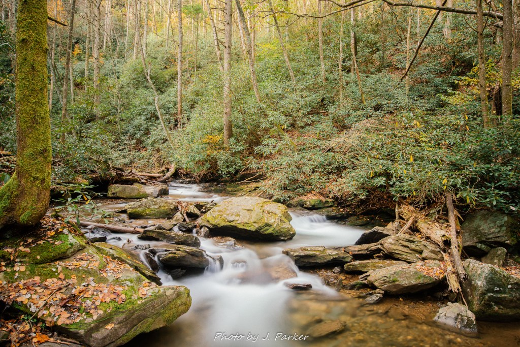
I followed the creek as far as practical, which was only some hundred yards or so before it became too adventurous to track further without a guaranteed payoff.
This was the far point in the hike; from here I would have to turn around and retrace my steps. Having already satisfied the curiosity for what’s waiting at the end of the trail, I was able to take a more relaxed pace on the way back, immersing myself in the beauty of the scenery and the ever present sound of rushing water not too far away. Only at this point did I start encountering other hikers along the trail, though they were still few and far between.
I wasn’t quite down exploring at High Shoals just yet; there was a fair amount of flat, easily accessible land between the top of Blue Hole Falls and the creek crossing that would give me a few extra views of the creek which I had bypassed earlier in my desire to get to the falls. I only ended up finding one spot that really worked for pictures, but it was one I was extremely glad to have gone out of my way for. I hadn’t found many places in this part of Appalachia which allowed a good creek view with fall color in the background, for many of the creeks have a lot of foliage that stays green year round.
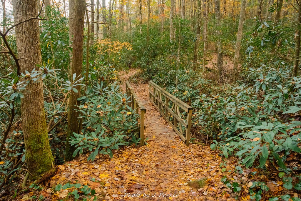
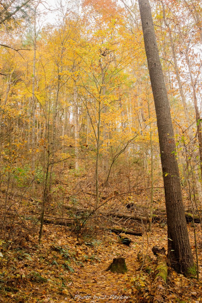
This was the last time I set up for a tripod shot here, but after crossing the creek again I enjoyed quite a pleasant walk through the woods back uphill towards my car. Facing upwards instead of down placed more of the wonderful colors in my field of vision as I walked.
My visit to High Shoals Falls was exactly what I was hoping for when I planned my three and a half day foray into north Georgia. A quiet, interesting trail with multiple waterfalls and water features to enjoy, brilliant layers of fall color, and even light to appreciate all of the various shades. It was a great start to a day that had only just begun.

Great post 🙂
LikeLike