
“Throw everything for a loop and go to Roan Mountain?” That’s what my immaculately prepared trip itinerary had listed for this Thursday in October 2017, the sixth day of our eight day mountain trip and our second in the vicinity of Grandfather Mountain and Linville Falls, likely next to a notation on a restaurant that had good barbecue and was open late (these notes are as important as knowing where to go at a trail junction, as failure to notate either one is likely to lead to you going hungry). My trip notebook, a three ring binder stuffed so full with notations on dozens of hikes, waterfalls, and anything else we could imagine visiting that the rings scarcely shut, contained not a single other notation on Roan Mountain. The hike, promising pastoral balds high above the surrounding territory, promised a dream. But not all dreams can be realized, and Roan Mountain seemed to be just far enough away that we weren’t going to visit.
We had blown past Grandfather Mountain and Mt. Mitchell State Parks along the Blue Ridge Parkway in 2011 without taking the time to visit either park located along those signature peaks just off the Parkway. We weren’t going to miss them for a second time, not even for a great hike. And we wouldn’t miss them this time (though we did fail to reach Grandfather’s McRae Peak on a hike which I detailed in my last post). What we did miss was South Mountains State Park – I hadn’t realized just how much difficulty we would have driving the mountain roads, and there was just no way for us to do South Mountains on Wednesday as we had planned while still hiking in Linville Gorge – something I wasn’t going to miss. Suddenly we had half a day freed up, and I noticed with glee that Roan Mountain, which I had somehow deemed a bridge too far (starring Sean Connery), was not that far at all from our hotel. We were going to Roan Mountain after all.
I hurriedly spent what little time I had in our hotel room the evening before cramming information about Roan Mountain into my head, needing to know where to park, what direction to hike, how far everything was from the trailhead, etc. (There are two popular hikes starting from Carver’s Gap along the Appalachian Trail. The signature hike heads north, but the southward hike, featuring very different scenery, is also well-liked among hikers). I wouldn’t have worried at all had I known how busy Roan would be and how obvious the layout would be when you got there.
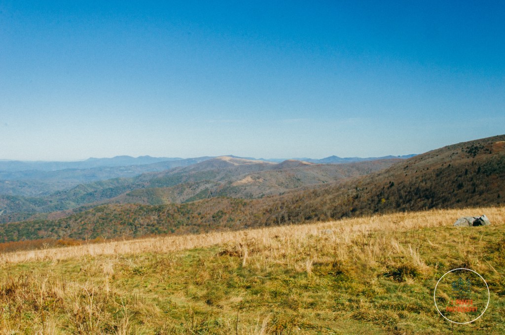
As we exited Grandfather Mountain State Park we were surprised to find dozens upon dozens of cars waiting to make the left turn into the park entrance. We were happy to leave that madness behind, though we’d enter our own as we got closer to the parking area (In my head I imagined that Roan was far more backwater than it actually was. I hadn’t realized just how heavily Carolinians will flock to signature spots, even if well off the usual through routes). The drive itself from Grandfather to Roan was a highlight unto itself, and I enjoyed that we got a traverse a small corner of Tenneesee, a state which had really instilled our love of the mountains on our pass through in 2015. This would be our only dip into that state this trip. Our journey in Tennessee started deep in the valley, one which also (somewhat confusingly) contained Roan Mountain State Park, despite not having the signature mountain peak within its actual borders. The road, lined consistently with the fall-laden woods of the Cherokee National Forest, climbed consistently though not overly steeply. We occasionally got an opening through the woods to views which grew increasingly more elevated over the valley below. A great ridge loomed over much of the drive, and partway up I identified that as Grassy Bald. As we got within two miles of Carver’s Gap, the consistent canopy gave way to mostly open views to the right. The views were awesome, with pine-filled peaks looming alongside a great sweeping valley with waves or ridges below.and it was crazy to think they would be even better from the top of the ridge looming overhead, where we’d be able to walk unencumbered.
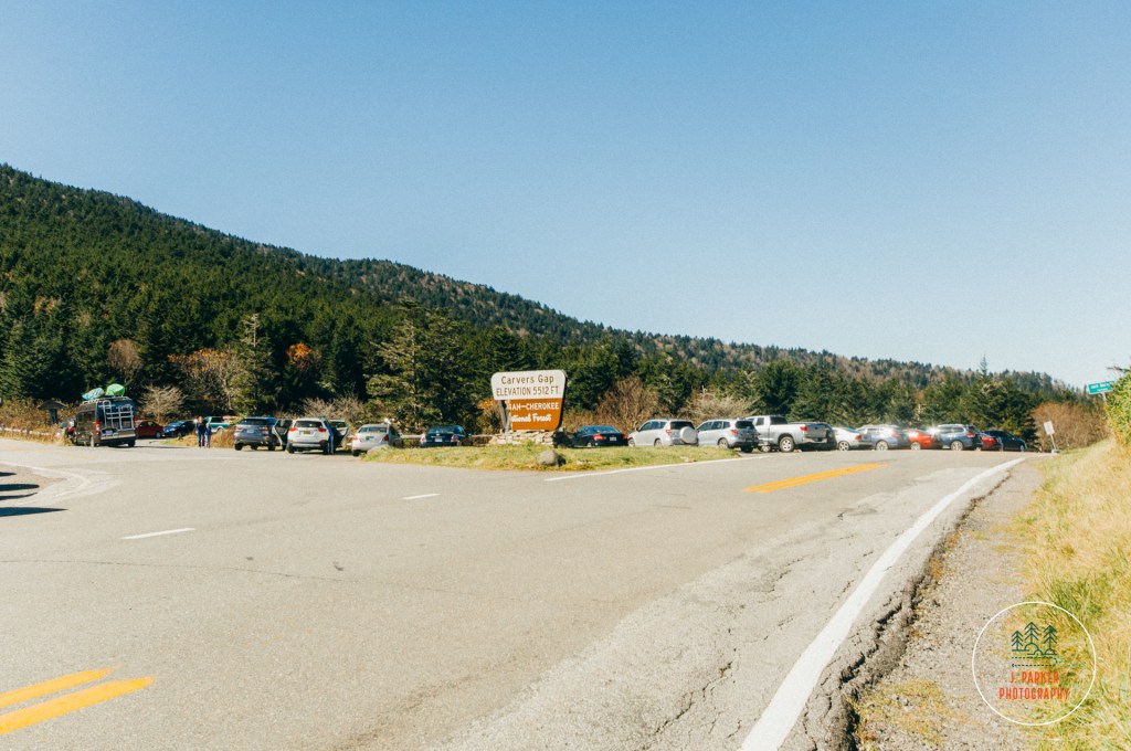
Jess was less enthused about the great views than I was, for they triggered her vertigo. She was driving this leg of the trip because I thought it would have less open ledges to the right. I thought wrong, but it was too late now. The road made a great fishhook around Round Bald, and then we arrived at our parking area. At least it might be our parking area. Lot’s of other people were parked here. In fact, so many that we had no place to park ourselves. We looped around the main parking area, but there was absolutely no space to wedge our Toyota Corolla into. We advanced forward, where cars were parked alongside the road, but eventually the shoulder disappeared, and we were worried about even finding a place to turn around. Fortunately, just as the last line disappeared, another line of cars came into view, parked where space again appeared along the shoulder. There wasn’t much space, but we pulled the Corolla into the slimmest patch of grass still large enough to house the vehicle, threw the emergency break on, and hoped that we would be able to pull out of the sketchy spot when all was said and done.
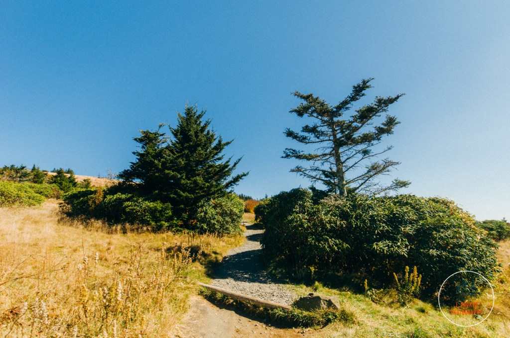
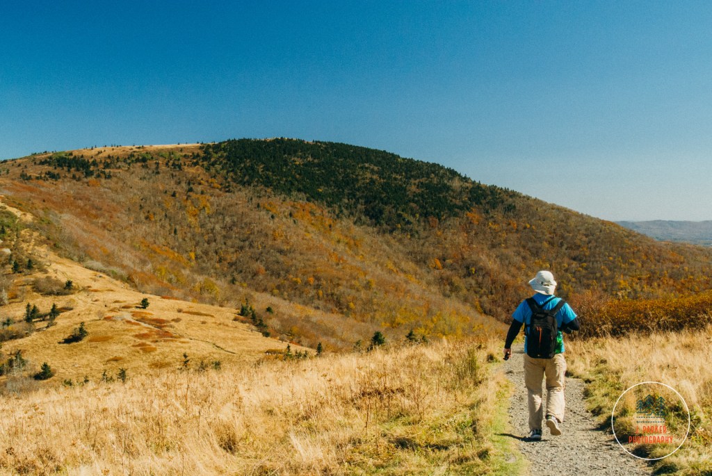
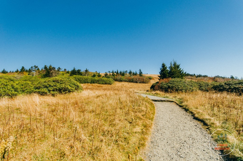
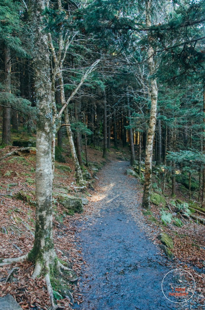
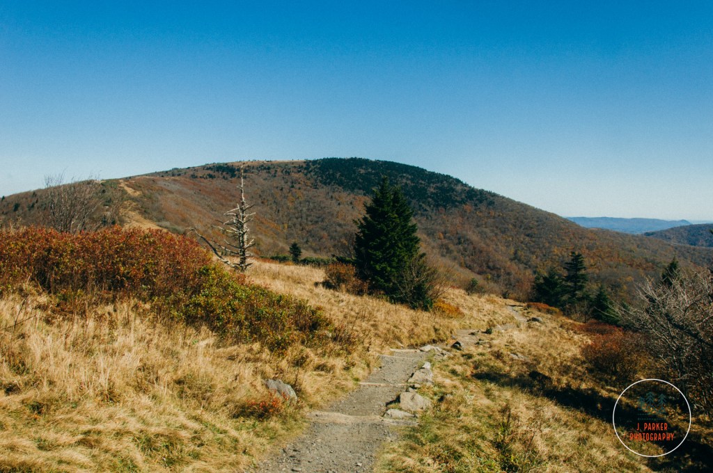
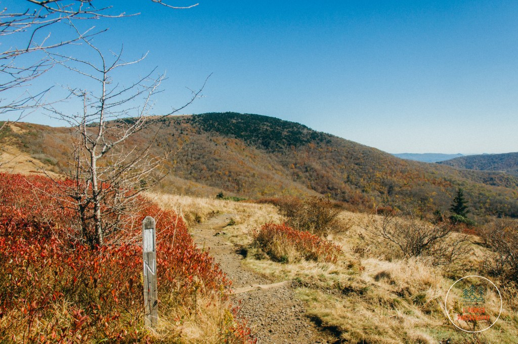
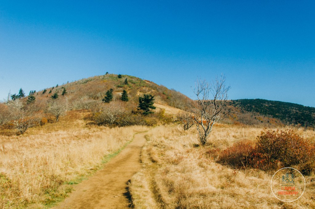
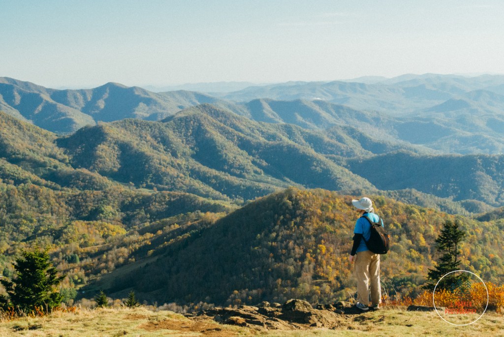
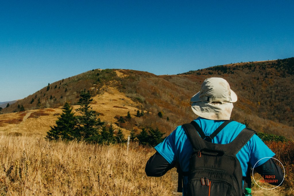
After the short roadwalk back to the trailhead, we walked between the wooden fence posts and prepared to enter another world. I noted as we transitioned from the paved surface of the roadway to the dirt path of the trail that this would be my first hike I could remember along any portion of the Appalachian Trail. For many miles in this area the AT straddles the border between North Caroline and Tennessee, as the border and trail follow the same ridgeline. The trailhead literally sits at the state line, and for much of the hiking here you can’t really tell what state you’re officially in. I just imagined that anything to my left (the northwest side of the trail) was Tennessee and anything to the right (southeast) was North Carolina. After our last few hikes being along Linville Gorge and Grandfather Mountain, territory for which the word “rugged” is an understatement, the wide, flat path of the trail here, well manicured to cater to the multitude of ages and peoples that casually visit this locale, felt like a veritable highway under my feet (in a good way). Large patches of rhododendron lined much of the trail, interspersed with open bald. During some months the rhododendron blooms, creating a spectacle celebrated throughout the area. Not today though. On this day, the rhododendron held onto a faint green, while the surrounding bald reflected not verdant shades of green but instead shades of red and brown while somehow contained both the pallor of death and the romantic life of fall. The trail navigated the hillside with the same care as a roadway would, with sweeping curves allowing one to ascend the ridgeline which loomed majestically above the trail. This ridge, a portion of Roan Mountain known as Round Bald, is the first one comes across on the trail, and it’s wide, open expanse is the primary destination for many of the hordes that fill the parking area.
At this point in the trail we already had an open view to the right, with Mt. Mitchell and the ominous Black Mountains forming the next major ridgeline over. We had been seeing Mt. Mitchell at every stop for days now, and I was ready to get on with finally visiting it tomorrow. This southerly view was partially obscured by the larger Roan Highlands to the south, where the ridge actually towers over the area we would be hiking today. Unlike the area we were hiking though, this ridge is almost entirely covered with trees, providing a much different hiking experience than the open balds to the north. I walked goat path just a bit, trying to look around this ridge, but was dismayed to find the view just opened up to the sun which dominated the view, and I retraced my steps. Nevermind that – there was a world of views to be had ahead.
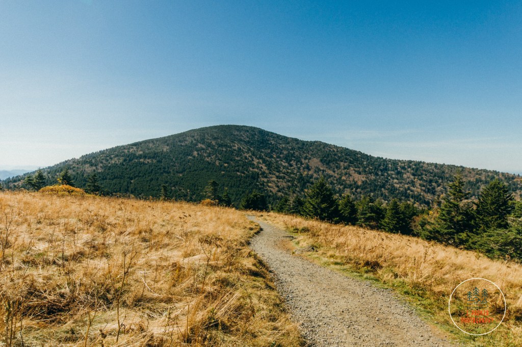
Before reaching the top of Round Bald, the trail spends a brief moment in one of the high elevation spruce pine forests, a type of forest dominated by evergreen which usually finds its home much farther north, but which does inhabit the tallest parts of the Appalachians this area. Grandfather Mountain, with its unique wealth of biodiversity, had provided small patches of this, but other than than we hadn’t encountered such a pure high elevation forest since our trip to the Smokies in 2015. The distinct Christmas tree smell filled our noses as our minds drifted back to falling in love with the mountains in 2015. This type of forest can get rather monotonous if one hikes a long stretch in it (hiking to Charlie’s Bunion and back in 2019 confirmed this), but in small doses its very pleasant, with the forest floor a mix of thick soil, green moss, and sporadic rocks providing a dramatic setting for these trees and their fresh aroma. Emerging from this forest, where views had been obscured, to the open bald again was akin to riding an elevator, for though we weren’t technically that much higher, we suddenly had a lot more in view, as much less of it was blocked by the towering Roan Highlands to the southwest. Here the trail made a fairly direct approach up a gentle slope to edge closer to Grassy Bald.
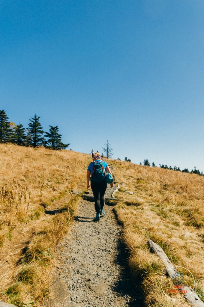
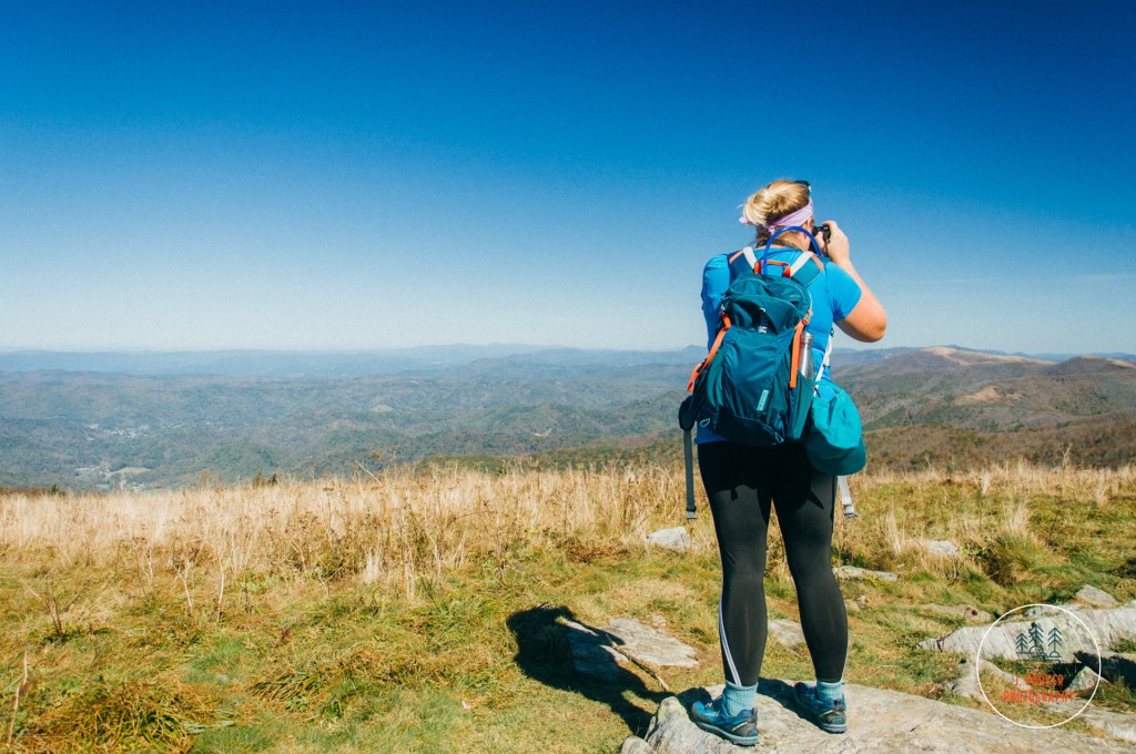
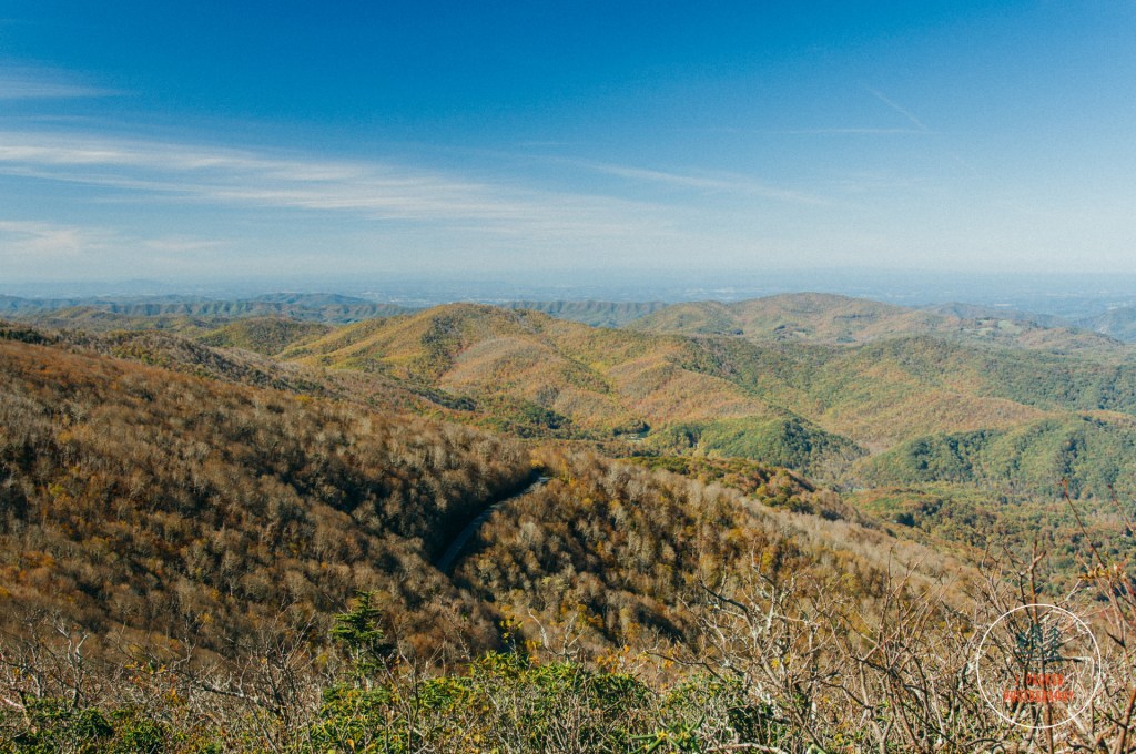
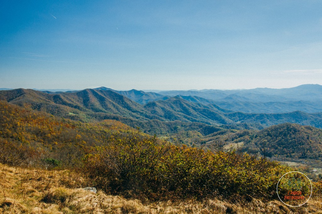
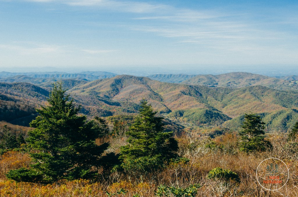
My feet, tired as they were from nearly a week of continuous hiking and walking, one of them lightly sprained from a misstep at Grandfather Mountain earlier, were called towards the top of Round Bald which loomed tantalizingly ahead. My photographer mind wasn’t just called to what was ahead though, for the further we went up the more we could see the pleasant scene of the path as it worked its roundabout course up the hillside. More impressively, we were starting to get our first glimpses above the treeline to a Tennessee valley (I hesitated to say the Tennessee Valley, since that term usually refers to the river which carves its way through the state which shares its name) which sprawled out below, with a small collection of lesser ridgelines punctuating the view. The caliber of a view from a place such as Roan Mountain is just not just by its altitude or prominence, but also by what that view is composed of. The view to the Tennessee side was interesting because of the vast distance one could see as well as all of the small ridgelines that detailed the view. The North Carolina side, on the other hand, was also filled with ridgelines, but one could scarcely call them lesser, for among the many tall ridges in the area were the Black Mountains, higher than anything else in the Appalachians, including Roan Mountain. Yet the North Carolina with these ridges was far from obstructed, as they were all laid out rather nicely and distant enough to make a compelling scene. The views into both states were equally interesting, and it’s wonderful to get two contrasting but interesting views within a short distance of each other.
The closer we got to the top of Round Bald, the more families we encountered. There were people everywhere. Other than a crowded summer swimming hole, this was the most people I had seen in a nature location (which could be expected, based on the parking situation). With that said, there wasn’t a crush of people. Round Bald offered an immense amount of space for people to gather without overlapping on one another. In this sense, having a lot of people without having them be obtrusive, the presence of others just added atmosphere and reinforced that you were in a special location.
We finally reached a wooden sign which denoted that we were on Round Bald. The Tennessee side was the most available, plus we had been seeing views in North Carolina for almost a week, so we ventured there first to savor the views of somewhere fresh. Round Bald towers over much of the area, offering views so prominent you would imagine they came from something with a sheer cliff, yet in almost every location the land just gradually slipped out of view, never once making you feel like you were risking danger to savor the views. This reinforced the imminently relaxing mood of the area. It was definitely an interesting experience clinging to the side of jagged cliffs at Linville Gorge, but after experiencing that nerve wracking adventure only to follow it up with Grandfather’s boulder-strewn pathways, I was all up for high caliber views that I wasn’t risking death for.
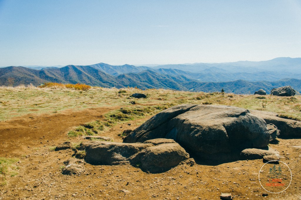
The surface of Round Bald was almost entirely grass, but occasional rocks provided ideal seats to savor the views and enjoy not having died at Grandfather Mountain. A small ideal set lay along the Tennessee side, and these rocks were about the only time we were impacted by the presence of others on the hike, as they attracted a small crowd jockeying for position while we were there. We then crossed to the North Carolina side on a well-worn side trail, evidence that thousands of others had explored Round Bald in the same exact fashion we did. Awaiting us at the end of the path was a flat rock perched directly beneath the sun, which seemed to reach out like the hands of heaven to ensure we did not miss our destiny. Here we enjoyed perhaps my favorite view during the entire hike, as we gazed upon sharp red ridges reaching into the sky, their pointy arches contrasting sharply with the aptly named Round Bald we were presently on. I’m rarely one to repeat experiences, but the view was nice enough here that we stopped by again on the return trip, enjoying the rock once more with the sun having moved on a bit so it wasn’t directly in our view.
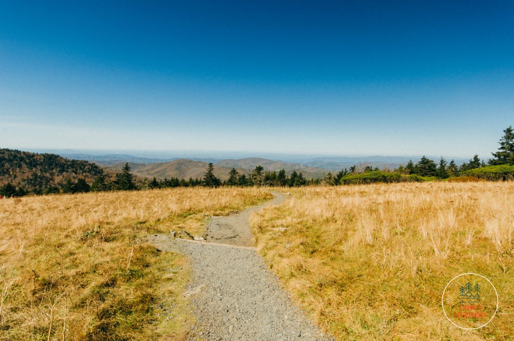
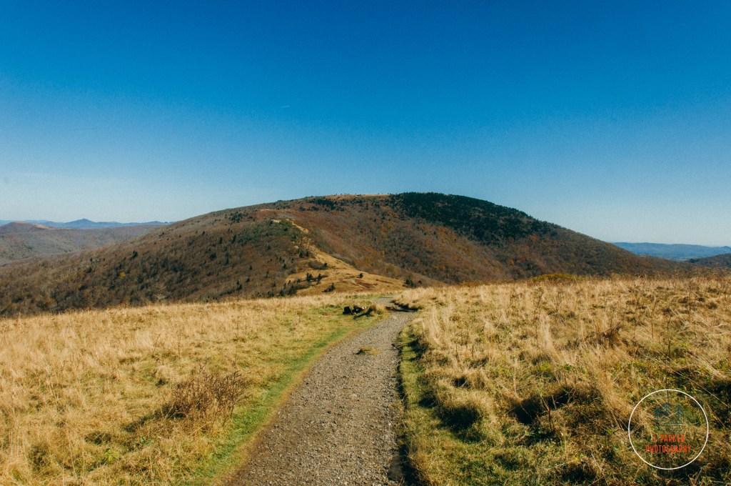
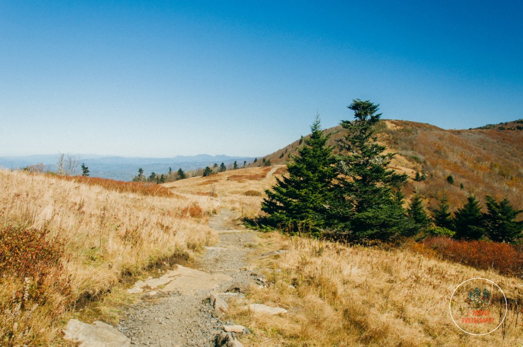
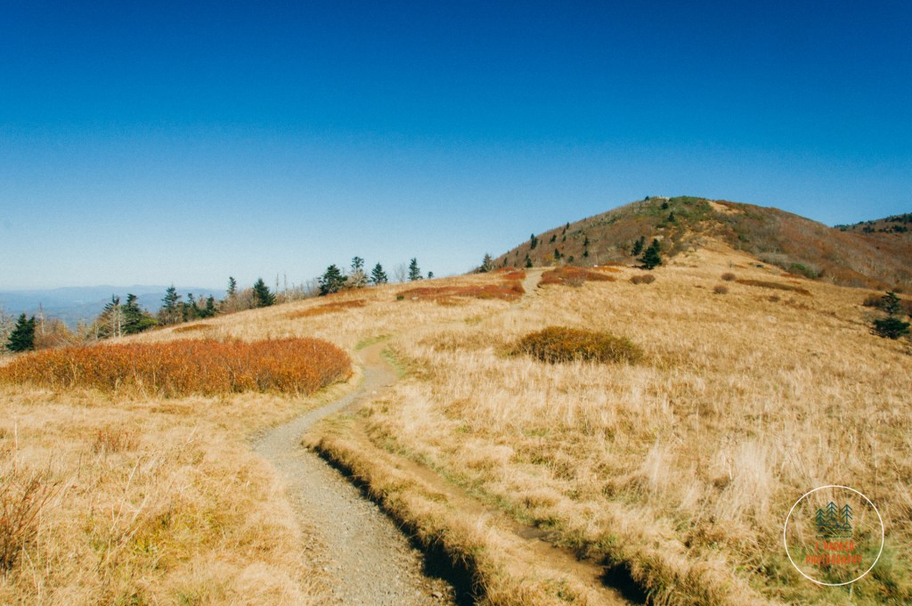
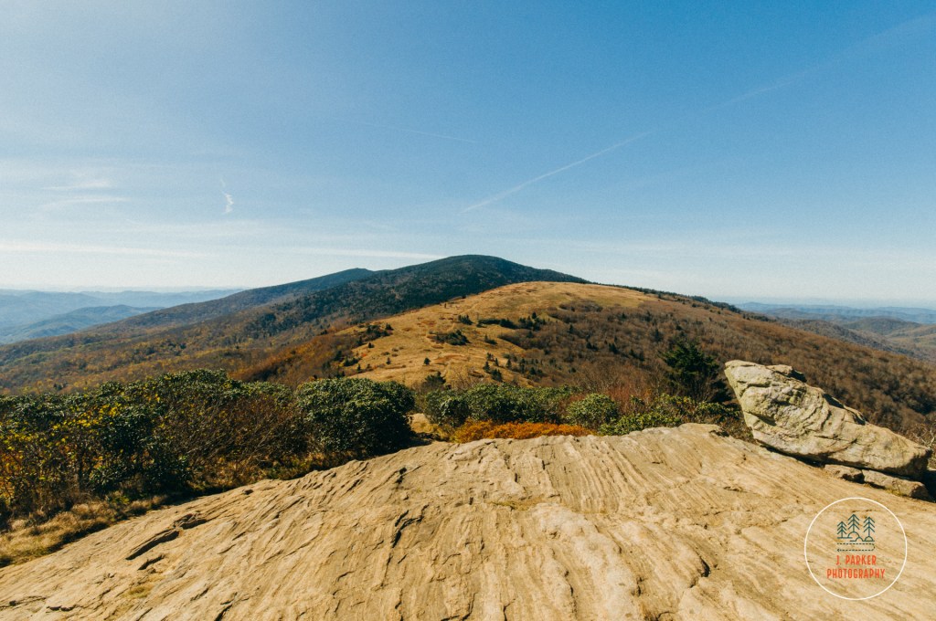
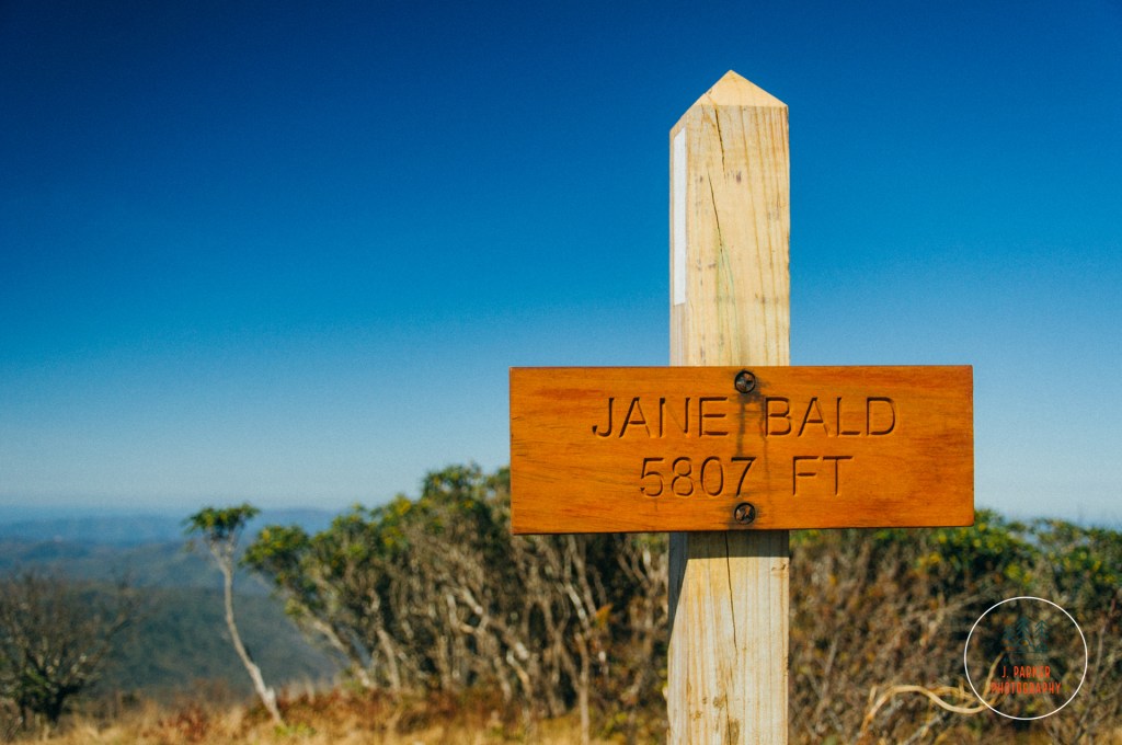
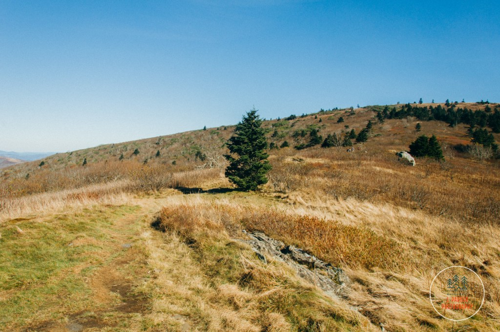
After savoring the views a bit on this first time, we ventured onwards towards the next bald up the path, Jane Bald, which lied some distance in elevation below Round Bald but still high above much of the surrounding valley. We headed onward on the trail as it bore an indirect, long curved path down the side of Round Bald, its course designed to maintain a gentle grade as it descended in elevation. Marking the path was clear, but at this point it was hard to tell what was considered to actually be Jane Bald. Terrain has an odd way of flattening out and distorting when you’re a bit above it. We experienced another odd optical illusion while gazing towards the massive round prominence that was clearly Grassy Bald looming largely ahead. Mostly bereft of trees, it was hard to gauge the actual size and distance of its huge form. It was only when we could see the faint outline of people appearing very, very small on its surface could we really appreciate the scale of the thing. As close as it seemed when there weren’t people to quantify its distance, Grassy Bald was a bit further than we were going to make it today (hiking to all three of Round, Jane, and Grassy Bald is perhaps the “classic” Roan Mountain hike).
Though Grassy Bald, and somewhere Jane Bald seemed to be not that far away, the indirect path made this section of trail far longer than the visuals would imply. But that wasn’t a bad thing, for this was a really pleasant section of trail to hike, my favorite section of trail to hike here. The trail was adorned with occasional shrubs, trees, and other red vegetation, which combined with the occasional stairwell almost gave the feeling of being in a well-designed garden, high up in the sky.
As we edged lower on the pathway we could finally distinguish Jane Bald from the rest of the climb to Grassy Bald. Whereas from far away it seemed to be just part of a continuous climb to Grassy, only as one got closer could it be distinguished as a separate entity from its larger neighbor, with its own rise and fall. That was for better or worse, as when one got closer to Jane, one realized that the ascent to it was actually somewhat steep – a start contrast to the gradual trail that had defined the hike beforehand. The ascent seemed to grow taller as one approached, and during its climb the trail was escorted by shrubs which encroached heavily on its path and somewhat obscured vision of what was ahead, a rare occurrence in the otherwise open area. At this point in the trip, my body was running on fumes, and I worked my way up the incline with the same zeal that my four-cylinder PT Cruiser navigated a steep bridge in its final days, with one never too certain it wouldn’t start rolling backwards at a certain point.
Jane Bald had several surprises. Whereas it appeared as if it would reach a distinct point, in fact there were several areas in which one could enjoy. We relaxed at a nice rock overlooking the Tennessee side, affording us the best views into that area. As we took in the views we made fun of ourselves for the snobbery we had developed from over a week in the mountains, as we had the nerve to call the other peaks we were overlooking “small”. While enjoying this spot, we actually thought we were one Jane Bald, but in fact were still a few hundred yards or so from the actual named bald. The area we were on was apparently undeserving of a name, despite being no more a part of Jane Bald than Jane was part of Grassy. This area was more narrow than the other named balds, but it was easy here to savor views of both sides within a very short distance.
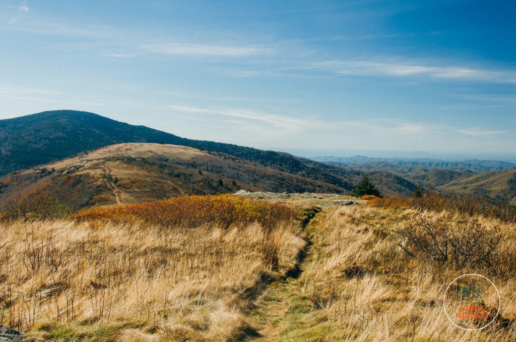
Awaiting at the top of Jane Bald was another series of views, similar to what had been seen before, but relatively more quiet. It’s more narrow ridge line offered a lot more photogenic rocks with which to make a natural bench and enjoy the scene. Jane was understood to be our stopping point, but as the trail stayed flat for a bit, and there was a nice open area partway up Grassy Bald’s imposing frame, we decided to work our way towards what I dubbed “medium notch”. Again, I’ve no idea why Jane deserved a name while these other areas went unlabeled. “Medium Notch” could be identified from raw away much easier than Jane could.
Naturally, the path up the notch began to appear steeper as we inched closer. Fortunately nothing on its path reached quite the steepness of Jane. We were taking a bit of a gamble on this unnamed spot, not knowing if it offered much in the way of open space to enjoy the view. Fortunately another series of great rocks offered more vantage points, though of course the view didn’t differ too much from what we had seen before. One of the most interesting things from here was just the opportunity to look back on where we had come from – seeing the line of ridges from our notch to Jane Bald, Round Bald, and then the larger part of the wooded Roan Highlands looming behind Carver’s Gap.
It had been our fourth straight day of perfect blue sky weather, and fortunately our main hikes every day of that were open, high-elevation hikes that took advantage of it. We really savored the views here, knowing it might be the last time we would get to enjoy such open views in such a free surrounding. With this being our second to last day of the trip, and us being Floridians who didn’t make much money, we had little way of knowing when our next opportunity to enjoy such scenery would be. It was odd to be saying this, what with the largest mountain in the Appalachians looming the next day, but I wasn’t actually certain what caliber views Mt. Mitchell would have, and I was quote sure there weren’t any open balds there to traverse.
The larger peak of Grassy Bald still loomed far overhead. While Medium Notch seemed appreciably up it a good distance from far away, it certainly didn’t seem that way when you were there. I had hoped to entice Jess to push on the final ascent to Grassy, but there was no way we were going up an extra peak that large at this late point in the day. We didn’t complete the traditional three bald Roan Mountain hike, but we had traveled quite a bit further than the general public stopping point at Round Bald, and definitely had an experience that didn’t feel incomplete despite not including Grassy Bald. Considering we were never supposed to visit Roan Mountain at all, this was a great bonus.
Except for the very gradual ascent up the backside of Round Bald, everything on the return trip was downhill. We made a leisurely stroll back to Carver’s Gap, stopping again at our favorite places to sit and enjoy them again, and photograph the same frames we had gotten before. But how many times do poor Floridians get to enjoy this type of view and experience? Not much.
Roan Mountain is definitely a great hike that deserves its excellent reputation. I myself ranked it as my 4th favorite hike of this absolutely awesome trip we did, but it could have easily been 1st, which is where Jess had it ranked. I myself had Black Balsam ranked first, but I might have felt different had we not done it three days before visiting Roan Mountain, and rank it higher partially for sentimental reasons. Aside from the business, which is more an issue for the parking difficulty than anything else, the only thing I don’t like about Roan compared to Black Balsam is that the former doesn’t have the option for loop hikes, meaning you have to experience on a thru or section hike or else retrace your steps. At a place with constant great views like Roan, this really isn’t that big of a deal, and heck, the back half of the loop at Black Balsam/Tennent Mountain was actually a pretty bland section of trail, but it’s still always nice to be able to use a larger trail system to design your own hike. I’ve heard Grayson Highlands has some similarities to Roan while also allowing for loop hikes, and I was going to find out first hand, hoping to get another taste of that Roan-like bliss, but I had to cancel my planned trip over Labor Day 2019 due to the threat of Hurricane Dorian looming at home.
