
Somewhere in front of us was a mountain. Not that we could see it, but we were taking it on good faith that it was there. I don’t know why, considering the Blue Ridge Parkway signage had been rather inconsistent this summer of 2011, but we were. We could definitely see the base of it, but impenetrable mist shrouded much of the top. And that top seemed to be enormously high – far higher than I had ever imagined could occur in Appalachia. Not that I had ever spent much time imagining the tallness of Appalachia. I was from Florida, after all, where the largest hills nearby are landfills (one might think I am joking. But it’s pretty much true). This massive peak was beyond anything I would have expected. It was mysterious, foreboding, fantastical. For a second I thought I might have been in Alaska, and that was only partially because I would end up in the hospital later that night with a systemic infection.
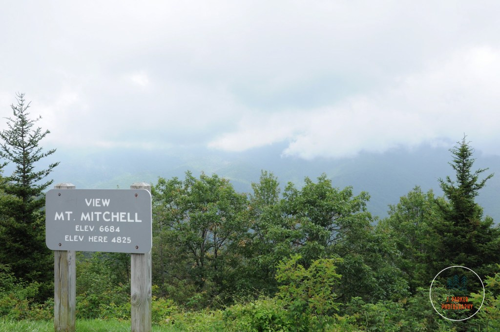
This mountain was Mt. Mitchell, the king of the Black Mountains and the tallest in the Appalachian range. Like many stops along the Blue Ridge Parkway, we weren’t going to have time to dip off the Parkway to explore it in depth during this 2011 trip. We had given ourselves only three days to explore the length of the Parkway, and there simply was only so much time for sidestops. Like Grandfather Mountain before it (which we had visited the day prior), we earmarked the place for a future visit, not knowing when that would occur. Flash forward six years to the fall of 2017, and it was one of first stops we placed on our itinerary and planned our trip around, as we had to plan our trip around the uncertainty of whether or not my ailing hip would allow us to hike. Mt. Mitchell was a place that could be enjoyed without much walking, as the state park road leads almost to the summit.
This was our 7th day of hiking out of the last 8. We were exhausted. We had already started the morning with a frantic hike to Crabtree Falls, where an assault of freezing air couldn’t make the hike end fast enough. We had no shame about driving to the top.
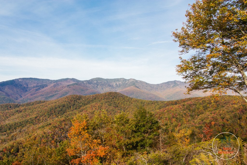
It was a pleasant drive from the Crabtree Falls parking area to the side road off the Parkway which led to Mt. Mitchell State Park. The Parkway is always beautiful, but on this day it was exceptional, with the mid-elevations still rife with fall color, perhaps a bit past peak but still quite lively with oranges, reds and yellows. We enjoyed the drive, but we were also a bit somber. This was the last day of our week in the mountains, and we were having a hard time imagining how we were going to enjoy flat Florida after the mountainous wonders we had seen – Tallulah Gorge, Dupont State Forest, Looking Glass Rock, Black Balsam Knob, Linville Gorge, Grandfather Mountain, and Roan Mountain, among others. We had done the greatest hits of Appalachia and by comparison Florida barely seemed to offer a decent album track. That was going to be tomorrow’s problem, and we tried to think of what we would lose after this last day in the mountains, but instead what we still had.
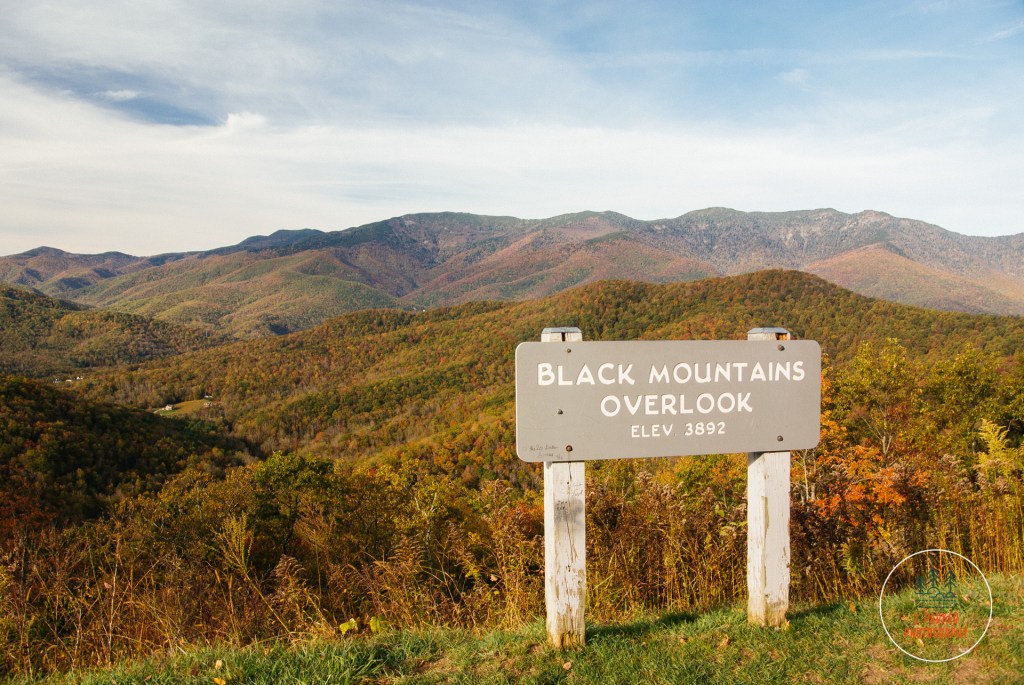
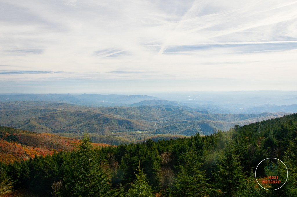
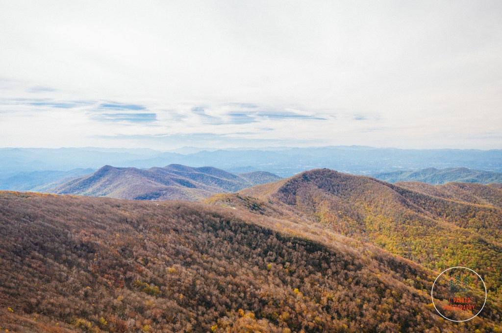
We stopped to enjoy the several overlooks that gave a glimpse of the crest of the Black Mountain range, which towers over this entire part of western North Carolina and had been visible from almost every location we had visited in the last few few days. After seeing this peak for days, we were finally ready to get on with it!
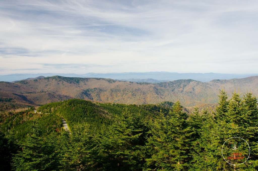
The Blue Ridge Parkway towers over much of the area around it. It’s very common to find yourself looking down on other peaks so far below that they appear as nothing more than waves in a sea of mountains. Mt. Mitchell, on the other hand, is an exception. Turning off the Blue Ridge Parkway onto North Carolina 128 begins a rather steady climb on what becomes the tallest highway east of the Mississippi River, an accomplishment because many people have difficulty spelling Mississippi. This steep road might have unnerved some lesser folk, but after having nearly lost our Toyota Corolla on a dirt road in north Georgia, then tackled the terrifying drive to the Table Rock Parking Area in Linville Gorge, this drive scarcely registered for us. Disappearing on the drive were the vestiges of fall color we had been treated to, as the higher elevations are inhabited by Southern Appalachian spruce-fir forest, consisting of evergreen trees which scarcely change with the seasons. What did change with the season had long since cycled through its fall colors and was now a dull brown. But never matter; one does not do the tallest mountain in the Appalachians trying to get fall color.
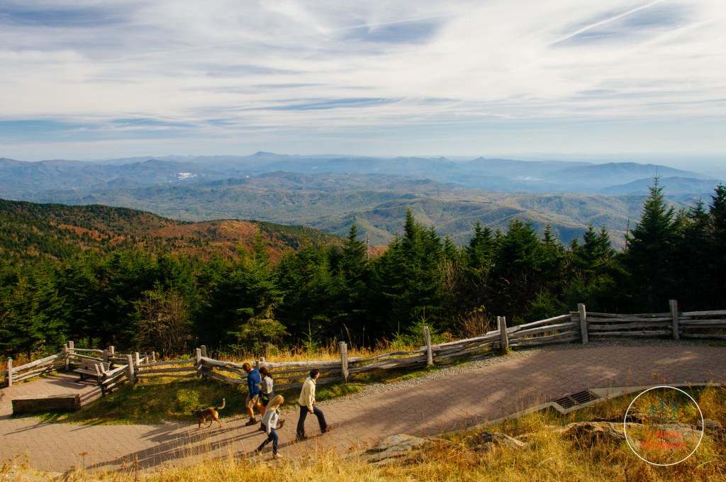
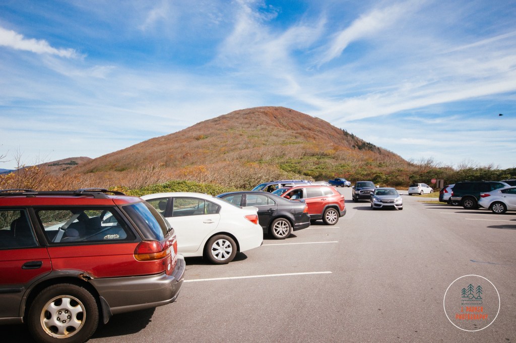
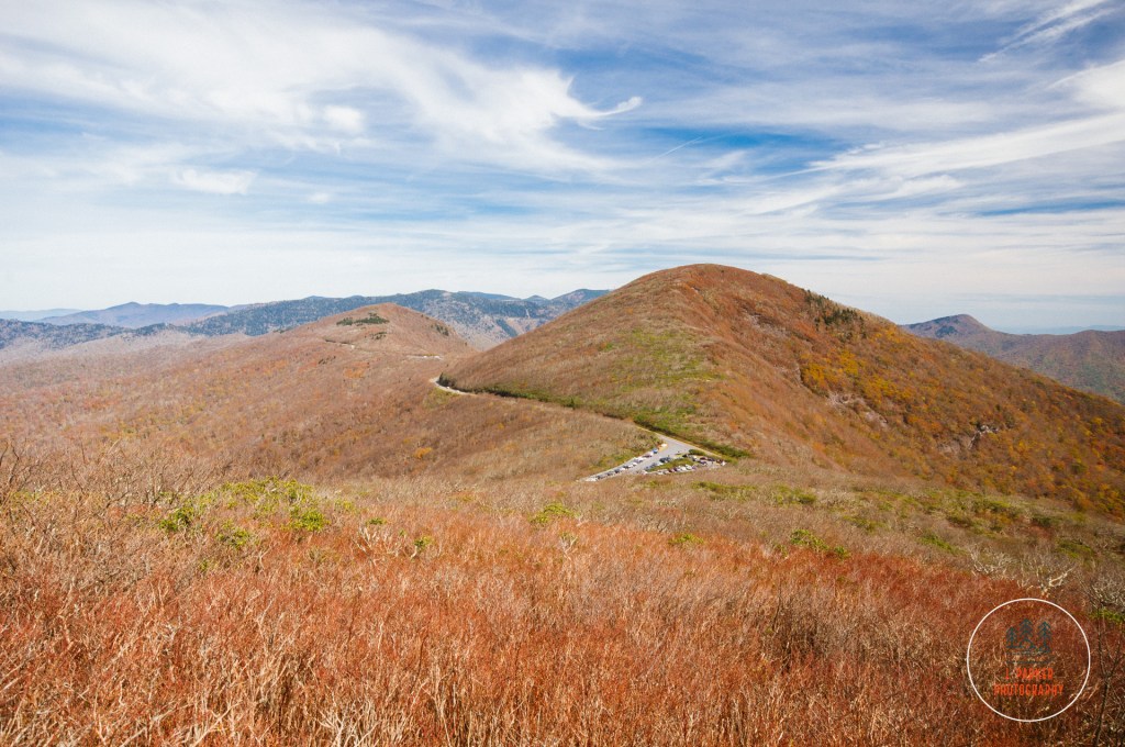
It was only a bit after 10 that we reached the parking area a short distance from the summit, but spaces on this fall Saturday were already getting to be a premium. Not that we had imagined it would be much different, but this certainly confirmed that getting anywhere among the crowds was going to be a challenge. Parking towards the top spoils some of the mystique of a summit view. Crowds, at least not the type that consists of dozens of carloads, doesn’t help either. But one must endure these type of things to experience some notable locations that bear all the hallmarks of a tourist trap, and we knew what we were in for. We trudged our way up the curving oath that led to the observation area on the summit, proud that our tired legs nearly allowed us to keep pace with the hordes of elderly snaking their way to the top.
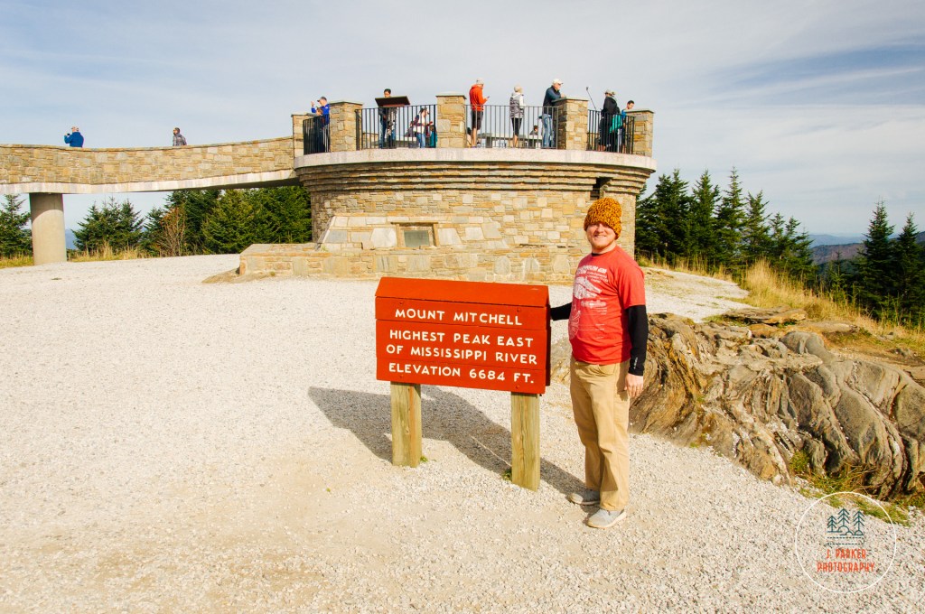
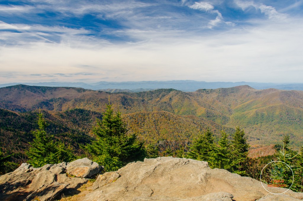
We made far worse time getting up to the top than I would care to admit, but we did reach the platform. We walked our way up the circular ramp before reaching the round platform that was the object of so many desires. At the risk of sounding pretentious, for some will always be a bit prudish about these “tourist trap” type views, for the tallest peak in Appalachia the view was a bit…underwhelming. Certainly one could see quite a bit from this extremely elevated perch, but perhaps not as much as one might imagine. Overall though, the views weren’t quite the same caliber of many of the other places we had been, where there were more interesting sights to actually fill the view, places like Linville Gorge, Black Balsam, and Roan Mountain, where you also had the freedom to roam and enjoy in a more organic way, rather than taking a short concrete pathway from a parking lot just off the summit. And Grandfather Mountain, a similar drive-up summit experience not too far away, was also a bit more impressive. But that’s not to say Mt. Mitchell’s summit wasn’t cool. It was. We just didn’t rank it above that whole slate of great Blue Ridge Mountain views we had already experienced in the last week, enjoyable as it was.
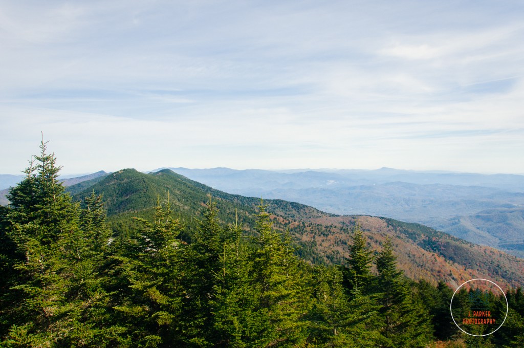
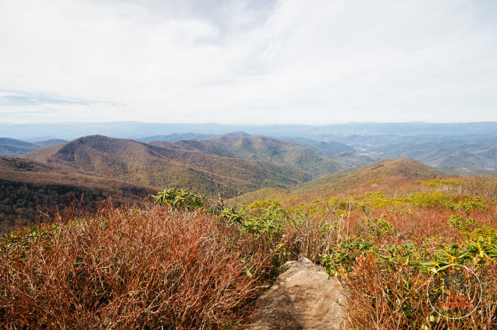
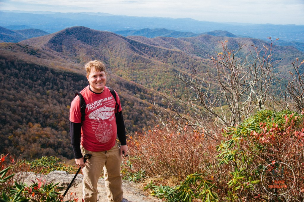
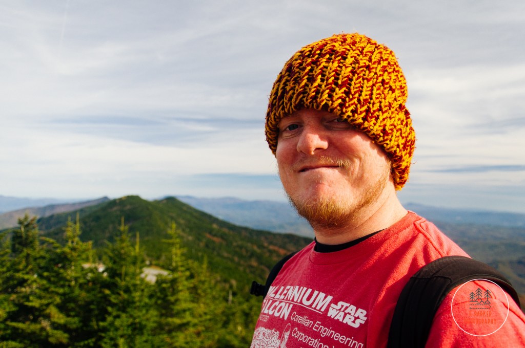
One of the better sights visible from Mt. Mitchell’s crowded platform was the peak of Mt. Craig. Mitchell’s neighbor to the north. Which, coincidentally, was going to be our hiking destination. Most of the hikes along Mt. Mitchell’s peak area were far too strenuous for us to consider when planning the trip around a bad hip, but the Deep Gap Trail to Mt. Craig offered the chance to get away from the crowds for a bit and enjoy a more natural view from the tallest ridgeline in Appalachia (Mt. Mitchell for intents and purposes is merely the tallest peak of many peaks along the massive Black Mountain Crest) with only roughly a two mile round trip. Mt. Craig is the second highest peak east of the Mississippi, thus the the Deep Gap Trail offered a chance to hike between the tallest and second tallest peaks in Appalachia – a cool concept which turns out to be pretty cool in person. After taking the requisite people on vacation shots (of ourselves, not the other people, which would have just been weird) we worked our way back down the serpentine path to the parking area and crossed in to the Deep Gap Trailhead.
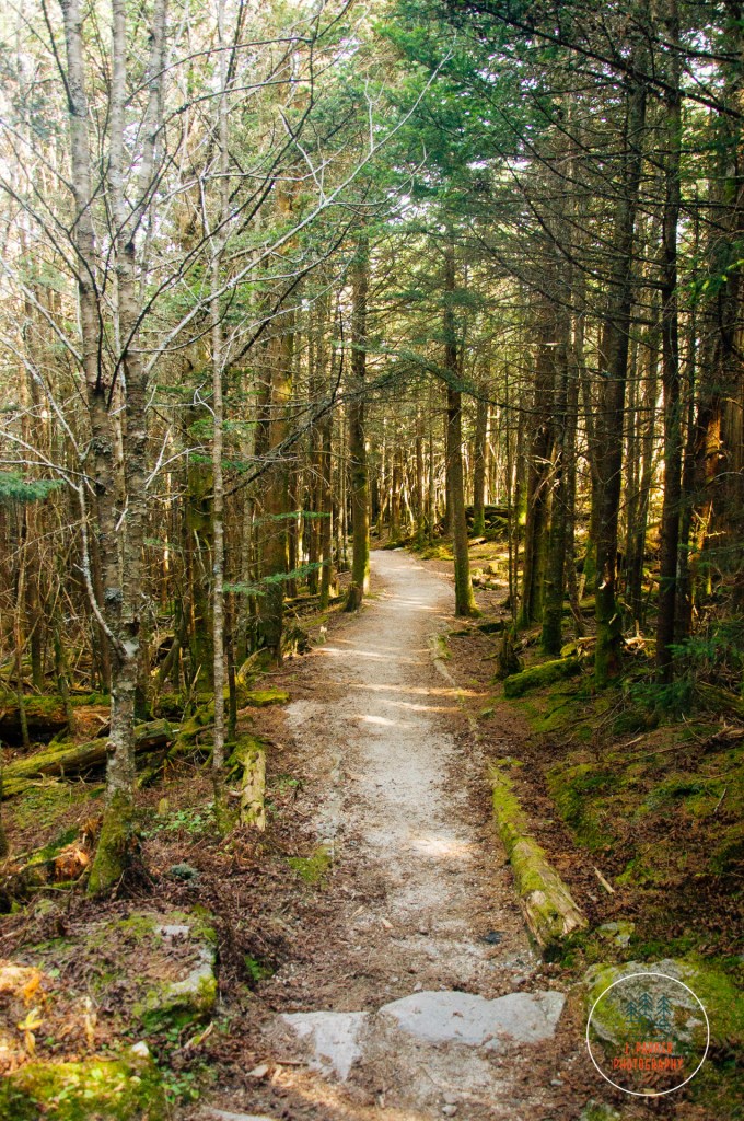
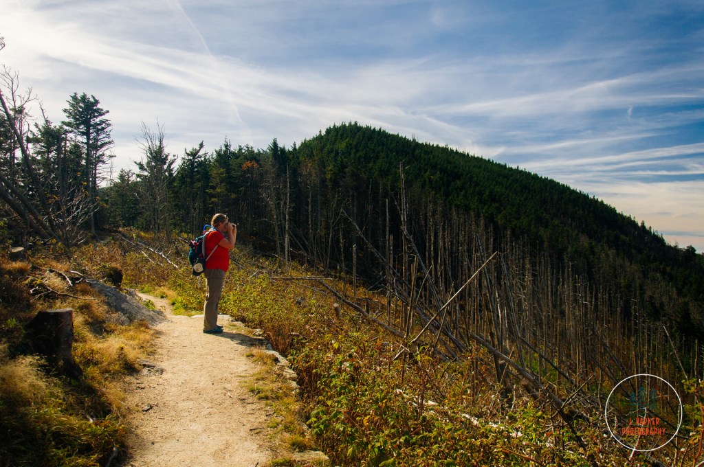
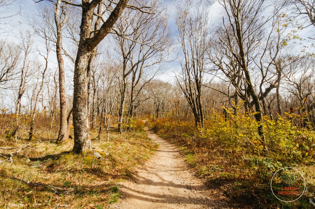
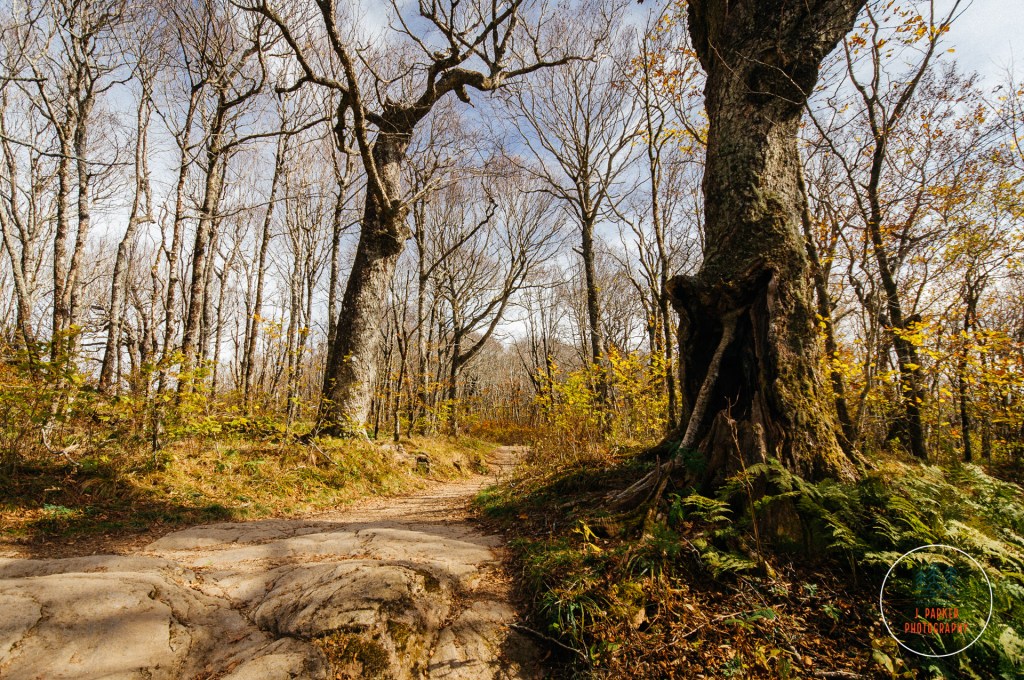
We almost laughed at how the Deep Gap Trail was labeled on the sign as “very strenuous”. It’s quite amazing how, even in the same region, the definition of strenuous can vary dramatically. What would be an easy or at worst moderate trail in a genuine hiking area earns the moniker “very strenuous” when in an area that might be overrun with families who must be dissuaded from wandering haphazardly on a genuine wilderness trail (when hiking the out and back to Charlies Bunion along the Appalachian Trail in the Smokies, we came across more than one family who hadn’t realized the trail was not a loop, not taking note of the distance to Mt. Katahdin in Maine (and the fact that this was the Appalachian Trail) posted at the trailhead. Immediately upon entering the trail we left the chaos of the parking area behind and immersed ourselves in the thick evergreen forest that always provides such fine fragrance. I normally enjoy taking in woods under cloudy cover, but the sunrays lightly filtered by the patchy cloud cover of the day illuminated the forest in a soft gold light, bringing out the green of the mossy patches that by and large covered its soil.
As indicated before, nothing on the Deep Gap Trail is all that strenuous, but there is quite a dip down as one works into the gap between the two peaks. On the way out this featured a lot of downward stairs clinging to the edge of the ridge, stairs that would have to be repeated as this was a one way trail. Nevertheless this was actually a quite pretty segment of trail as the sight of the stairs cascading down the hillside was quite pleasant to the eye. Shortly after the trail leveled out we reached a rather curious area where essentially the entire forest had been flattened somehow, with piles of logs appearing as matchsticks on the former forest floor, with the occasional barren tree trunk solemnly pointing towards the sky. While I could conjecture that there was probably some type of storm, either a tornado or strong microburst, that leveled the forest for this roughly hundred yard wide stretch, there wasn’t any official signage to indicate what had happened. While the pile of logs looked rather unsettling, it was certainly interesting to get this open view from such an elevated area.
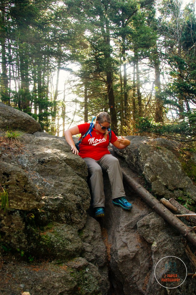
The trail had some other interesting moments. We had a few interesting rock scrambles, the type that required a bit of concentration to navigate, but nothing all that difficult, certainly nothing to the level of Grandfather Mountain, and what was there just tended to make everything feel more fun. Some sections required us to scoot on our butts as we worked our way across the rocks. The Deep Gap Trail is part of the larger Black Mountain Crest Trail, which as one could imagine is known as a tough cookie. From what I saw on this section of Deep Gap Trail, which had some adventurous passages without significant elevation gain, I can only imagine what an ascent up the challenging trail could be like. That is an experience that will never be within my skill level.
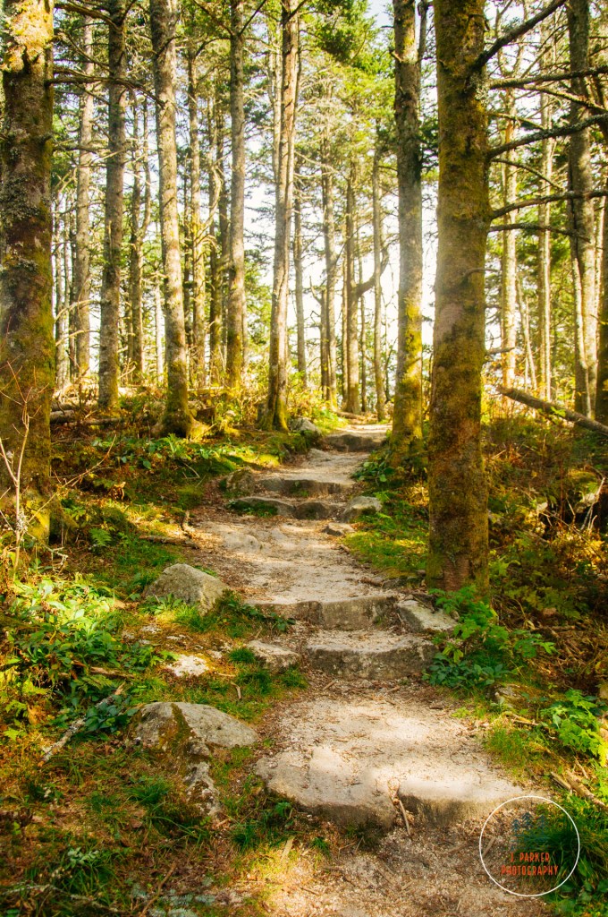
It wasn’t that long of a distance to Mt. Craig, so the trail didn’t stay in the relative flatness of the gap for long. When we started the ascent up to Mt. Craig’s peak the top was obscured by the forest, so we had little way of judging our progress as our shoes tenuously clung to the sloped, craggy rock. We were teased with a few views between the trees that gave us a taste of what was to come. Getting closer to the top the trail got more and more open, and logs marked the path of the trail over the rocky summit area of Mt. Craig.
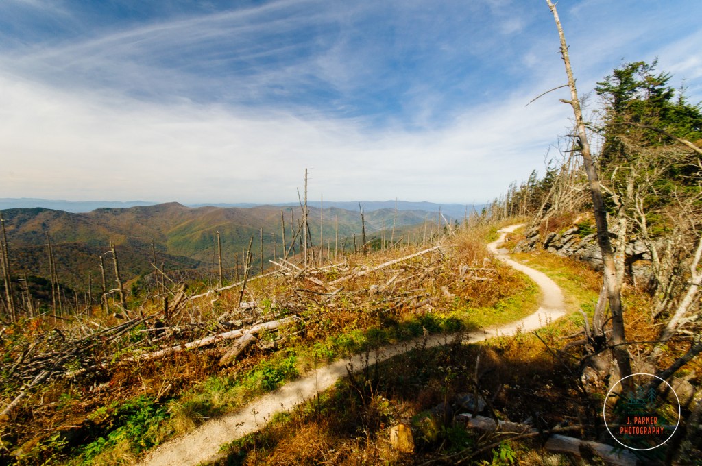
The view from Mt. Craig wast just phenomenal. I can’t tell you honestly whether or not my view of it is skewed compared to Mt. Mitchell just because of the easiness and business of the latter, but while Mt. Craig didn’t necessarily place anything into view that wasn’t visible from Mt. Mitchell, the framing of it was much more pleasant. My preferred platform for mountain views is from an authentic mountain rock slab, which feels liberating compared to the confining observation platforms. The view from Mt. Craig, along with other aspects of the Deep Gap Trail, make it a very memorable hike despite its short, nature trail-like length. I don’t think any trip to Mt. Mitchell State Park would be complete without visiting Mt. Craig, which feels like the “real” way to visit the Black Mountains.
Mt. Mitchell State Park offers other trails as well as an on-site restaurant. Of those we were far more interested in the latter, but much to our chagrin there was no parking available for the restaurant on this busy Saturday. Knowing we would be hiking every day on this trip and needing to sustain our energy we had made it a point to never miss lunch, but with this being our last day of the trip we decided to just forego lunch and power ahead with our next, and last, planned slate of stops at Craggy Pinnacle and Craggy Gardens. Both of these are short trail segments located along the Parkway between Mt. Mitchell and Asheville. The area gets its name from the stunning display of rhododendron which occurs in late June of each year, and it has long since been a natural attraction in this part of North Carolina. Visiting in late October, we certainly weren’t going to see them at their best, but I still wanted to take in the area in more depth than we had done on our honeymoon six years prior. Aside from these two stops, the area between Mt. Mitchell and Asheville doesn’t quite have the same caliber trails as as the rest of the Parkway, and we wanted something to cap off our trip.
It’s quite the contrast from the massive ridges of the Black Mountains to the ones that make up the Great Craggy Mountains not far away. The origins of their name is readily apparent as you get close, for in the place of large ridgelines are smaller conical peaks that dot the horizon. The Parkway curves between these cones around Craggy Gardens, and several of them overlooked the parking area for Craggy Pinnacle, teeming with vacationers like us, when we pulled in.
The Craggy Pinnacle Trail scarcely qualifies as a hike, as its really just a circuitous uphill climb to an overlook at the top of the cone, working up several hundred feet of elevation in the process. It certainly was a bit odd going through an area known for its breathtaking verdant displays when it was at this point a rather brown and barren landscape. The trail was packed such so that even stopping to take a single solitary shot along the trail was difficult. The real highlight of Craggy Pinnacle shown through once we were able to reach the top. The benefit of a rather conical peak is that it offers a nearly 360 degree view, and we quite enjoyed the numerous overlooks it offered.
The highest overlook was naturally the busiest, but we actually enjoyed an overlook that was a big further along the peak, which offered a more open viewing area that contained sweeping views in multiple directions. Certainly we weren’t near as high up as Mt. Craig, but it was still another high quality view. We spent more time at this one than at the more accessible overlook.
After hiking back down to the parking area our plan was to head to the next one right around the corner, the Craggy Gardens Visitor Center, where we would again navigate some short trail. Those plans were foiled, however, when no parking space could be found. Suddenly I grew concerned that we weren’t going to be able to finish our 8 day trip in proper fashion, as there wasn’t really a stop between there and our lodging in Asheville that piqued our interest. We started down the road to see what we could find, my head in the dumps of the potential of reaching a premature end to our trip, when just a short distance later we found an additional parking area at the Craggy Gardens Picnic Area. There was ample parking here, though we were somewhat dismayed to find that hiking back towards the Craggy Gardens involved an all uphill journey.
We piled out of the car and began to head uphill, the beginning of the end of our trip. At this point, we were walking not towards a particular destination, we were hiking to enjoy one last immersion in the Appalachian Mountains before beginning the sad journey back to Florida. I had to make peace with the fact that the most amazing trip of my life, one filled with sights and experiences I never could have imagined before starting, was coming to a close. A trip that began with fears that I wouldn’t be able to make it past Tallulah Gorge before my hip going bad had seen my hip remain stable as I tackled the toughest mountain hikes I had yet undertaken. Craggy Gardens was a rather awkward way to end the trip, for instead of offering sweeping views or pastoral woods, it offered a stark, foreboding forest that even in the middle of the day took on a haunted quality. Only a forest floor which reflected a gold tint seemed to offer some life. We worked uphill and explored the woods for a bit before deciding we were content and making a slow journey back to the car, savoring every breath of fresh mountain air along the way. This last foray hadn’t been about anything but preparing ourselves for the return to reality that would start as soon as we got in the car from our last stop.
So ended the last stop of a trip that felt like my miracle trip. Until 2020 and all the terrible that has come with it, there was no doubt 2017 was the roughest year of my life. But in this trip there were moments when I could have cried, for the physical challenges of the hikes themselves and the enormity of the experience overcame me. Until one has been confronted with the possibility that they might not be able to walk without restriction again, one could not imagine what it feels like to have climbed to the summit of a mountain. It felt like a miracle then, and it would feel like a miracle now. When I began writing this series of entries about my 2017 trip it started with describing the long journey with my hip injury that summer. Ironically I ended up aggravating my hip around the same time. While I knew it was the most serious aggravation I had faced since 2017, I could not have imagined that four months later I would be no closer to recovery than I was then. I could not have imagined that I would again be in the position where I didn’t know when the next time I’d be able to hike a mountain without restriction would be, or if that would involve expensive and painful surgery. There are no clear answers right now except to have more tests and work with doctors to find a path, even though one doctor says something different than the next. It’s the most daunting, ominous challenge I’ve faced, and it looms over every moment of my existence regardless of what I am doing. I look at the pictures and video I took on this trip and watch that person who had been so stricken for so long this summer overcome physical challenge after challenge with ease. It was my miracle then – will I get a 2020 miracle now?
Only time will tell, and here in this moment I know little of what the future will hold. I only know that I am confined to the couch with a hip that is scarcely more reliable to cover a mile than an old Ford van, wondering if I will ever be able to do the one thing that makes all the challenges of my life worth enduring.
