We were stuck in traffic. This may not have been uncommon if we were back in Orlando, where we have the happiest congestion on Earth, but that’s not where we were. We were miles away in rural Tennessee, waiting on the entrance road to Cades Cove in the Great Smoky Mountains, an entirely new opportunity to inhale carbon monoxide fumes and allow your middle finger to get some exercise. It seemed apocalyptic; cars stretched in either direction as far as we would see. They were releasing women and children only. The vehicle in front of us had long since resorted to cannibalism. That’s just the situation we were in.

We weren’t necessarily there to see Cades Cove. At least not anymore. We had given some thought to stopping to enjoy the scenery if it looked nice, as we had previously explored the 11 mile, one-way drive on a rainy day, when it still had too much traffic for us to really feel at ease enjoying it, but those thoughts clearly dissipated once we realized that things were going to be exponentially more crowded on this summer morning. As it was we ere going to have ample time to enjoy the scenery from the car, as we would be enduring true stop and go traffic for more than 6 miles, as we worked our way towards the Abrams Falls Trailhead. As the cove wasn’t opened till around 8AM, we weren’t able to just get up early to beat the crowds. And apparently, lining up for the gate around 7:30 didn’t even grant you a good place in line. I had to wonder how early the people up front had gotten there, my guess was that they had camped out for months, just like people did the for the Phantom Menace. It took us nearly an hour of laborious travel before we were parked and ready to enjoy the hike.
The Abrams Falls Trails is one of the most popular in the Smokies, leading with an out and back path of a bit over 5 miles that leads to a roughly 20 foot tall waterfall that is the most powerful in the Smokies. It was mostly for the sake of being a completist that I wanted to get this done; it being a notable hike means a repeat visitor to the park should get it done at some point. But other than that, I wasn’t overly excited for the hike. High flow, wide but short waterfalls don’t really appeal to me that much, neither in person nor photographically. And from the pictures and video I had seen, I didn’t necessarily think the trail there really had a spectacular forest like the rest of the national park, more resembling the type of forest you would easily find in other mountain locations. That doesn’t mean it wouldn’t be pleasant, it’s just that so much of the Smokies have otherworldly forest that is just a step beyond anything you’ll see elsewhere in Appalachia. When everything you see is far and away exceptional in the national park, it feels like quite a step down to see something more standard, as if it defeats the entire purpose of visiting the national park.
The Abrams Falls Trail has a peak elevation of 1758 feet. This makes it much lower than most of the other trails in the national park, which reaches elevations of over 6,000 feet regularly. That elevation range is also common with what you’d find for trails spready all across southern Appalachia, hence why the forest comes off as more “standard”. On the plus side, the hike had a total elevation gain of 675 feet, which is a big reason why I felt comfortable giving this one a shot despite my acute hip problems.
Regardless of whether or not I felt a trail would be “standard” or if the fall wouldn’t be my preferred type, it’s impossible not to feel a little thrill as you get your hiking gear ready to set out on a trail, knowing your curiosity will soon be satisfied and you’ll still enjoy a nice walk in the woods.
We pulled into the gravel parking area, which was quite large. There wouldn’t be the same issue that we had faced at Grotto Falls two days earlier, where the paltry number of spaces offered led people to make parking spaces where nature, and the park, had clearly not intended. There were many spaces still open as we finally pulled in just a bit before 9am, but owing to the large lot there were a lot of vehicles already parked. We definitely would not be alone on this trail – not that we expected.
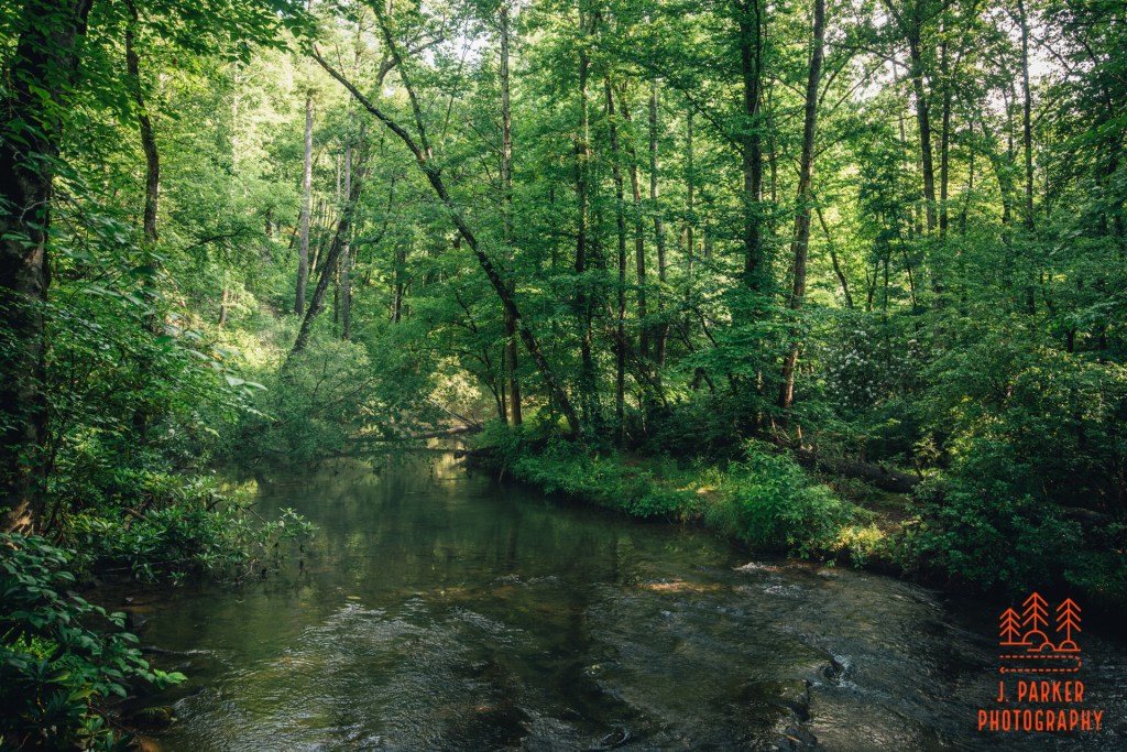
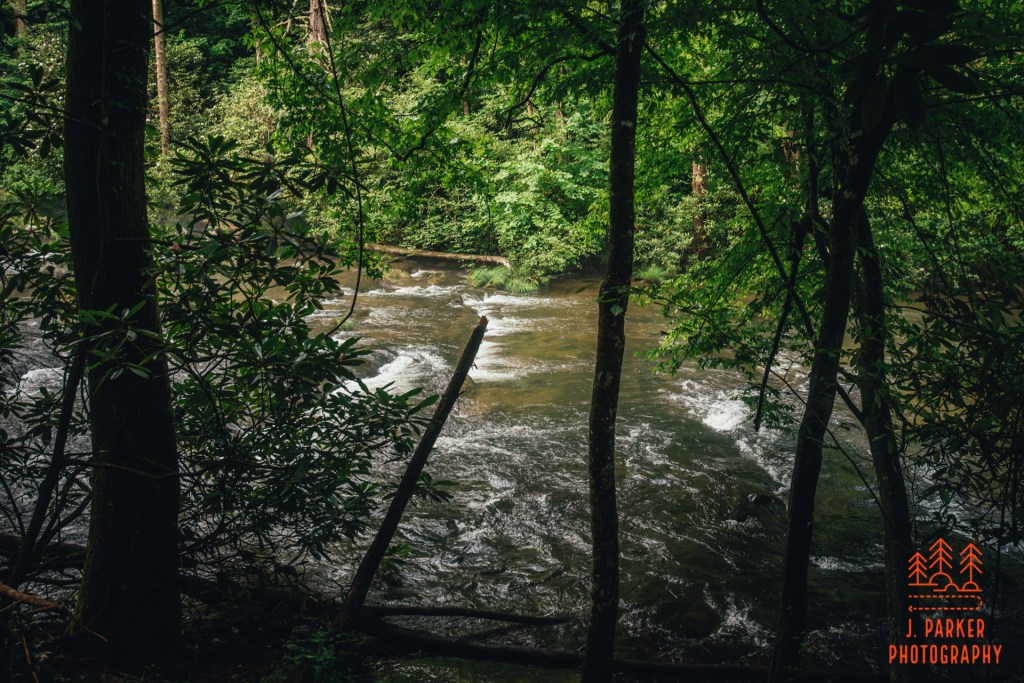
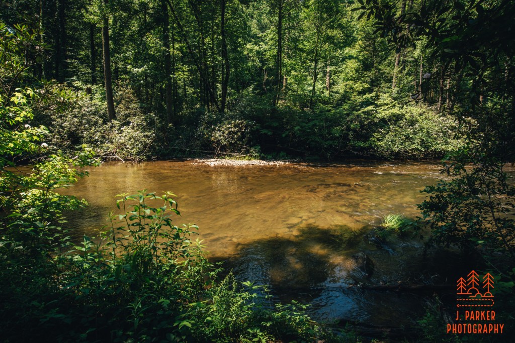
The trail almost immediately crossed wide Abrams Creek on a narrow bridge. I was surprised when we crossed the water to find it flowing in a different direction than I anticipated; not having ever traced its path on a map, I had always imagined the creek flowed into the cove in this area, to exit somewhere on the eastern side of the cove, where creeks do flow out to join up with Middle Prong near Townsend, one of which (Laurel Creek) lends its name to the road heading to the cove – that same road in which we spent over 1/2 an hour stuck in traffic this morning. In fact, Abrams Creek actually drains pretty much all the cove to the west, where it carries the water to join up with the Little Tennessee River very close to the southern terminus of the Foothills Parkway. The narrow bridge actually caused us some issue on the return trip, for it was far too narrow to provide space for social distancing when people were going both directions, and a constant stream of people were beginning the trail as we were leaving. Thus we had to wait a few minutes before an opening was granted for us to cross.
For now, on the outbound trip, I spent a moment looking out at the creek in both directions. While it locked a bit foggy and mysterious upstream, complete with a dark bottom, it quickly adopted a predominantly sandy bottom downstream. I’m sure people who wanted to could enjoy a nice wade or shallow swim in parts of the creek, though we didn’t see a standout “swimming hole” (and the fall itself shouldn’t be used as a swimming hole – more on that later).
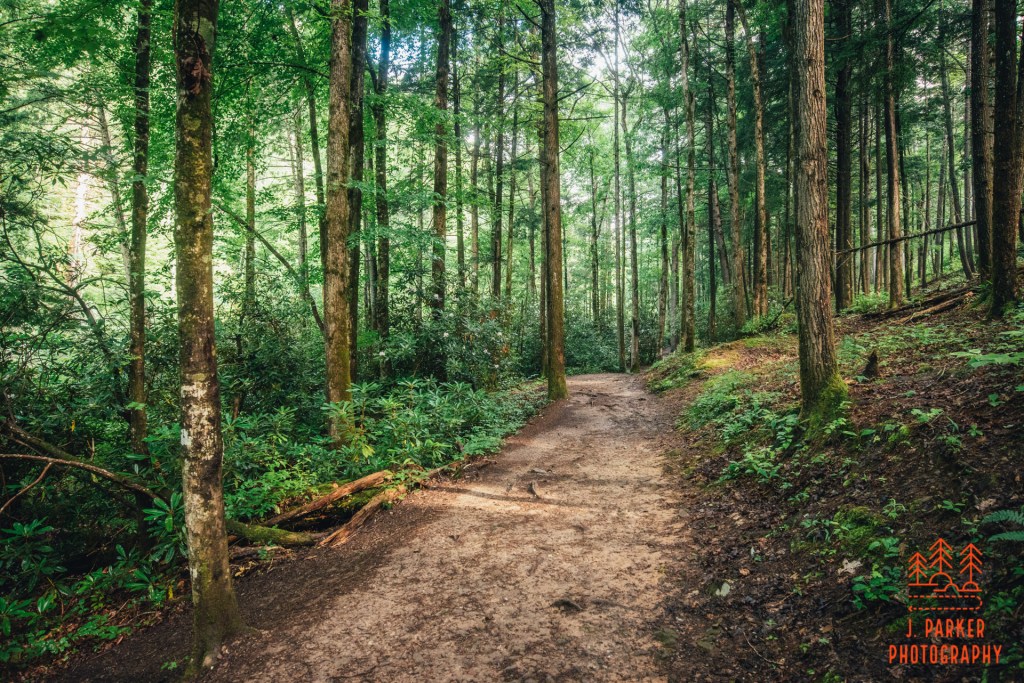
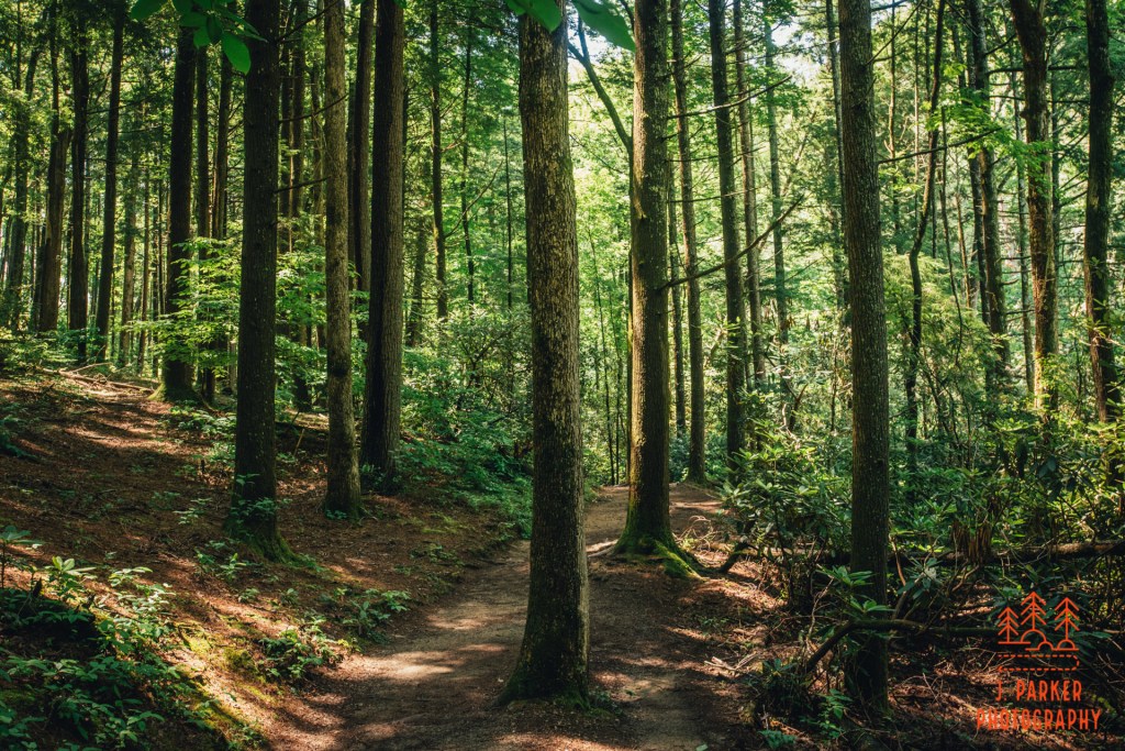
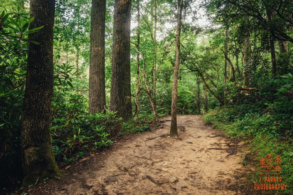
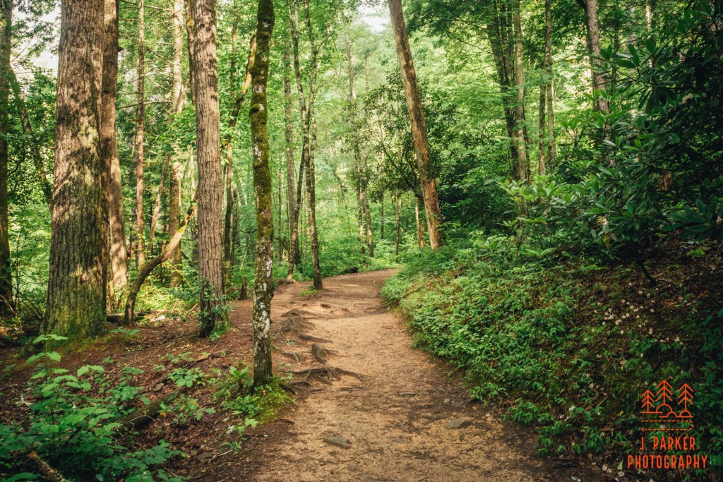
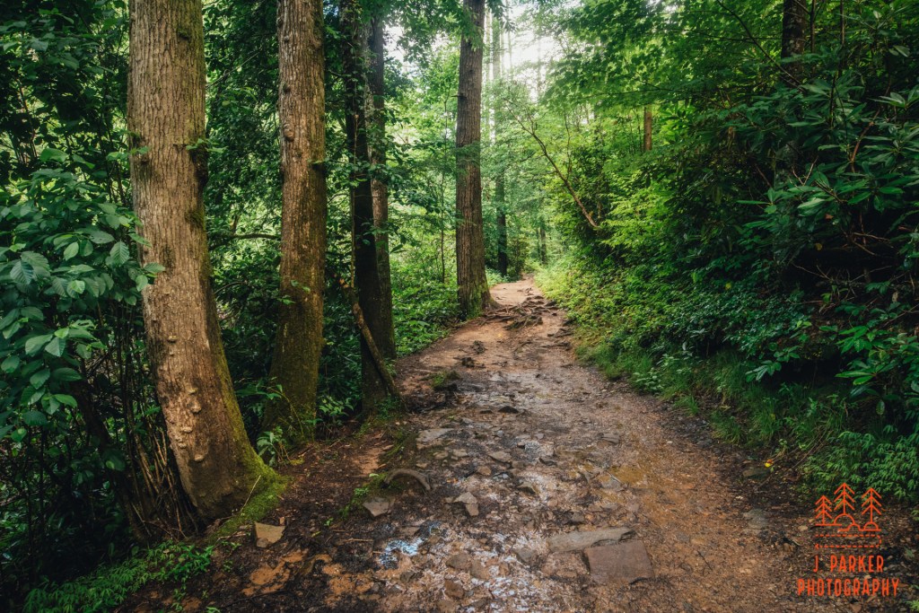
Starting down the trail in earnest, the creek was to our left, which would be a regular occurrence throughout the hike. Our feet made soft steps on the soft, almost clay-like soil. Our surroundings, a bit nicer than I expected, reminded me a bit more of upstate South Carolina than it did the rest of the Smokies. At the start of the trail especially the sides of the trail were dotted with the large trunks of hardwood trees whose tops stretched far above the trail, and did a good job of minimizing the sun rays piercing through to the forest floor.
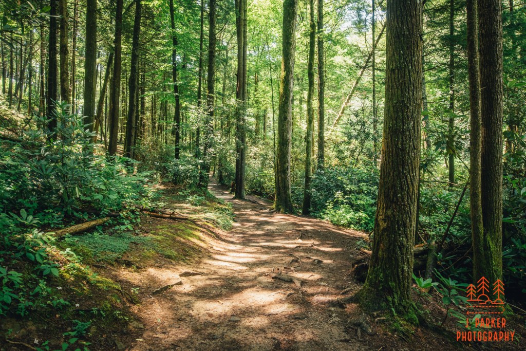
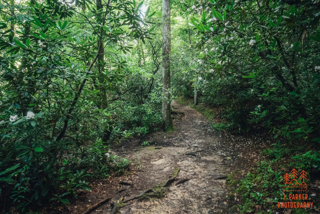
In places the vegetation encroached upon the trail as it dipped into the lush foliage growing from the moisture-rich soil along the creek. This formed a tight cocoon which sometimes was just above your head as you maneuvered down the pathway. With the niceness of the woods, and the interesting tunnel-like sections, the early parts of the trail here were my favorite.
The trail only had a couple notable climbs. One early section of trail featured a short climb. This section was less notable for the climb than it was for another nice bit of woods along the trail.
We soon came across the first of several crossings of small tributaries via trademark narrow, open-sided Smokey Mountain bridges. I took in the beauty for a second, but the popularity of the trail in this covid summer meant that there was a pretty steady stream of people behind us, so I didn’t even get a picture of the creek or the footbridge before we moved forward, not wanting to obstruct traffic on the narrow footbridge. The crowds would also be a problem shortly ahead. We encountered frequent gaps in the trees with rocks alongside the creek, but nearly all of these were occupied by trail goers usually taking advantage of the good opportunity for a commemorative photo. I would have liked to enjoy these rocks myself, but they weren’t worth waiting in line for either, so we continued ahead, hoping that by passing these people there’d be that many less people at the falls where we got there. The creek itself looked pleasant, though with just occasional rapids it lacked the drama and intensity of other waterways in the park.
For quite a while here the path towards the falls maintain a consistent character. Always pleasant, never dull, and never offering much difficulty in footing or elevation. Just a pleasant walk in the woods, which were thick enough as well to at least dilute the effect of the crowd that was dissipated along the trail. The soil always maintained a very brown, clay-like quality. I wondered what consistency it would be in the event of a rainstorm, though that was much less of a worry than whether or not the soon would pierce the canopy with intensity.
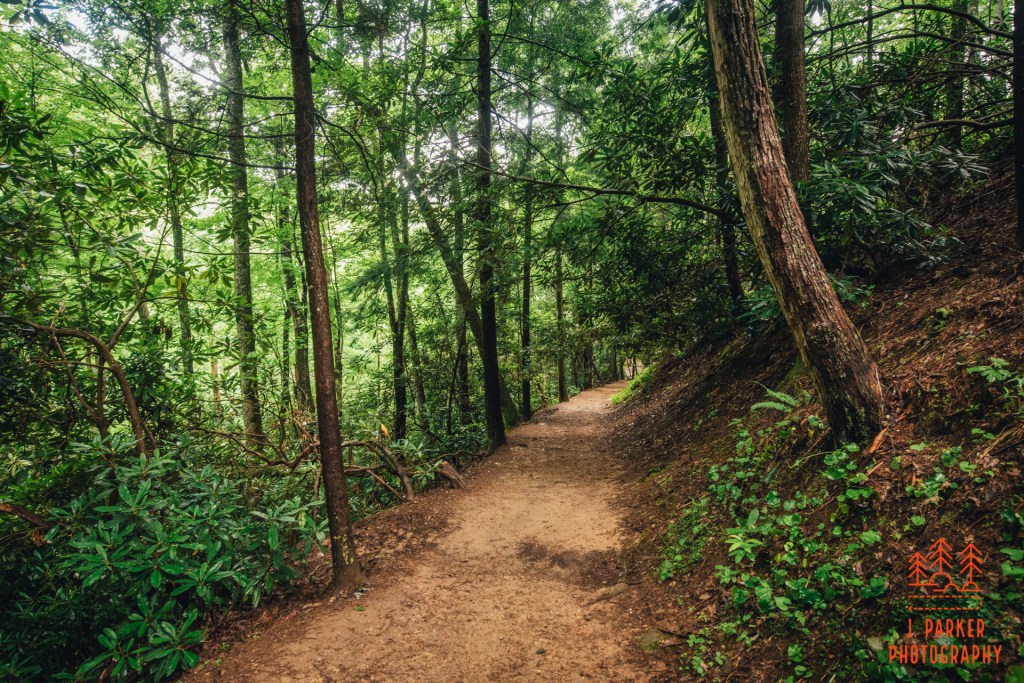
Gradually the vegetation and canopy began to thin out. Once it began thinning, it never again adopted the thick canopy of the early sections of trail. I wasn’t sure if I was confusing it with a different trail, but I thought I remembered that part of this trail had been struck by a tornado at some point a few years prior, something that’s actually not uncommon along mountain trails. It certainly looked as if that would have been possible. Whereas normally the sun creates what (to me) ss quite an unpleasant effect on the woods, here the canopy thinned out enough that the sun bathed the entire woods in a pleasing golden hue.
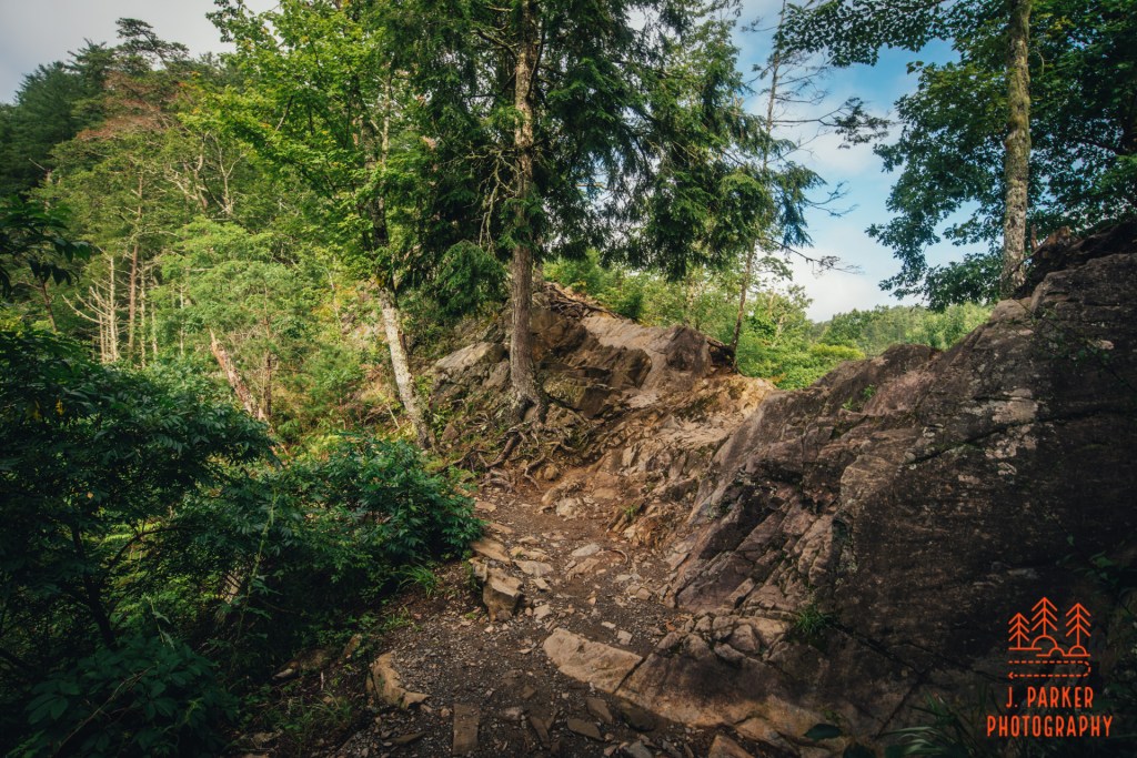
About halfway to the falls we began the most significant climb of the journey. Being an ascent of only a couple hundred feet at most, it was just enough to get one’s blood pumping without being all that strenuous. The ascent had stable footing all the way to the top, though at its apex there was an odd rocky section that one had to briefly climb up and over in the process of making a 180 where would descend on the other side. What made this stand out even more was that some of the rocks had dozens, or even hundreds of bees. As somebody who is allergic to insects, in years past this may have exceptionally unnerved me. I’ve come to realize that, as long as they don’t get too curious (which happens on occasion), bees are rather oblivious and innocuous, quite different than other, more nefarious insects. I passed through without incident, and we’d have to repeat this process on return trip.
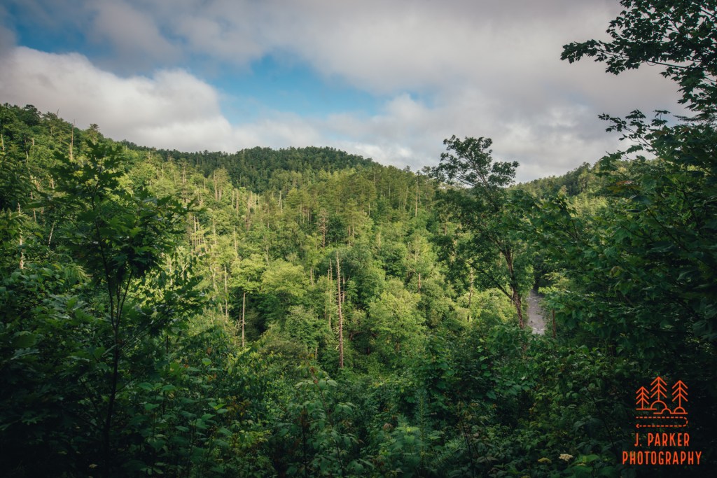
After the turnaround was one of the more interesting sections of trail, where one got a brief section of unimpeded vista from a couple hundred feet above the creek far below. Now, this wasn’t the standard panoramic view for miles. It was merely a view to the ridgeline on the opposite side of the creek, with a single peak standing out behind that. However, it was quite pleasant to see an intimate view of thick, green ridges. It made that one moment on the trail feel much more wild and exotic than otherwise possible along a quite busy trail with an immensely congested access road.
We plunged down along the opposite side of the ridge. Again, the footing was quite good, though we occasionally encountered stretches of rock poking through the floor of the trail. Our climb up and down the ridge over, the next section of trail was a bit less distinct, being just a constant, mostly level passage through the woods. Most everything we were encountering was simply a lesser version of what we had seen prior on the trail, and I certainly began to get anxious to actually reach the falls. I’ve rarely not been anxious to reach a waterfall while hiking to one, but this trail had a bit less variety than most of the non-forest road waterfall hikes I had done. It was also beginning to get warmer, which made the summer woods a bit less pleasant than they might have been.
We welcomed the obvious final descent to the falls when we reached it. Unlike almost all of the trail prior, there were some portions of the trail that were a challenge here, as the smooth footpath gave way to rocky passages. This part was probably made a bit harder by neither Jess or I being that comfortable using our trekking poles for such a section as of yet, but it was still no significant challenge. At the bottom of the descent was a bridge over another tributary. The sound of moving water was loud, but that had little to do with the tributary. Instead, it was the sound of the Smokies most powerful waterfall some one hundred rocky yards further down the trail.
We were finally there. So, of course, were a lot of others. The falls were on the far side of the viewing area from us. The viewing area featured a rock-strewn open section in front of quite large, and also quite turbulent, pool. The falls themselves, being only a bit larger than twenty feet tall, and not much wider, were much smaller than the pool. A series of boulders curved around the side of the pool, and could be used to walk right alongside the cascade. There were currently some children along the boulders, so I figured I would find a good angle to shoot the falls until they were done. I worked my way along the rocks to what appeared to be the best view, setup my tripod among a few other photographers, and I waited. And waited. And waited.
To my frustration, it seemed as if the children weren’t going to be leaving the area of the fall anytime soon. Losing the photograph, I wasn’t really that concerned, for the sun was so bright that any photo I was going to take would scarcely be portfolio quality anyway. But in the position they were in, I couldn’t even take a video clip of the waterfall that I’d be able to post on youtube. The children were using the boulders to jump into the pool in pretty close proximity to the waterfall itself. I could understand the sentiment to get in the water, for the day had gotten warm enough that I was feeling the itch to enjoy mountain water myself, but what they were trying to do, swimming so close to the raging waterfall, and not in the rest of the very large pool, was immensely dangerous.
You’ve probably noticed that nothing in the trail I’ve described so far has sounded as if its the least bit dangerous as far as trails go. Nevertheless, the Abrams Falls Trail is actually among the top 10 most dangerous trails in the entire country. This has everything to do with the waterfall itself, where many, many drownings occur. Apparently most people don’t realize the forces that can occur around the base of a waterfall and many drownings occur here. No doubt, the traffic this trail enjoys from inexperienced hikers exacerbates the problem here.
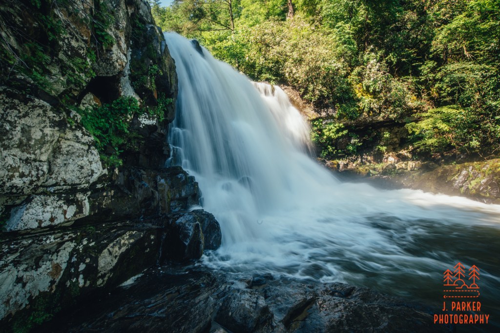
I decided to take matters into my own hands. Rather than waiting for the children to leave the waterfall area entirely, I waited until they gave me an avenue to squeeze behind them and setup my tripod between them and the fall. I had to be very, very careful here, even more careful than I normally am on the edge of the water, because the boulders weren’t exactly dry and the raging current below meant that if I or my camera fell, we weren’t likely to be found in working order again. In this spot I was practically right on top of the waterfall, and I could only go so wide with my lens, but there wasn’t much opportunity for a creative frame to begin with. I did the best to take a long exposure as well as a few quick video clips, and then I vacated the area, happy for myself and my camera to both be intact. The children had left before me; apparently the rock was no longer cool now that I was out there as well. As I got back to the other photographers, I told them they could thank me for driving the children away. At least briefly on this busy day the rocks around the fall were devoid of people, but I scarcely felt the need to take a different angle of a rather featureless fall in the scorching sunlight.
Other than crossing the bridge next to the parking lot we had a rather uneventful return trip. The only think that changed on the way back was the creek, which grew to be very inviting as its sandy bottom shimmered in the direct sunlight. I would have liked to enjoy the water here, but at the same time, never seriously considered doing so, for with as many people as there were along the trail, and with little opportunity to disappear in the woods off trail, we wouldn’t have had an easy time trying to change into swimsuits. Besides, there are other easy and quiet swimming holes to be found in the Smokies, and we did in fact enjoy several of them later on this day.
In some ways the hike to Abrams Falls exceeded my expectation. The woods, especially towards the beginning of the trail, could be quite lovely. I’m sure any nature lover could find something to enjoy along its canopied corridors. However, in other ways, the trail was exactly as I expected, in that it was nice enough but I just wasn’t blown away by it. Some waterfalls look one way in pictures but end up far more exciting in person, but Abrams Falls wasn’t in this category. Of course, any fan of the spectacular national park should eventually get to this one – it isn’t a bad hike, and the fall is one of the park’s more well-known features, even if I personally wasn’t overwhelmed by it. For my money, though, it’s probably not even in my top 10 hikes just in the national park, and I’ve still just scratched the surface of it myself. It’s also worth noting that there isn’t a way to get to Abrams Falls except via Cades Cove, an immensely frustrating proposition that offers absolutely no opportunity to get in and get out quickly, making a trip there more of an investment in time than other hikes in the area.
This was the last hike we did in the Smokies on this 2020 trip. We were looking forward to spending the next two days on a triumphant return to an area of the mountains we held very dear. Unfortunately, things wouldn’t work out quite like we planned.