We weren’t going fast enough. Sometimes that can be more of an issue than others. Today, it was. Flat Laurel Creek hadn’t proved as flat as we hoped. At least not yet. The footing had been very bad, even if the elevation change hadn’t, and consequently we were moving about the same speed as a tourist who had just seen their first bear on a one lane scenic drive. We were trying to make haste because of ominous storm clouds that loomed overhead. Storm clouds that threatened to rain down on my non-waterproof, light-weight camera bag when we were still at least a mile in any direction from the car. Trying to hike as light weight as possible due to my injured, I didn’t have an umbrella either.
I always try to be prepared, but we wouldn’t even have traveled two and a half hours that morning if the weather report hadn’t advised a 0 percent chance of rain in the first place. We had options that were far closer to where our cabin had been in Wears Valley, TN., but when the weather looked absolutely perfect to hike in the Great Balsam Range, I knew it was finally time to return to an area we had enjoyed so much in 2017. I have a feeling I wasn’t going to look back this day with that same fondness if all of my camera camera gear got soaked by the storm clouds which were moving fast overhead despite the weather report.
Reaching a relatively flat area, I kicked it into high gear and moved as quick as I possibly could, poles and feet crashing in furious and uncoordinated fashion into the grassy ground along the trail. And that was when it happened. My right ankle in foot erupted in pain as I had misstepped and landed with my foot sideways on the uneven ground. I couldn’t tell what was actually hurt, foot, ankle, pride….I just knew that it was NOT GOOD. Now, as somebody who has been hiking for years, I’m quite used to the run of the mill twisted ankle. On longer trips I usually get a good twist about every three days. Sometimes, like at Grandfather Mountain in 2017, that ankle twist will be with me for weeks. Twisted ankles are quite common for Jess as well, to say the least. As a former cross country runner, I’m well accustomed to just dealing with your run of the mill ankle twist. But nothing about this felt run of the mill.
In a single moment, it felt like our weeklong trip to the mountains had come to a crashing halt, with the two days I had most looked forward to left in the dust. For someone who had been through so much to get here, it was a bitter, bitter disappointment.
Hiking at Black Balsam in 2017 was one of my life’s definitive moments. It wasn’t just a hike for me – it was the culmination of triumph over many challenges just to have gotten there. That visit was featured in one of my previous posts. Knowing that Black Balsam was part of an interconnected trail system featuring some other outstanding highlights, I was desperate to get back. Not to repeat the same hike we had already done, but to have a similar experience at one of the multiple adjoining peaks. More than once we were close to making it by, but there were always circumstances like severe weather or the return of the McRib that kept us away. But this 2020 trip seemed like the perfect time to get back to it, if things lined up right. We knew we were going to be spending 5 days renting a cabin in the Smokies, but we intentionally left a few days at the end of the trip unplanned so we could be flexible and go to whatever place would be best, dependent upon a few circumstances. One of those would be weather, and as I alluded to earlier, weather in the area of Black Balsam was supposed to be spotless – perfect for an open vista hike like this area offered in droves. Another variable was my health and hiking ability. As we started the trip, I wasn’t sure if a torn hip labrum in the midst of a bad episode would let me walk 100 yards, much less do a legitimate hike. During our drive up, I just hoped and prayed that I’d get a single hike in to hang my hat on. Much to my pleasant surprise, I found that I could manage my way through some moderate length hikes, even if hiking injured wasn’t ideal.
Even with sentimental reasons set aside, the Black Balsam area was perfect, considering my current physical state. We planned to hike the Flat Laurel Creek Trail, which was devoid of any significant elevation changes, and take the spur trail to Sam Knob along the way. Sam Knob had a bit of a climb, but even that climb was very gradual. Just doing that would make a really nice morning hike. But there was a world of options for us to extend our hike as well if we felt like. We could take the trail to Black Balsam’s multiple peaks along the way, even connecting to Tennent Mountain again (we had done those two before but during barren late October). Or we could take the Ivestor Gap Trail into the Shining Rock Wilderness. Since even the elevation gains in this area aren’t strenuous, the opportunities were almost limitless. Or so I thought.
The biggest challenge to hiking in the Black Balsam area has nothing to do with hiking, it’s the parking. With outdoor activity being at a peak due to covid, the problem became even more acute. There are several parking areas that lead to the immensely popular Black Balsam, neither with space for very many vehicles, and only one of which connected directly to the Flat Laurel Creek and Sam Knob Trails. I knew of a parking area on the far side of the Flat Laurel Creek Trail, but as this would add 3.4 miles total just to reach the Flat Laurel Creek Loop, I was crossing my fingers that we wouldn’t need to use it.
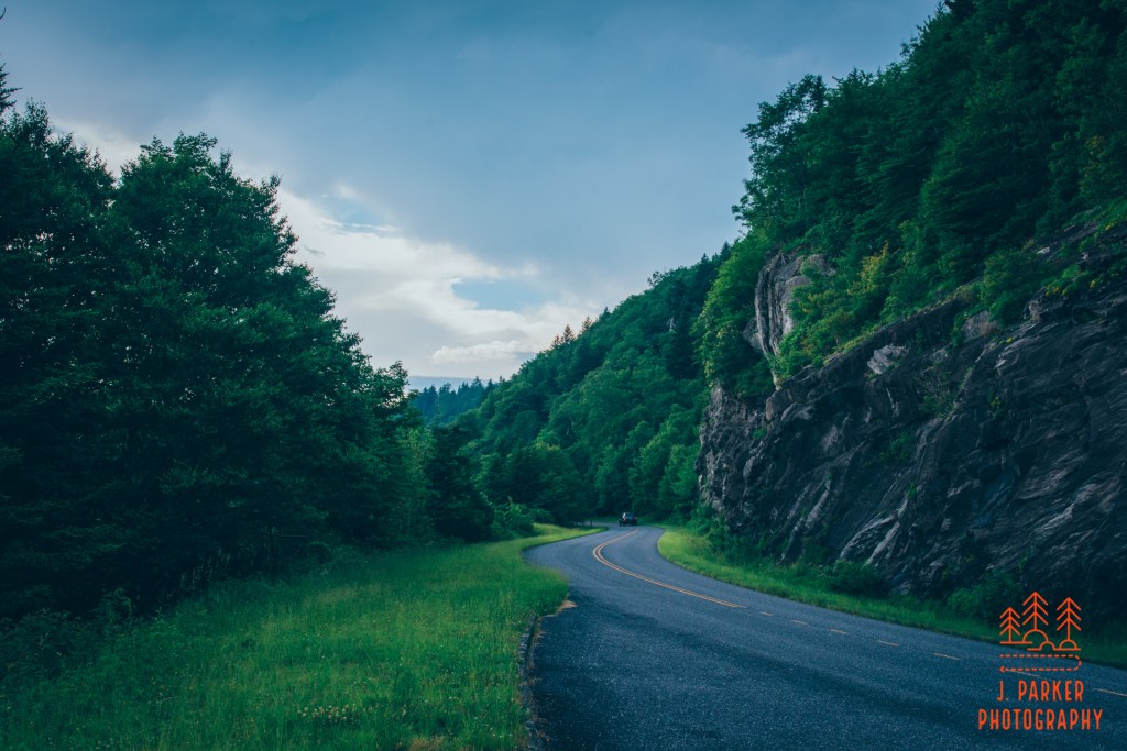
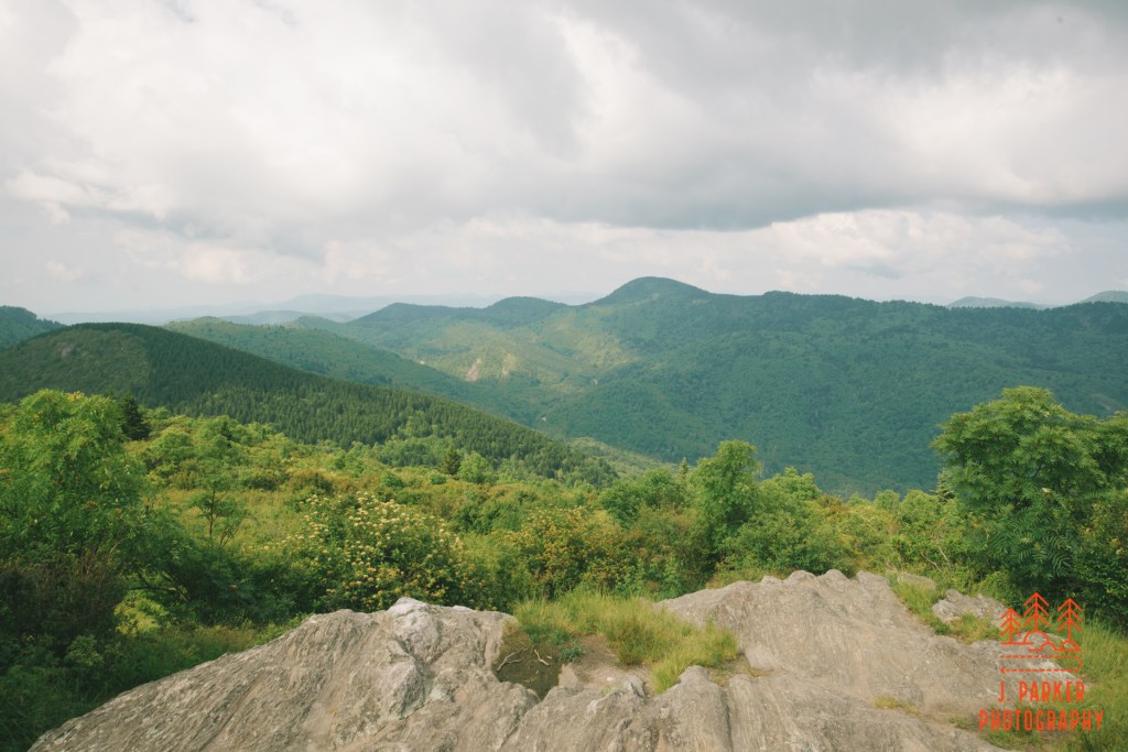
We left our cabin in Wears Valley as early as practicable when checking out, and got out the door before the sun began coming up at 6. Our drive took us into the Smokies and over Newfound Gap Rd. as the sun began to share the hopeful rays of the new day. That in and of itself was quite a spectacle, and it was no less a spectacle when we took the final leg of our two and a half hour drive on the Blue Ridge Parkway. We zoomed by stunning overlooks as the full force of daylight began to set in over the mountains. As inviting as the overlooks were, we had no time to stop and enjoy them in our rush to secure parking. I spent part of my time glancing out upon the mountain ridges below the parkway, and part of my time calculating the minutes it would take for us to reach our destination. Finally we reached the turnoff to mile-long Black Balsam Knob Rd, and were pleasantly surprised to find an open parking space in our ideal lot at the end of the road.
So far so good. And the stench from the pit toilet, which is among the worst smelling things I’ve ever encountered, wasn’t going to spoil my mood. That would come later.
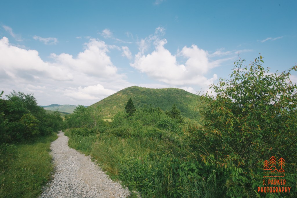
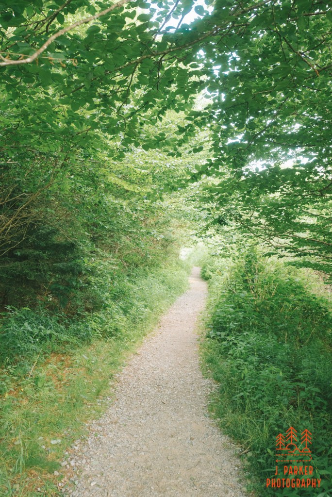
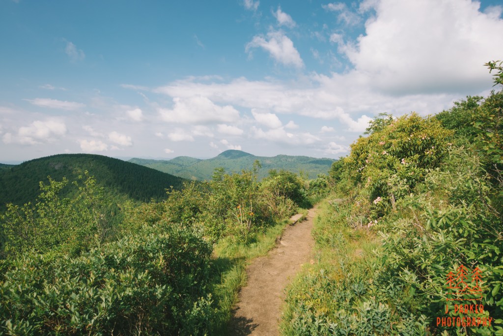
I had the bathroom to thank for one thing – if not for it, I might not have found the beginning of the trail, which was almost completely obscured by weeds along the parking area. There was, however, a larger opening right next to the bathroom, and it was through that opening I actually first saw the trail. We began our journey after I confirmed it was the right trail by locating the trail sign sticking out of the weeds. It was an inauspicious start, but the trail was actually so wide and smoothly graded here it may have been wheelchair accessible. At least to this point the weather was exactly as expected. The sun was so bright that after we had traversed a couple hundred yards, Jess doubled back to grab her sunglasses, since she tends to get migraines from direct sunlight. I myself had worn my sunglasses from the get go, having had a couple occasions in similar locales where I needed them to protect my eyes from a continuous batch of small flies that displayed a distinct preference for flying into my eyes.
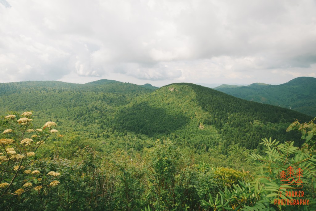
Aside from occasional partially obstructed views into the valley to our right there wasn’t much to look at along the trail at first. That changed quickly, however, as we rounded a bend and the brush opened up to a clear view of the distinct sharp twin peaks of Sam Knob thrusting majestically into the air. At least at this moment, the trail bore a direct path to the knob, and the mountain beckoned to approaching hikers. After a few days of hiking in the Smokies, often shrouded in mystery and with open views hard to come by, it was an interesting contrast to see a peak so open and available (the best of the Smokies is less about open views and more about the sense of wonder contained within those wooded peaks that ooze mysterious fog).
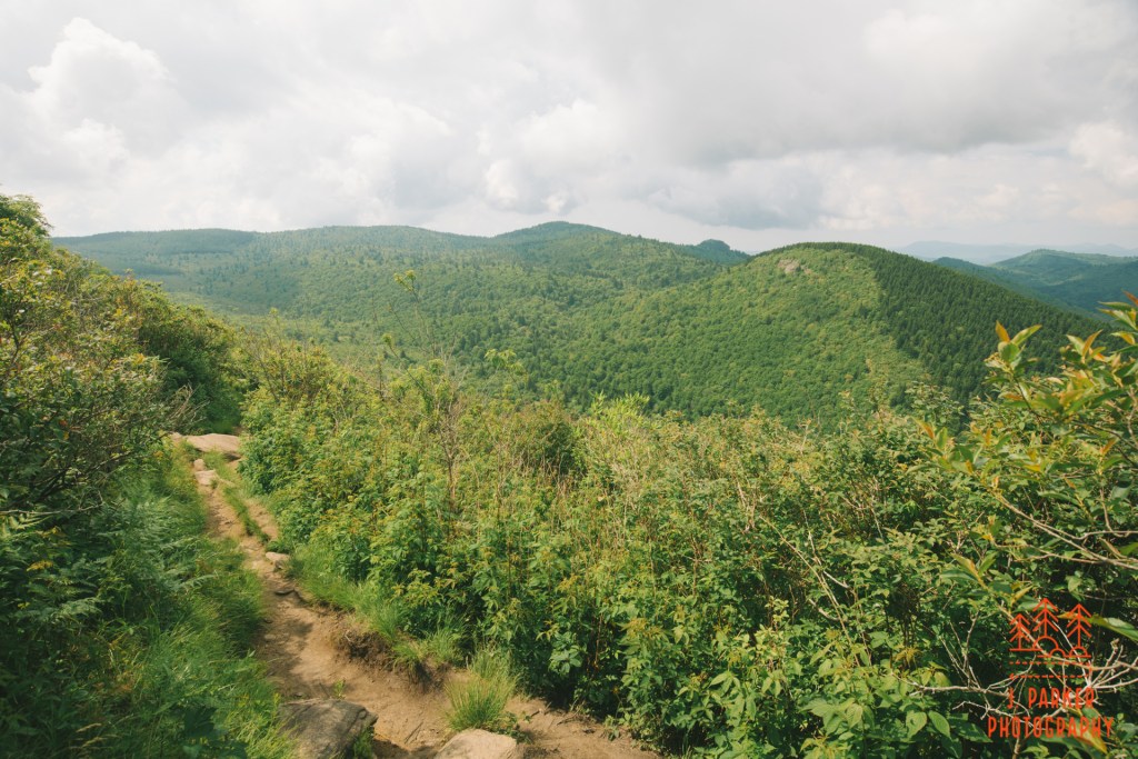
What happened next was one of the best parts of the entire trail. We worked our way over the easy path towards Sam Knob, eventually reaching a boardwalk that gave off the sound of a miniature railroad as our combined sets of trekking poles clicked on its wooden surface. Near the boardwalk was a small camping area currently being enjoyed, the first of many we would see in such a state as the holiday weekend approached. The boardwalk periodically dropped a few steps at a time, revealing more and more of a large, grassy meadow framed by Sam Knob in the background.
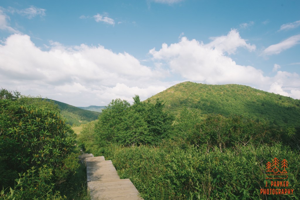
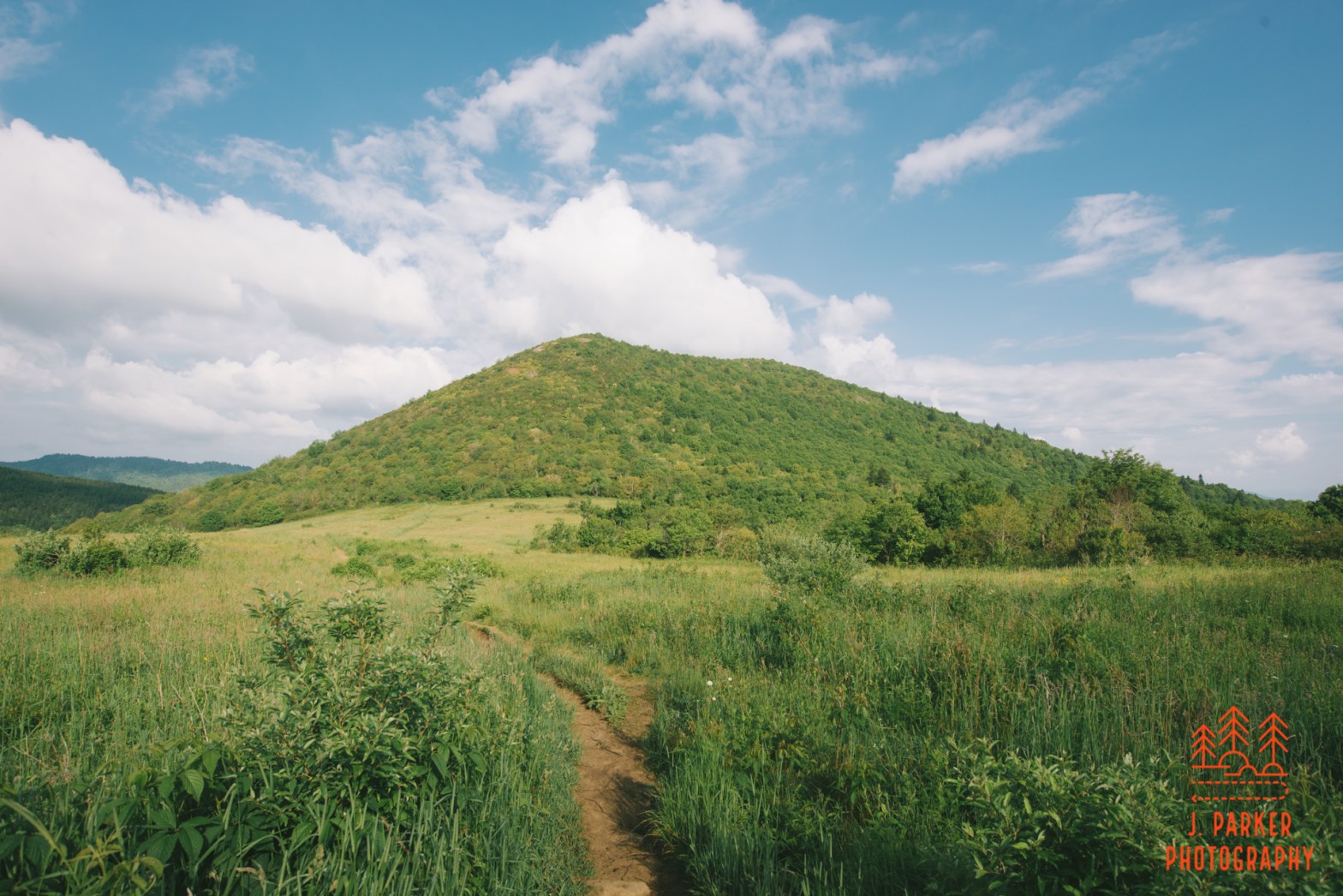
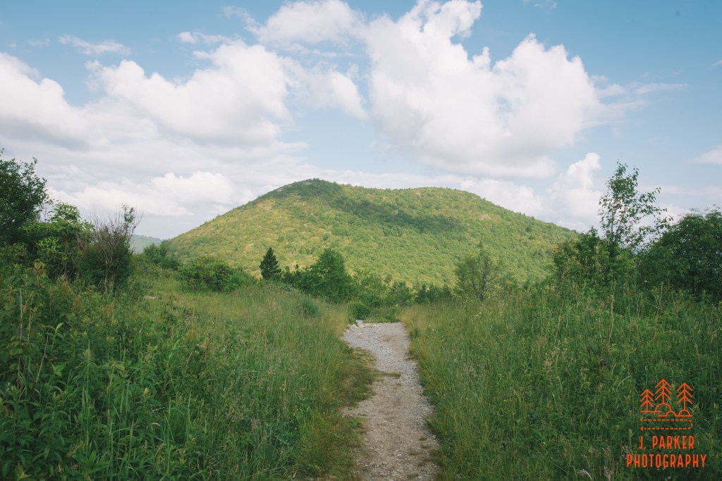
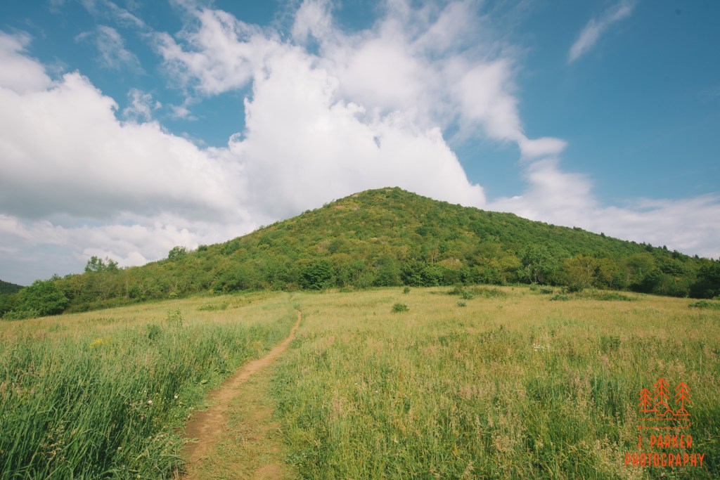
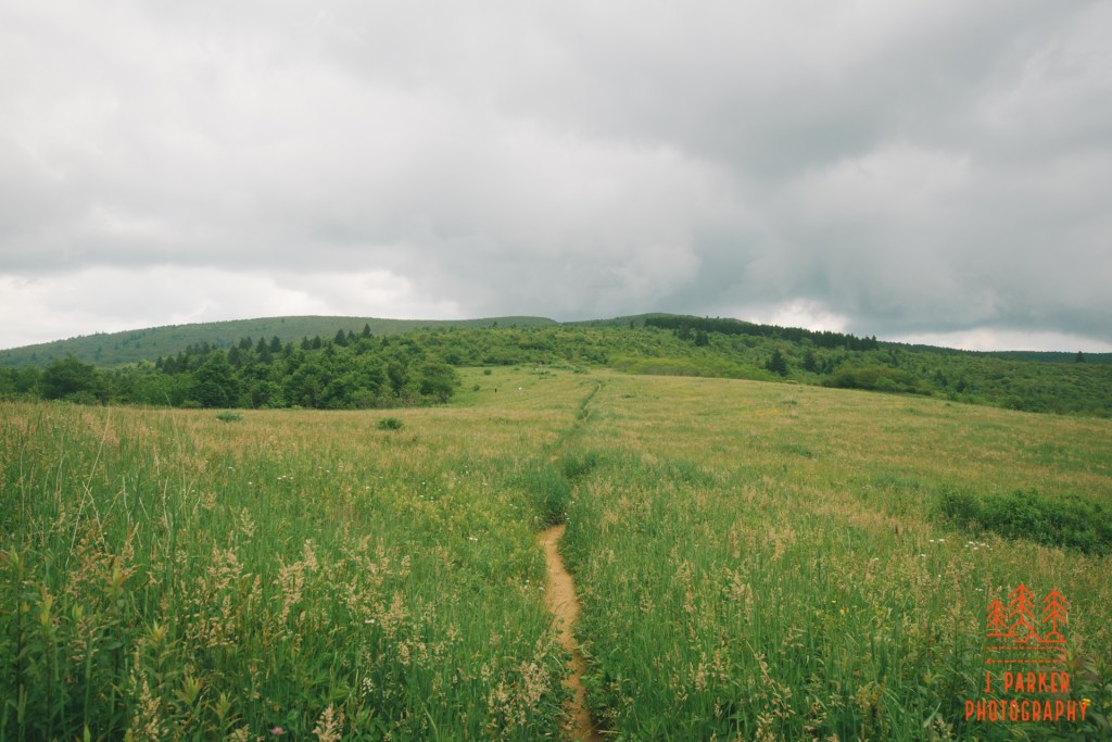
Eventually the boardwalk dropped off to the meadow, where the trail dissected the grasses as it bore a straight line towards the south corner of Sam Knob. This placid meadow, a bit of flat land nearly 6,000 feet in elevation on its own, and framed by the distinct peak of Sam Knob on the far side, is one of the most unforgettable scenes I’ve ever encountered. I wouldn’t necessarily say best – though it was sure good – just unforgettable. I’ve seen lots of nice views in my time, but I can’t necessarily remember all the shapes and contours I saw in those views. Sam Knob, with the meadow in the forefront, is so distinct a shape that it’s easily etched into my memory. I remember the details of this view far more than the much higher sweeping views from Sam Knob itself. And this meadow view is encountered merely by hiking the loop. It’s important to note that the loop could be be hiked in either direction from the parking area. We took the quickest route to Sam Knob, helpfully called the Sam Knob Trail (if you can find the sign) until it reaches the Flat Laurel Creek Trail, where you take a left to loop back to the parking area. I highly recommend this route so we can get the meadow view while hiking. While one can always turn their head to get any available view along a trail, that doesn’t compare to experiencing a magical view while you are actually walking, and to my knowledge there is nothing that quite compares if hiked in the other direction.

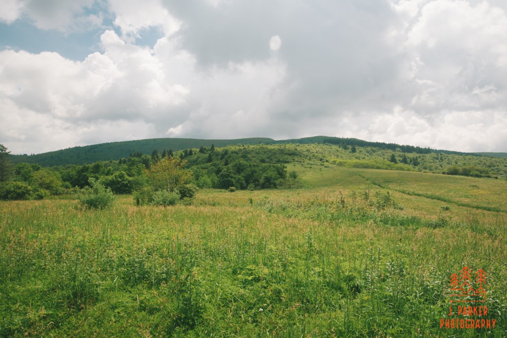
As we began crossing the meadow it was apparent to me just how different an area like this was during the summer than it had been during the fall/winter. Aside from the obvious difference in vegetation color, it amazed me just how thick and encroaching the grass was. This was not a lightly trafficked trail, and yet the path through the meadow was at times not much wider than myself. During our weeklong mountain odyssey I had enjoyed the benefit of my trekking poles to alleviate the burden on my hip, but to my dismay my poles were almost a hindrance here. The thick grass grabbed my poles and threatened to yank them from my hands as I passed. Also, the trail carved a deeply eroded channel anywhere from 6 inches to a foot beneath the surrounding terrain, making finding purchase for my poles a difficult proposition. I had imagined a flat valley area would be the easiest area to use trekking poles, but in fact it was one of the hardest.
At the far end of the meadow we would pick up spur to ascend Sam Knob, if I could find the right trail that is. At one point there was an unmarked but decently well trod path through the grasses that split off at an angle to our right, heading in the direction I knew we needed to go. As it was unmarked, I had reservation about taking it, and we paused for a minute to allow another group of hikers to catch up. They weren’t sure if that was the correct trail either, and a decision was made to continue forward on the trail we were on. It turns out our fears were unfounded. Some 50 yards further we found the signed official trail to Sam Knob, and the unofficial trail we had seen was merely a brief shortcut.
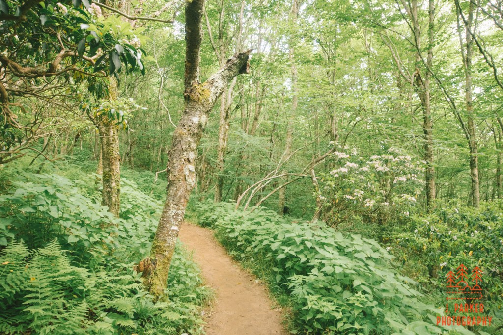
Though most all of our projected hike would be in the open, the Sam Knob spur begins by traversing a thickly wooded section. Surprisingly, this would actually be the most difficult and time consuming part of the ascent, not because of any significant elevation change, but because the soil was muddy, slick, and filled with roots. While there wasn’t significant elevation gain here, there were very brief moments of steep ascent that were a challenge to traverse. This section was also drawn out, as with nothing exceptional to this particular batch of woods and no views it didn’t maintain that much scenic splendor. As we climbed higher towards more open air we did find something interesting, which to my untrained eyes appeared to be a small bunch of flame azalea which generally only occurs in any significance within the Smoky Mountains. Navigating a small stairwell, we began to encounter small pockets of rhododendron as the trail popped into the open air again. One of the reasons I had wanted to get to this area was to catch a glimpse of the blooming rhododendron, which I had barely gotten a taste of despite numerous mountain trips up to this point.
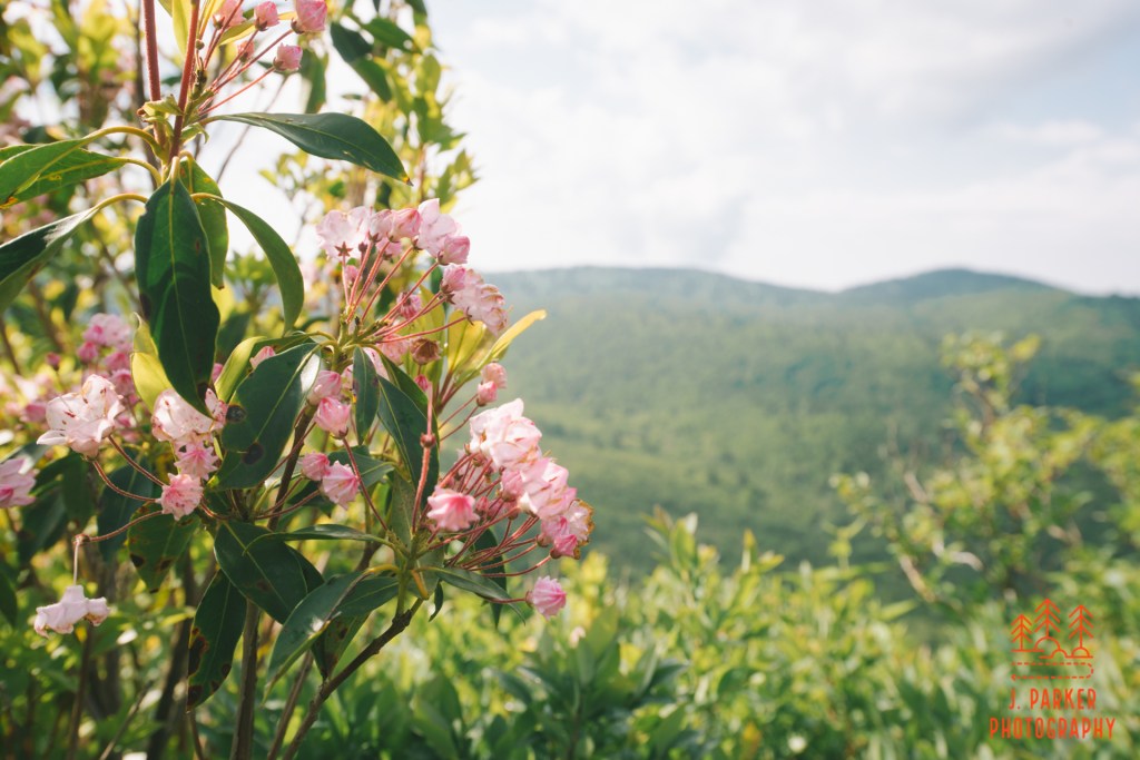
From here on, the Sam Knob spur would stay in the open. While it seemed as if this ascent would be grueling when viewed from the Meadow, in actuality it went marvelously quickly. The trail made a curved, gradual ascent, first beginning on the East side, then the South side, before finally approaching the twin summits from the West. A narrow patch of rhododendron clung to the outside of the trail, shielding it from having an open drop, but rarely did this provide more than a brief obstruction to the views, which were beginning to be fantastic. Occasionally there was a rock or two to scramble up and over, but there wasn’t anything exceptionally challenging, and to be able to complete this ascent while experiencing impressive views meant one hardly even noticed any exertion in getting to the top.
I had seen reference to overlooks from both peaks of Sam Knob, which has a north and south summit that one can see in pictures. I was expecting to encounter a fork in the trail at some point. I was surprised to find us on a grassy area not far from the north summit and having still not seen anything that amounted to a rough goat path diverge from our current trail, which was clearly working towards the north summit. I figured we would go ahead and enjoy the obvious overlook and then see what we could find later as far as the other.
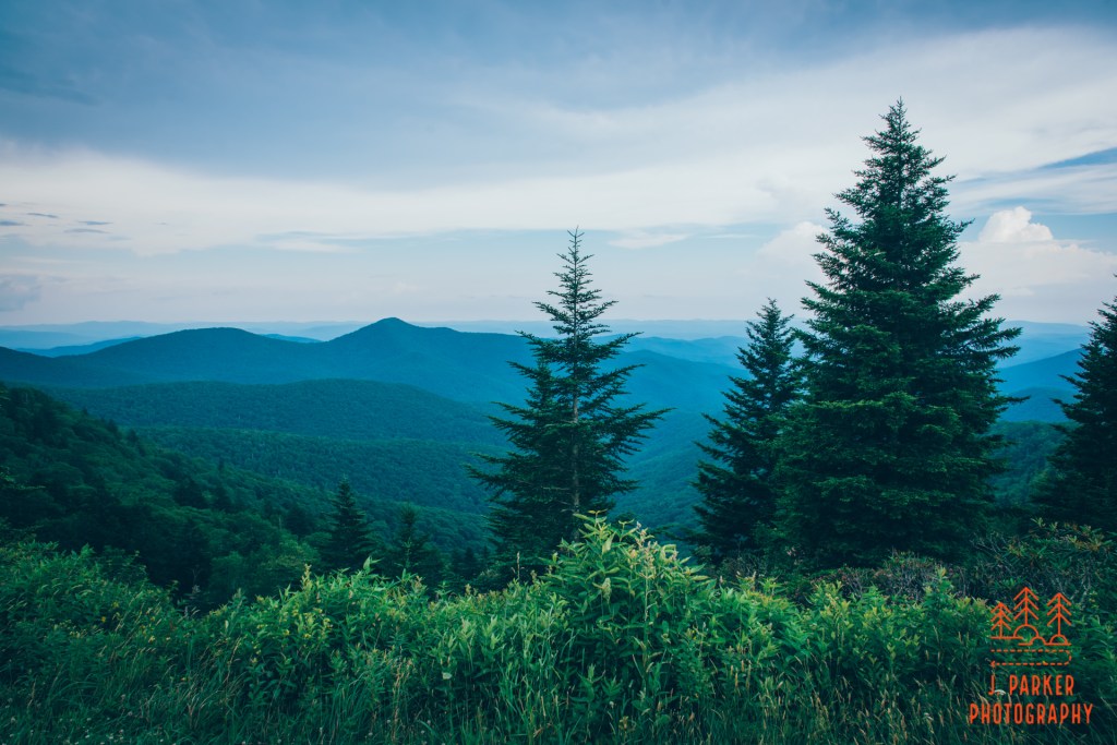
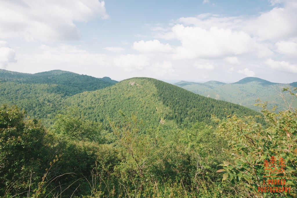
A nice rock with ample surface for sitting sat along the north summit, which offered an outstanding view of several green ridgelines in the distance, in an area which is criss-crossed by NC-215 heading towards Canton. It was a great view, and it was a nice spot to relax and enjoy a refreshing snack, since we’d been on the go for hours even though only part of that had been spent on the actual hike. There were patchy summer clouds hanging over the ridgelines we peered out on.
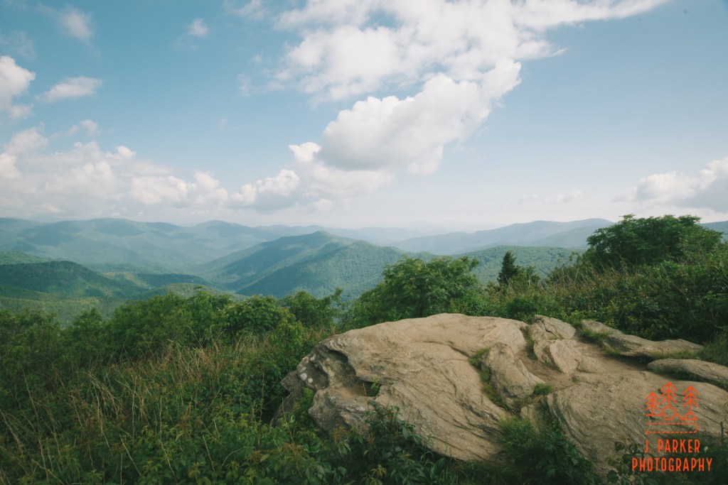
There was a second rock some 30 yards from our current perch and a little lower in elevation. Nothing but open ground stood between us and it, so I headed down to take in the view from here, which was primary to the west and south and featuring the peaks of Devil’s Courthouse and Mt. Hardy and, as I was to learn later, Little Sam Knob. This was another enjoyable vista but it was marred by an unexpected cloudy sky that cast unsightly shadows through much of the scene. That we were supposed to be getting almost entirely clear weather made it doubly disappointing, but for the moment all it amounted to was a slightly less pleasing vista view than it otherwise might have been.
After spending a short duration enjoying the second rock I began to explore some of the goat paths, both out of worry that we might miss a standout view available somewhere else, and also hoping to find the path to the opposite summit. I first tried to take a path through the rhododendron opposite the first rock we had stopped at. It didn’t take long for me to realize getting much of anywhere on a barely defined path through rhododendron was going to take immense effort. The brush grabbed at my clothing, camera, and limbs with little give as I tried to push through. Every shrub seemed to fling up its own personal collection of bugs and bees. Even though I’m allergic, I’m little bothered my your run of the mill bees these days. Nevertheless it didn’t seem like a good idea to antagonize them by pushing through the brush, either. I got far enough on this path to see that there really wasn’t much to see on the east side of Sam Knob. Though I had envisioned it as a place of 360 views like Black Balsam and Tennent Mountain, in fact looking east from Sam Knob just reveals the hulking mass of Black Balsam, and what little I could see was about as pleasing of an image as a concrete wall.
We backtracked a little and took another better defined side trail, but this merely led to a campsite with no views. Another trail continued in a different direction (in fact, towards the other summit) from the campsite, but the brush was even thicker than the previous goat path I had been unable to complete, so I knew that was a no-go. Finally, I examined the first side trail I had come across on the way up, and for a short distance it had a pretty clear path. But not too far up it again became another rhododendron hell. I pushed a few feet in before being reminded of the difficulty of the task, and decided to turn around again. If I would have been certain that any one path was the one that lead to the south summit and more good views (I wasn’t sure if there actually was an overlook there) I may have been physically capable of pushing through. But as it stood, none of the paths I had seen obviously lead to the south summit, so it hardly seemed worth the effort. I couldn’t be sure that there wasn’t a side trail I had just overlooked on the way up, but as it turned out, this trail was the last possible path.
The fun wasn’t over just because we left the summit of Sam Knob. Although we were merely retracing our steps, there were great views going downhill, far better than what it had been going uphill, since we were now looking over the shrubs in our sightline virtually the entire way down. Partway down I noticed something peculiar while looking into my camera, which was the large of a large bug appearing in my viewfinder. Upon inspection, I found the bug was not only inside my camera, but actually on the inside of the mirror itself. It was impossible to reach that portion of the camera at that moment, so I could do was hope for the best and that it wouldn’t interrupt me getting an important shot.
It took us a bit to navigate the wooded area again – it was actually tougher navigating the mud going downhill (especially with a bad hip) than it was going uphill. By the time we emerged, the sky had started to take a much more ominous tone. No longer were parts of it merely cloudy, instead it was beginning to be filled with burgeoning grey storm clouds. It was difficult for us to get an accurate assessment of the full picture since being next to the base of Sam Knob, a large portion of the sky was shielded from view, which just so happened to include the area of interest. We weren’t on high alert yet, for if we had been, it wasn’t that far simply to return to the parking area. But with the Flat Laurel Creek Loop being only 2.5 miles total (without the spur we had just returned from), and with us under the impression it was all rather easy to traverse, it wouldn’t necessarily take us that long to complete the loop, so we thought.
I had little appreciation for just how difficult the next portion of “flat” trail would be. For a long time after leaving the Sam Knob Spur there would not be a single easy step. Rocks, roots, creek crossings, presidential elections, there wasn’t much the trail didn’t throw at you as our pace slowed to a crawl. I had imagined the first part of this trail would be navigable in a wheelchair, while the part of the trail I was on now was liable to leave careless hikers in a wheelchair. I’ve found in my time that quality of footing has far more of a bearing on how quickly you can navigate a section of trail than elevation change in any direction, but even knowing that, I just hadn’t expecting on encountering such rough footing here. Normally I wouldn’t have given it much thought, but in this instance, I was trying to move quickly, and it just wasn’t happening.
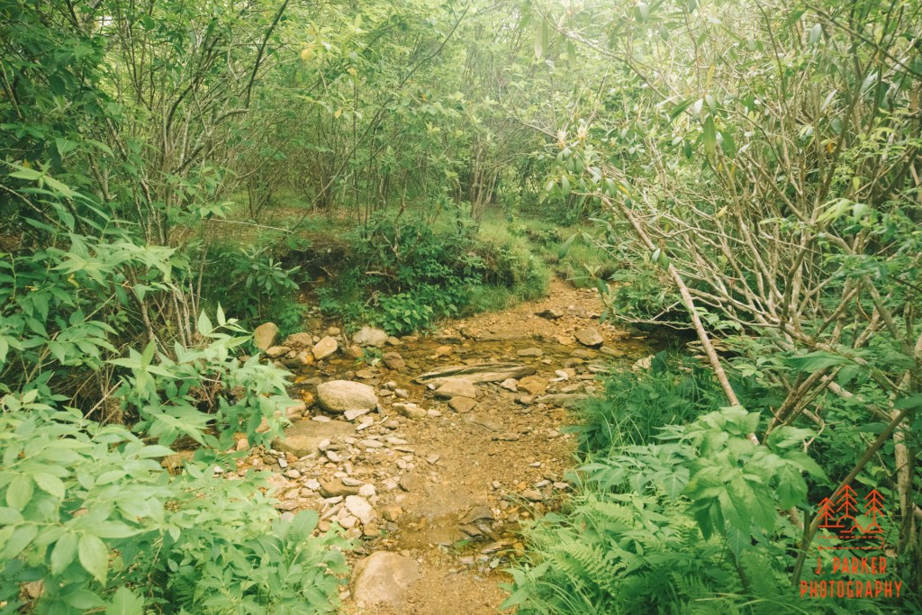
There were some nice moments in this section. There was a campsite along the trail which provided a nice view of a small stream flowing past. Back on the main trail, we soon crossed a section of boardwalk which descended through wet terrain that included the aforementioned stream. My appetite was merely getting whetted for the upcoming Flat Laurel Creek itself that I had been so excited to see. I didn’t know that I would never reach it.
Finally we began to break into the open in an area where much less of our view was blocked by Sam Knob, whose narrow side now faced the trail. And what I saw in the developing storm clouds really concerned me greatly. By this point though, we were nearing the halfway point on the loop, at least from what I thought. If we truly were running on borrowed time before weather hit, I didn’t want to waste time digging out my maps and trail guides. I just wanted to finish the loop which I knew to be not that long. So that’s where I was at once the footing at least reached a level where I didn’t feel I needed to concentrate with every last step. I was going as fast as I possibly could, faster, in fact than I could safely account for my feet. And down I came on the side of my right foot, the same side of my body as my bad hip (hiking on my bad hip had no bearing on me hurting my foot on a bad step).
I had never injured myself on a hike before and was a little shocked when it finally happened. As clumsy as I can be in my regular life, I usually maintain pretty good awareness while out on the trail, and I don’t take unnecessary risks. But here I was, and there wasn’t much I could do but stand there for a second while I waited for Jess to catch up so I could tell her the bad news. Some hikers passing by noticed I was injured and offered some wrap and inquired if we needed more help. Jess at least had some rudimentary wrap, and while I wasn’t confident that I wasn’t seriously hurt, I at least felt assured that I could “power through” to get back…or at least I was going to try.
My trekking poles had thus far served to help take the load off my hip. Now they were going to be my crutches.
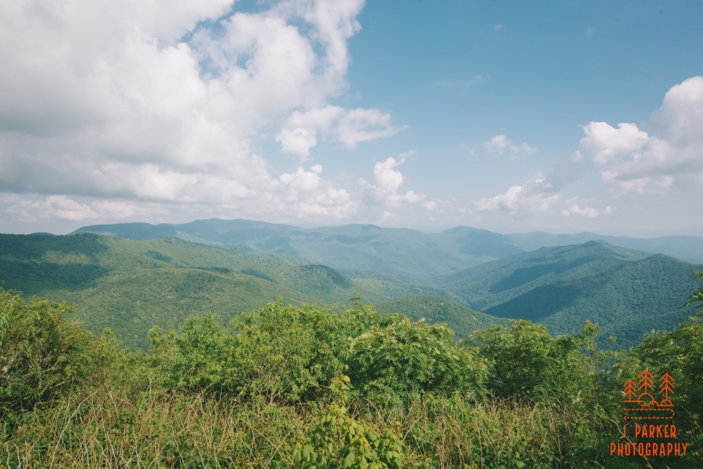
Though we went far from halfway, there was no question that the best thing to do was turn around, and that’s what we did (and it’s a good think we did too. I found out later there were some creek crossings ahead that would have been impossible to navigate with one foot). It stunk to have to repeat the arduous section we had just completed, especially while trying to not put weight on a now-injured foot, but at least I knew exactly how long the difficult section lasted. It was just a question of getting through it to get to the easy portion of trail on the other side. So up we went, through the wet creekbed, over the roads, slowly but surely. For the most part I managed to use the trekking poles and my left foot and press forward, though I found I wasn’t completely unable to use my wrapped right foot (thanks, adrenaline!) when it was necessary. I was agonized, for I had to take it on good faith that Jess was getting appropriate video of my ordeal, which is a key part of wilderness injury management. I hadn’t ever taken my camera off my neck, so upon reaching the meadow again (which also happened to be the end of the difficult section), I snapped a picture of the view back towards Black Balsam. Even injured, I never cease to be a photographer. The trail wasn’t devoid of other hikers, and nearly everyone expressed their concern, but if I could endure living in Central Florida in general, I wasn’t going to be taken down so easily.
Once we reached the meadow, I had little doubt that I could make it the rest of the way back, and I did exactly that, one labored step at a time. It never did rain on us, though the sky continued to get worse every minute we were out. We had planned to hike the Flat Laurel Creek Loop with Sam Knob and then hike for as long as we felt physically able afterwards. As it turned out, I wasn’t even able to finish the Flat Laurel Creek Loop. Even with the injury aside, it was a horribly bitter feeling to have been so excited to return to an area after 3 years and several aborted trips, only to have that occasion marred by injury. It wasn’t so much that I didn’t get to re-visit actual Black Balsam Knob, but to have not finished the simple loop I wanted to do at bare minimum was tough. And while getting to Sam Knob and the views from the top were really nice, getting injured and leaving the hike so incomplete made it feel as if my return trip to the area never happened in the first place. It was almost blocked from my memory and made to feel as if it were only a dream.
I wasn’t sure what state the foot was going to be in or what was going to happen as we left Black Balsam. For the moment, I just wanted some food, and there was a familiar Pizza Hutt in Brevard that had served as a rallying point for us before, so it seemed fitting to try it again. I couldn’t even hobble on the foot as I made my way in, adrenaline having worn off (it took us quite a bit more time than expected to get into Brevard, as holiday weekend traffic led to devastating traffic on US-276 getting into town). I enjoyed a meal as I surveyed my notes and maps of the surrounding area, wondering if it was all in vain since I couldn’t be sure I’d be able to really take another step again this trip. I hadn’t brushed up on the stops right around Brevard just yet since I hadn’t expected to be around town until the day after. We picked up some more substantial wrap at Walgreens in town, and I decided that, being unwilling to give up just yet, we’d try to find a swimming hole that I could at least hobble too. Mountain water had done my hip well this trip, and I hoped it would do well for my foot too.
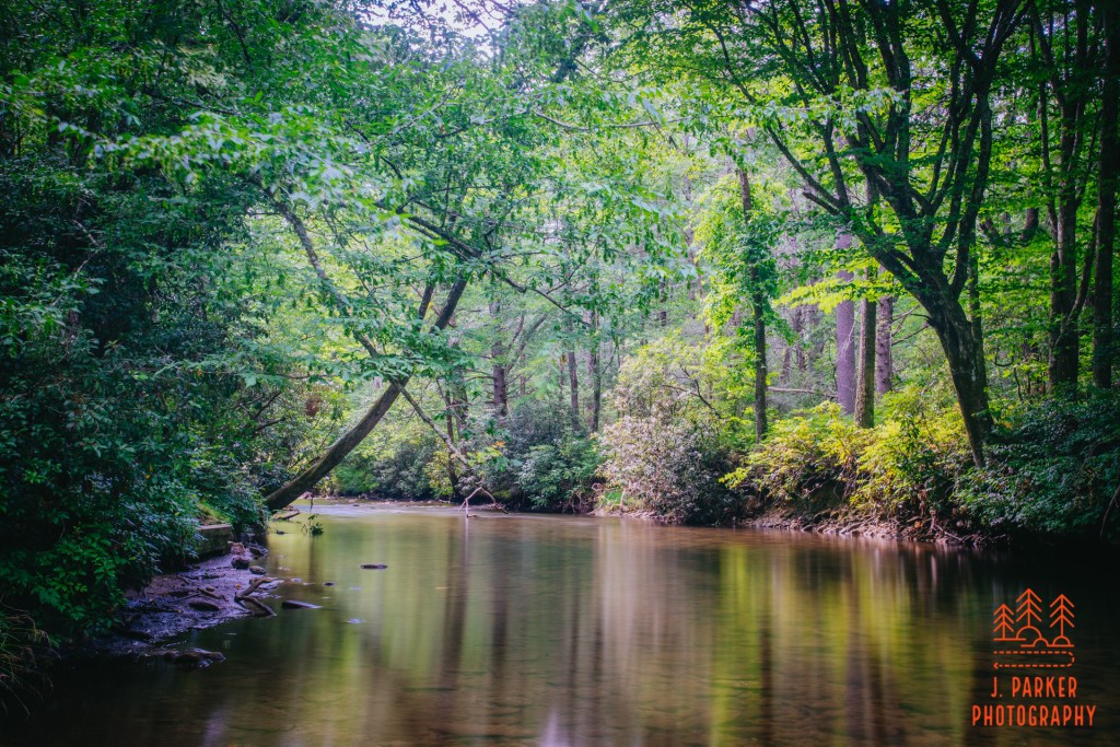
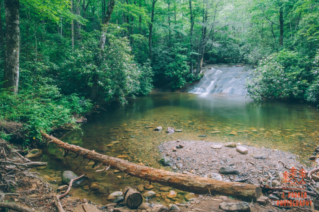
As it turned out, we had quite a bit of success with swimming holes that day. We first visited a small one along a dirt road, then visited the Davidson River near the Pisgah Center for Wildlife Education. The latter stop was kind of bittersweet for me, for it sat right in front of John Rock, another hike I had missed out on for years that it had been our plan to hike the next day. It loomed over both the river and my mood. The water there wasn’t deep enough anyway, so we moved to find Cove Creek, where I was able to stay on my feet for about two miles to walk to two different waterfalls. I even took in a half dozen trips down a sliding rock for good measure. Everything hurt, but I had begun this whole trip injured to begin with, and as long as I could physically tolerate it, I figured the greater pain would have been having to return to an endless cycle of painful workdays feeling unrequited.
All had seemed lost, but at least for a moment I had persevered. Only time would tell, however, what the next day- and it’s day-after injury pain- would bring.