I wasn’t sure I could go. I was pacing, or at least the best approximation I could do, back and forth in our hotel room, testing out the injured foot that would need to have far more than the 20 hours I’d give it to recover from the nasty turn I had given it on the Flat Laurel Creek Trail. It really wasn’t good. My foot had swollen so much through the gaps in the compression sleeve that I was wearing that the edges nearly cut my skin. I wasn’t sure I could walk down to the car, and was half hoping Jess would push me a luggage cart. I could barely make it from bed to bathroom, and yet in less than an hour I was hoping to tackle a 7 mile, 1100 foot elevation gain hike.
In normal times I might have heard the fat lady sing. But these were covid times, and the fat lady’s performance was canceled as it was against CDC regulations.
I made the decision that we were gonna try it, backed by the power of 800mg of ibo profen. It’s not that I had any great assurance or confidence that what I wanted to do was the least bit feasible; I wasn’t even sure I’d make it out of the parking lot (to be fair, the Pisgah Wildlife Education Center parking lot is massive compared to your average trailhead). But I had two really great reasons for at least giving it a shot:
- I was ill prepared with an alternative for how to spend our last vacation day in the mountains and, quite frankly, a little stressed at the prospect of ending our trip on a dour note.
- I really wanted to do it.
It’s hard to argue with that unassailable logic.
I wasn’t being quite as reckless as it might seem. I felt from my past experience with athletics and injuries that if I was able to go a certain distance on a bad foot it wasn’t likely to leave me physically incapable of completing the hike, especially since we could support it well with wrap and lighten the load by using trekking poles (already a necessity due to my injured hip). And, as I told Jess to make her feel more comfortable about the whole thing, if I was really having issues we could always just do the loop around John Rock without taking the offshoot to the rock. In this I was being a little duplicitous. Yes, what I was describing was a very real possibility – there is a way to loop the rock without going out on it – it just wouldn’t have really saved us all that much exertion as I kind of implied it would. By the time we would reach the offshoot for John Rock, we would have already climbed much of the hike’s overall elevation. It would be a fait accompli by then.
I’m a sneaky bastard, I know.
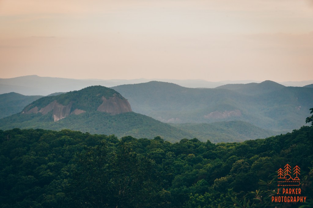
John Rock is one of several prominent plutons (large, formerly volcanic rock formations that tend to over wide, rounded areas that make for perfect viewing areas) near Brevard, NC., with the most famous of these being Looking Glass Rock, which just so happened to be almost immediately beside, and eminently viewable, from John Rock. We had hiked Looking Glass Rock in 2017 and found the view was outstanding but the overall hiking experience was rather bland since the hike offered no other point of interest other than the terminus over more than three mile one-way trip. Equally frustrating was that you never once caught a glimpse of the entirety of rock you were hiking on, which as Looking Glass Rock is so distinct, was disappointing. John Rock seemed to solve all of these problems. The hike offered far more than just continuous switchbacks trying to reach a single point of interest. In other words, it would be a complete hike.
That’s why I had wanted to do this for so long.
The Looking Glass Rock Trail offered not a single view of the namesake rock. John Rock rectifies this by being viewable before you even begin hiking. As we made the left turn into the large parking area I was filled with excitement and anticipation seeing the rock just absolutely tower over us from far, far above. While this experience is probably very common in the west, and maybe even in other parts of Appalachia, from what I’ve seen it’s just not something very common in southern Appalachia, where heavy foliage, less prominent peaks, and more circuitous paths seem to make the experience rare. Other than Table Rock in Linville Gorge, whose bulbous peak was faintly visible through the trees, I hadn’t previously done a hike where your ultimate destination occupied an imposing position high above your starting point. Looking up, it was hard to imagine that I’d be able to scale that monstrosity with a bad hip and freshly injured foot, but I was going to try.
For the sake of my mental health, I had to.
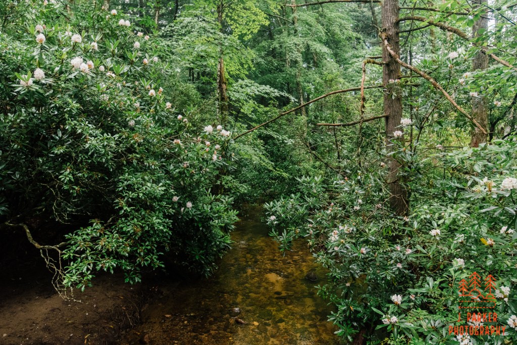
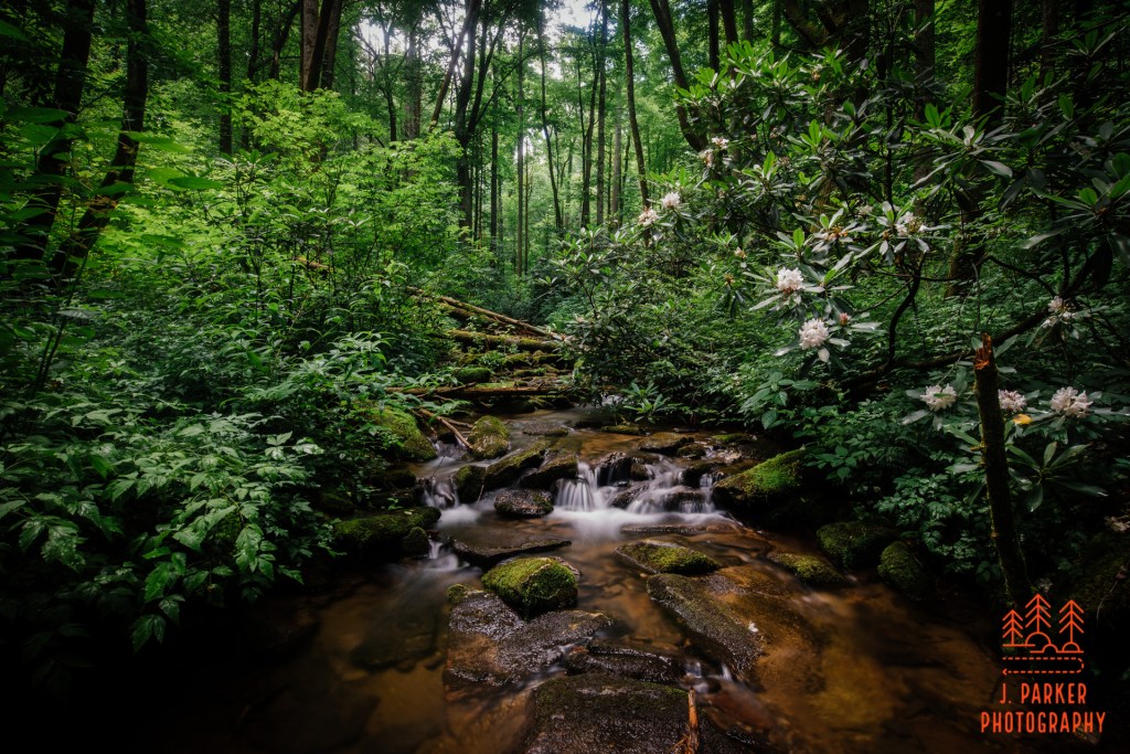
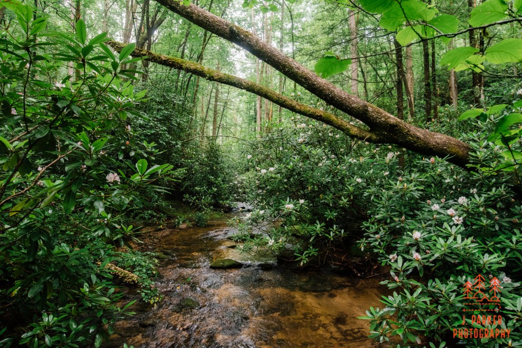
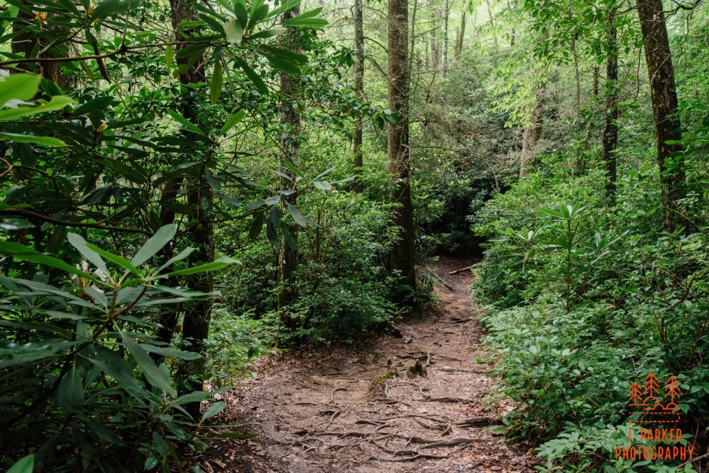
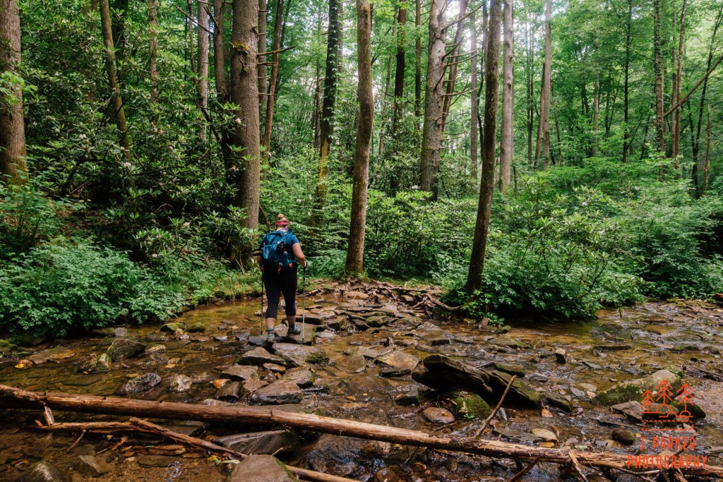
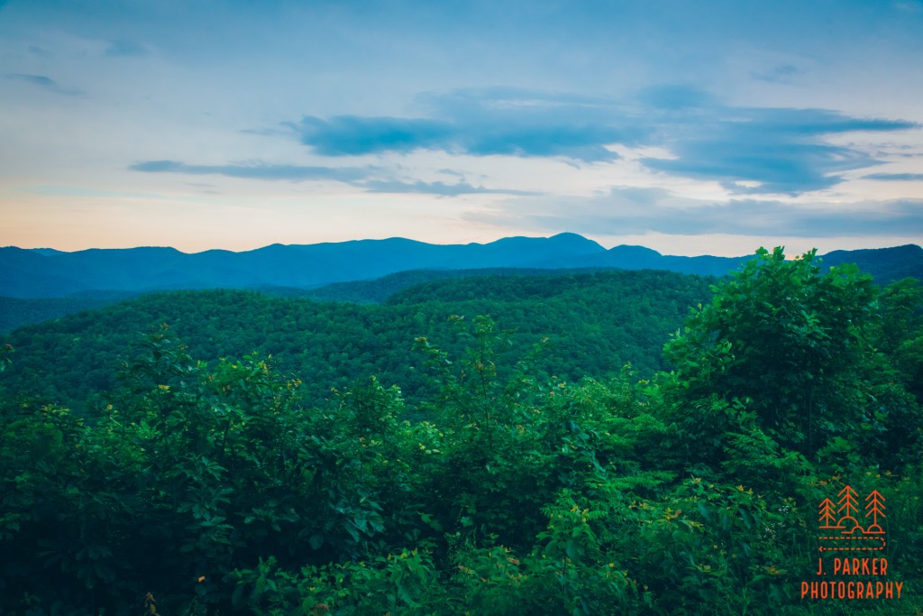
We opted to take a space in the expansive parking area far from the beginning of the trail, but right next to where we would finish (it’s the worst to have to walk through a big parking area when you’re tired or worse at the end of a hike). Being a loop, you can start going either direction, but the directions I had were counter clockwise. Being that this way takes you by several waterfalls early in the hike, and it also gets the high point in the hike done before the halfway point, this way certainly seemed to have its advantages and we were glad to have taken it. The trail started by crossing a creek. We took a moment to ponder this creek on this pleasantly cloudy summer morning. Like the creeks in the Smokies where we had been, the creekbed was surrounded by a path of immensely green foliage and mountain laurel. Somehow though, the character of the foliage was different, in ways that are beyond my capability of describing.
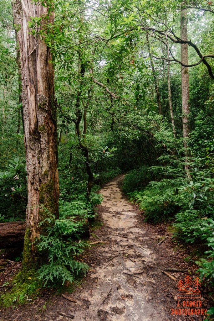
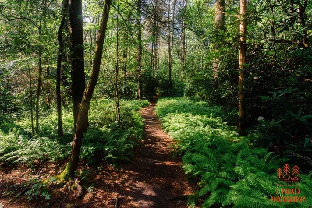
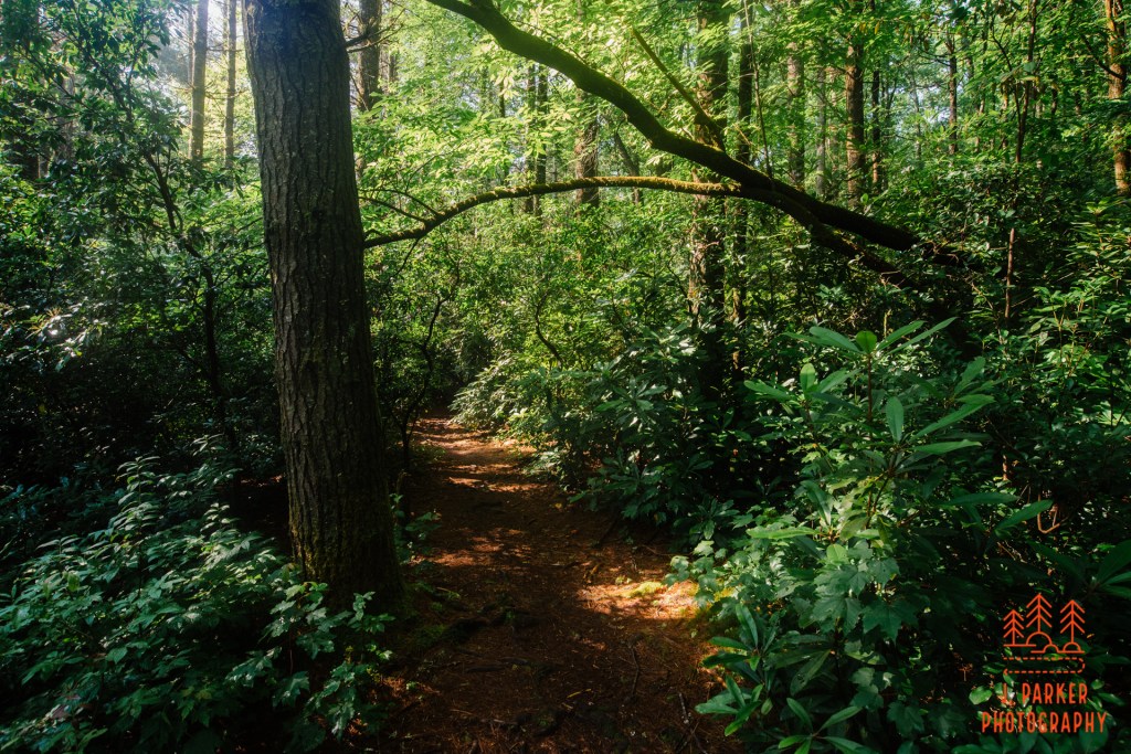
Our route took us to the right just on the far side of the creek, where we picked up the Cat Gap Loop. From here we would begin following a fairly wide path through a forest that often had a carpet of ferns surrounding a variety of tall hardwood. For my money, I don’t think there’s anything more fantastic than a mid-elevation forest in the Smoky Mountains, which has a truly exotic feet, but I certainly found a lot to like about the forest along the trail here. Everything was made more beautiful by the unique morning conditions we were having. Not only was it a bit cloudy, there was also a touch of moisture and the least hint of fog hanging in the air, which really made the trees glisten and made the green all the more resplendent. And we were only just beginning.
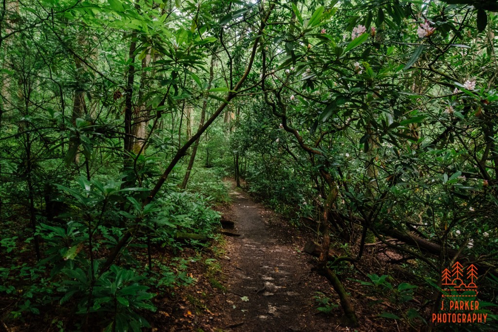
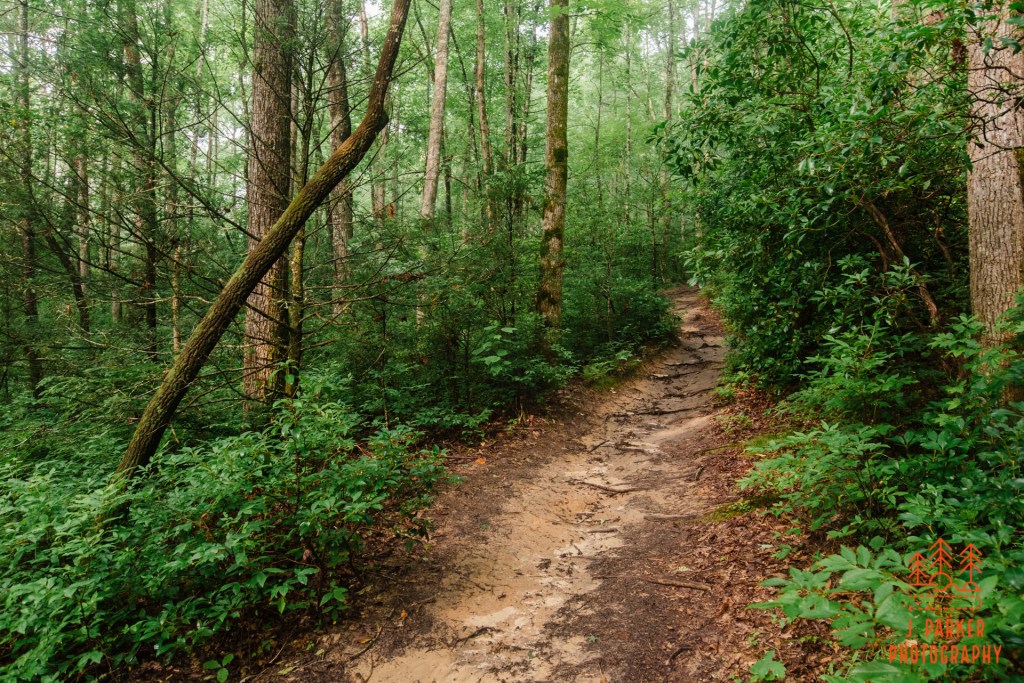
We had some brief climbs in this early section, but in general the climbing was very gradual. At times here the foliage packed in tightly on the trail, we had to avoid small bits of sticky mountain laurel. Other than some understandable weakness and discomfort, I was keeping enough strain off my wrapped foot to keep everything manageable, and the path was very good quality. A small creek began run parallel to the trail. I would have liked to have walked down the small bluff to get a better view of the creekbed, since creeks of any type always pique my curiosity, but the only way I was going to complete a strenuous 7 mile hike with two different injuries was to be smart, which meant not taking unnecessary side excursions.
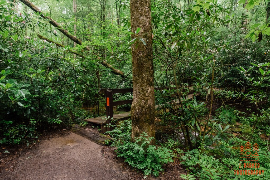
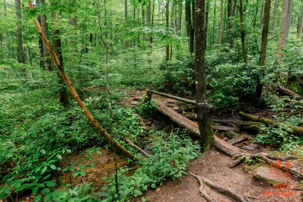
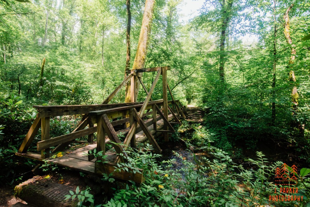
Fortunately, I would get a better view of the creek up ahead. Soon we came upon a spot where the trail bent to the right and embarked upon a bridge. This bridge had a railing on one side but was open on the other. It was built on solid, standard planks which thankfully weren’t slippery on this somewhat wet summer morning. While on the bridge I enjoyed the view upcreek, where one could see it bearing a serpentine path through the mountain laurel.
With this trail being so close to Looking Glass Rock and having obvious similarities, the two hikes are intrinsically linked, and hard not to compare. With its two creek crossing and the nice patch of forest we had already traversed, even in its infancy we had already seen more interesting (non-overlook) features than we had on the entire passage out to Looking Glass Rock. And like the Carpenters, we’ve only just begun.
Climbing in elevation began again after we passed the creek. While this would be some of the most significant climbing we would do on the Cat Gap Loop, it still offered no significant duress. Our only difficult moment came from a small clump of deadfall containing multiple tree trunks bunched together. This took a bit more concentration and effort to get past than your usual single tree trunk, but we made it past without being any worse for the wear, and we encountered no more obstructions on the entire hike.
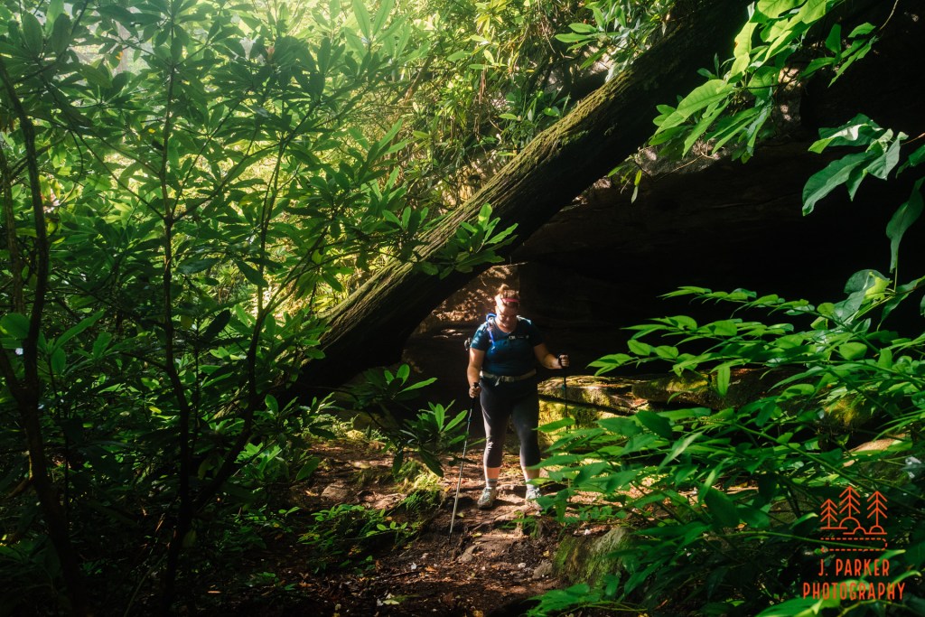
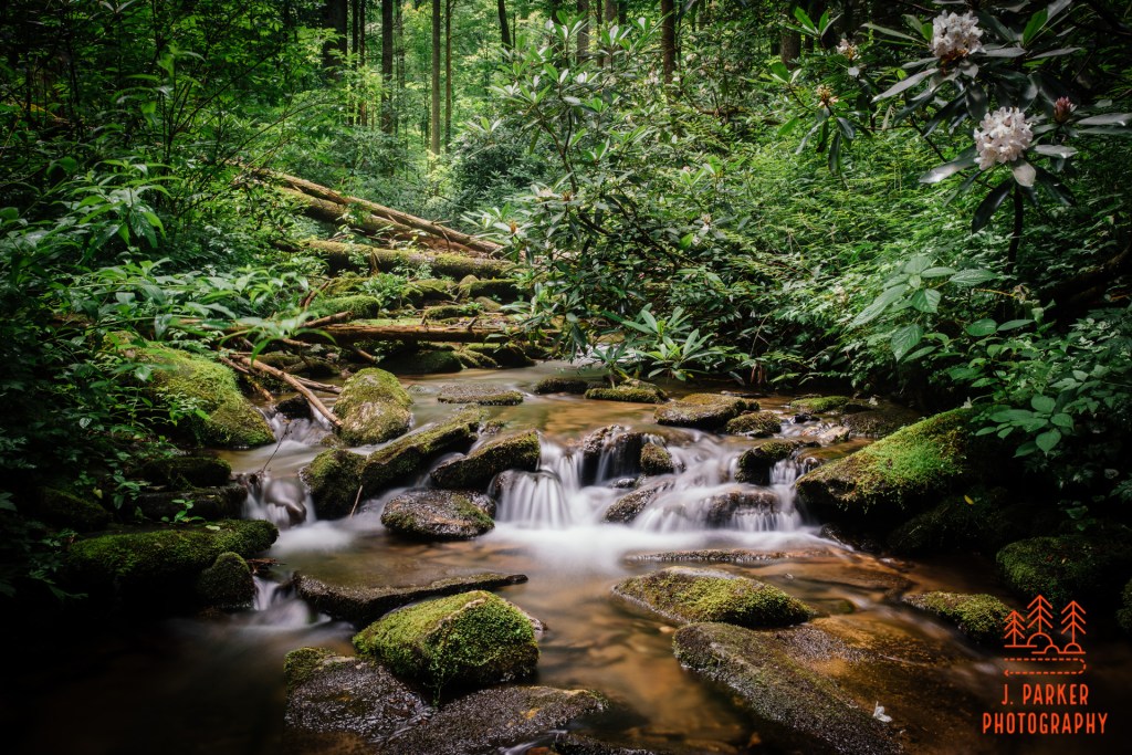
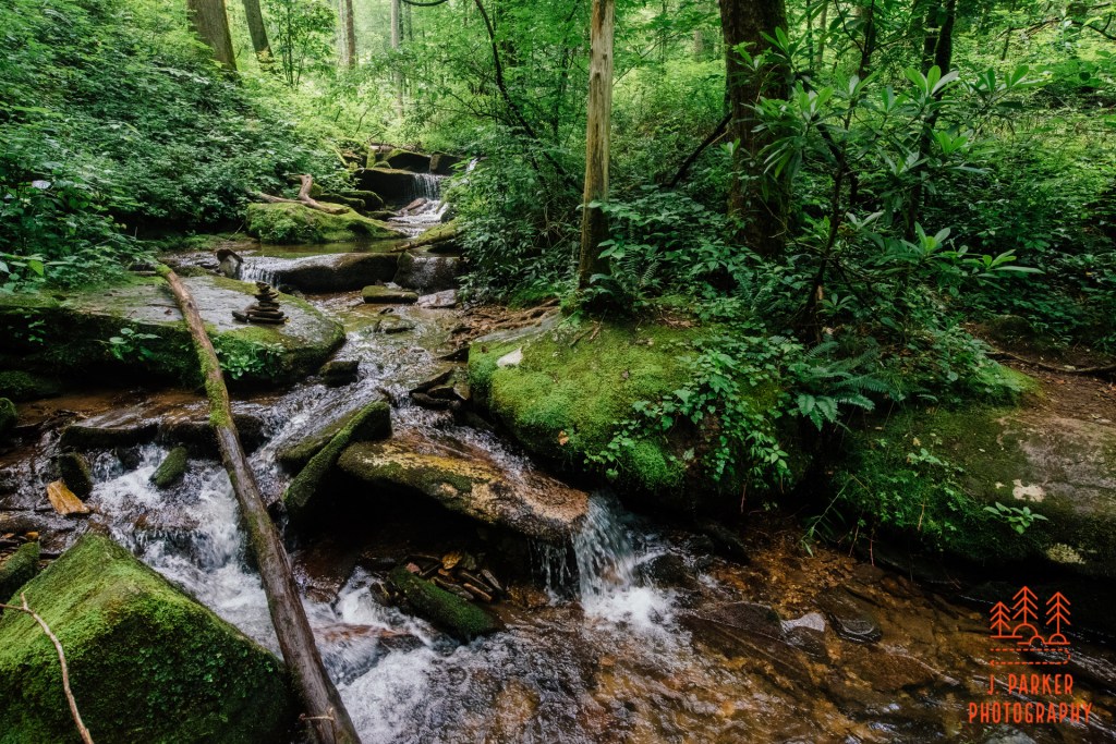
It was getting to be the point where we should encounter our first waterfall on the hike. This wouldn’t be located along the trail itself, but on a short side trail we had to keep our eyes out for. We came across one side trail that seemed promising. We began following it with some trepidation figuring that, in the worst case scenario, we would die. The vegetation hugged the trail closely, and being an unofficial path it wasn’t free of obstruction, but it was heading towards the sound of rushing water growing louder as we approached. For much of its course this path was fairly level, and it was eventually joined by a very steep path on the right, coming from further up the Cat Gap Loop. The final ascent to the waterfall was, however, very steep, and even worse, it was over very moist clay soil. The only saving grass was that it had a lot of roots, which provided some much-needed stability.
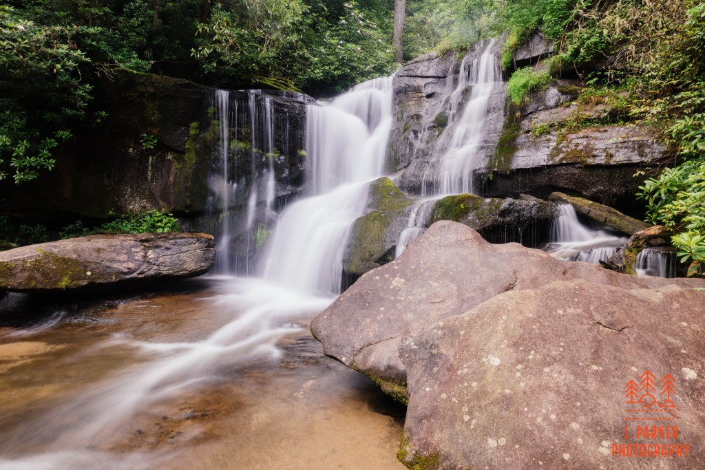
I carefully made my way out to a set of rocks where I could get a frame of the fall, called Cedar Rock Falls. In my physical condition I had to be content with just getting a shot, and really couldn’t lament over not getting a perfect frame. Jess assisted me with the gear as best she could. Cedar Rock was a nice little fall, especially considering it was just a bonus to the main focal point on a hike. There were some nice patches of rhododendron in bloom around the fall that I wish I would have gotten in frame, but with the sun beginning to come on I was satisfied just ensuring I got the fall in even light. When it was time to return after a few minutes of photographing, we opted to return on the same rustic path we came, rather than try the more direct, but much more steep route.
Just upstream of Cedar Rock was another waterfall, though we had to take a circuitous route to reach it. This one way also not located directly on the trail, but being at the back of a campsite was much easier to locate. I’m not sure of the exact name of this fall. It certainly wasn’t quite as notable as Cedar Rock, being far smaller, and it’s rounded shape meant it presented a much less pleasing frame for the camera. It wasn’t as deep as its downstream brother, so there was much more sunlight streaming in here. I snapped a couple pictures of this before we continued on.
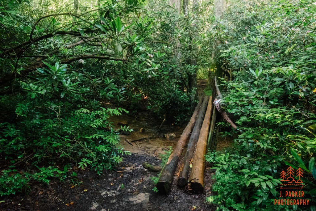
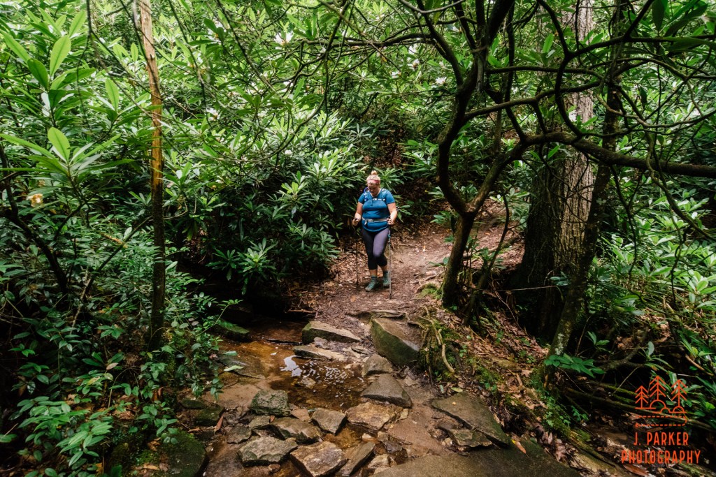
Just past the campsite we encountered an intersection with the Butter Gap Trail our first intersection in a while. Our route took us left, where a rickety bridge made of three small logs provided a little bit of a nerve-wracking crossing over the creek. The bridge had no railing, just a cable strewn between trees on either side of the creek which only loosely ran parallel to the bridge itself. The creek had been significantly wider at the two waterfalls, but just upstream it was a corralled in a tight channel that formed a very small slot canyon in the vicinity of the bridge. This was not a place I wanted to fall in, for I doubted the sunlight streaming in would allow for appropriate video of the incident, and I was surprised by the challenge navigating this short bridge presented. Much to my relief, we both navigated the bridge safely.
Upstream of the waterfalls the creek changes in character from a tumbling, rocky creek, to a placid, meandering, boggy creek. The next trail segment scarcely ever went all that far from the creek, and it was a marvel to see the immense contrast. That contrast extended beyond the creek itself, for it shifted the entire habitat into one completely different. We were in a high elevation bog area, where the terrain was remarkably level. In some areas the entire forest floor was carpeted in ferns. We had seen some ferns earlier, but not in the same abundance. While if anything the vegetation was thicker than previous sections, the canopy had become less dense overhead. Thus streaming sunlight made capturing all the shades of this forest a bit of a difficult proposition. Nevertheless, I loved the variety along the trail, and even though the sunlight made photography difficult, seeing its rays shine through a shroud of mist in the varied foliage added an air of magic to the hike. I wouldn’t have wanted it any other way.
The only think that wasn’t magical about this section was an even more exciting bridge crossing than the one we had just endured. This one was very more slippery, and also lacked a substantial railing. Fortunately, the creek was fairly inconsequential here, unlike the rocky morass that we had crossed prior. We made it over this one without incident as well.
We encountered a small campsite which we had entered following the sound of water running over rocks. Though we weren’t able to find the source of the sound in the creek behind the campsite, several logs made for convenient seats in which to have a moment of reflection under the sun rays softly penetrating through the trees. There was something vaguely reminiscent of the Pacific Northwest here, and I was reminded that if this year had gone to plan, Jess and I would have been starting our trip to Washington State around this time, a true dream trip we had concocted. Of course, this year hadn’t gone to plan. First, Jess’s mother fell seriously ill and then passed a few weeks later. Pretty much concurrently my bad hip had inexplicably gone south, never to recover in the months ahead. And then, of course, covid provided a dramatic shift in everyone’s lives a few weeks later.
We should have been driving the North Cascades in at that very moment. Instead, we were back in North Carolina, and I was damaged goods to say the least. But all we could do was make the best, and that we would, for the hike we were one was still measuring up to be one of the most satisfying I had taken.
Ahead we had an unbridged creek crossing that was about 15 feet wide or so. The creek was but a few inches deep, and we both managed to successfully rock hop across. I was happy to keep my feet dry, for while I normally don’t bother expending that much energy to keep my feet dry, all the other shoes I had brought on the trip were still wet, and I didn’t want to get my wrap wet either if I could possibly help it. Mission accomplished.
Here we encountered a new phase of the trail where the Cap Gap Loop climbs consistently for some time. This was the park I hadn’t really told Jess about – the fact that we’d be doing a lot of the climbing for John Rock while on the Cat Gap Loop. By this point though there wasn’t much concern that my foot wouldn’t hold up anyway, painful though it was. While there is a lot of climbing here, and the trail zig zags just a bit, there’s nothing quite in the usual pattern of monotonous switchbacking to dull the brain either. It wasn’t exceptionally steep, but this was still probably the steepest bit of trail that Jess and I had yet done on this entire trip. Neither foot nor hip nor poor fitness gave me any undue trouble through here, thankfully. Once the trail leveled out again we began to look for the Cat Gap Bypass, a mostly level shortcut to the John Rock Trail that is standard for people looking to hike the rock.
The Cat Gap Bypass was probably my least favorite portion of the entire hike. While it was fairly level, it didn’t really offer any distinguishing characteristics either. We also were a little frustrated by a separate group of hikers who looked akin to the surviving members of Lynyrd Skynyrd. When behind us, which happened multiple times, they constantly digged at our heels, as if we weren’t going fast enough, but when we would let them pass, their pace reduced and they would obstruct our own passage. I’ve got no problem allowing faster hikers to get ahead of me, it’s proper etiquette and I do it all the time, but for this group it was not about pace at all, they just didn’t want to hike behind anyone. Fortunately, this section of trail was short, and when we reached the a 4 way junction which included our left hand turn for the John Rock Trail, Lynyrd Skynyrd apparently had to wait for another member of their band to arrive before continuing.
The climbing on the Cap Gap Loop not long ago had left me winded, but what we encountered at the beginning of the John Rock Trail was in a completely different category. For several hundred yards we were treated to a climb of sheer, unrelenting brutality, easily of the steepest primitive trail segments I had yet to come across. The climb was of such a steep nature and the path narrow enough that I really couldn’t photograph it with any hope of showing its steep gradient. I wasn’t thinking much of photography anyway, I was just trying to push myself forward the best I could, and stick and stone feet thrashed for purchase as I did my best. This section is what I dub a “little ass kicker”. Luckily, brutal as it was, the climb had the mercy of being brief. I had motivated myself to push through with visions of the fantastic rocky outcrop I just knew had to be waiting ahead, but as the trail leveled out it became apparent that we had quite a bit to go.
Around this point is actually the high point of the trail, which means that we would predominantly be going downhill from this point forward. I was surprised by how much we actually went downhill before we reached the primary overlook, another great reason to do the hike in counter clockwise fashion, for it would be much less relaxing to be at the primary overlook, knowing you still had a bit of climbing (plus that brutal stretch we had taken as a climb but was steep enough to be challenging as a downhill, too) to go. Once we hit the high point on the trail, there really wasn’t another bit of significant difficulty we encountered the rest of the way.
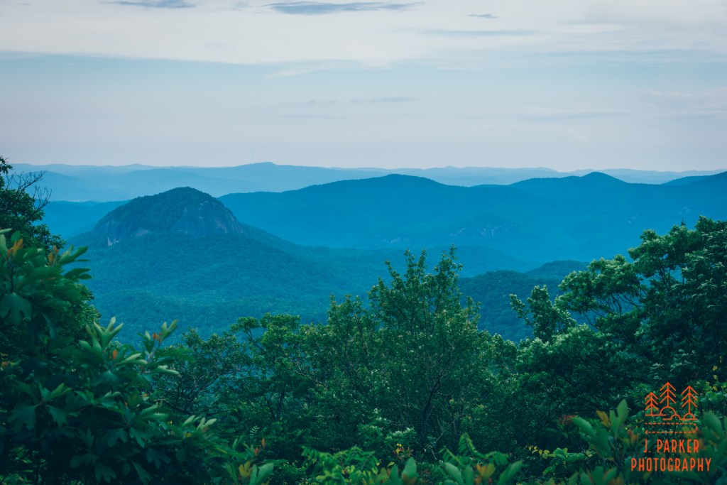
Though we were not that close to the overlook, we could clearly tell that we were on a prominent ridge with sheer drop offs to either side. At certain points I took a variety of goat paths leading towards the edge, trying to ensure I wouldn’t miss one of the unheralded bonus views that always seem to litter hikes such as this. At least with summer foliage present I didn’t find any unobstructed views, though at times I caught of a bit of a glimpse through the trees. One side path to the right brought a partially obstructed view of what was clearly Looking Glass Rock. Now I really couldn’t wait to get to the overlook.
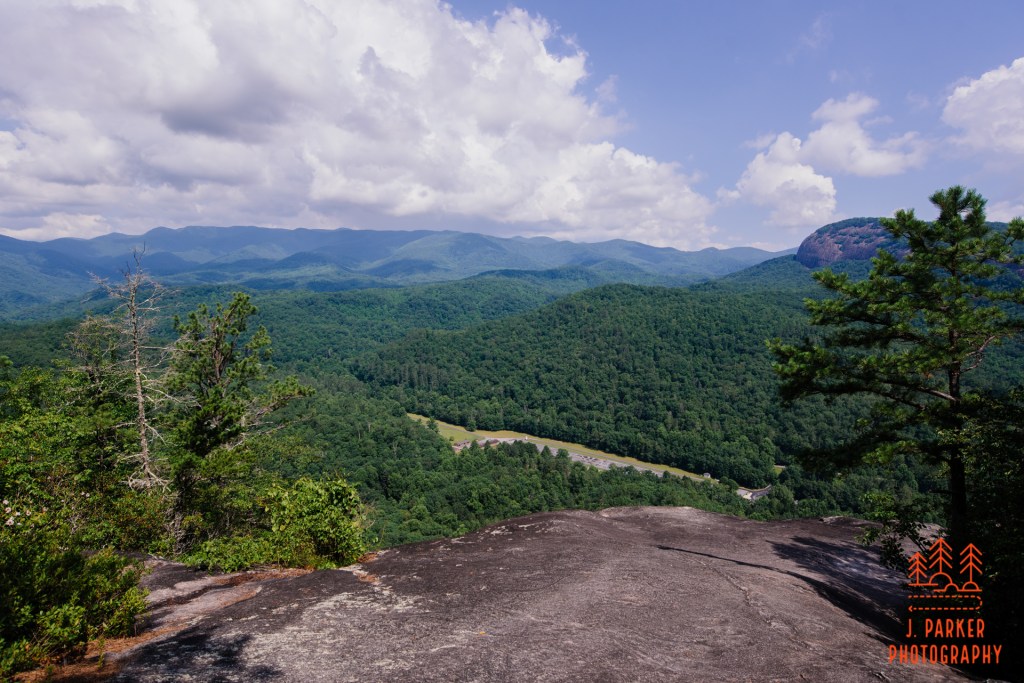
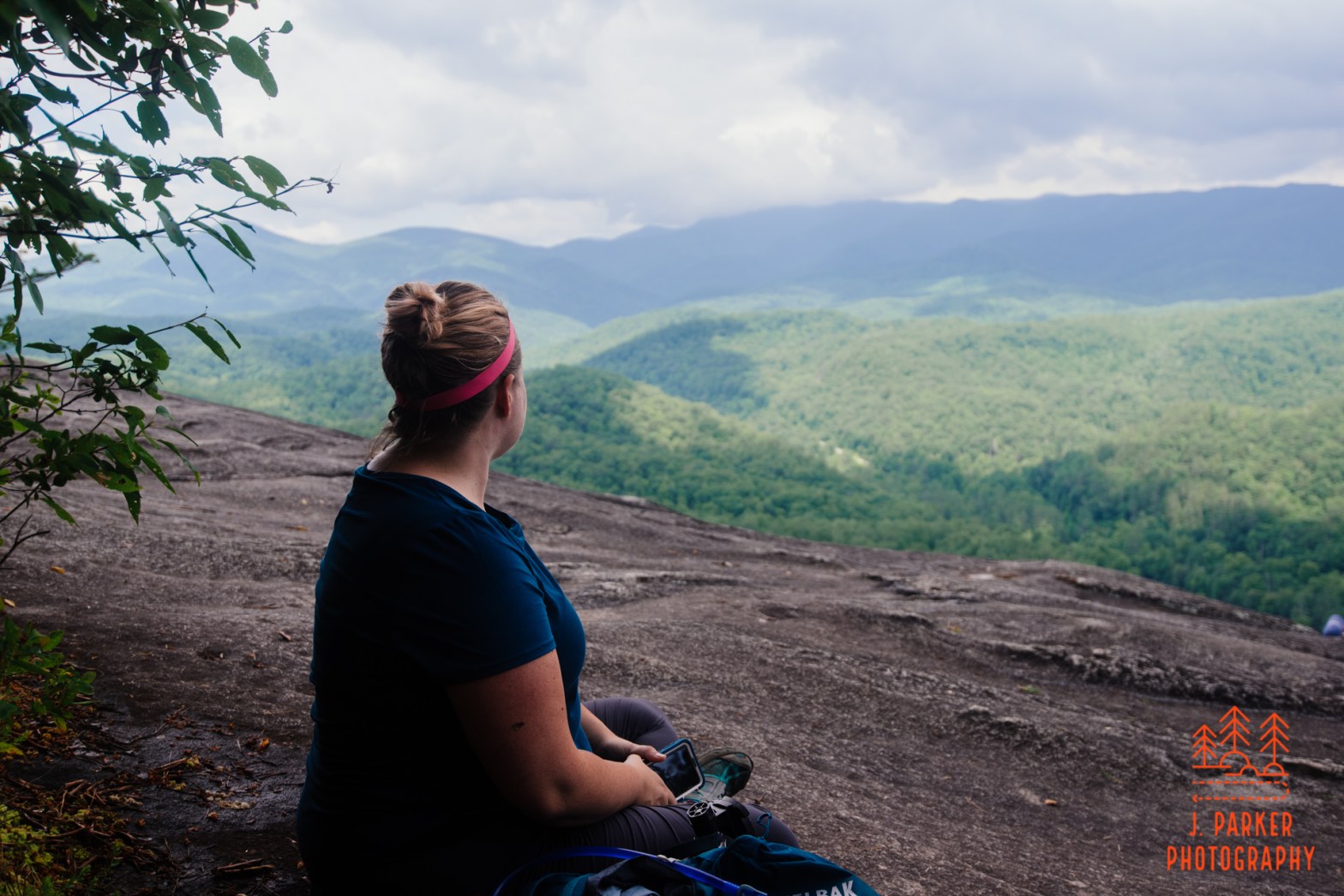
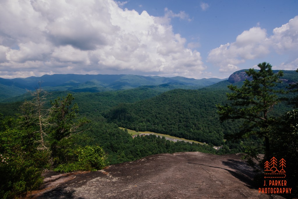
Finally we emerged at the overlook proper. Us, and many others who were out enjoying Saturday. Unfortunately one other group kept us pinned rather close to where the trail came out for the time being. The rock in front of us sloped down rather quickly, it was more gentle and flat to our left, but our way there was blocked by an oblivious few who blocked our passage to the rest of the rock. Fortunately they were not long in parting, and from there we were able to enjoy the view in its entirety.
Far below sat the parking lot we had begun our day at. To the left, the crest of the Pisgah and Blue Ridge Parkway, which was faintly visible in places, rode from its lofty perch nearly 3,000 feet higher than our current elevation. And to our right was Looking Glass Rock, partially obstructed by a copse of trees. I knee from pictures that the view of Looking Glass should have been unobstructed, and I began to see that there were people on a lower tier of the rock, behind the trees. The rock face was steep but not excessively so, and I decided I needed to see what was done below. Jess, ever on the edge of vertigo, wasn’t willing to take her chance on the steep surface. I made my way down carefully, and after do so I realized that was a trail access point to this portion of the rock, so I made my way around to retrieve Jess, since the views were far superior being on the unobstructed section farther below.
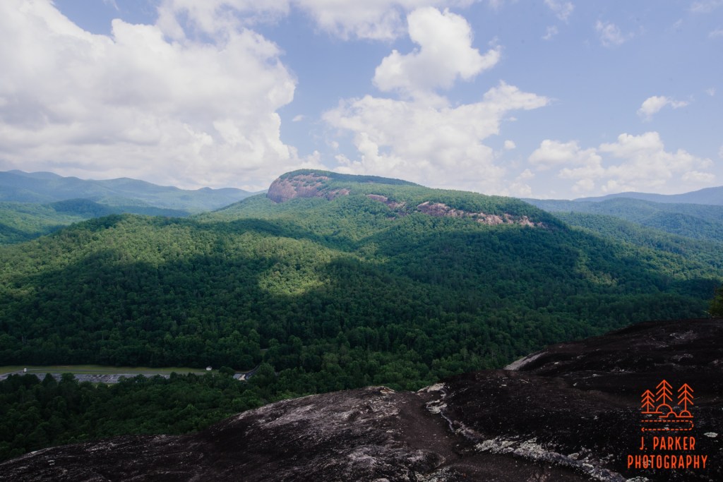
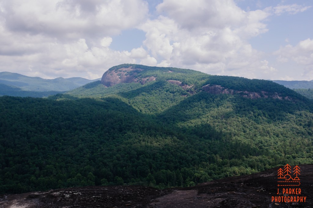
From here Looking Glass Rock really dominated the view. I would venture to say that the view from the end of Looking Glass Rock was better, with it facing directly at the Pisgah Ridge, but seeing such a detailed view of it from John Rock was a really interesting experience too. I was able to observe its every curve and crevasse, imagining the path the trail we had taken three years ago would fit on the outline we were seeing, and where we would have been helicoptered out had we been injured. I had always know that a close view of Looking Glass would be a highlight of the hike, but even my imagination wouldn’t have allowed for how close the rock actually felt to us. Looking Glass Rock is one of North Carolina and the Blue Ridge Parkway’s most famous icons, and it may be one of the most identifiable and easily recognizable peaks in Appalachia. And there it was, right in front of us. And since the rock face we were on had a very gentle slope for quite a distance before it fell off, one could work fairly close to the edge without it being unduly dangerous.
It was here that I allowed myself to feel a certain sense of triumph. I had begun our weeklong odyssey with the dim hope that pushing my torn hip would be the thing it needed to make the symptoms go away (this had happened once before). That didn’t happen, but not only was I able to manage my way through a number of hikes and outings without having my hip become completely dysfunctional, even the injured foot just the day before didn’t keep me from my goals. I knew that most likely my hip was beyond salvaging without surgery, and that I’d probably be able to push my foot without causing permanent injury. With both, it was a matter of pain tolerance, and I didn’t let that hold me back. So while the trip didn’t work out the best case scenario I envisioned, in the end when I had spent the months prior nearly being brought to tears every workday due to the mental and physical I was having to endure, I would have considered it a major accomplishment just to do a single hike the level of a John Rock. I had been so distraught when I had hurt my foot the day before because that goal had just begun to be attainable when it was seemingly snatched away from me.
I had triumphed anyway.

With nearly every “view hike” I had done previously there was very little of note to see once you got past the signature views, partially since a lot of view hikes are out and back hikes. With this hike we were far from over, so while it’s always hard to say goodbye to a stunning vista, at least in this instance something made it easier than most. And from here we would only be almost entirely going downhill, a relief to my injured joints.
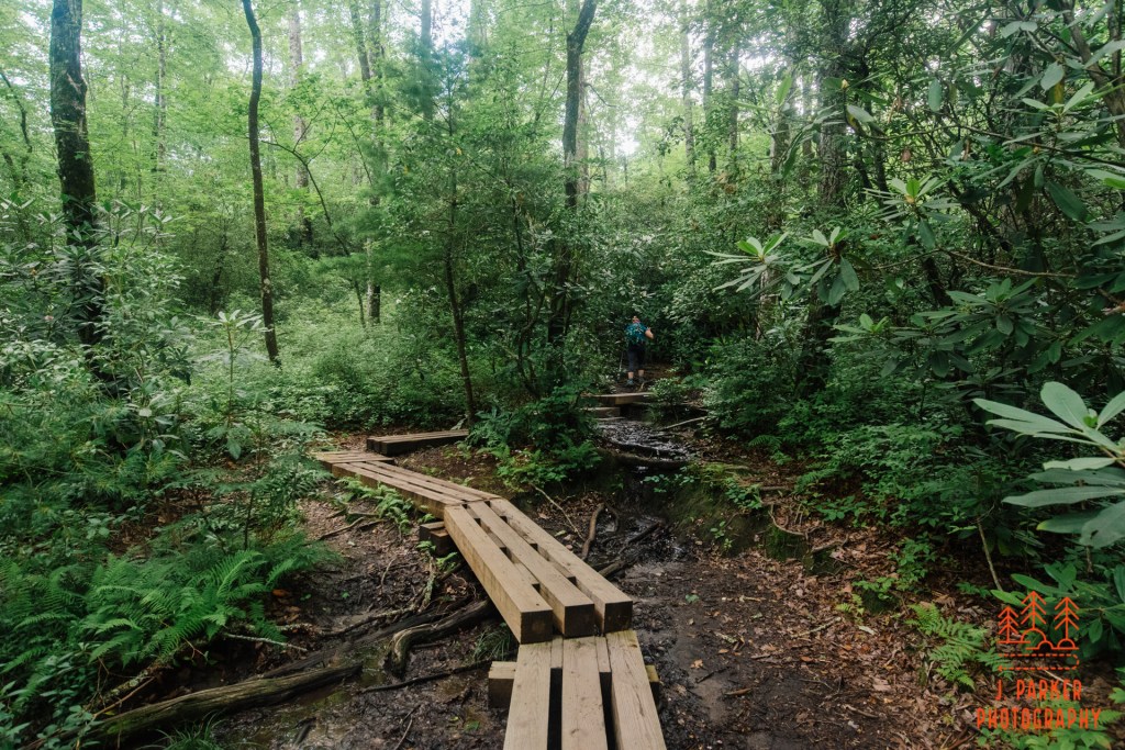
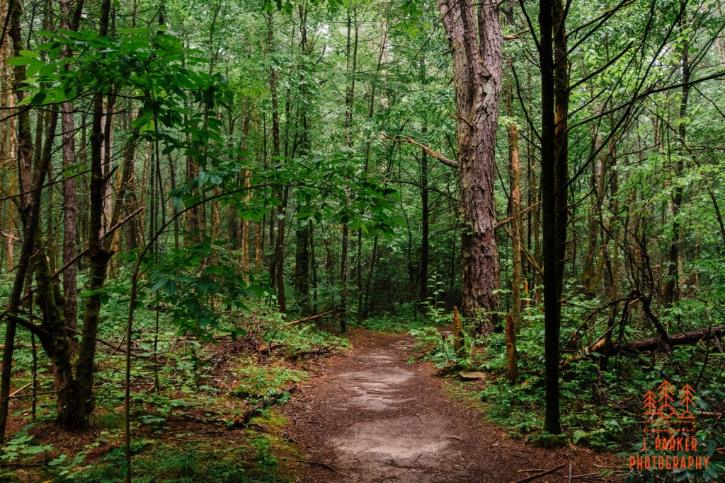
Heading counter-clockwise again a nice forest awaited as we began to drop elevation pretty quickly. We bottomed out in an area that featured several muddy pools. It was obviously the beginning of some creek, though there was little to give it much flow at this elevation. Several sections of boardwalk navigated the trail through the worst sections, including one which snaked through the trees for some 30 yards or so. In other places the trail was the only thing in sight which wasn’t entirely consumed in greenery. The forest in parts had more of “wet” feel, featuring foliage that is usually found around creekbeds. We had only dipped into this briefly on the trail before now, so this was yet another new bit of habitat that provided even more variety to the hike.
We did cross a few small ones which didn’t even require a bridge. This may have been why the foliage developed the look it did.
We encountered quite a few trees with had an impressive girth. These escorted us on our way as we worked towards a junction with the Cat Gap Loop again, where we would take a left. The path was easy to follow, but oddly enough I never noticed the trail we were supposed to turn on. Somehow we just ended up on the Cat Gap Loop heading in the right direction. Never a neglectful navigator, I made sure to verify we were heading in the right direction on the map, which was easy to see since at this point we were making a beeline towards the Davidson River. It was in this area we crossed a creek with another rickety log bridge. From here on we would be interacting a lot with this or other small creeks, something that made the second half really enjoyable.
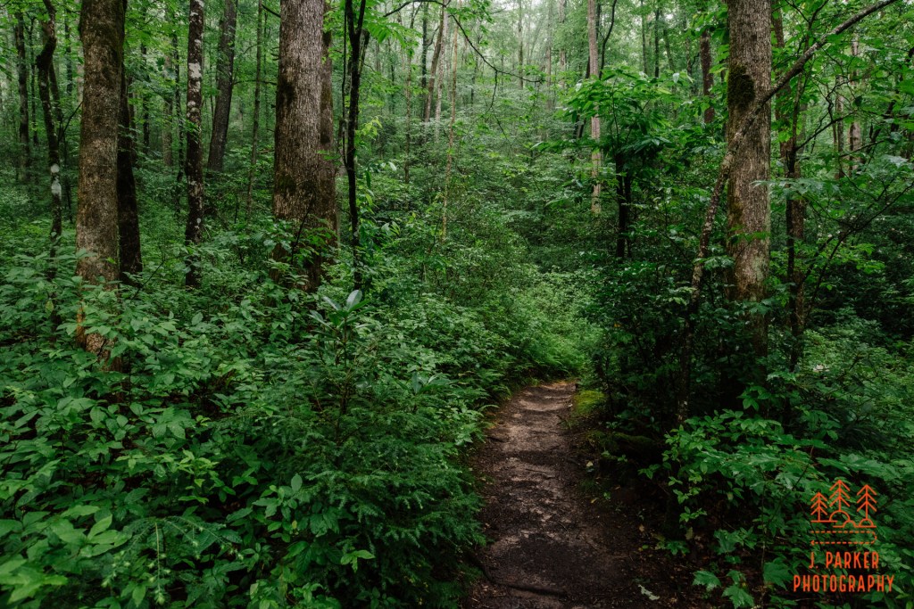
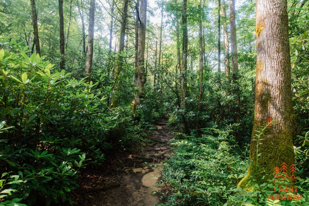
After the creek crossing we entered a remarkably beautiful stretch of hardwood forest. The trail alternated being the huge trunks of majestic trees, which were all showing well in the cloudy weather that had emerged overhead. It didn’t surprise me that this section of what may have been rather standard hardwood forest showed well. Almost everything along the this trail was the best version of itself, more than the sum of its parts. I was pleasantly surprised to be finding this second half so interesting, for I just didn’t think about it, assuming the other half would be the superior side owing to the waterfalls. In truth, neither half was superior because both were good.
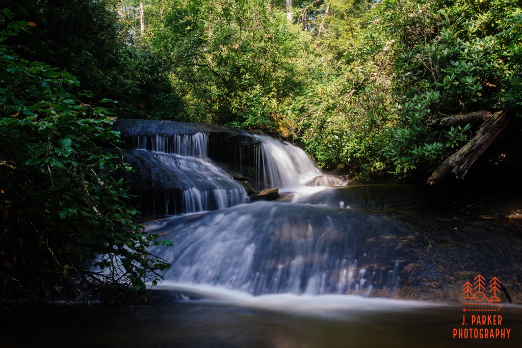
One of my favorite moments along the entire trail was the next creek crossing we came across. This one was another unbridged rock hop, and I had to try much harder to balance on the rocks here than I had on previous crossings. Once I got partially across, I realized I’d be doing a lot more balancing, for there was a stunning set of rapids framed by a bit of lush foliage, some of which was in bloom. I carefully setup the tripod here, adding the challenge of controlling my camera gear to my mission of keeping my feet dry. Fortunately, I successfully achieved both, and got a picture that makes me happy in the process because the view of an unheralded seems to capture the experience of hiking the trail this day even more than the overlook views or the waterfalls. It was the unexpected little things that added up to something fantastic. Where I had stopped was only partially through a rather lengthy and actually somewhat confusing crossing, for it wasn’t quite clear where the trail actually went from here. Jess went ahead and found the continuance of the trail just a tad downstream in an area not eminently viewable from where we had started the crossing.
We pushed onward, creek to our right, until we heard the telltale sound of water flowing over rocks. I followed an easy goat path towards the sound, hoping to find a small waterfall. There was a bit of a downhill flow in a lovely little spot, one in which I really enjoyed taking in. The sound of rushing water is always soothing to one’s soul, and this spot was even more relaxing being tucked away off the main trail just enough for the frequent traffic to drift on by repeatedly. I should have taken the time to get a bit better shot here, but I was definitely beginning to tire out just a bit, not to be unexpected considering my physical condition.
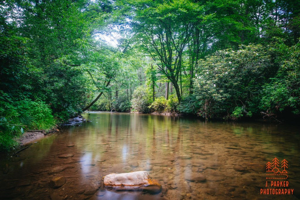
We were getting to the final leg of the hike, and the sun began to reappear and bathe the woods in harsh light. The final portion of the trail ran parallel to the Davidson River, and running close to the river resulted in occasionally rough terrain as the trail had to find purchase between the river and a sharply ascending ridgeline. A substantial bridge crossed a creek not long before it entered the river. This was the last creek crossing on the trail.
Though we were walking close the river, there weren’t many open views of it either. In some places there were short trails that got closer to the river, but on this busy weekend campers were making use of those areas, and we didn’t feel like mingling. We had actually been at the end of the trail, where it follows the Davidson River close the parking lot, the day before when we were looking for a spot to get in the water. I was relieved when we began to see familiar territory, where a path diverged off the main trail to run directly along the river, with entry points every ten to twenty yards. I again took the scenic route, but I didn’t need to linger there today, having already taken in the splendor of the river and captured in the day before. I continued on to the car, thankfully parked near where the trail emptied into the parking area.
As I began to unload my pack and trekking poles I was left in awe of what a great hiking experience we just had. I had known that at a minimum I’d be seeing good views from the rock itself, and just being up on that rock that loomed so majestically over the parking area would bring some satisfaction. But I never anticipated just how wonderful the other parts of the hike would be. While there was the occasional dull moment (rare is the hike that doesn’t have those) by and large it was just one fantastic moment after another. And the fact that was so much variety in those moments was a great boon. “Habitat variety” is rarely the thing that draws the hikers out, but when you’re doing a hike that already features some waterfalls and a phenomenal view from a pluton, adding a different type of woods every so often just escalates the quality of the hike. When I look back on this hike, I think as much about the nice creekside moments and the interesting tracts of woods as I do the looking out from the rock. The weather was also a great boost to this hike. While it could have been a better sky at the overlook, in general it was sunny in the right moments, and cloudy in the other moments, and that bit of mist that hung in the air through much of the morning just made things feel special.
Maybe I appreciated the hike more than I would have otherwise just because of the context I was hiking in, having been injured and having to fight for everything, while it was a shining moment in what was otherwise a pretty tough year for all. But this hiking experience definitely falls in my top 10 for sure, and I’d have to think very hard about where I would place it among my second tier of favorite hikes. I’m confident that anyone hiking the John Rock Trail would really enjoy it, for its a complete hiking experience that offers almost everything you’d want to see in an Appalachian hike.
This one tends to be overshadowed a bit by the Looking Glass Rock hike which starts roughly a mile away. Indeed, I myself wasn’t even aware of the John Rock hike until after I had completed Looking Glass Rock and been underwhelmed. I’ve come to realize that a lot of people can hike a trail that offers little outside of an outstanding overlook and really enjoy that. Of course, that is ok – everyone has their preference. Those people would probably prefer Looking Glass Rock. And there is a certain joy that comes from summitting an iconic mountain. For me, a nice highlight only means so much. I want there to be a complete journey with things along the way besides just the highlight. In this, there is no comparison – John Rock is just vastly superior to Looking Glass Rock. I would say that this is the hike that I would recommend to people, but these days I’m not going out of my way to change people’s opinions and send more people to my favorite trail in our forests which are becoming rather crowded. If the masses want to continue venturing to Looking Glass, I’ll let them, and I’ll enjoy watching them from vantage point not far away on a hike I like more.
John Rock was the exclamation point on our surprisingly good summer trip, but we weren’t quite over. We still had an afternoon to spend, and while my injured body parts were spent, we still had the phenomenal Blue Ridge Parkway nearby. It’s so nice when you’ve gotten your hikes done to just relax with nowhere to be and just enjoy the expansive views spread out ahead. We cruised to Richland Balsam, which we hadn’t even stopped to appreciate before, then meandered all the way towards Asheville. Enjoying a sunset on the parkway was the absolutely perfect way to cap off our trip, and not even the hordes of flies that prey relentlessly upon unsuspecting tourists enjoying the overlooks could change that.