I’m not sure if the ridge that the Blue Ridge Parkway rides west of Asheville through Mt. Pisgah and to the Great Balsams is actually the Pisgah Ridge. I saw that name on a sign once, though, so I’d like to think it is. Maybe its name is Gerald. I like to learn a lot about how gorgeous the views from mountains are, and spend a lot less time learning what to call them and the things I see from them are. What I do know about that glorious ridge west of the Asheville and north of Brevard is that, whatever its named, its got some of the most gorgeous views of some of the most interesting peaks (like Looking Glass Rock) in the southern Appalachians. And you can usually enjoy them shoulder to shoulder with 20-40 of your new best friends and, since its North Carolina, always their compulsory hiking dog as well. I thought that this was always the trade off for these amazing views, until I able to take in a view about as good as all the rest, only without the hordes of people.
I found this view along a portion of the Mountains to Sea Trail, which, much like its name implies, runs from the mountains to the sea. The exact location was called Silvermine Bald, which likes its name implies, contains neither silver, nor a mine, nor a bald to the best of my knowledge (at least none available along the trail). That notwithstanding, this would be the centerpiece of a very enjoyable hike, one which, in addition to a trip along the Big East Fork, completed a nice afternoon of visiting under the radar locations in an otherwise busy area.
I had always planned to do a hike in this area in the afternoon, but I kind of surprised myself by opting for Silvermine Bald over Graveyard Fields or Black Balsam, which are among the cream of North Carolina hikes. I think I imagined that I would have the opportunity to do both, which were on my must do list, before the end of the trip, and wanted more time to do longer hikes stemming from those places. I also didn’t want to have to contend for afternoon parking spaces. So not wanting to shortchange any of those key places, I thought a nice low-key hike to views at Silvermine would be great, though I wasn’t as well versed in the trails along this route as at the other locations.
This particular under the radar hike started in a place that was decidedly the opposite, which was the Devil’s Courthouse parking area. I felt like I had just been here and, perhaps in the grand scheme of things, I had. Just three months earlier I had been there with my wife as we finished our weeklong mountain trip with a solid cruise along the Blue Ridge Parkway. Though we had cruised or otherwise been in the area a few times, we had never had a hearing at the Courthouse until our July trip. We were thoroughly impressed with the view form the parking area then, but owing to a badly sprained foot I had hiked over ten miles on in the last two days, I was barely able to hike from my car to the hotel elevator by that point, much less a half mile uphill to the viewing area. The Courthouse was just an almost incidental bonus to my longer hike, but it would turn out to be a nice bonus. I soaked in the view a bit before heading uptrail.
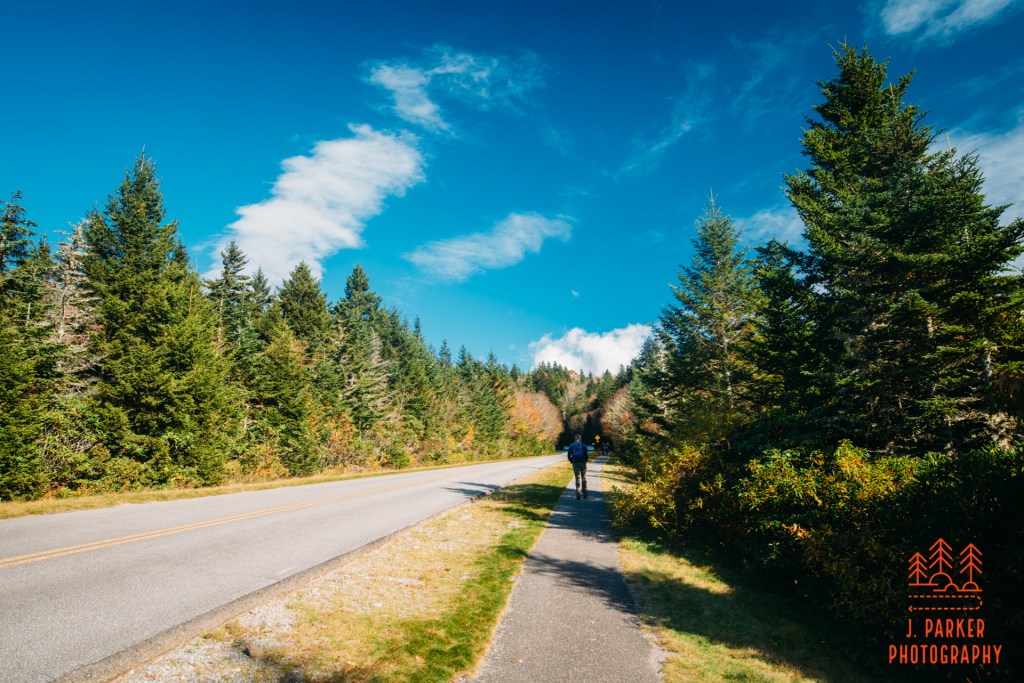
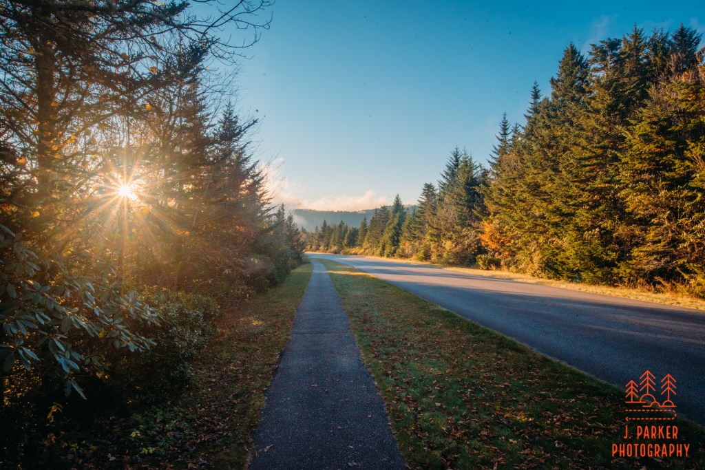
In this instance, heading uptrail actually means following the Blue Ridge Parkway a short distance. Fortunately, this didn’t involve walking along the roadway itself. A trail led to the right of the road for several hundred yards. The Parkway soon disappears in a tunnel, while the sidewalk deviates into a pine forest that lines the sides of the Courthouse. Coniferous forest lines most of the higher elevations of this part of Appalachia, and it’s a pretty sure sign that you’ve gotten pretty high up. I definitely wasn’t in Florida anymore.
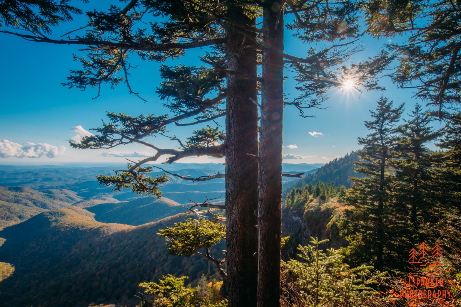
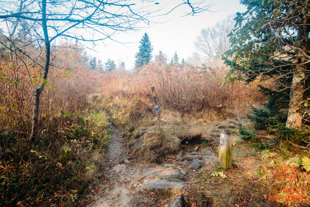
The path stayed paved for a moment as the trail began climbing towards the observation area at the top of the Courthouse. While this climb is pretty negligible compared to doing a real hike, these observation area trails often have steep enough ascents to get your breathing heavy, and this is no exception. The pathway eventually gave way to a rocky trail, and as you got closer, pretty much bare rock with railings on either side to help you navigate to the top. As I was ascending I was keeping my eyes peeled for a pathway to the left, which would be my connector to the remainder of my hike. I spotted it, a rather unassuming pathway just before the railings began which would be easy to miss if you weren’t looking for it. For now that could wait – I definitely wanted to take in the views from the Courthouse, which wasn’t far away.
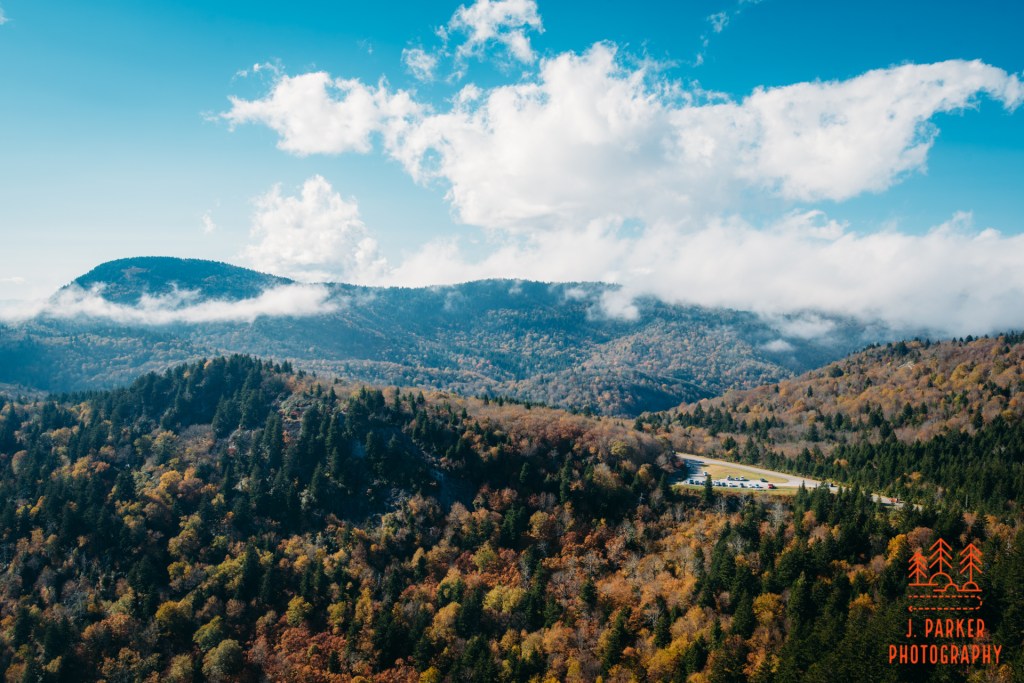
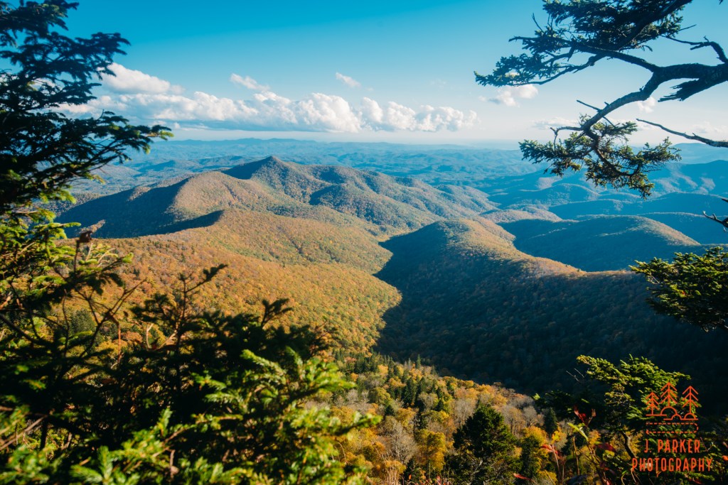
For anyone used to hiking to views, its hard to admit just now fantastic the views from these sterilized general observation areas can be. And its true, its hard to really compare a view that you haven’t won the honest way to one you had to build up towards via hiking. But man, the views from the Courthouse are genuinely fantastic. Not that this was much of a surprise. I’ve taken in the views from numerous nearby places, including the parking lot below, and they are all generally very good. That’s why this area of the Parkway is such a treasure. There were a small handful of people here, but my good luck was that on this Friday afternoon the crowds hadn’t really gotten to this point. All that would come later.
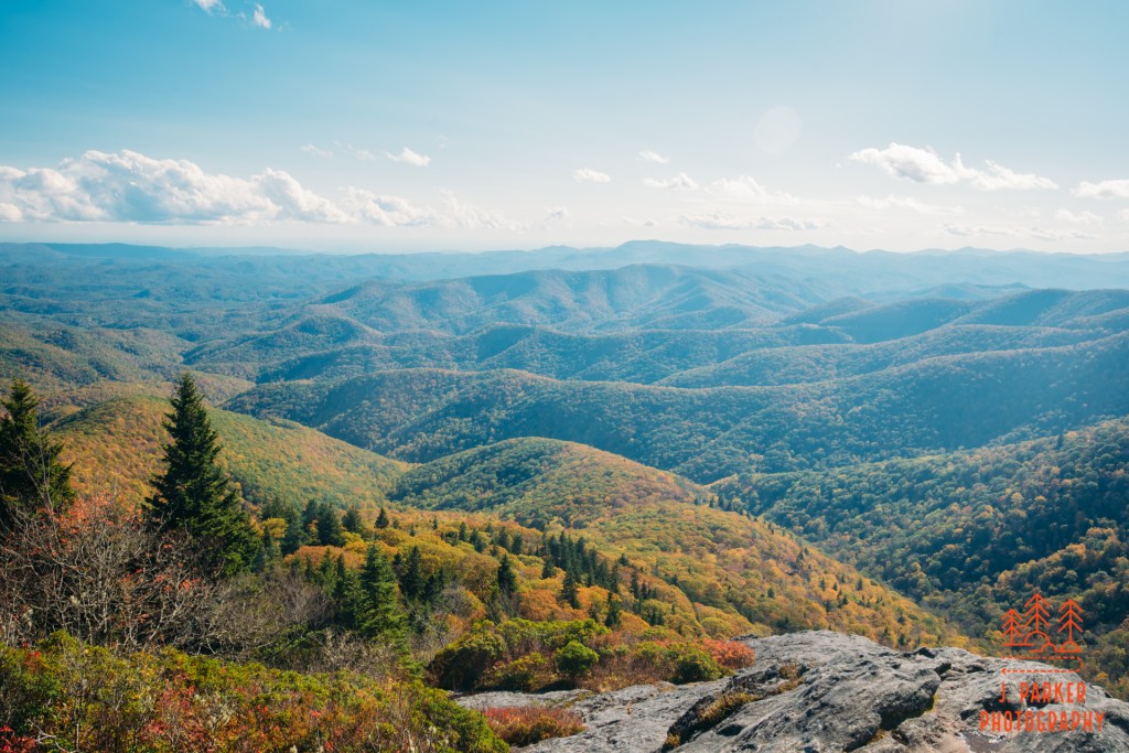
While my first view was towards the parking area, once a few people dispersed I was able to get a view out towards the Pisgah Forest towards the Southwest. This was a top caliber view. It wasn’t just that you saw a great outline of a sea of peaks ahead. It was also that the downward slope of the courthouse, with a nice rock face and several trees to highlight the scene to the left, made a truly perfect natural frame. One of the nice things about the viewing area is that your only impediment is a small stone wall, and you genuinely feel as if you’re somehow in one of the clouds you see lingering around the mountaintops (this has the unfortunate effect of some people choosing to leave the viewing area and trample upon sensitive habitat).
I stayed long enough to really experience the scene, but I definitely had to get going to the rest of my hike. I had a 4-5 more miles of hiking I wanted to do, and daylight wasn’t going to last forever. Though I wasn’t quite sure what awaited me, I knew that at least some views were supposed to await me at my destination of Silvermine Bald. Down I went, making careful use of the railing to aid my unstable hips.
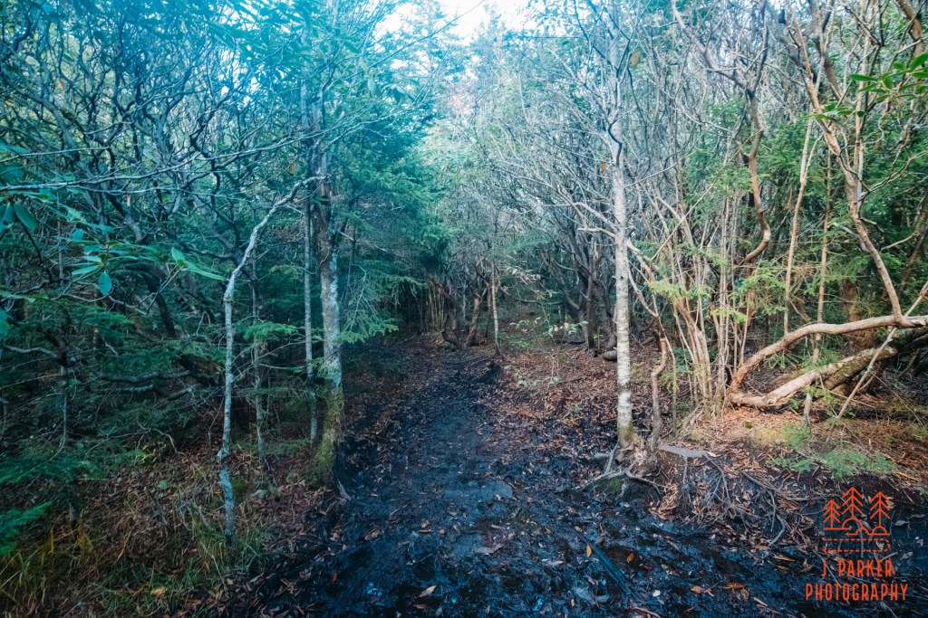
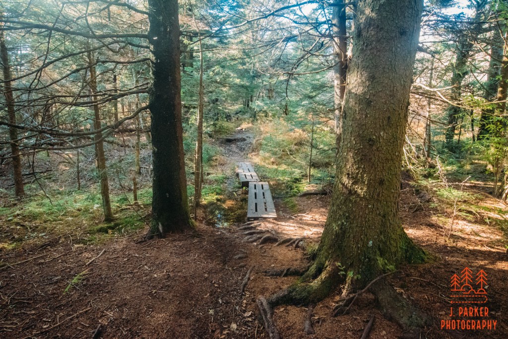
The path and overlook at the Courthouse are so curated, its funny to imagine the juxtaposition that awaits as you take the unassuming connector to the Mountains to Sea Trail, which has a way of making you feel immersed in the untamed wilderness. And if there was any doubt, the fact that the pathway which diverted from pavement just a short time ago becomes a veritable mud pit just yards in really brings that point home. On the other side of the mud, however, things evened out a bit, and I was soon greated with an exceedingly pleasant Though I was practically walking on top of the Blue Ridge Parkway in a tunnel below, I couldn’t have felt farther away from the hustle and bustle of vehicles. In short order the Mountains to Sea Trail came in from my left while the path I was on became the Mountains to Sea Trail going forward. At least on the larger trail there were small boardwalks to escort you through the muddy passages, where weren’t exactly scarce.
Not far past where the Mountains to Sea Trail came in there was another trail that diverged to the left. In this instance, I hadn’t anticipated the junction. I actually knew the rough route of the Mountains to Sea Trail, and that it would eventually take me to Black Balsam (where I had hiked before). I knew the Sam Knob and Flat Laurel Creek Trails nearby because I had hiked part of it before spraining my foot in July. I didn’t know all the trails though, and so I was caught off guard when the Little Sam Knob Trail came up despite not being listed on my guide or really visible on my map. On top of that, a campsite was right near there, and campsites are about the #1 place to lose a trail in the woods as you can easily take a spur to a campsite without even realizing you’ve gotten off the main trail (they are pretty much always as well trod as the main trail, and sometimes more so). And I did, in fact, get off the main trail and onto a campsite trail at one point here. While the Mountains to Sea Trail is blazed white, that doesn’t always mean the blazes are plentiful. I did eventually get headed in the right direction, but I still felt concerned that I was somehow not on the right trail, and would walk a long way without ever really finding my destination.
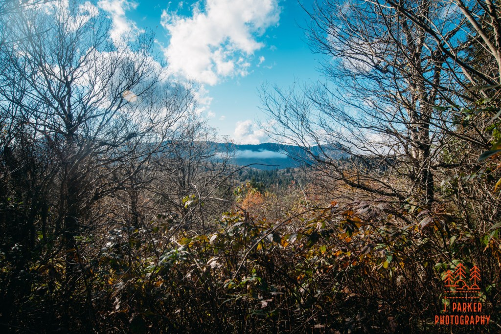
The area I was hiking in was fairly high in elevation, and as such what wasn’t coniferous had already lost it leaves, making for some barren stretches mixed in with nice patches of pine forest. This did lead to a little bit of a bonus view I caught to the left. Not enough to be really notable, but its still nice to get a pop up view every now and then to give you a sense of place amongst the mountains.
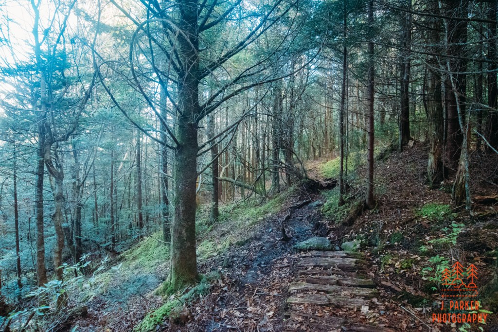
For quite some time afterwards the trail made a narrow path partway down a ridge, with the peak of some type of knob to your right and a slope dropping off to your left. The muddy pits made a return, and this was a bit unfortunate, since I had taken my shoes and socks off to walk in the near freezing water of the Big East Fork, and had never put my socks back on. This mean for every muddy morass I walked through, it caused quite a bit of shoe rub, so I was developing quite a blister. I didn’t want to stop until I reached the bald, though, partially because my hip problems made it a challenge to reach my feet without a good location to do so. So I trod onward. As I did, the woods took on somewhat of a blueish hue, with the woods being rather sparse and on the north side of a sloping ridgeline which was heavily shaded at this point of the day.
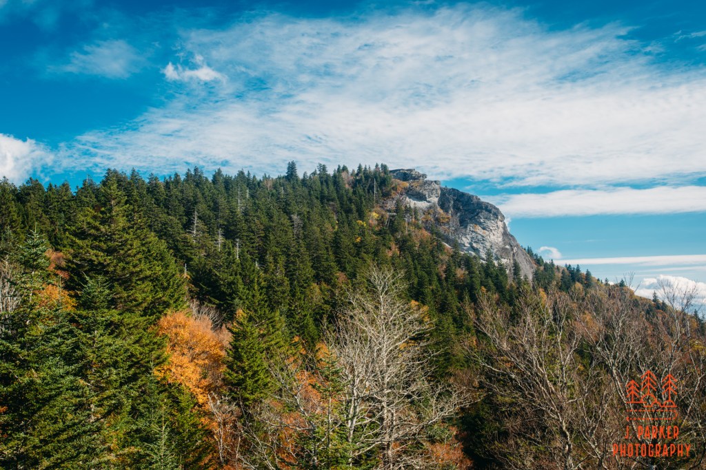
As I neared the end of the ridgeline the trail began to drop a bit in elevation. The woods to my right thinned quite a bit, to the point where it seemed somewhat tempting to try and walk a bit off trail. To my recollection, I found out later that quite a few people actually do this, heading to an area called Chestnut Knob or Chestnut Bald. Late in the day, and not exceedingly familiar with everything around me, I wasn’t really tempted to jump off trail when my existing destination seemed sufficient – and I seemed to be getting close to reaching it.
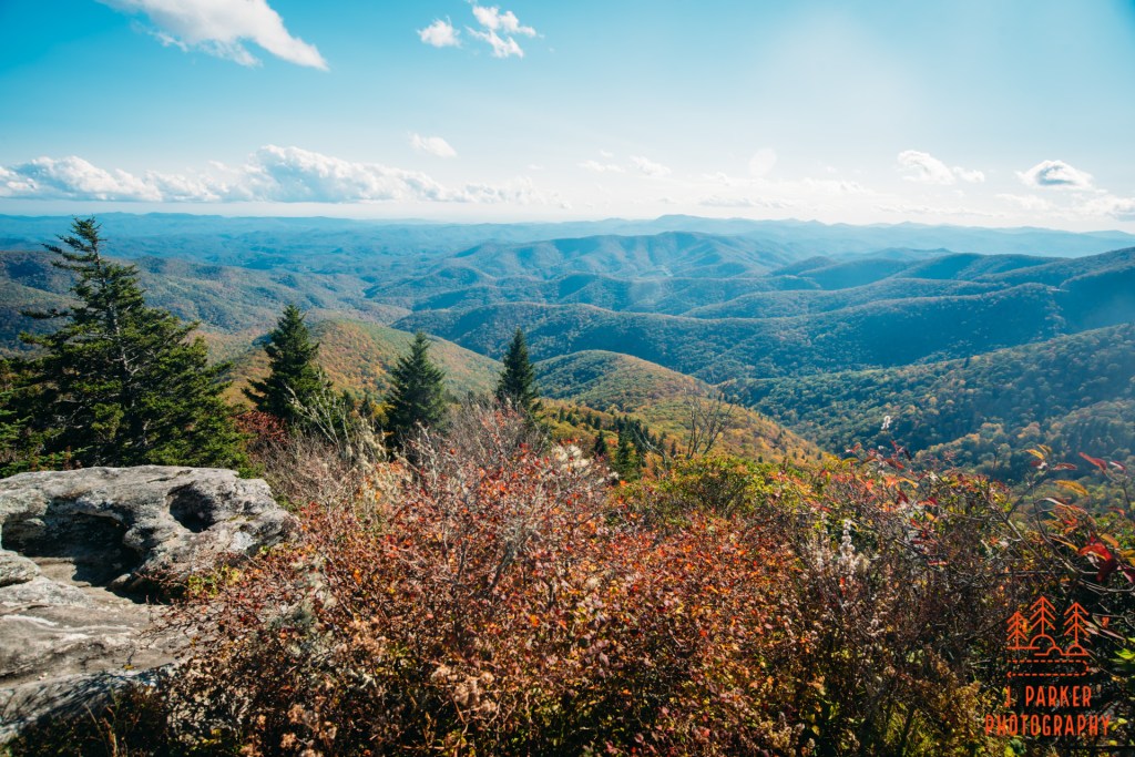
It wasn’t long before I came across an obvious rock face to the right. Though I wasn’t ever quite sure what Silvermine Bald was supposed to be, but it seemed pretty clear that wherever I was it was probably the main event. I stepped out onto the rock face, a common feature of the greater area I was in, and found there was plenty of safe purchase for me to enjoy the spacious views without much danger (something a person with shaky hips had to be mindful of). As I had been forced to rush to make sure I took advantage of cloudy weather at Big East Fork after arriving in NC, and then I had to rush even more to make sure I had time to get in a “bonus” hike at the end of the day, this was the first time I had gotten a much needed moment to relax in quite some time. I quickly delved into my beef jerky supply as I soaked in the views of one of my favorite mountain areas.
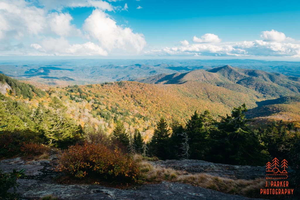
Ultimately, this wasn’t the best view from Silvermine I would get, but it was still a pretty solid view for the first one. I could see the familiar and distinctive rock face of Looking Glass Rock all to the left, a pretty identifiable beacon for the entire area, and one in which I’d had a disappointing hike in 2017. Less clear was the face of John Rock, where I had done my last big hike that summer even though I had badly sprained my foot. For as big as the rock seems when you’re on it, and it looms even larger over the parking area, its barely a blip in the greater mountains near Brevard. I could only spot it by identifying the larger rocks behind it. There was also the distinctive peak of Cedar Rock, which absolutely towers over the rest of that area, and one in which I’m determined to conquer at some point after finding out it’s not as crazy of a hike as I thought.
Behind me a slate of college age hikers emerged, discussing their camping location which they were needing to reach soon. Being a solo hiker, I had a moment of reflection which watching them go about their journey. Maybe in another life I would have connected with a group of similar-minded people at an early age, but I didn’t discover my love for hiking until years after I had finished college, and at any rate most people going to college in Florida rightfully believe you’re as likely to have a heat stroke or get struck by lightning as have a good hike in Florida. If you engage in outdoor activity in Florida that’s not hunting or fishing, you’re one of those radical liberal socialists and not to be trusted. At any rate, that ship sailed for me, and now I’m just lucky to get to hike with some buddies every once in a while or take longer trips with my wife. I engaged in some quick conversation with some members of the group as all of us moved on to the next view-laced rockface.
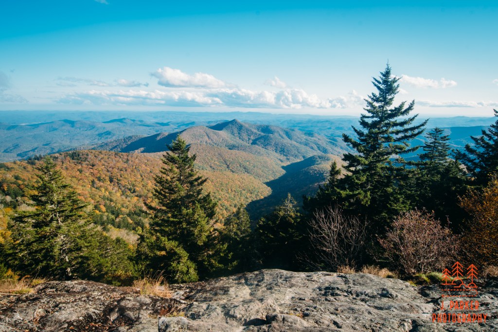
This next view was probably the most superlative here at Silvermine, with the opposite mountain ridge (name unknown to me) squarely in view and nicely framed by fir trees. If one looked far below, the Blue Ridge Parkway could be seen winding its way along a lower elevation, though if one didn’t concentrate on finding it, they wouldn’t even remember that it’s there. Again, the rock gave ample room for rest and relaxation. I wouldn’t say that this view was quite as stellar as what I had seen at the Courthouse, but that was made up for in the absence of wide pathways and large groups of people (well, other than those campers who had marched along with me, who shortly moved forward). It seems so rare these days that you can get to any overlook where there isn’t a small crowd, at least on all but the weekiest of weekdays in offseasons. But here I was pretty much left to my own devices, like my smart phone, which I used to send a picture to my wife which served the dual purpose of sharing the nice view I had found while also letting her know that I had not died yet, nor had my hip impeded me from getting about today.
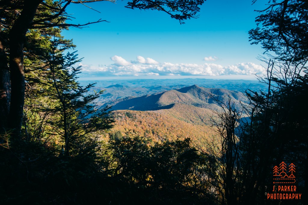
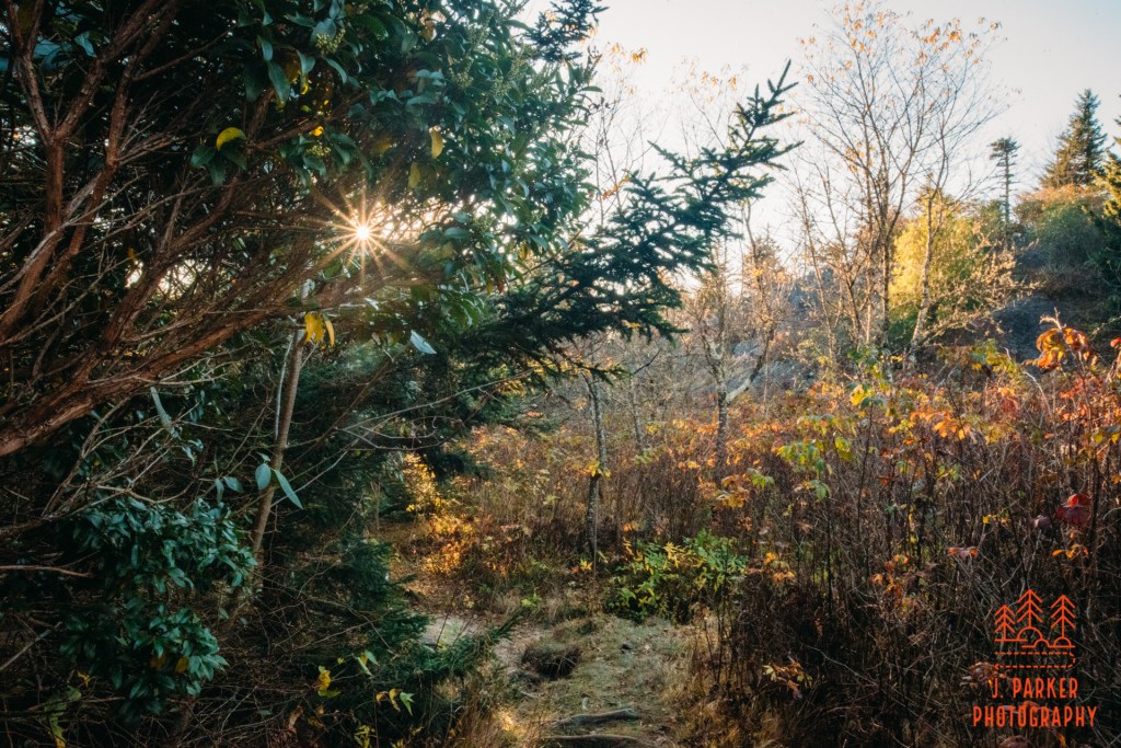
While the first two overlooks I was looking for were extremely obvious, at least for one who knew they were looking for one, the next one was just a bit more challenging. Fortunately there were some men camping along the trail, and when I inquired as to where the next overlook was, they pointed me to a trail on the opposite side of their campsite. The first two overlooks had been really fantastic, and I was hoping for more of the same. Once I actually navigated the very rustic goat path from the campsite (it turns out that there was a much closer way from the trail which ran very close by), I found there wasn’t a wide rock face here as in the other places. Instead, there was merely some small openings between brush that let you get out to a very narrow rockface, one which scarcely gave you standing room in from of the bushes. Being both by myself and also weak of hip, I only very carefully worked out to the rock to the extent that I was comfortable.

While I was to be disappointed that this wasn’t a wide, relaxing viewing area like the first few I’d reached, the actual view was no less impressive, even if it was at times just a bit encumbered by the foliage in the area. I used the foliage to my advantage, however, when I used it to nicely frame the vista below as well as to create sun stars, or sun flares (sun flares really resonate with people, and take a normal shot and make people think its extraordinary. When I look at pictures they don’t do a ton for me, but I recognize that it’s something that people appreciate, and it’s also something I have some lenses that do real well). Though this spot didn’t have the same space for relaxation, I still did my best to take a few moments of slow time here. Though I wasn’t operating on an itinerary as much as a list of prioritized places I wanted to get to, I knew that much of what I wanted to see was on a veritable greatest hits list – known to locals, myself, and everyone who has ever wanted to hike from Atlanta northward. And while it would turn out having moments worse than even I could imagine, I had no illusions about what a peak leave season weekend would be like around Asheville. It was nice to get a quiet moment on a quiet trail, for I wasn’t likely to get many quiet moments coming up.
The guide I had wasn’t super explicit on where all the overlooks were, so while I was fairly confident I was likely at the last of the easy overlooks, I moved a bit forward on the Mountains to Sea Trail just to be sure (I’ve all too often completed a hike, only to find out one of the best things along the trail was an overlook or fall I had just missed). I moved far enough forward without encountering another view to feel comfortable turning around, knowing that I had maximized what I could do with this hike. While it wasn’t that early, I knew exactly how far it would be to return to my vehicle, and so I had ample time before dark to take a rather leisurely pace back. Though I was only retracing my steps on the return trip, I enjoyed it a bit more since the light had dropped enough late in the day to really bring the color out of the woods (coniferous forest has a lot of color regardless of season).
As part of my journey back I had to pass that junction with the Little Sam Knob Trail that had caused me so much anxiety before. I actually decided here to dip my head down the trail just for a short distance. A main reason why was because of the very large rock face that sat not far off trail and within view of the trail junction. I wondered if there was a way to get to the top of this rock and if there were any views from it. I could see only the roughest of goat paths leading to the rock, and I couldn’t see any way of easily scaling the rock once I got there, so I decided it was better left alone than to try and do something unsafe at this hour (preferred hours to do unsafe things are between 10 and 2).
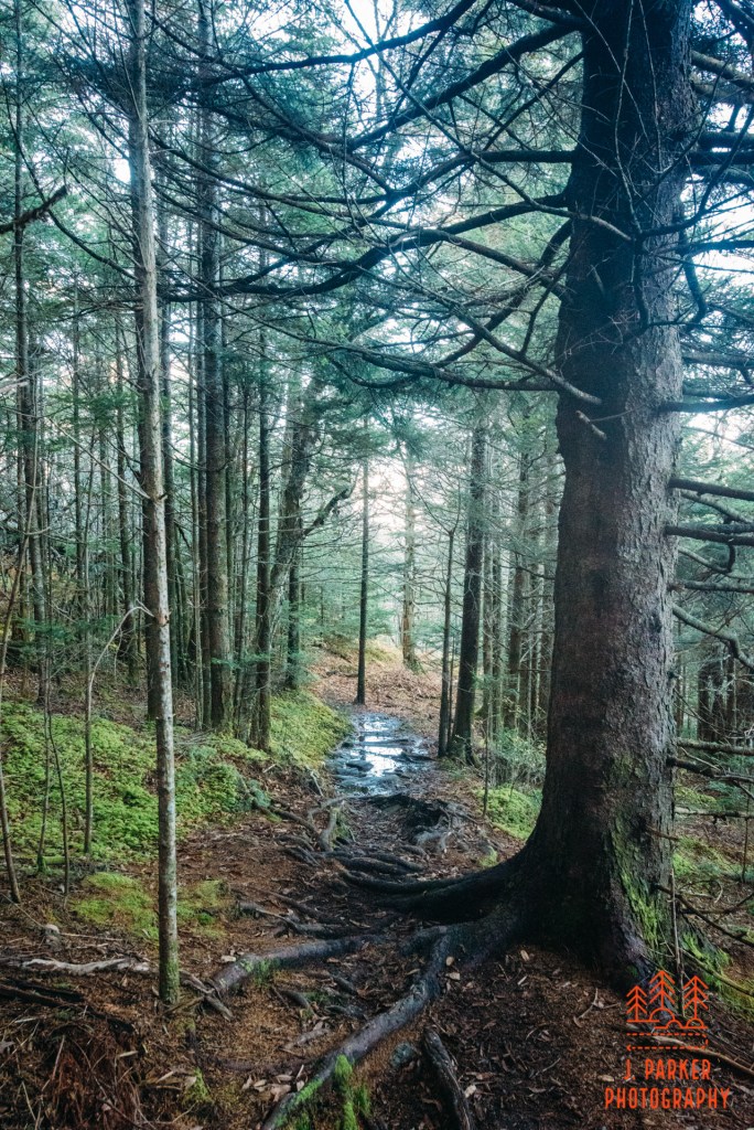
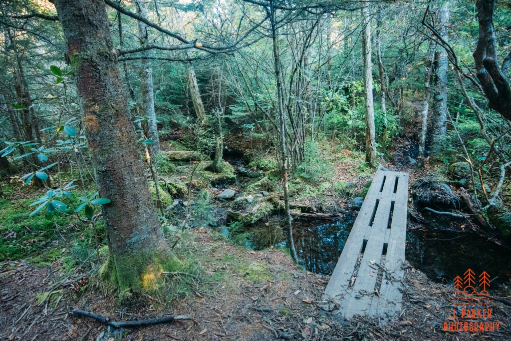
After passing the trail junction, I entered a lot thicker forest. When I had been here previously, I had both been in somewhat of a hurry, and also the sunlight had kept me from really seeing all the shades of the forest. This wasn’t an uninteresting segment of trail through the coniferous forest, and occasionally small high-elevation creeks were crossed on small bridges by the trail. There wasn’t a creek I could tripod and photograph, but it was interesting enough to walk past.
As I reached the Devil’s Courthouse again, the sun was just beginning to shine through the understory as I made my way down its paved trail towards the parking area. We weren’t that far from sunset, but I knew I had enough time before complete darkness to get one more small bonus stop in.
Not far to the west of the Devils Courthouse, the Blue Ridge Parkway intersects with NC 215. A whole host of waterfalls lies not far from that road (one waterfall even goes under the road) and, with good directions to all of them, I had visions on visiting a lot of them this trip. For now, I’d only have time for one, and the best bet seemed to be Bubbling Spring Branch Falls, which lied just a couple hundreds yards off the road a bit north of the Parkway. As I hurriedly drove to the pull-off for the falls I tried to observe the surrounding hillsides, for I was hoping to hike again here maybe as early as tomorrow. The hillsides here are quite steep and some of the peaks much closer together than you would normally see in this part of Appalachia. NC 215 seems to barely squeeze between towering ridgelines as it works its way northward. Some slopes were completely filled with orange, which gave me some hope that if I hiked here again, my hike wouldn’t be so devoid of color as the strictly high elevation hike I had just completed.
There is no designated parking for Bubbling Spring Branch, just an area where a rough path travels steeply under the guardrail. It’s obvious if you know what you are looking for, and completely innocuous if you don’t. There was a camping area setup near where the trail leveled out, but I walked right on past to get close to the waterfall. I didn’t have enough daylight to worry about alternate angles of attack, so when I was separated from the rock at the base of the waterfall by a small creek, I didn’t even hesitate to walk through the creek to get to the rock.
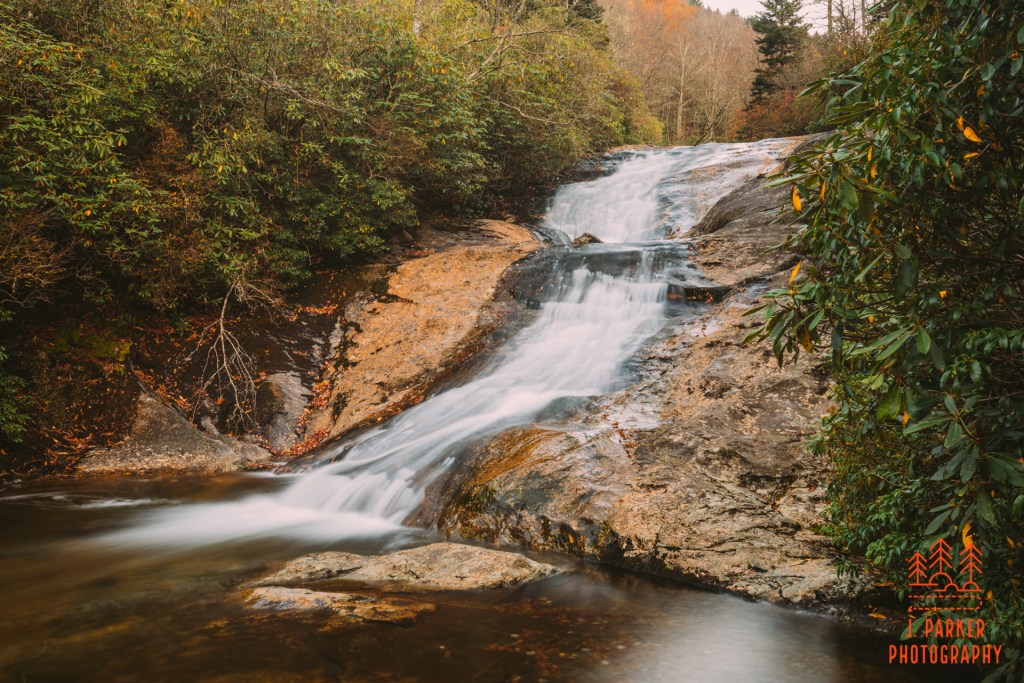
Bubbling Spring Branch Falls isn’t my preferred type of waterfall to photograph. The falls between here and Graveyard Fields are very open falls flowing over orangish-brown rock, with only sparse, dry vegetation along their immediate flow. I definitely prefer more verdant falls which a different type of channel. But a waterfall is a waterfall, and it certainly had its own unique appeal which was even more apparent in person. Viewing the pictures later, the fall appeared quite small, when in fact it was a decent sized fall, all things considered. It had a curving flow which had such a small gap in the middle that one might be able to say it had two tiers. I didn’t see a way for one to reach the middle tier of the fall, and was more than happy just to get some shots from where I was. As I was letting the camera take some time exposures a couple returned to the campsite nearby. I exchanged some pleasantries as I completed the task of photographing the fall as the last light of the day expired.
I had had a very nice first day in North Carolina. I had started out with a nice river walk, seen some high caliber views, both at a popular observation point and also at a more quiet location, and I had gotten my first real waterfall photography done at a new to me fall. None of the stops had been bucket list stops or top hikes really, but they were plenty fulfilling, and aside from the blister on my foot, everything had gone reasonably well. I had come to North Carolina not knowing if I could walk more than a few hundred yards without breaking down, and I’d ended up getting in 7 or so miles of hiking. I’d definitely call that a win. I was looking forward to getting a little rest at my hotel in Asheville, and then looking for a “best hike” type of day tomorrow, since it seemed that I was going to make it physically. Little did I know that due to a cascading series of unfortunate events the day I hoped for and the day I got would end up being vastly different.
