My car said it had a flat tire. Driving down Interstate 40 in the ballpark of towns preparing their application for a second stop light, this wasn’t exactly an opportune time (I will say that I have yet to find an opportune time for a flat tire warning). It was early on a Saturday morning, though not as early as I would have liked. Out of practice, for the second year in a row I had underestimated the time it would take to put on cold weather gear, or how long it would take to get out of a hotel parking lot the size of a dumpster with windows fogged up on a vehicle I wasn’t familiar with. While saying a Ford was nice seems like an oxymoron, in this case it at least had fancier electronics than my 2015 Rav4. And in this case, those electronics were telling me my tire was flat.
If the interstate I was on was desolate, I was hardly going to feel much better once I got on the county roads and eventual dirt roads where I was heading. I couldn’t imagine much worse than than having a flat tire on a forest road, except for maybe my wife locking the keys in the Rav4 in a back area of Great Smoky Mountains National Park, so I certainly didn’t want to take my chances. That would be out of my hands though. There were exactly two gas stations between myself and my hopeful destination, the Hawksbill Parking area, and neither of them had an air pump. At the first one, I got out and surveyed the tire. It didn’t look bad to me, so I made the executive decision to take my chances, but all the challenges of that morning added up to me being over an hour being schedule. That was going to be an issue.
It turns out, I needn’t have worried about having a flat tire on a empty forest road, for there were no empty forest roads to be found on this peak fall color Saturday. Once I finally reached my intended destination, the Hawksbill trailhead on the east side of Linville Gorge, even farther behind schedule for my GPS failing multiple times to give me instructions at a road split (which is common in this area), the parking area was akin to Disney World, only with slightly more children. There simply wasn’t a legal parking spot to be found. I’m willing to do a lot of things to maximize the value of my trips, but one thing I won’t do is be “that guy” and park in an illegal fashion at a trailhead. I do the responsible thing and get up early early to find parking, or I find somewhere else. Unfortunately, some things this morning were out of my hands. I was hardly capable of the vehicle acrobatics needed to find an adventurous parking space that day, in an unfamiliar vehicle that was also a Ford. Nevertheless, some acrobatics were needed just to turn around on the narrow forest road containing the trailhead, and in the roughly 20 minutes that elapsed after I had turned around, dozens of vehicles had parked blocking an entire lane of the narrow two lane road, and it felt like a disaster movie trying to get out, only I didn’t have any popcord.
This wouldn’t have been my first visit to the gorge. I had an absolutely magnificent hike there at Table Rock/The Chimneys in 2017, and ever since then I had deigned to return. But a second trip to the Gorge was seeming like an impossible ask. I had made plans to take two hikes there Labor Day weekend of 2019, only to have to cancel them for the likely landfall of Hurricane Dorian in Florida, but by the time I actually flew home that weekend the storm had decided to ride off the east coast of the state instead. Now this…I was beginning to feel like a second visit would just never happen.
It might be hard to understand the allure of the Gorge if you’ve never been. While all of Appalachia is nice, the Gorge is one of those places, along with the Smokies, that give you magical scenes far above the others that you just won’t ever forget. The depth of the beauty is so great, sometimes you see the pictures afterwards and wonder if it was even a real place. But the Gorge comes with a caveat. While it plays host to a handful of hikes that are enjoyed by the general public, once you get away from these hikes you’ll find an adventuresome collection of hikes running through the federal wilderness area that are the sometimes lethal combination of extremely rugged and poorly marked. The adventuresome hikes here were generally beyond my physical or navigational ability, and that of many others as well, so it’s not as easy to find easily available (aka free) maps online for the area, and I didn’t come prepared for alternate hiking in the gorge. Therefore, when I saw something called the “Sitting Bear” trailhead on my way out, it definitely piqued my curiosity, but I wasn’t about to go pathfinding blindly with two bad hips into one of southern Appalachia’s most formidable hiking areas.
So what now? Well, that was going to be a challenge to figure out, and I was under the gun trying to figure it out, since other trailheads were similarly going to be filling up. I didn’t even have anywhere I could stop to try to get my bearings, so I made a beeline for the nearby Blue Ridge Parkway, where I knew trailheads by memory without needing directions. There isn’t much more lovely than the area of the Parkway around Grandfather Mountain in peak fall, but in terms of crowds, it was like I had just left Epcot to go to Magic Kingdom. There would be no reprieve, and I was under no illusions of it.
At least my tire hadn’t gone flat yet.
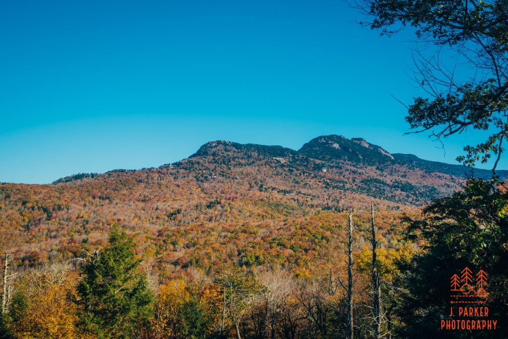
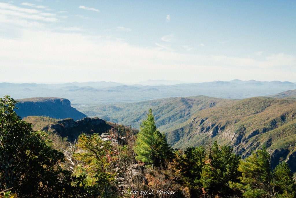
Having been several years since I had seen it, I was sufficiently impressed by as Grandfather Mountain came into view. That mountain is just massive in every way for this part of Appalachia, and there’s many reasons why this rugged collection of peaks should be considered one of the signature mountains of the range. While I knew time was of the essence, I simple had to stop at an overlook to gawk when this thing first came into view. It’s an impressive mountain from far away, although its jumble of varied peaks at the top makes it a rather unshapely thing. Before my day was done I’d be seeing quite a few more views.
Though I wasn’t thrilled about it, the idea from here was that I would park at the Beacon Heights Overlook and take a hike along the Tanawha Trail, which while working its way parallel to the Parkway along lower elevations of Grandfather Mountain, traces under the famous Linn Cove Viaduct, crossed some creeks, and visits the awesome views of Rough Ridge. Unfortunately, after a comedic series of errors, I drove the Linn Cove Viaduct exactly three times while obtaining zero spaces at the Beacon Heights Overlook, which had filled up. I finally was able to obtain shaky parking near Wilson Creek. My enthusiasm was already a bit waned at being past the Linn Cove Viaduct, part of the selling point of the Tanawha Trail, and I sunk even further upon reaching the bridge over Wilson Creek and finding it just a collection of non-flowing shallow pools at the time. The sun was blistering, and given the lack of creeks, really the only notable sight along the Tanawha Trail would be Rough Ridge, a long out and back hike away. I had already done Rough Ridge in 2017, so there would be nothing new except all new people to rub shoulders with, something that limits enjoyment even in non-plague times. I didn’t like not having a real idea of what to do, but I liked even less the idea of hiking the Tanawha Trail on this apocalyptically busy, abominably sunny day, so I begrudgingly retraced my steps over the portion of the Tanawha Trail I had already done, where I had to dodge traffic to return to my vehicle.
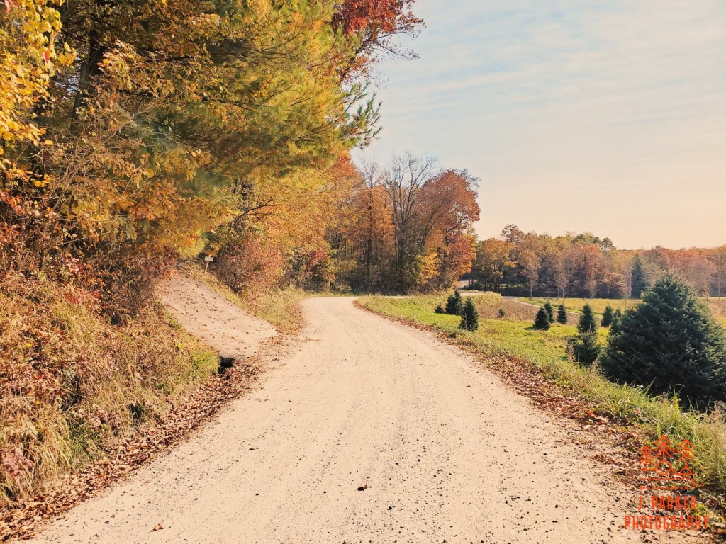
In the moment I took before starting off again, I had my wife text me the number for our roadside service, just in case. And then I set back down the portion of the Parkway from where I had come, this time heading towards the Wilson Creek ranger district, a new to me area where I had information on nearly a dozen hikes, ones whose greatest ability might be availability at this point. I felt a great sense of relief when my turn off the Blue Ridge Parkway led me to a quiet dirt road that seemed a million miles from the chaos that was ensuing just a turn away. This felt like the first good moment I’d had all day, and I savored it by stopping the car and grabbing a few cell phone pics of the rural scene.
Not to worry – I soon started making bad decisions again. I had what, at the time, appeared to be unassailable logic for the hike I would do next; it had available parking. I couldn’t count on that happening anywhere else, and it was with that in mind that I set out on the Big Lost Cove Cliffs Trail. This trail is essentially a one trick pony, a 3.3 mile round trip out and back to a nice, large slate of open rock with a great view of Grandfather Mountain. While many people are perfectly happy with hikes that don’t have much besides a single signature moment, I vastly prefer hikes that consistent deliver scenic splendor, especially when those are so plentiful in the mountains. Hikes like Big Lost Cove Cliffs are what I consider “bonus stops”, something to be done to augment your day after already doing a more complete hike. At the time, though, I was happy just to be setting out on any hike.
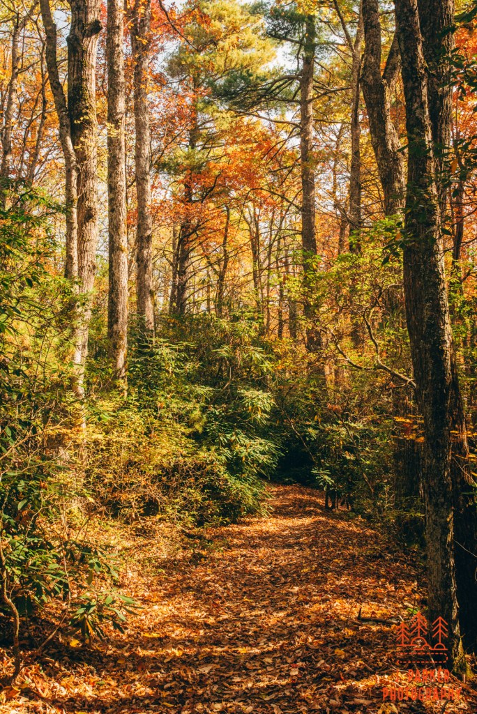
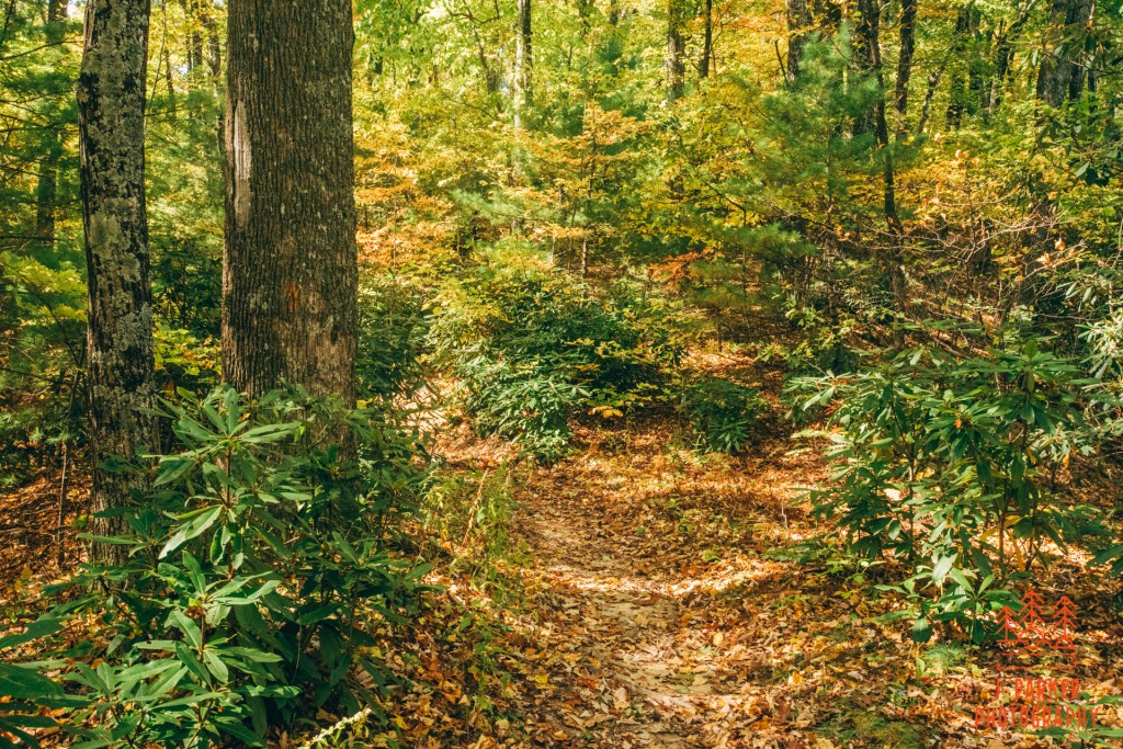
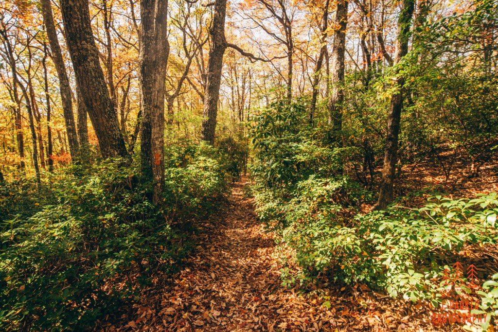
The trail would start by navigating a series of switchbacks. Like most others of their ilk, there wasn’t too much to look at as they climbed steadily upward. I did enjoy that the path was nicely carpeted with fallen leaves, and while there was a lot less deciduous forest than you might expect, as some some of it was decently colorful as I worked my way upwards. The path alternated in width between wider than forest road-passageways and others where the foliage heavily encroached upon me as I went past, though it never was what you would call overgrown. I passed groups and other hikers every now and then, enough to make me feel like I wasn’t alone in the woods while never making the trail feel all that busy, either.
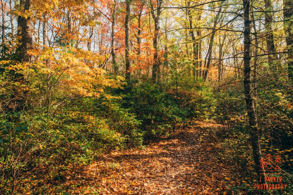
Unfortunately, there wasn’t much in the way of signature moments along the journey. The woods were consistently nice without every offering much variation to pique your interest. It continued this way for much of the mile and a half plus out to the cliffs. Now, there are worse things to be found than woods that can be consistently nice but unchanging, but I had gotten up early this morning thinking I’d be taking in one of the most awesome natural wonders in the eastern United States, so you’ll have to forgive me for feeling a little underwhelmed.
The only real deviation from the norm came about 2/3 of the way in, when there was a small rock to the left which offered a partially blocked but still pretty good view out, with Grandfather Mountain clearly identifiable in the background. I had little conception of what the surrounding area was like, so I enjoyed this little teaser of what was ahead. The rock would have been easy to miss, and many people did. It was big enough for someone to get on without fear of falling off, while not being much larger. I grabbed a snack at this point, happy to have had at least something worthwhile today.
The rock got my hopes up that I was getting close to the end. I was a lot further from it than I thought I was. Much to my dismay, the trail started going downwards, and kept that way for longer than I would have thought possible. Certainly it wasn’t near as far I had traveled upwards to get here, but generally when you hike an out and back to an overlook, its almost always a continuous climb until you reach the end. This is nice because you get to enjoy the overlook with the satisfaction that everything from there is downhill. In this case, I’d start the return trip having a bit of a climb.
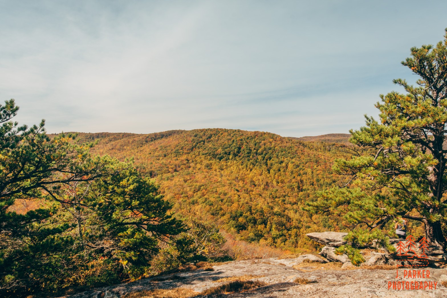
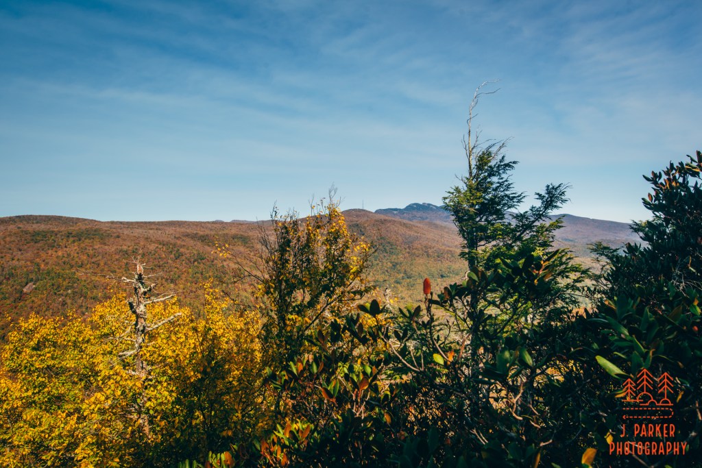
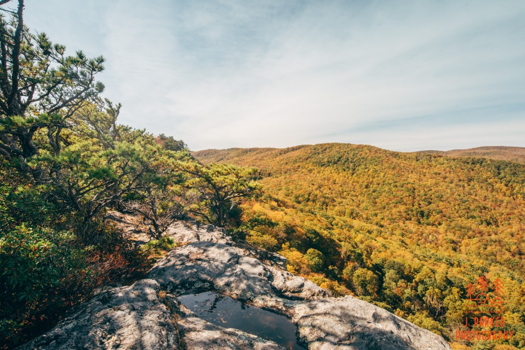
There was quite a large rock slab that greeted me at the overlook once I actually reached it. Maybe a dozen people were spread out across its surface, which was plenty large enough for you to practically leave everyone else out of view if you so chose to. The primary view was towards Grandfather Mountain, its distinctive peaks clearly identifiable even though we were quite some distance away. One could also clearly trace the path of the Blue Ridge Parkway, which was the same path I had taken a short time ago. As impressive as Grandfather Mountain is to view up close, I wouldn’t say where I was at provided the best vista I had ever seen. Still, the rock slab, which I guess I could call Big Lost Cove Cliff, was a cool spot since it did offer a view and a great deal of space to enjoy it.
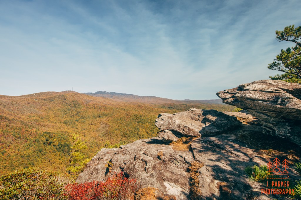
I walked around a set of craggy rocks and under pine trees and shrubs to reach the far side of the cliff. There wasn’t much new to see on this side of the rocks, for the mountain encroached pretty quickly and blocked any possible view in that direction. From here, I was left to peer upon Grandfather Mountain again, with the signature radio tower identifying Grandmother Mountain in front of it. After spending a relaxing moment refreshing myself with some beef jerky, I retraced my steps back towards the other people who were enjoying the slab.
I struck up a conversation with some older folks that were savoring the view. Pretty much everybody I talked to this trip I had to brag a little bit about the fact I was working through bad hips two weeks before my surgery. Since I hadn’t been in the area, and they were local, I discussed some of the other local trails with them. Naturally, they recommended Harper Creek Falls, which is pretty much the signature hike of the immediate area I was in. I had every intention of getting both the main Harper Creek Falls and Little Harper Creek Falls in, hopefully during this trip, but I wanted better waterfall weather. It’s the debate every hiker/photographer has to make with every trip. Do you want to a signature hike even if the weather won’t allow you to photograph it properly, knowing that you’ll just have to re-do it later if you want to photograph it? Or do you want to do hikes that are probably a lesser experience, but in which the weather is optimal for their signature feature?
I wasn’t writing off doing Harper’s Creek Falls. But I didn’t want to head there in the middle of the day, either, with a lot of time between myself and late afternoon light. I shared my plan to next hike Little Lost Cove Cliffs, which had been recommended to me, and in which I assumed would be a superior hike so I didn’t feel at the time would be redundant. An older lady recommended I do Harper Creek Falls, since I had already done a vista hike, and I would wish I had taken that advice later.
I had lumped the hike Big Lost Cove Cliffs in the “short” category because I knew it wouldn’t be prohibitively strenuous, but there is still a big time difference between a 2 mile round trip and a 3.3 mile round trip hike. Without anything interesting to stop for I attempted to go as fast as my dual injured hips could take me and, upon completing the hike, I moved forward to my chosen trailhead for Little Lost Cove Cliffs (it has two trailheads roughly equidistant to the cliffs), one which also shared a trail to one of the Harper Creek Falls.
Little Lost Cove Cliffs was a much shorter journey to the main event, being roughly a mile, but it was a much steeper ascent than its big brother. While I had found its predecessor somewhat bland and repetitive, Little Lost Cove was even more so, since a good portion of its ascent was done on a wide, featureless forest road. Well, I wasn’t here for the trail anyway, and I tried to hurry as best I could, but I didn’t get the response from my out of shape, Floridian body that I was hoping for.
The benefit of the forest road setup was that at least there was ample area for spacing, for this was a busier trail than the last. In particular, there were several vans parked at the trailhead, which each dumped large contingents upon the trail. One load composed of youth and councilors was coming down as I was going up. I watched with amusement as practically ten people in quick succession hit a steep patch of trail covered with nuts, and each one of them lost their footing, some falling down completely which others merely lost their footing. Well, that wasn’t going to happen to me.
The trail leveled off after some time, mercilessly ending what had thus far been a constant ascent. Here the trail narrowed, passed through a small meadow, and then entered another patch of woods. In these woods the main trail went straight, but an offshot went uphill to a campsite. Having learned about hidden bonus vistas, I reluctantly climbed the extra little bit and found another trail behind the campsite, which led to a completely uninhabited, wide rock slab that was as large as the main overlook on many trails. This would have been a huge “win” except for one simple problem:
It was almost indistinguishable from the view I had hiked to earlier at Big Lost Cove Cliffs.
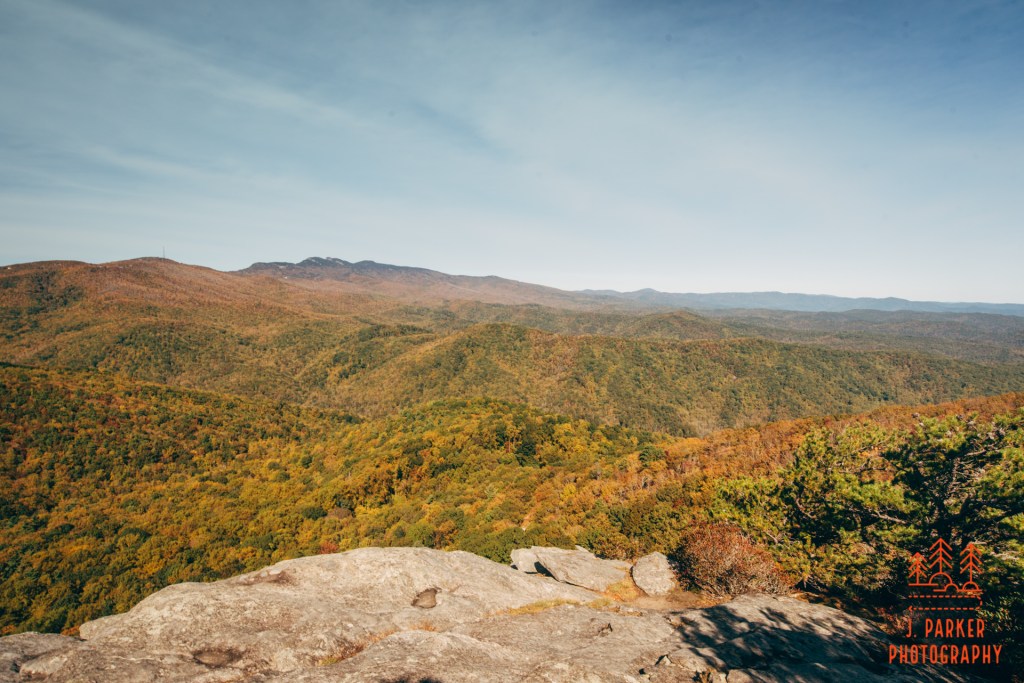
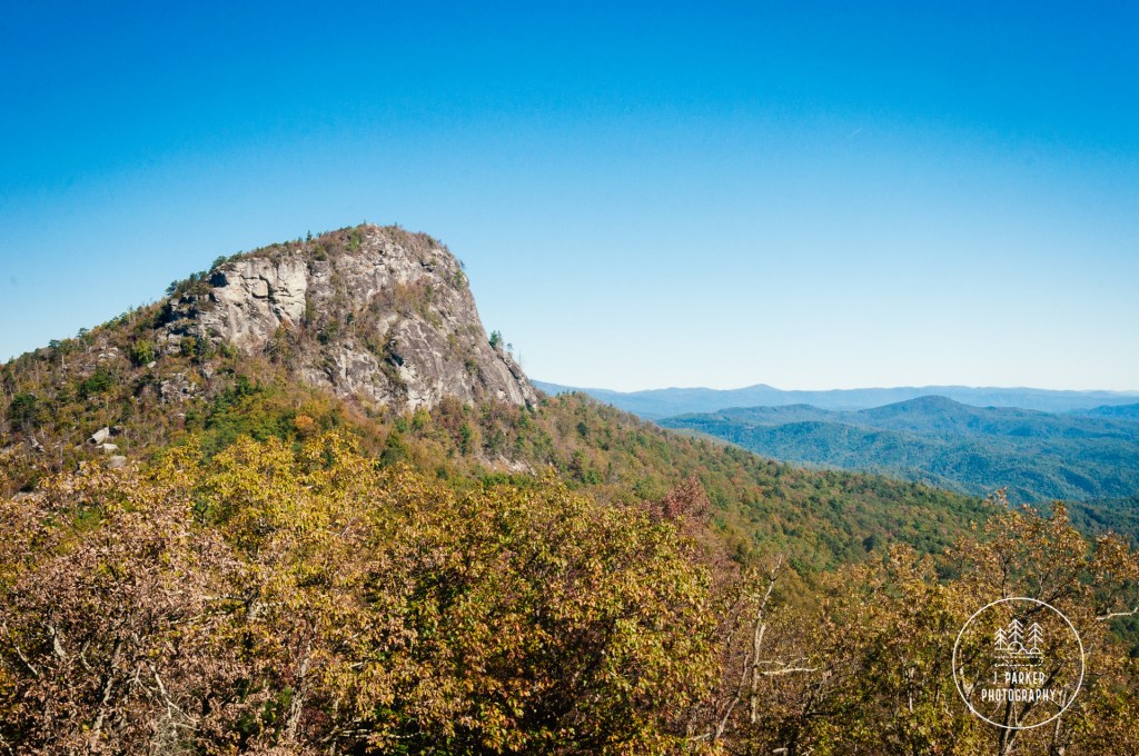
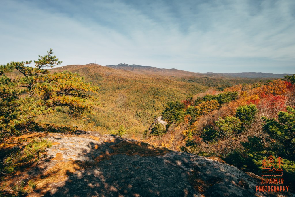
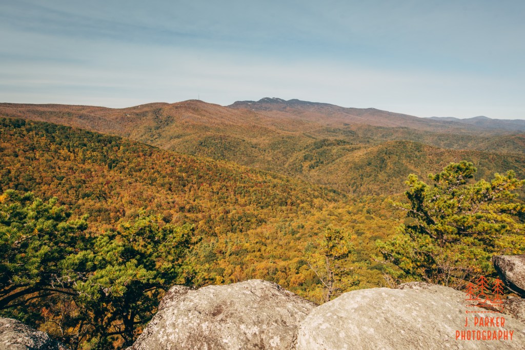
I had hiked 1.7 miles back from Big Lost Cove, driven to another trailhead, and then hiked basically a mile uphill only to get to an extremely similar view. Now I know why the older lady had recommended I not do this trail. Now, I must say, the view I was at was clearly a better view than the one at Big Lost Cove. The presentation was more balanced and pleasing, giving better shape to the mountains in front of Grandfather Mountain. But still, in the grand scheme of things, I was looking at a view from roughly the same distance of Grandfather Mountain from the south. Despite being better, it wasn’t a bit enough distance to feel like I added anything more to my day. To my left lie the main Little Lost Cove Cliffs, and I hoped that they would offer something different than this first.
Down I went, feeling a bit smug from having found a vista that was, no pun intended, overlooked by so many, but otherwise feeling a bit discouraged. I reached the main overlook a short time later, where a massive tall rock dominated the scene and seemed to split it into two different areas, one to the right which offered rocks showing the standard Grandfather Mountain view, and another facing forwards towards a valley and opposite peaks which were mercifully not Grandfather Mountain. For obvious reasons, I visited the latter first. The rock here was a little more sloped than the places I had visited before, so I had to take very careful steps with my shaky bad hips.

This was clearly a superior place than Big Lost Cove, but naturally I had been super anxious to get on a trail with something worthwhile. Since these were so redundant, yet Little Lost Cove in a different category, I would have been well served to just visit the latter. As it was, even though this place was better, I definitely felt like I had cheated myself a bit. I certainly savored the views – I was there of course. But I didn’t spend too long, for I was feeling guilty for squandering so much of my rare time in the mountains, just 13 days before I’d be losing the ability to hike for a possibly very long time.
As you might imagine, I was in rather of a hurry once I started making the all downhill trek back to my car. So in a rush was I that I completely forgot about the nut-covered slope partway up. That was brought to my attention when my feet slid out from under me and I took a tumble, my hand caught in the strap of one of my trekking poles as I and my bad hips fell to the ground. I was fine, but I knew with the way my hand got caught I was lucky (for once) that I didn’t get hurt. Even more fortunately, despite it being a busy trail, nobody saw me fall. My dignity wasn’t hurt either.
Once I got back to the car I had to evaluate a lot of things. Ultimately, I came to the decision that Harper Creek Falls was just not going to get done today. With my poor hips, I just wasn’t moving that fast, especially when laden with a camera bag with supplies and a tripod attached. I knew that if I visited the falls I would be wanting to stay their late photographing moving water of some type, which could only be photographed in late afternoon/early evening light. I was going to end up staying later than I should, not only risking having to make a decently long trek on a possibly rough trail as it got dark (I had packed my head lamp for the trip but forgot to have it with me for hiking) and there was still the matter of a suspect tire on the car. The trailheads were a long way down a narrow forest road, and I could possibly end up in need of help without cell phone range or other vehicles coming along. I wasn’t willing to risk that.
I felt like I had an alternative though. Part of my rationale for missing the falls was that I’d at least get to see more of the Wilson Creek area, unknown to me before today. And it seemed like there would be a way I could do it and double back to Upper Falls, which wasn’t near as far off a main or that long of a hike.
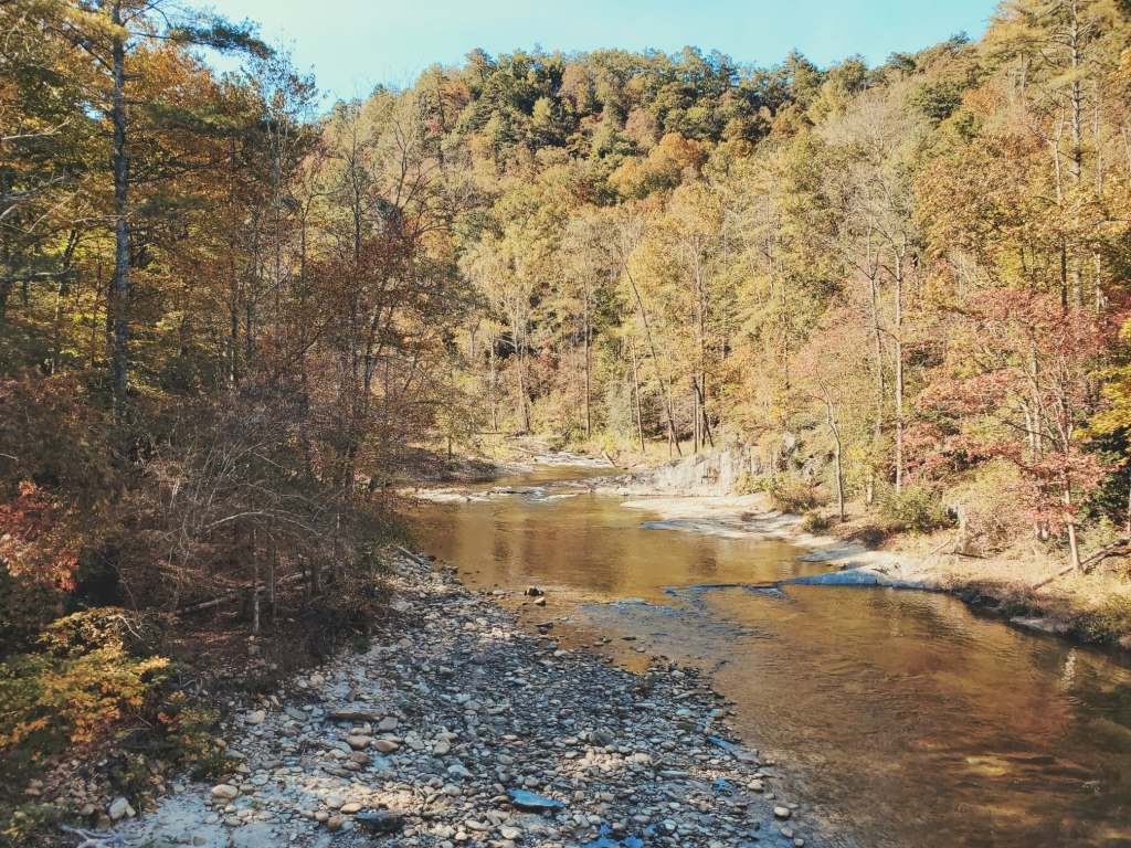
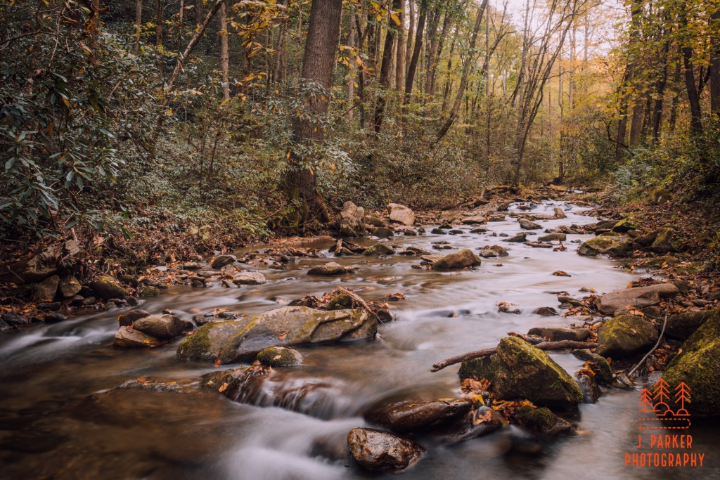
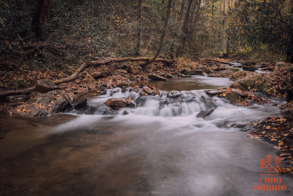
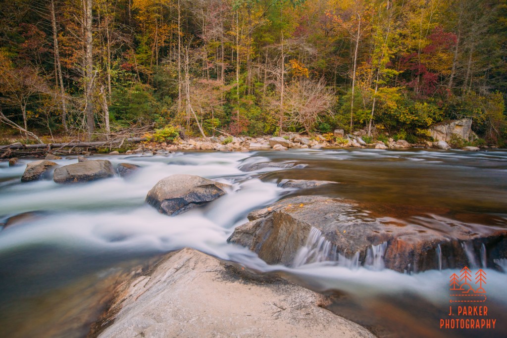
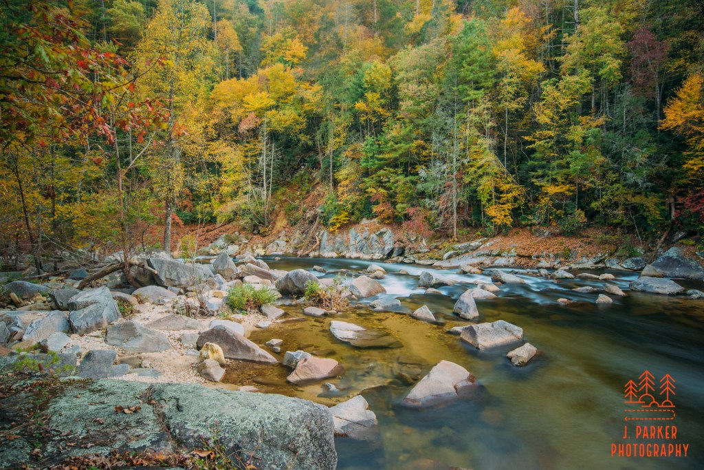
I ventured down the road till it crossed Wilson Creek, which was pretty much river-sized at this location. And boy, did Wilson Creek look gorgeous! While I later found out that there IS a trail that covers some of the upper reaches of Wilson Creek, I hadn’t been able to find information about it in my trip research, despite hoping I would find it. Wilson Creek here is the type of exotic looking shallow mountain waterway that I absolutely dream about. I had to park the car near the bridge and then carefully walk the bridge to see of it, for the bridge was one lane. Not knowing what I would find, and trying to keep up a hasty pace, I left my real cameras in the car. Had I known what a beautiful scene awaited me I probably would have grabbed my larger cameras, but my Samsung S10 did a fine job capturing the scene anyway.
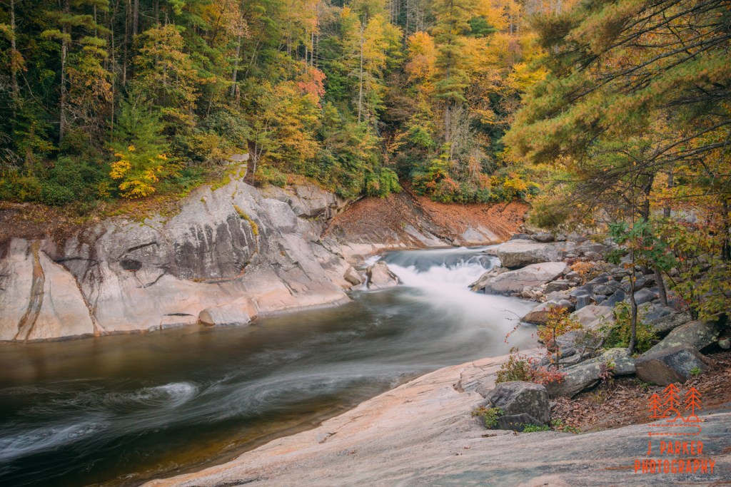
I wasn’t done seeing Wilson Creek, though I’d see far more than I imagined. From here I would follow a road that ran parallel to the creek, before hitting Craig Creek road, which would loop me back towards Upper Falls. As I turned down the road, which ran alongside the creek that gave it its name, I came across a few very nice scenes. I got out and took a few good long exposures where I could frame a shot. This was an unexpected, pleasant surprise, though I’d soon run into a less pleasant surprise.
The road was closed a short distance ahead. And I’m not sure if this road is always closed, or if it was just a temporary closure. Several large boulders were placed to block traffic, so it certainly seemed it could be a full time thing. What I can tell you is that google definitely thought the road was open for traffic when it clearly. Boy, now I was REALLY dejected. No Upper Falls. Nothing nice to photograph to cap off what had been a pretty lousy day when I could ill afford to waste time.
Or so I thought.
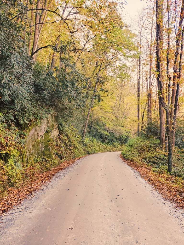
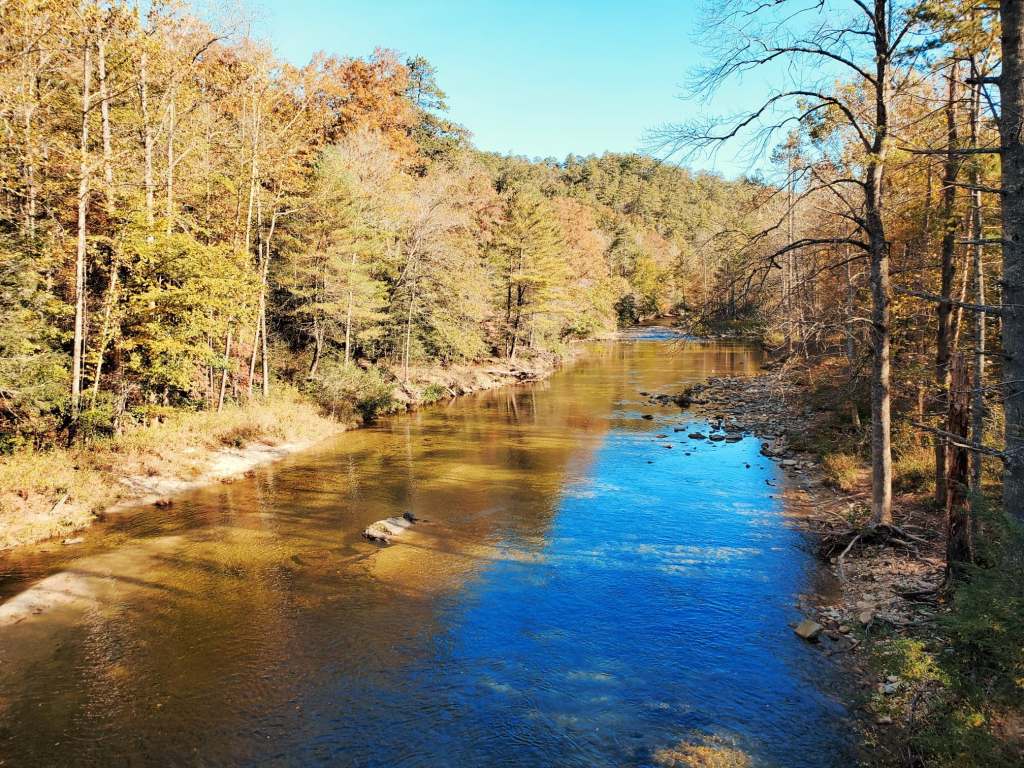
I had accepted that there was nothing else I could do but keep driving the road I had bene on south, till I eventually reached civilization. The road seemed quite pretty, and I stopped to take a few photos with my phone, but I was completely oblivious to the fact that it would a bonafide scenic drive ahead, with countless overlooks of a burgeoning Wilson Creek, complete with rapids and fall color. I was absolutely thrilled at my unanticipated good fortune as I found my first frame of a gorgeous small rapid, bathed in even light as the ridgeline on the opposite side of the gorge blocked the sunlight. Wilson Creek was an incredibly appealing photographic subject, and yet I hadn’t even known this scenic drive existed until stumbling across it through an unfortunate series of events.
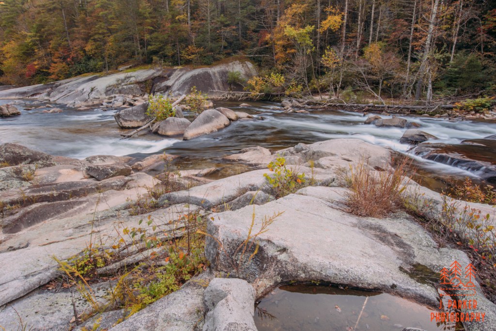
From here on I’d be presented with numerous opportunities to photograph the creek, as there were frequent parking areas and pulloffs with trails of varying degrees of formality heading down to the creek. My biggest challenge would be the occasional visiting family and fisherman getting in what would otherwise be nice frames.
The road I was on was Brown Mountain Beach Rd, referencing nearby Brown Mountain, which gives rise to the famed Brown Mountain lights, so named because they are lights that emanate from Brown Mountain.
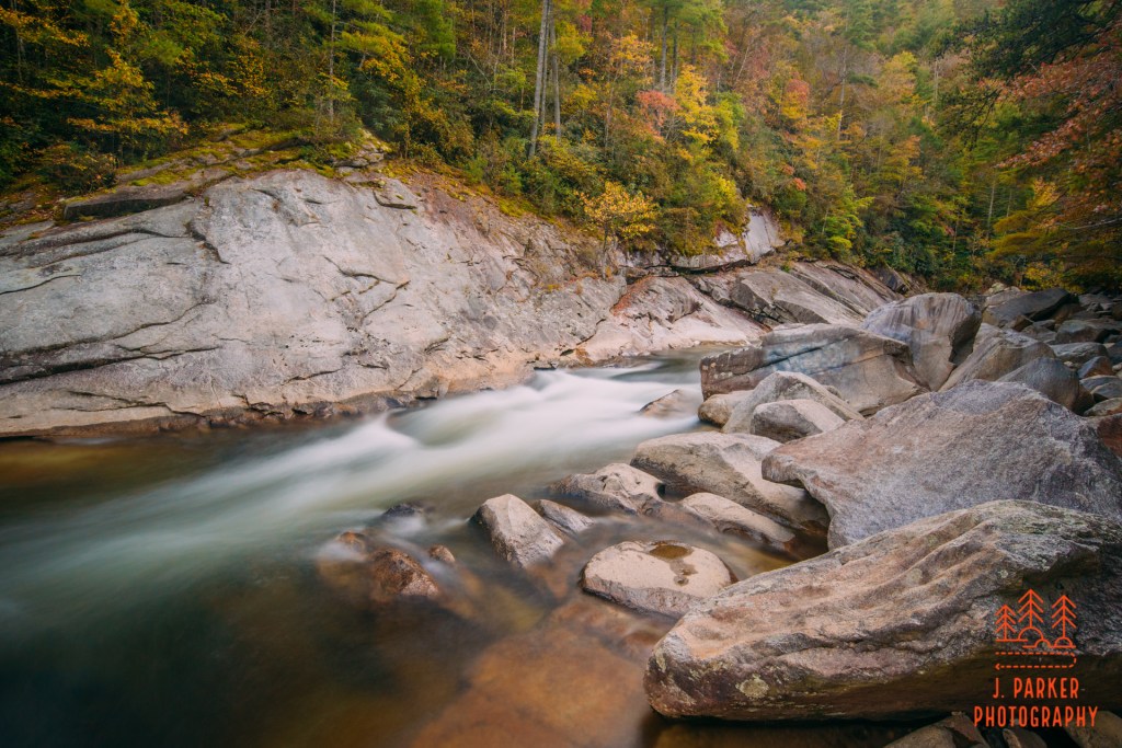
Wilson Creek was a different beast here than what it had been upstream. It’s gorge was deep, it’s channel flowing with a lot of power through an imposing channel flanked by stone walls and large boulders. It made a great photographic subject, and while I didn’t get a huge volume of pictures as I cruised the road, after the hellish luck I’d seemed to have the rest of the day, I was happy to have a couple that to me seemed like pretty high caliber.
As I headed for my hotel in east Asheville, I had a couple things to be thankful for. First, I had at least ended a disappointing day on a high note. Second, that my low tire had not gone flat. I call that a win.
