
Short but brutally steep. That’s how the hiking guide described the path up the side of Sitting Bear Mountain. And that had lived up to the description. Getting up had been the type of hands and knees in the dirt, grab the next root type of ascent, more of a climb than a walk, which was not for the faint of heart. But getting up hadn’t been the real problem. When it comes to a path this steep, it’s getting down that will be the time that tries a man’s soul (female souls are apparently unflappable).
I peered over the edge, trying to figure out which route which cause a slightly marginal decrease in the likelihood of severe injury compared to the others. So too were close to ten others, hikers who had come from the other direction on a loop hike, not the out and back I was taking, and thus had not yet experienced this thrilling trail segment. I had come across them on my return trip, and had discussed strategies for how to handle this tricky section. My preferred method was the butt method, where you don’t run the risk of having your feet fall out from under you since you aren’t on them in the first place. This tried and true strategy is idea for Florida flat-landers, especially ones with bad hips, and it’s the exact strategy that I decided to employ here. Soon I was sliding down foot by foot, my hands gripping for patches of firm dirt, tree trunks, and roots, whatever would help me make a controlled descent besides the friction between my butt and the ground below which had long since caused the back pocket oy my pants to lose its functionality. And soon, most of the folks behind me had joined in, so there were a near dozen of us sliding ungracefully down the slope, all on our butts. From below, we might have looked silly for those not in the know. For others, they know that’s it’s just another part of hiking in Linville Gorge, one of the most rugged hiking areas in the East.
I was supposed to have hiked here the day before, and after a series of unfortunate events caused me to arrive after parking had already filled up, one of the last things I had in mind was returning to the scene of my great shame the very next day. But I ended up not really being given much of an option, due to something much more tragic than me not finding parking at the trail I wanted to hike. When I envisioned my 4 and a half days of hiking, I knew whatever sunny days there were I was going to focus either on the Linville Gorge area or the Blue Ridge Parkway north of Brevard (Graveyard Fields and Black Balsam area). The day before I had returned to my hotel room to reconnect with civilization and found that Facebook was abuzz with news that there was a missing hiker in the vicinity of the Shining Rock Wilderness and Black Balsam. This was a little unsettling, for the trail system I had hiked two days prior (during which the hiker would have been missing) was part of the same local trail network. Since I was at my closest only 2-3 trail miles from where the person’s vehicle was still parked in the Black Balsam parking area, they could have very well gone missing on the same trail I was on, for all I knew. Authorities were requesting that people stay off the Parkway in this area so as not to impede the search efforts. That basically took every hike I wanted to do in this area off the table.
I wasn’t going to settle for doing a mediocre, second tier slate of hikes from the second day in a row. Nor was I going to do a hike that wasn’t well suited for an entirely cloudless today. With that in mind, the only thing left I hadn’t yet done were the hikes along Linville Gorge. I wasn’t sure if I wanted to try Hawksbill Mountain again, not just because of my shame at missing it the day before, but also because that hike was far from a full day hike, and I had dipped into my pool of secondary stops in the area the day before. As I was trying to think things through, I decided to take a look at the Sitting Bear Trailhead I had passed the day before. Even as people were parking illegally at the Hawksbill Trailhead as if it were a restaurant serving the last slices of bacon on Earth, there had been parking at Sitting Bear. I was pleasantly surprised but also mildly embarrassed to find that the Sitting Bear Trailhead is almost as good of an access point to Hawksbill Mountain as the actual Hawksbill Trail, being only marginally longer but yet being a more gradual and natural ascent. But on top of that, the trailhead actually connected to the Jonas Ridge Trail between Hawksbill and Sitting Bear Mountain, with the latter being essentially off the radar of the general public, but offering an interesting series of views on its own, in addition to a distinctive rock from which it derives its name.
After being shamed the day before, the idea of returning to the Gorge just to hike one of the overwhelmed “tourist” trails hurt my pride a bit. But being able to do a “real” hike in the Gorge, one that required some navigation and took me off the proverbial beaten path, well that felt a little bit redeeming. It would enhance my “street cred”, especially since I would be doing this as a solo hiker less than two weeks before having hip surgery. It would also take up a lot more of the day, so I wouldn’t be focusing my day around a short hike that would only take a few hours and leave me without much to supplement. I found a great guide outlining step by step how I would need to navigate my way first to Hawksbill and then Sitting Bear. I normally prepare all my hiking resources, like guides, maps, and emergency driving directions, prior to leaving home on a long trip, but for this hike I created a PDF which I transferred to my phone to follow. While downloading maps I also found something else interesting – I saw that the Spence Ridge Trail provided a pretty short journey from a roadside parking area to the Linville River, to an infamous spot that used to be crossed by a bridge which, after being washed out, has required backpackers to make a sometimes tricky water crossing. I didn’t know that there was a spot with such easy access to the Linville River mid-gorge, so I saved information about that as well.
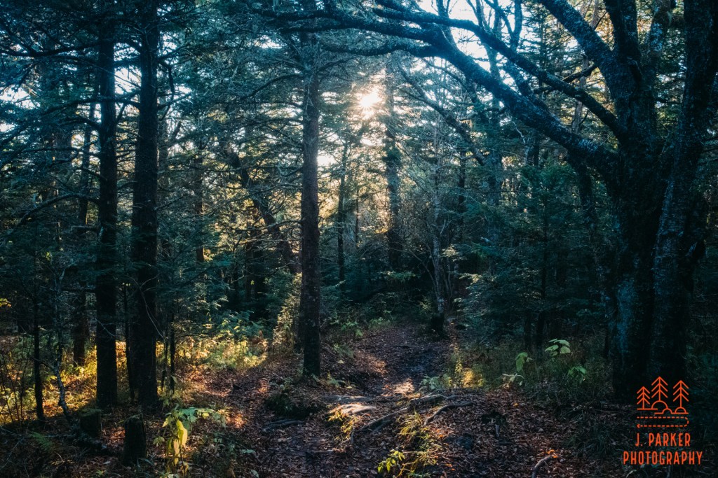
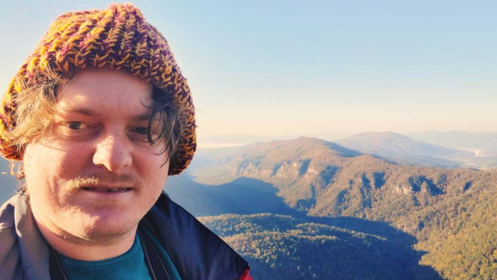
I successfully set out before dawn this day, and the colors of early morning floated over the western part of the Gorge as I dodged hunters also stirring this early morning. Driving from Asheville to the East Rim of the Gorge actually involves the a circuitous route outside the West Rim of the Gorge, but I was quite familiar with the turns of route, having missed some of them the day before. With no flat tire warning to slow me down I arrived at the Sitting Bear Trailhead around sunrise, where I had no difficulty parking. The woods were still doused in the blue hues that dominate prior to the arrival of the sun as I set out on foot to begin what would be an incredible journey.
It was a cold morning, floating close enough near the freezing point for me to feel pretty decently chilled. Most of my body had suitable cold weather gear to fight off the cold. Unfortunately that didn’t include my face. As I felt the searing chill reach through my cheeks it occurred to me that I had something that might help; my cloth covid face mask, currently in my pocket in the event I ran into any crowded trail sections where close contact was briefly unavoidable. My mask fit snugly on my face, and also held the warmth of my breath in, so soon I felt very warm.
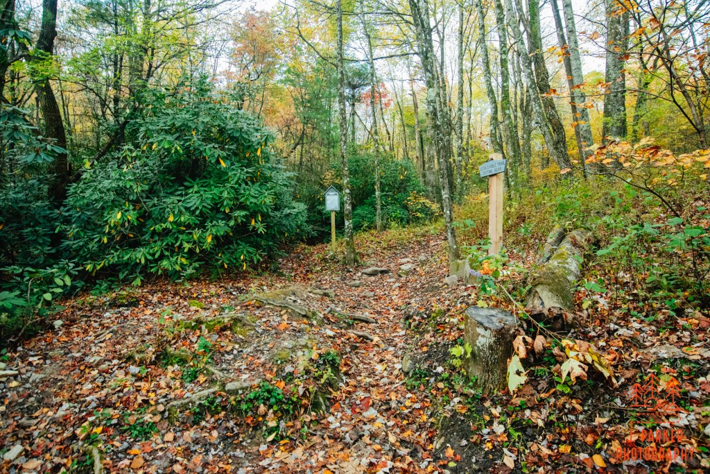
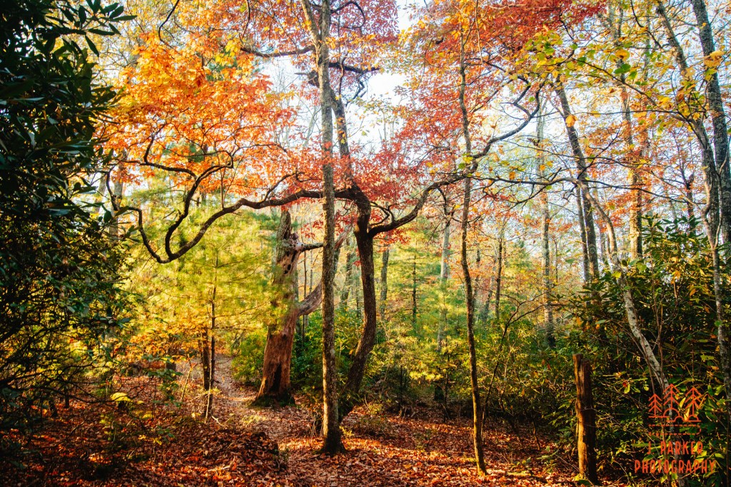
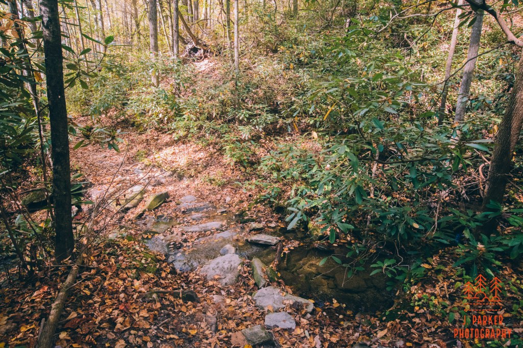
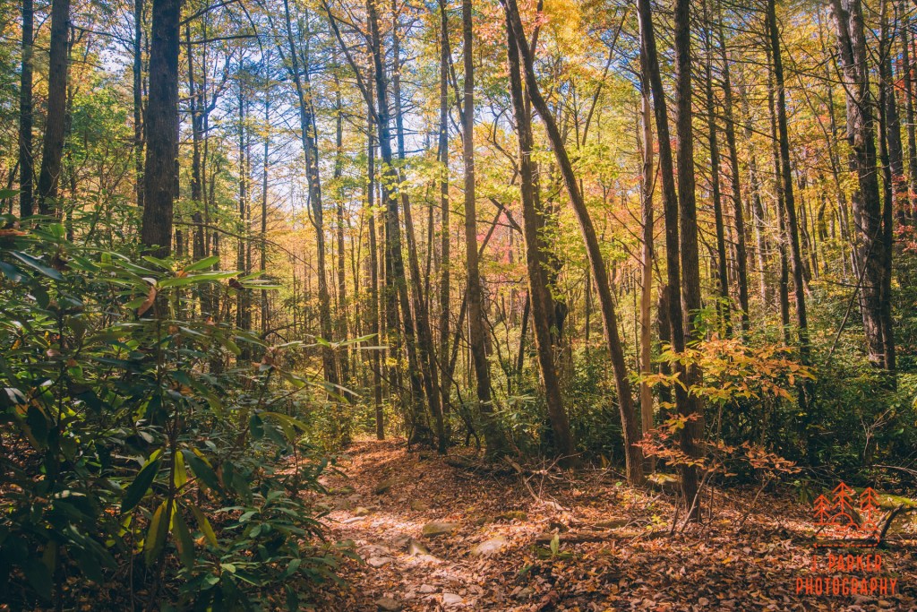
Simple things on a map aren’t necessarily so simple in person. My first trail junction was where the trail from the trailhead approached a campsite, where an unmarked trail referred to as the Jonas Ridge Trail ran laterally in either direction, the left heading towards Hawksbill. When I reached the junction there were several diverging paths, everything running over a forest floor that was carpeted by fallen leaves, with much of the forest having reached the “fell” stage of fall. Not 100 percent sure which trail to take, I took what appeared to be the best path in the direction I was hoping to go. Keeping a close eye on the path I was making on my hike tracker, and comparing it to the map, I soon felt comfortable I was on the right path.
The trail took a journey over a knob that, compared to the fullsize peaks around it, constituted barely a speed bump, but it was enough of a climb from the campsite to start getting my blood pumping this morning. As I crested the knob the bright rays of the sun, penetrating in sharply between the rather barren trees, greeted me at the top. Everything was golden, the fallen leaves appearing to be on fire from the strength of the sun rays.
There was no view from the top of the knob, and I was shortly descending again. The descent was shorter than the ascent, and I was soon at yet another campsite where I would be picking up another trail, this one the Hawksbill Trail to lead me to the summit. This time, I made the wrong decision – at least at first. I continued straight on the trail I was on, but knowing I was near the base of Hawksbill, and that the Hawksbill Trail should be making its ascent in earnest, I grew suspicious when my trail started dropping elevation. This mistake was easy to make – the trails actually diverged a few feet from the campsite, not the campsite itself, and from the angle of the junction one was naturally inclined to continue forward on what for most people would be the wrong trail. I doubled back, and when the other trail started ascending fairly rapidly I was certain I was heading up Hawksbill.
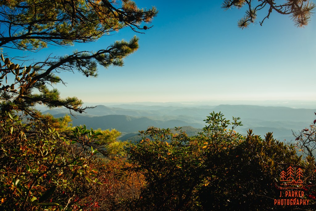
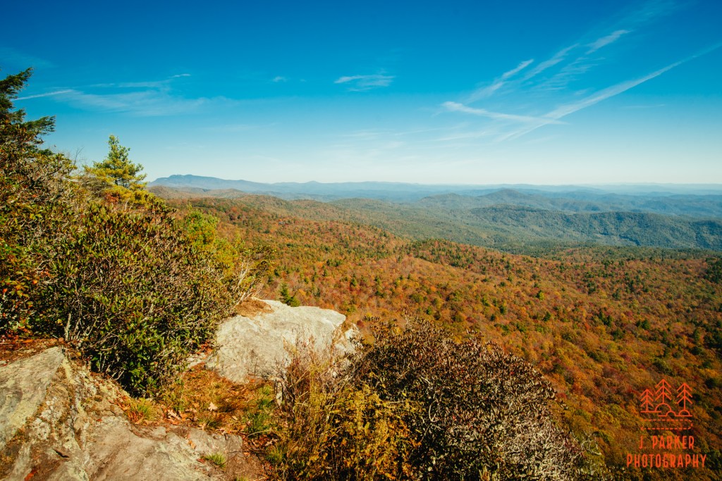
The ascent up Hawksbill wasn’t as long as I thought it would be. Heading up peaks like this can often seem this way, where you have enough teases of views and anticipation to shorten time. I knew blue skies awaited me at the top, as well as one of the finest views in the Carolinas, and I climbed vigorously to reach a view that for me had several times appeared as a bridge too far. The trail snaked to the left, barely clinging to the east edge of the mountain, before it doubled back upon itself. Where there was a rock that gave one just enough height to peer over the descending rhododendrons I was treated to my first view from Hawksbills. Here I gazed mostly towards the east-northeast, over a jumble of small peaks that likely included some of the Lost Cove viewpoints I had begrudgingly taken in the day before. This was not “the” view – in fact, it hardly held a candle to anything I’d see the rest of the day. But that first time of the day when you set your eyes upon a host of peaks below is always a special moment.
The trail spilled out at a wide flat area. This was obviously the summit area, though there weren’t any views immediately available to me. My natural inclination was to go to the left, where trails were much more obvious and in view. This is where the “real” Hawksbill views started to promulgate as I made my way between boulders and small groups of pine foliage that mark the top of Hawksbill. I could see the distinctive round peak of Table Rock as wound my way towards the first unobstructed views on the other side.
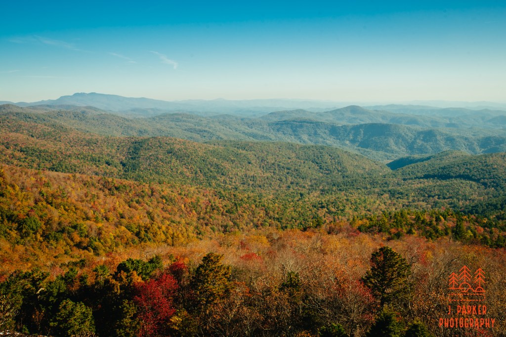
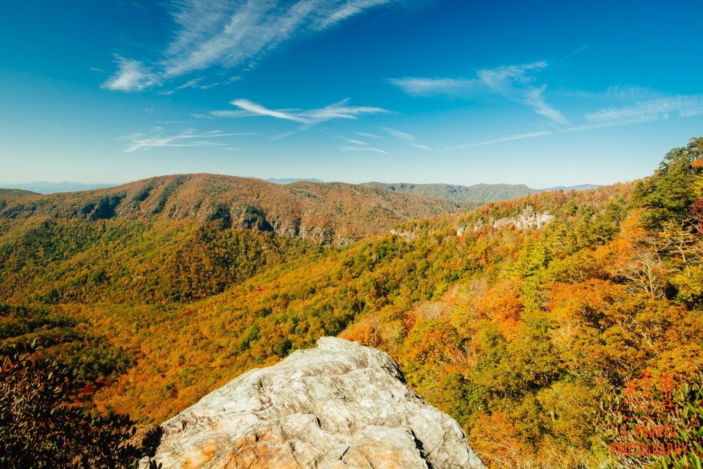
And finally, a huge stretch of the Gorge sprawled out in front of my eyes. A hurricane in 2019, then an immense day of misfortune the day prior, I was wondering if I’d ever get to return to this place that had so enthralled me in 2017. Finally, I was here.
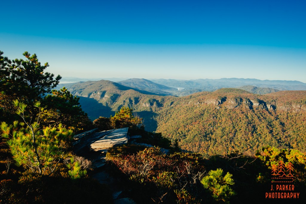
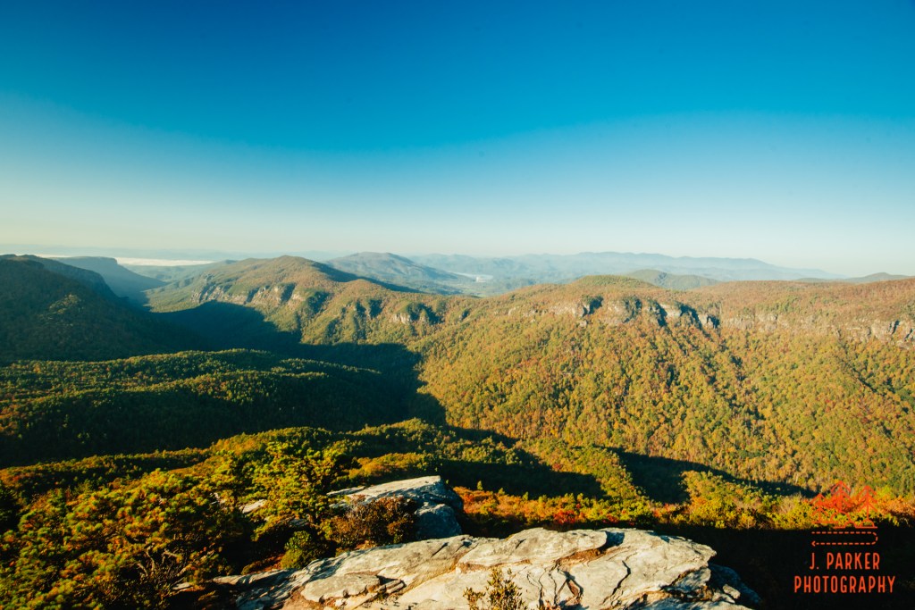
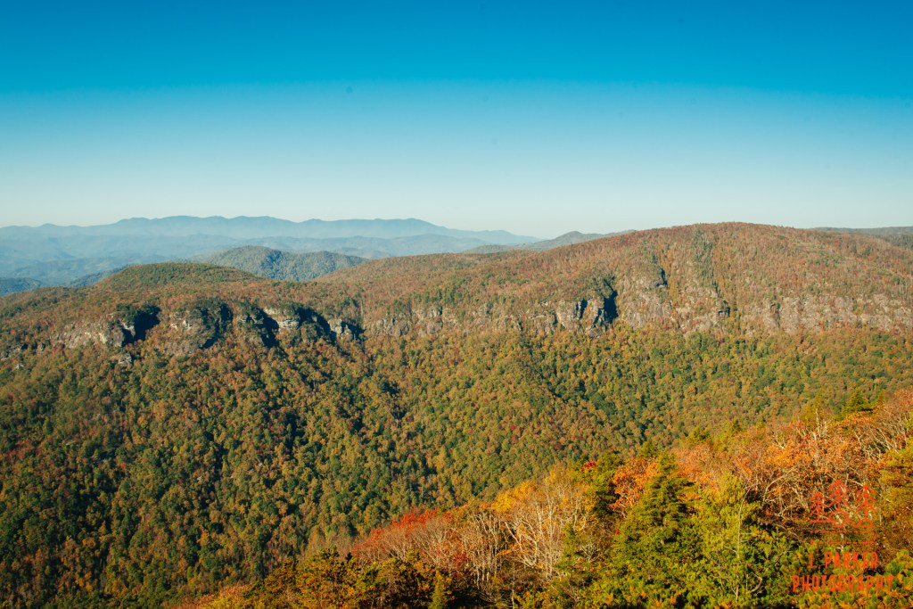
It’s hard to describe the majesty of the Gorge to those who have never been there. It is truly one of the most incredible singular sights that southern Appalachia can provide. It’s the type of place that when you are viewing it in person, you’re almost not sure of what you’re seeing. And when you see pictures of it later, you’ll scarcely believe that it’s a place you’ve actually visited. Even knowing what to expect, I was no less impressed on my second visit than I was on my first. And it’s all the easier to appreciate since all the signature hikes on its West Rim (Hawksbill, Table Rock, The Chimneys, and Shortoff) offer ample open rock upon which to relax and enjoy its spectacle.
The day, like much of the rest of my trip, was brilliantly sunny, absolutely perfect for a view-laden place. The only downside this morning was that the unfiltered early light made facing directly towards Table Rock somewhat harsh and into the sun. But no matter, I was going to enjoy the scene and experience regardless, and there was no such hampering of the view towards the opposite side of the Gorge. Everytime I viewed that opposite side I tried to make sense of the myriad of rock formations that create sharp, definitive walls, but my mind was never able to make much sense of them.
One very interesting and distinctive feature of Hawksbill’s south side is the way the rocks stair step lower and lower. Each time you reach a rock you think will be the last you savor a few from before turning back, there’s another that is reachable below. Curiosity runs rampant, as it always seems like you may be able to see more from the next rock than you are from where you are at now. You certainly don’t want to stop and then find out later that you missed something grand, and Linville Gorge always seems to offer a promise of grand from any rock or side trail you see.
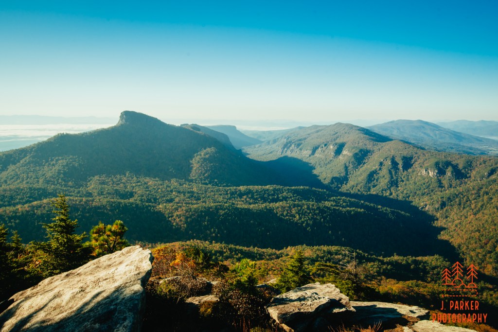
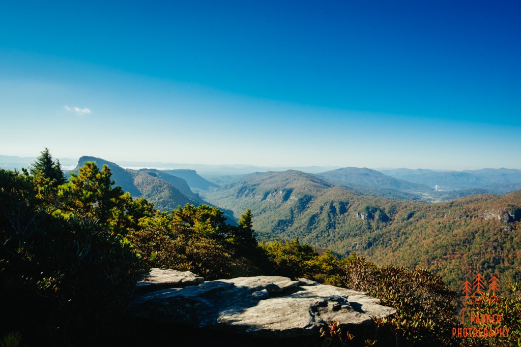
This south view from Hawksbill may be “the” view of the Gorge. It’s really hard to say if the view I had was truly better than that of Table Rock, or maybe it had been so long since I had seen the view from Table Rock that the majesty of seeing the Gorge again was clouding my evaluation. At any rate, the view from both is fantastic, though hiking Table Rock and the Chimneys is a more complete hike. From here, I was able to take in the same East Rim of the Gorge, but I also had a view of the West Rim that included the odd shape of Table Rock, whose distinct peak clinging above the rim of the Gorge seems to defy logic. You don’t get a view of Table Rock when you’re on Table Rock, which is one clear advantage Hawksbill has. I could also see the flat expanse of the summit of Shortoff Mountain, which acts like a sentry at the end of the Gorge. That was another hike I was hoping to complete in the Gorge this trip.
I never reached a point where it was obvious I couldn’t continue downward to more rocks, rather it was the thought of diminishing returns and the fact that I’d have to climb back up all these rocks I was descending that finally turned me the other way. I had a few talks with others as I was making my rock scrambles, and I did confirm that the side of the mountain I was exploring was only half the experience. As hard to believe as it was for how much awesomeness as I had already taken in, there was still a summit area with views towards the opposite direction I had yet to explore.
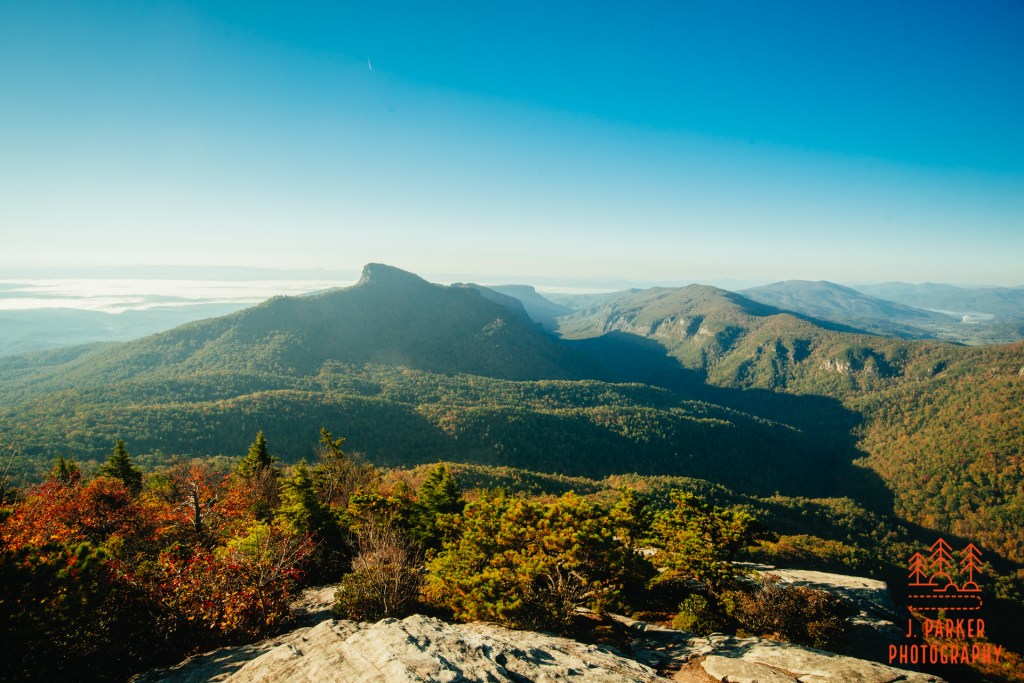
I slowly worked my way up and then passed through the flat camping area where the trail had come in, and I found a path past a large boulder which went the short distance uphill to the actual summit of Hawksbill. A large expanse of craggy, mildly uneven rock marked the actual summit, where there was at least some extent of 360 degree views, though from here you could head in every direction and get a better view. My natural inclination took me slightly towards the left, where there was an impressive view of the West Rim, with a nice ridgeline from the East Rim providing a pop of red and orange fall color. Behind the West Rim and several other peaks was the tallest of them all in Mt. Mitchell and the Black Mountain Ridge, which I take great pleasure in identifying. I wasn’t sure if I was going to have a close passage of the Black Mountains this trip, so I wanted to savor that once (as it turns out, I would not ever get closer to them).
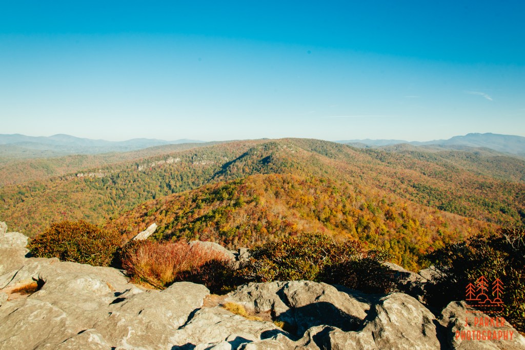
Wandering right upon the summit area, I found my next view squarely ahead towards Sitting Bear. I hadn’t yet committed to doing that portion of the hike just yet, so I looked upon the adjoining mountain, behind the small knob I had gone over earlier, with kene interest. To the right of Sitting Bear and well to the rear was the large shape of Grandfather Mountain, though after my disappointing day prior, where one of the only things I accomplished was a seeing Grandfather multiple times, I was a bit less enthused about this.
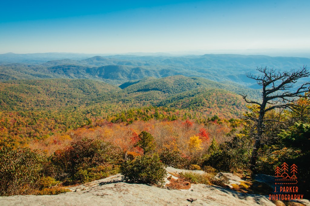
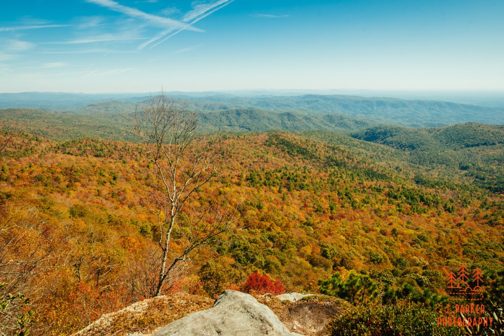
Naturally, on a peak fall weekend on one of the area’s most well known mountains, there were certainly a fair amount of people spread out across the wide expanse of available rock. I was quite pleased, however, to find to my right a small area behind a copse of foliage with an interesting view towards the Northeast, one in which everyone else seemed to be overlooking. It wasn’t the awesome view of the gorge that the other areas provided, but it provided quite a pleasing and photogenic frame down towards what I’ve thought of as the “sea of mountains” south of Grandfather which I had first seen from Rough Ridge in 2017.
I amaze myself sometimes at what I can do. I had spent most of the last few months on a couch after work, unable to walk much on my failing hip. I was going to be having surgery in less than two weeks. Yet here I was, having pulled my way up to one of the most inspiring views anywhere in Appalachia. It had less to do with not being in pain, and more to the fact that at least for a brief period of time, you make a truce with your body that you are going to be in a little bit more pain than normal, but at least you are going to do something worthwhile with that pain, instead of still being in pain for mundane everyday life. I couldn’t be sure what I was going to do the rest of the trip or even the rest of the day, so I spent an extra moment digesting this view that I had yearned for years to get back to.
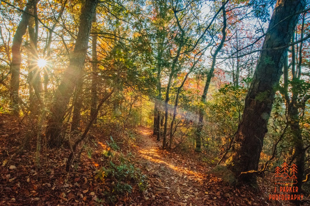
Hawksbill invigorated me, and I hurriedly made my way down the trail and began working my way towards Sitting Bear Mountain and the trailhead I had parked at. I had tasted awesomeness today, the day was still fairly young, and I wanted more. I reached the campsite where the trail to the parking area diverged and I paused a moment to consider my options. Really, the only good alternative I had was to try and venture to waterfalls like Harper Creek and Upper Falls, but with the immense sunshine, this just wasn’t that appealing of an option. As Robert E. Lee had said at Gettysburg, the enemy was here. I was going to attack it. I was going to head to Sitting Bear. Not that the steepness didn’t concern me – that’s the reason why I hadn’t fully committed before now. But the multiple trail guides I had consulted were very clear that while it was an epic trail segment, it really was only a couple hundred yards. I was ready to try that.
I regret that the steep portion of the trail is essentially not covered in my pictures, but the sunlight was so intense coming into the woods that it was washing out large portions of any pictures I could take anyway. It was best for both my safety and my camera to put it in the bag.
This part of the ascent certainly didn’t pull any punches. It was grueling but just below the need to grab roots to pull yourself forward. The trail seemed to undulate left and right, grass to one side of you with somewhat of a dropoff to your right. Trekking poles did little good here. I was anticipating a small flat section with a side trail to the left. At one point the trail at least moderate its ascent, and there was a rough hint of a trail to my left. As it turns out, this was premature, and I doubled back and pushed uphill ever so slowly.
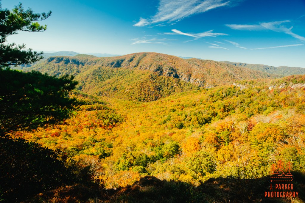
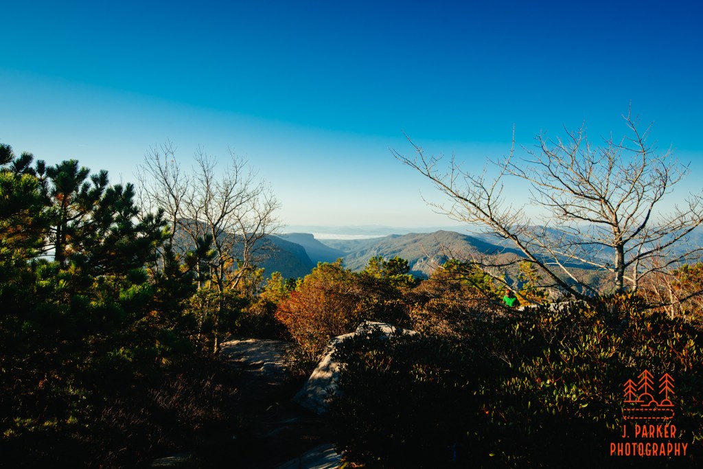
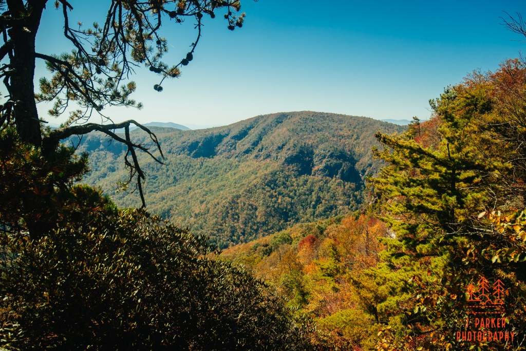
Finally I found a much more obvious trail to the left, and I took it a very short distance to where there was a small rock outcropping with just enough purchase for a couple people to safely sit. This, and another viewed obtained on another side trail just a few feet away, constitute what is called Cummens Overlook, and the views from here were one of the highlights of my entire trip. While it was far from encompassing like the views from Hawksbill, there was a feeling of connection of closeness to the Gorge and the things you were viewing that just didn’t exist from those high perches. There was a fantastic view of the opposite rim, of other parts of Sitting Bear, but perhaps most impressively a view down the gorge form farther up than I’d ever been previously (save for Linville Falls, which doesn’t really look down the main portion of the gorge).
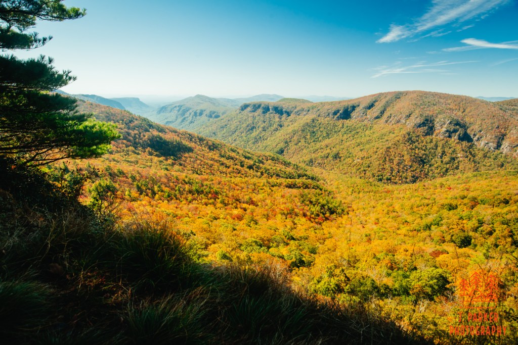
The upper part of Cummens Overlook was no less accessible than the first. Sitting Bear Mountain doesn’t have an obvious summit area like Hawksbill, and every view you take in will come from a side trail. Nevertheless, there’s an impressive series of views to be found here. This upper portion of Cummens Overlook was a little larger, though the rock was a little more unsettling, so I tread very carefully here. Some trees between here and the previous overlook made it a slightly lesser view up the gorge, but it was an even more inspiring view of the West Rim and of Hurricane Wall.
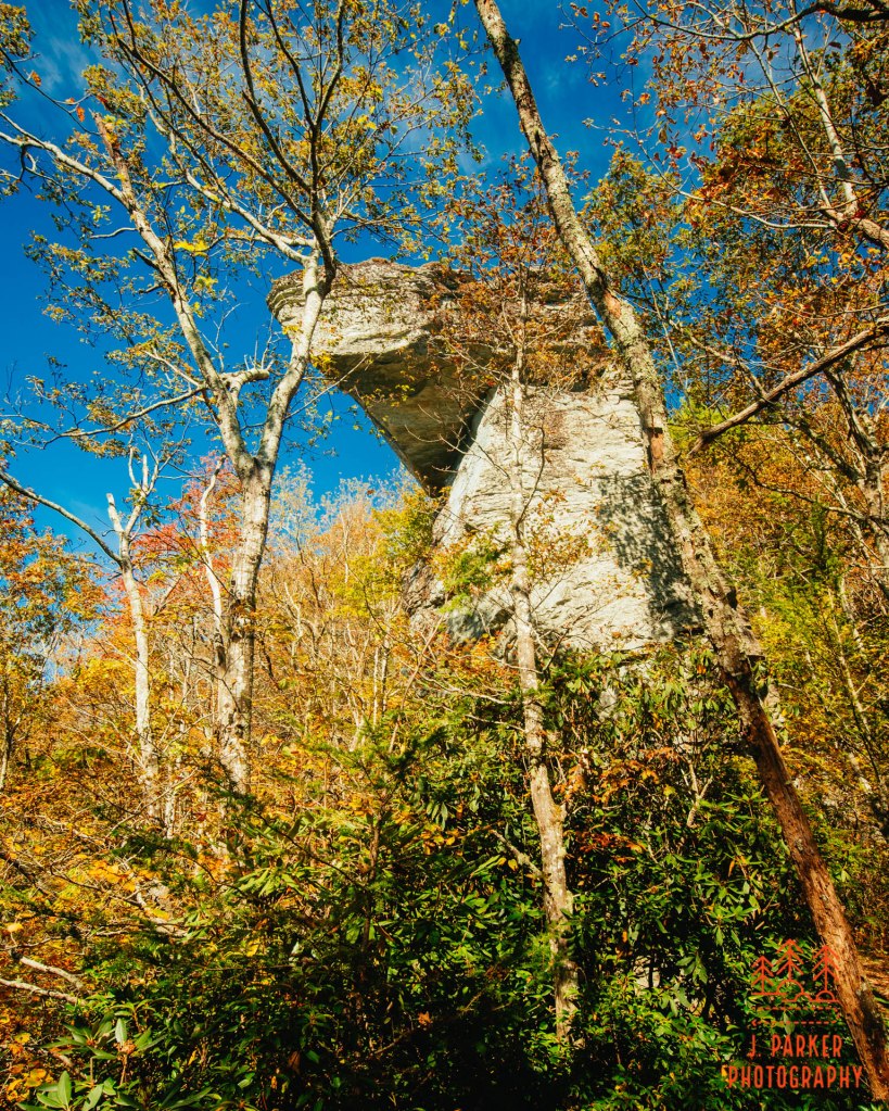
Outside the overlook stood the monolith that gave Sitting Bear its name. To me, the odd tall rock outcropping much more resembled a trojan horse than a bear, but that’s just me. I can’t confess to have gotten the greatest view, for I’ve scarcely encountered a day with a brighter sun, and the rock was mostly enshrouded in the woods. To me this rock was more of a curiosity than that much of a trail highlight. The greatest benefit I got out of it was just to be able to say I had seen one of many identifiable oddities that define the Gorge.
My respite at Cummens Overlook had lured me into a false sense of security. While the previous ascent had been among the steepest I’d ever done on anything outside of a goat path to a waterfall, the upper portion of the journey to Sitting Bear was just ridiculous. My guide had indicated that there had been a series of switchbacks installed there, but nothing really fitted that description, for there was nothing that could provide for anything close to normal hiking. This last portion was legitimately a climb. I pulled myself root by root, for while I wasn’t in danger of falling back towards my starting point, it was impossible to get higher without climbing. Luckily, one could practically see the end of the ascent from the start, so I knew I would eventually reach the end after a few grueling minutes.
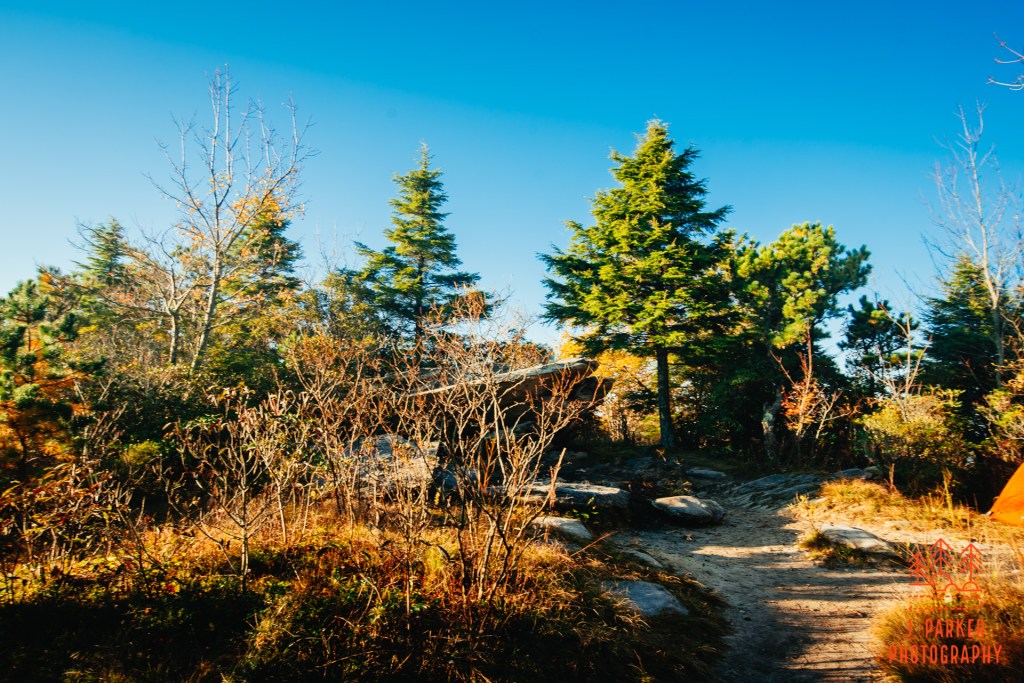
Up at the top there was almost immediately a path to a rock on the right. There was a young man with two ladies currently enjoying that rock, a group I had also seen at Cummens Overlook. I patiently waited for them to finish before crowding them on the rock, and I had a brief discussion about the mountain with them before the moved on. The man was a local who regularly visited the mountain, and I wanted to make sure there wasn’t going to be a hidden treat that I missed, so I picked his brain briefly. I can only hope that, in exchange for guiding the ladies to the awesome views of Sitting Bear, that the man was able to enjoy intercourse with one or both of the ladies that was with him afterwards.
Getting the best of this first overlook wasn’t easy, for I had to haul myself up and over the side of a boulder to get the unobstructed view of the Gorge. Once I got up there I had a very interesting view, where you could see Hawksbill, Table Rock, the Chimneys, an Shortoff in succession. It wasn’t as natural a view as others I had seen, but it was somewhat interestingly framed by the trees around it.
There was also a small rock with a view towards the “Sea of Mountains”. The rock here was ever so narrow, and not really large enough to sit comfortably, so I got my picture before moving ahead on the trail, happy that every view I got from here wouldn’t involve another murderous ascent.
Further on there was another overlook in this direction, but truth be told, the view from it was so similar that, if not for the timestamp on my pictures, I’d hardly be able to tell which overlook I had taken the picture from.
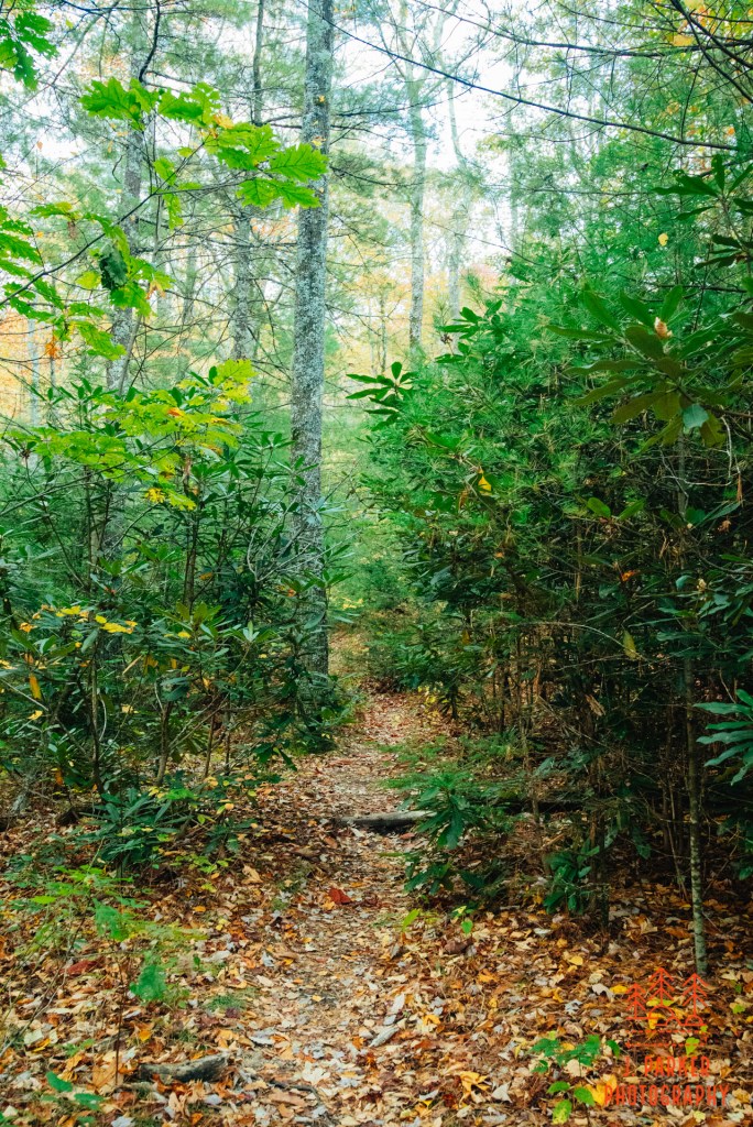
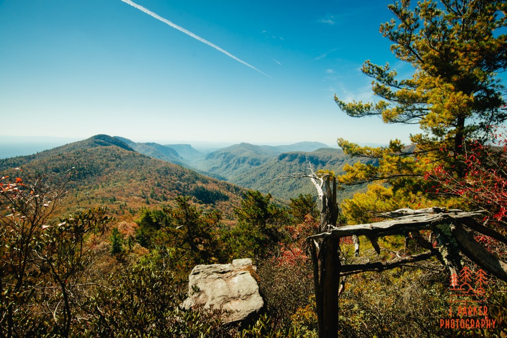
The turnaround point for my hike was a place called Celestial Point. Getting there from where I was required no less than three unmarked trail junctions. If I did not have directions to this spot, there is no way I would have found it in the non-descript past-peak forest. As it was, at one point the distance I had traveled seemed far greater than indicated in my directions, and I began to get just a shade nervous. I wasn’t worried I couldn’t find my way back, as much as that I wouldn’t find this final highlight. Luckily, I passed a couple returning from Celestial Point, and they confirmed that I was about to reach its side trail.
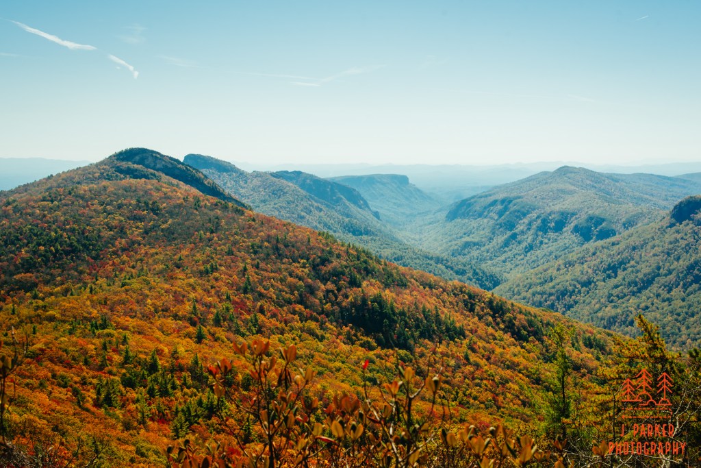
There was a time when Celestial Point was said to be the best view to the south in the Gorge. I knew enough to know that description was a bit overblown, however it was still an interesting view. While part of the East Rim, the way Hurricane Wall pushes into the Gorge, you are practically getting a view straight down the center of the Gorge from here. All of the major peaks of the West Rim lined up in perfect succession. Having now visited all the major peaks along the West Rim except Shortoff, I was already looking forward to getting that one completed as I viewed its distinctive flat plateau from here.
I carefully retraced my steps back to the Jonas Ridge Trail from here. As uniform as the past-peak woods were here, it would have been easy to pass some of the side trails that led me back, so I carefully marked my progress on my hike tracker so I knew exactly when the trail junctions were coming. Once back on the main trail, I was just ahead of a large group of hikers. They were coming from one of those trails that approached Sitting Bear from up the Gorge, and hadn’t yet experienced the steep section. I warned them about it, for it hadn’t escape my mind that I’d have to navigate it going down, which is a much more dangerous proposition than going up. I had texted my wife from Celestial Point, letting her know that my return trip was going to involved a rather dangerous section.
A great way to minimize the inherent danger in a steep decline is just to eliminate the high probability of losing your footing and possibly falling uncontrolled down the incline. Going down a descent in fall is probably about as bad as it gets aside from pouring rain, for the multitude of fallen leaves are pretty much guaranteed to cause lost footing. So I had no shame in riding my butt for the long haul, working slowly and using everything I could, including rocks, roots, and tree branches to control my descent. To the relief of both my butt and my pants, I made it to the bottom of the worst section without incident. The rest of the descent past the sitting bear wasn’t devoid of danger either, but at least did not require the butt method to traverse its several hundred yard section. I did eventually reach my car, a little worse from the wear from the current day’s travels, but at least alive.
Once finished, I decided to continue in the Gorge and take the Spence Ridge Trail I had just found out about. It would be well less than a thousand feet elevation change and just a few miles total to get down to the river and back. There was basically only two trail junctions, so even without a guide I would easily be able to find my way. This trailhead isn’t one of the major ones in the gorge, so even though I was a bit nervous I was still able to find parking even during one of the busiest weekends the gorge will see. As I prepared my supplies and gave a moment for my phone to recharge in the car, I had a few discussions with fellow hikers. Everyone else was using this trailhead to hike to Table Rock. I didn’t even know there was an alternate day hike to Table Rock besides the Table Rock parking area. If I could guess, it probably involved a lot more elevation changes than I’d like to do, but it at least would cut out one of the scariest mountain roads I’ve ever driven, so that’s a trade off I guess.
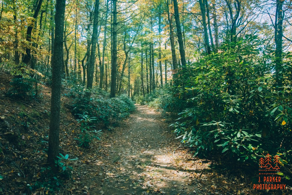
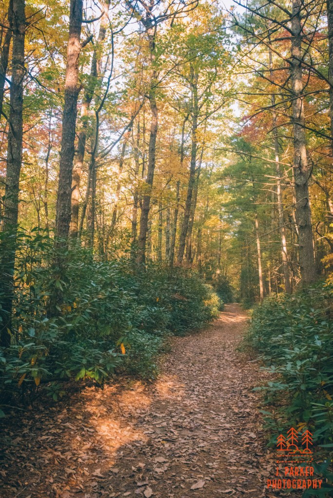
There might not be a flatter, straighter section of trail in the Gorge than the first part of the Spence Ridge Trail. That made it easy to traverse, but aside from the occasional nice corridors of foliage, it also left the trail devoid of much to see. Being at a lower elevation than I had been the rest of the day, there were more leaves on the trees than I had seen previously, but the woods were still looking towards the barren side. The only advantage was that I could see through the trees from time to time towards the sharp peak of Hawksbill towering above. There was a bit of added dimension to this since I had hiked it this morning. But it was a mostly non-descript journey to my first trail junction, where a sign notated clearly the Spence Ridge Trail branching off to the right.
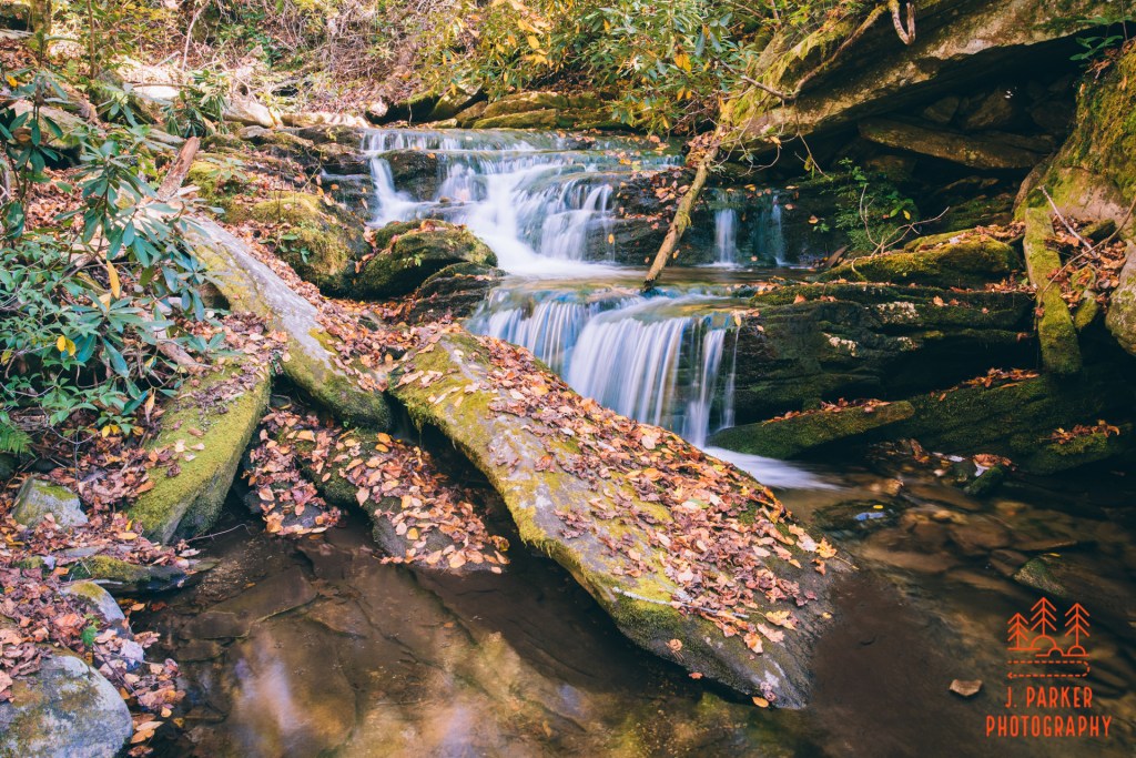
After the junction the trail dropped much more consistently and got a lot more rocky. The sound of moving water came to ear, and seen it became apparent that the trail was dropping towards a creekbed, which it traversed easily with a small set of rocks. I’m quite the creek fan, but given the harsh light coming in, I saved myself from taking any offshoot to the creek until the return trip. Though the trail was essentially all downhill towards the river, it was the type of trail that made you concentrate on each of your steps, lest you end up turning an ankle on a rock.
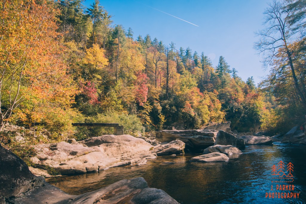
I reached my destination of the river after many careful steps. This place was both a decently scenic spot yet one that also disappointed me a bit on the same time. I had hoped by getting to river level I’d be filled with wonder at being at the foot on such a spectacular gorge, with those incredible rock walls surrounding me. Unfortunately, it turned out that you couldn’t get much view of the greater Gorge while being down here. The river here was nice, maybe not as nice as I imagined it could have been, but still nice. There was a set of large rapids or a small cascade upriver of where the trail came in. The trail used to cross the river on a bridge here, but the bridge washed out years ago and there are no current plans to replace it. I was hoping to uncover a goat path or informal trail that would allow me to follow the river a bit, but the best I could find was just to hop along the rocks towards that small cascade upstream.
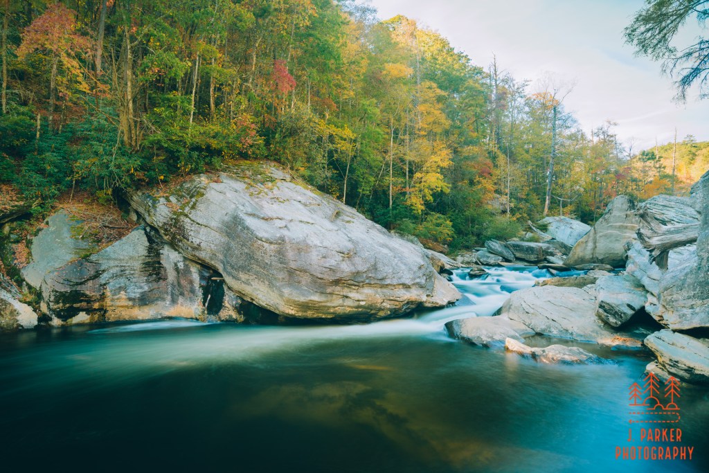
I setup to take a long exposure of the rapids. There was still a lot of light coming in, so I didn’t have an ideal setup. As I did this, a group of hikers emerged at the opposite side of the river. I watched with one eye on my camera, one eye on those crossing. For backpackers, crossing water like this is supposed to be no big deal and is practically a right of passage. That said, the care they had to take to do so, having to get themselves and a lot of gear they would prefer to stay dry across the river, was a challenge I’m not sure I’d like.
I was hoping to see more interesting aspects of the creek, both at the river itself and along the hike. Unfortunately, where it joined the river there wasn’t a tumbling little fall, just gently descending rapids blown out by the sunlight. I was open to stopping at spots along the creek on my return trip, and I did stop in one spot that I thought looked promising from above. As it happened, once I got to the creek there was a large rock that blocked the bottom of the fall, and I ended up having far more difficulty setting up around the creek than I would have imagined. After that disappointment, I ended up feeling pretty overwhelmingly tired. Part of the reason for this is that, while I had set out prepared for the cold weather in the morning, the day had warmed up quite a bit, and I hadn’t shed any layers. So I was both a little too warm, thus sweating out a lot of energy, and also carrying extra weight. My hips were both in sore shape at this point. The Spence Ridge Trail had seemed rather inconsequential, but in the shape I was in, I had legitimately never moved at slower pace than I did on the rather monotonous journey back to the car.
I hadn’t necessarily known that Spence Ridge would definitely be my last trail of the day when I started it, but both time and energy meant I wouldn’t get any other hiking done. Prior to starting my trip I had scope out some spots where I might be able to find something worth photographing in a pinch, and one of those was the Linville Picnic Area along the Blue Ridge Parkway upstream a bit from the well-known Linville Falls.
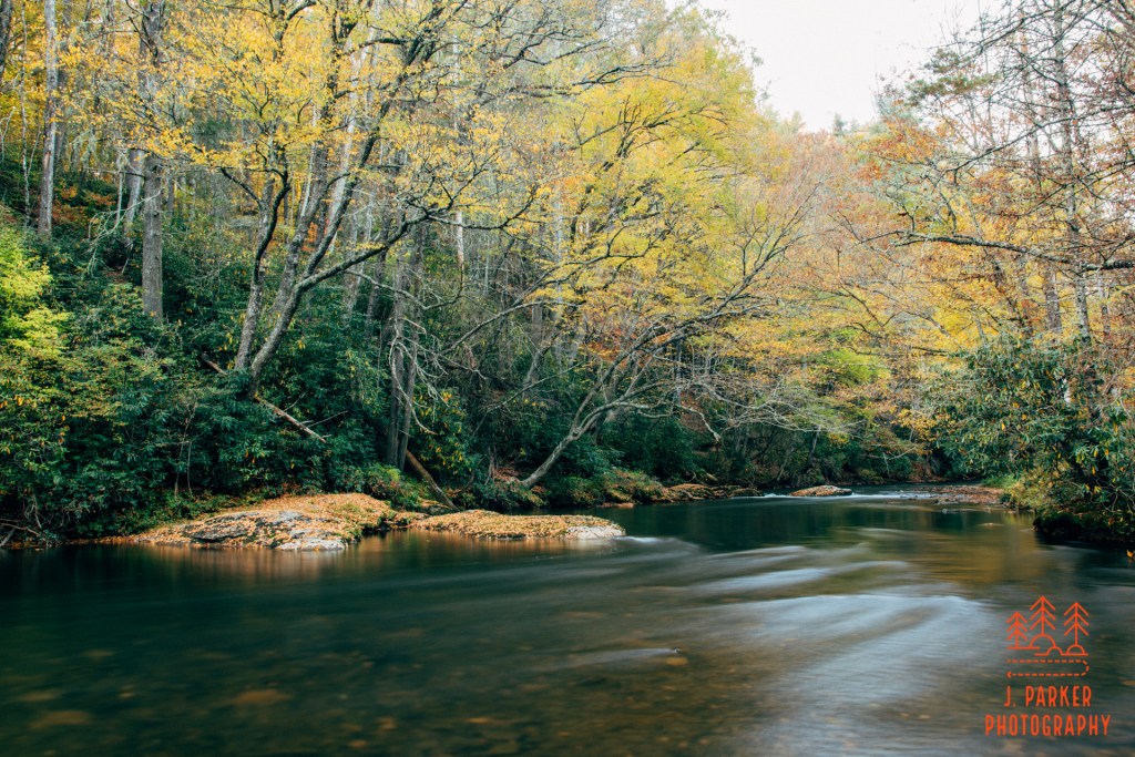
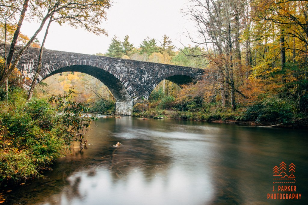
Upon reaching the picnic area, there was neither the water features (rapids/rocks etc.) I was hoping for, nor the solid fall color. There was just a trace of both, so I squeezed out everything I could in getting two shots, mindful of the fact that I had come up to North Carolina during fall and had scarcely gotten much fall color in my pictures. First I started at a small hint of rapids where the surrounding trees hunt over part of the river. By and large the trees were barren, but a small slate of them still held some leaves which showcased the extreme colors that come just prior to the leaves falling. The picture I made makes the leaves that are there far more prominent than the barren branches. Next, I headed downriver to where there is a view of an historic bridge upon which the Parkway crosses the river. Here again there was only a trace of color left, but what was there I was able to use to frame the stone structure of the bridge nicely. Had I arrived a few days prior I’m sure I could have gotten something better, but I couldn’t do anything about that, and I was happy with the picture I got, as well, as the skill it took to make either picture under the current conditions.
Though I wasn’t blown away by the Spence Ridge Trail, I had a fantastic day. I had gotten Hawksbill Mountain, another one of Linville Gorge’s signature hikes done, and it had lived up to its (Hawks?) billing. I had gotten off the tourist paths and done a hike to unheralded Gorge overlooks that required a bit of navigation to complete, and those provided views that were a great accessory to my primary hike. Table Rock and the Chimneys was still by far my favorite Gorge hike, but there was a reason I had chosen to do that one my first visit. I had satisfied my curiosity in taking the Spence Ridge Trail to see the river mid-Gorge. And I had ended the day taking pictures at a spot I had taken the time to research so I could find a place in a pinch. This was a day full of accomplishment, one good for anyone. But it was even more awesome realizing that I accomplished a challenging hike like Hawksbill and Sitting Bear despite barely being able to walk approaching this trip. I had rebounded from a disappointing day prior, now I was wondering how much else I could accomplish with two days remaining in this trip.
