My GPS tracker had stopped working. Well, it was still tracking me. At least I think it was. But that wasn’t going to be much use to me until I finished the hike, and with me not being able to access the information on the tracker, I was worried that finishing the hike in the form I was hoping was a little less of a certainty than before. I felt like I had become the example in a cautionary tale, the guy too reliant on his technology. I had grown very accustomed to checking my route getting mapped out on the tracker to confirm that I was heading in the direction I was supposed to, or making the shape that matched what was on the map. Just the day before it had come in handy more than once on the notoriously poorly marked Linville Gorge trails, helping me correct getting on the wrong trail or locating an easy to miss trail intersection. While most of the trail system I was on today was marked much better, that didn’t necessarily apply to trail segment I was on right now.
I was probably a little bit more on edge than normal, but hiking in woods where people were already looking for a hiker who had been missing for roughly a week will do that to you. I had encountered the search parties multiple times, first on a rock near Little Sam Knob, second as they were spreading out along the trail to search the Flat Laurel Creek valley. I had walked past the missing hiker’s truck parked in the Black Balsam parking area. I had been forced alter my plans multiple days to accommodate the wishes of the authorities for traffic to stay off the Blue Ridge Parkway segment nearby. That missing person, who would later be found deceased deeper into the Shining Rock Wilderness, was never far from my mind, therefore the knowledge that I too could become a missing hiker was never far from my mind. As I continued along the unblazed trail which I hoped would lead me to where I had parked my car, the sun began to fall behind the surrounding ridgelines, and cold air began to seep through the my clothes. Trying to blindly finish what was the longest mountain hike I’d ever done, hips feeling like paper had been wedged into them, I was filled with one comforting thought:
At least there were plenty of people already searching these woods who would likely find my body pretty quickly.
Prior to July of this year I had never left a hike uncompleted due to an injury. That all changed when I sprained my foot pretty hard trying to complete the Flat Laurel Creek Loop after summiting Sam Knob with my wife. My head had been filled with statements that the Flat Laurel Creek valley was really just a less busy Graveyard Fields, an area which I had thoroughly enjoyed when taking a casual hike on my wife and I’s honeymoon in 2011 despite the fact that we got lost and had to turn around. This area was also interconnected with Black Balsam, which was a “life moment” hike when I visited there in 2017 after recovering from my first hip injury. Getting a similar experience to both Black Balsam and Graveyard Fields by hiking the Sam Knob/Flat Laurel Creek Loop hike had my very excited, especially since I could cap off that hike by heading across the parking lot to Black Balsam if I felt up to it. So naturally I was very disappointed when my injury caused me to abort my hike prematurely.
I had unfinished business, and though I had already done the Sam Knob portion, I still wanted to see why the Flat Laurel Creek Trail got so much praise. A fan of mountain creeks, I had not even made it to the actual Flat Laurel Creek when I was hurt. I wouldn’t necessarily have wanted to do this over returning to the actual Graveyard Fields, which this was just supposed to be a poor man’s version of, for a proper hike, but using that part of the Parkway was being discouraged. When plotting out potential hikes for my trip, I must have included at least a half dozen variations of hiking around Flat Laurel Creek and Black Balsam, almost all from the Black Balsam parking area which was currently ground zero for search and rescue operations and officially closed, not just “discouraged”. There was a way of hiking the Flat Laurel Creek Loop from NC 215 without ever accessing the Blue Ridge Parkway – indeed, the actual Flat Laurel Creek Trail left from here and ran for a few miles before joining the Flat Laurel Creek Loop. The Mountains to Sea Trail crosses NC 215 about half a mile from here, and a popular hike is to take the MST to Black Balsam and take the Flat Laurel Creek Trail back. Well, I had already hiked a fair portion of that MST segment three days ago when I visited Silvermine Bald, and that loop left out one side of the Flau Laurel Creek Loop. I made my own variation – deciding I would take the MST from NC 215 and then connecting the Little Sam Knob Trail to the Flat Laurel Creek Loop.
That was the gist of the plan I set out with, and the hike would have options too. I could walk across the parking lot to ascend Black Balsam. I could even head all the way to Tennent Mountain beyond Black Balsam, like I had done in 2017. I could hit Sam Knob again, enjoying the more open vegetation of late fall to explore vistas I hadn’t been able to reach in summer. While naturally ascending the mountains offers some workout, overall there isn’t really anything strenuous in the area, so I felt the sky was the limit when I set out early that morning.
My first order of business that was to visit a waterfall before starting my hike. This was made easy since numerous waterfalls are accessible from NC 215 and, in the case of Sunburst Falls, the road literally crosses the waterfall. I would have liked to have gotten up extremely early to beat the sun on these cloudless, but this was a solo trip and it was difficult to find time to drive several hours, manage cameras, get food, prepare supplies, and assemble directions for the next day’s hike, so I only got out after catching six hours of sleep.
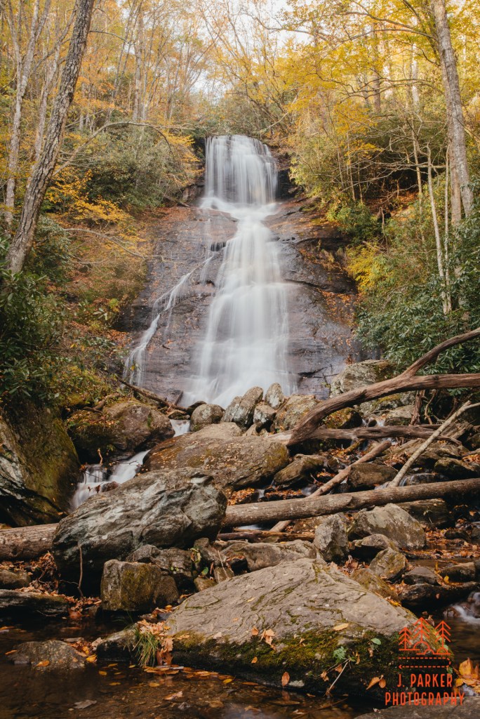
When I pulled into the small roadside pulloff near the fall there was already sunlight starting to stream in on the partially exposed fall. I was not the first vehicle there, and there was another photographer setup on a rock partway up the fall. The photographer saw me and offered to vacate the rock for my benefit. I thanked them but told them I was fine. They were here earlier than me, they deserved to do that they wanted. Aside from a person-free fall, I had hoped to see some fall color surrounding it. I had driven NC215 three days ago and there seemed to be some color surrounding the rock, but it was getting so dark I couldn’t tell much, nor did I even notice when I actually passed the waterfall. Disappointingly, everything around the fall was starkly barren, but there was somewhat of an interesting sight with the rocks surrounding the fall being nearly completely covered in leaves. The fall itself was somewhat interesting, with the largest part of the upper tier being some distance away, and with it gradually tumbling through a variety of drops till it reached the road, where it sharply dropped as it passed under the bridge.
A light wind shook the barren trees a bit this morning. I made the best frame of the fall I could while excluding the other photographer. It wasn’t very inspired, but once I saw that conditions weren’t great I was merely going through the motions, already looking towards my hike. Nevertheless, I wanted to see the lower tier if only for my own curiosity. There was no trail down, just a somewhat steep rock hop, and by the time I got down to the bottom with my bad hips I felt extremely fortunate that I hadn’t fallen. I ended up precariously standing in the water with my tripod, and was disgusted when I saw the streaming sunlight creating unsightly blotches on all my shots. In my physical condition, I really couldn’t frame well in this environment, and I decided that I’d feel good if I merely got out of the situation with myself and camera intact. I clawed my way up hill and finished the drive to the trailhead.
I would drop my car off at the Flat Laurel Creek Trailhead, but I wasn’t quite finished with the road myself. I started my hike with the required half mile roadwalk to reach the Mountains to Sea Trail for two reasons. For one, I wasn’t entirely sure when I would finish the hike, and walking the winding road with no real shoulder and limited sightlines for vehicles was dicey even in the daylight, much less getting dark. Two, I hate ending my hikes with a boring roadwalk when you’re exhausted and just ready to reach your vehicle. To my surprise, I kind of enjoyed this bit of roadwalk. NC215 marks a scenic course winding between much taller peaks, and the view that was nice from a car was hardly less so from foot. After a bit of hurried walking I reach the Mountains to Sea Trail crossing, and I darted into the woods to the left, knowing very little of what would this section of the trail would be like.
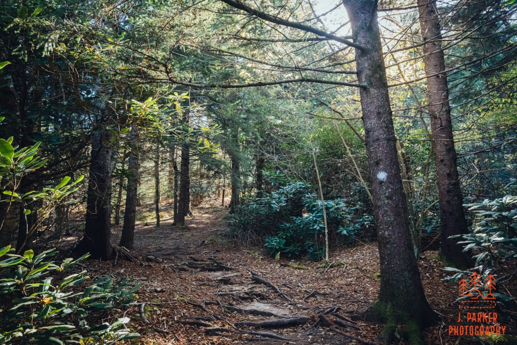
As it turns out, it was quite nice. I was almost immediately greeted by what I call “fairytale forest”. If you hike a lot at higher elevations in the Appalachians, you’re very aware that coniferous forest is not exactly uncommon. It absolutely permeates places like the Smokies and Mt. Mitchell. It’s never ugle, but can often appear rather uniform and monotonous. But then there are others than stand apart from that and just appear to have a certain magic. The first place I encountered that was Panthertown Valley, but I got the same feeling along these first sections of the Mountains to Sea Trail. I had been thinking this trail segment, which wasn’t known for any specific highlight, to be just a means to an end to get where I really wanted to go, but much to my surprise I actually enjoyed this as much, or more, than anything else I hiked this day.
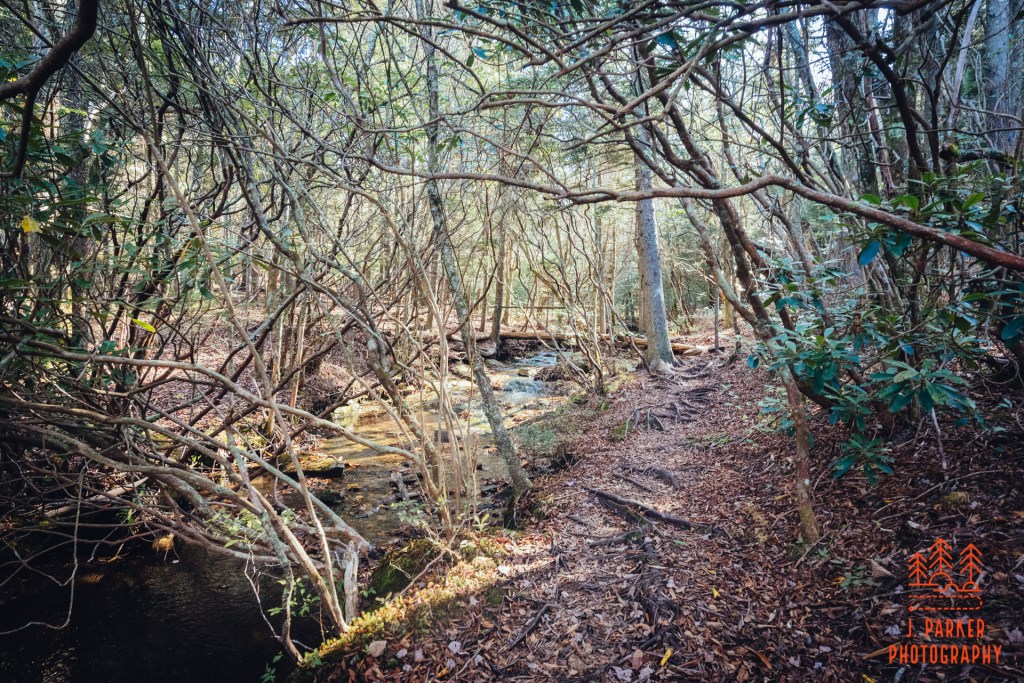
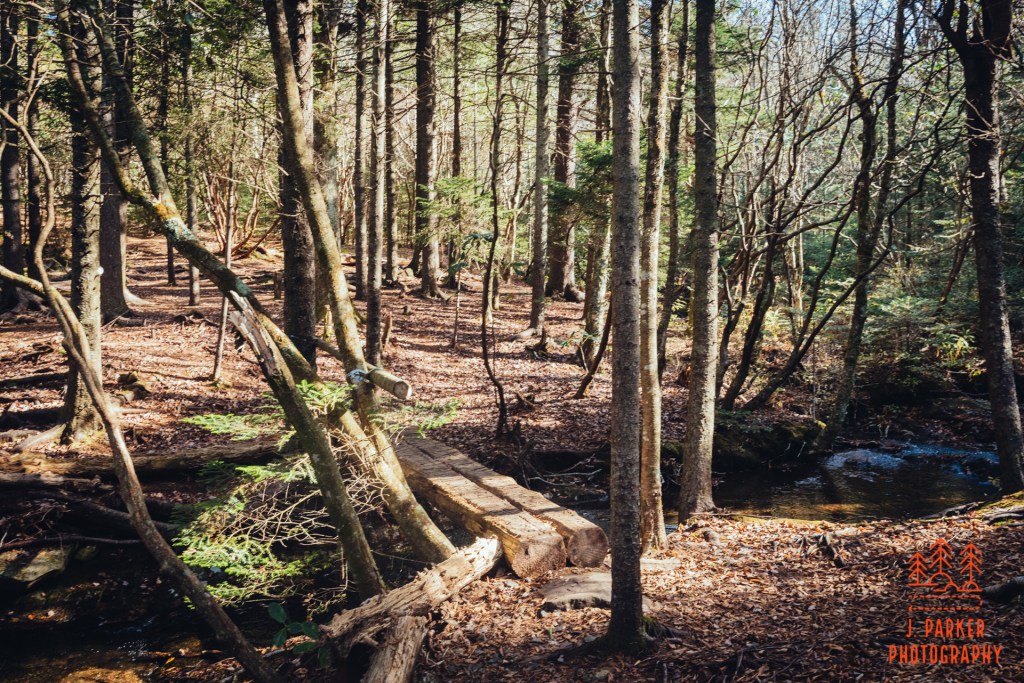
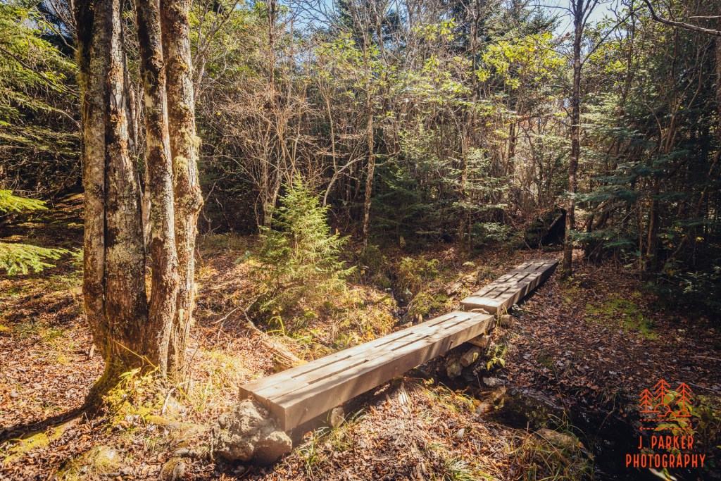
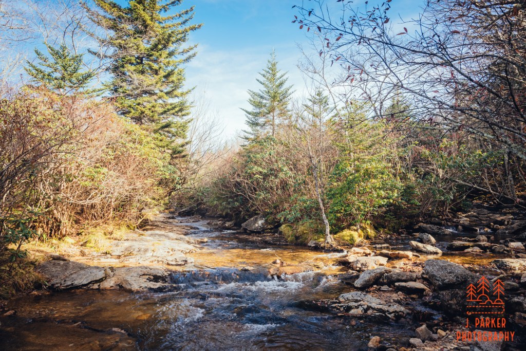
I was soon greeted by the welcome sound of a creek flowing. For a short time the creek was out of view, but then the trail began to parallel the creek. This was a nice treat, since I didn’t really follow up if there were any creeks in this section of a trail. After it paralleled the creek a short distance a short bridge took the trail across the creek.
Ahead the trail navigated around a large rock face, with a peek of views to the left of the trail, with the Blue Ridge Parkway’s path faintly visible. The views weren’t exceptional – in fact, in other seasons they may have been completed obscured by foliage. As it was, coming before any other views in the trail, it was still a nice trail component. I gave some thought to climbing at least partway up the slope of the rock, and I certainly wouldn’t have been the first. As it was, the passage wasn’t going to be all that easy in my physical condition, so the reward wasn’t really there just to have marginally better views. I moved forward.
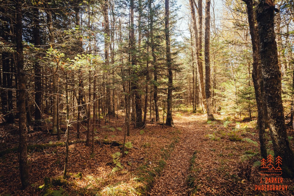
Ahead was more fairytale forest. Sunlight made this part of the forest glow golden as I made my way through to the smell of Christmas trees. While normally I’m very averse to sunlight in the woods, the coniferous forest always seems to trap and reflect it quite well. Ahead the trail curved in an out of small tree-dotted meadows. These were just isolated patches, far different from the largely open Flat Laurel Creek Valley I was heading towards, but they added a nice dynamic to the hike. I reached familiar ground when I walked a short boardwalk section which crossed a small creek. I recognized this from my hiking three days ago, where I had hiked a section of the Mountains to Sea Trail from Devil’s Courthouse to Silvermine Bald. I would be doubling over part of that hike today, but only briefly, for not long after the Devil’s Courthouse connector came in, I reached the Little Sam Knob Trail, where I would diverge from that.
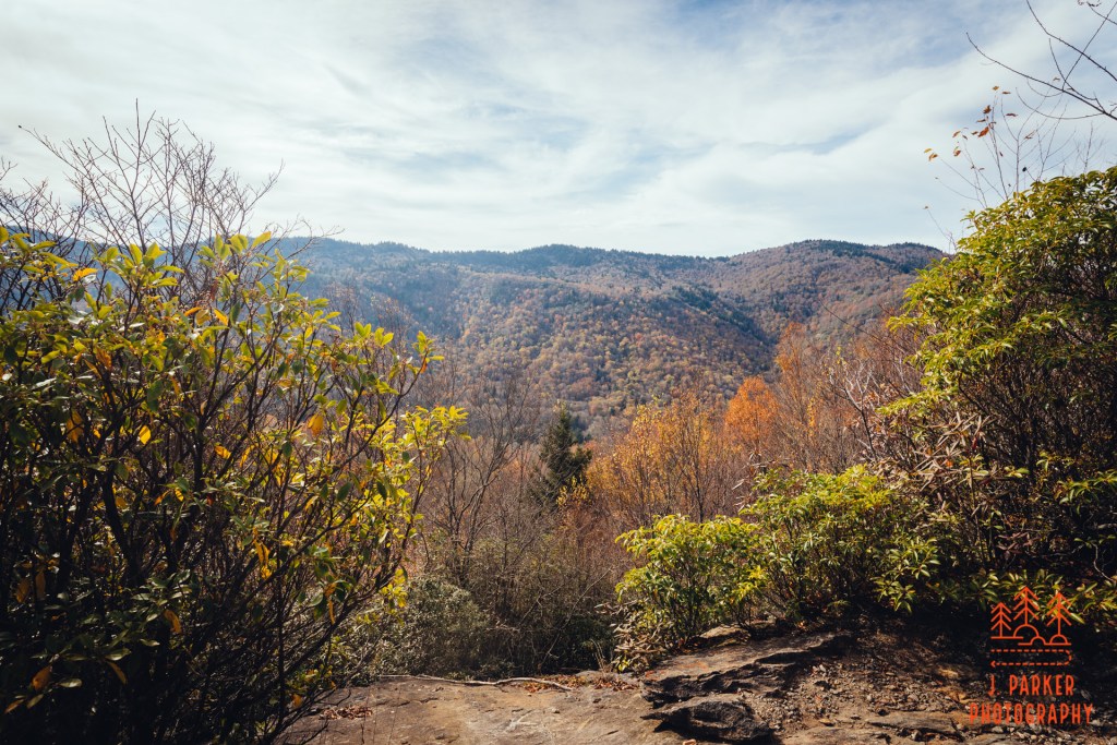
Three days ago I had taken in the large rock that sits near the Little Sam Knob and Mountains to Sea Trail junction, but didn’t see a way to climb up it. I found out there was a way up it in the most concrete way possible; I saw two hikers at the top. I began talking to them and they helpfully pointed out the way up, which ended up being the place I had eyed three days prior. I just hadn’t felt comfortable trying to scale the rock on my own, without knowing it could be safely done, but once I saw two were already up there, found that it was scarcely all that challenging. As it turns out, the men were of the search crew for the missing hiker. They weren’t from the area, and while on the rock they were serving the dual purpose of getting an elevated view so they could see observe more areas, and they were also getting an elevated view….just because it was an elevated view. I discussed with them that I’d been in the area three days ago and today, but hadn’t seen any solo hikers like the one missing (by this point, the hiker’s face was well known to me, having been plastered across many news articles and in many hiking groups). They were called back to assist in another part of the search, leaving me alone on the rock. As the rock wasn’t very tall, there wasn’t necessarily a massive unobstructed panoramic view, but I was afforded nice looks at Little Sam Knob and some other adjoining peaks, and this was another nice bonus to my hike.
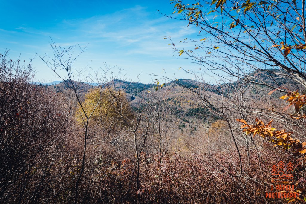
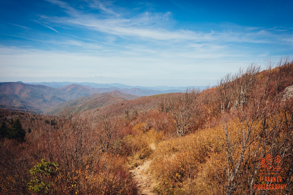
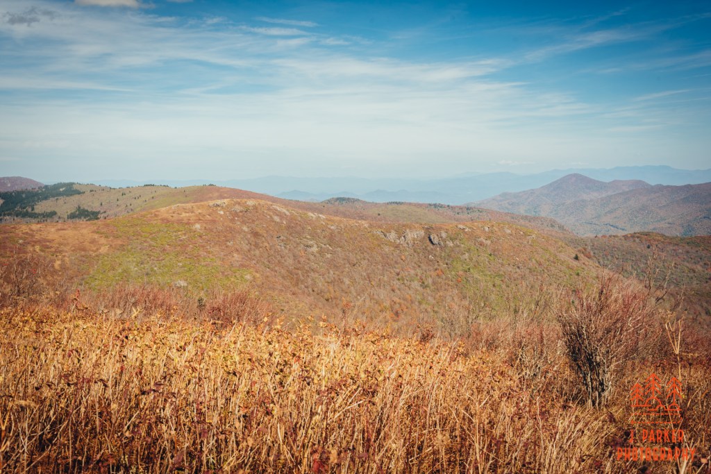
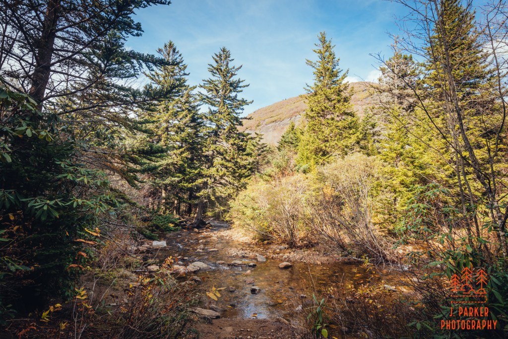
Back on the door, I was entering a segment that would feature more views as is scurried around the edges of Little Sam Knob. Nothing was of the type like found at Sam Knob, Black Balsam, or the other peaks with massive vistas nearby, but these subtle views added another nice element to the hike. I was disappointed to find there were so few leaves left on the trees. In fact, I’d say it was a net negative overall on my hike. But this was another portion that, owing to the season, I got fairly unobstructed views at. After skirting Sam Knob I crossed a creek, no doubt a tributary to Flat Laurel Creek, which I was much anticipating encountering.
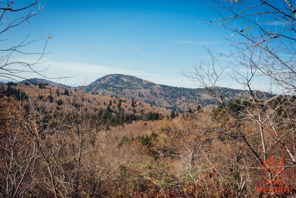
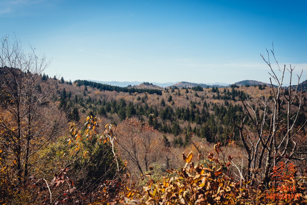
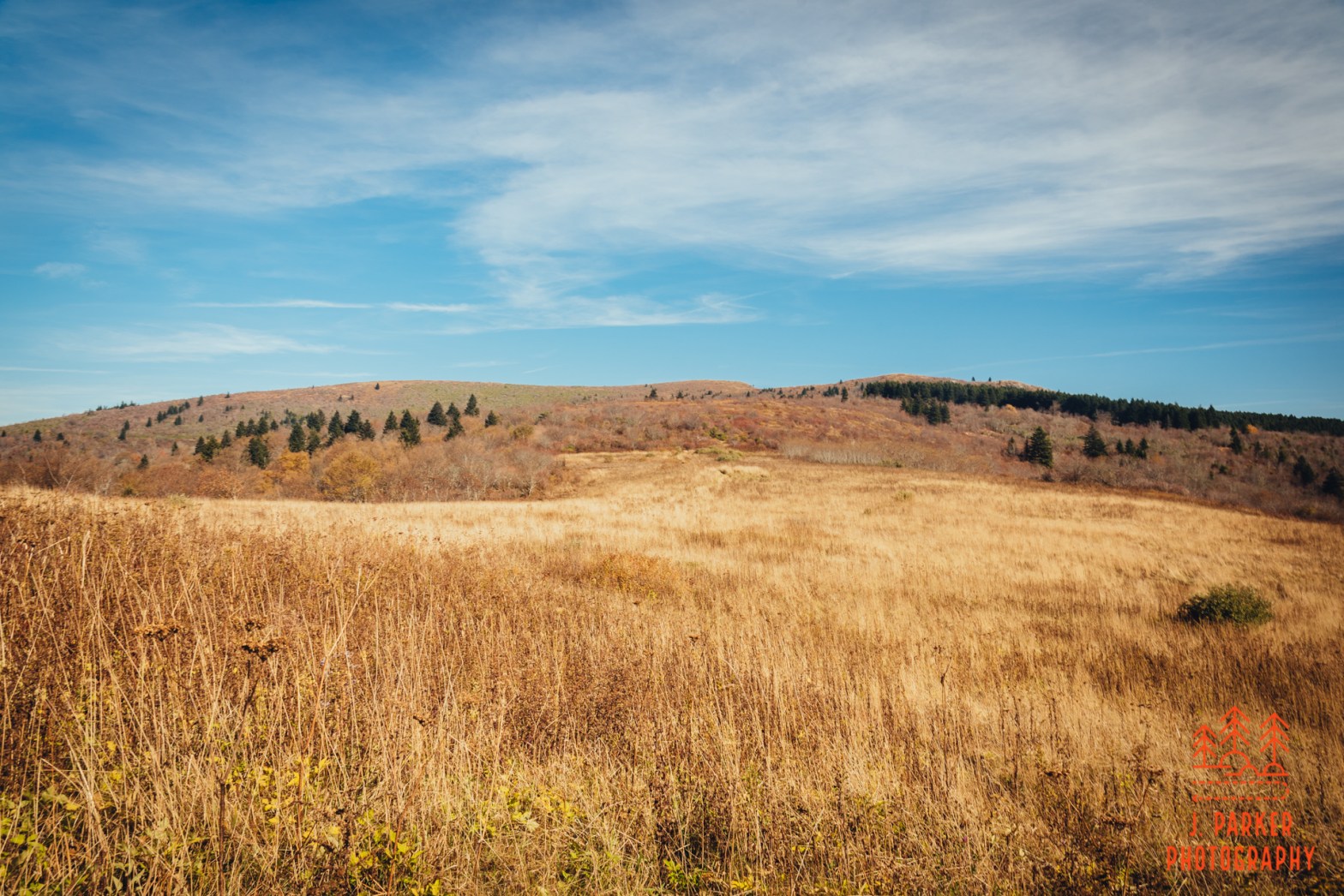
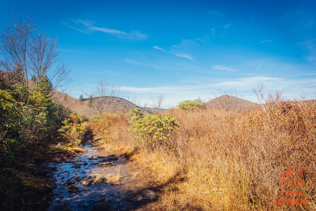
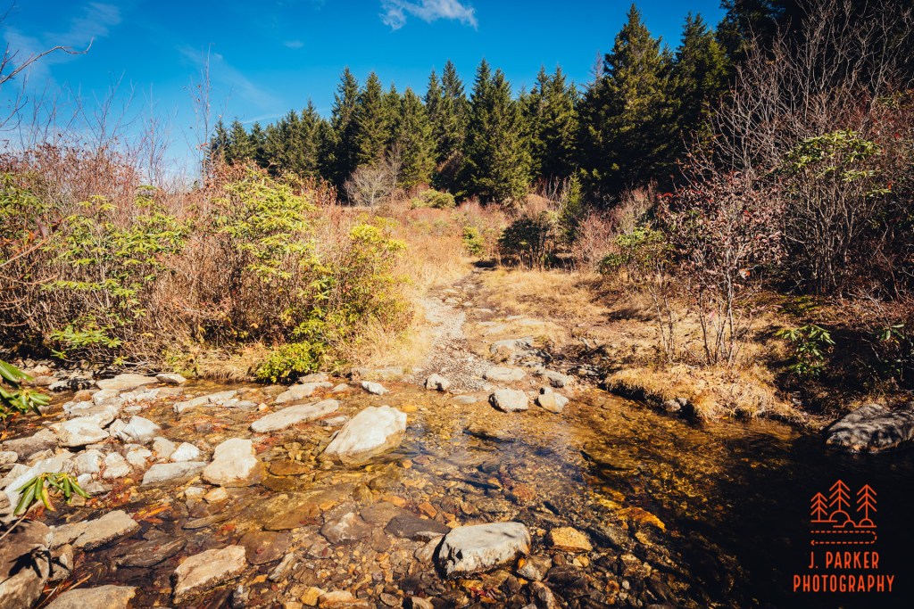
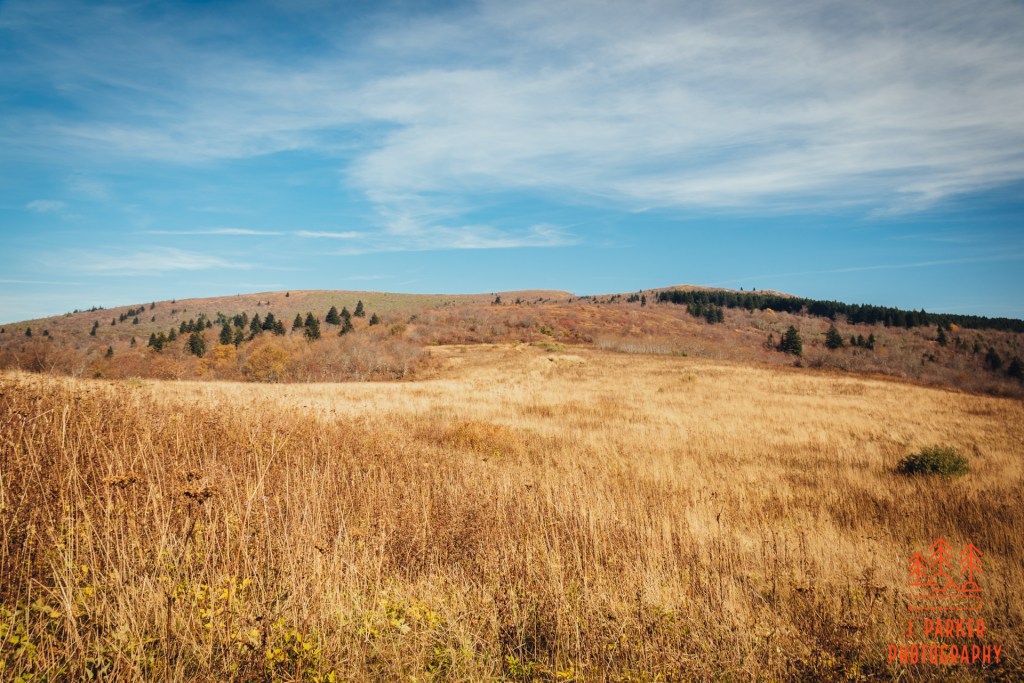
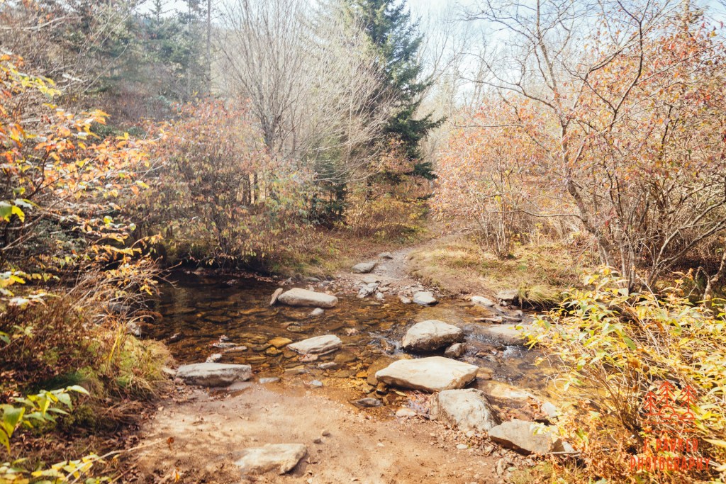
I met the Flat Laurel Creek Loop after dropping down in elevation where I entered the relatively level valley of Flat Laurel Creek. Enough bonus views – I was starting what I thought of as the main event. This section of trail wasn’t part of the portion I’d been able to hike in July before spraining my foot. While I was excited, it had a rather inauspicious beginning. I was hoping for more of an open feel, but I felt very enclosed by a lot of surrounding brush, and wasn’t overjoyed by the watery footpath, either. After walking a bit I started to get some views towards the open valley and Black Balsam to my left. Eventually things open up a bit more, and while there wasn’t much to see in front of me, looking back I started to get a view of Sam Knob to the right and Little Sam Knob to the left.
Ahead, I crossed a shallow creek. While there was a fair amount of brush outside the trail, by this point there were almost no trees of consequence. This wasn’t exactly the open meadow I had been envisioning, but there was at least a sense of the surrounding area to be had at all times. The trail, which roughly resembles a square on the map, began to turn to reorient itself towards the imposing Black Balsam ahead. I encountered a small clearing which appeared to serve as a campsite, and I took advantage of the clearing to get the best view of Sam Knob and other peaks to the West. From here, Sam Knob had a conical shape, while every previous view I’d gotten of the peak showed its trademark double hump look.
As I was leaving the campsite I encountered a small crowd of search and rescue personnel heading along the trail towards me. They were gradually spreading 10-20 yards apart on the trail, preparing to all go off trail into the interior of the valley in line to canvas the area. Here I felt a little awkward and guilty, for while I knew that the Black Balsam parking area, just a short distance ahead, was their headquarters for the search efforts, I hadn’t really envisioned that I’d be getting in the thick of their search efforts, with news articles indicating they were centering their efforts on areas on the other side of Black Balsam from where I’d be hiking. On top of that, I was a solo male hiker of a similar age range, and though I didn’t really resemble the missing hiker, from far away that might not be easy to see. I couldn’t do anything about that now, and it’s not like I had entered any officially closed areas or anything. I just tried to be as unobtrusive as possible as I slinked by the people doing their job.
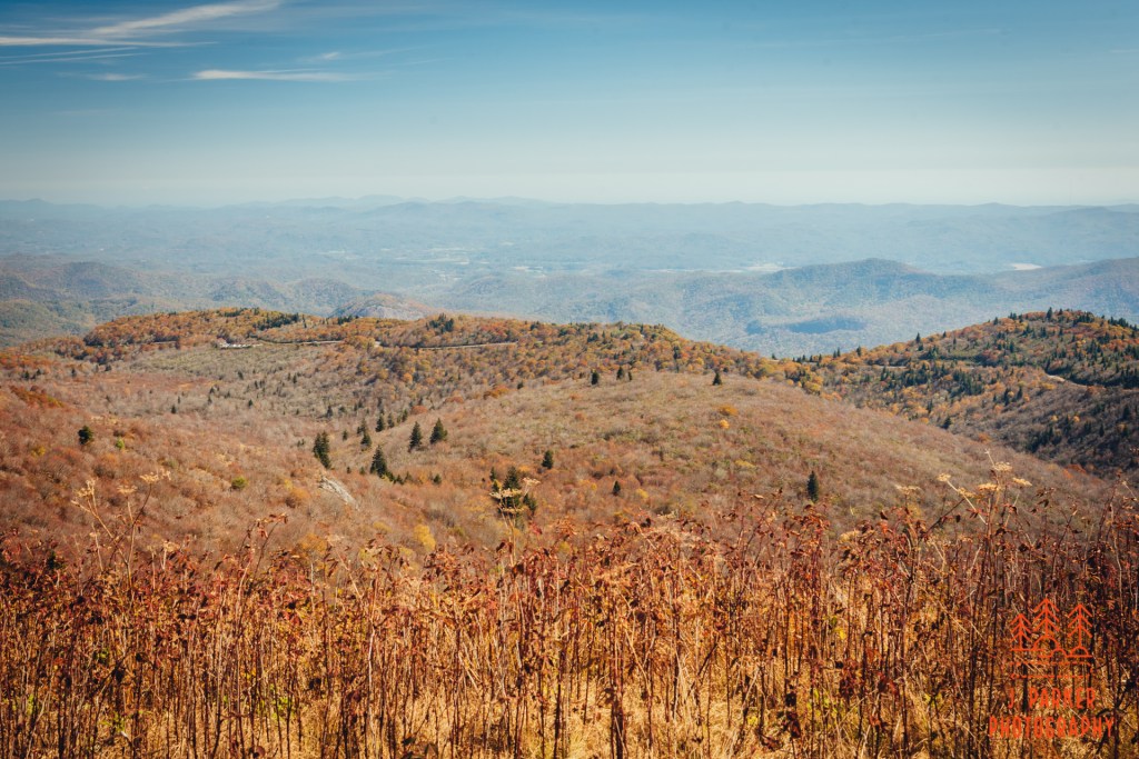
As I finished the segment leading to the Black Balsam parking area I was in the high point of the valley, and thus I had better views that I had gotten so far. Most of these views were of Sam Knob, which while nice, they weren’t near as good as the views to be found on the portion of the loop I had gotten to hike heading to Sam Knob in July. I had already gotten to hike a fair share of what I had left undone when spraining my ankle, and I was beginning to find that maybe I hadn’t really left an untapped gem when I had to short it months ago. But there was one thing I knew along this hike that was as good as anything anywhere, and that’s Black Balsam.
Black Balsam, or at least the path to it, lied just on the other side of an awkward parking lot crossing from me. I wasn’t 100 percent sure I would be doing Black Balsam, not because I didn’t want to, of course. I was sorely disappointed I hadn’t been able to re-visit three months ago. But Black Balsam would be crossing a Rubicon of sorts – once I did that, I was committing myself to making the longest single hike I’d ever done in the mountains. It would be out and back spur from where I was – there was no shortcut to get back from Black Balsam to my car along NC 215. But, as far as anyone can everyone feel with two bad hips, I didn’t feel that bad – at least I didn’t feel worse than I anticipated. And there really wasn’t much in the way of climbs at all on the way back. I had envisioned doing at least Sam Knob or Black Balsam to add some “wow” to my hike. I had done Sam Knob three months ago – it had been three years since Black Balsam, three years in which I had nostalgic memories of that first visit. I was in.
If I had an invisibility cloak, I would have worn it as I crossed the Black Balsam parking area which had been converted to an emergency operations center. I quickly made my way across to the Ivestor Gap Trail, which I would be on for a very short distance unless I reached the Art Loeb Spur, as the main Art Loeb Trail crossed the road about half a mile up the road from here. This would be a new approach for me, as the first time I had taken ascended the knob via the Art Loeb. The way that path traversed an evergreen forest before making a gradual and easy open ascent to a promontory on Black Balsam was part of the “magic”. I was hoping for a similar experience on the connector trail.
I wouldn’t find it.
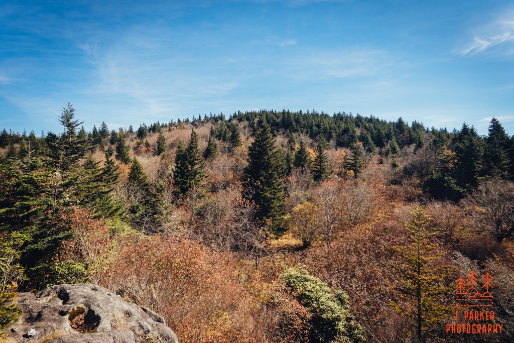
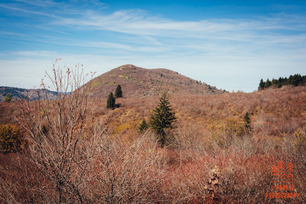
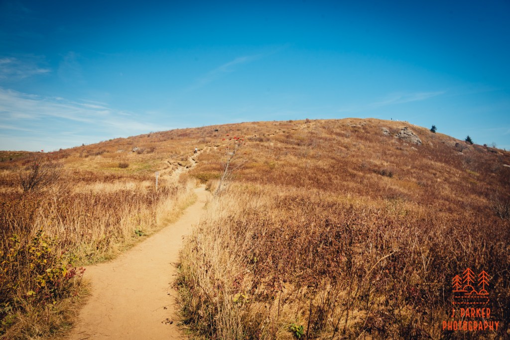
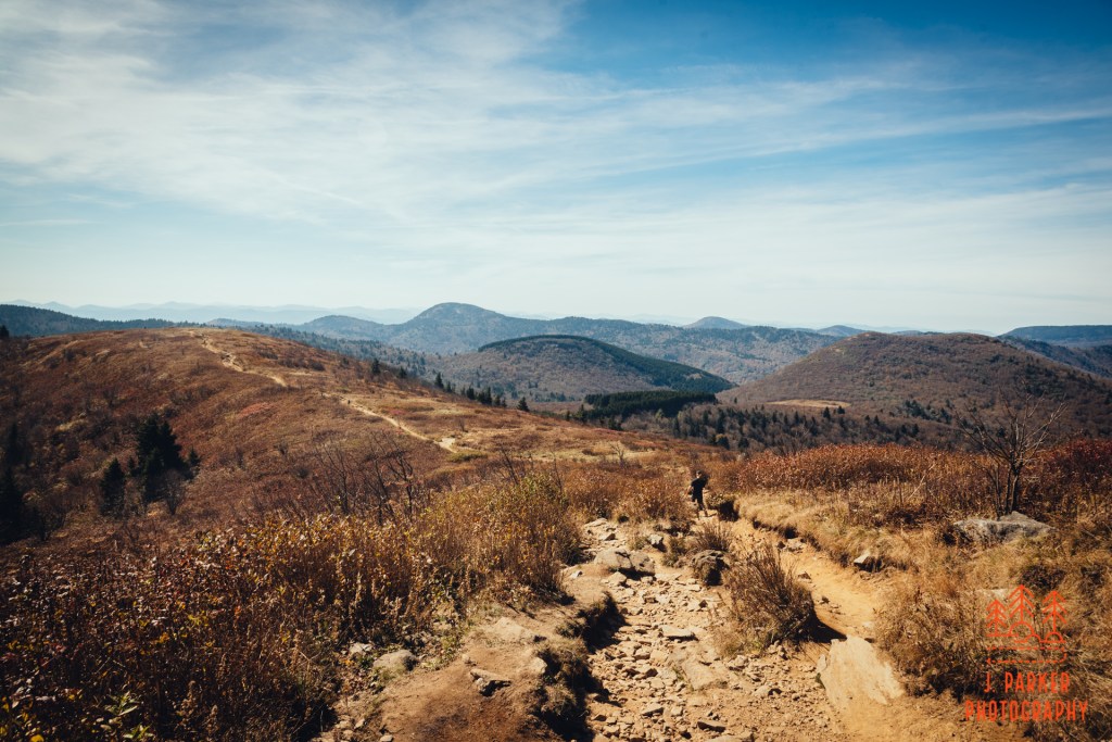
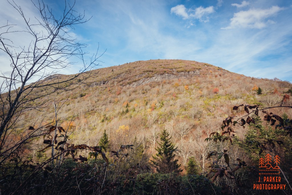
Not that the Art Loeb Connector was the worst trail segment I’ve ever done. It’s just that it had the feeling of being a slog to some extent, with a rough and narrow footpath at times traversing nondescript lean forest. It just wasn’t magical. I got winded for the first this day as I made the ascent through steady switchbacks. Finally I began to break out of the ugly dwarf forest and into open area which offered views taking advantage of the prominence of Black Balsam – if I looked backwards that is. But mostly I just wanted to move forward so I could be done with the steady ascent.
At some point towards the top several paths diverged and headed towards different parts of Black Balsam’s flat expanse. I would find later that I had deviated from the official path, but no matter – the joy of Black Balsam is that there are endless well-defined paths to take, all in an open area easy to orient in. I finished the final climb to the top, anticipating the same overwhelming sense of wonderment that I experienced on my first trip. But I experienced something very different.
Everything on Black Balsam was if I’d never left three years ago. I had come at the exact time of year, and the color of every single piece of foliage and every flake of grass might as well have been the exact same. When I looked through the camera viewfinder, a much nice lens and camera setup than I had in 2017, it was like I was looking at pictures I had already taken. Because by and large, I had. It was like being in a dream, but the thing with a dream is that you aren’t always supposed to experience them in real life. I had come here three years ago with my wife and had a life-changing experience. Here I was, alone, and while the views hadn’t changed at all, the person whose eyes were beholding them had changed a lot.
Maybe it wasn’t that I was ever hoping to return to Black Balsam at all. Maybe I was just hoping to return to what I was and how I felt in 2017. But I wasn’t that same person anymore. I had come here in 2017 having experience few mountain hikes, and certainly nothing with the views of Black Balsam. And I had at the time returned to normal health and unrestricted physical activity after spending that entire summer dealing with my initial hip injury. But I wasn’t ever going to be that same person again. I was a man who took every step with the knowledge that I had prematurely entered into the phase of my life where I’d be living with permanent affliction.
While I felt very alone not having anyone to share this experience with again, I wasn’t necessarily alone on the wide summits of Black Balsam. The activity and closures surrounding the search for the missing hiker had lessened but not eliminated the crowds. Still, it was a far cry from the usual torrent of people – and a far cry from Hawksbill Mountain the day before. I looked at the other people with envy. Maybe they were having their own life-changing experience. Maybe they were as blown away as I was. on first visits.
Maybe they hadn’t wrecked their hip at 32 and ended up with a dysfunctional hip by 35.
I wasn’t about to pick up and leave just because I had found that being on Black Balsam just brought my current life crisis to the forefront. I had come a long way to get here – both just the journey from Florida, and also the long hike I had taken. I still made my way across the expansive summit area to take in all those great views. And from this I was able to reframe a bit of what I had experienced in 2017, where I had come away amazed at what I had seen without necessarily remembering the blow by blow of the hike. So for all the weird feelings this brought back, at least I had that little benefit.
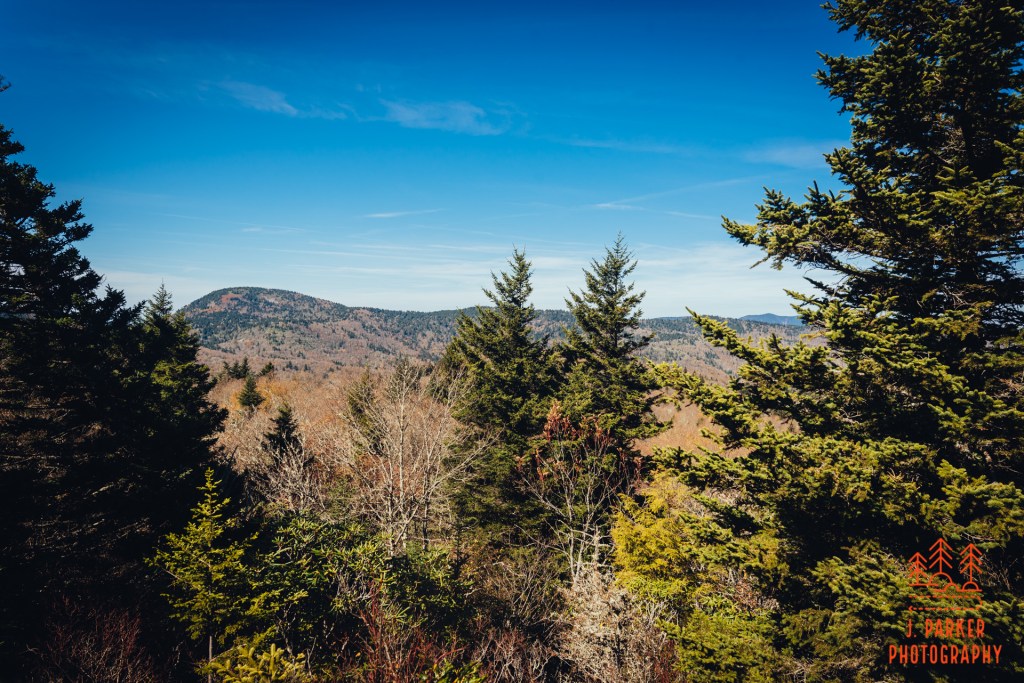
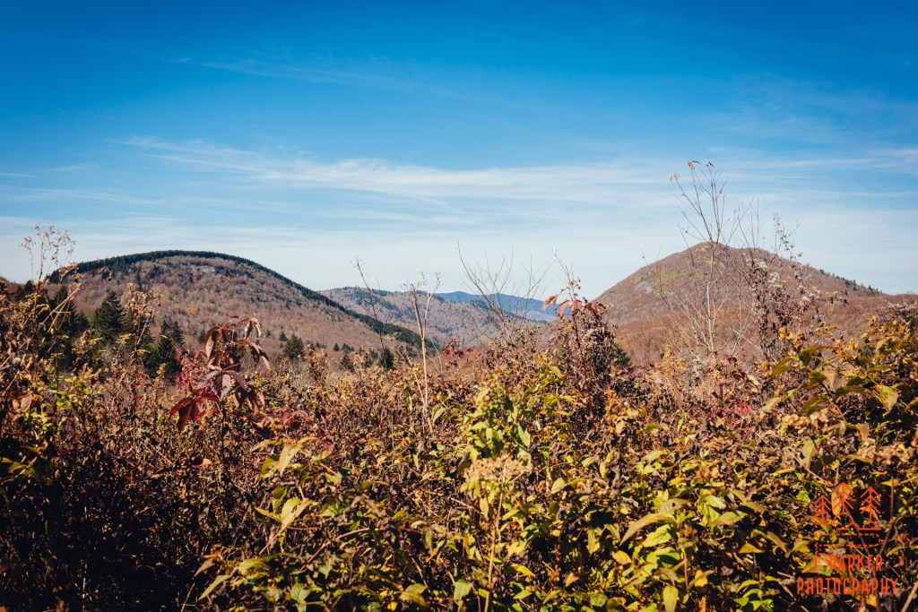
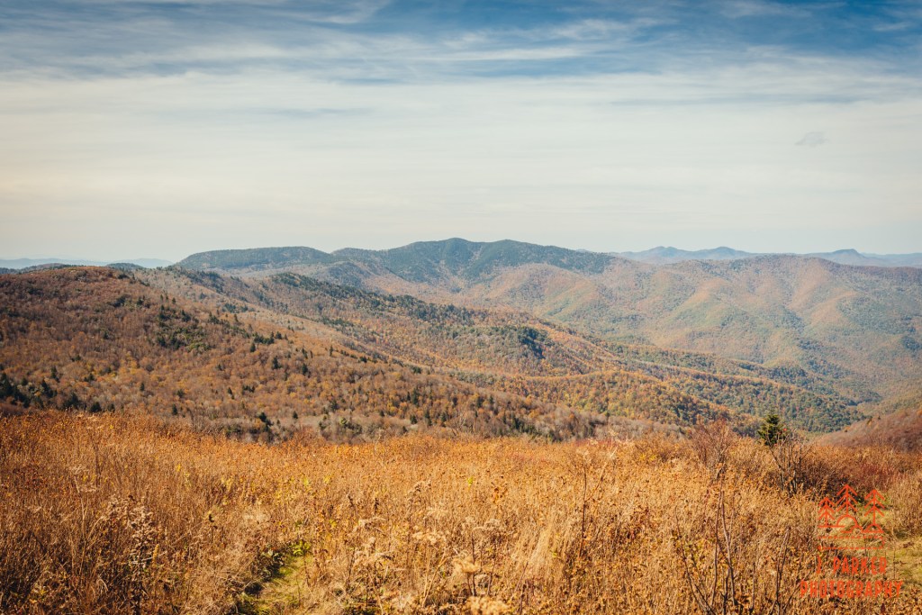
I did feel like I was reconnecting with an old friend when I laid eyes upon Tennent Mountain, a peak not as easily seen or identified from afar like Black Balsam as it is tucked away behind the other peak. For as much as Black Balsam provided in 2017, my favorite part of that hike was ascending the comparatively narrow but open spine of Tennent Mountain, with massive views on either side. My brain flirted with the possibility of re-visiting this one, and my hips were so accommodated to pain at this point that adding a few more miles would have been just a little more. But the bigger investment would have been time – and it seemed ludicrous to spend so much time on this when I had no idea what nice sections of trail might lie ahead where I would want to spend more time.
I retraced my steps along the ridge of Black Balsam, a little taken aback at having had such a lukewarm experience despite being on one of this part of Appalachia’s best wonders. I no doubt would have felt a bit different had my wife and I returned here in July as anticipated. The different season would have provided a different spectacle. But in my rush to make up for failing to complete that hike, I had overlooked that it might not fill me with the warmest feelings to experience the same exact views, or how coming back would influence that. But like a lawyer who accidentally attended a zoom court hearing with a cat filter, I was prepared to move forward. And I was not a cat.
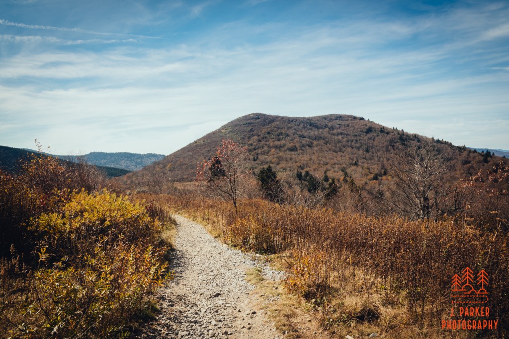
I was eager to get back to territory that felt far more fresh. After returning along the Art Loeb Connector to surreptitiously hike through the Black Balsam parking area. I met up with the Sam Knob Trail. If I needed any confirmation at how different seasons could result in a very different experience along the same trail, here was my reminder, for I was now treading a path I had taken 3 months ago, only instead of a wealth green foliage seemingly racing towards the sky to be the first to grab energy from a sun ray, there was sparse brown vegetation and a feeling of openness. Sam Knob’s welcoming double humps created a striking backdrop as the wide trail navigated a gentle curve past a campsite.
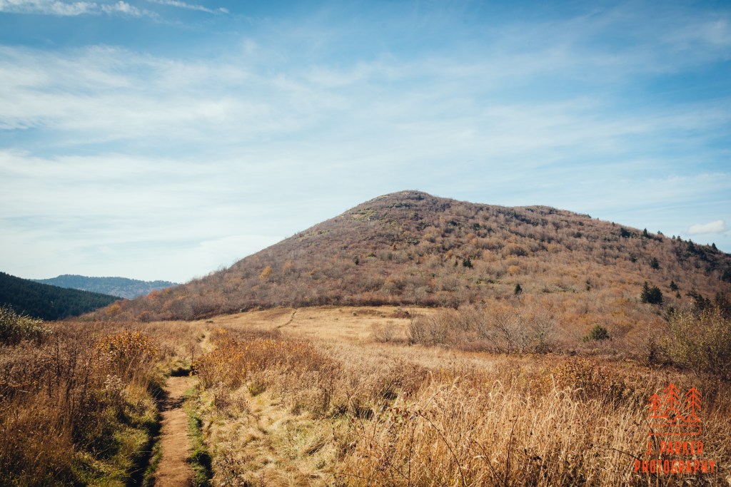
Up next was one of my favorite parts of the hike in July, an area I call “the meadow” (not just “a” meadow) which you approach on a descending boardwalk which empties you out into the open area at the foot of Sam Knob. If anything, this area was even more impressive with the multiple shades of the season providing a romantic feel. In summer the thick grass lining the pathway had wanted to rip my trekking poles from my hands as I traveled through the area. Here, my only impediment to quick travel was the sometimes eroded channel. In no time I found myself where the trail to Sam Knob’s summit veered off, and unlike Tennent Mountain, I was much more seriously considering re-visiting this one. It was a far quicker and easier ascent than might seem from the ground below, and I had more than enough energy to get up and back. Unlike Black Balsam, there were actually paths at the top here which I had yet to explore, leading to viewpoints that had been just too overgrown to reach in summer.
It was an easy decision to make though. I knew that, by visiting a peak I’d just been on three months prior, I’d be trading in the opportunity to attempt high end photography along moving water somewhere. I moved forward.
I didn’t have the greatest memory of the next section of Flat Laurel Creek Trail, and I wanted to get it done quickly – but not too quickly, because my bad memories came from spraining my foot trying to move through it too fast. I took careful steps, marveling at how I had managed to traverse this (in reverse, uphill) with an acutely sprained foot, considering I still found it a bit of a challenge even with two good foot. With great relief I passed ground zero for my July foot sprain and a short distance later came across the object I was most curious about in Flat Laurel Creek.
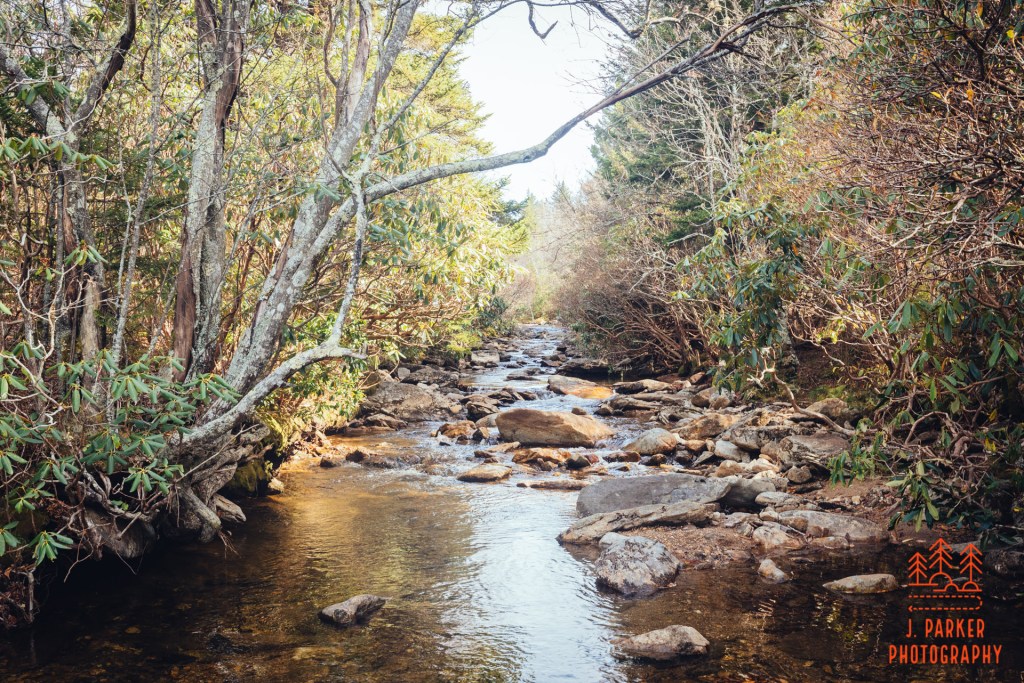
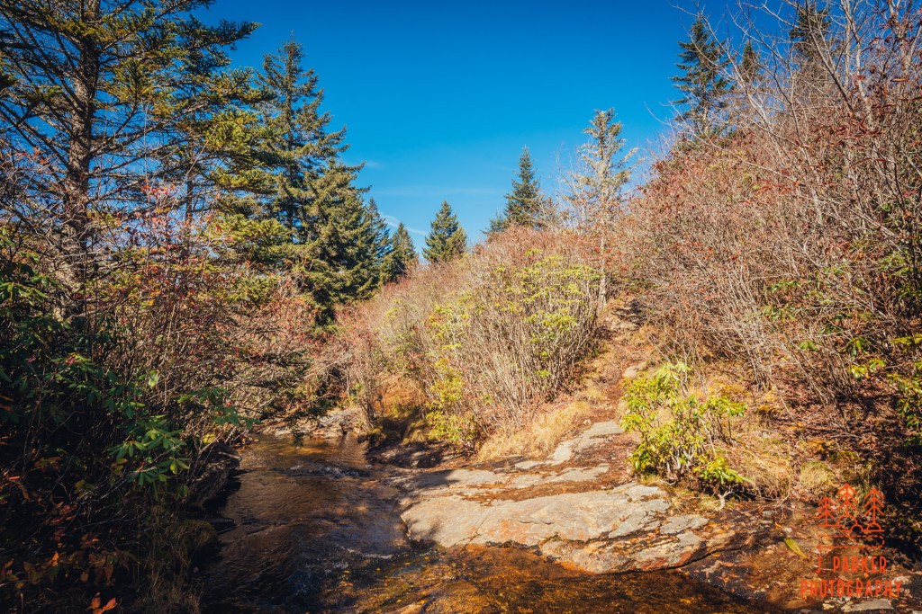
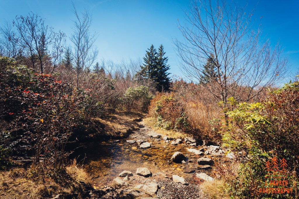
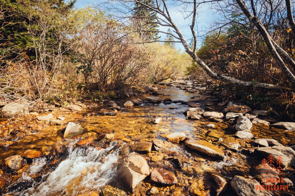
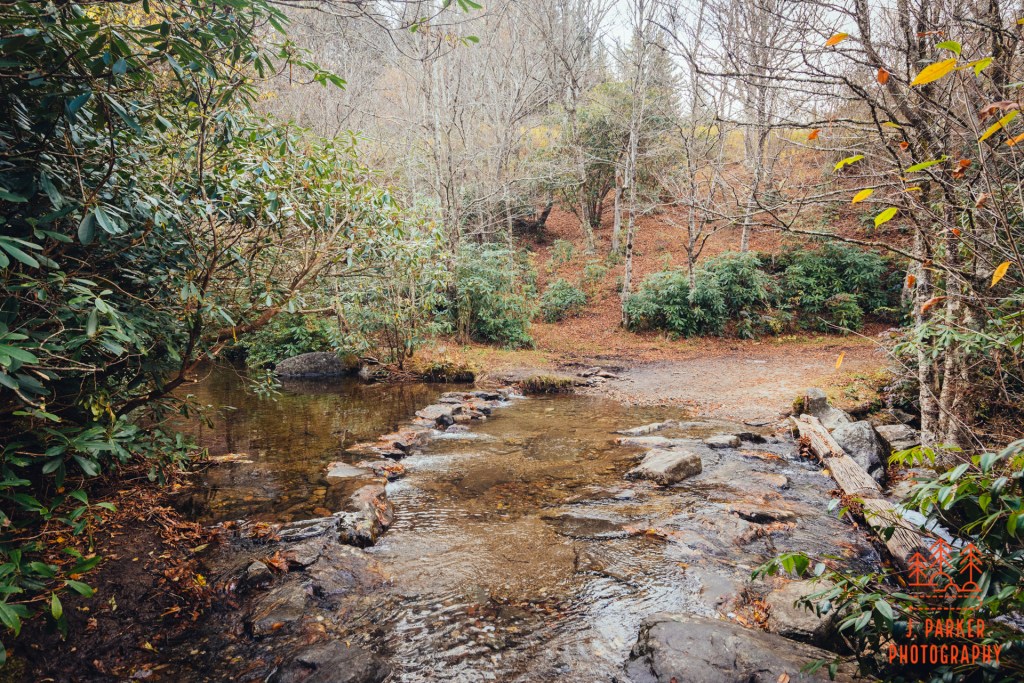
The crossing of Flat Laurel Creek is a notable part of this trail. The creek contains a rather impressive flow for being at such a high elevation. In some instances the creek can reach a level where the unbridged crossing here is difficult, but that was not a problem on this day. I was thankful I had turned around before trying to cross this one after spraining my foot, but it gave me no issue crossing its rocky course now. While in the middle I beheld its course. It was not really the type of course I wanted to photograph in depth, at least not with the current light and foliage, but it was pleasant enough.
At the far end of the creek was essentially a T-intersection. To the right was the trailhead where I parked my car, but at least for a bit I was heading left. The Little Sam Trail had come in uptrail of here, thus I hadn’t hiked some of the Flat Laurel Creek Loop. The trail, which was almost a forest road here, held close to the creek for a bit, only a small line of trees between us. I periodically peered between the trees to get an up close view of the creek. I walked down to a confluence of two creeks, with the trail following to the right of the smaller branch which flowed down a very gradual slope. I walked to the middle of Flat Laurel Creek to get a better look. I walked a but to where the trail crossed over the creek, then proceeded a bit further. I hadn’t walked all the way to where the Little Sam Trail had come in, but it began to be apparent I was probably not going to have another close creek interaction before the junction. I felt like I wasn’t missing anything monumental, so I decided I was ok with turning around here, though as I wet my feet a second time I wished I had come to this conclusion before I crossed the creek.
By now, save for that small portion I had essentially completed the regular Flat Laurel Creek Loop. As it turns out, what really makes the trail stand out was stuff I had already done in July, so there wasn’t much “wow” left, at least not after the leaves of summer and fall wer egone, it was all just a pleasant walk. I think what makes the Flat Laurel Creek Loop so interesting is the meadow in front of Sam Knob, and combining the hike with an ascent of Sam Knob, Black Balsam, or both. As a standalone, it doesn’t really belong in the echelon I was hoping for. But I still had the actual Flat Laurel Creek Trail, which operates as a several mile connector from 215 to the loop.
I passed the T junction next to the creek and entered unfamiliar territory along a low-set, muddy path, with the peak of Sam Knob soon looming just to the right. There were lots of nice creek interactions ahead, and as the light from the day started to fade a hair the spruce trees along the creek in the foreground of Sam Knob made quite an exotic view.
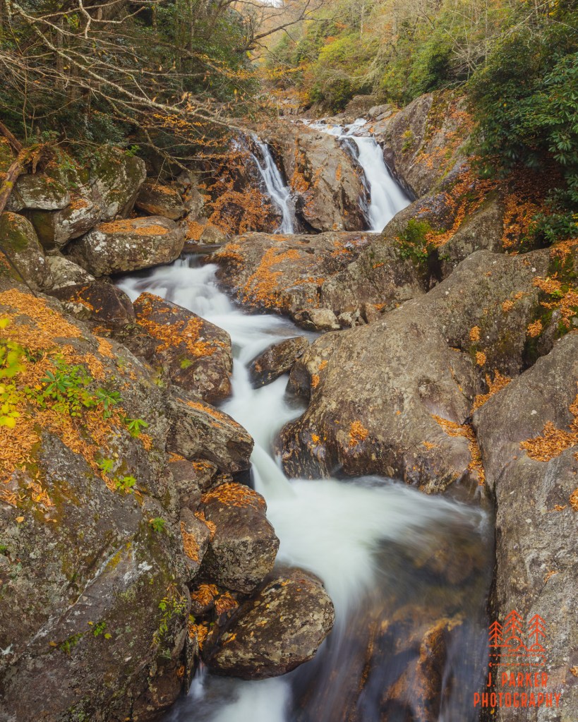
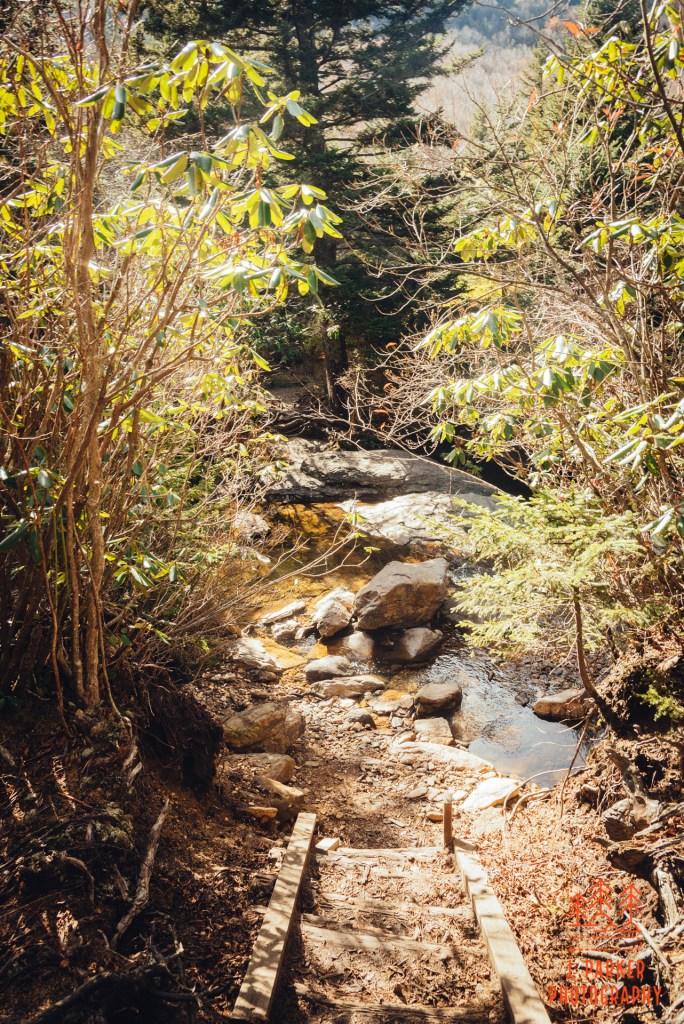
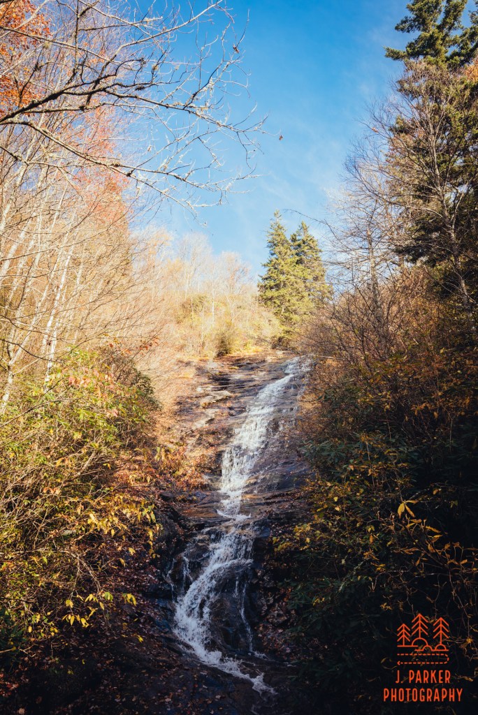
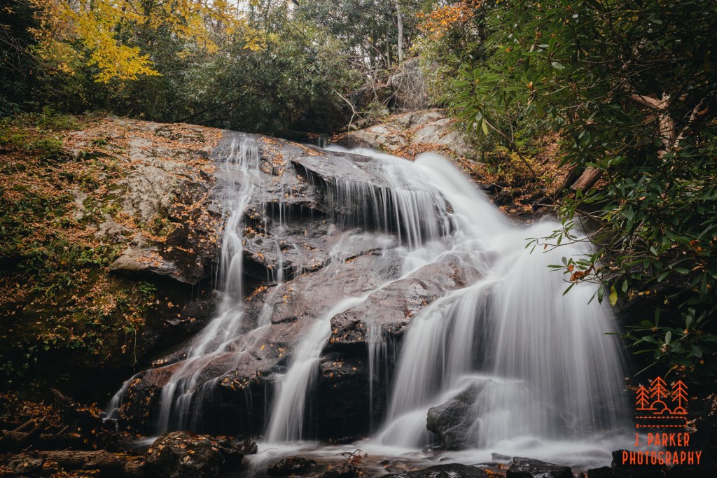
As I went further the creek began to drop elevation. I was nearing Flat Laurel Cascades, where the creek plunges out of the high elevation Flat Laurel Creek Valley to the elevations below. The trail was still running essentially right next to the creek, but I wasn’t sure what type of view I’d be getting. As it turns out, that would only be a very partial one, and not one that I could photograph. What I could see though was fairly impressive. Its plunge height was much larger than I had imagined, and I know understood why some took treacherous paths either down from the trail or hopping up the creek to get here. From the trail, there weren’t any obvious scramble path, and the height was well beyond what I would have been trying for a scramble path from this height to begin with. I was sad to go past the cascades, for after this the creek would be out of view. For at least a short time getting to peer across its gorge towards the back side of Sam Knob, which appeared quite different from this angle. The section between the T-junction and just after the cascades was actually my favorite new part of the Flat Laurel Creek area.
It was around this time that I realized that my GPS tracker wasn’t going to be much help. I really hadn’t gotten any trail guidance since the T junction, but I hadn’t much needed it with the creek just to my right. But now my navigational tool was gone, so if there was well defined unofficial trail somewhere (which I had come across at times) I wouldn’t have a great way to tell which one was the right one. I felt GREAT.
Fortunately for me, almost the entirety of the remainder of the trail was essentially a forest road. Unfortunately for me, almost the entirety of the remainder of the trail was essentially a forest road, so there wasn’t much to look at. There was a where the trail ran next to a dropoff, and the rhododendron broke a few times to give a bit of view. Aside from that, without much in the way of leaves on the trees, there wasn’t much to look at until I reached the next point of interest in Wildcat Falls.
When I had skipped Sam Knob, I had imagined spending time photographing a waterfall in the late afternoon light. It didn’t take me long at all to realize that wasn’t going to be any part of Wildcat Falls. It was an interesting moment along the trail, being a tall fall, but its height left it half exposed to the sun still, meaning I’d have to wait for better light. With a lean, low flow it wasn’t worth waiting for – I had already envisioned a fall to head to that would be a lot more photogenic, and if I hurried, I’d have enough time to see both upper and lower Dill Falls. I upped my pace.
The forest road didn’t offer much to see, but at least it allowed for quick passage. I knew I was getting close when an another small creek came into view, for the last step before reaching the parking area was a small creek crossing. As I crossed the creek, I was putting the finishing touches on an 11.2 mile hike, .7 miles longer than I had gone before on a single mountain hike, but I took little time pondering what I had done, for I was in a hurry to get to Dill Falls, a short drive away but one that involved forest roads of unknown quality.
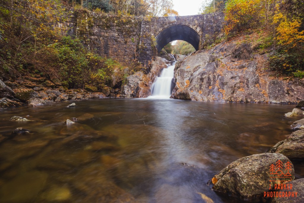
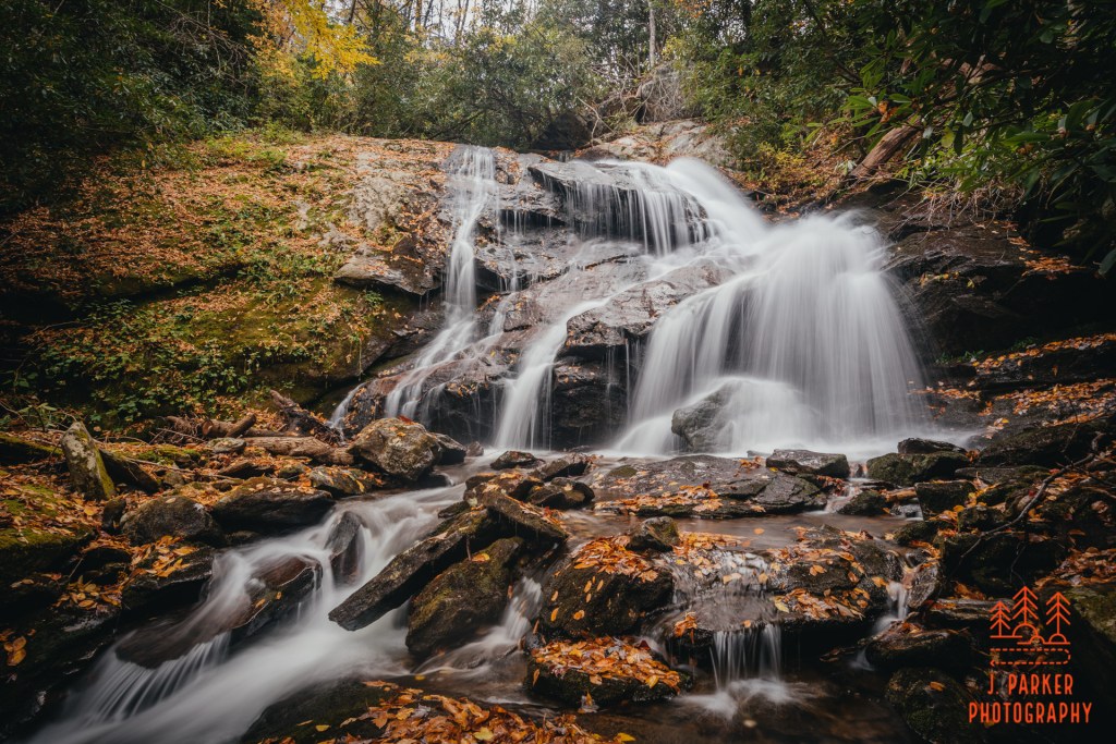
The one lane forest road off NC215 that led to Upper and Lower Dill Falls might have at one time given be anxiety, but I was well past that now. Nevertheless, it was quite tucked back, and I was surprised when the narrow road gave way to a parking area that was already occupied by a handful of vehicles. For a second I worried that people would obscure my ability to photograph the falls, but as I was readying my camera gear a rather sizeable family emerged from the trail to Lower Dill Falls, and all the vehicles belonged to them. There were separate trails to both Upper and Lower Dill Falls leaving from the parking lot, but I opted for the lower first, as it appeared to have the most easy access.
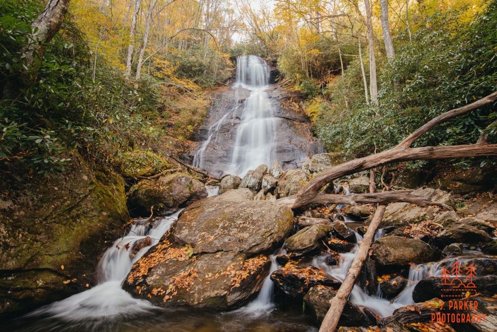
The short trail emptied out at a flat creek, but looking to my right was a beautiful fall set behind a smaller cascade covered in some pleasant driftwood and fallen leaves. And for the first time in the four days I had been in North Carolina, it seems like I had finally arrived at just the right time for perfect fall color, at least in my eyes. Shades of orange and gold highlighted the fall nicely above an understory of more lush green foliage. I had to do the hard part of actually photographing the fall, but I kind of felt like a great weight had been lifted on my shoulders having finally found fall I could photograph again with only a day left in my trip.
I really enjoyed the spectacle of Lower Dill Falls in person. I ended up being a little underwhelmed when looking at my pictures later, though, for my pictures tending to severely understate the size of its main tier. A Florida resident, I’ve been trying to get 1-3 mountain trips a year since 2017, and naturally I try to get a good selection of waterfalls when possible. Photographing them only intermittently, there are a few mistakes I’ve made a couple times, and one of them is photographing tall falls in such a way that their size is made underwhelming in pictures. Worse still, I would be in such a time crunch between my adventure days that I wouldn’t have time to review my pictures and see my mistake, and I’d repeat it the next day at another fall. Oh well.
Lower Dill Falls was so simple to get to that I had plenty of daylight to get to Upper Dill Falls, which was more challenging. The path from the parking light was a moderate climb for a short distance, but that wasn’t the issue. What was the issue was the very steep, leaf covered scramble path that was necessary to really get a photographable, unobstructed view of the fall once I got close to it. This is exactly the type of trail that in the past I would have taken one look at and said “bad idea”. Especially since I was having hip surgery in just over 10 days. But I had taken a big gamble by taking this trip in the shape I was in, and I had done some crazy things. I navigated an unmarked hike in Linville Gorge of all places, including a trail segment so steep it was laughable. I had just done the longest hike of in the mountains of my life, and done it solo with two bad hips. I had driven on mountain roads an entire day on a tire going flat. I had used an Amazon hub. I stopped at stop lights. There were a lot of firsts this trip. So I wasn’t going to let another stupidly steep slope stop me again, even if it was getting dark and I was having to go down first, uncertain of how difficult it would be to get back up, especially with a camera bag and tripod on my back.
I had one more day in the mountains, and after that I didn’t know if I’d ever have the physical ability to hike in the mountains. So I was beyond caring, and I went for it – sliding down on my butt, of course.
I was immediately glad I did. Upper Dill Falls was just beautiful. It’s the type of fall that the real waterfall guys seem to get to, but that don’t seem to be found along your every day trail – at least not since such a gorgeous, natural state, sans boardwalk viewing platform (was I now a real waterfall person?). It would have been a beautiful sight any type of year, but of course the fall color around it made it real special. It didn’t matter that, had I gotten different weather this trip, I may have gotten to visit countless other falls like this one in good photography weather. I was here now, and in this moment I was happy, and the thought that I’d be having my hip taken apart in a short time was the furthest thing from my mind. I tried a couple frames before making the difficult climb up the steep slope. It took all the energy I had, but the climb was just short enough that adrenaline seemed to carry me, and I was up and over before I knew it.
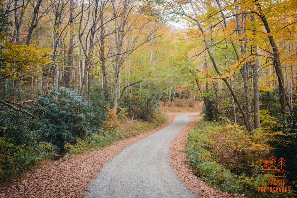
My hike had had as many disappointments as nice moments, so it was nice to feel like I ended on some good fortune. But my good fortune wasn’t quite done. I hadn’t taken to observing the road too closely on the way in, being preoccupied with getting to the falls, but I really enjoyed the way it looked on the way out. I commonly take pictures of roads in fall – their canopy often offers better fall color than you’ll see on the trail. But other than a nice snapshot to show people there wasn’t much to do with them. I had no idea that this would be any different when I got out to take a couple shots of the road here. But somehow I ended up capturing the shot I’ve been looking to get for years – a shot that had beautiful curves, lines, and color. At least to me, it was finally a shot that really showed the magic of driving a forest road in that season. I wouldn’t have much time to see this shot for some time, but I’ve grown quite fond of it.
This had been a long day with a lot of happenings, good and bad. As long as this day was, I only had one more day in the mountains – maybe my last day for a very, very long time. I had wanted to do so much more this trip but the weather just wasn’t ideal for following the rivers and creeks I wanted to do. The weather wasn’t going to be any different the next day. What I was going to do was both work with the weather, and do what I wanted to do in spite of it. It was going to be a heck of a day….
