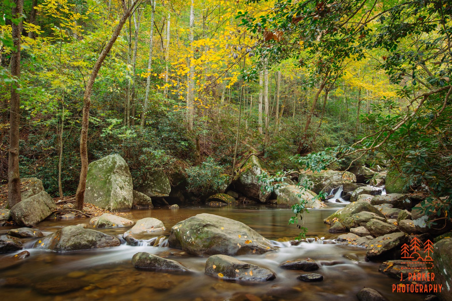
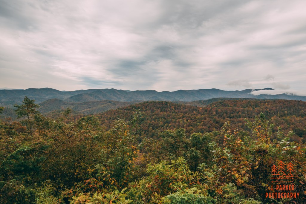
It was nearly dark as I made my way along a footpath I could barely see. I resisted the urge to use my cell phone as a flashlight, though it wasn’t because I was worried about the power consumption. Rather, I wanted to spend a moment disconnected from everything, instead in tune with the woods around me for one last moment, even if I could barely see them. Besides, the family of nearly a dozen not far behind me on the trail was providing enough occasional illumination to give me everything I needed to get back to my car. This day, my last in the mountains of North Carolina, had ended almost the exact way it started; hiking in the dark since I was squeezing every last moment of daylight I could.
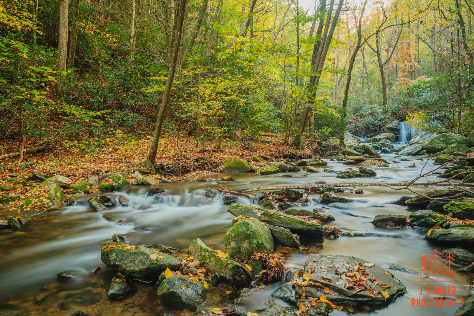
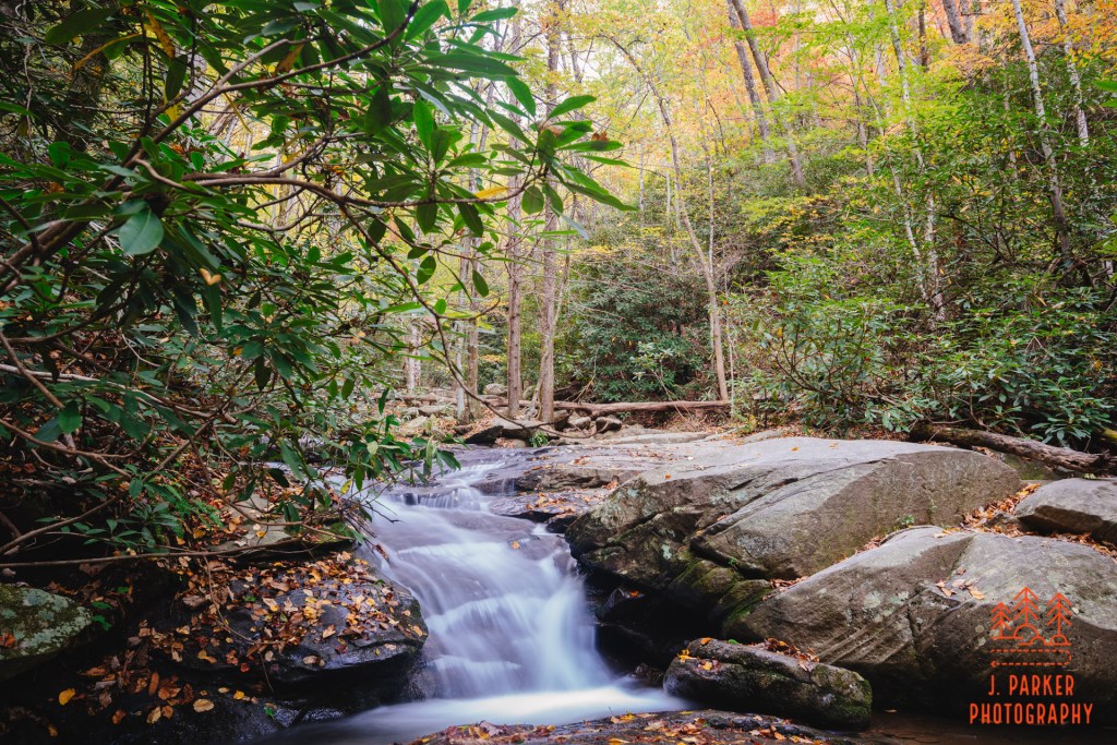
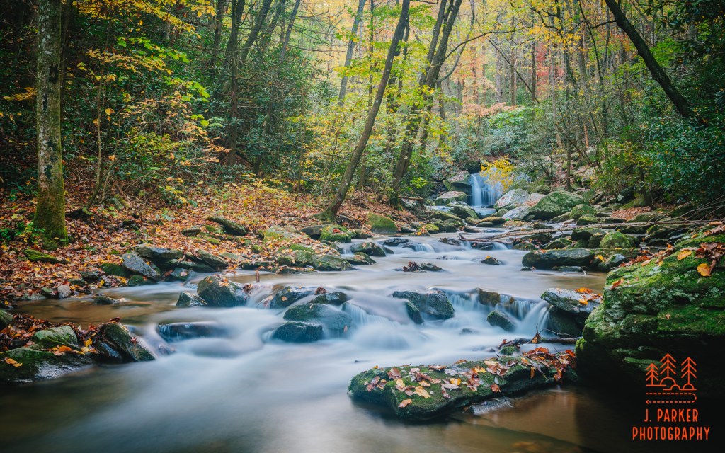
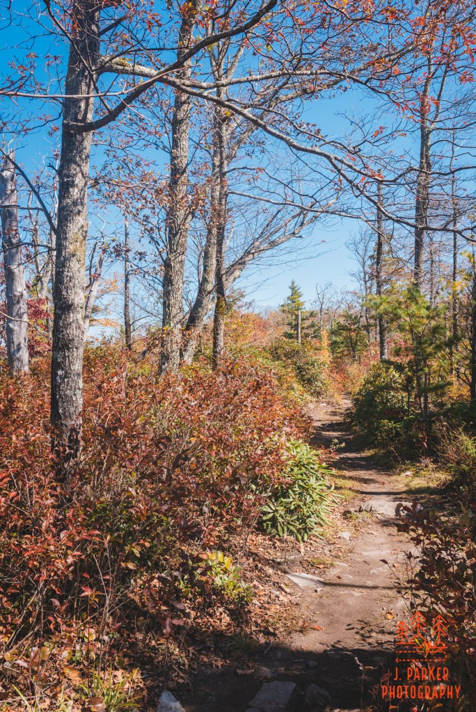
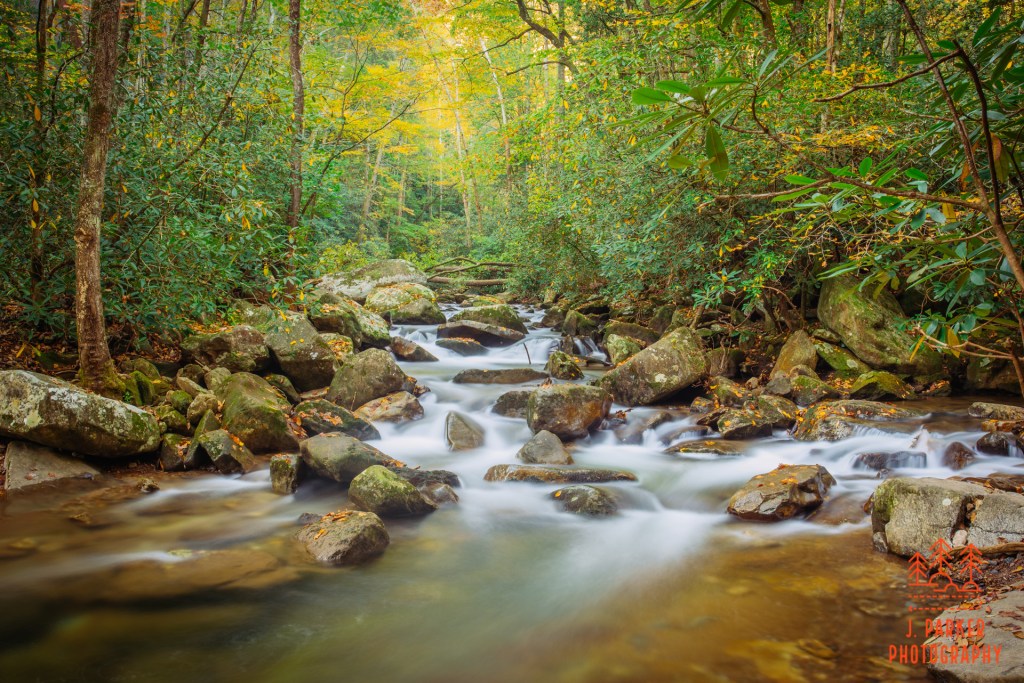
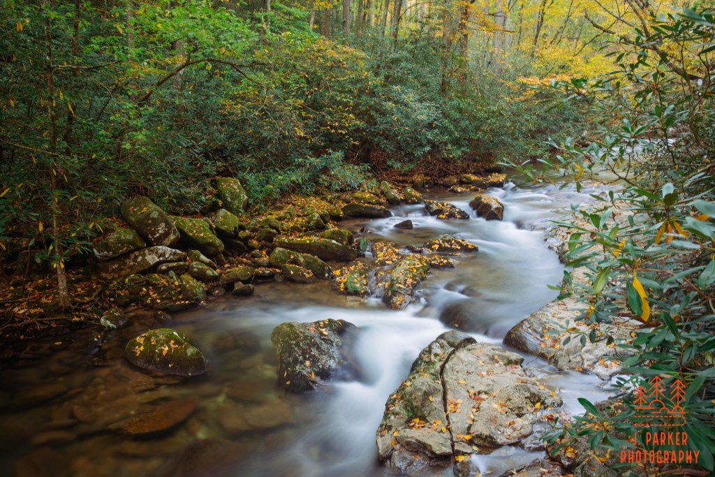
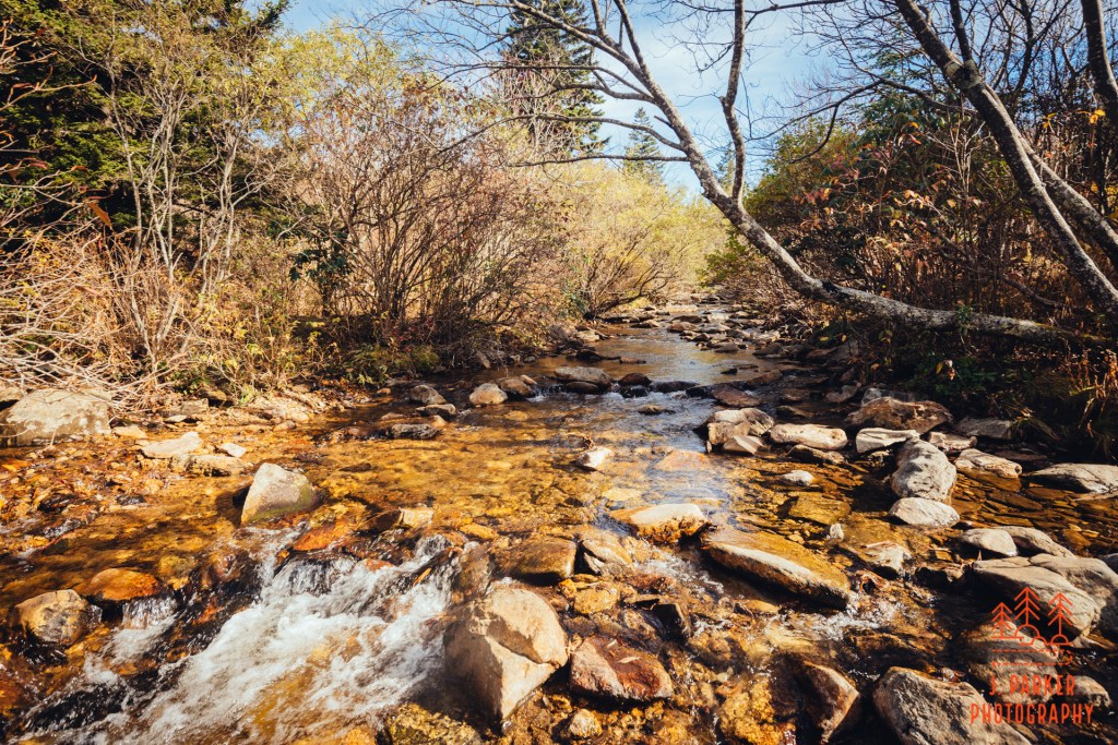
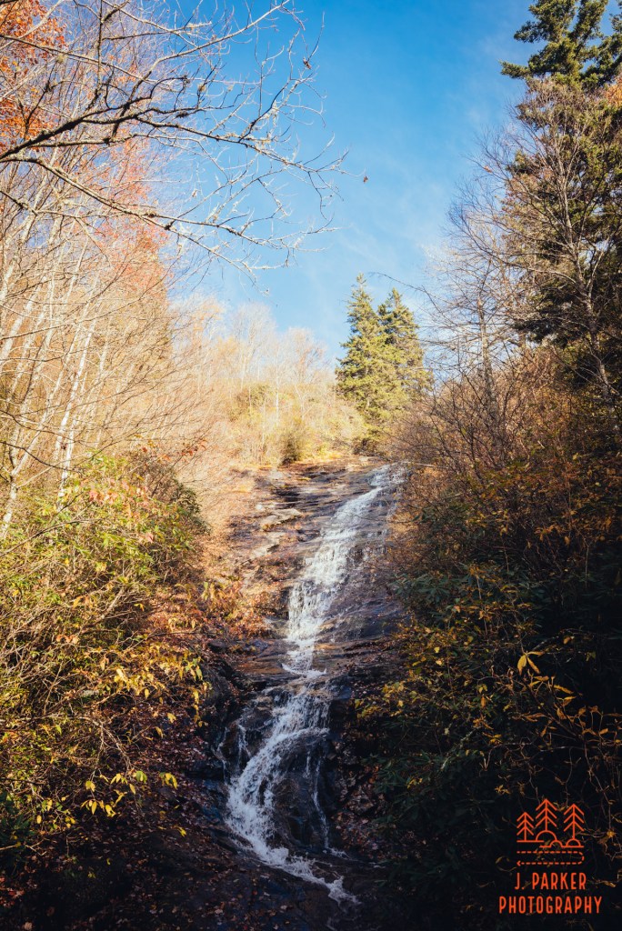
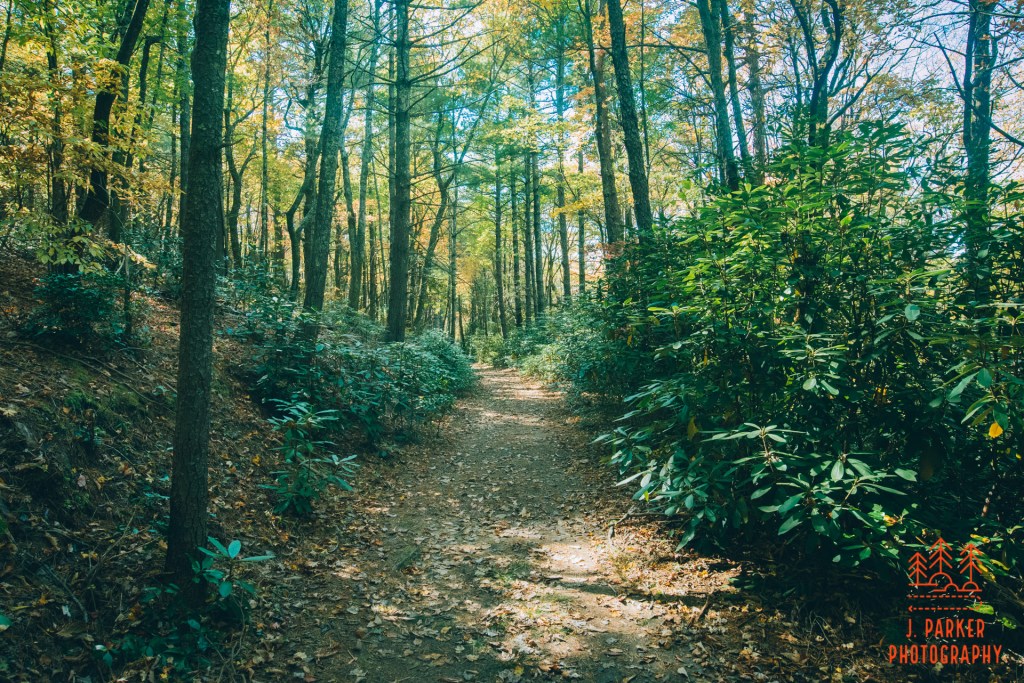
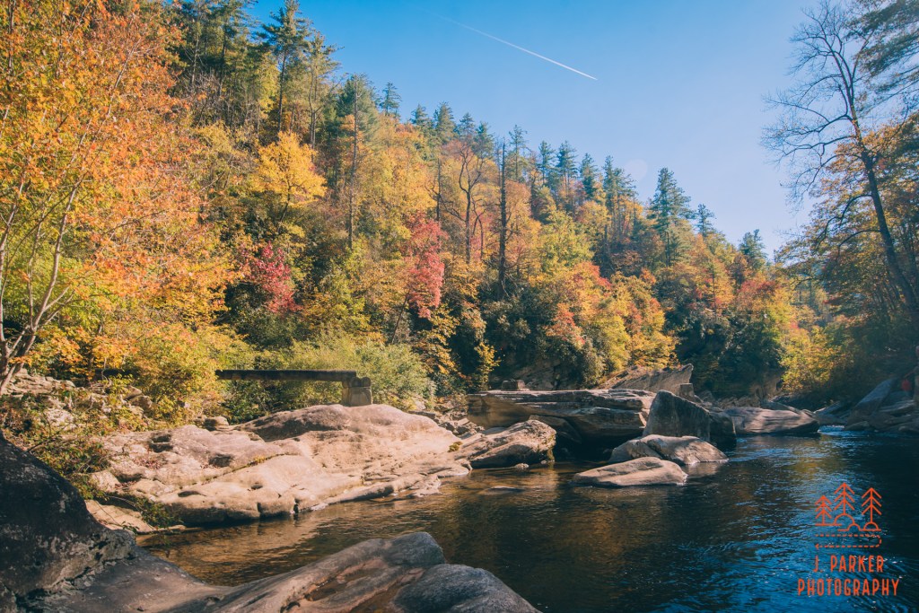
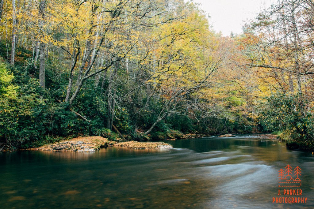
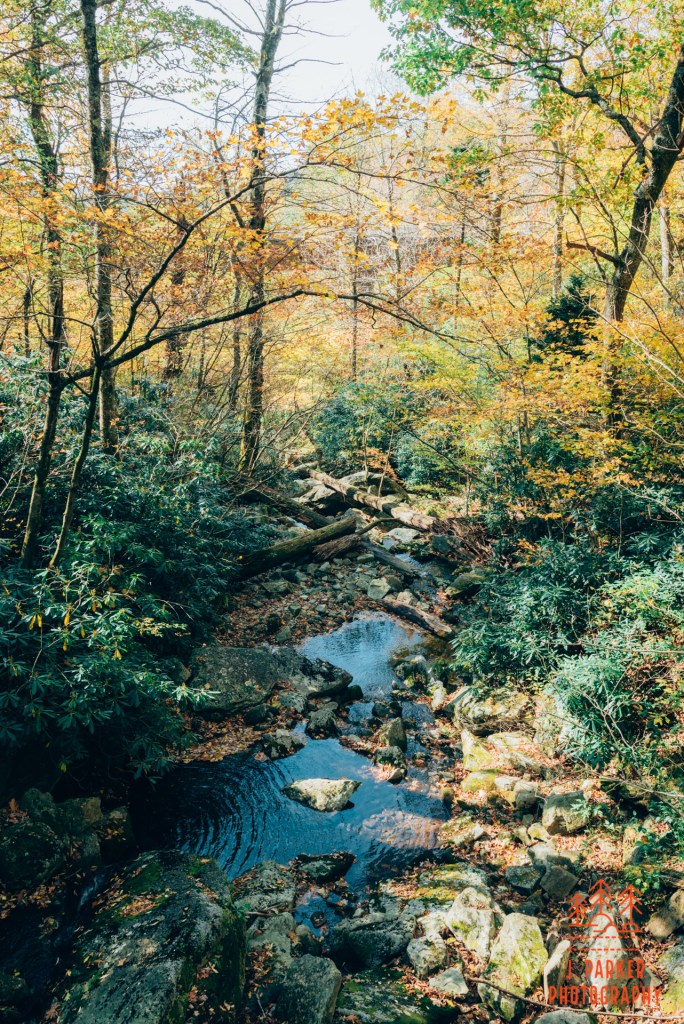
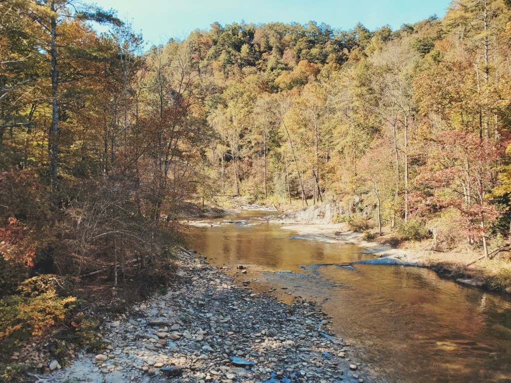
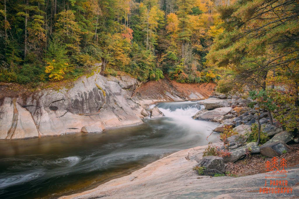
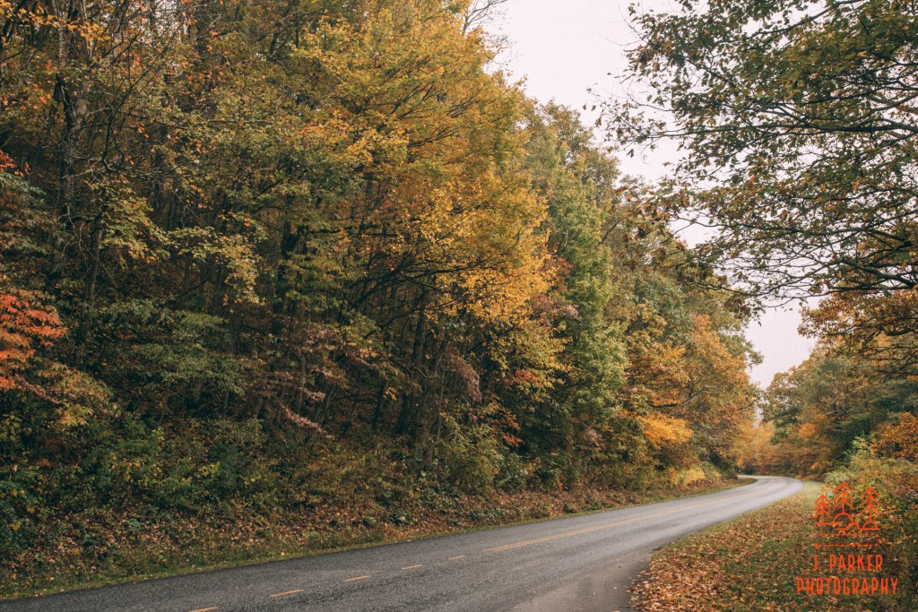
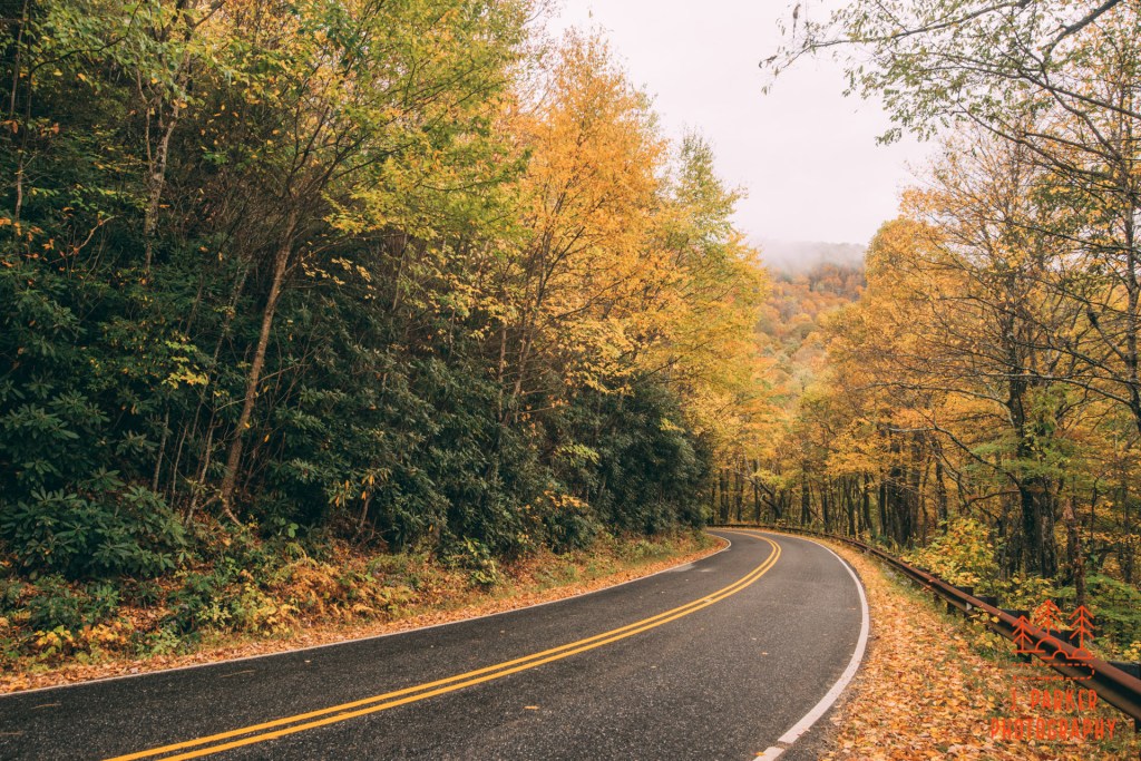
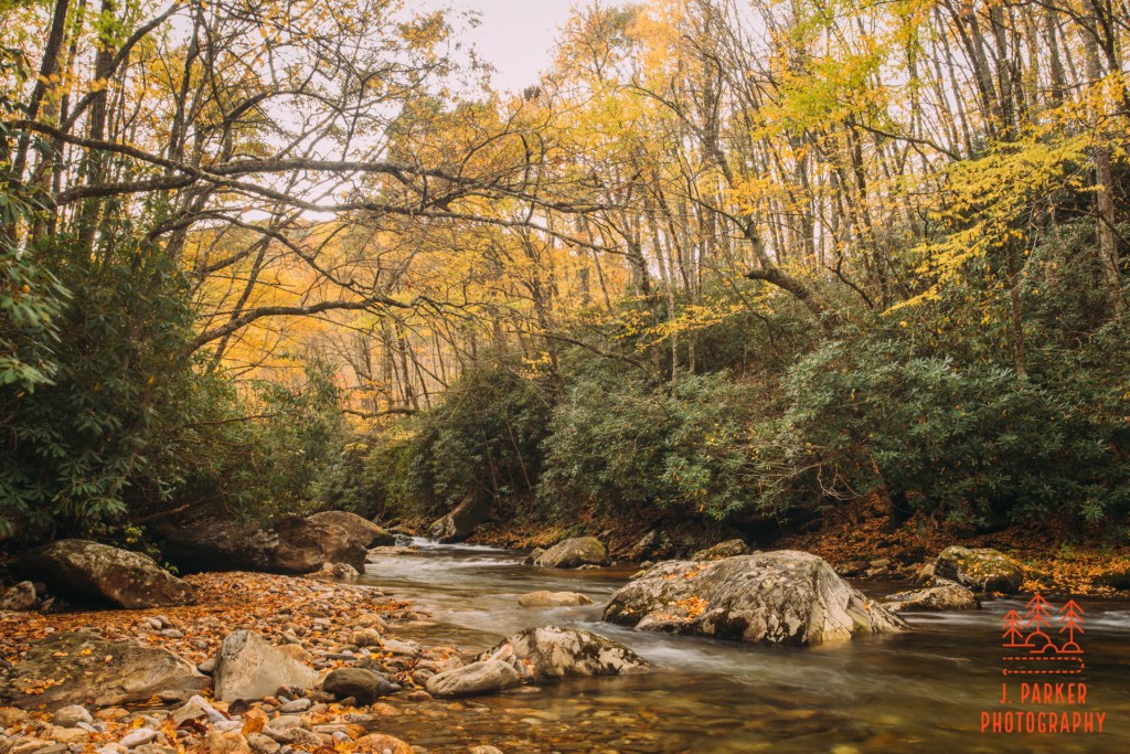
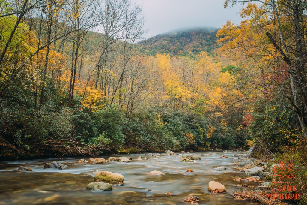
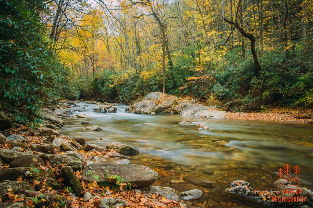
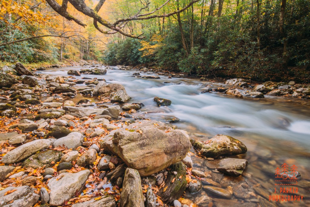
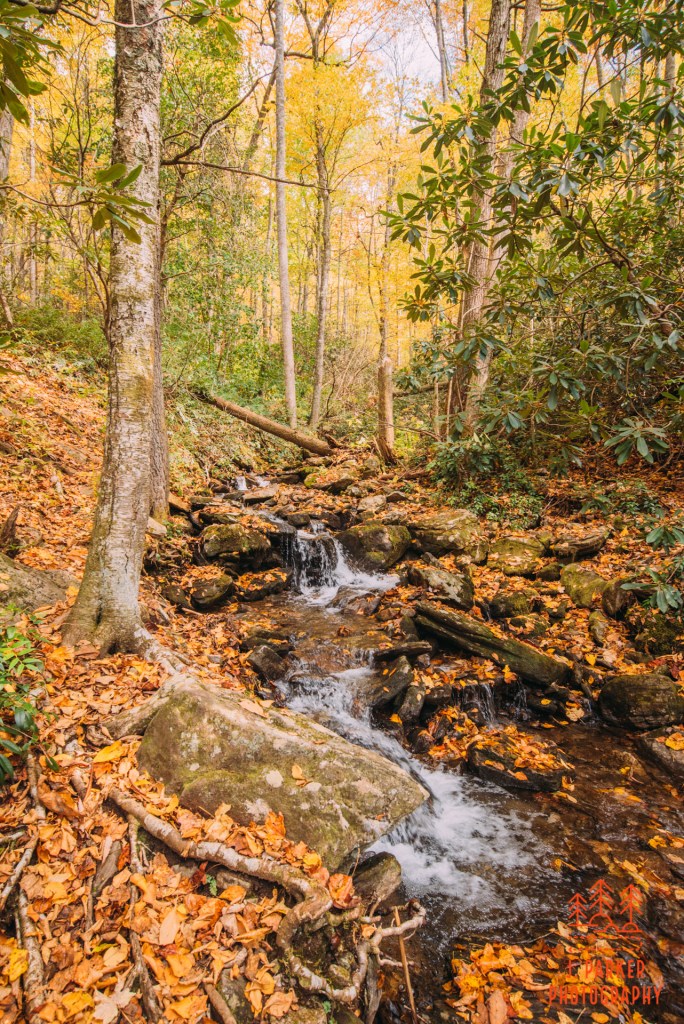
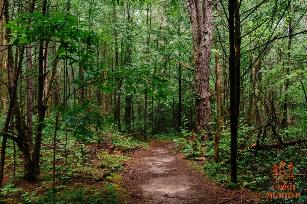
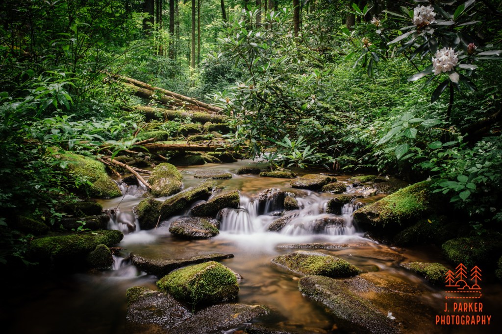
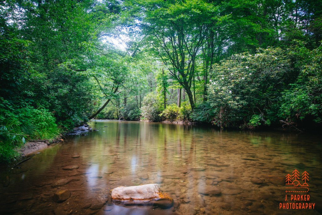
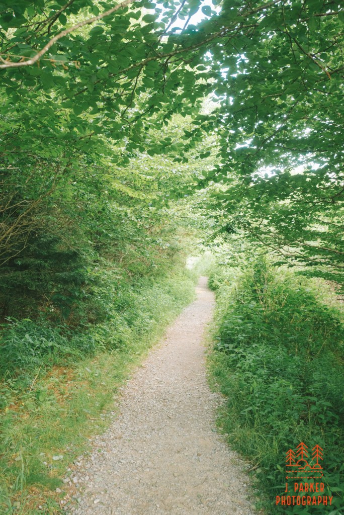
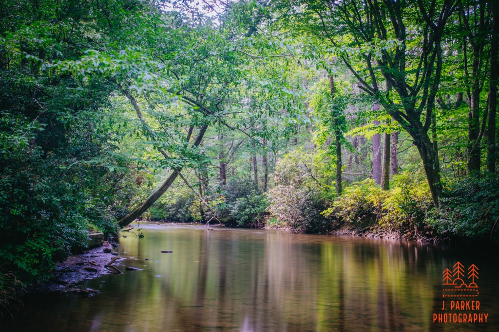
The place was not South Mountains State Park but instead Catawba Falls. I had rushed here from Shortoff Mountain to try to squeeze in one last good sojourn and one last chance to nail some shots of moving water in late day light. Aside from the chance to photograph, Catawba Falls is one of a small handful of falls within driving range of Asheville that I still had yet to see, only the immensely sunny days I had encountered throughout my trip just didn’t lend themselves to visiting a ton of waterfalls. Catawba was nice in that it had a trail that was short enough to walk quickly, a necessity if you wanted to photograph till the edge of darkness, while it was long enough to have a lot of possibility of encountering nice scenes. It’s trail ran in close proximity to the river, which was really much more of a creek here. If you follow my work, you’ll know that I enjoy much more the act of photographing tumbling creeks than actual waterfalls.
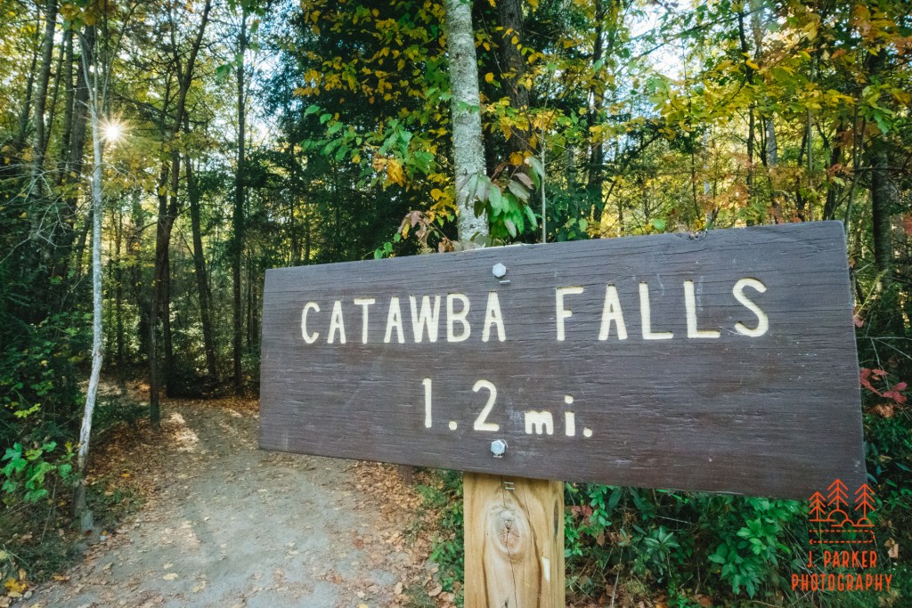
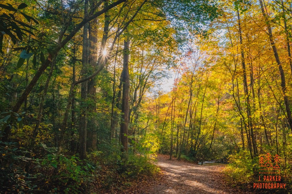
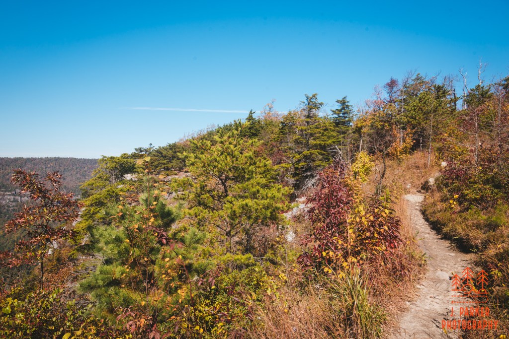
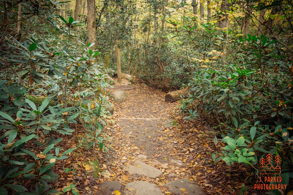
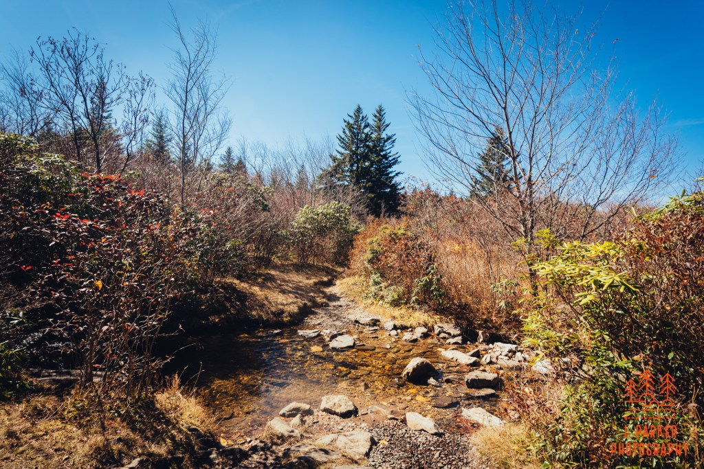
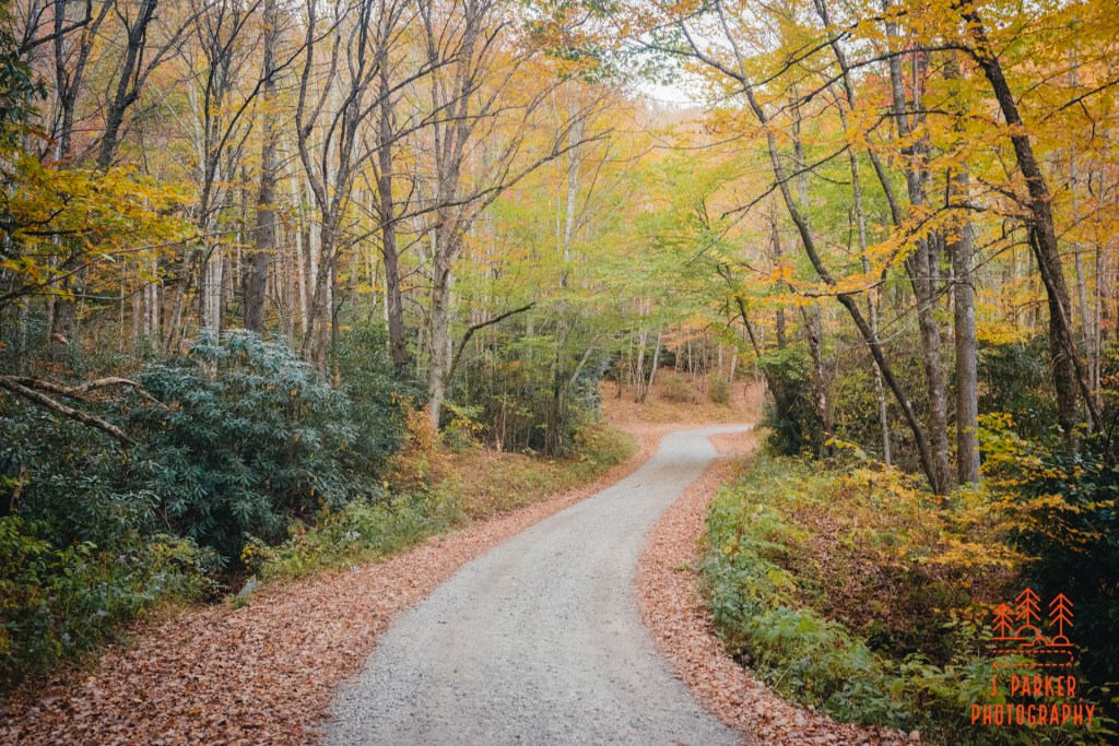
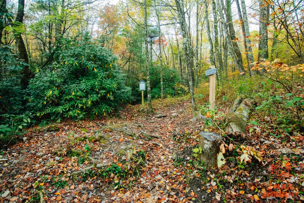
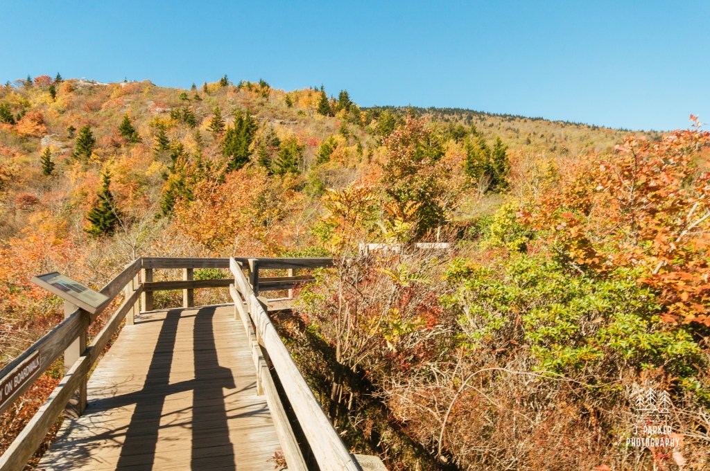
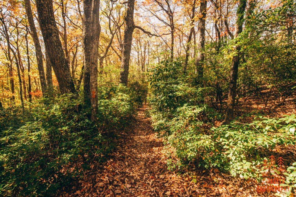
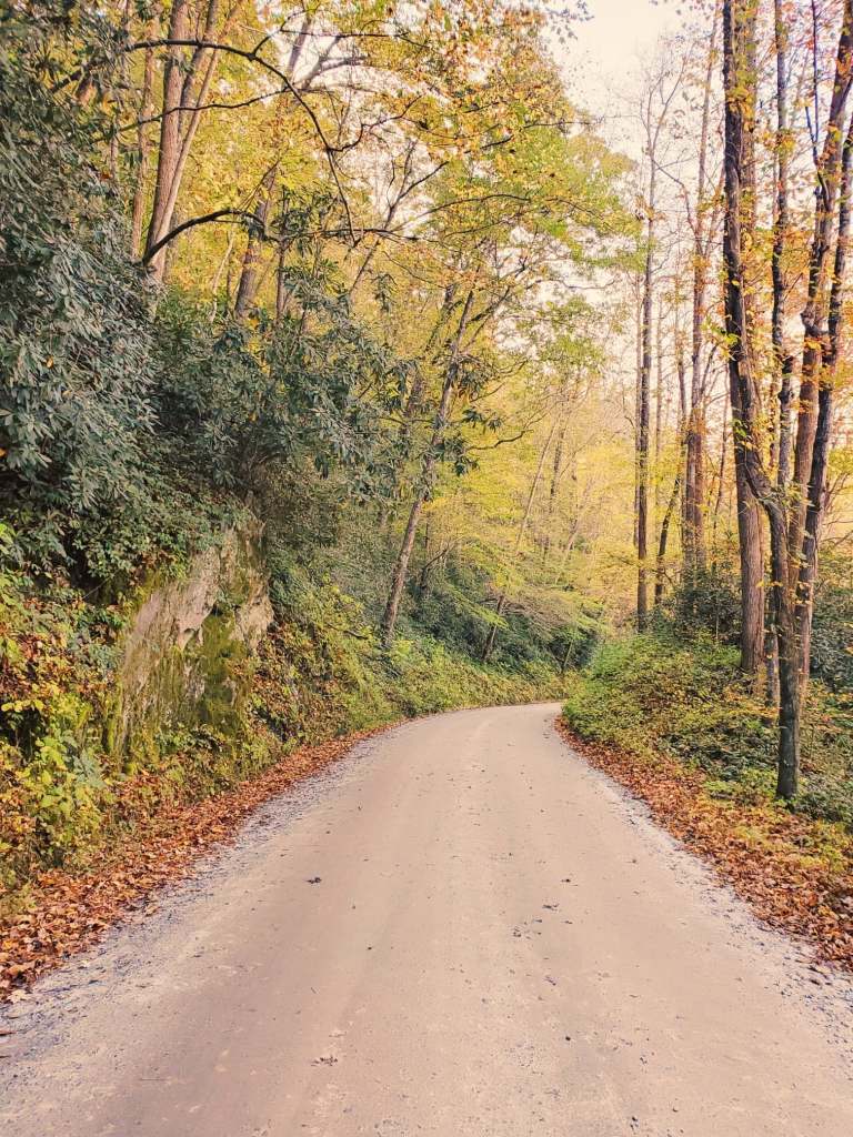
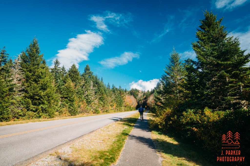
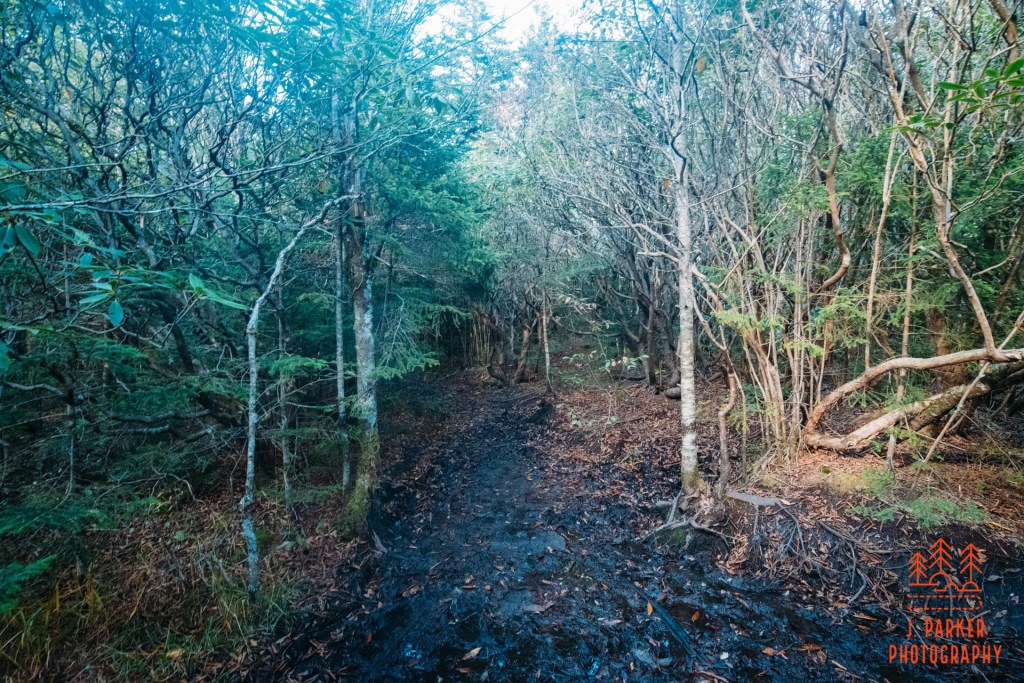
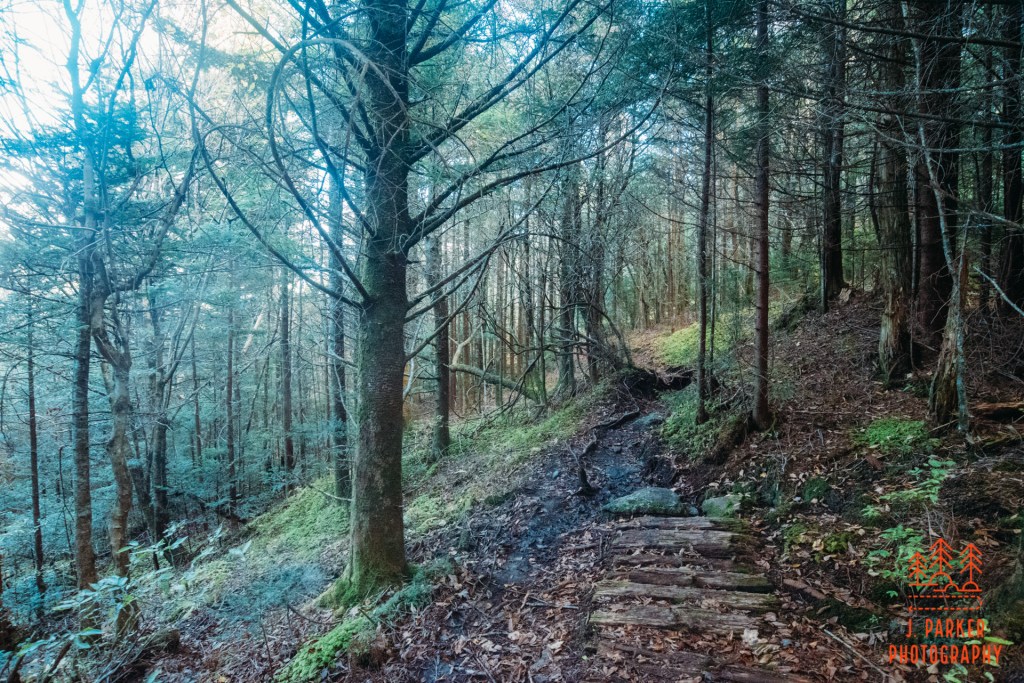
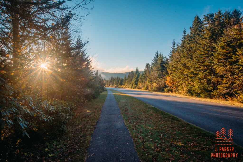
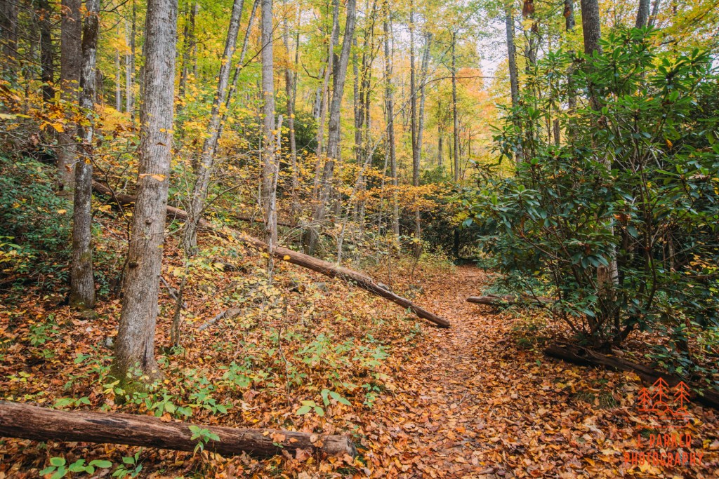
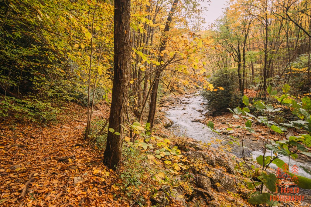
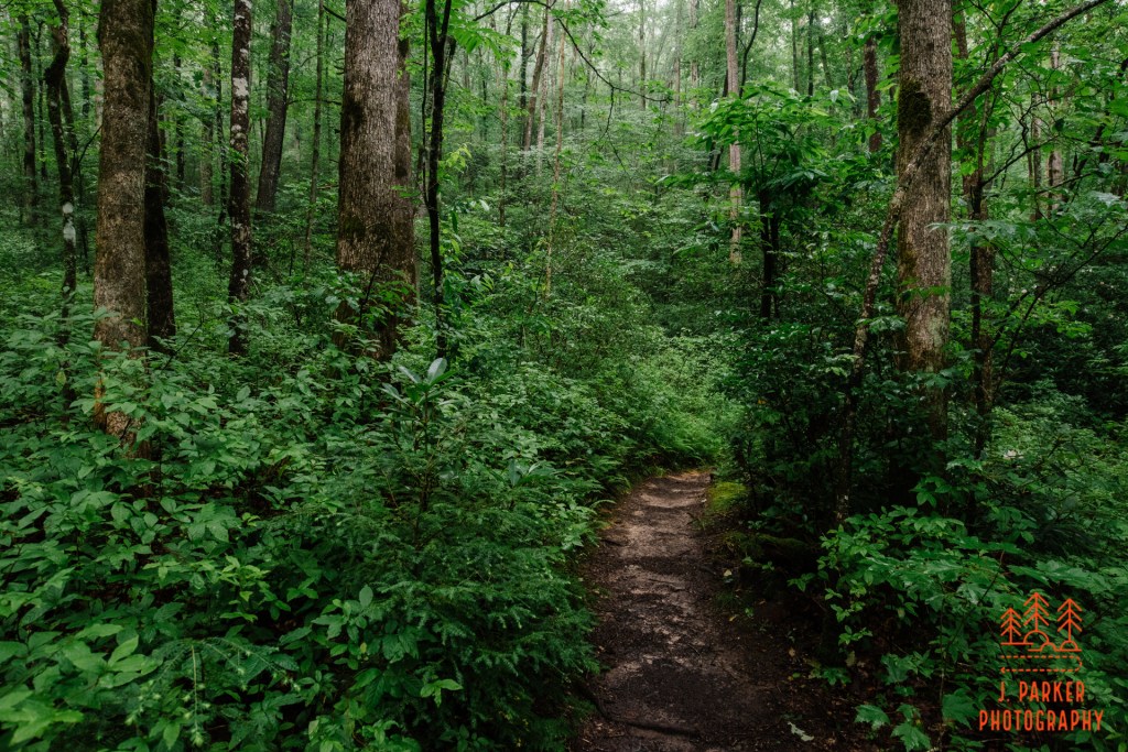
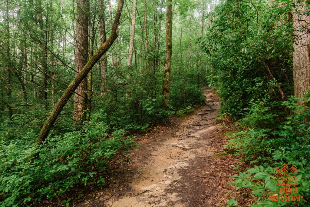
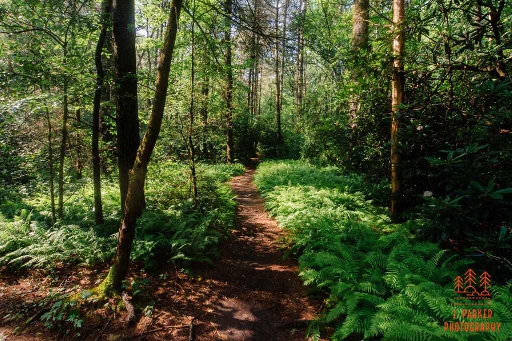
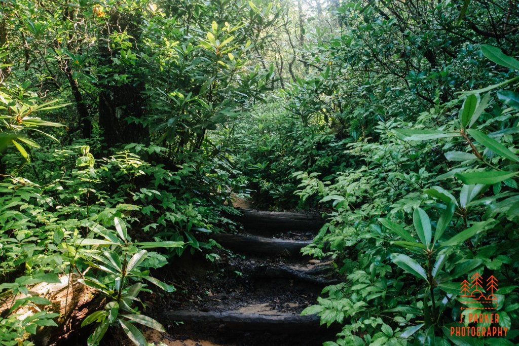
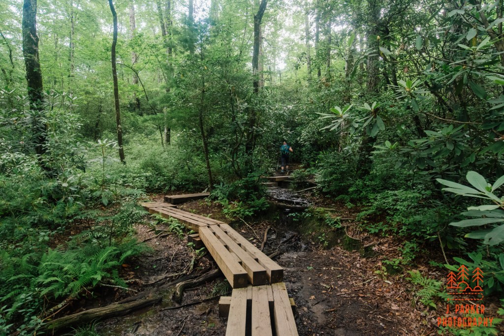
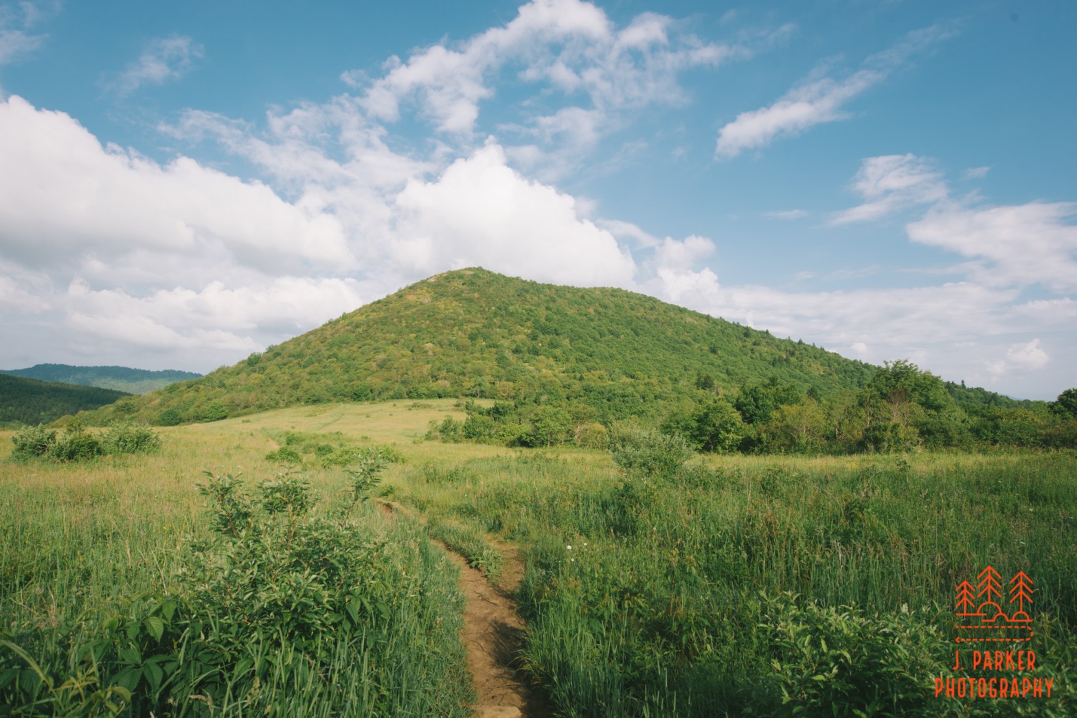
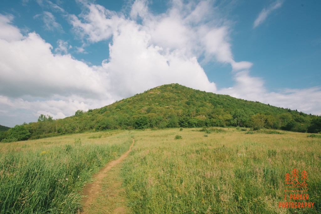
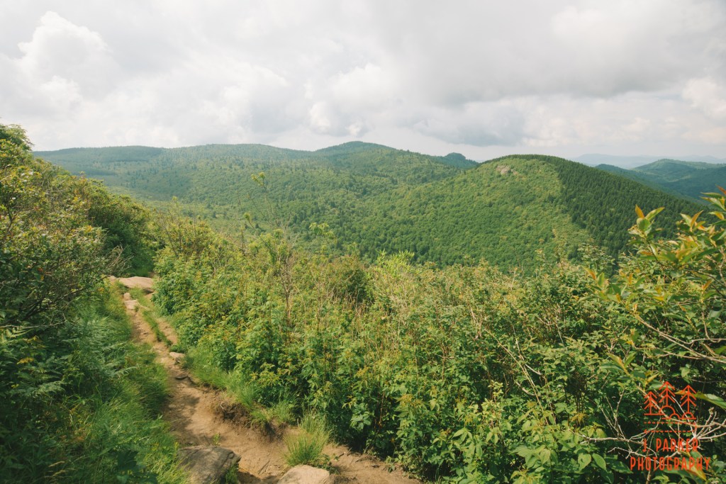
Start of Catawba Falls Trail
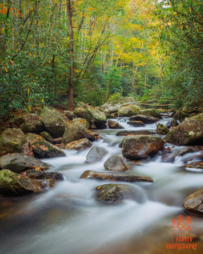
The parking area was teeming with people as I pulled in late in the afternoon. Though it wasn’t unexpected, being a popular waterfall at the height of fall, it was a little bit of a shock to my system. For a few days in a row I’d actually felt relatively isolated on the trails, culminating in my 11.5 mile journey through the Flat Laurel Creek area which was largely abandoned, save for search and rescue personnel, due to the active search for a missing hiker. To be honest with myself, I had expected nearly every place I went to be buzzing as Catawba Falls was – that’s how it was every day at every stop when my wife and I had been in North Carolina almost exactly three years prior. For much of the trail it wouldn’t be that big of a deal, for the trail was plenty wide to allow for distance and most people typically completely overlooked the creek scenes I like so much. Getting a good long exposure of a waterfall with this type of crowd…that might be a unicorn.
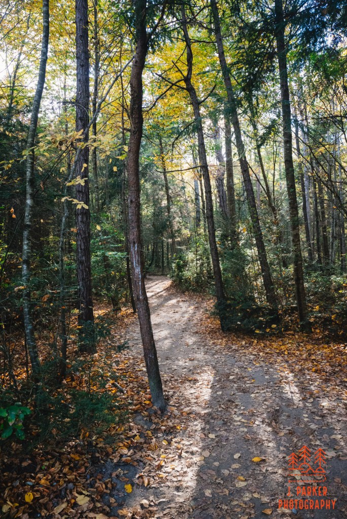
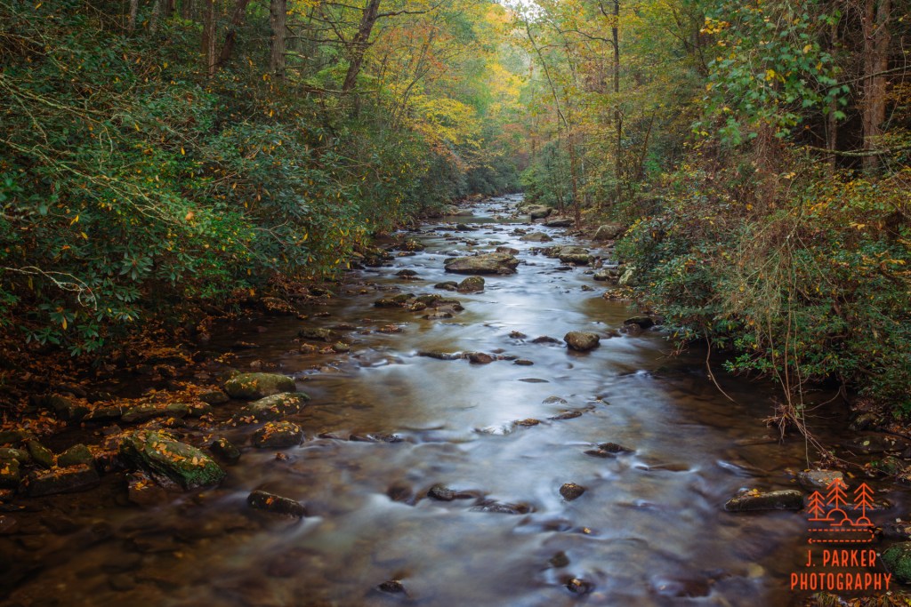
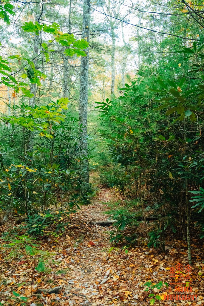
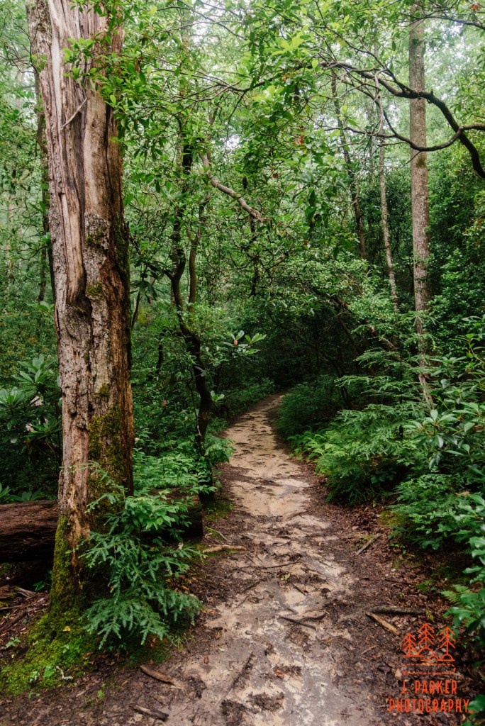
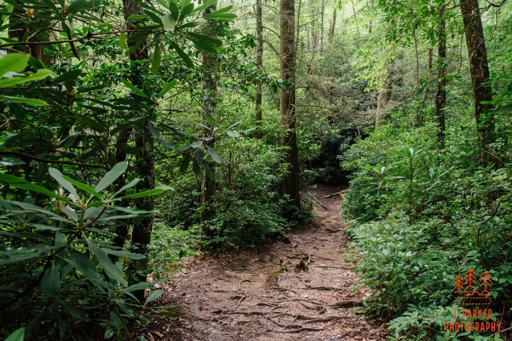
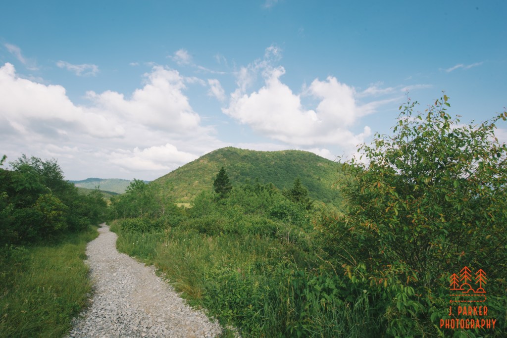
Early on the Catawba Falls Trail
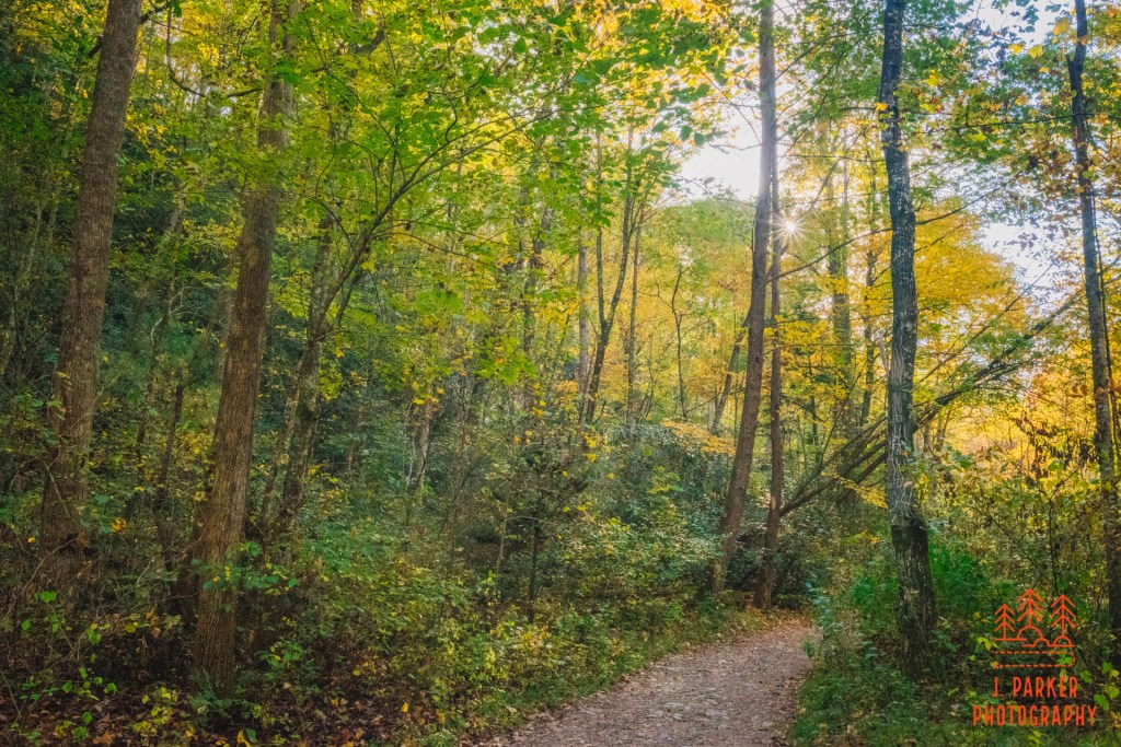
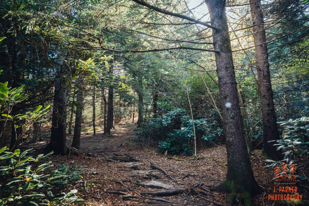
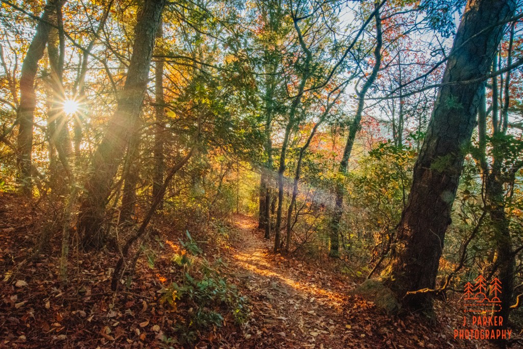
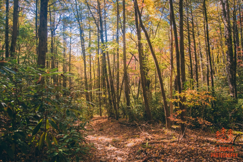
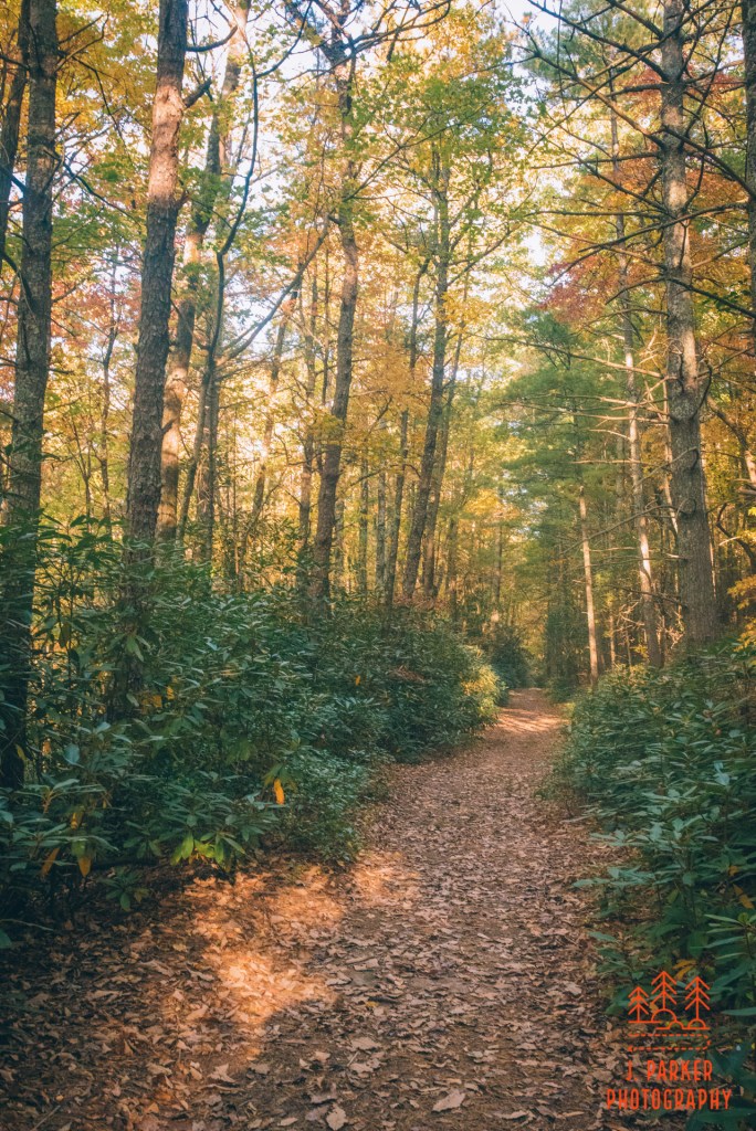
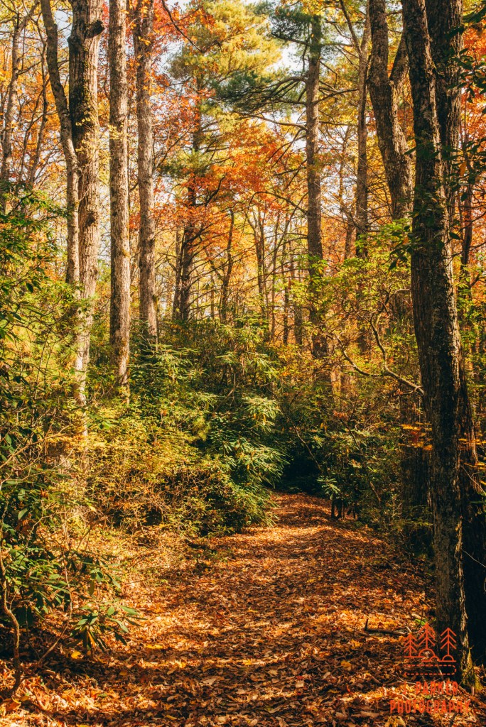
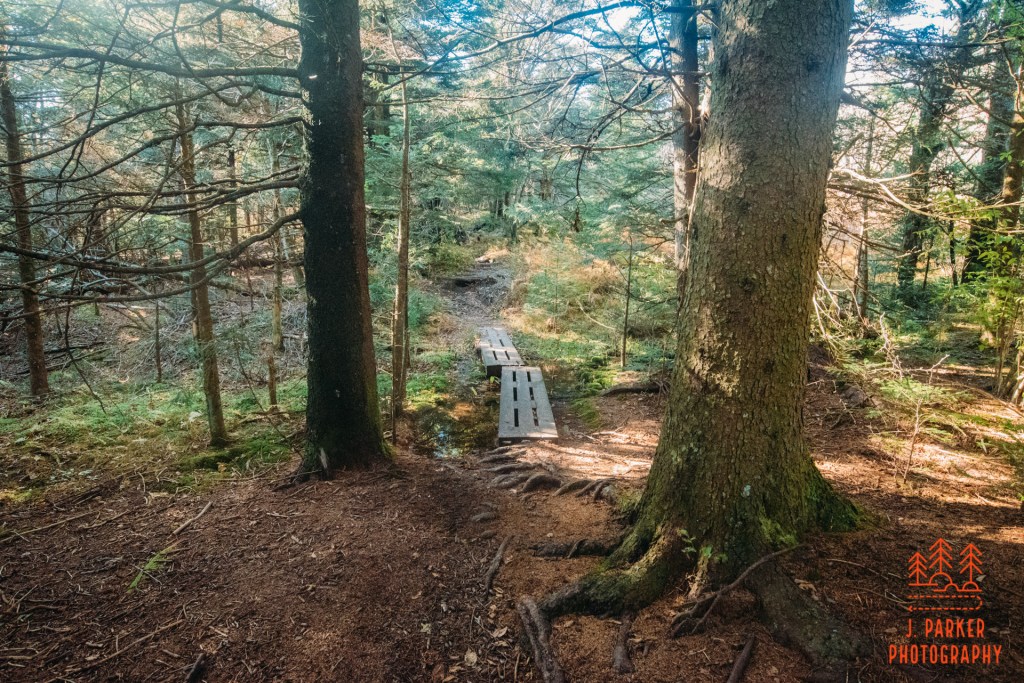
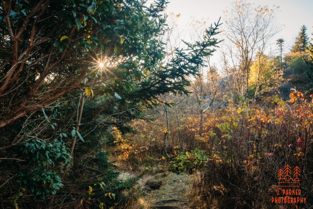
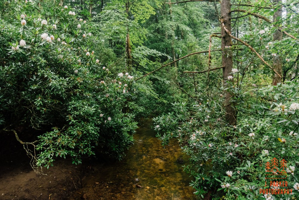
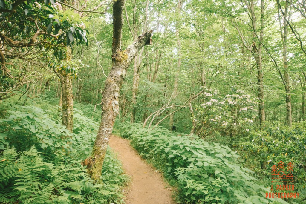
As I started out on the trail I could tell right away that this was going to be a really beautiful place. The path started out winding through a stack of rhododendron that was still lush even late in the year. The path was so smooth here it may as well have been paved. At least in this section I didn’t think I’d have any trouble at all walking in the dark if I stayed late. Soon the path straightened out and widened. It was also heading right towards the sun which was low enough in the sky to be peeking through the trees. I took advantage to try and utilize the trees for some sun flares. The sun provided some golden shades to the trees, but by and large there was still a lot more green than one might expect at this juncture in fall – especially considering how many places I had been this trip that were essentially barren.
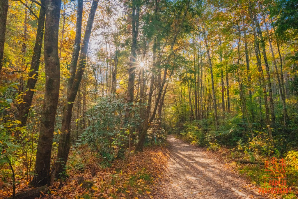
Walking into the sun
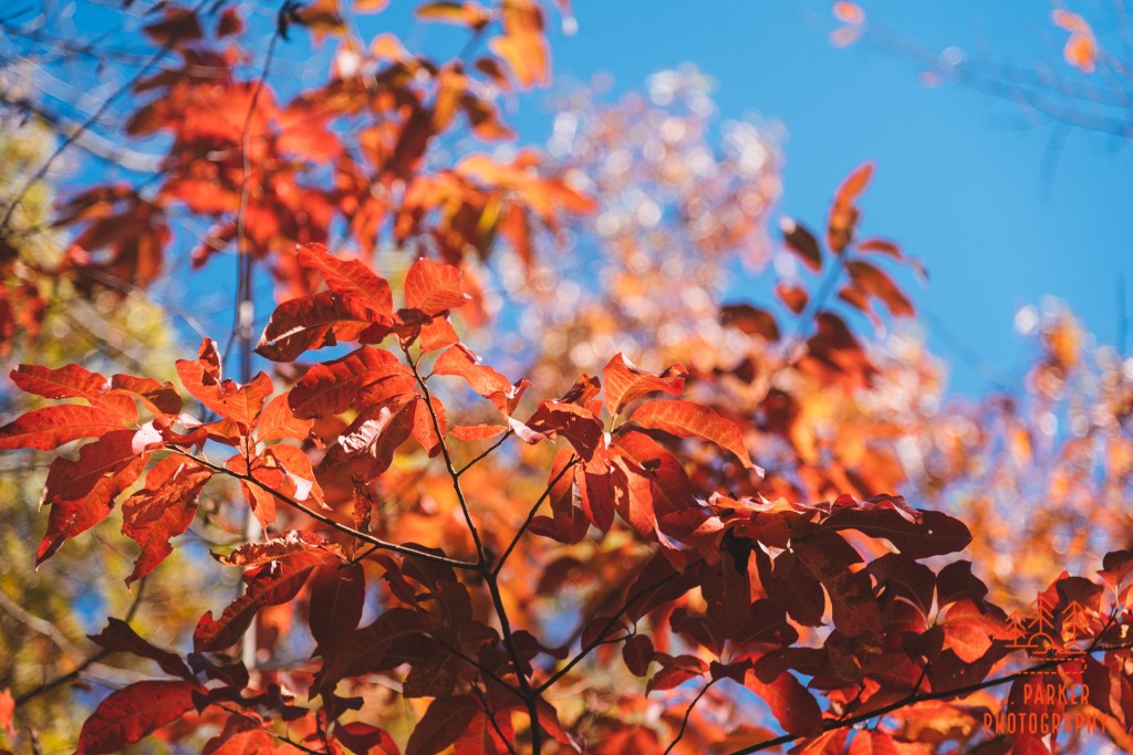
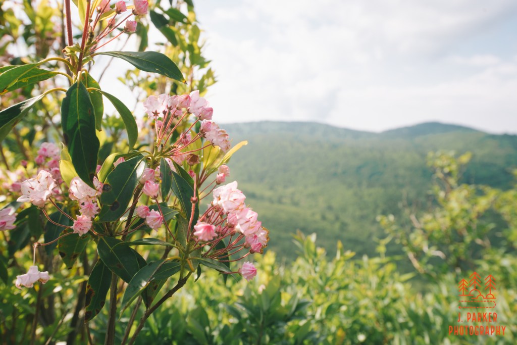
This is the second year I’ve taken a trip up north in the fall, and I’ve definitely more swings and misses in terms of fall color as I have hits. There is no doubt that you can encounter a certain magic and romanticism when you stumble upon the right fall scene – probably the most beautiful thing you can encounter. But there’s also a lot of times when you’ll encounter barren or mismatched woods. As somebody who didn’t really experience how lush the rainforests of southern Appalachia can be until well into my adult life, I found there’s not much less magic in mountain summer, and the consistency and predictability of what you’ll see makes the season more enjoyable to me. It just took me a couple fall trips to really figure that out.
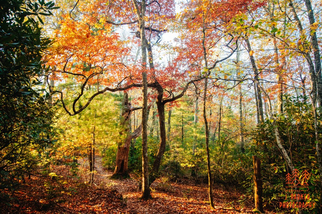
Another sun flare shot
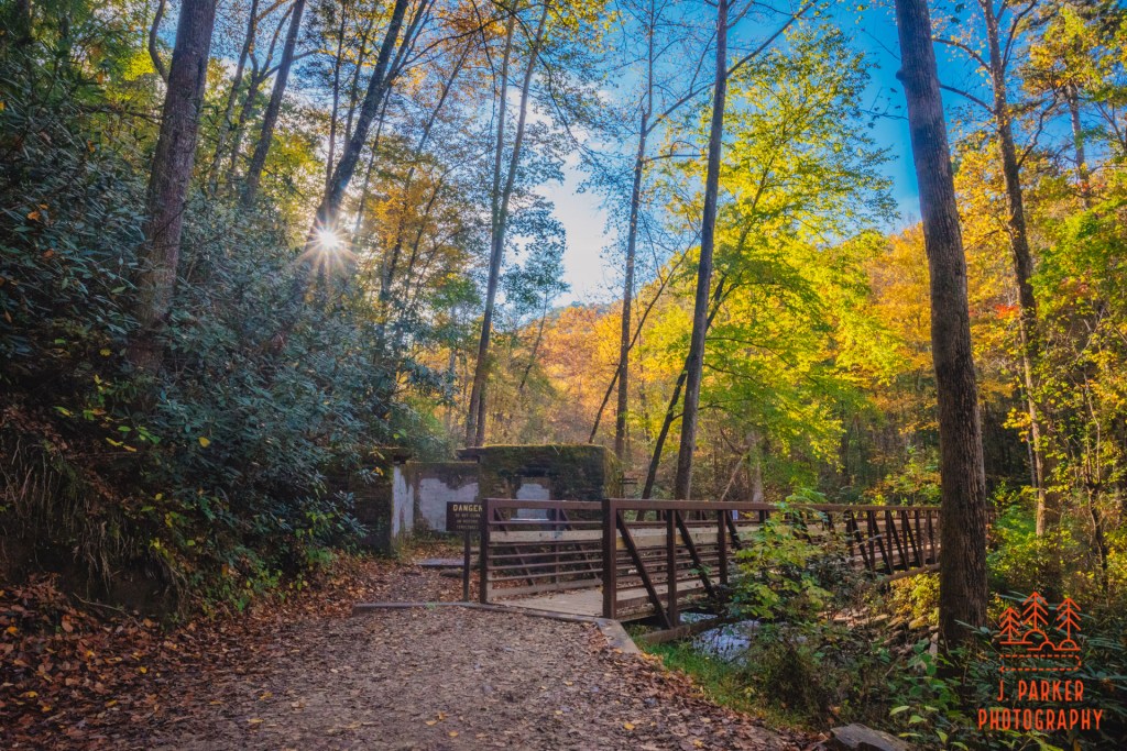
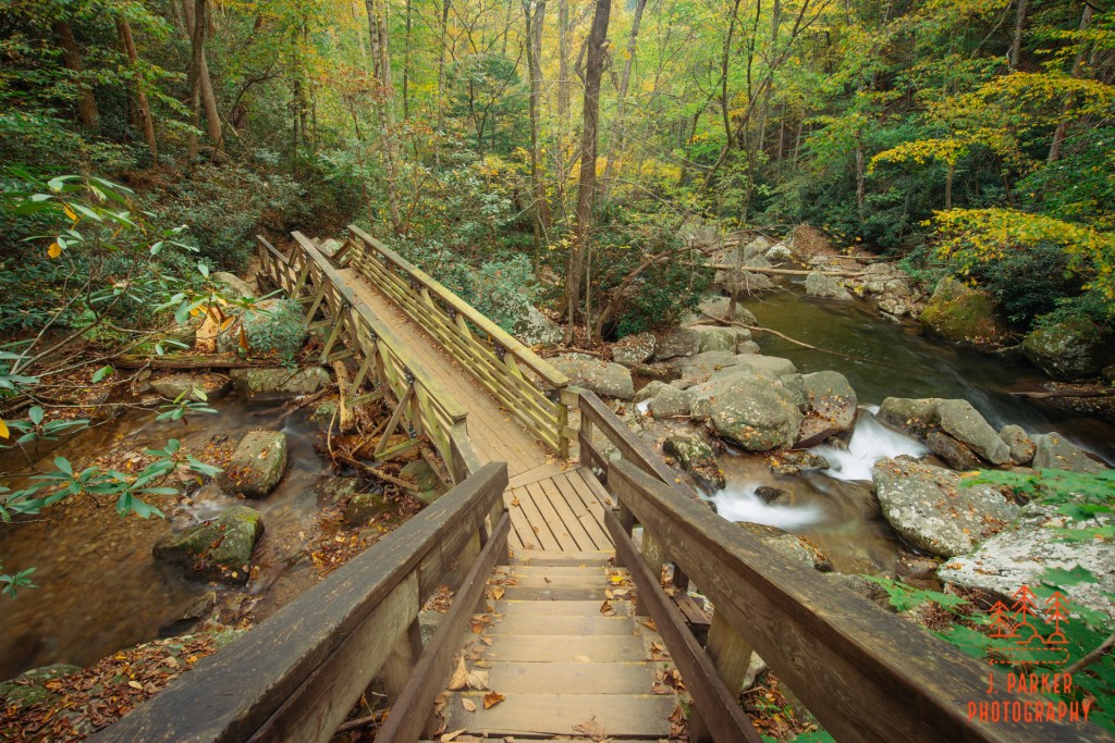
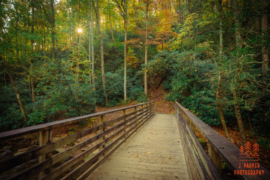
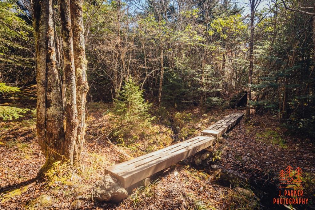
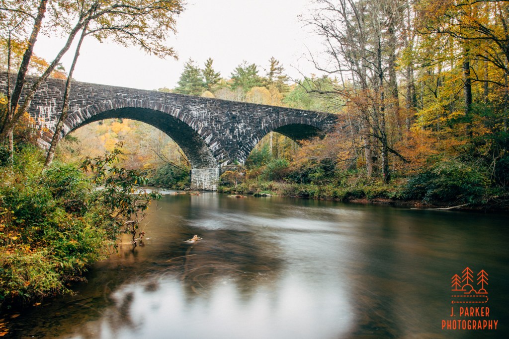
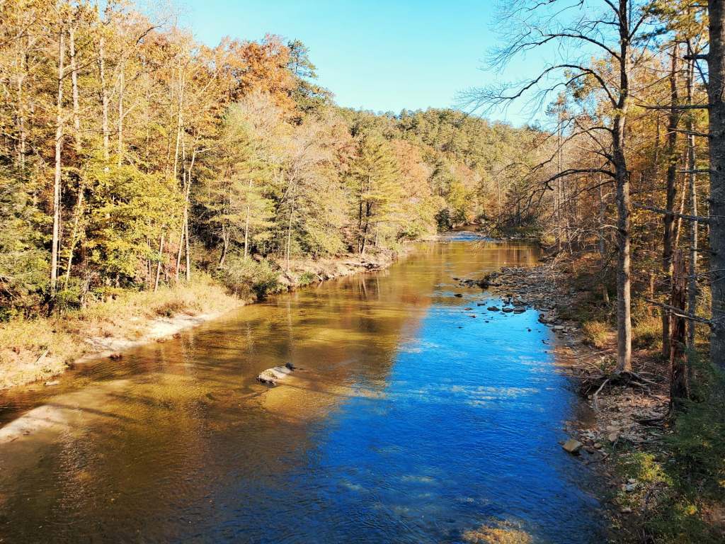
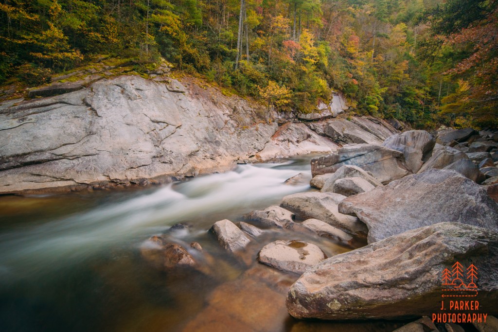
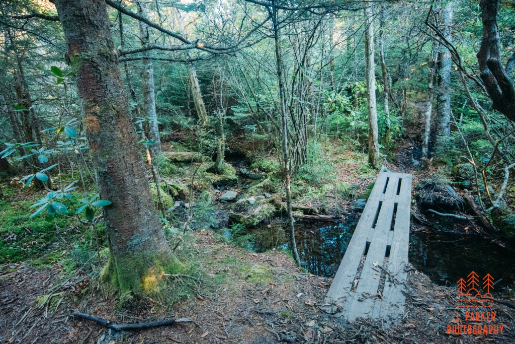
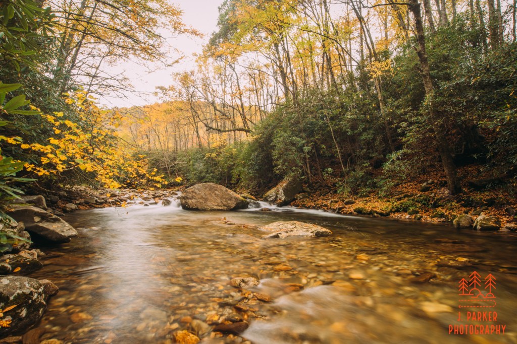
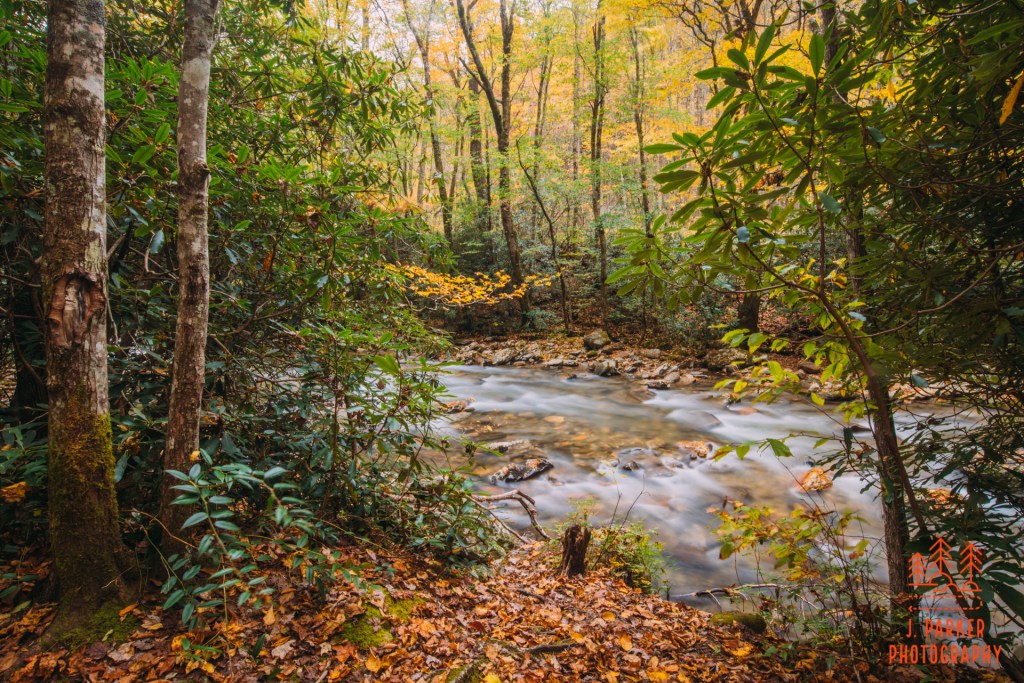
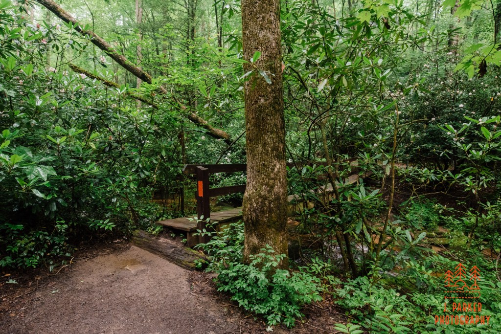
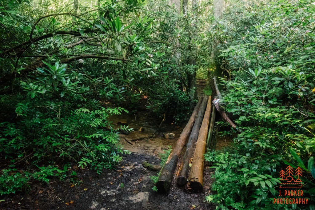
Ahead I got the first views of the small river just to the right of the trail. It was pleasant enough, but there wasn’t much to photograph here, and thus I didn’t have time to linger. As I moved further up the trail the river ran in close proximity to it, providing a nice feel to the walk. Ahead, I encountered the trail bridge over the river. This scene was nice enough, with the sun shining through a patch of rhododendron to the left, and quite a bit of golden foliage in the canopy, that I did something I rarely do and got the tripod out for a non-moving water shot. And amazingly, despite the busy trail, I was able to hone in the shot to my liking without interruption.
Trail bridge over Catawba River.
After the trail crossed the bridge it ventured a ways from the river but still in view. The trial then oriented itself in line with the sun once again. This gave the opportunity for some nice views framing the trail, but it didn’t necessarily bode well for my chances at capturing the river. With the sun being directly in line with both trail and river, this meant that the surrounding ridgelines weren’t really blocking the sun, which is part of what I was counting on to be able to get shots of the river even on a sunny day.
Walking into the sun again.
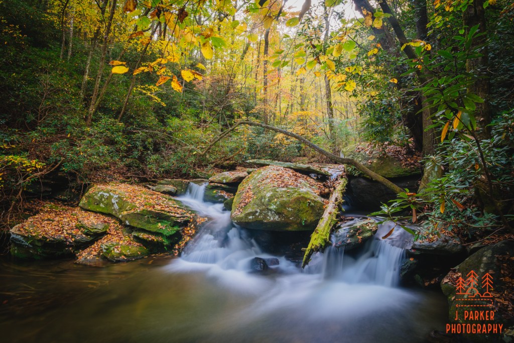
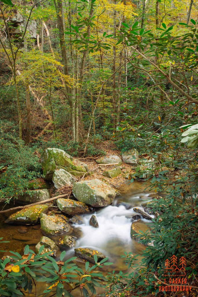
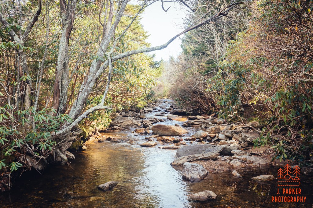
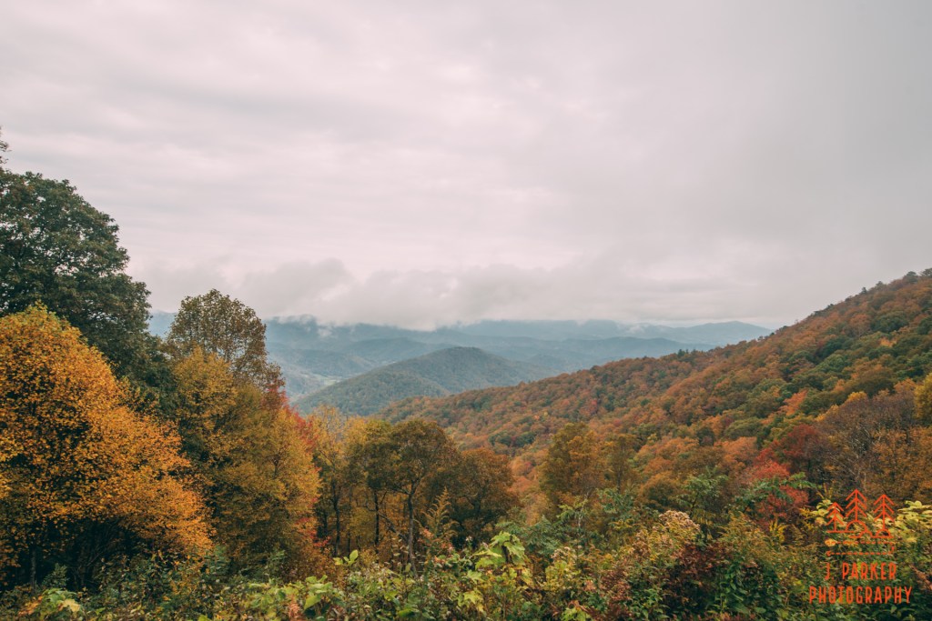
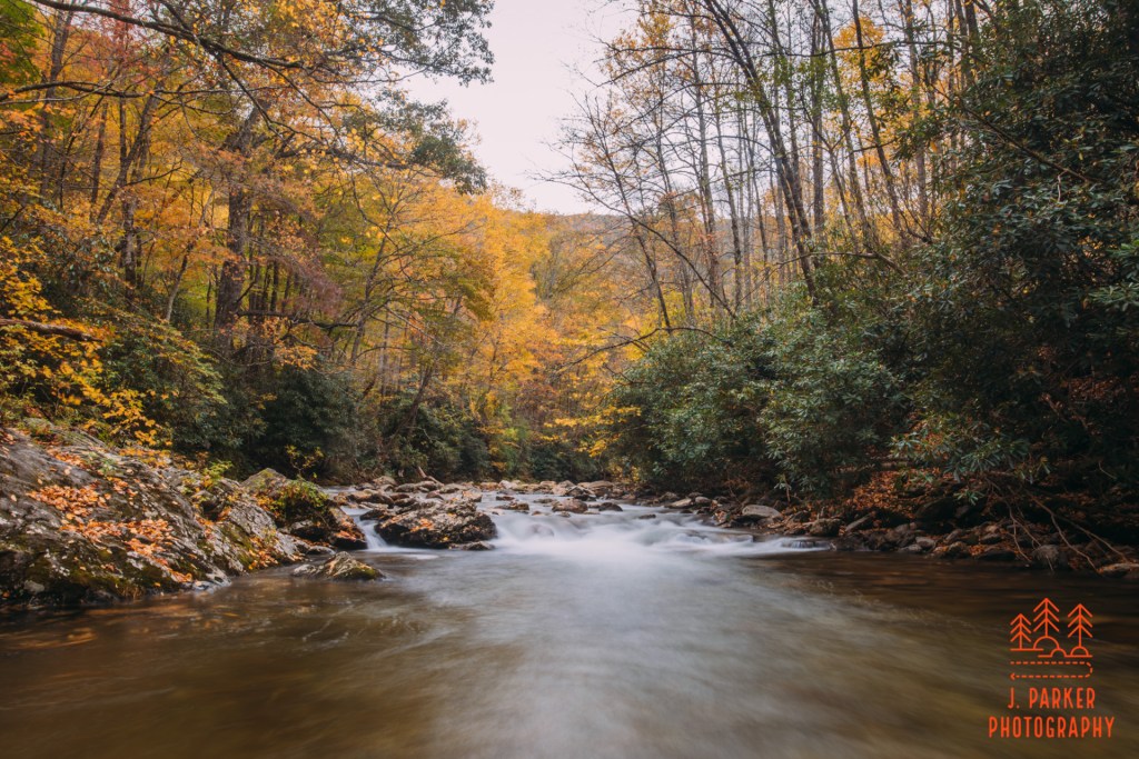
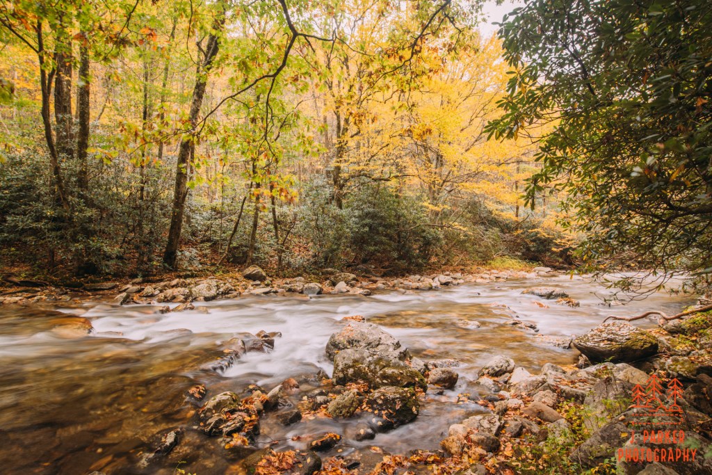
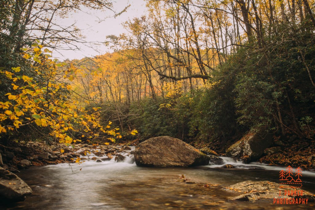
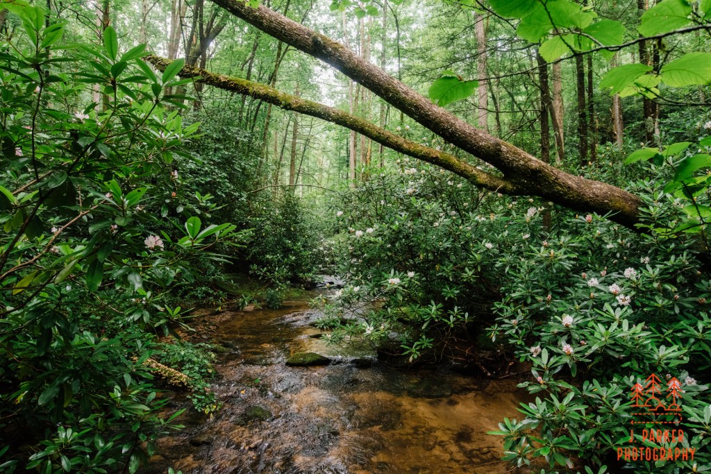
I spent a long stretch on the trail making my way to the waterfall not quite as fast as I could have because by now I realized that I was going to have to hold out till around or after sunset to photograph the way I would like. As I ventured ahead the trail gradually climbed in elevation, to the point where eventually the trail was at the top of a tall but very gradual slope working down towards the river. As I looked at the waterway down below I felt a twinge of sadness. It had a near constant series of small rapids that I would have found sheer heaven to be able to photograph. If I had really wanted, I could have made my way through the light brush to reach the river, but it wasn’t worth the effort with their not being the necessary light. As it was, I was looking down on a missed connection that, being my last day in the mountains, I’d have no chance of making right for a long time. And it wasn’t just the beautiful Catawba River down below that I was or had picked off; rather, it was all the waterways that I’d missed out on photographing, only having about two hours of cloudy weather in nearly 5 full days.
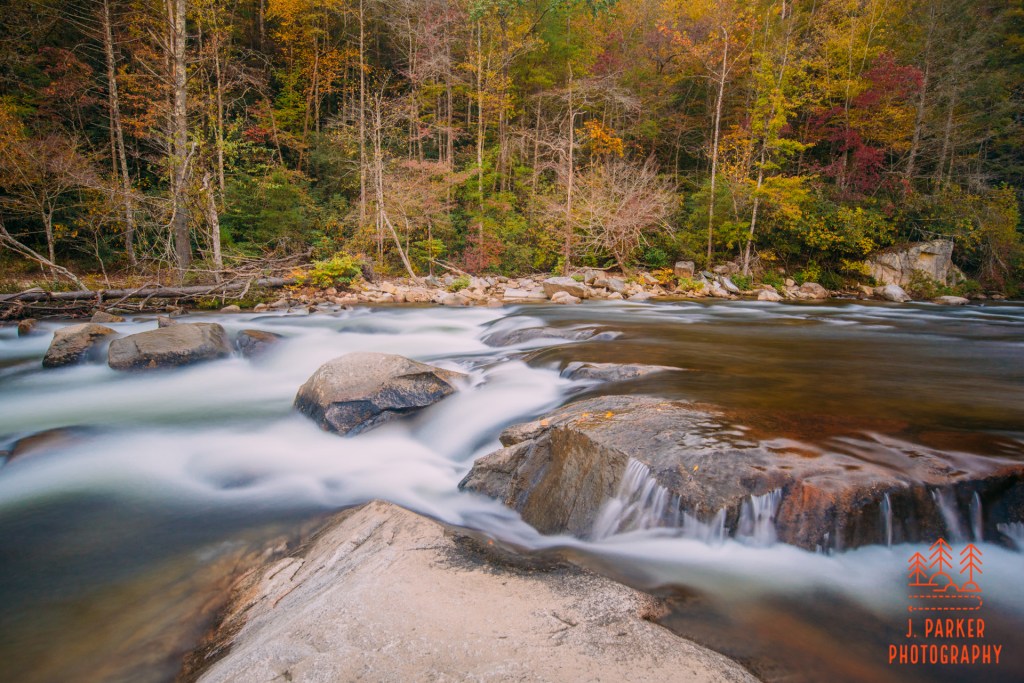
Catawba River
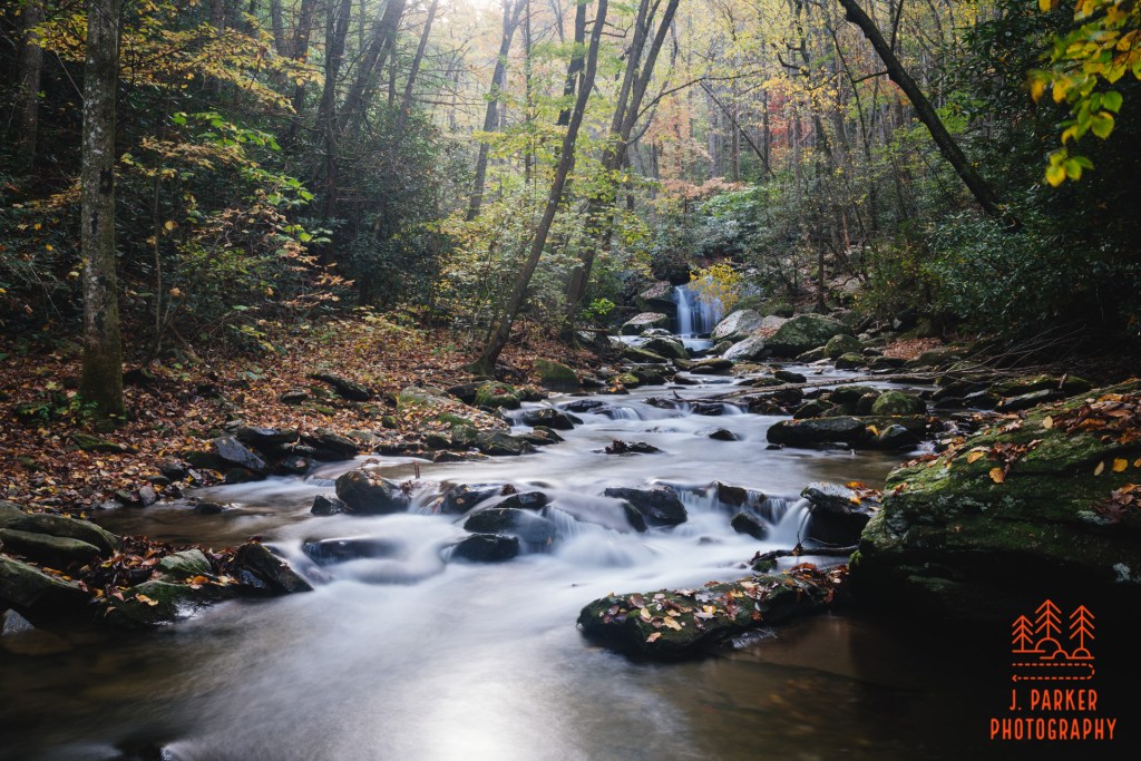
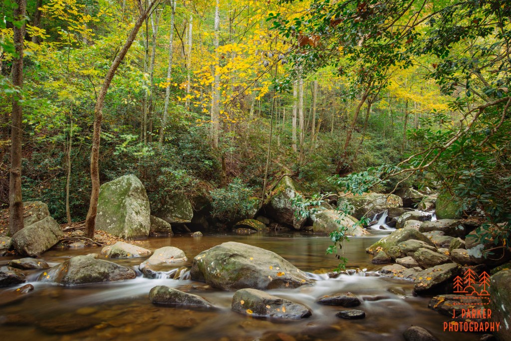
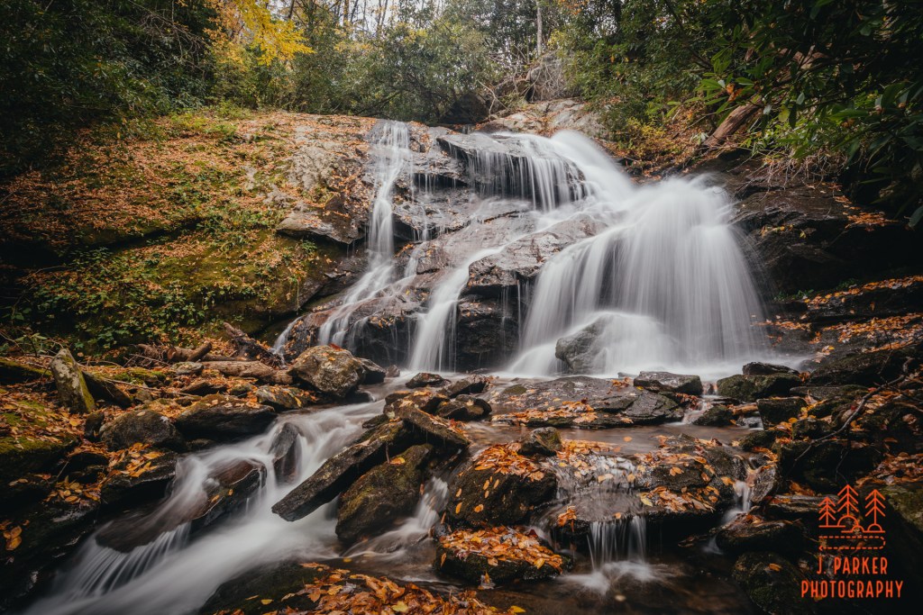
Eventually there was a rather define trail that took a diagonal course down the slope towards the river, and I took the chance to get an up close view again. After 100 yards or so through some woods I reached the river and it was every bit as beautiful as it appeared it would be from above. There were constant small rapids traveling between rocks that were sometimes completely covered in fallen leaves. Maybe sixty yards upstream a small waterfall made for a nice background. The light wasn’t ideal but the scene was nice enough that I went ahead and setup to take a shot. When I saw the results it was probably worse than I expected, for backlight creates a massive fog when using a neutral density filter, at least one that isn’t graduated, which I didn’t have.
Half hearted attempt
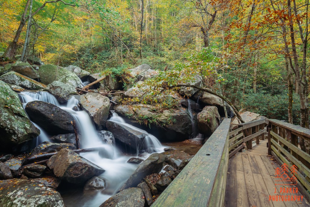
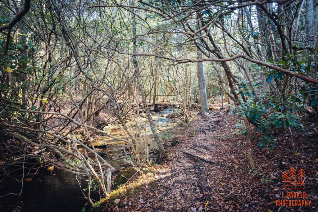
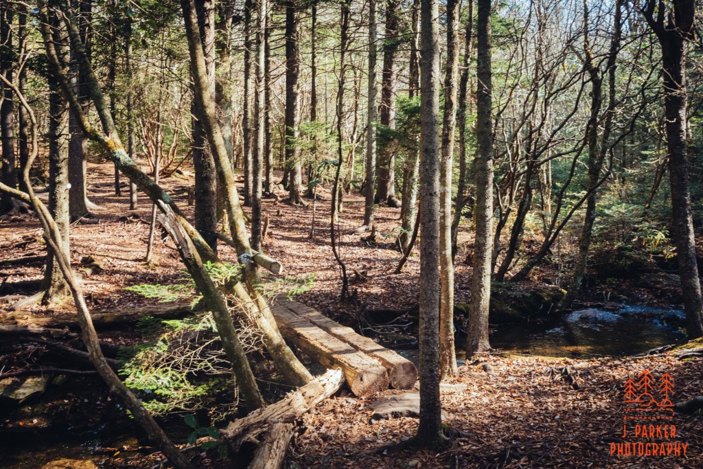
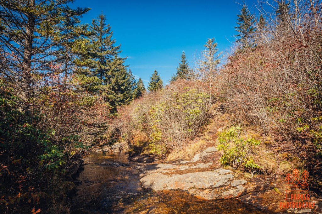
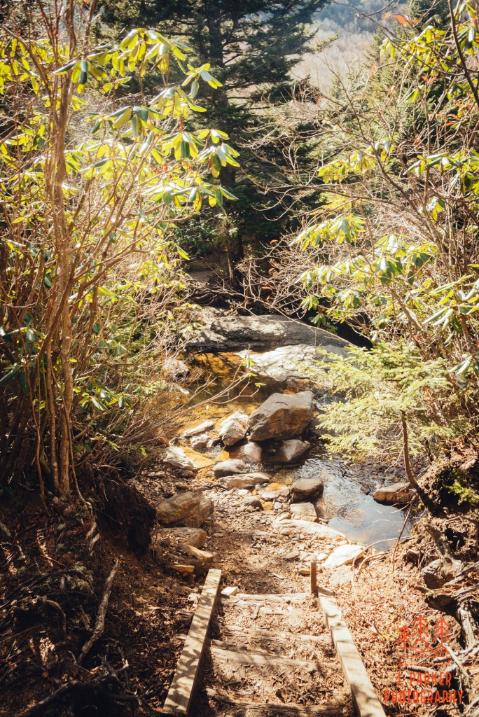
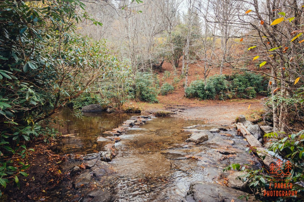
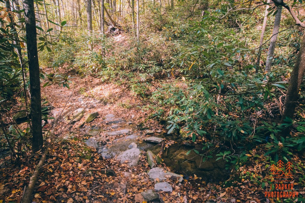
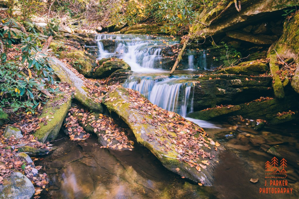
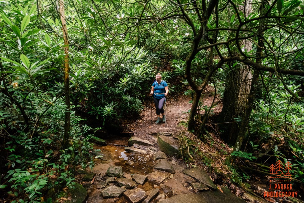
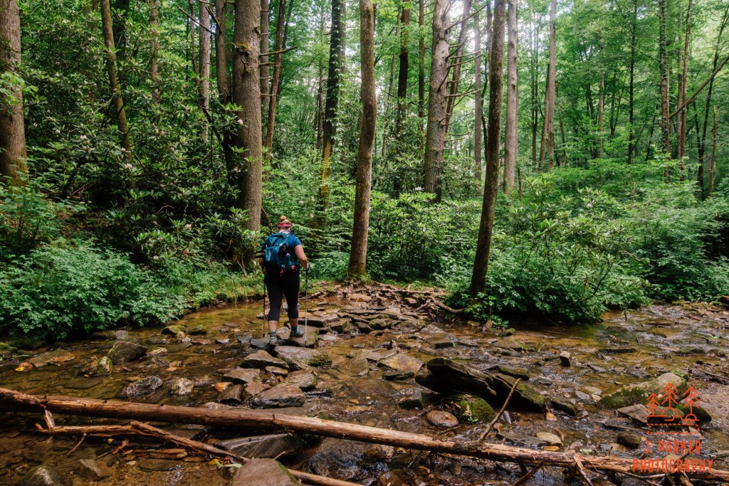
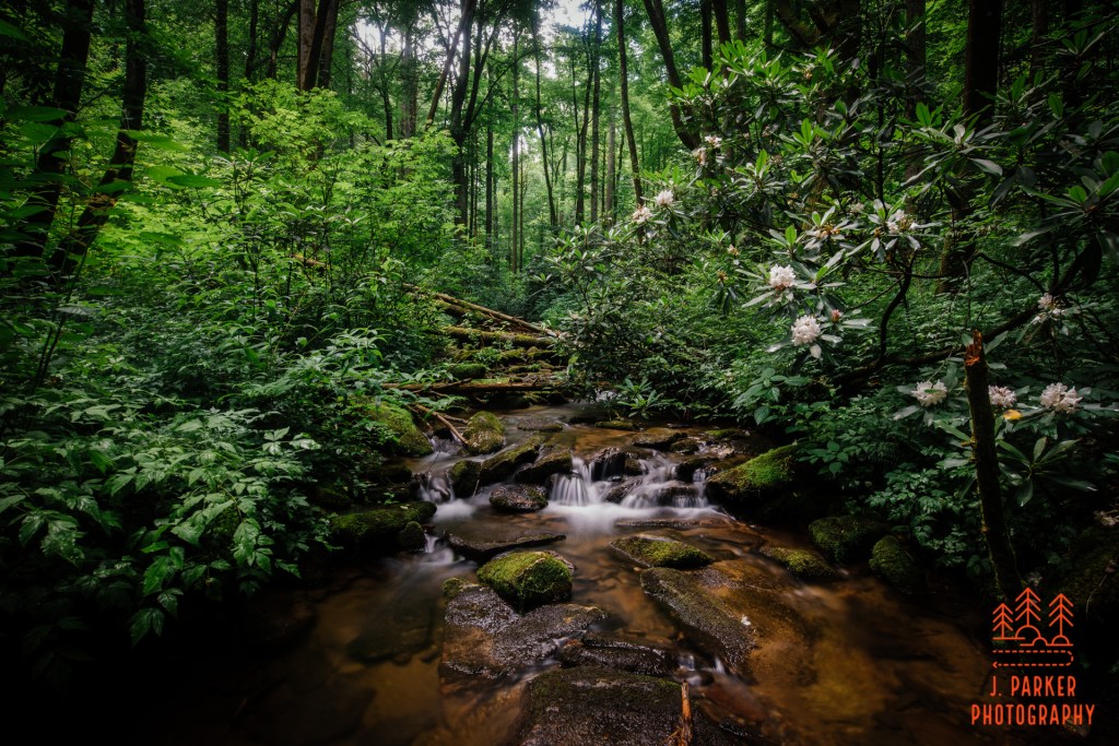
Back on the trail again I came across an unbridged creek crossing . By now many families were going to and from the falls, all of them opting to rock hop over the very shallow creek. I had long since dispensed with such efforts at comfort, for my feet had been wet since walking in the water to photograph the Jacob Fork River at South Mountains just after sunrise. While walking across the creek I noted the small waterfall coming in. Just for the satisfaction of photographing something that wasn’t spoiled by the sun I tried a shot here, but my heart wasn’t in the shot, and the constant gaggle of people going just behind my back eroded my concentration even further.
A secondary creek
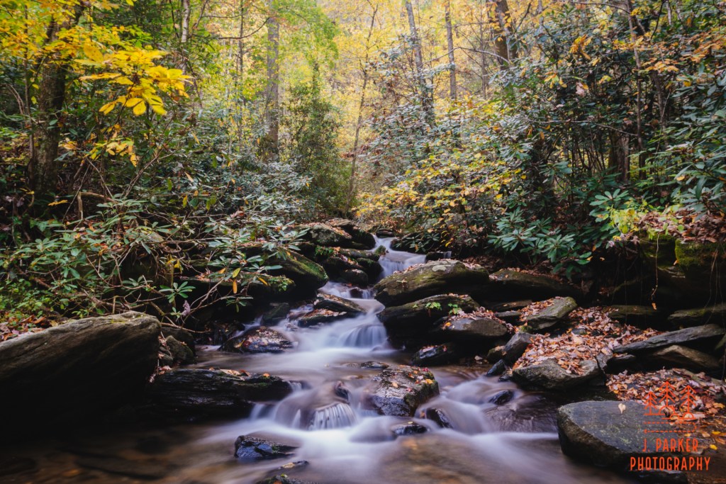
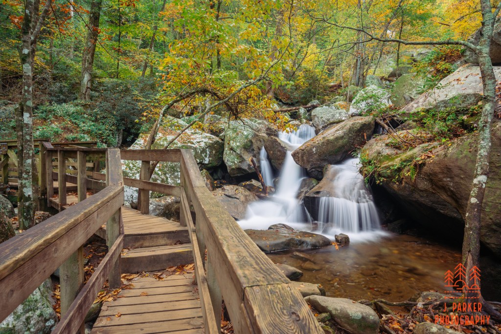
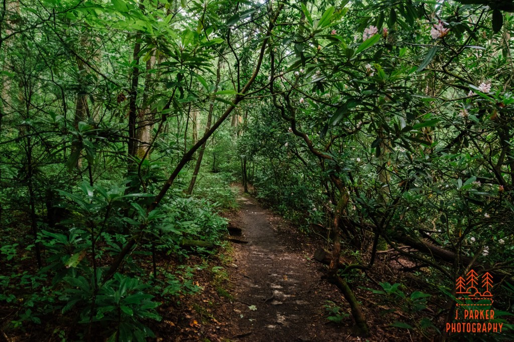
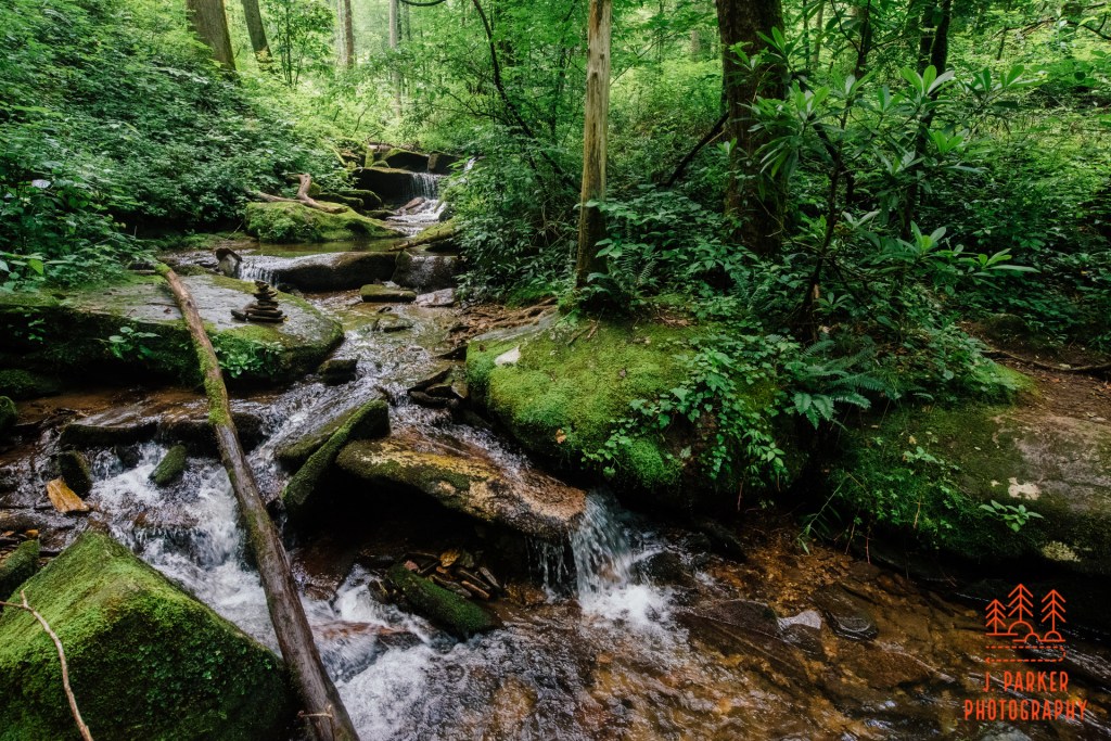
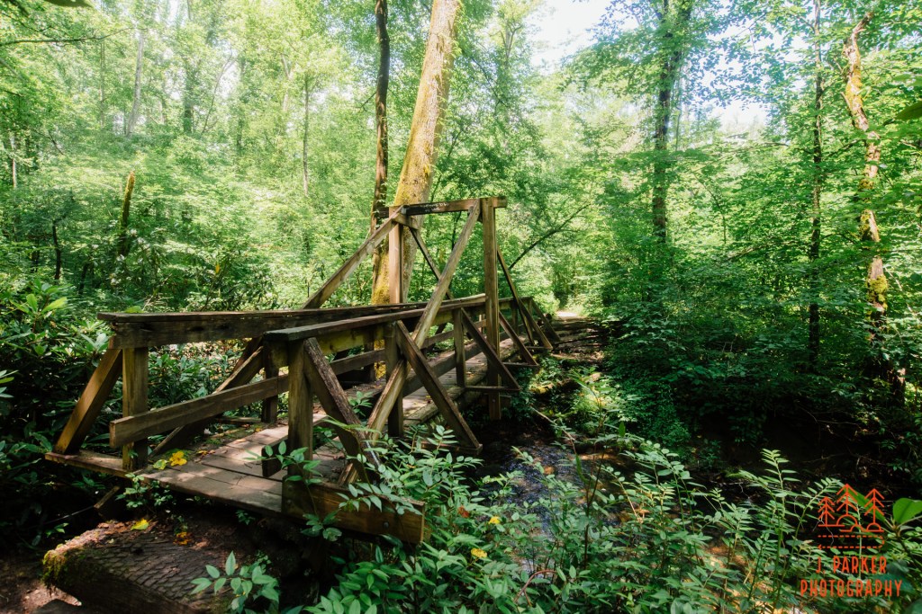
There was a more satisfying tributary creek crossing ahead. This one had a bridge, and the terrain was getting that telltale ruggedness that lets you know you’re getting close to a waterfall. Most people were simply walking right past this spot on the way the fall. I had no reason to rush, for I knew the later I got to the fall, the less chance I’d waste time waiting for the sun to get out of the way of my shot. On top of that, I found this lightly tumbling creek a very pleasant sight anyway. It wasn’t necessarily a full waterfall here, but at any rate the creek was cascading with regularity.
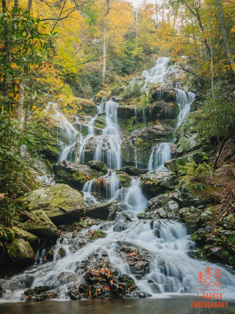
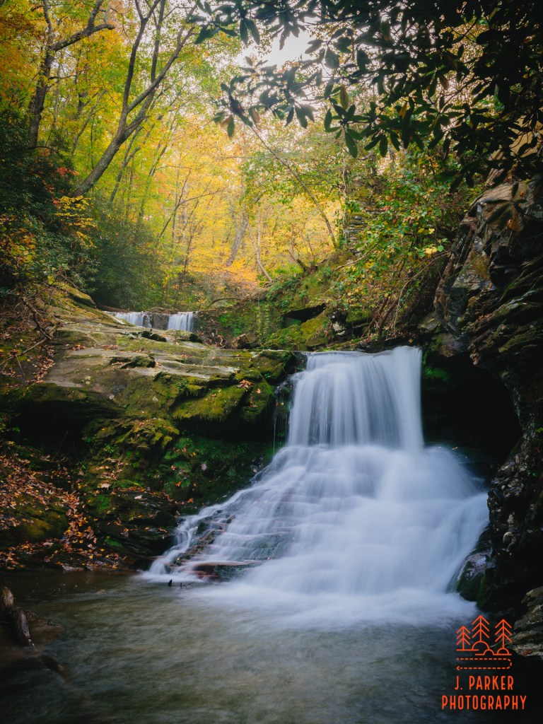
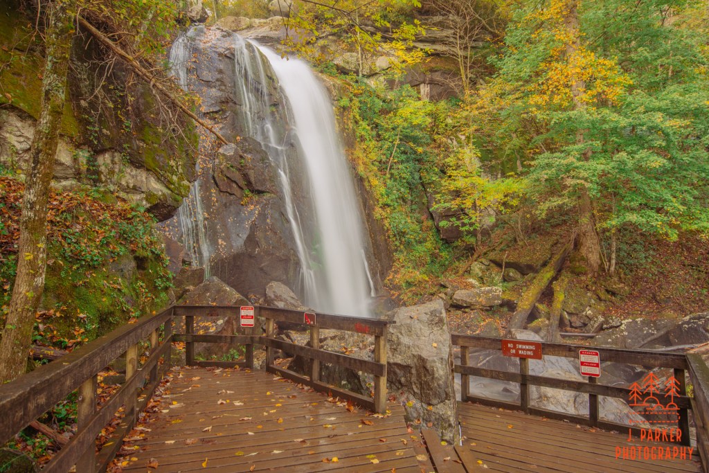
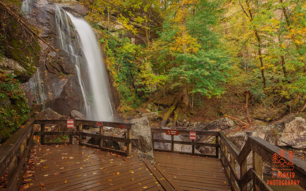
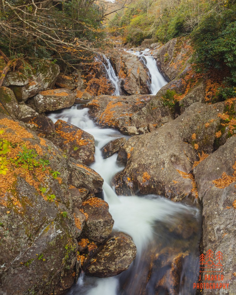
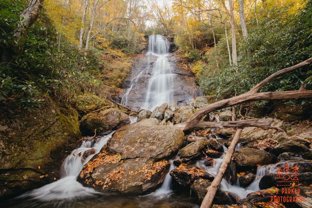
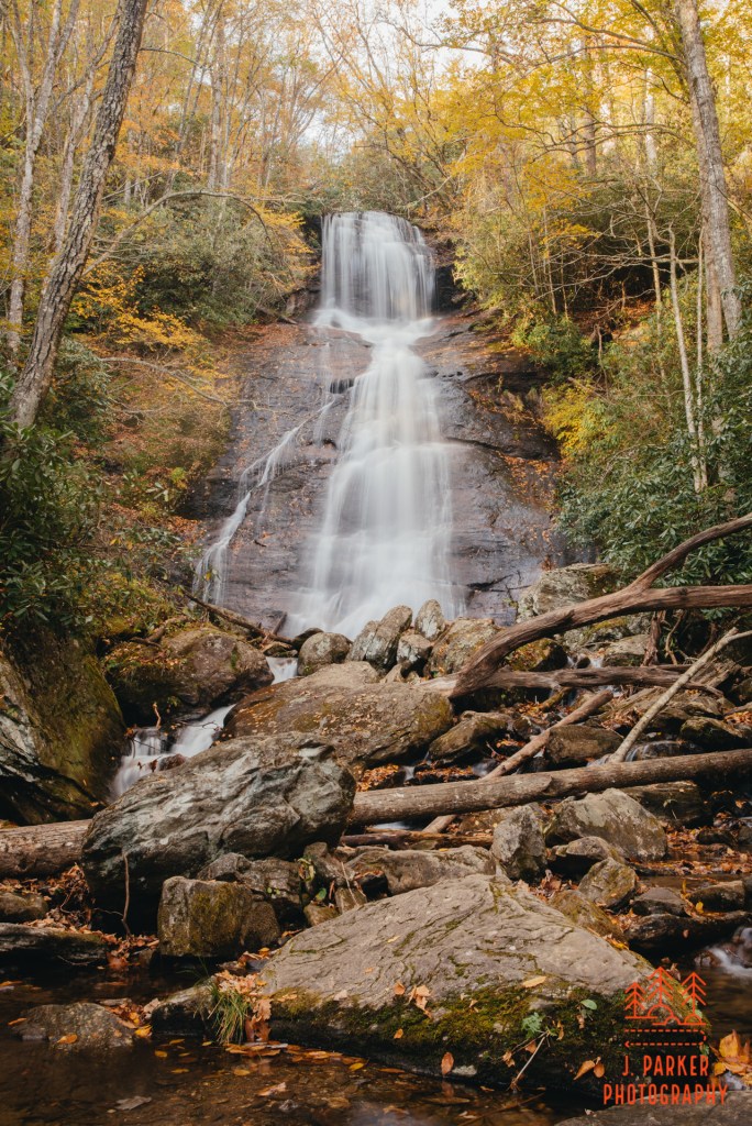
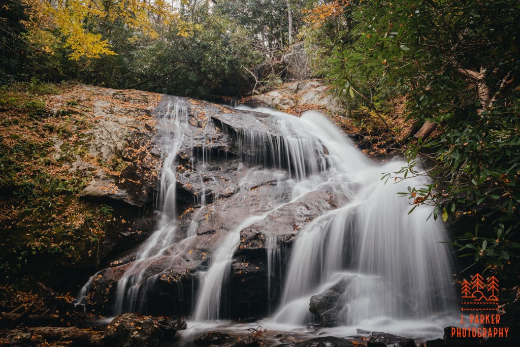
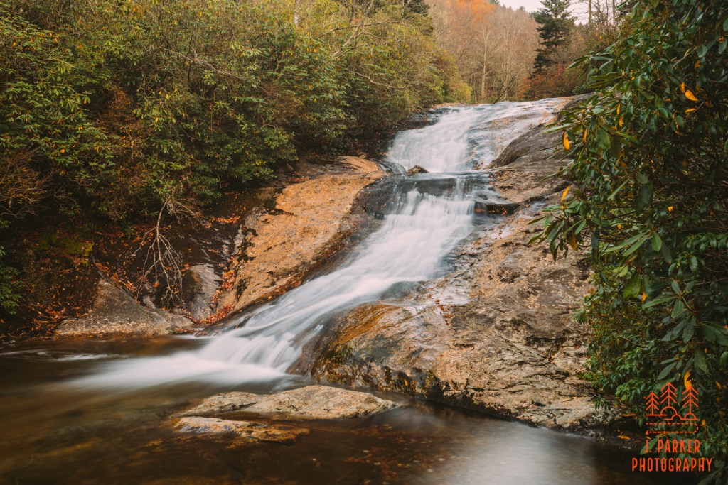
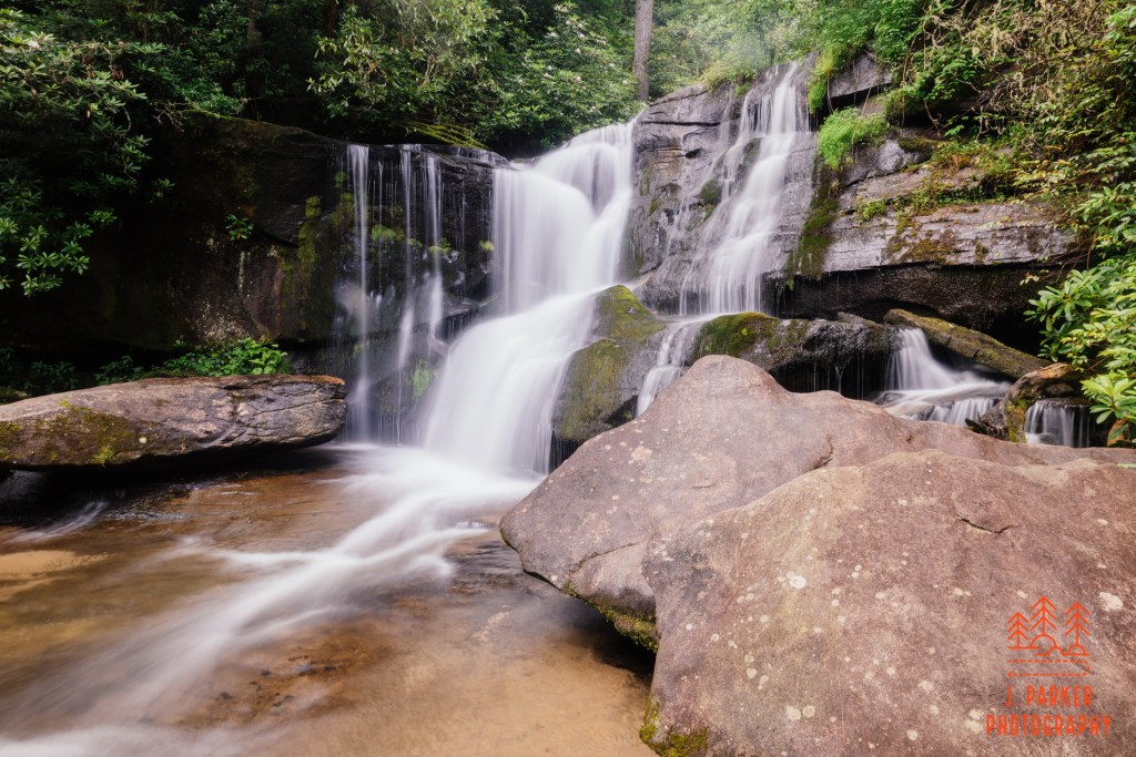
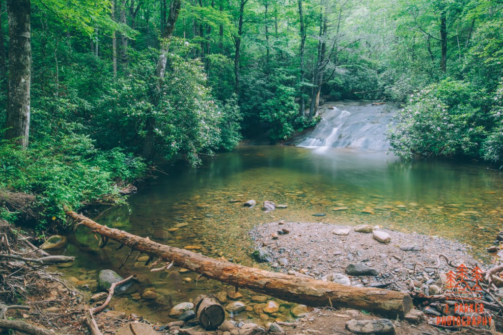
Once I had gotten my frame hammered down of the creek I packed up and headed towards the waterfall in earnest. I reached the fall and noted the shallow pool in front of it. I had expected this, since I had seen pictures of some of my friends standing in this pool when they had visited over the summer. When I saw that there was nobody in the pool or otherwise climbing on the waterfall, I didn’t hesitate, and in no time I had my tripod deployed and the fall frame. And just as I had hoped, the sun had finally gone far enough down that it wasn’t going to impact my shot. I took aim and fired.
Catawba Falls
I didn’t spend an immense amount of time honing my shot beyond a few variations in zoom. For one, I was wanting to get some shots of the river in the short period of good light before dark. But also, I was definitely encouraged to hurry this along when my feet, tired from the assault of 5 straight days of activity and not assisted by my bad hips, nearly lost footing in the water, possibly taking my very expensive camera rig down with it. That was all that was necessary to get me moving again. Catawba Falls, I hardly knew thee.
(there is an upper Catawba Falls that I was aware of. I had never entertained visiting that as I knew the trail was beyond my ability level being injured during this trip)
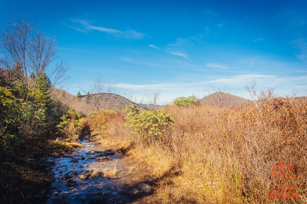
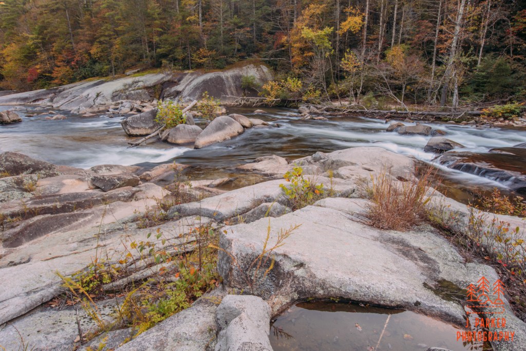
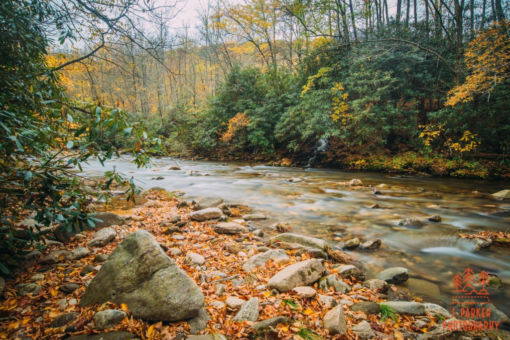
River downstream of the falls
I wasted absolutely no time getting down to the river however I could. The light was finally good, and I was going to take advantage, but it was ever so close to dark now – I had really hoped I would get more time. The first place I came too looked more exciting in person than it did in the camera once I got setup, but not wanting to leave completely empty handed I did a few cursory shots anyway before moving foward.
Miniature waterfall
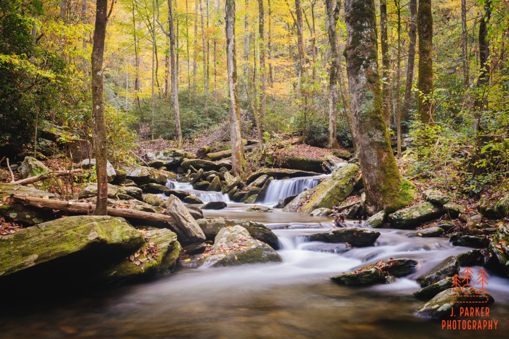
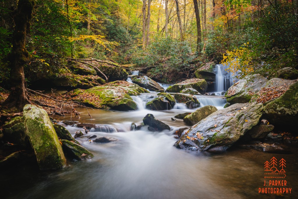
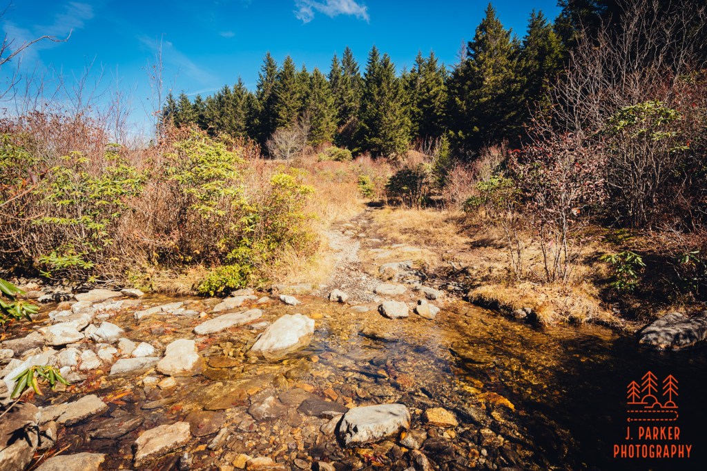
I next made my way down on a much more difficult descent to what was essentially a small waterfall, flowing over another set of rocks adorned with leaves, with more nice color in the frame. I thought this was a pretty cool spot, and I felt really good as I was dialing it up for a shot. What I found when I actually got to review the shots sometime later was that it didn’t pop on the screen quite as well as it did in the camera. Still, this was a better representation of the river than I had gotten thus far.
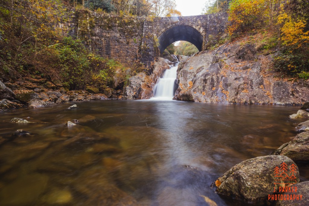
The old mill falls.
While on the outbound leg of my journey I had noted the location of the old mill, which is essentially another unofficial waterfall located along the trail. What is unofficial about it is that this fall is actually pretty much artificial, being the result of manmade activity years ago. Nevertheless I thought it would make a good picture- at least I did before I went down to see it in person. I had done a really treacherous descent to Upper Dill Falls a few days prior, and in general I had been very aggressive at doing scrambles I normally would have passed up. This little to scramble down to the mill may have been the most challenging I did, and I found that from the bottom it wasn’t exactly the spectacle I was hoping for. A big reason why was that the upper tier was almost entirely obscured from where I could get to. What had made this look potentially worth the challenge in the first place was the two tiers in succession. So again, I took a half-hearted shot, but this was one scramble that was definitely not worth the effort at all.
Daylight, and by extension my time in the mountains, was evaporating quickly. I still didn’t feel like I’d gotten one noteworthy shot of what was a tremendously captivating waterway. I was beginning to feel a little desperate. For me, it wasn’t necessarily for my own vanity that I needed even more shots to add to what by now is a pretty good list examples to show that I can photograph well every now and then. It was more that I had seen something truly beautiful, and I wanted to share with others. And for my own sake, I wanted an image for posterity and to capture my experience that I could view years and years from now. Forward I moved, taking the next chance I could to get down to the river as there were only waning minutes left before all it was too dark to photograph.
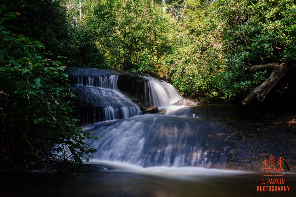
The familiar small waterfall
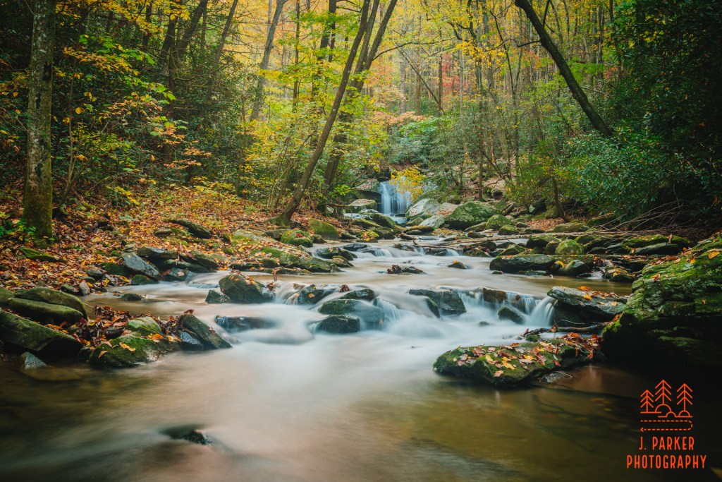
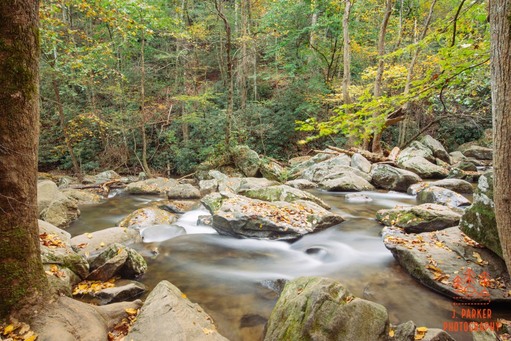
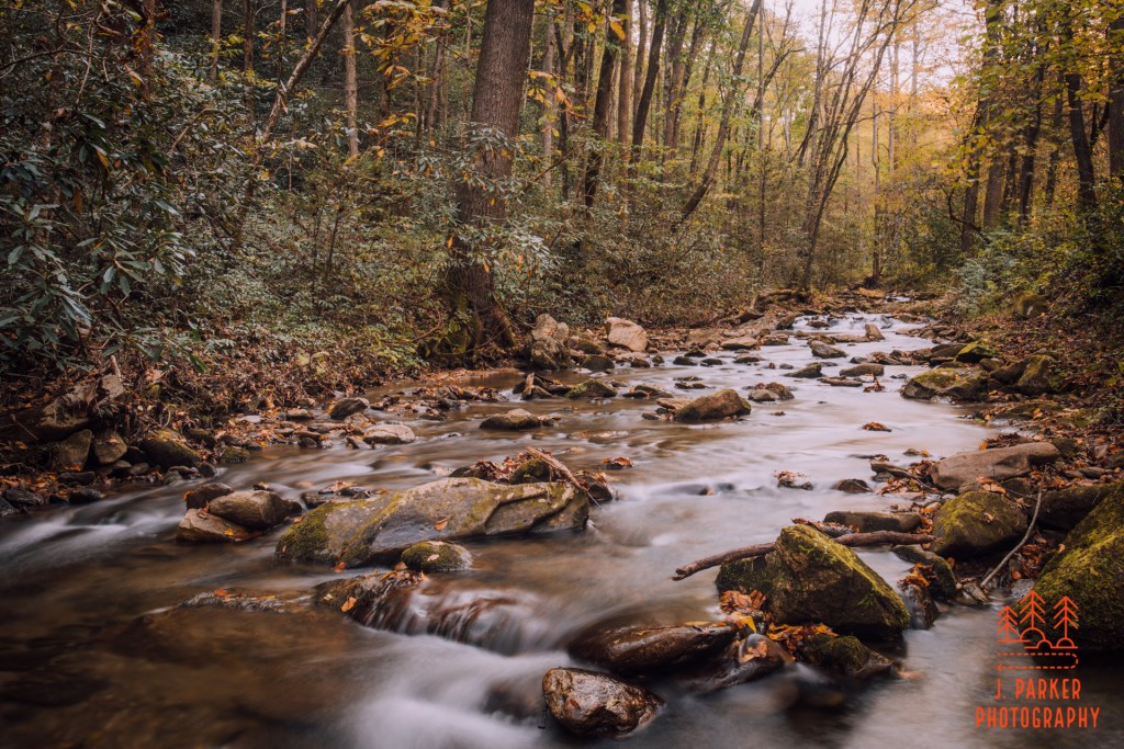
The next path I took down to the river was another somewhat challenging scramble that involved clawing through some brush at the end, but I finally emerged at a familiar spot right near the small waterfall I had seen on my very first side trek to the riverbed here. By now, I didn’t have time to overthink, so I dropped the tripod down and did the long exposure version of firing away. I got the most balanced frame I could and as long as it appeared I got things in focus without camera shake I moved on to the next.
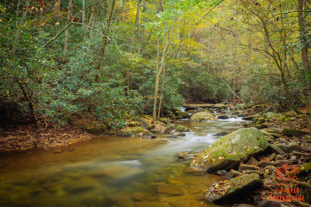
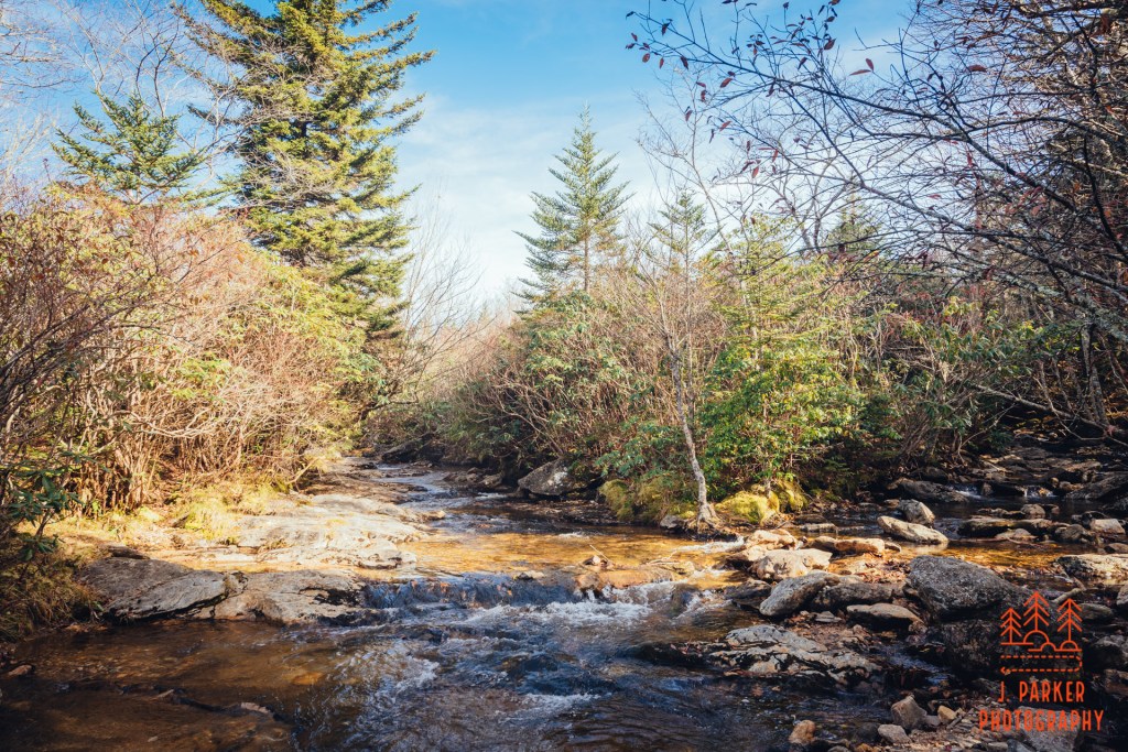
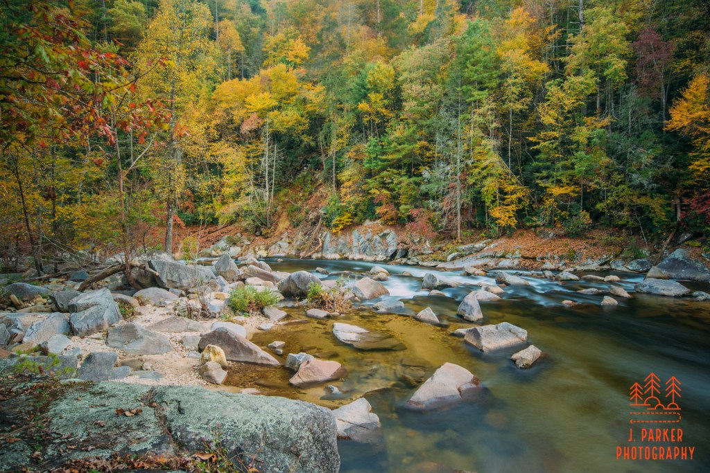
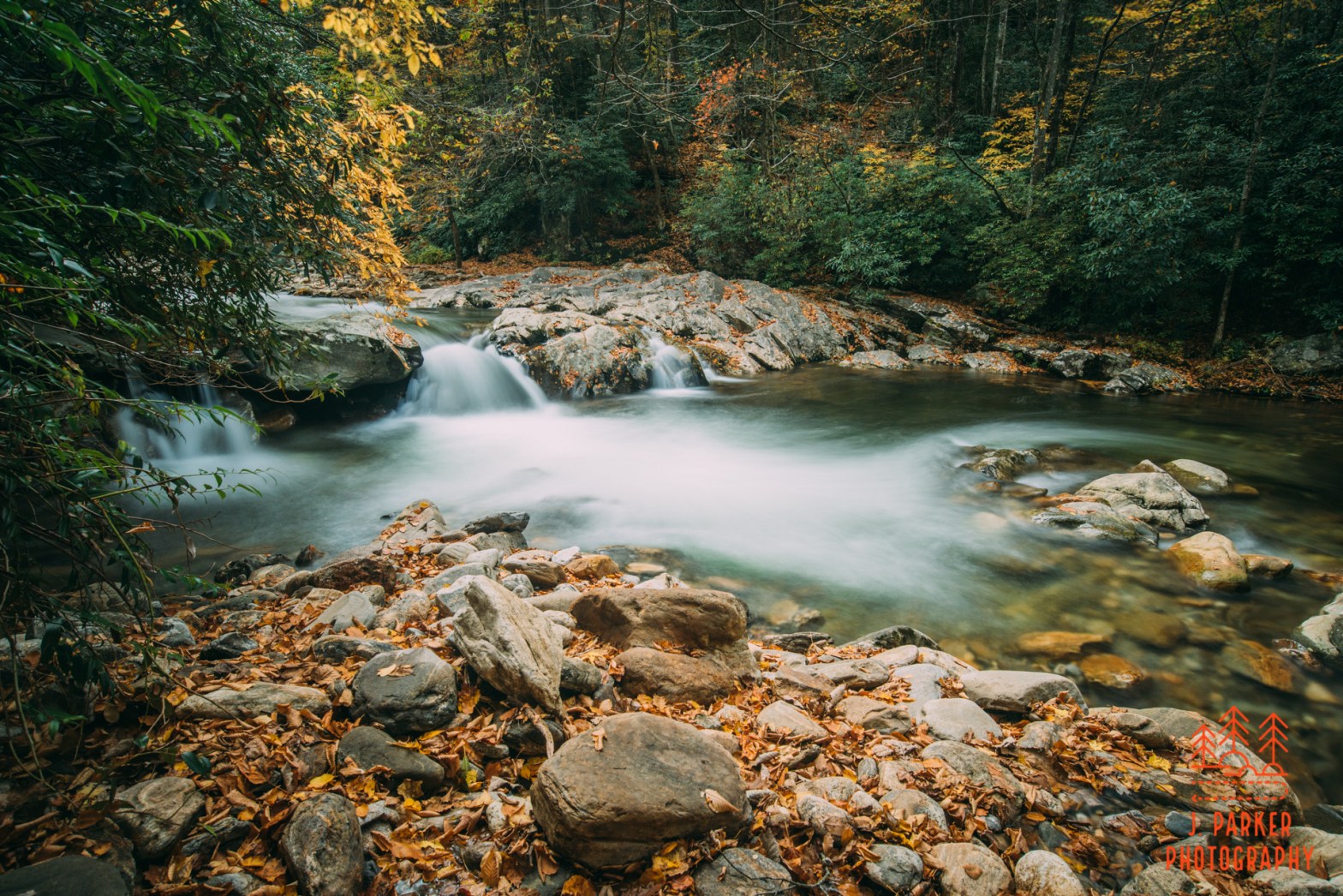
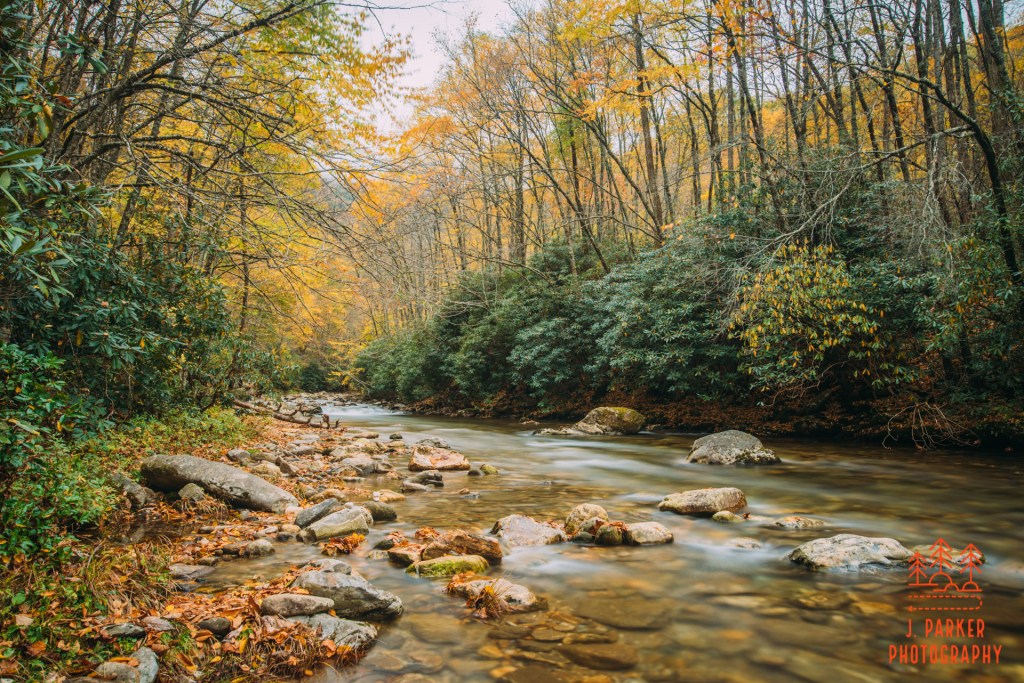
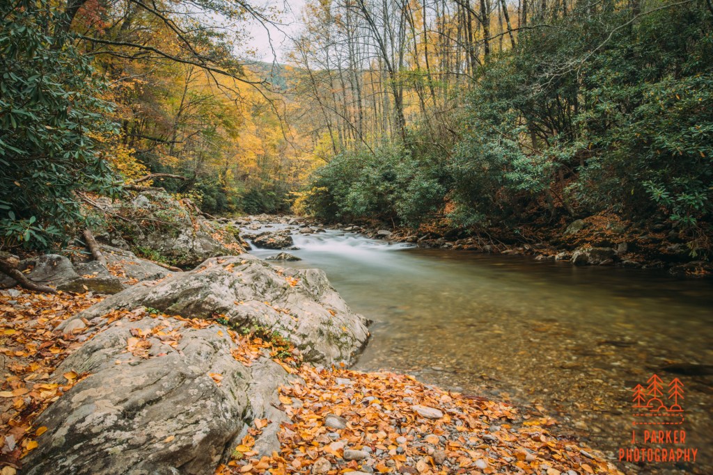
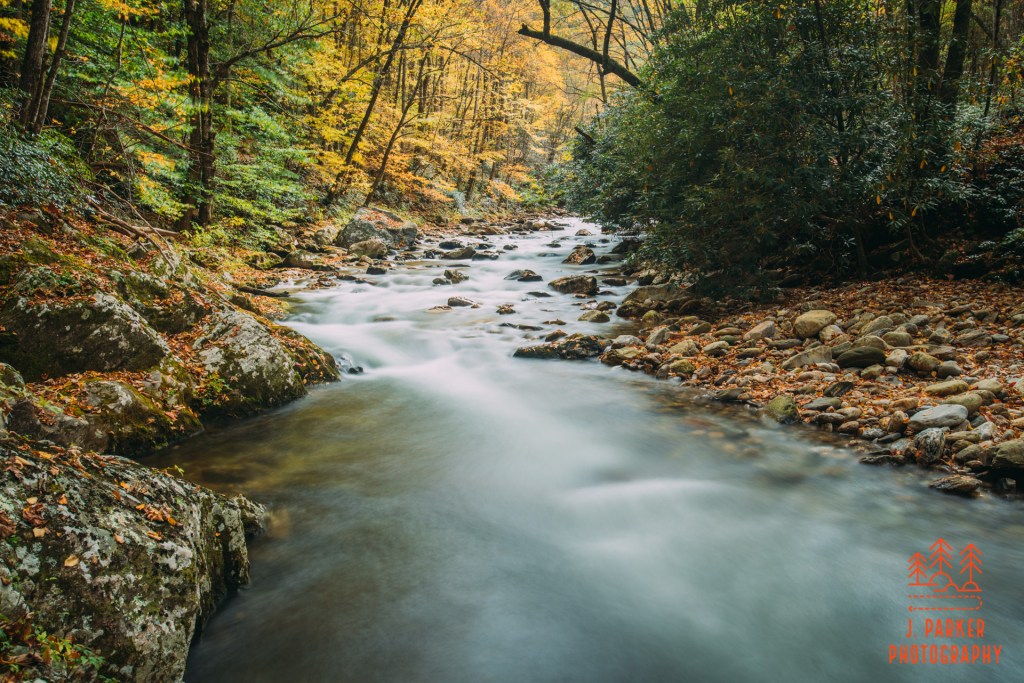
Catawba River
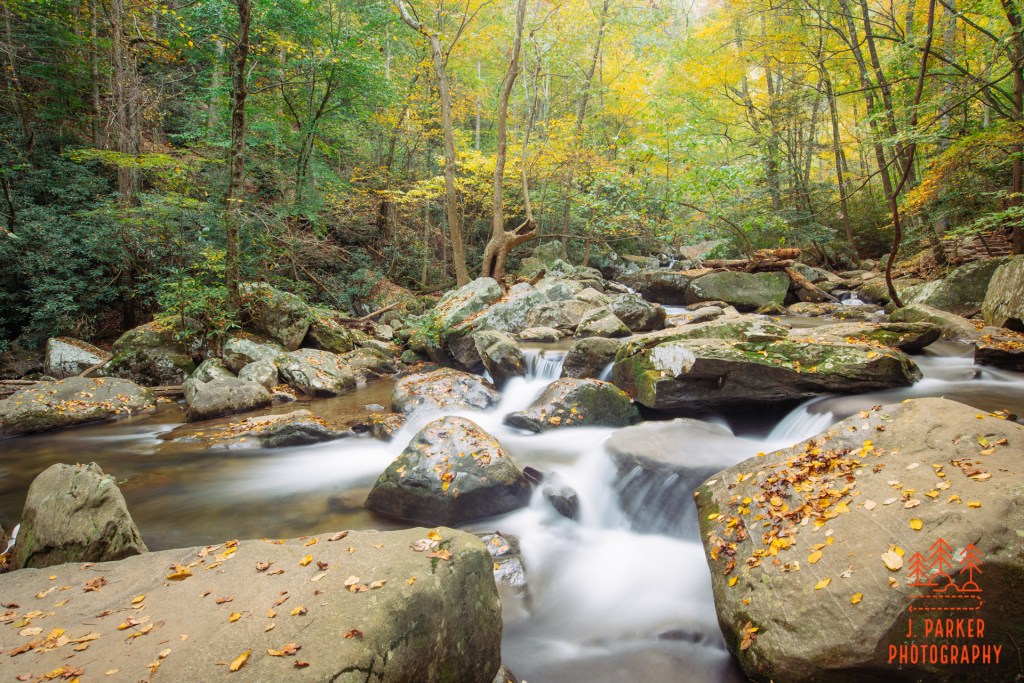
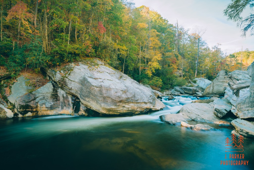
I’m not the least bit shy about getting my feet wet in these small creeks and rivers if it’s what’s needed to get a good shot – and usually it is. Doing that in this river was kind of easier said than done though. It had a very rock and uneven course, both above and below water. With it being so close to dark I really couldn’t see what was underwater well at all. It took a lot of effort and concentration to safely move downstream so I could get a different shot. I mostly stayed very low to the ground and used my tripod as an impromptu walking stick whenever possible. I definitely felt rewarded though when I found a nice angled shot of the river that also included the color in the area and the small fall in the background. Here, mere minutes before complete darkness, I was finally getting the shots of the river I had hoped for.
Late shot of Catawba River
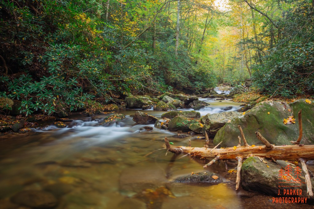
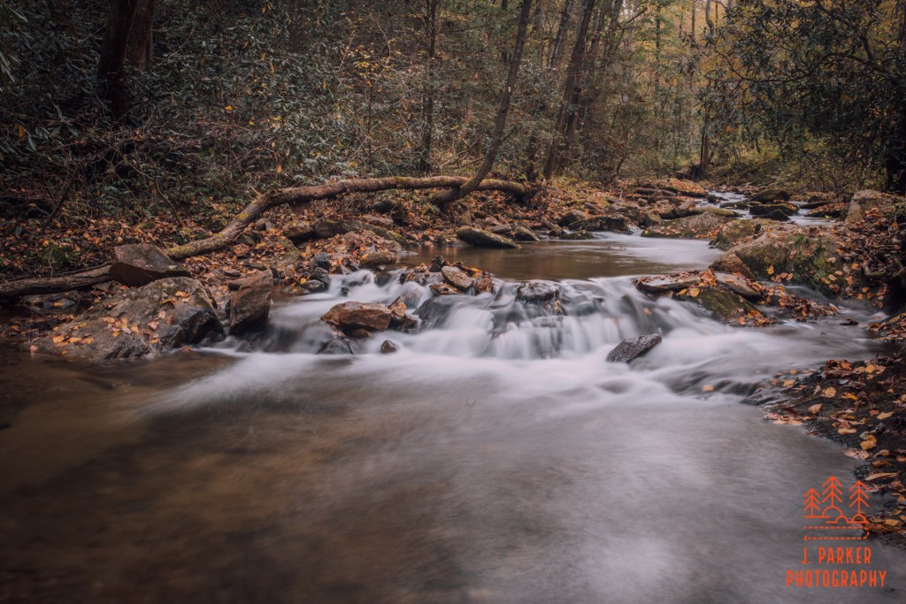
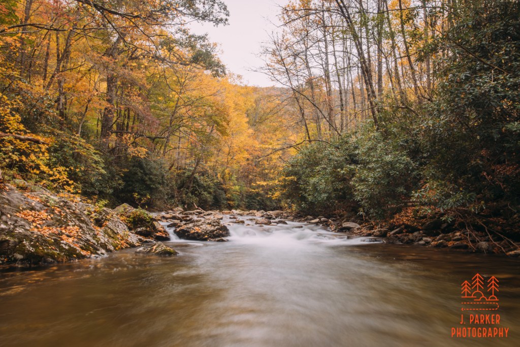
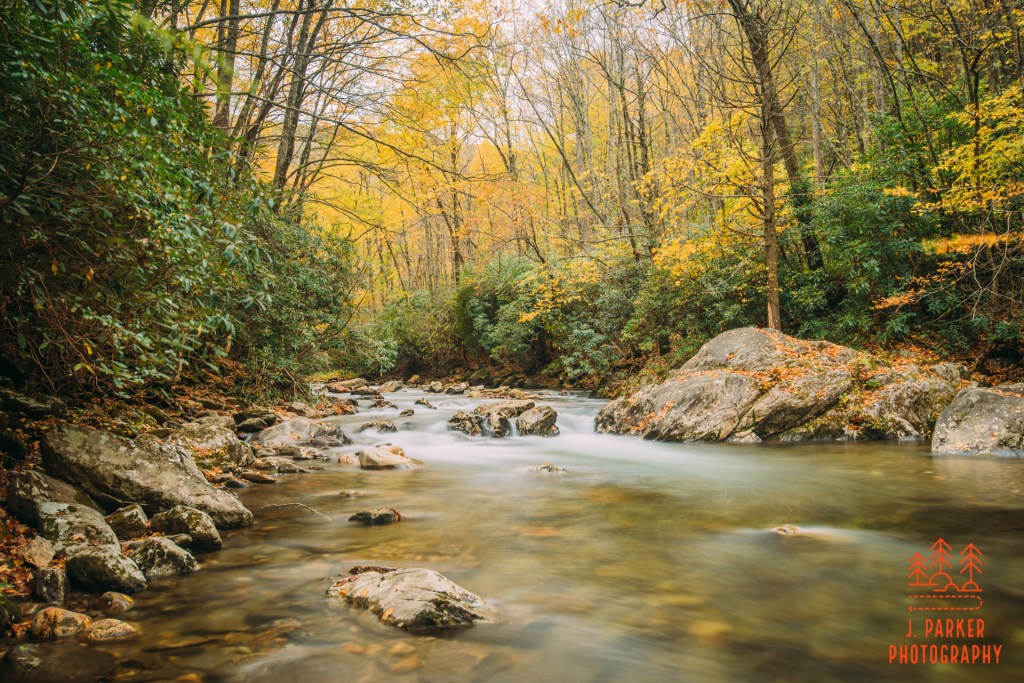
I moved back even farther, ever so carefully working my way past another set of small rapids in the process, and I absolutely loved what I saw. The rapids made such a beautiful subject. Not that it was a surprise that they did – this was the second time I had visited them today. They are the same ones I had been at earlier, only now the sun wasn’t casting uneven light along the river. In fact, the sun wasn’t casting any light at all. It was clear that this was it – this was the last spot I could photograph at Catawba Falls. This is the last spot I could photograph before leaving the mountains. This is the last spot I could photograph before having hip surgery and losing the ability to hike for possibly a very long time.
Knowing that, I couldn’t stop trying to hone in on the shot, I couldn’t stop trying to perfect it. I made minor variations, stuff so small that when viewing the pictures later I might not even be able to tell what I was trying to do. Though it was only a few minutes, I photographed until the camera couldn’t focus anymore in the dark. I felt my feet grow numb in the cold water of the fall creek, but I didn’t mind. The fact that I could feel discomfort holding my feet in a cold mountain creek at dusk made me feel alive. I didn’t want to let go on the trip, one that had started with me legitimately afraid that I wouldn’t be able to walk more than half a mile before my bad hip would get too inflamed to continue, and ended up seeing me do some of the longest, most challenging, and adventurous hiking I’d ever done despite two bad hips. I didn’t want to confront the reality that was waiting for me at home – having to return for another stressful week of work prior to surgery, then having to deal with whatever pain and other trials the surgery left me with. I wish I could have never left the Catawba River, but it WAS dark, and I wanted dinner too.
The last shot of solocation 2021.
I solemnly headed back uptrail, with the trickle of families that had been at the falls late also making the trek. I had no possibility of photographing anything, and could scarcely see the trees lining the trail, but just the sense that I was in the forest for a few more minutes gave me a bit of joy. AS I reached the car and began stowing my gear, the fun of my pre-surgery mini trip had ended. From here on it was all going to be business – the journey back to Florida, back to the real world, and back to significant challenges.
I found Catawba Falls just as beautiful of a place as South Mountains State Park, but even though I had ever so limited time to photograph either place in the absence of overwhelming sunlight, I seemed to have much better luck at South Mountains. Nearly every place I was able to reach to setup there was a good shot easily found. At Catawba Falls, I just didn’t have the same luck in finding great frames under duress. Likewise, I hadn’t been able to do but a fraction of what was at South Mountains State Park – only doing the journey to High Shoals Falls and back – but what I did get to do, I feel like I saw the best it had to offer. With Catawba Falls, there was just enough degree of separation between you and the river to make it take a bit of effort to get an up close view of the river in all but a few places. Thus I ended up feeling like there was a lot of stuff left unseen, even though the course of the trail was only a mile and a half.
I was right to feel concerned about the effects of the surgery on my ability to hike. Even having to spent a few months not hiking back home in Florida is hard for me to swallow. Following the surgery, I was able to hike in gradually increasing doses 3-4 months following the surgery, but it’s now more than 6 months after the surgery and I am still having significant pain and trouble every day. I’ve made it to nearly 8 miles since the surgery, with some discomfort of course, but have done that in Florida, where even our most hilly trails are barely more than speed bumps compared t the mountains. I have serious doubts about whether or not I’ll make it hiking in the mountains. I have serious doubts about whether I’ll ever resume a normal life where pain and dysfunction isn’t limiting me. So this trip I took, working my way through on bad hips – it was a worthwhile endeavour. I may not have been able to photograph places like Catawba Falls the way I would have wanted to, but I did get out and get to explore and enjoy, and I will never take that for granted with what I have been through. If you have that ability, neither should you.
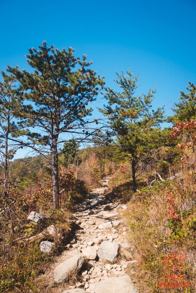
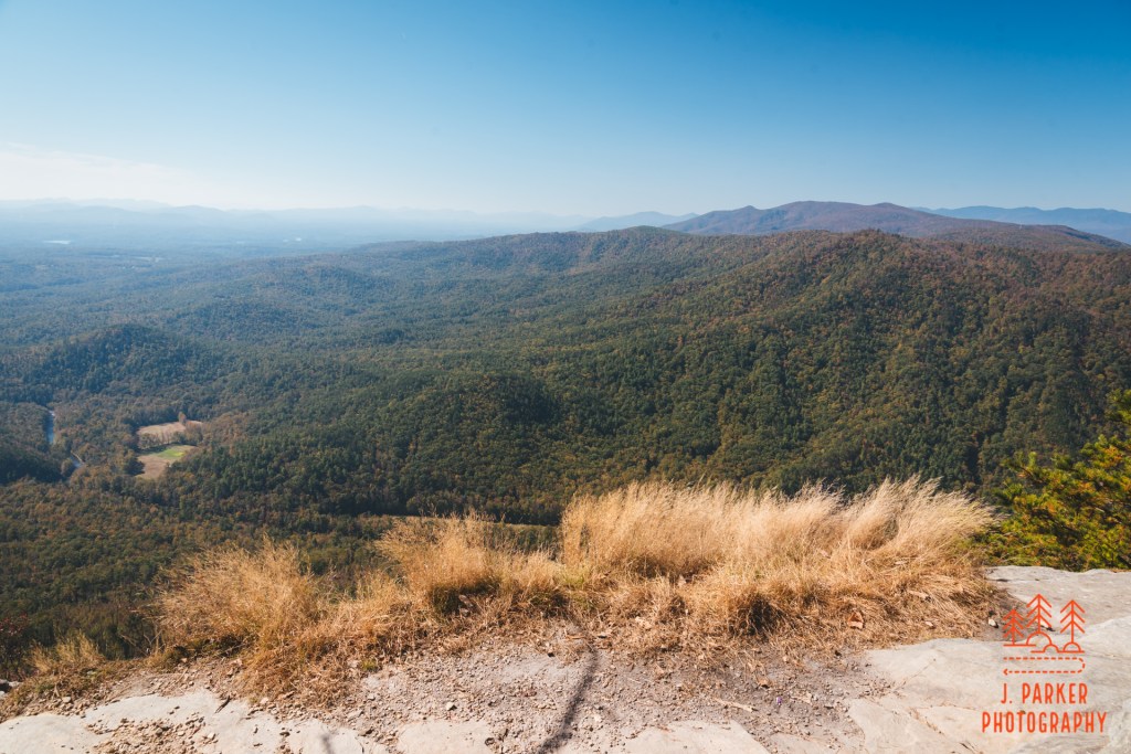
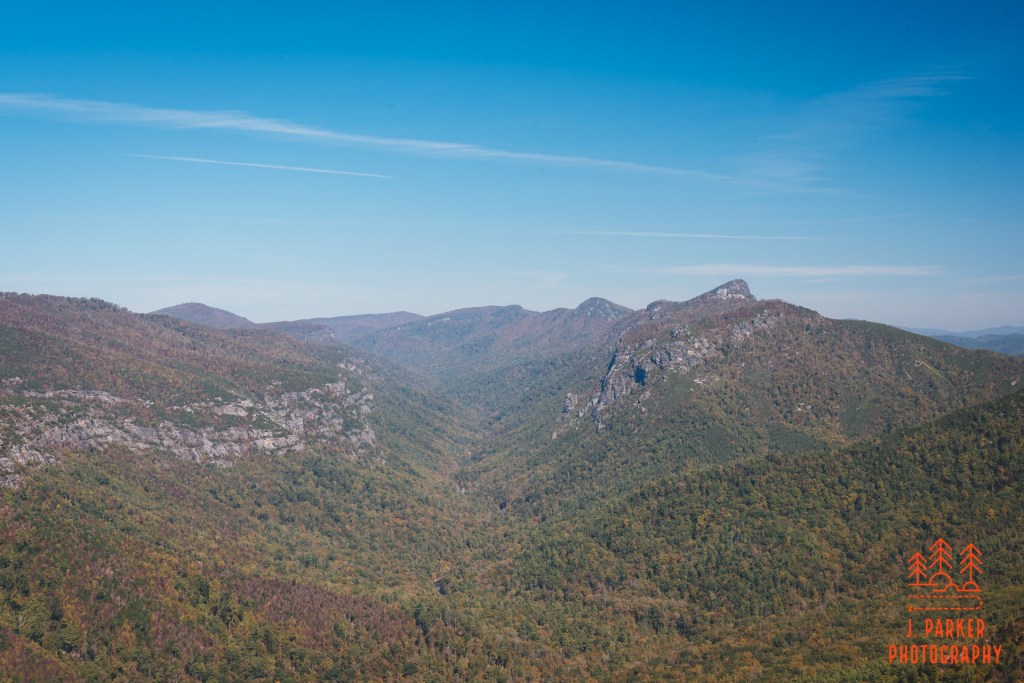
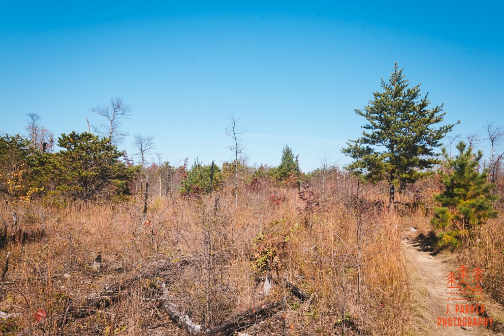
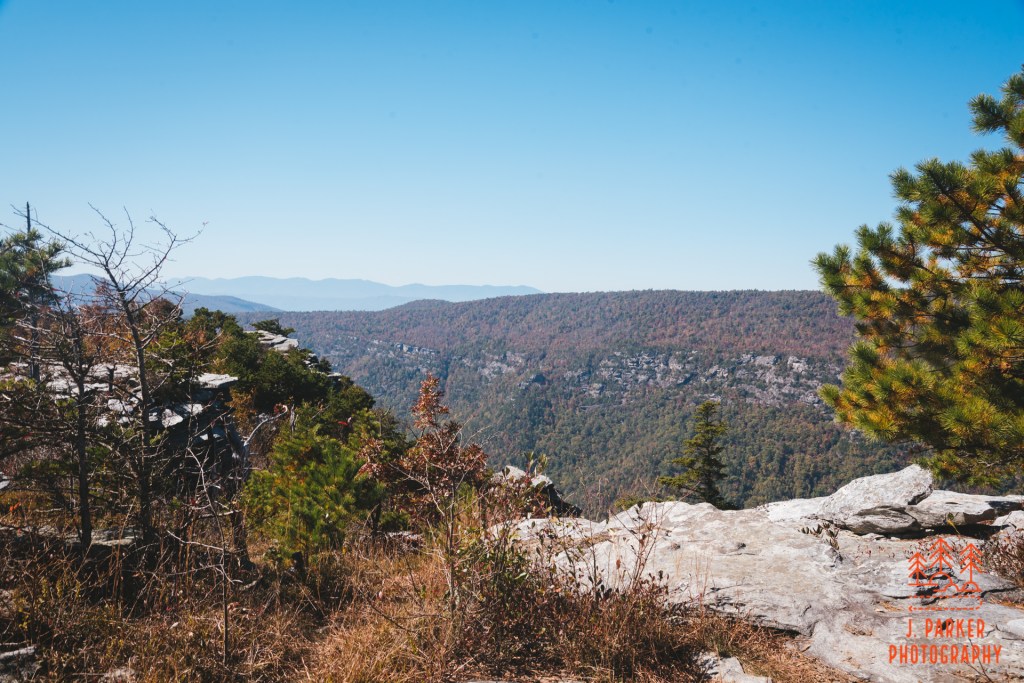
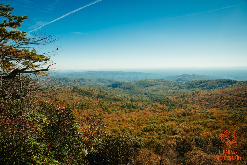
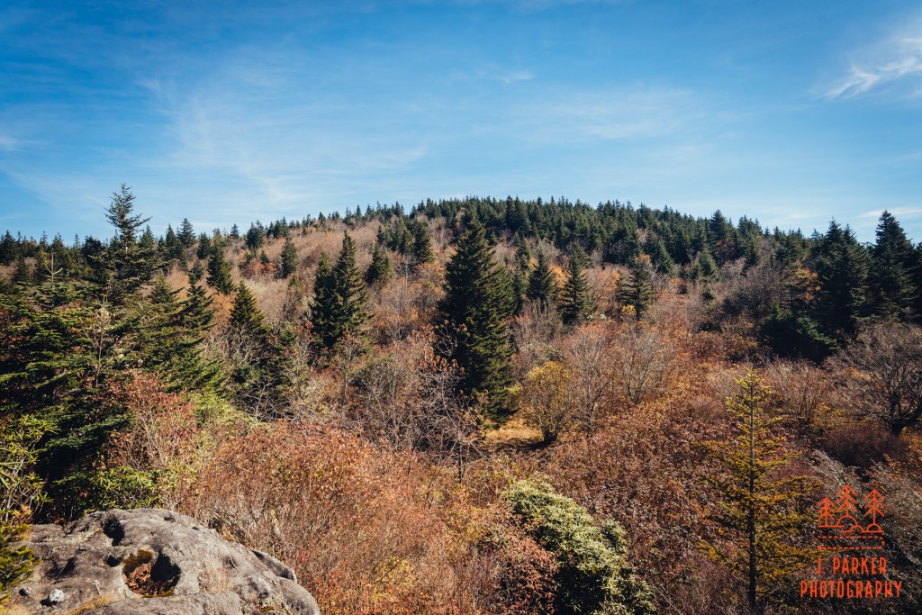
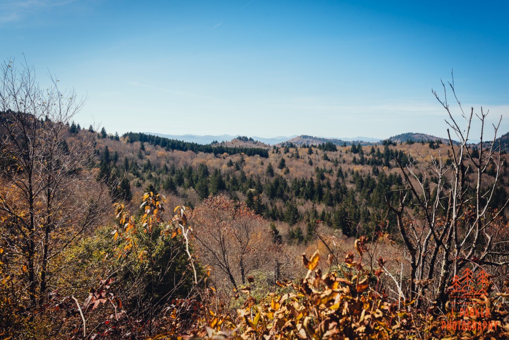
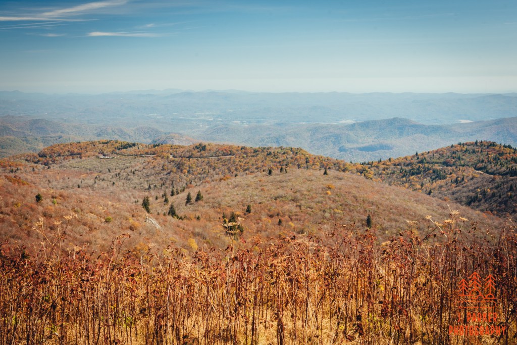
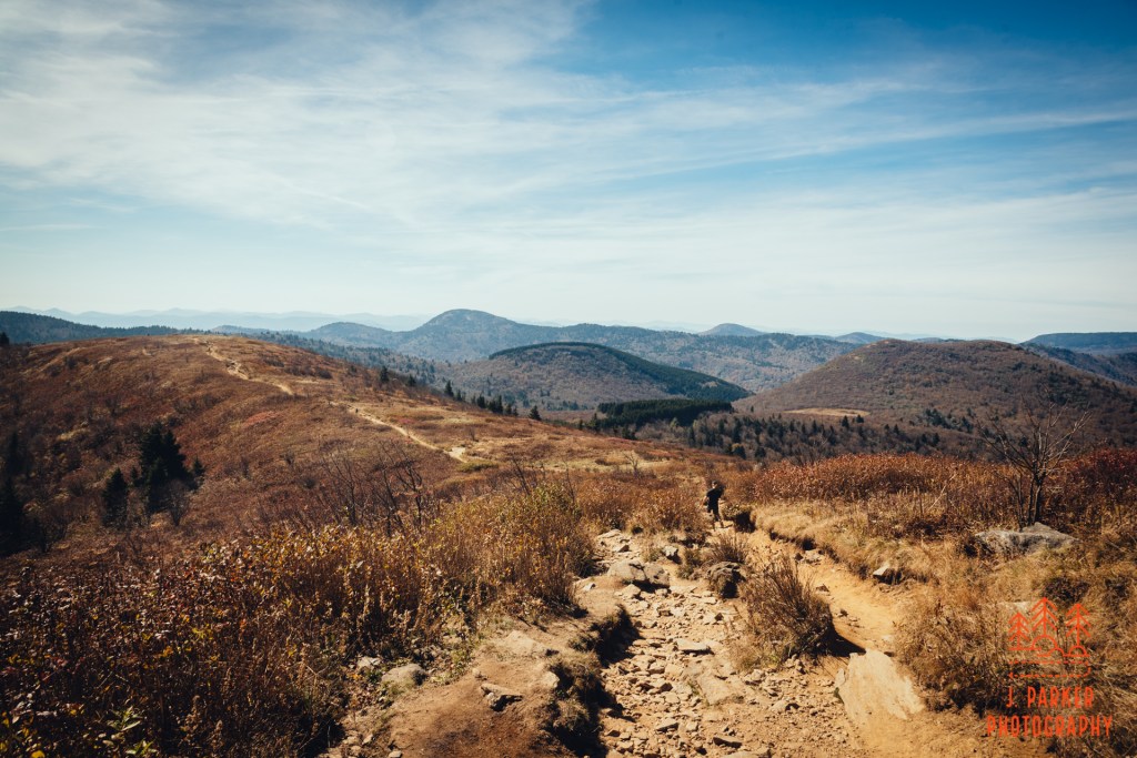
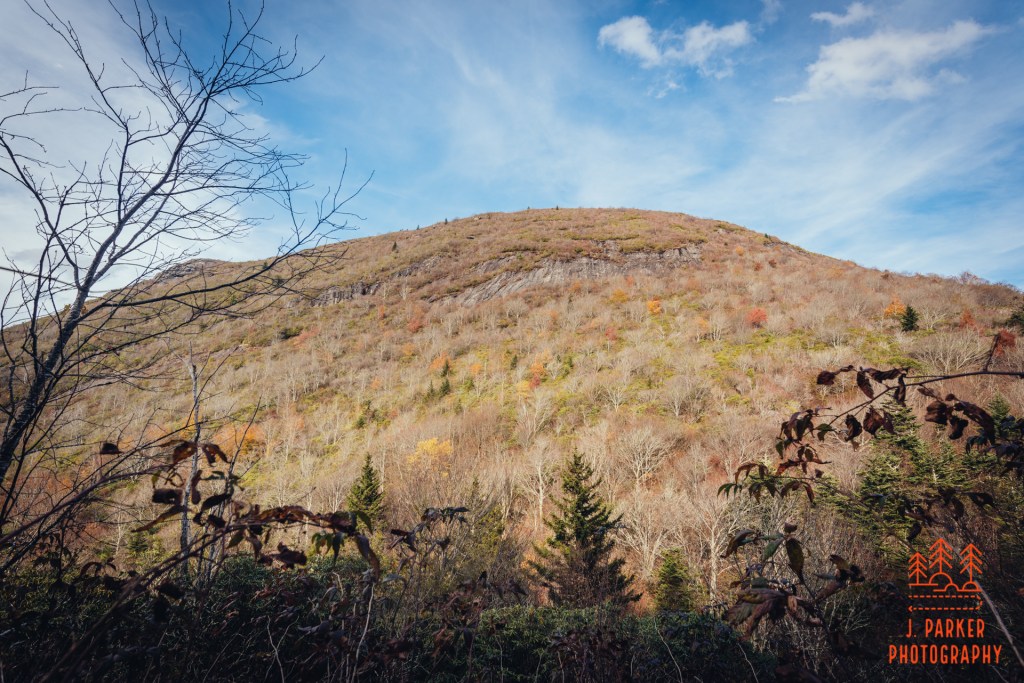
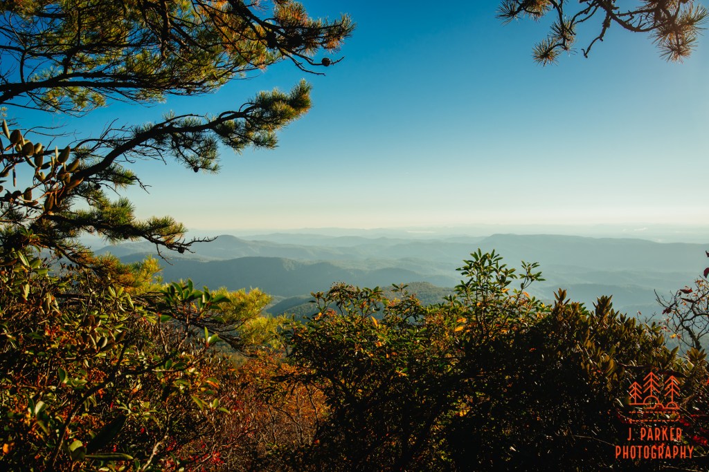
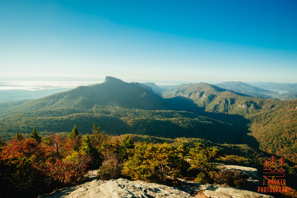
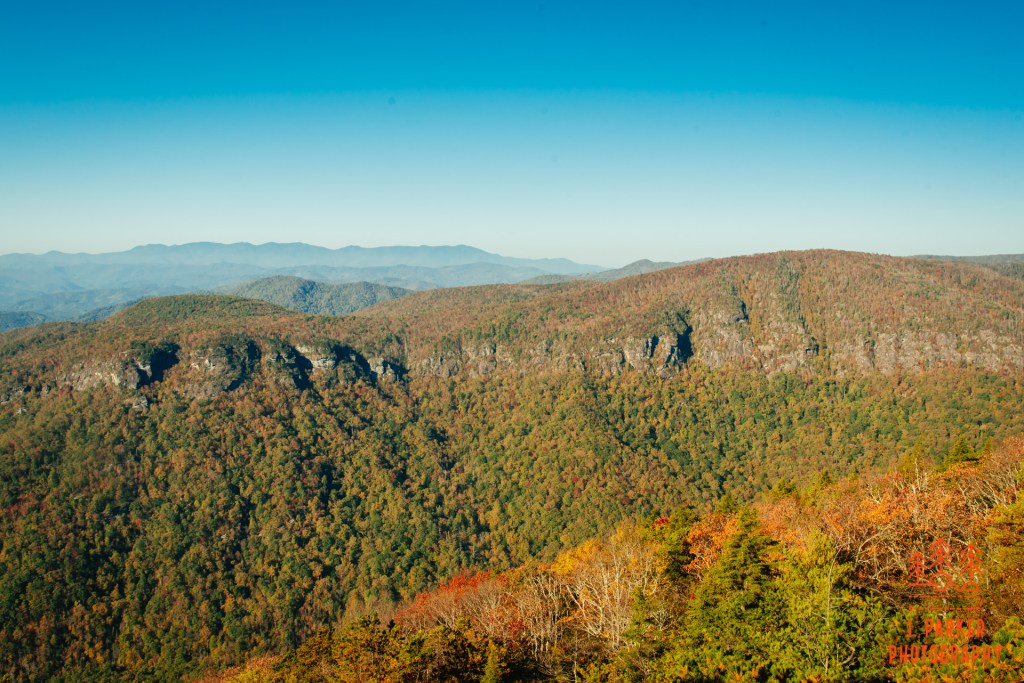
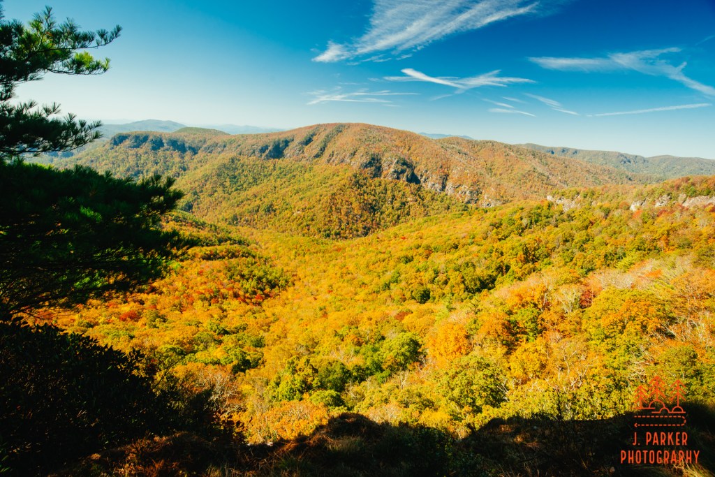
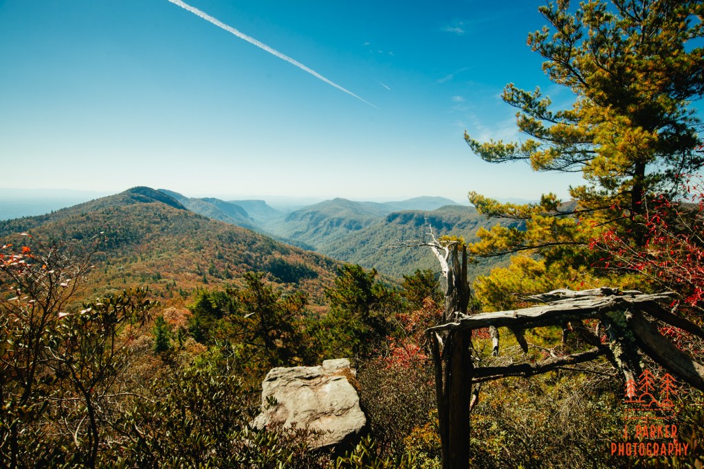
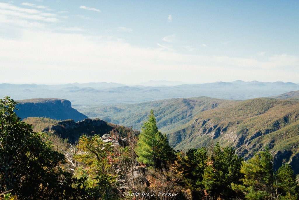
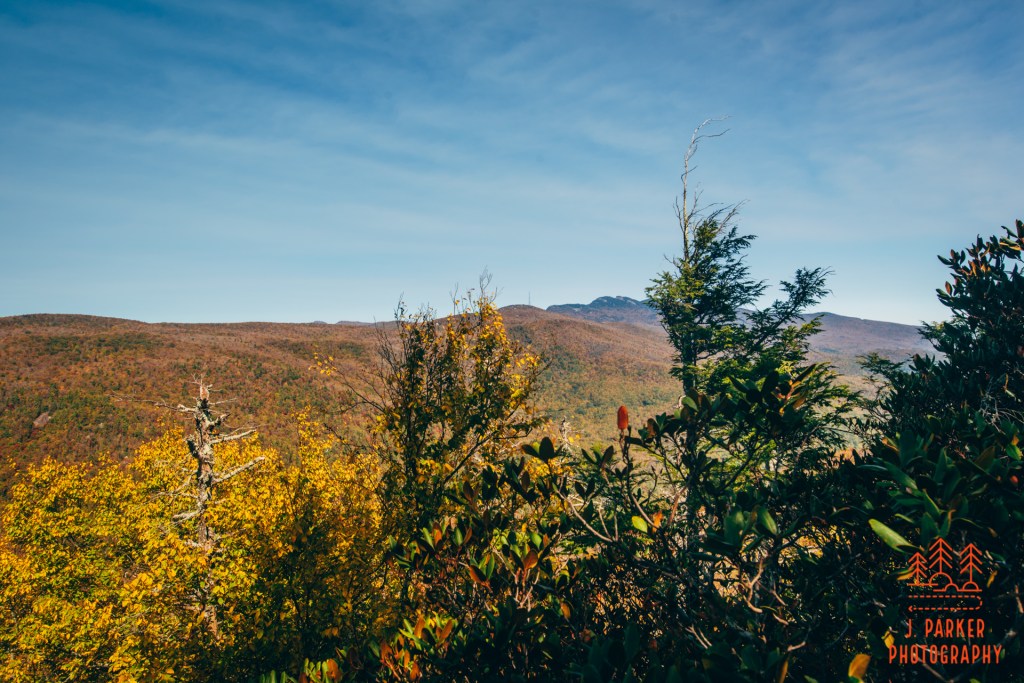
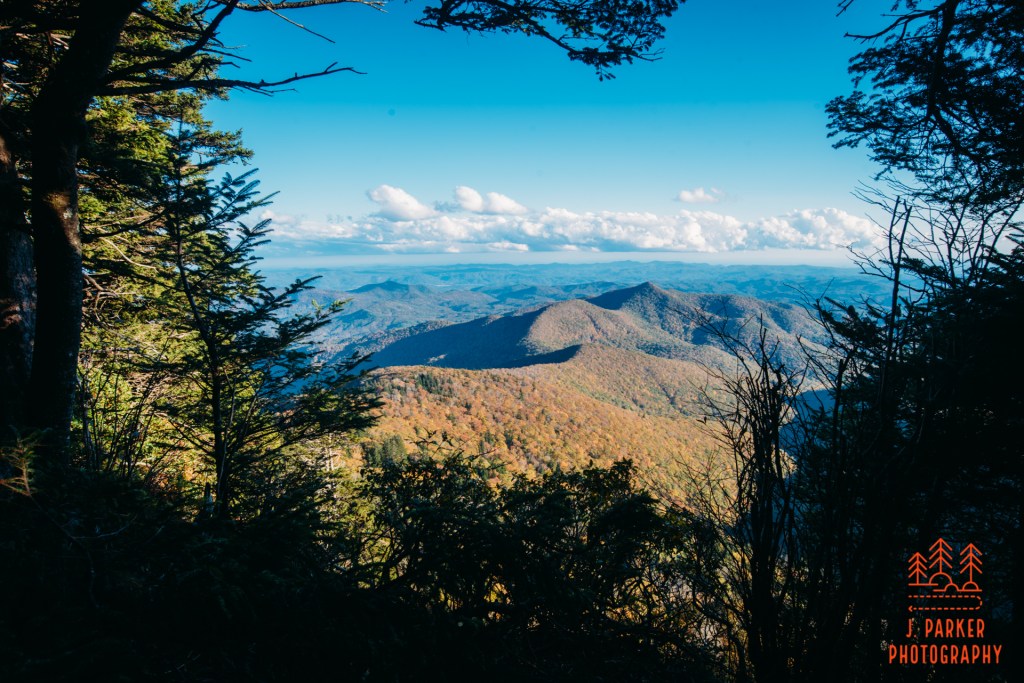
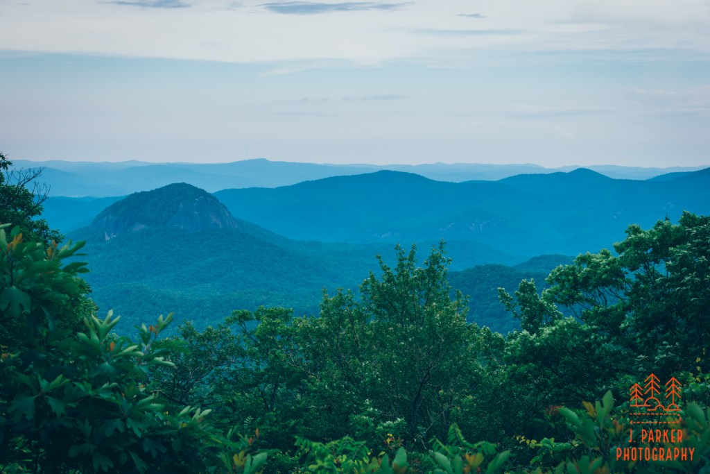
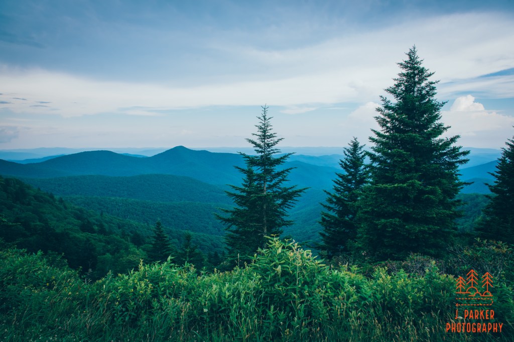
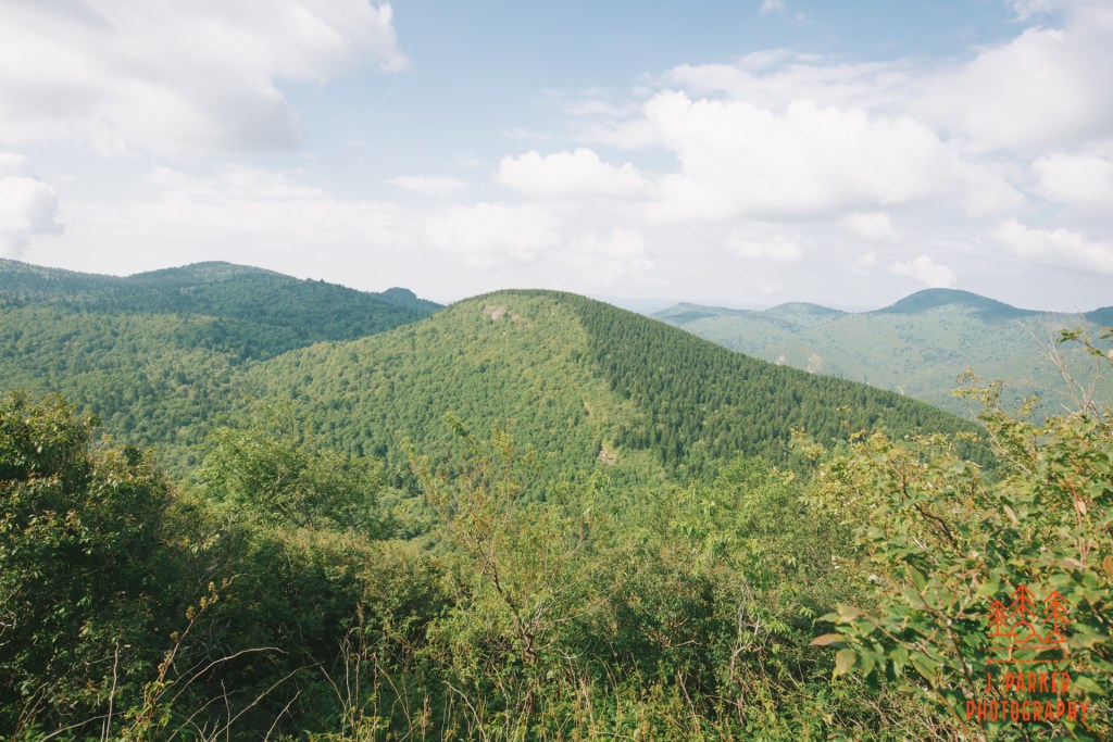
My feet made a grinding sound as they trudged along the dusty and rocky pathway, no doubt trapping some of the small rocks that littered the trail with each step I took. The landscape ahead was dark and scrubby, and if not for the immensely blue sky it may have appeared quite foreboding. As it was, it was mind numbing, for it was the same landscape I’d been hiking in the hour since I’d left the Wolf Pit parking area, a lot that couldn’t have been difficult to park in had it been an actual pit of wolves. For better or worse, I was venturing towards a wide elevated plateau that would no doubt have some impeccable views. But the worse of that was reaching that plateau required navigating a constant uphill grade for nearly two miles, all in the same unending wasteland I’d been journeying through.
This was Shortoff Mountain.
The unending pine-filled woods of Shortoff Mountain
Hiking up a mountain is a phrase that sounds fairly ominous for those who haven’t done it a couple times. For those who have, they know the journeys are not the dragon filled, death defying escape that they might have imagined. For one, dragons are expensive, so due to budget cutbacks they only appear on weekends now on most trails. But getting to the top is often a circuitous route involving only gradual climbs, a few highlights along the trail, and at least in Appalachia woods and other features which obscure the totality of the climb and keep you in anticipation of what you’ll see next.
Shortoff Mountain is not one of those. No, it does not have dragons, since they are banned in federally protected wilderness areas, but with an uphill hike pretty much entirely in the open, it leaves nothing to the imagination as far as how far you have to go and how much you have left to climb. It is far from the steepest, longest, or highest climb, but what it lacks in that category it makes up for with a special type of mental torture due to the drudgery of the uphill climb. It’s the type of trail where you should pick your hiking companions wisely, for you’ll be spending lots of time in conversation to pass the minutes. I was hiking this trail by myself, and I’m not very good company.
Pine woods of Shortoff
I had started the day by hiking in South Mountains State Park, starting well before dawn, which you can read about in my previous post. Given that I was going to have a 5th day in a row of painfully sunny weather, I knew Shortoff Mountain would be a perfect centerpiece to my final day in North Carolina prior to hip surgery in 10 days. For one, Shortoff is entirely about views, making it ideal for sunny weather. But also, since reading about in in 2017, I had been wanting to hike it. It’s the last for me of what I consider to be a triple crown of sorts for the moderate hikes of Linville Gorge’s east rim, a list which also includes Table Rock/The Chimneys, which I had done in 2017, and Hawksbill Mountain, which I had done two days ago. I would have hiked here in 2019 had Hurricane Dorian not caused my early return to Florida.
As I rushed up a consistently climbing dirt road a cloud of dust trailed my car, reflecting the speed at which I was navigating this rustic road. I was entirely aware of the fustercluck that Wolf Pit Trailhead can frequently be, and as one who tries not to park illegally because, for one, I don’t want to get my car towed, and two, I’m not an asshole, I wanted to get to Wolf Pit not too late in the morning. I usually quell my anxiety by just getting to sketchy parking situations first thing in the morning, but the cost of my brief trip to South Mountains is that I would be getting there around mid-morning.
Once I reached the Wolf Pit, I could easily see why the parking area causes so many issues. It’s hardly a suitable parking area for a festering port-a-potty, much less one of the signature hikes within driving range of Asheville. Calling it a parking area is hardly fitting, for it was more accurately a place where the road ended and there were a couple places to wedge a car between trees. If you weren’t one of the first dozen or so there, it no doubt took some creativity and bravado to find a place to park without blocking someone in. Luckily, this seemed to be a rather quiet Tuesday, and I found one of the few set parking spaces unoccupied.
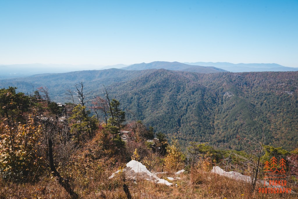
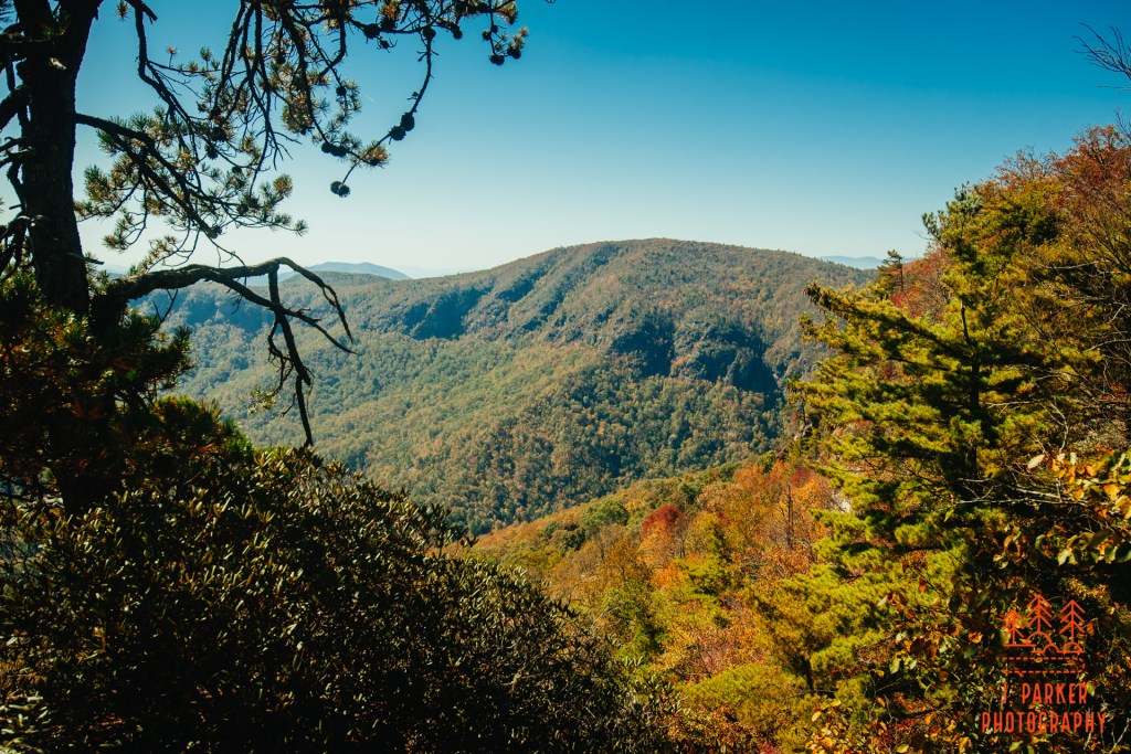
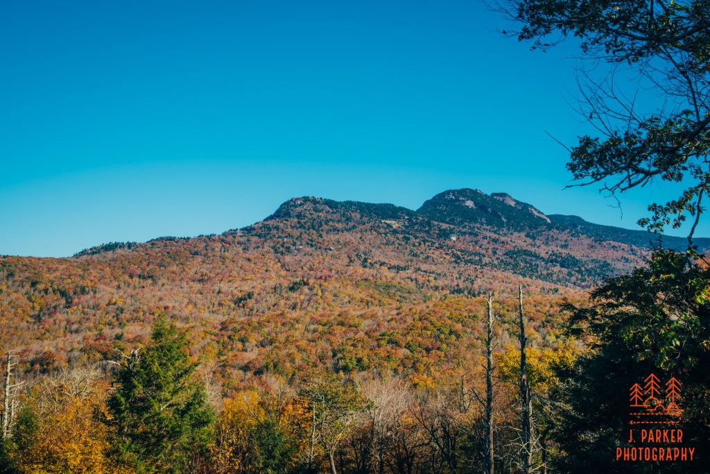
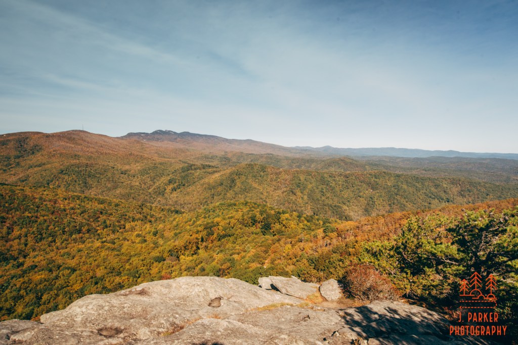
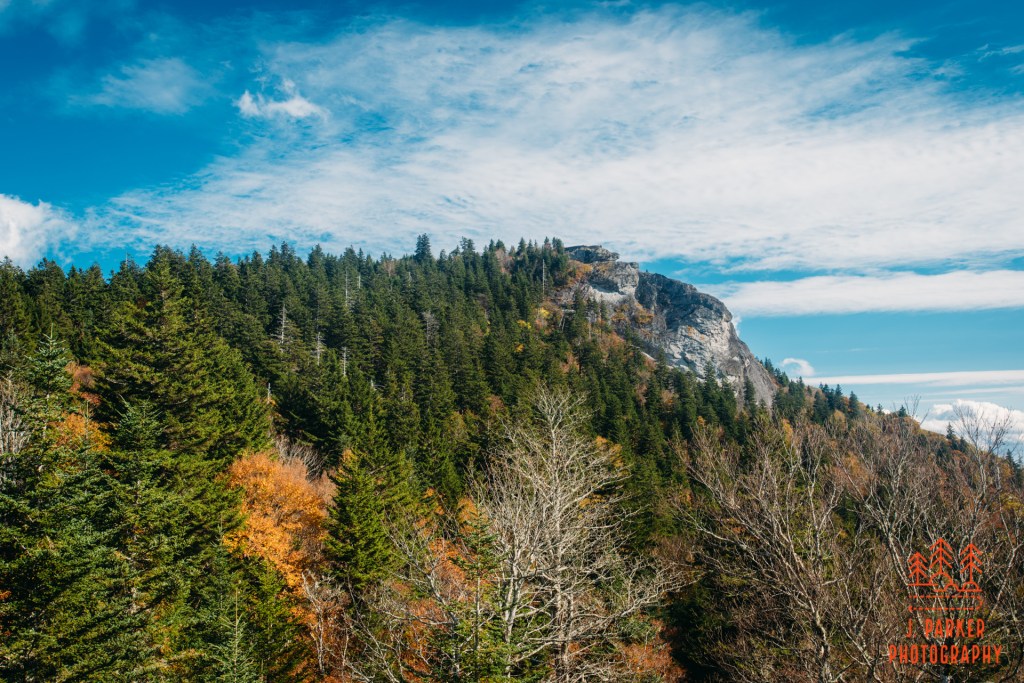
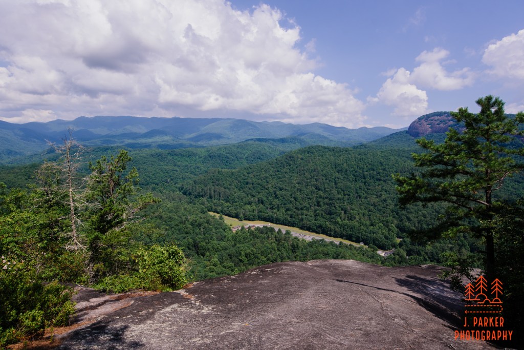
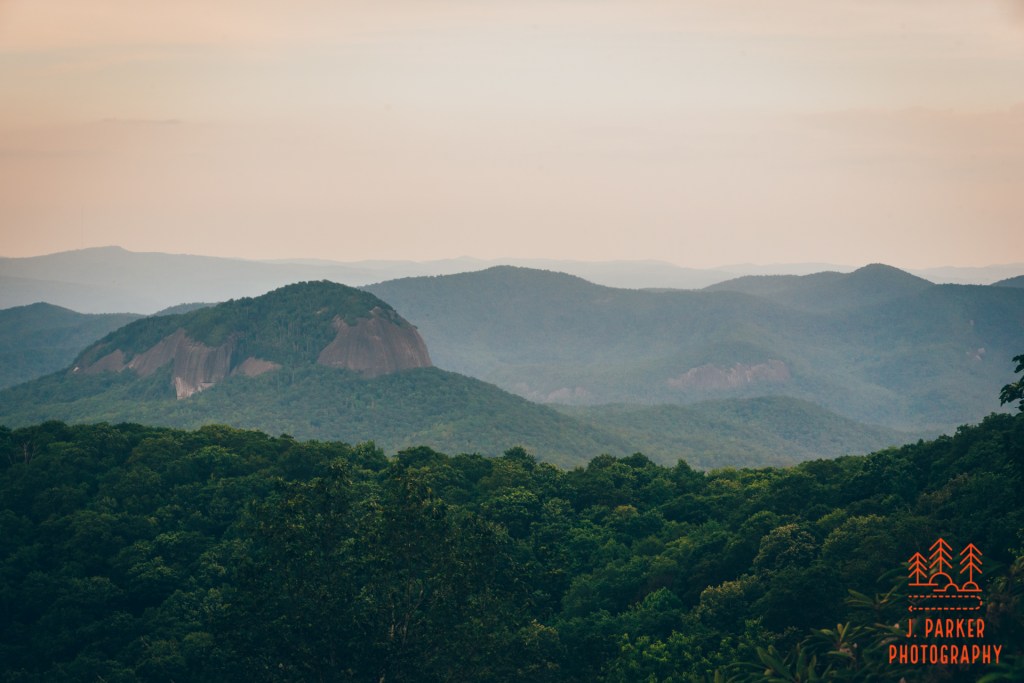
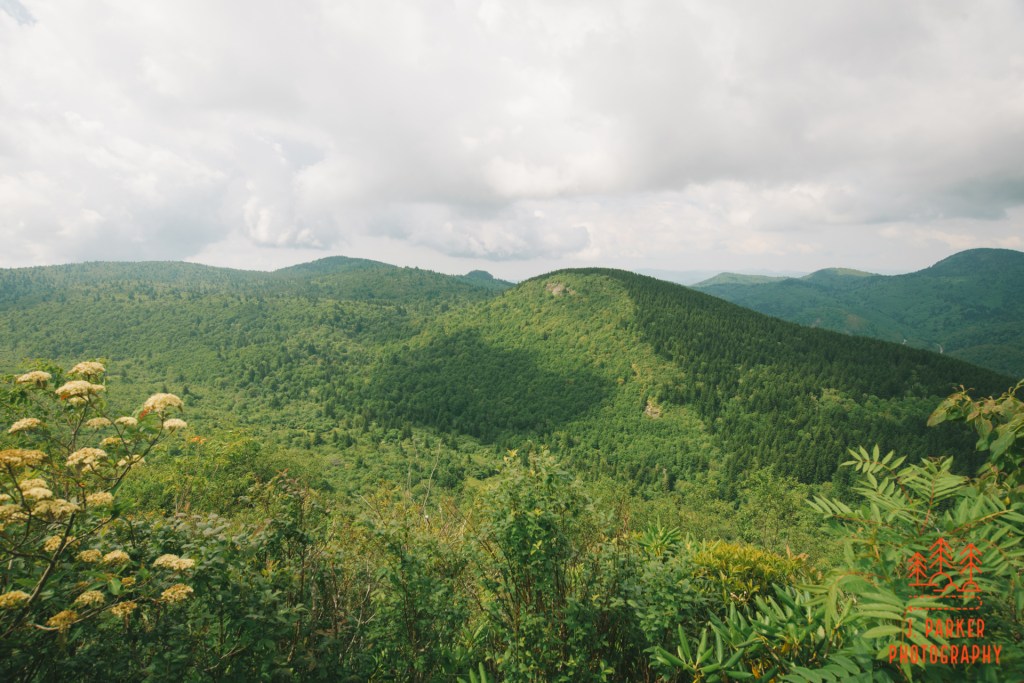
A look down the gorge from Hawksbill Mountain. Shortoff is the flat peak to the center left.
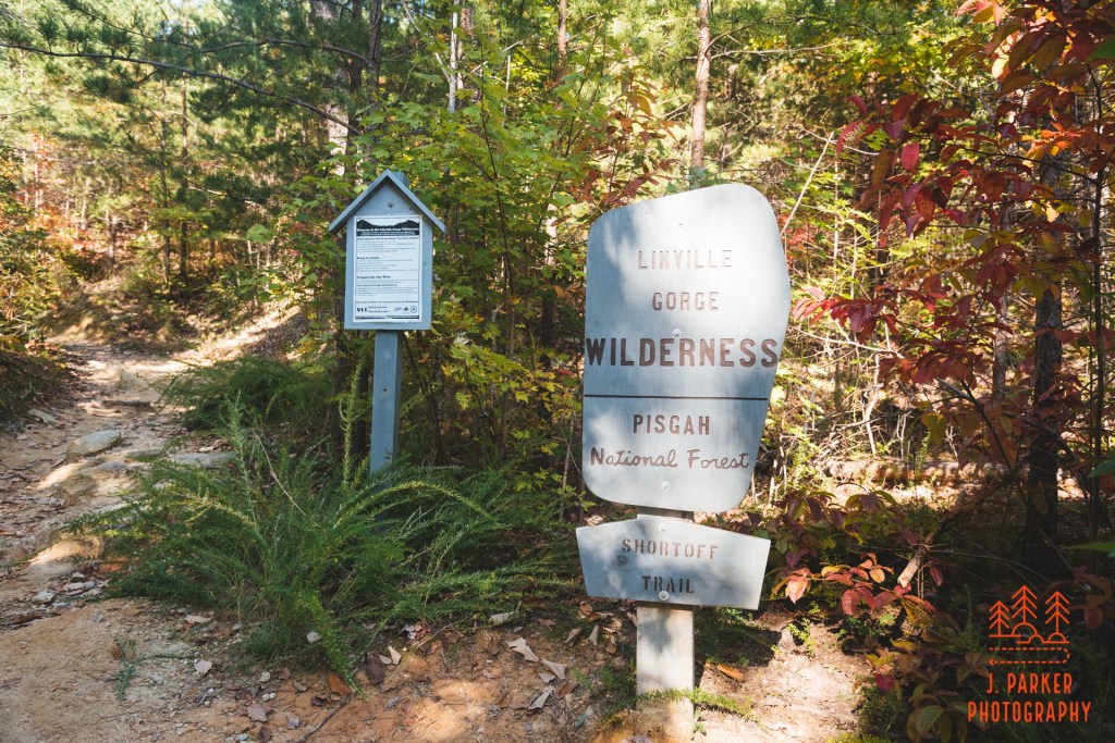
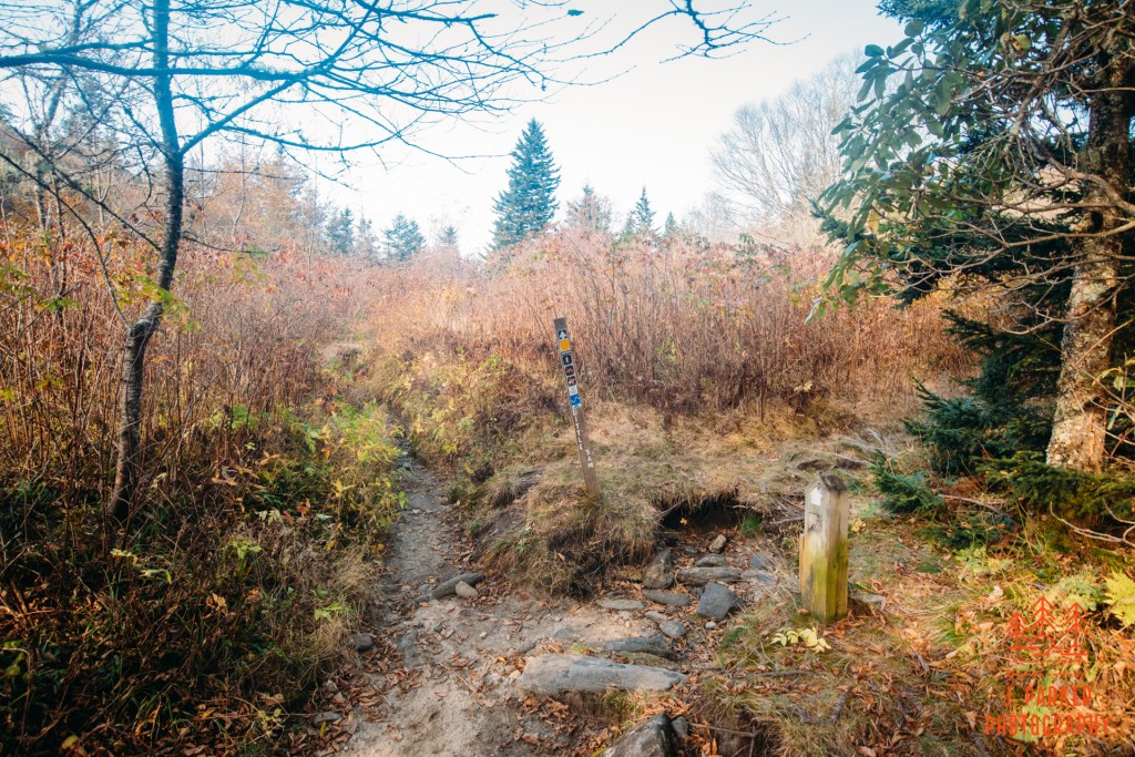
At the end of the parking area was a sign clearly marking the bounds of the Linville Gorge Wilderness and the Shortoff Trail. I definitely felt a twinge of excitement once I was really on the move, for the plateau of Shortoff guarding the lower reach of the gorge had always filled me with wonderment as I viewed it from other hikes like Table Rock and Hawksbill. I was finally going to satisfy my curiosity, which is probably the driving force for my life.
The start of Shortoff
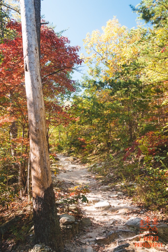
Right away, I could tell this was a different type of hike than most I have done in the Blue Ridge. Many of the hikes in this area feature an immense lushness to the woods, unless they are at higher elevation, in which case they adopt a spruce-fir forest that has its own cold but inviting feel to it. Shortoff was as far from lush as Disney World is from being affordable. A variety of trees were present, but none of them provided any type of canopy, they merely lined the trail. While the fall season had provided them with a variety of shades from green to amber, nothing except the immense blue sky felt all that colorful owing to the prevalent dust and lack of fullness of the foliage.
Woods lining the Shortoff Trail.
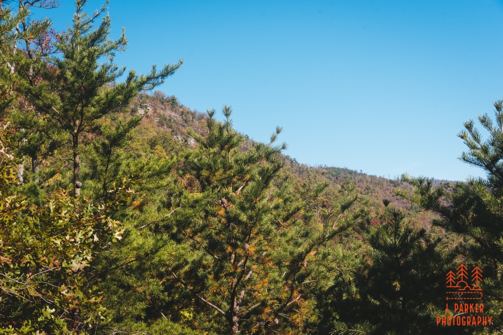
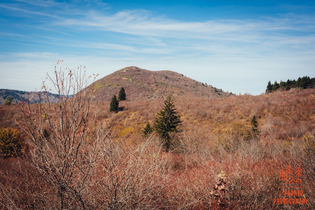
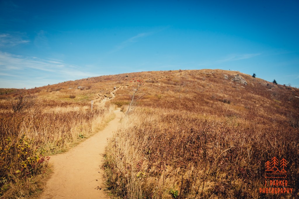
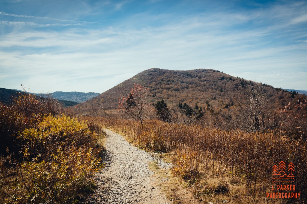
Just a few moments into the trail, an obvious sign guided hikers to the right as another path went straight. Not very well versed in the other trails of the area, I wondered where the trail going straight actually went, but that was a question to be answered another day. From here, the trail began navigating a wide series of switchbacks in earnest. My hiking tracker said my hike was 1,220 feet in elevation gain, and that comes pretty much entirely in the first mile and a half of the hike. The mountain, while frequently at least partially obscured, loomed large overhead. Occasionally there were brief wide gaps between the trees, allowing you to get a good view of the contours of at least part of the mountain.
A peek at the backside of Shortoff.
The day was actually mildly warm. Having nothing in the way of the sun certainly didn’t help/ Now, it has to be mentioned that I am from Florida. You may have felt heat, but I was born into it. Molded by it. A 70 something degree day is scarcely something to make a disaster movie about. That said, part of the joy of leaving a Florida that was still reveling in summer temperatures was feeling a refreshing coolness. There was nothing refreshing about trudging up Shortoff on this day.
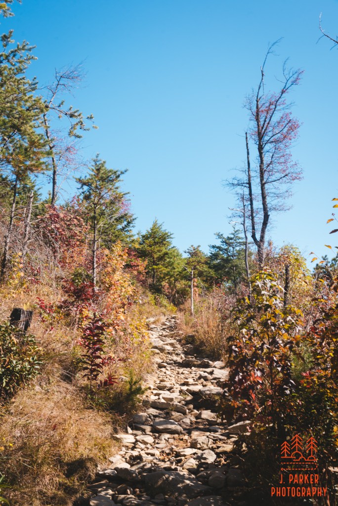
Rocky path
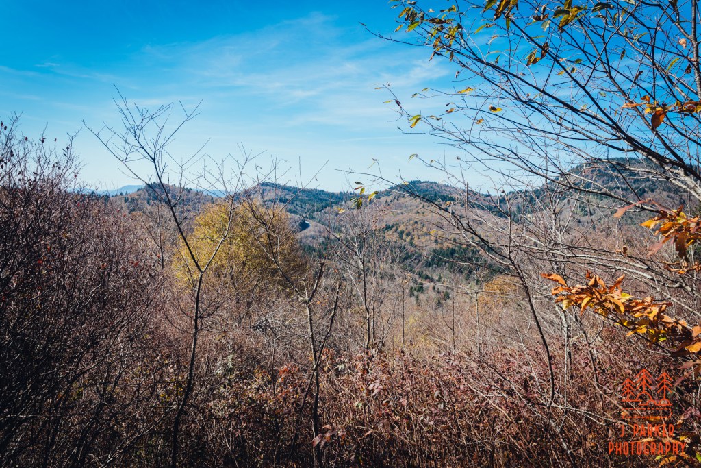
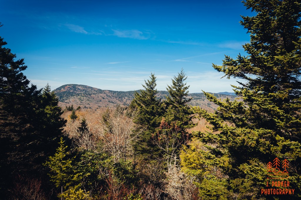
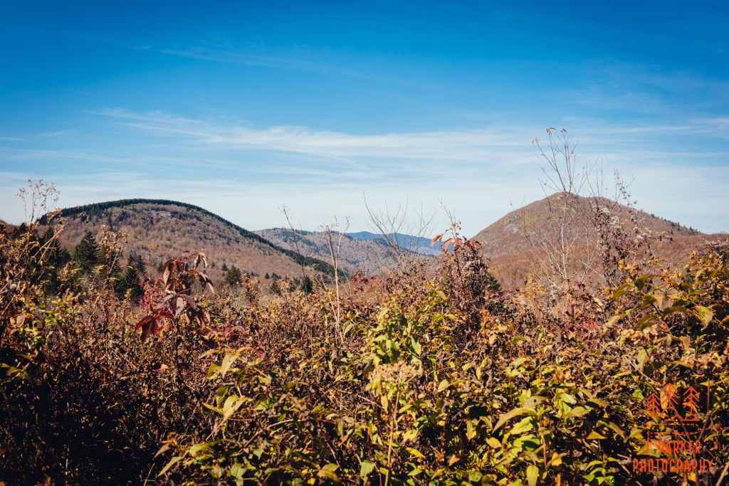
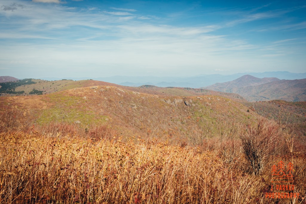
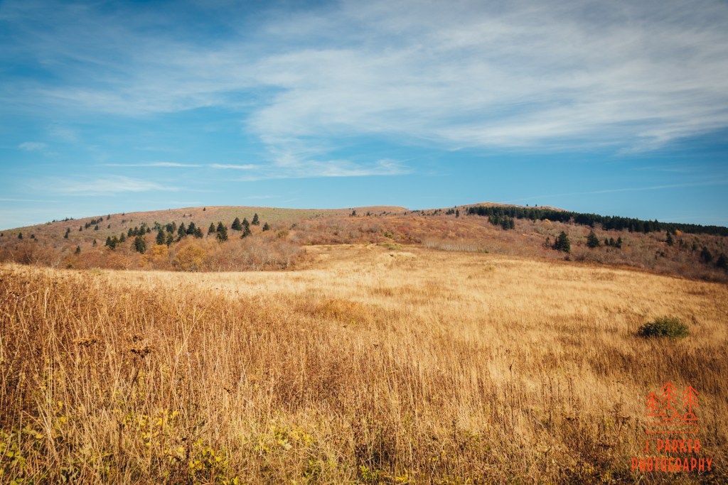
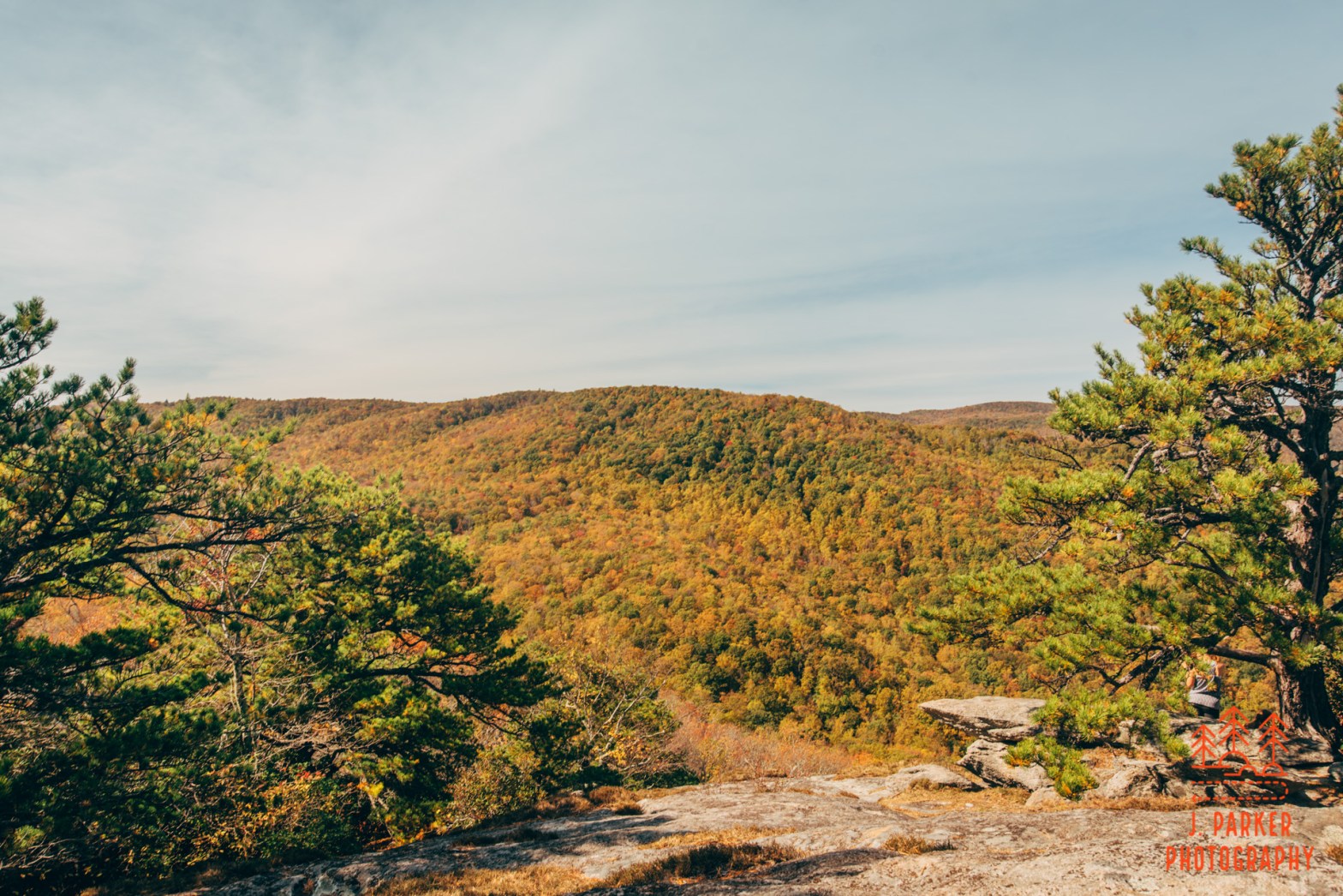
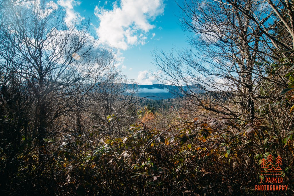
Now, being out in the open white hiking up a mountain has it detractions – I’ve certainly enumerated them well here. But, there is a huge benefit to it as well. Once you get higher, you start to get frequent, almost constant views. I didn’t get that far up Shortoff before I started getting to see things. At the start, the view didn’t consist of that much though, for there just wasn’t much tp see yet. I was surprised at the flatness of the terrain south of the opening of the Gorge. It seemed to be a very large valley until you hit another slate of mountains far in the distance, and those mountains were almost shrouded in the trademark haze of the Blue Ridge. I wasn’t discouraged by this view at all, for I knew once I could see into the gorge I’d have all the wonder I’d ever need.
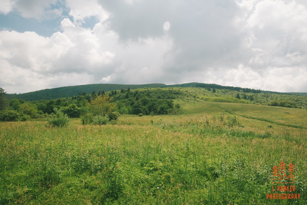
Flat view from the trail.
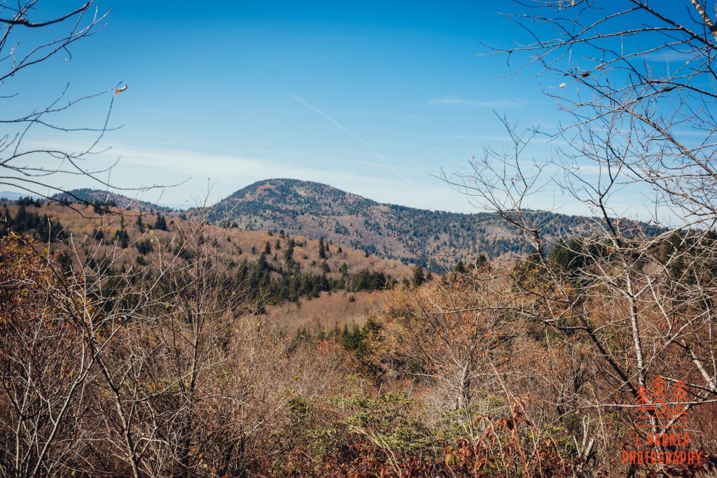
At one point, the trail made its farthest foray out to the East, where you could see around the hulk of Shortoff to get an unobstructed view to the Piedmont. There was a small spur on the trail, jutting out just a few feet, that beckoned you to stop and take a view here. Once again, it was a bit surprising to find just how flat by comparison the land in this view was. I had gotten views into this area on my previous gorge hikes, but never had it appeared so flat as near Shortoff.
View towards the Piedmont
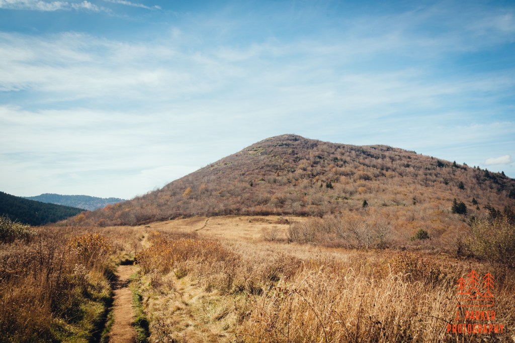
Time passed very slowly as my legs, tired from their 5th straight day of hiking with two bad hips, grappled forward for their next rocky purchase. I reached another clearly marked trail junction where a sign clearly guided you to the right. Once again, I didn’t know where the other path would have gone. I perked up a little bit when the trail seem to turn into rocky stairs and claim at a bit higher pace. Rocky perches began to permeate the side of the mountain, including one not far ahead that seemed to hang off the side of the mountain, likely giving some good views.
Shortoff gets rockier.
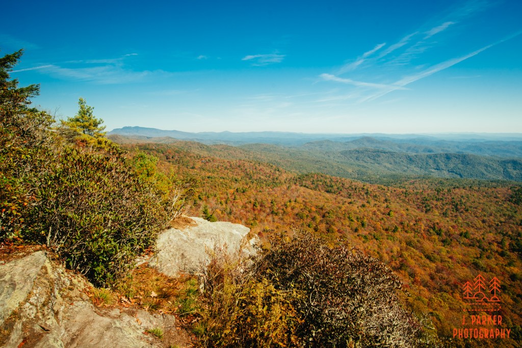
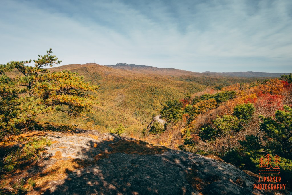
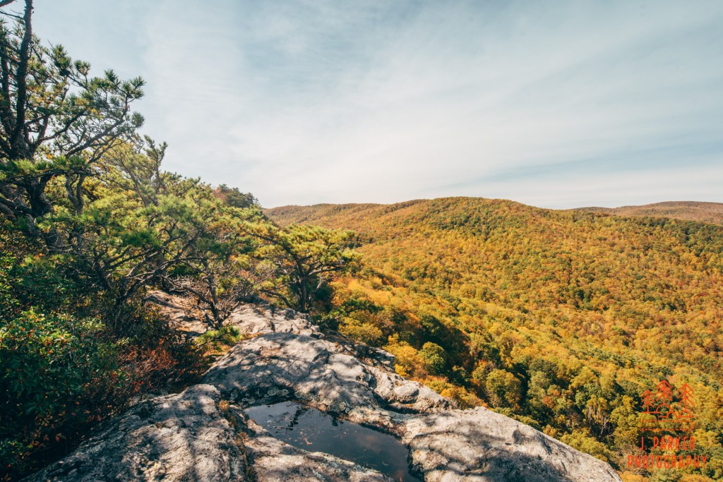
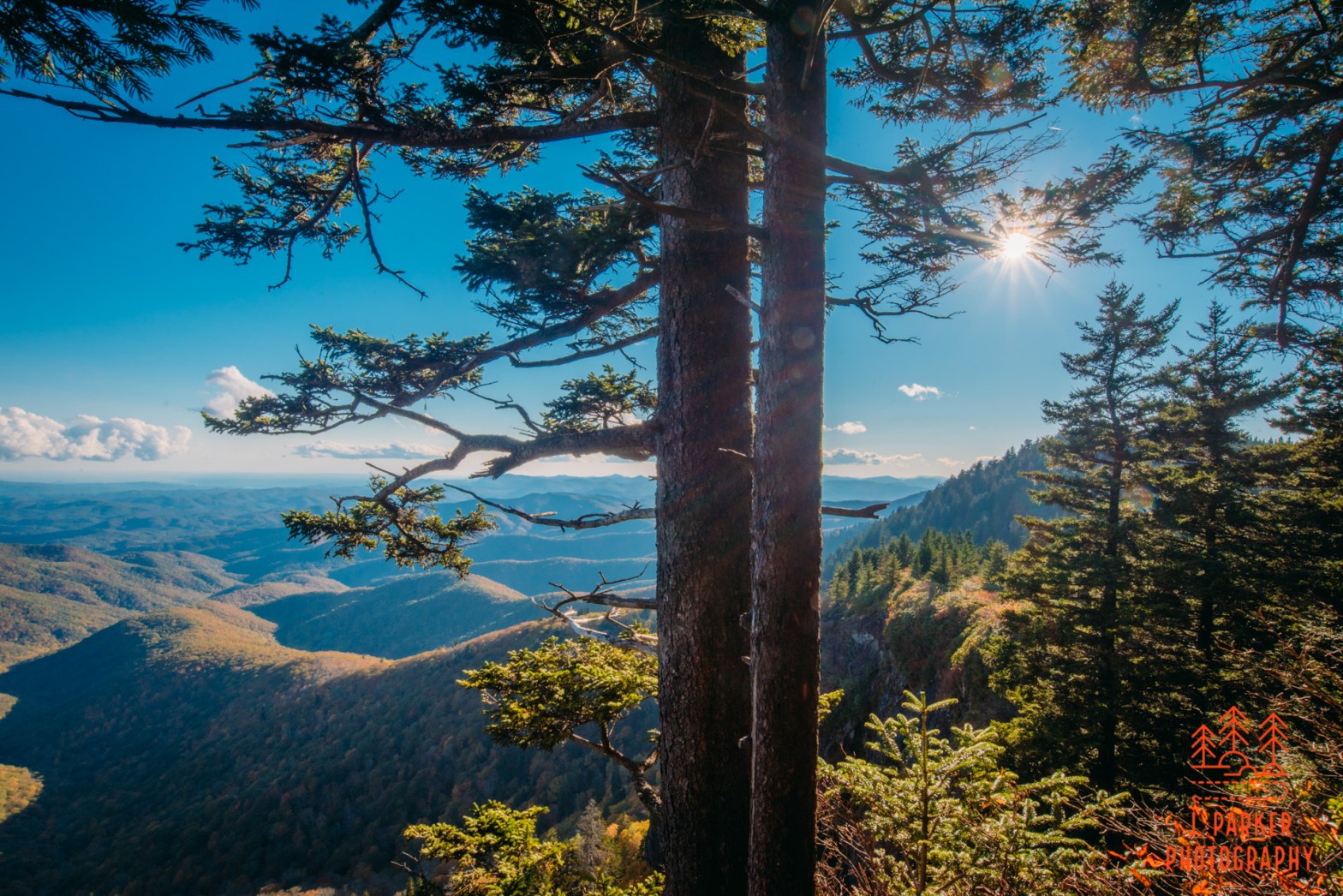
Naturally, I was impatient to get to the climb over and get to the top, where I’d have the satisfaction of knowing the physical toll was over while finally getting to answer what the view from the top was like, but I had to take a pause here to enjoy the views for a second. I let my pack off my shoulders for a brief break, taking a seat on the rock as I took in the view. To my right, I could just start to see the west wall of the Gorge for the first time. Forward was a similar view to what I had been seeing since the parking area, but a bit more dramatic and full with the rocky precipice.
Open rock view.
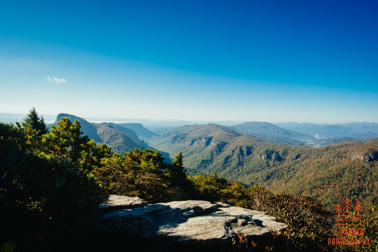
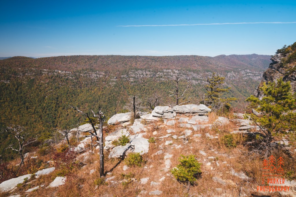
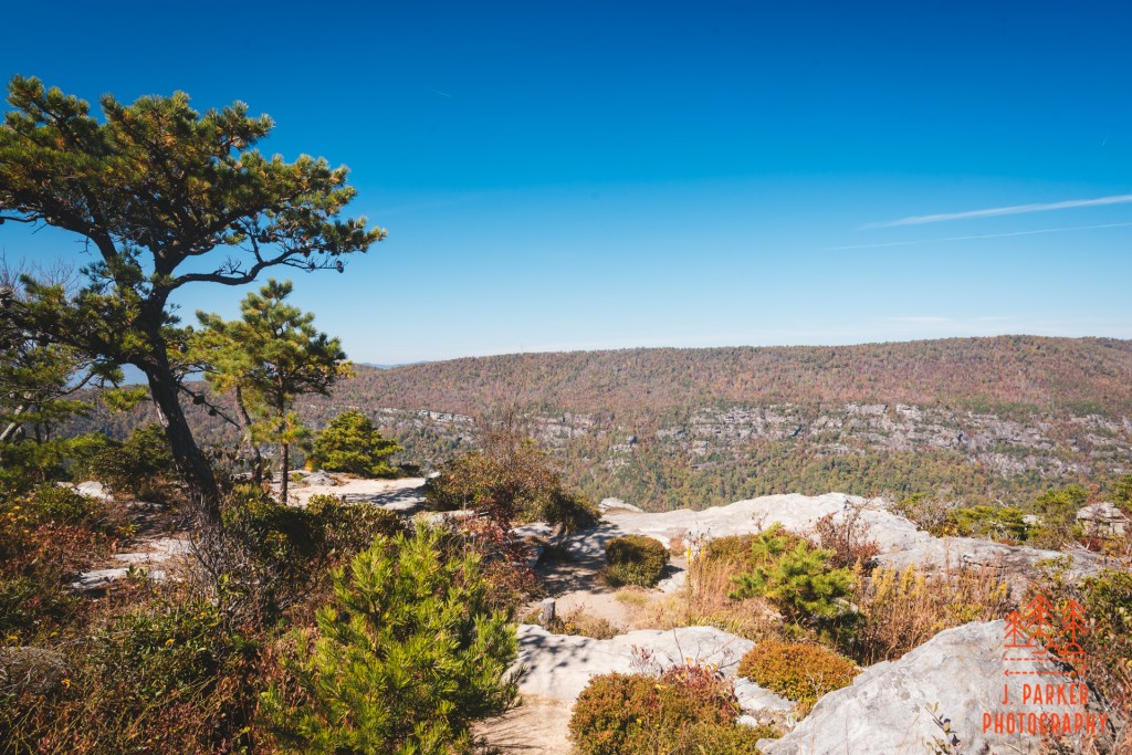
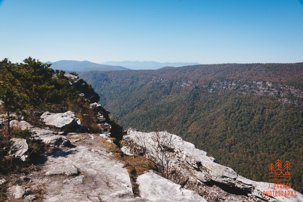
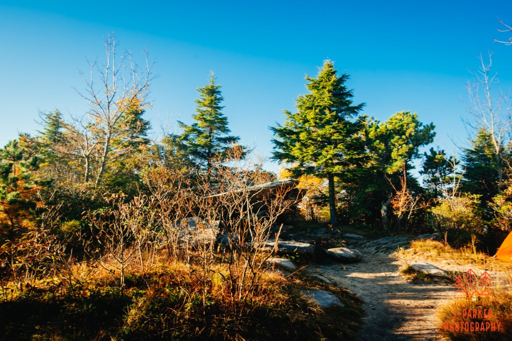
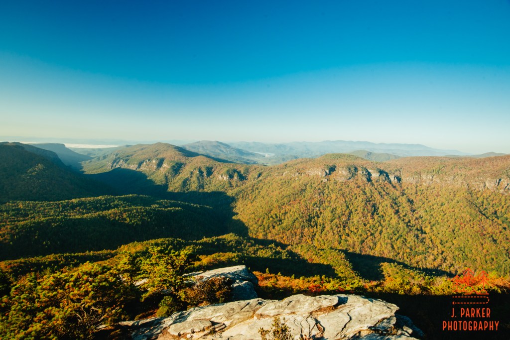
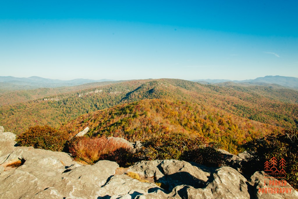
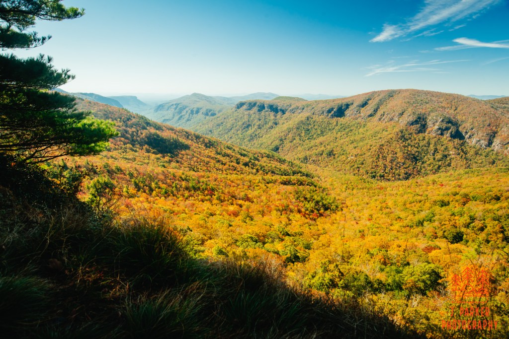
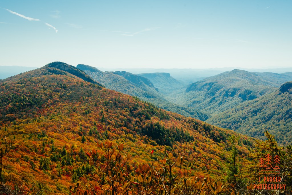
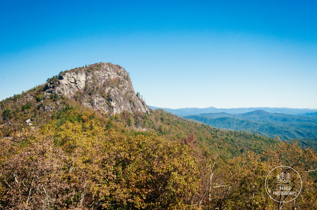
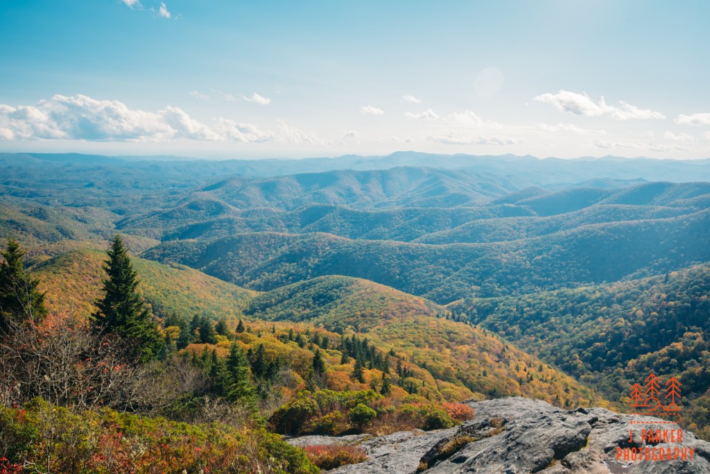
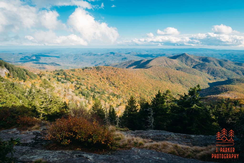
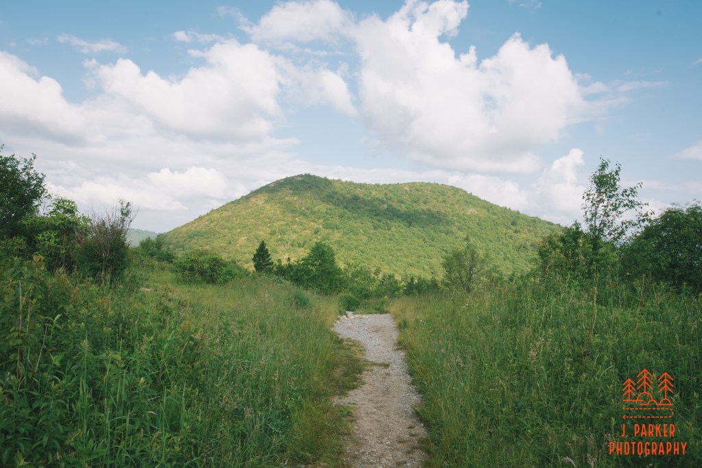
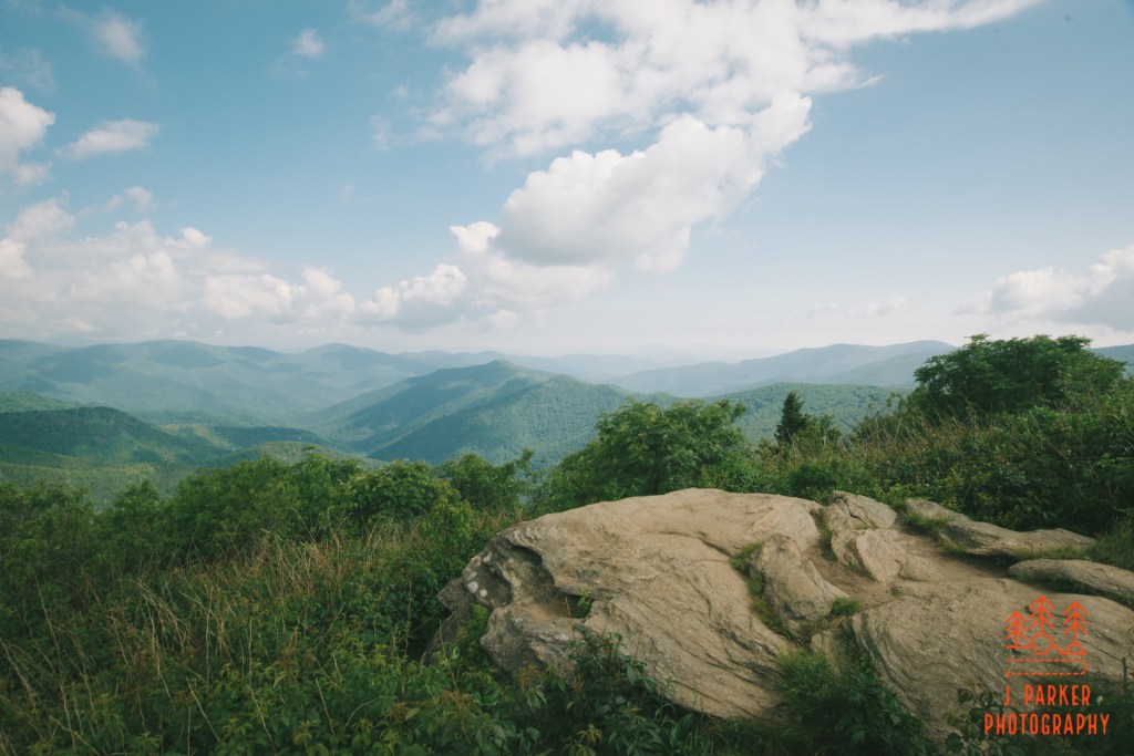
I knew the top of the mountain wouldn’t be far ahead, and my brief stop at the rock re-energized my. I plunged forward through the craggy landscape. In another ten minutes, I finally reached the plateau of Shortoff’s peak. An open rock face lied just to the left of the trail, beckoning you with its views. This legitimately was the rock at the opening of the Gorge, for it curved around a bit, one side facing the open end. Straight ahead, finally, I could see the distinct wall that made up the West Rim of the Gorge. I had arrived.
The opening of the Gorge
Overlooking the rocks towards the West Rim
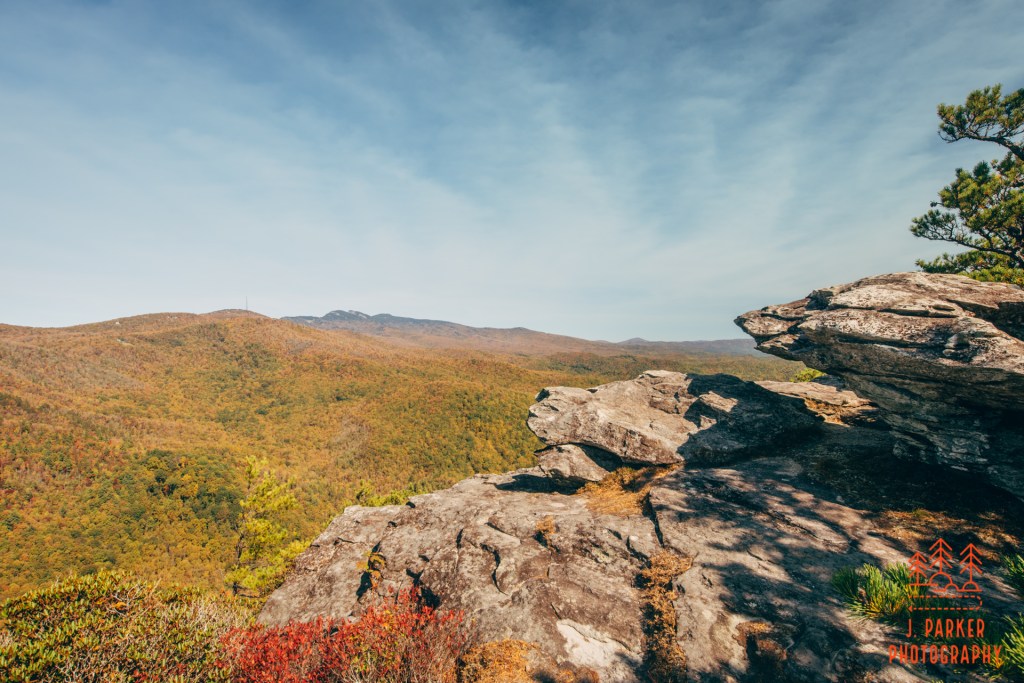
It had been a tiring climb, as much mentally as physically, but I finally had reached a spot where I could truly relax for a second. There were areas of flat rock that were quite easy to traverses, but other parts of the area featured a jumble of flat rocks rising out of the terrain. I got a great view in two directions, but to my right there was a craggy knob rising up a bit from the rest of Shortoff, and jutting forward so as to impede my view farther up the Gorge. No matter this was just the start, there was going to be more to explore.
View upgorge blocked by this rocky outcropping.
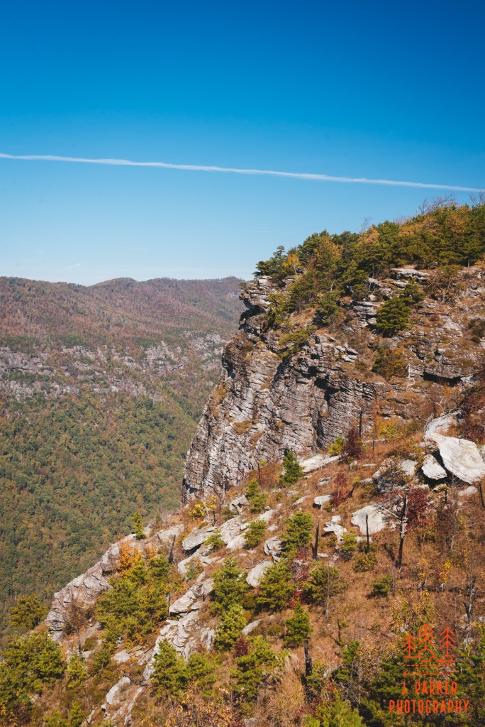
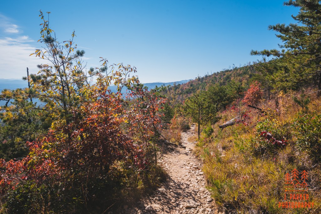
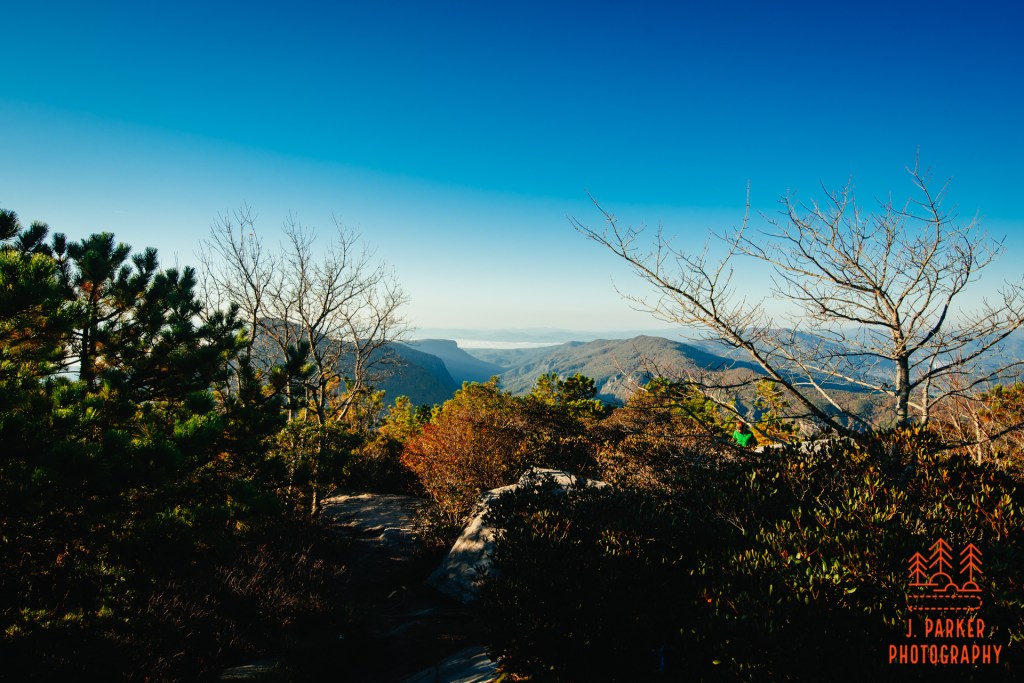
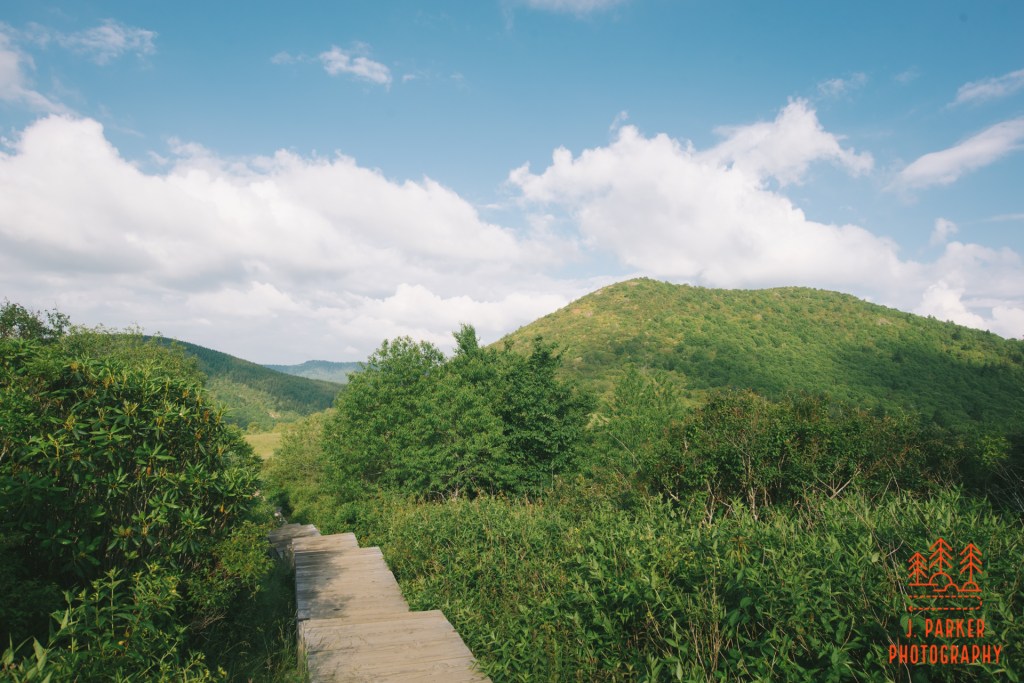
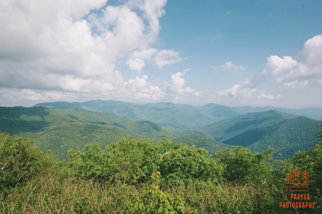
From far away Shortoff looks very flat, but of course in practice it has terrain which undulates a bit. The trail ran an uneven course going forward, and at one point that was actually a drop of several feet along the trail. I made my way down, but I worried a bit about making it up coming the way back, for Shortoff was an out and back hike. Luckily I had no issues with it on the return trip. In this area, the foliage was especially sparse, so while I wasn’t walking right along a sheer drop, I still got fairly good views. The woods being in the foreground of the drop and the West Rim actually added some dynamic.
Looking between the trees towards the West Rim.The trail moving along the Shortoff peak.
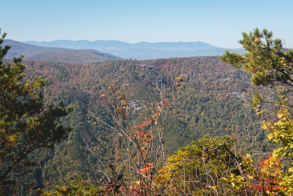
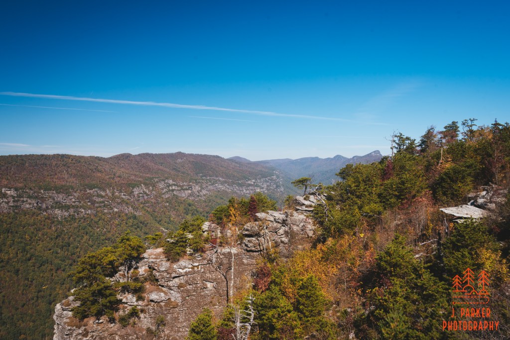
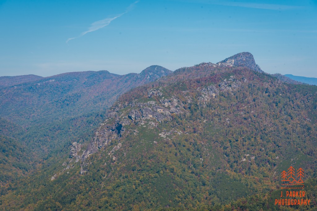
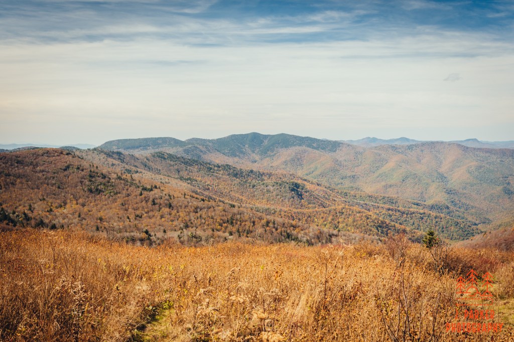
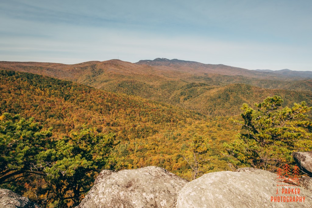
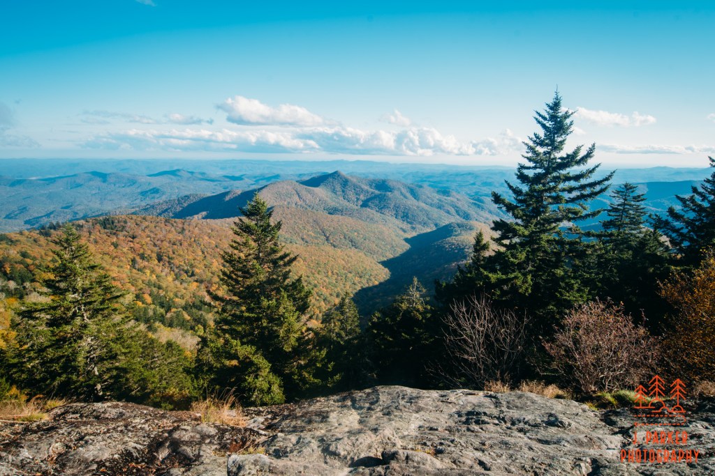
More views lied ahead. To the left, a nice view of the West Rim, another ridge behind, and then way in the back, Mt. Mitchell and the Black Mountains. Ahead I was finally starting to get a view over that craggy outcropping up the Gorge to see Table Rock and Hawksbill Mountain, though I had to strain to really see them. I would get much better views farther along.
Looking towards the Black MountainsThe West Rim and another set of rocks to view from.Looking over the rocky outcropping to Hawksbill and Table Rock.
Ahead I walked around the rim, where there was an informal trail, and made my way to a campsite where some backpackers were getting set up. This wasn’t a wide open rock face but instead was a largely canopied area with a couple small openings where one could reach small open rock faces between the brush. I didn’t want intrude on the campers, what with the pandemic going on, so I talked to them to make sure it was ok for me to go around them and get a peek. It was a pretty impressive view, for I finally got an unobstructed look at Table Rock and the Chimneys. While I was very familiar with the shape of Table Rock as it looms precariously on the rim of the Gorge, I simply had no concept of the crazy rock structure that sat below the Chimneys. It was simply indescribable to see that from far away. There are ways to see at least part of that up close, but doing so had been beyond my skill level in 2017. Maybe someday…
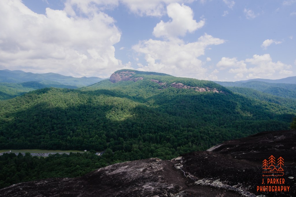
Upgorge view towards The Chimneys.
I had kind of imagined that Shortoff would be one continuous series of views as you navigated the curve of the plateau. I would come to find out it was actually quite different. This little view I got at the campsite was actually the last I’d get for a bit, for I’d enter the woods and the trail would actually curve away from the rim for a bit. This was the thickest section of woods I encountered along the trail, but even if twas still reasonably sparse, made even more pronounced by the vegetation thinning in the season. There was a little bit of color to be found, but it wasn’t enough to really add much to the hike. I wasn’t doing this hike for fall color anyway.
Walking through some of the woods at Shortoff.Red leaves along the trail.
I knew what was coming up next along the trail, which was a small pond. I don’t remember the exact distinction, but I know that seeing something like that at the top of the moment is a very rare event. I’m sure much of the general public walking the trail gives little thought to the pond as they pass by on their way to the primary overlook at Shortoff, but I gave it a moment’s time to appreciate it before moving forward. This part of the trail was very open.
The high elevation pond.Barren woods towards the top.
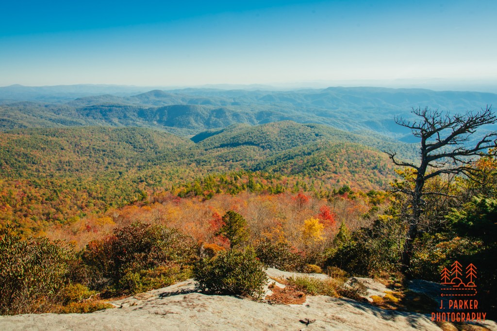
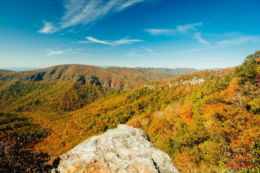
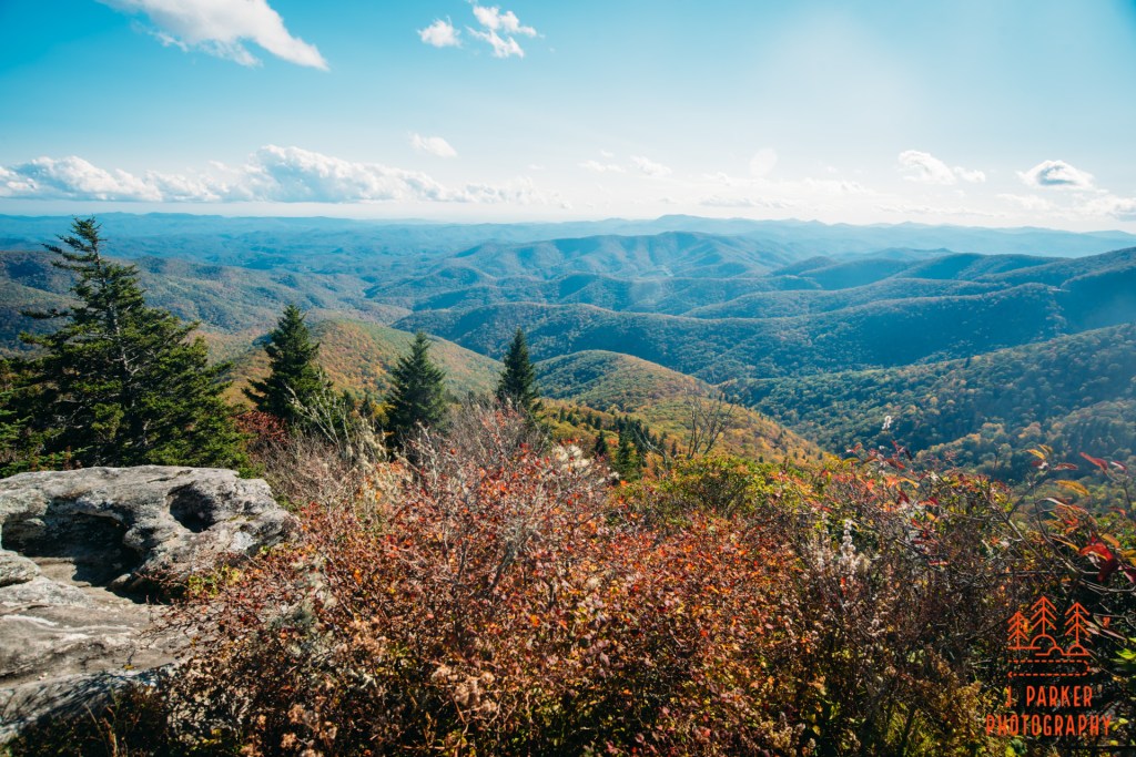
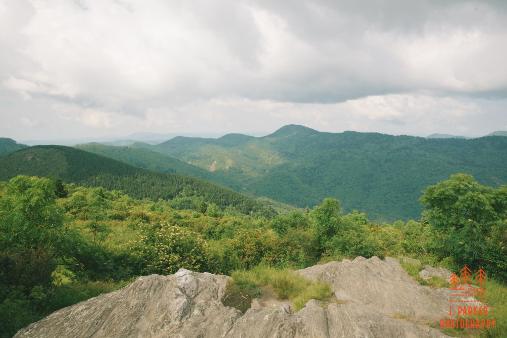
I knew that the main overlook was going to be to my left at some point and I didn’t want to miss it. What I didn’t know was how I would know when I was seeing a path to the main overlook. Past the pond a bit I caught a hint of a trail cutting through the brush. It was well trod enough for me to think it may be a path the the overlook I was looking for. It seemed well cut for a while, but as I got about 100 yards in the path began to dissipate. I could tell, though, that I wasn’t that far from some type of view. I clawed my way through the rapidly encroaching brush, and lo and behold I did start to get some views when I was close to the gorge. I could tell, however, that there were better views just some 20 yards away, where there were a number of people sprawled out on what was clearly a significant, probably the main overlook. So through more I trudged, branches clawing at my shoulders and bag, before I triumphantly emerged onto the rock face that everyone else was enjoying.
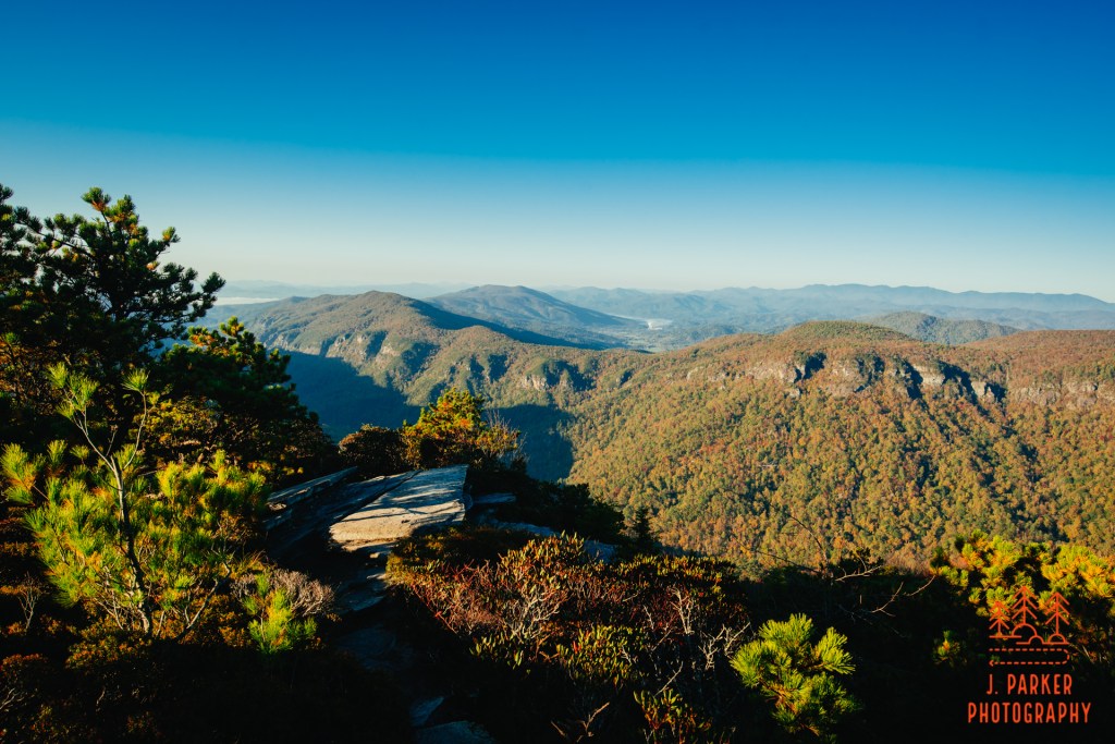
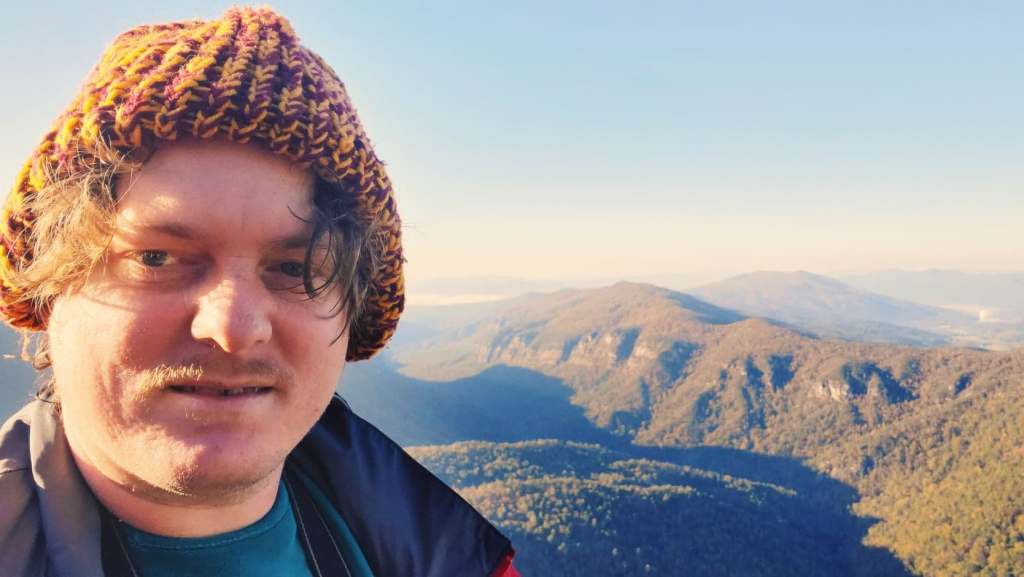
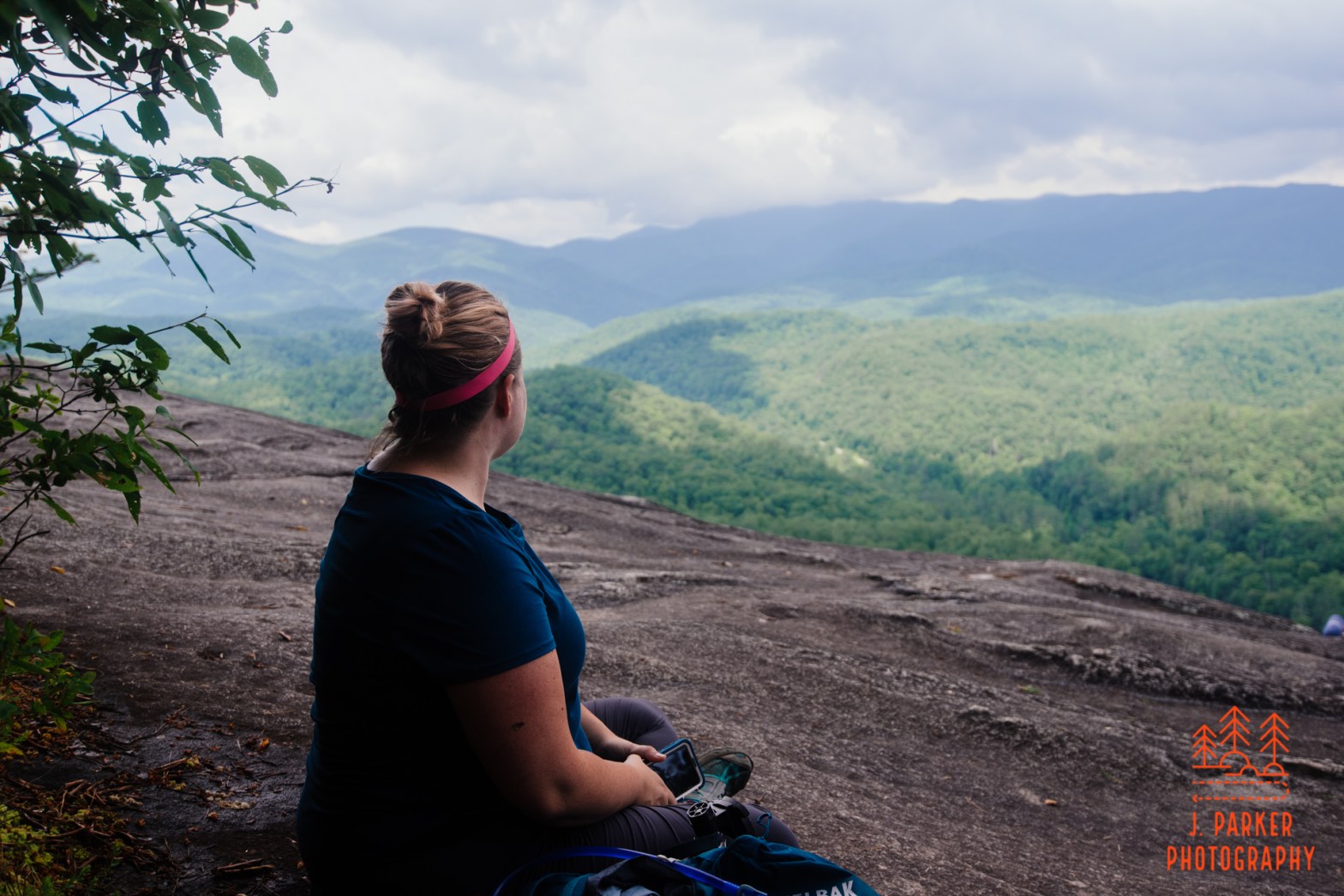
There wasn’t anything monumentally different about this view from what I had seen at the campsite. What was different was that, instead of just being a small peep through the trees, instead this was an ideal spot to sprawl out and relax. I certainly did here. I had done a lot of journeying today, from driving an hour and a half pre-dawn just to reach South Mountains before the sun came up, then the hectic drive to Shortoff to secure, then the numbing ascent up 1200 feet of switchbacks. It was nice to bathe my troubles in beef jerky and gatorade for a second. I sat down within talking range of a nice man and woman, and we talked a little bit about the hike while we sat and enjoyed the views. The pair was of an age where it could have been a father and daughter out enjoying nature, but the girl was relatively attractive and they didn’t necessarily interact like a father daughter combo. I didn’t ask, and whatever relationship they had, they were nice people.
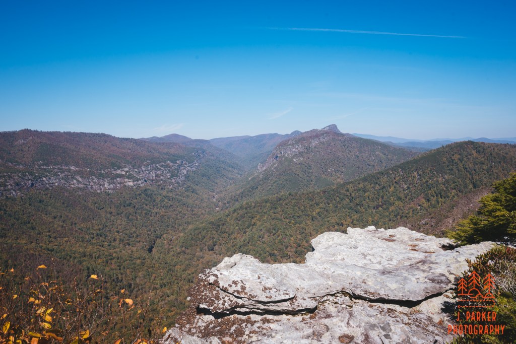
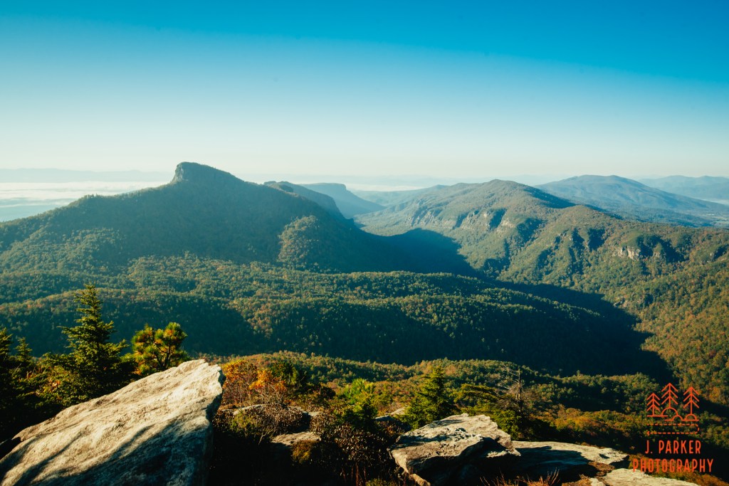
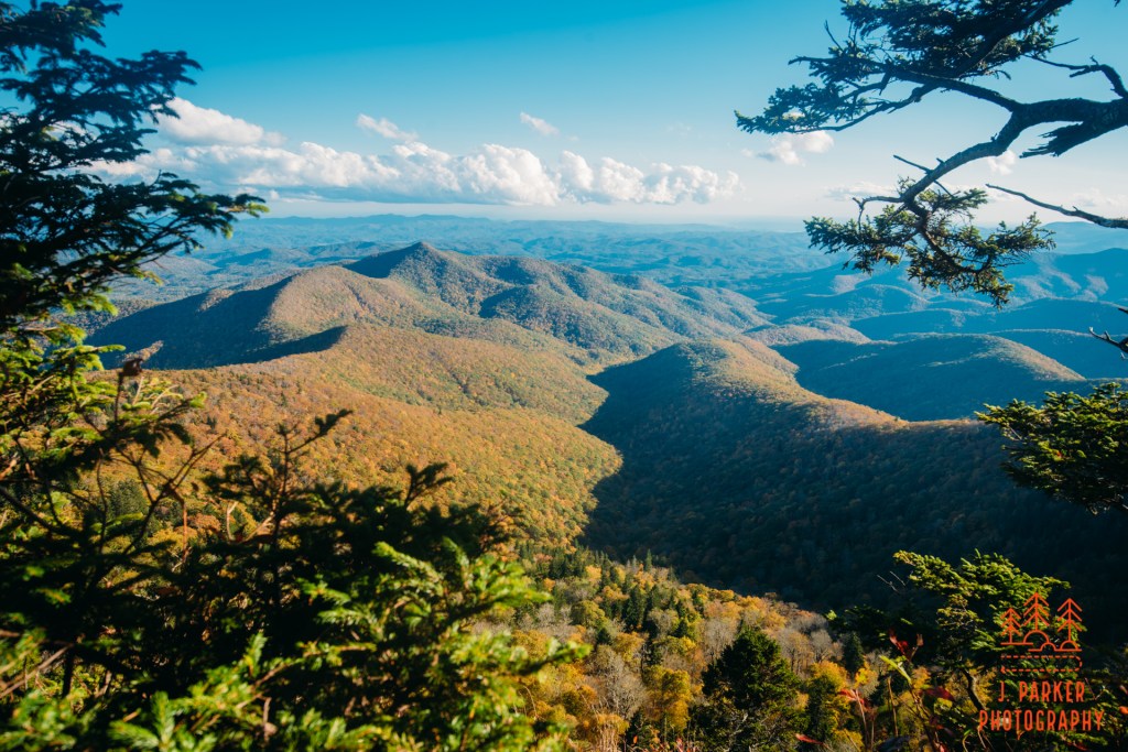
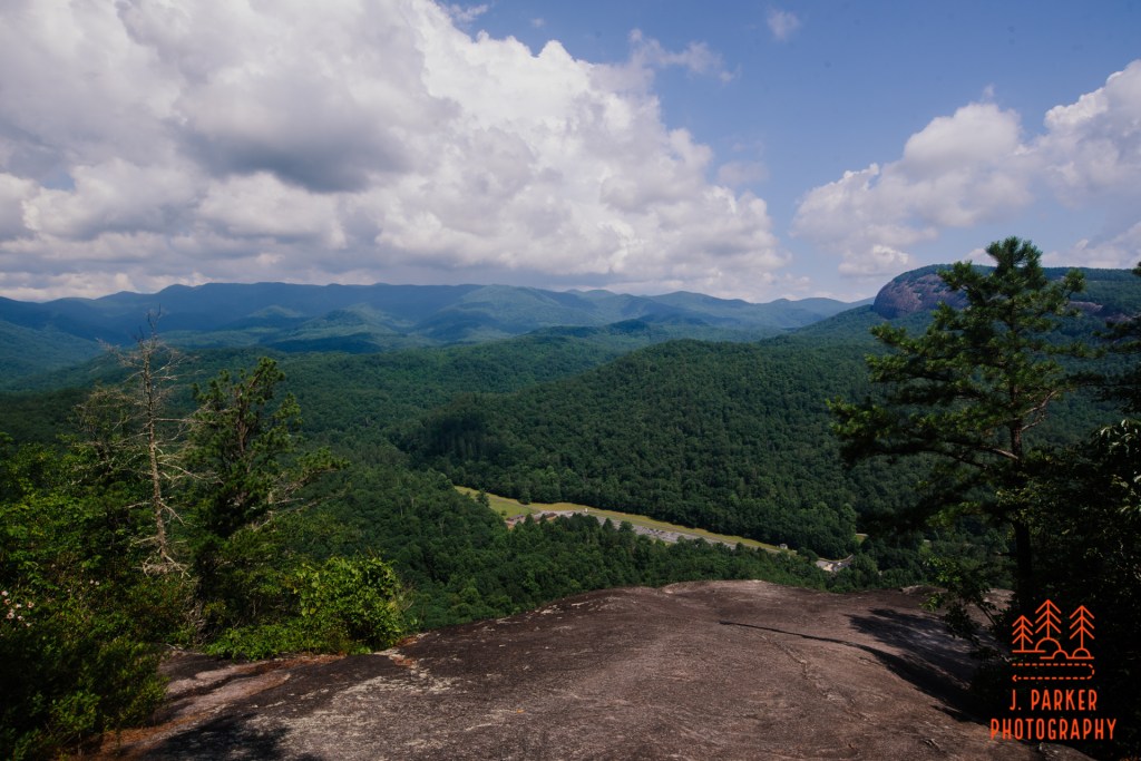
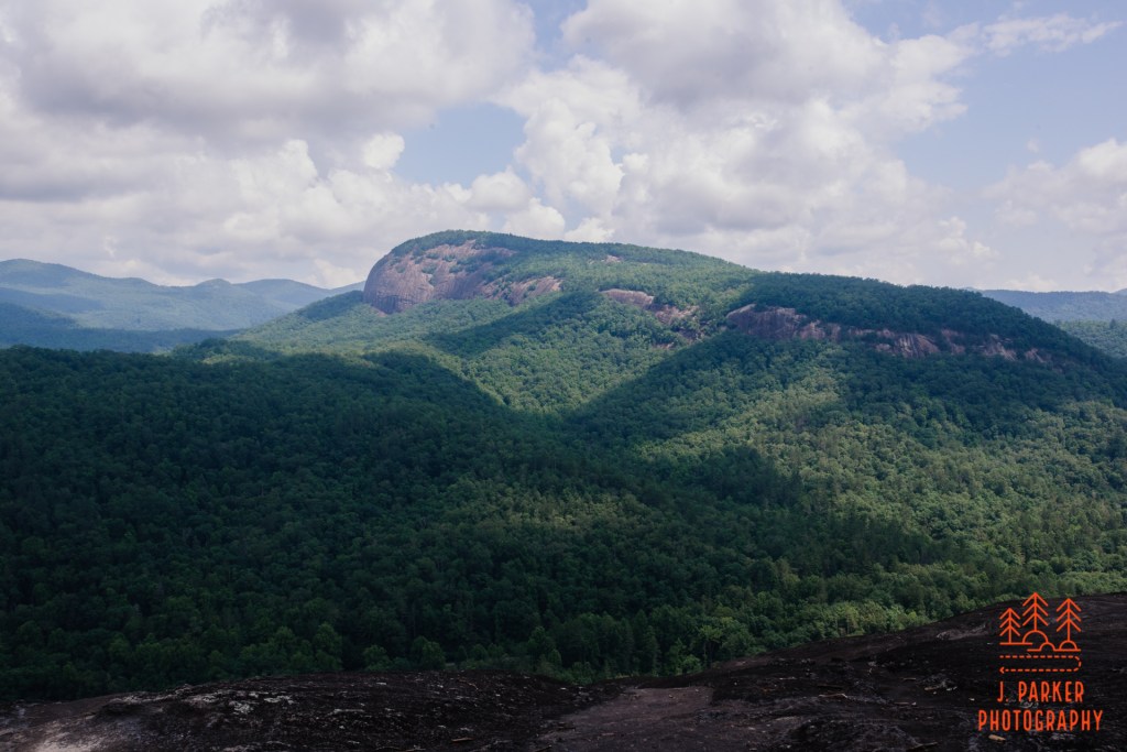
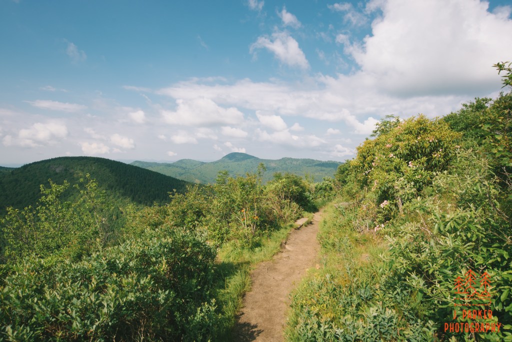
View downgorge from the main overlookView towards the Chimneys, with Table Rock hanging over the top,Hawksbill just to the left, and the Sitting Bear and Hurricane Ridge to the left of that. I had hiked all of these by now.A rock which I climbed to.
I moved farther down to where there were some tall rocks near the edge. Normally I don’t do much like this, but I was feeling adventurous, so I squeezed between the branches of a pine tree and pulled myself onto the rock (not on the sheer drop off side. I don’t do that). It was an interesting feeling taking a look up at the Gorge, imagining what I had accomplished. Here I was at Shortoff, the peak at the opening of the Gorge. Further down was the striking shape of the Chimneys, with the distinct Table Rock behind them that I had hiked in 2017. Behind that was Hawksbill Mountain, and further behind that were Sitting Bear and Hurricane Ridge, all of which I had hit 2 days prior on a very adventurous hike. I had gotten to see firsthand all of the major peaks of the East Rim. It was an interesting feeling.
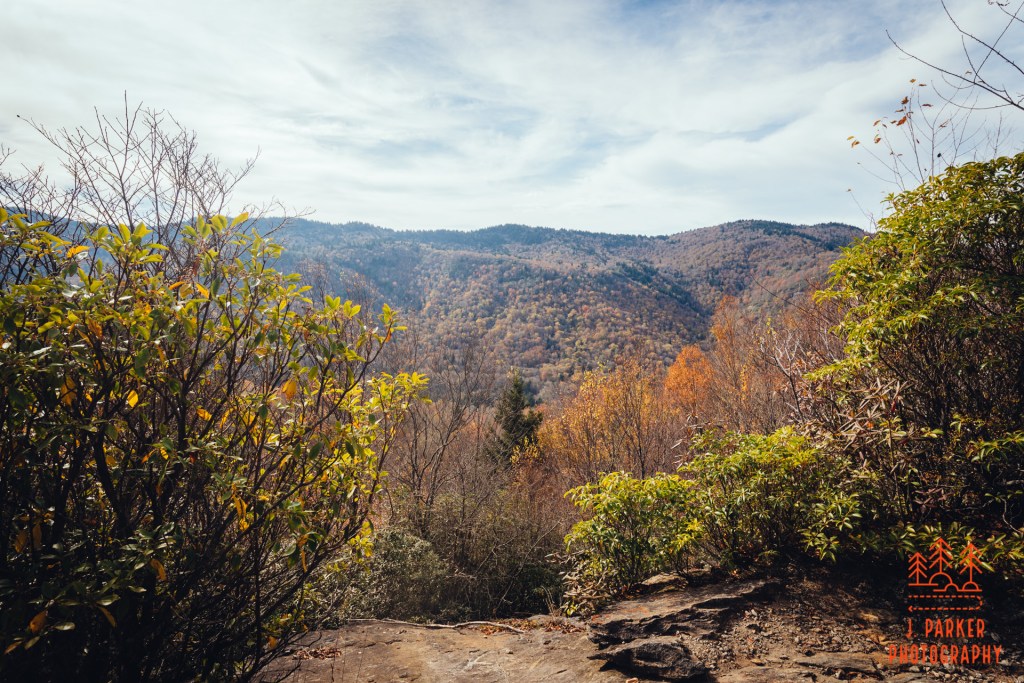
I didn’t have the experience of seeing Shortoff when it was my first exposure to the Gorge. And I didn’t have the experience of seeing the Gorge for the first time in 3 years like I had two days prior at Hawksbill. If I had experienced things differently, I might have had a difference of opinion. I will say though, that while I had a hard time figuring out which out of Table Rock or Hawksbill I thought was better, to meShortoff wasn’t at the level of those two views. To be sure, the Gorge is magnificent anywhere you see it. But there’s layers to those views that aren’t there with Shortoff. Crazy as it might sound too, but with so much of the Shortoff hike showcasing the flatness outside the Gorge, it almost ruins the mystique of the Gorge to see where it opens up. When you’re at one of the peaks in the middle of the Gorge you can imagine that the Gorge runs forever.
I was glad I was experiencing what Shortoff was right after four years of wondering. At the same time, I’m glad I did my triple crown in the order I did, and I certainly think it’s a great way to do it for anyone looking to experience the Gorge.
Gorge view.
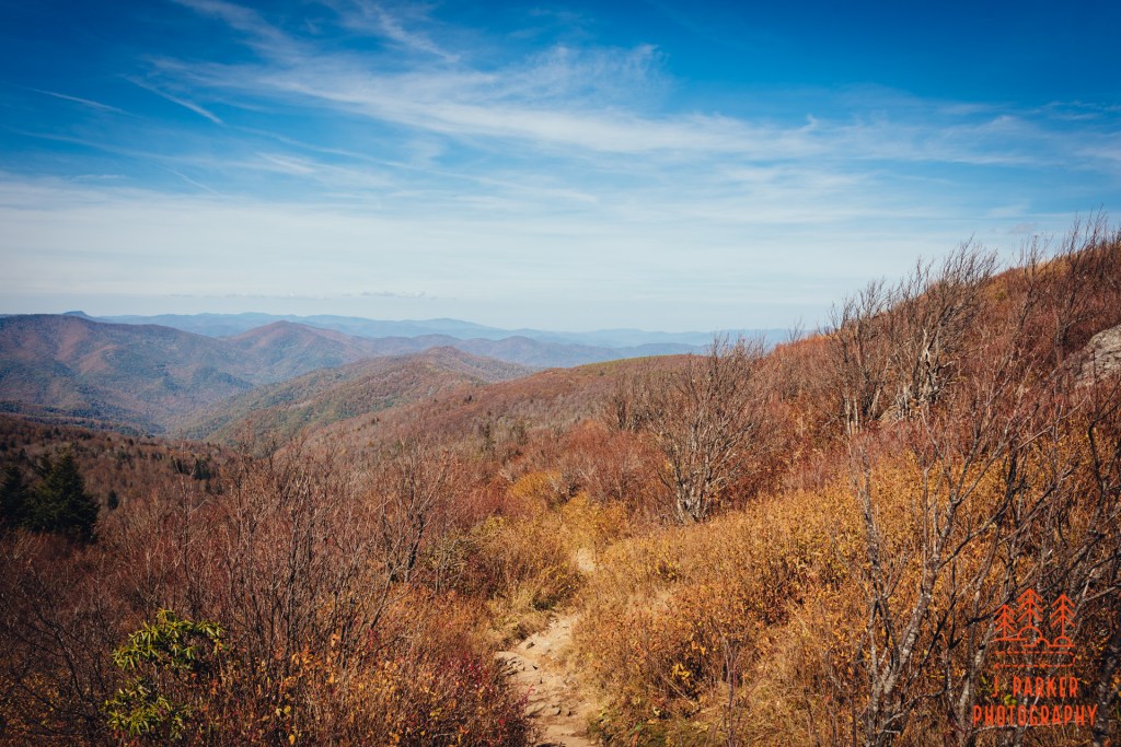
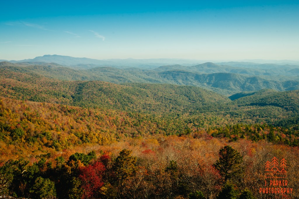
From here, it was all backtracking. I took the actual path you’re supposed to take off the main trail – had I continued just a bit farther it would have been impossible to miss. I walked through the woods and stopped by each successive view on the way out, including the campers again, but as there wasn’t even really a cloud in the sky even the lighting hadn’t changed one bit since I had first come through. I mostly stopped to savor the views for a last time – these were going to be the last elevated views I’d be getting for a long time, and between myself and any other views would be a significant surgery and challenging recovery back in Florida.
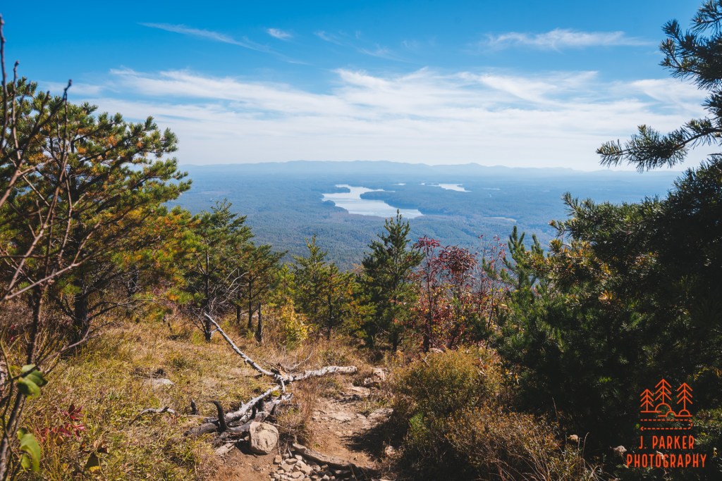
A nice view downhill to what I believe is Lake James
Going up Shortoff had been a chore. Going down over sandy rocks would be a chore too, but at least going down a relatively open path means you are looking out on views much of the time. Of course, I always try to catch glimpses of these when I’m going up, but it takes turning around to be able to see, so of course you can’t take in everything. There was a good lake view not far from the top that I enjoyed. The lower that I got though, the views disappeared and dissipated in strength. And what I could see was just the same thing I had seen the entire way down. Going down may have been marginally better that going up, but after a certain point I just really wanted to be done, and the switchbacks seemed to continue forever. There was never any doubt how much further you had to go down either, for you could see the parking area the entire way. It was far from my favorite moments on a trail, that’s for sure.
Walking down Shortoff
As a child I had learned that even James Cameron’s Titanic eventually ended, and so would the descent down Shortoff. Just neither one of them quite as I wanted to. Shortoff had been my main event – the one thing I knew was ideal for the weather – but it wasn’t the last thing I had up my sleeve. I was going to finish the day, and by extension my trip, with a visit to Catawba Falls – as long as I could make the drive there in enough time to hike to the waterfall, that is. Shortoff had been nice – maybe not the top tier hike I had been hoping for, but still nice. While I would have preferred a less boring approach to Shortoff, sometimes you have to endure some boring things to have a really nice payoff. For instance, as a Floridian I can’t drive anywhere nice without having to suffer through southern Georgia, so I should really be used to it. So it was I said goodbye to Shortoff and Linville Gorge, hoping that I’d have a fruitful visit to Catawba Falls to cap off my long day in the mountains.
It was completely dark as I worked my way along a footpath I couldn’t see. Fortunately, I had packed a headlamp for just such scenarios. Unfortunately, I had left the bag where I had packed it in Florida. My cell phone, with it’s flashlight function, was going to have to pull some extra duty today. But I didn’t want to use it too much – I had a LOT to do today. I was going to be needing my cell phone for navigational purposes, both while hiking and driving, and I was going to fighting for charge throughout the day.
This was day 5 of my 5 day trip – no more after this. And except for about two hours of my first day, each day had brought a constant barrage of completely unblemished sunlight. Meaning I was a Floridian in the land of waterfalls and, except for just after dawn and just before dusk, I hadn’t gotten weather suitable for photographing waterfalls. As I had bided my time through the sunny days on repeat, I had looked enviously towards the last day of my trip, where it appeared like I’d get some cloudy weather.
Appeared.
The chemtrail is this picture was the largest cloud I saw in 4 days.
As the looked for day got closer, I was dismayed to see that image of a cloud on the project weather disappear, to be replaced be yet the same old image of a full sun I had seen the previous four days. This stuff again…..this was disappointing, because I had been waiting all trip for a cloudy day to explore South Mountains State Park, a location south and east of the normal Blue Ridge Mountains in a separate range that, as you might infer, were called the State Park Mountains. This park featured lots of canopied creek/river walk that had absolutely called up to me when I was first learning the highlights of western North Carolina back in 2017. I had liked it so much that I put it on our trip itinerary in 2017, to be done in the morning before visiting Table Rock and the Chimneys in the afternoon. With much sadness, I took had to take it off the itinerary mid-trip when I realized we just weren’t as comfortable driving the mountain roads as we would need to be to complete what I had planned.
That was only the beginning of my missed connections.
Like Hawksbill Mountain, this was another location I was going to visit in 2019 when Hurricane Dorian had other plans. To make-up for that I had done a short fall foray a few months later, and had explored making South Mountains my primary destination. But with the time I had to take that trip, South Mountains was ever so slightly too far to drive. To say I felt a bit overdue was an understatement, and I was going to make it first priority as soon as the right weather came. But it never did, and needing a real show-stopper of a main event for my last day, I had already earmarked Shortoff Mountain (another hike I had planned to do in 2019) as my main event – with hopes of finishing off the day at Catawba Falls, which I could photograph as the sun was going down. Shortoff had limited parking, and I was going to need to be there early to do as I had envisioned. Trying to do a hike at South Mountains starting at dawn just wasn’t going to cut it. There wouldn’t be enough time.
But then I had a crazy idea. What if I started well before dawn? Could I hike the 1.5 miles to High Shoals Falls, which was the main trail there I wanted to do, and get some quick tripod shots of it and the Jacob Fork River, before the sun came up, and before I needed to get on to Shortoff Mountain? On the surface, there wasn’t anything except for common sense and the fact that I had two injured hips and would be hiking over rocky surfaces in the dark to prevent me. The state parks in North Carolina opened up early, and that’s if there was even going to be some type of gate that would keep me out of the park till opening time, which I wasn’t sure there was. I was hungry to see South Mountains. And I was hungry to get more long exposures than the paltry number I’d been able to attempt so far. I was up for it. It wouldn’t be the half-day exploration of the park I had always hoped for, as I was adamant I wouldn’t let this interfere with my Shortoff Mountain hike, but it would be something.
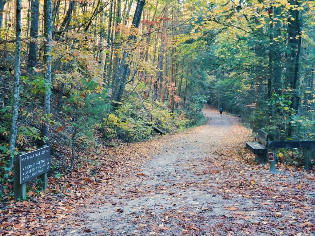
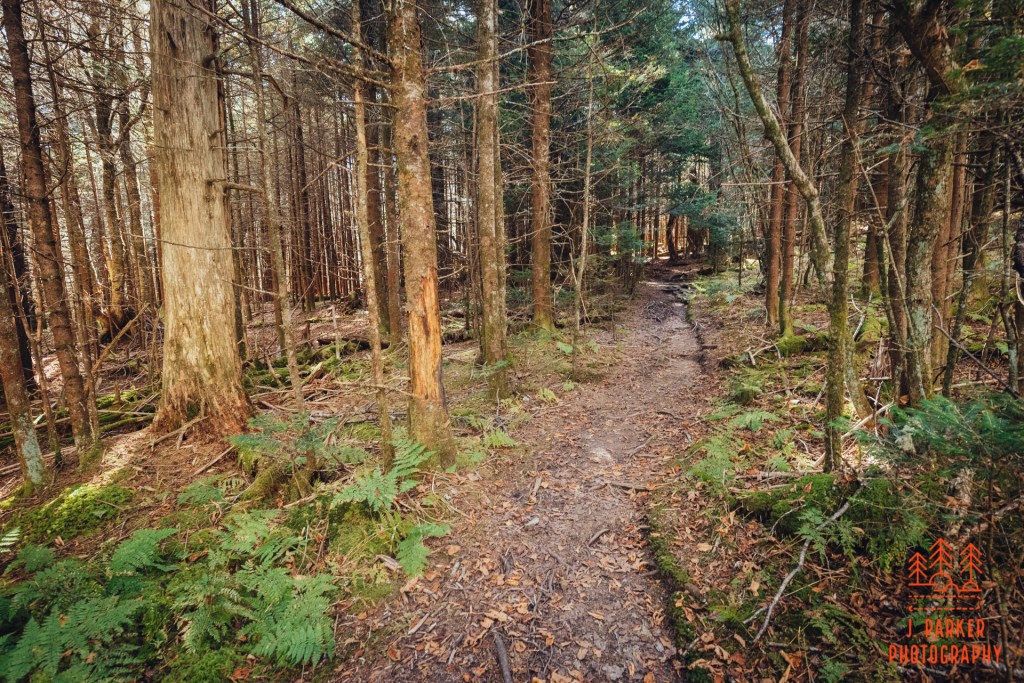
So there I was, trudging towards the High Shoals Falls Trail, tripod on my back, feet heavy on an otherwise quiet trail, in near perfect darkness. There had been no impediment as I completed my last of many miles on a winding country road and parked at the trailhead. So I would get to start my hike right upon arrival. The first part of my journey was a 1/2 mile outward trek which appeared very straight on the map, and turned out to pretty much be as straight in person. It was also a wide path made to accomodate horses and hikers, actually even larger than your average forest road. So having to maintain the path wouldn’t be an issue. I still had to worry a lot about my footing though, for while the path was wide, straight, and about as well trod as possible I couldn’t be sure there wouldn’t be a stray rock or two that could cause a trip and fall for unsuspecting feet. The camera, which couldn’t be used in the dark anyway, was going to stay in my pack so I didn’t risk falling forward onto it.
First part of the trail to High Shoals Loop – obviously taken on the return trip, after the sun came up.
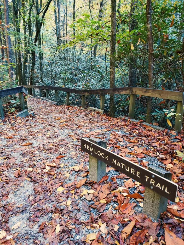
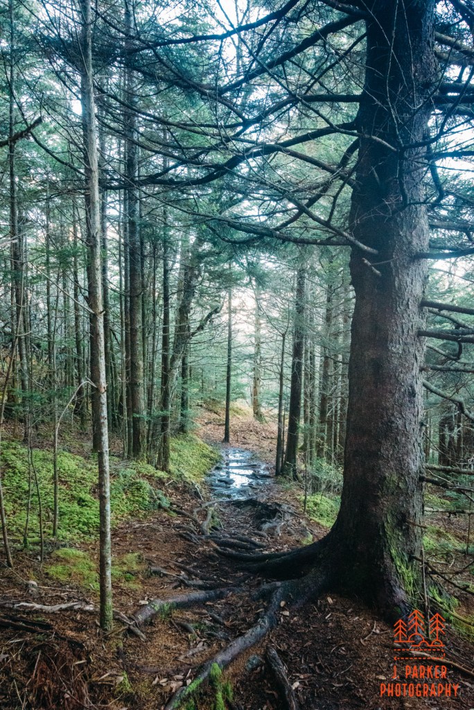
To my left, I could hear the flow of the river over rocks, though I couldn’t see it yet. The trail I was on ran parallel to the river, though there actually was a more rustic path running around 10-20 yards to my left in the Hemlock Nature Trail. I would take this path on the way back to see the river better, if there was time. For now, to save time I was going to avoid even taking a quick peek at the river, even after light started to peek through. I was here to photograph the boardwalk leading up to the falls and the falls themselves, I was going to get those first and then fill in what I had time for before the sun got too harsh, and I had to leave anyway for Shortoff, on the way back. All the other parts of the river I would see would be downriver and deeper between the opposing ridges than the falls anyway – the day’s sunlight would hit them much later than the falls anyway.
The darkness made it seem a lot longer than it normally would have when I finally reached the first milestone on the trail when I crossed a wide bridge over a creek which joined the Jacob Fork River immediately downstream of the bridge. Here I’d have a couple trail junctions in quick succession, and I was prepared to have to concentrate a lot in the darkness. Fortunately the trail was well marked with signs that were large enough to be hard to miss even without much light. It also didn’t hurt that the trail stayed close to the river the entire time too. After I crossed the bridge, the wide path disappeared. For here, I was left with a much more conventional double wide trail. This trail, while well maintained and manicured, followed the contours of the land, rather than just being a mostly level road, so there were frequently rocks and steps I had to navigate. Pre-dawn light was starting to fill the woods, at least illuminating the oncoming trail obstacles somewhat, so I wouldn’t have to depend on my phone for anything but notifications on what attractive young woman with a total of 2 followers just happened to see my instagram and wanted to chat for some reason.
High Shoals Trail, shot on the return trip.
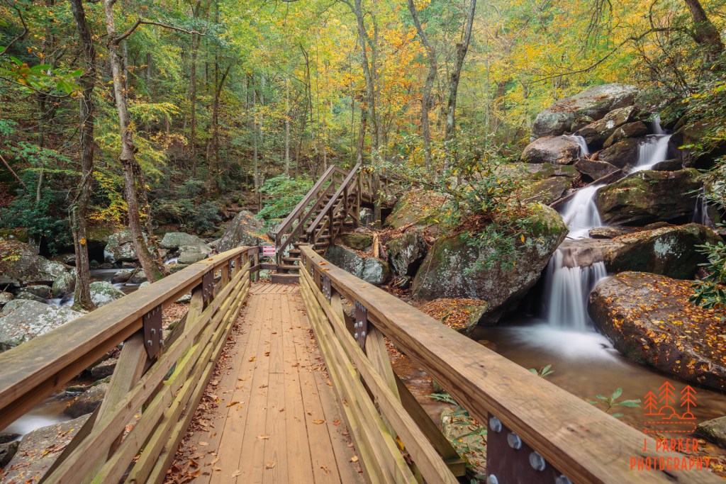
The trail was traveling upriver, so naturally there was a gradual climb to the trail even through its undulations. Sometimes a thick patch of rhododendron blocked the view of the river entirely, but in others the trail ran right alongside the rocks of the riverbed. I could only hope they would provide me with a good setup for a nice frame – a definite bonus in a time crunch. I trudged onward, not knowing quite how far it would be till the boardwalk I was looking for began. The boardwalk in question is one I’ve seen photographed and featured in trail guides and in pictures by other photographers. Not only did it seem to make a great photographic subject, it looked like a truly photogenic spot.
The boardwalk over the Jacob Fork River
I was a little bit surprised when I encountered the sought after boardwalk on an uphill section of trail. I hadn’t expected to come across a river-crossing boardwalk during an uphill. I immediately recognized the boardwalk segment, though the spot ended up looking a bit different than I expected. I hadn’t really noticed it until afterwards, but the trail guide I liked the most advocated hiking the trail in high water. It was easy to see why, for while at times the bridge seems to cross just inches above white water which shimmers dramatically under the close canopy, what I was seeing was a rather placid and almost small stream. This was especially noticeable in the cascade that sat to the right of the boardwalk and just upstream, for in high water the white water absolutely envelops a lot of the rock face, but I was instead presented with a tightly wound flow that was dominated by the surrounding rocks. Though it was still a nice spot, the difference between the way this looks in low and high water completely changes the atmosphere.
This was the first time of the day where I got out the camera and tripod to do some work. It was dark enough that I didn’t even need a filter to get a long exposure, though I had to take multiple shots solely to make sure one was in focus, since cameras struggle when there is so little light. As I waited between shutter releases I got to absorb the character of the foliage for the first time. It was a mix of green and yellow, definitely a bit pre-peak. I hadn’t known where South Mountains would be at, given that Black Balsam area was barren while parts of the Linville Gorge area ranged from peak to well past peak. Naturally I had been hoping for peak, but given that I had encountered a lot of leafless trees this trip, it was great to have any color, given it was a lot more than I’d ever see at any point in Central Florida.
Second spot along the boardwalk.
The spot where the bridge crossed the river under the cascade faced a set of stairs. Moving up the stairs led to another part of the boardwalk which faced another small cascade. This one, also lying to the right of the boardwalk, was more full looking than the prior one. I took another few shots here before moving forward and getting a reverse view of that little section.
Reverse of the second spot.
Where all this boardwalk and trail was leading was towards a waterfall called High Shoals Falls. Up to this point, the trail had only featured a gradual rate of ascent. It was about to get much more difficult as the trail began a dizzying series of stairs. The more I hike, the more unwelcome these boardwalk staircases become, as their constant sharp rate of ascent not only tires you out in the short term, but the burst of energy expended to get you up them seems to never fully recharge through the course of the day. I was looking for relief at the top, both from completing my ascent, but also the relief that comes from knowing I had accomplished a goal in beating the sun here, and would be at liberty to photograph as I saw fit on the return trip.
There were nice things to see along this section, with the river, basically just a creek here, flowing over, under, and between massive boulders, but the stairs as well as the size of the boulders meant there wasn’t really anything to frame. At the top I reached a wide platform which straddled a rock, behind which was the waterfall. The rock actually obscured the bottom of the fall from most of the platform, which I found a bit frustrating. Even though this didn’t appear to be a time of high flow at all, quite a bit of spray from the fall reached the platform. Because of this, I didn’t have a choice but to setup far to the rear of the platform for a shot, and make the platform part of a shot. As for the fall itself, it was decently tall but almost perfectly straight and uniform as it plunged over the a vertical rock face. A front facing view of it might have been interesting, but the platform basically restricted your view to a side angle which was at least pleasing.
I did feel more connection to the river that I had followed on the way up than the fall itself. The trail continued up a steep uphill path that veered left before you got to the fall. I’m sure there were more water views and maybe even more cascades (an upper falls?) up the path, but the sun was already beginning to hit the top of the main fall here, and I could see that whatever lied at the top of that climb wasn’t going to be shielded by the surrounding ridges. Even beginning the hike well before dawn had only given more a very narrow window as high as the falls. I hate leaving things undone, but knowing I probably couldn’t photograph up there, that it would require a lot of energy expenditure, and that I had visited this park under a time crunch, the decision was easy to turn back here.
Usually, my favorite things to photograph around waterfalls aren’t the falls themselves, but rather the rapids and smaller tumbles of the creeks and rivers. I was definitely very excited to see what I had only caught a glimpse of before the boardwalk on the trail, and I was hoping the height of the surrounding ridges would keep the sunlight at bay long enough for me to capture whatever scenes I encountered.
Different angle of the falls.
While on the way down I encountered another nice reverse view of the boardwalk section, this one peering down the stairs towards the bridge. I quickly setup the tripod to get this interesting angle, highlighted by capturing a lot of the river as it curved under the boardwalk to then flow beside it.
View down the stairs on the boardwalk
I headed down the small incline which had proceeded the boardwalk, reaching an area where the trail run right alongside the rocks on the bank of the river. I hopped up on a rock to survey the scene, and found that looking upriver provided a great scene. It’s rare that the first time I photograph a river or creek in earnest ends up one of my better shots, but the very first shot I took while setup here ended up being the shot I’ve shared the most from this visit. While the boardwalk I was hoping to capture seemed to suffer a bit from lower water levels, and fall was hard to be that creative with due to the limitations imposed by the platform itself and the mist, here I was encountering a scene solely because it looked good in its existing state. This is a big reason why I enjoy the freedom of just photographing a creek or river rather than capturing a set space. It’s a lot more fun when you’re just looking for a frame that appears to you as nice under current conditions.
My first shot of the river.
I next found a spot I could photograph from right on the trail. This was a side view of the river, with two trees serving as bookends. I setup my tripod on the trail and let the long exposure do its work. As it turns out, while my tripod was setup I encountered the first people I had seen thus far that morning, and I was in the way, so I wrapped up my shot rather quickly so I could clear the way.
Side view of Jacob Fork River
This was a nice area, though, so I checked out the surrounding rocks to see if I could find a good frame. What really highlighted it was the amount of color in the canopy above the creek as it worked slowly downhill above this spot. There was a good amount of whitewater in the small tumbles as well. But whereas I hadn’t had any issue finding a frame right away just prior to this, here I had a nice scene but no obvious pleasing and balanced composition. I ended up what I often do in this situations, and went ahead and captured the scene as best I could so at least I could see the scene for myself later on.
A nice scene but one I had trouble framing.
Back on the trail, I descended further. I found another spot where I could peer down at the river and a nice small set of rapids. Even from far above, the collection of fallen leaves on the rocks stood out as a nice highlight, and I took a moment to frame this one up before continuing.
Vertical shot of the Jacob Fork
From here I reached the point where the river’s rate of descent slowed some. There were still rapids, even small cascades, but not coming at quite the same frequency. While traveling here I captured a couple snaps of the trail for the first time, though I pretty much kept the camera on the tripod to doing so. Normally I try to capture every part of the experience, both for others and myself, but I just couldn’t afford much time this day to switch the camera back and forth between long exposure and trail mode.
This part of the trail doesn’t follow the river quite as closely. I had to take short side trails and walk up and down the river to get good views. Being shielded from the bulk of the trail by a huge curtain of rhododendron was actually a bit refreshing, as it made me feel like it was just me and the river here. The river seemed to undulate back and forth here. As one would do with a woman, I tried to highlight its pleasing curves with my lens.
Jacob Fork RiverJacob Fork River
I was real excited about getting to the bridge, which I had crossed in such darkness I could only get a hint of what was happening with the confluence of the river and the creek. Once I got here I could see this was a pretty exciting spot. Both creek and river joined together while each was navigating a series of rapids, with the rapids on the river side essentially being a small cascade. There was an easy place to jump down from bridge/trail level to the rover, so I wasted no time heading down. The nature of the confluence was such that, for the best angle, I’d really need to get right in front of it, so for the first time this day my feet went into the water.
While it was easy to see that this spot should be photographed, there was so much happening it was hard to figure out exactly what I should be getting in frame. I ended up spending more time here than anywhere else trying variations on frames capturing the creek and the river, as well as some just focusing on the Jacob Fork River cascade as it came down. In all the shots, nice touches of gold above the river really highlighted the magnificent white water, which unlike spots farther up river seemed to be at about the perfect level to really look great.
Capturing the confluence of the creek and river.Vertical of Jacob Fork River
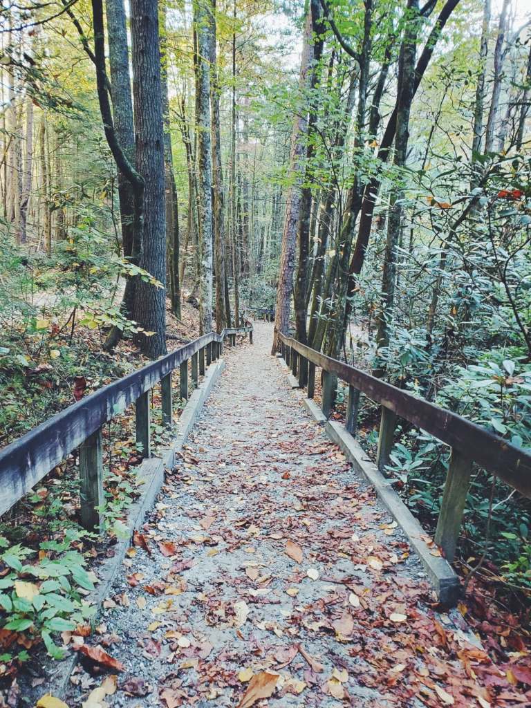
My next connection was with the short Hemlock Nature Trail which spurred off the wide trail I had taken in the dark to the bridge. This lead to a nice path sculpted out of the rhododendron which ran along the river bank. It was a pastoral feeling place to walk, though it wasn’t quite the constant view of the river I had envisioned it might be.
Cell shot of Hemlock Nature TrailCell shot of Hemlock Nature Trail
Views of the river were limited to those from a platform high above the river. On the one hand, it was a little disappointing to not have any way to get intimate access to the river like I prefer, where I can hone in on sets of rapids. On the other, the scene obtainable from the platform was just an absolutely perfect view to frame, and I knew from the moment I saw it that it was a ready-made frame, as long as there wasn’t a gust of wind to jostle the foliage helping set the frame.
River view from the platform
Though I couldn’t really tell from the platform, once the river passed this rapid its large-scale tumbling was over. Though it still maintained a very rocky course, there wasn’t a large drop in elevation around any rocks, therefore the white water good for photography was missing. The next good view I got of the river was from well down of that platform, where there was a bridge that another trail used to cross the river. Peering upstream from the bridge, I saw that I hadn’t missed any singular rapid or cascade that would have merited a closer focus. As it was, though, the rocky course of the river was still quite pretty, and I did setup to get what I knew would be my last river shot here at South Mountains.
The rocky course of the Jacob Fork
Even if I had not been reaching the last spot I could photograph on the river, the sun was just starting to peek over the ridgeline to shine down on the river below. This actually led to an interesting possibility with the sun rays coming through the trees. So I tried to setup a shot the captured the trail bridge while also using the trees to create a sun flare. I was somewhat limited in what I could frame and still get that sunflare, but I spent a moment crafting one last shot here at South Mountains.
Shot of the bridge with the sun in the background
With that, I began packing up my gear and preparing to make a hasty journey to the trailhead for Shortoff Mountain, which the weather was gearing up to be perfect for. While I had barely dipped my toes into what South Mountains has to offer, this brief morning excursion was never intended to be an examination of everything the park has to offer, for that would have been sheer impossible. For what I was looking for, this trip was exactly what I needed. I practically doubled the amount of long exposures I’d been able to take this trip. I’m also one who makes secondary getting great pictures to the in-person experience, but I try hard to align my experiences so I can also get good photographs, and when I journey from flat Florida for a five day excursion to the mountains, I feel like I wasted a rare opportunity if I come back empty handed in the great picture department. My journey to South Mountains wasn’t just about the pictures; it was a beautiful experience getting to photograph this stretch of the Jacob Fork River. I hope that situations align to where I can have a more in-depth visit to South Mountains in the future, but as my experience has shown, even when you’re making it you’re highest priority, sometimes things just don’t add up for you to get to places, and you have to roll with and make the best of what life presents you.
The next step of my day would be to find a parking spot at the notorious Wolf Pit below Shortoff Mountain. Would I be able to find parking? And would I, with two bad hips, be able to complete that challenging ascent up to the rim of Linville Gorge? That will be a tale for my next chapter.
My GPS tracker had stopped working. Well, it was still tracking me. At least I think it was. But that wasn’t going to be much use to me until I finished the hike, and with me not being able to access the information on the tracker, I was worried that finishing the hike in the form I was hoping was a little less of a certainty than before. I felt like I had become the example in a cautionary tale, the guy too reliant on his technology. I had grown very accustomed to checking my route getting mapped out on the tracker to confirm that I was heading in the direction I was supposed to, or making the shape that matched what was on the map. Just the day before it had come in handy more than once on the notoriously poorly marked Linville Gorge trails, helping me correct getting on the wrong trail or locating an easy to miss trail intersection. While most of the trail system I was on today was marked much better, that didn’t necessarily apply to trail segment I was on right now.
I was probably a little bit more on edge than normal, but hiking in woods where people were already looking for a hiker who had been missing for roughly a week will do that to you. I had encountered the search parties multiple times, first on a rock near Little Sam Knob, second as they were spreading out along the trail to search the Flat Laurel Creek valley. I had walked past the missing hiker’s truck parked in the Black Balsam parking area. I had been forced alter my plans multiple days to accommodate the wishes of the authorities for traffic to stay off the Blue Ridge Parkway segment nearby. That missing person, who would later be found deceased deeper into the Shining Rock Wilderness, was never far from my mind, therefore the knowledge that I too could become a missing hiker was never far from my mind. As I continued along the unblazed trail which I hoped would lead me to where I had parked my car, the sun began to fall behind the surrounding ridgelines, and cold air began to seep through the my clothes. Trying to blindly finish what was the longest mountain hike I’d ever done, hips feeling like paper had been wedged into them, I was filled with one comforting thought:
At least there were plenty of people already searching these woods who would likely find my body pretty quickly.
Prior to July of this year I had never left a hike uncompleted due to an injury. That all changed when I sprained my foot pretty hard trying to complete the Flat Laurel Creek Loop after summiting Sam Knob with my wife. My head had been filled with statements that the Flat Laurel Creek valley was really just a less busy Graveyard Fields, an area which I had thoroughly enjoyed when taking a casual hike on my wife and I’s honeymoon in 2011 despite the fact that we got lost and had to turn around. This area was also interconnected with Black Balsam, which was a “life moment” hike when I visited there in 2017 after recovering from my first hip injury. Getting a similar experience to both Black Balsam and Graveyard Fields by hiking the Sam Knob/Flat Laurel Creek Loop hike had my very excited, especially since I could cap off that hike by heading across the parking lot to Black Balsam if I felt up to it. So naturally I was very disappointed when my injury caused me to abort my hike prematurely.
I had unfinished business, and though I had already done the Sam Knob portion, I still wanted to see why the Flat Laurel Creek Trail got so much praise. A fan of mountain creeks, I had not even made it to the actual Flat Laurel Creek when I was hurt. I wouldn’t necessarily have wanted to do this over returning to the actual Graveyard Fields, which this was just supposed to be a poor man’s version of, for a proper hike, but using that part of the Parkway was being discouraged. When plotting out potential hikes for my trip, I must have included at least a half dozen variations of hiking around Flat Laurel Creek and Black Balsam, almost all from the Black Balsam parking area which was currently ground zero for search and rescue operations and officially closed, not just “discouraged”. There was a way of hiking the Flat Laurel Creek Loop from NC 215 without ever accessing the Blue Ridge Parkway – indeed, the actual Flat Laurel Creek Trail left from here and ran for a few miles before joining the Flat Laurel Creek Loop. The Mountains to Sea Trail crosses NC 215 about half a mile from here, and a popular hike is to take the MST to Black Balsam and take the Flat Laurel Creek Trail back. Well, I had already hiked a fair portion of that MST segment three days ago when I visited Silvermine Bald, and that loop left out one side of the Flau Laurel Creek Loop. I made my own variation – deciding I would take the MST from NC 215 and then connecting the Little Sam Knob Trail to the Flat Laurel Creek Loop.
That was the gist of the plan I set out with, and the hike would have options too. I could walk across the parking lot to ascend Black Balsam. I could even head all the way to Tennent Mountain beyond Black Balsam, like I had done in 2017. I could hit Sam Knob again, enjoying the more open vegetation of late fall to explore vistas I hadn’t been able to reach in summer. While naturally ascending the mountains offers some workout, overall there isn’t really anything strenuous in the area, so I felt the sky was the limit when I set out early that morning.
My first order of business that was to visit a waterfall before starting my hike. This was made easy since numerous waterfalls are accessible from NC 215 and, in the case of Sunburst Falls, the road literally crosses the waterfall. I would have liked to have gotten up extremely early to beat the sun on these cloudless, but this was a solo trip and it was difficult to find time to drive several hours, manage cameras, get food, prepare supplies, and assemble directions for the next day’s hike, so I only got out after catching six hours of sleep.
Upper Sunburst Falls
When I pulled into the small roadside pulloff near the fall there was already sunlight starting to stream in on the partially exposed fall. I was not the first vehicle there, and there was another photographer setup on a rock partway up the fall. The photographer saw me and offered to vacate the rock for my benefit. I thanked them but told them I was fine. They were here earlier than me, they deserved to do that they wanted. Aside from a person-free fall, I had hoped to see some fall color surrounding it. I had driven NC215 three days ago and there seemed to be some color surrounding the rock, but it was getting so dark I couldn’t tell much, nor did I even notice when I actually passed the waterfall. Disappointingly, everything around the fall was starkly barren, but there was somewhat of an interesting sight with the rocks surrounding the fall being nearly completely covered in leaves. The fall itself was somewhat interesting, with the largest part of the upper tier being some distance away, and with it gradually tumbling through a variety of drops till it reached the road, where it sharply dropped as it passed under the bridge.
A very bad photo of Lower Sunburst Falls.
A light wind shook the barren trees a bit this morning. I made the best frame of the fall I could while excluding the other photographer. It wasn’t very inspired, but once I saw that conditions weren’t great I was merely going through the motions, already looking towards my hike. Nevertheless, I wanted to see the lower tier if only for my own curiosity. There was no trail down, just a somewhat steep rock hop, and by the time I got down to the bottom with my bad hips I felt extremely fortunate that I hadn’t fallen. I ended up precariously standing in the water with my tripod, and was disgusted when I saw the streaming sunlight creating unsightly blotches on all my shots. In my physical condition, I really couldn’t frame well in this environment, and I decided that I’d feel good if I merely got out of the situation with myself and camera intact. I clawed my way up hill and finished the drive to the trailhead.
I would drop my car off at the Flat Laurel Creek Trailhead, but I wasn’t quite finished with the road myself. I started my hike with the required half mile roadwalk to reach the Mountains to Sea Trail for two reasons. For one, I wasn’t entirely sure when I would finish the hike, and walking the winding road with no real shoulder and limited sightlines for vehicles was dicey even in the daylight, much less getting dark. Two, I hate ending my hikes with a boring roadwalk when you’re exhausted and just ready to reach your vehicle. To my surprise, I kind of enjoyed this bit of roadwalk. NC215 marks a scenic course winding between much taller peaks, and the view that was nice from a car was hardly less so from foot. After a bit of hurried walking I reach the Mountains to Sea Trail crossing, and I darted into the woods to the left, knowing very little of what would this section of the trail would be like.
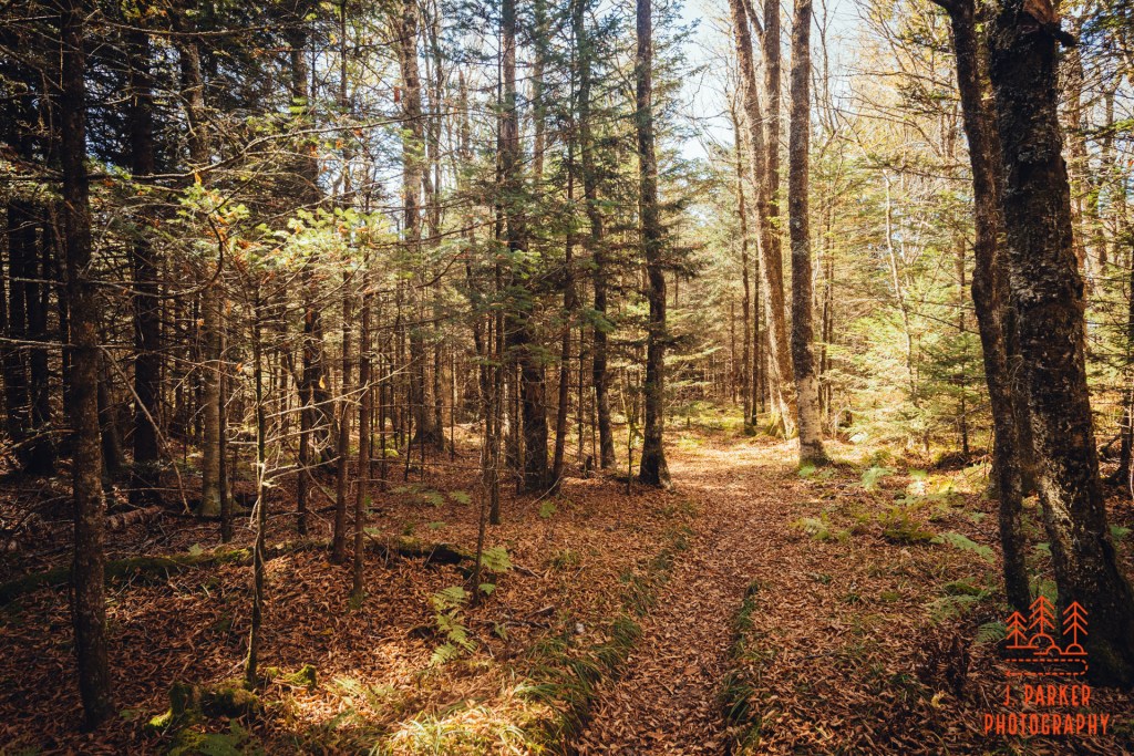
As it turns out, it was quite nice. I was almost immediately greeted by what I call “fairytale forest”. If you hike a lot at higher elevations in the Appalachians, you’re very aware that coniferous forest is not exactly uncommon. It absolutely permeates places like the Smokies and Mt. Mitchell. It’s never ugle, but can often appear rather uniform and monotonous. But then there are others than stand apart from that and just appear to have a certain magic. The first place I encountered that was Panthertown Valley, but I got the same feeling along these first sections of the Mountains to Sea Trail. I had been thinking this trail segment, which wasn’t known for any specific highlight, to be just a means to an end to get where I really wanted to go, but much to my surprise I actually enjoyed this as much, or more, than anything else I hiked this day.
Small creek running beside the trail.The trail crosses the creek.
I was soon greeted by the welcome sound of a creek flowing. For a short time the creek was out of view, but then the trail began to parallel the creek. This was a nice treat, since I didn’t really follow up if there were any creeks in this section of a trail. After it paralleled the creek a short distance a short bridge took the trail across the creek.
Surprise views
Ahead the trail navigated around a large rock face, with a peek of views to the left of the trail, with the Blue Ridge Parkway’s path faintly visible. The views weren’t exceptional – in fact, in other seasons they may have been completed obscured by foliage. As it was, coming before any other views in the trail, it was still a nice trail component. I gave some thought to climbing at least partway up the slope of the rock, and I certainly wouldn’t have been the first. As it was, the passage wasn’t going to be all that easy in my physical condition, so the reward wasn’t really there just to have marginally better views. I moved forward.
More fairytale forest.Sun shines through the fairytale forest.
Ahead was more fairytale forest. Sunlight made this part of the forest glow golden as I made my way through to the smell of Christmas trees. While normally I’m very averse to sunlight in the woods, the coniferous forest always seems to trap and reflect it quite well. Ahead the trail curved in an out of small tree-dotted meadows. These were just isolated patches, far different from the largely open Flat Laurel Creek Valley I was heading towards, but they added a nice dynamic to the hike. I reached familiar ground when I walked a short boardwalk section which crossed a small creek. I recognized this from my hiking three days ago, where I had hiked a section of the Mountains to Sea Trail from Devil’s Courthouse to Silvermine Bald. I would be doubling over part of that hike today, but only briefly, for not long after the Devil’s Courthouse connector came in, I reached the Little Sam Knob Trail, where I would diverge from that.
Small bridge over a creek.
Three days ago I had taken in the large rock that sits near the Little Sam Knob and Mountains to Sea Trail junction, but didn’t see a way to climb up it. I found out there was a way up it in the most concrete way possible; I saw two hikers at the top. I began talking to them and they helpfully pointed out the way up, which ended up being the place I had eyed three days prior. I just hadn’t felt comfortable trying to scale the rock on my own, without knowing it could be safely done, but once I saw two were already up there, found that it was scarcely all that challenging. As it turns out, the men were of the search crew for the missing hiker. They weren’t from the area, and while on the rock they were serving the dual purpose of getting an elevated view so they could see observe more areas, and they were also getting an elevated view….just because it was an elevated view. I discussed with them that I’d been in the area three days ago and today, but hadn’t seen any solo hikers like the one missing (by this point, the hiker’s face was well known to me, having been plastered across many news articles and in many hiking groups). They were called back to assist in another part of the search, leaving me alone on the rock. As the rock wasn’t very tall, there wasn’t necessarily a massive unobstructed panoramic view, but I was afforded nice looks at Little Sam Knob and some other adjoining peaks, and this was another nice bonus to my hike.
Little Sam Knob (I think)A view including Mt. Hardy to the left
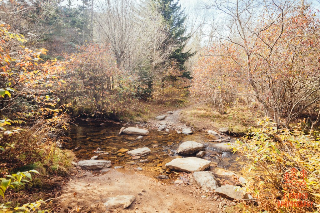
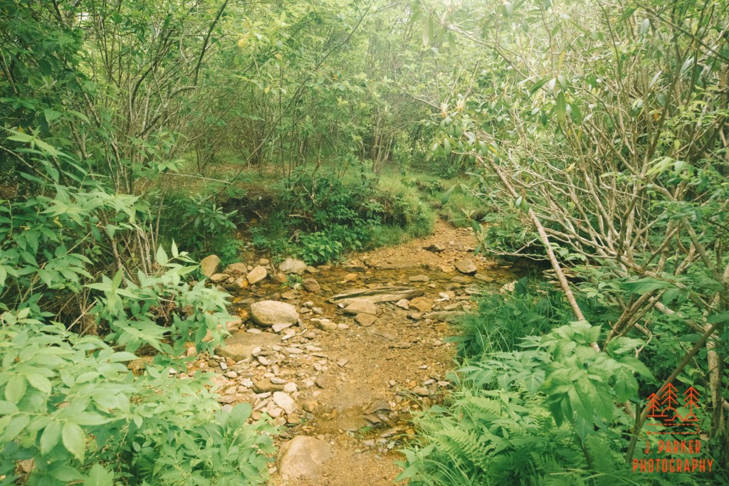
Back on the door, I was entering a segment that would feature more views as is scurried around the edges of Little Sam Knob. Nothing was of the type like found at Sam Knob, Black Balsam, or the other peaks with massive vistas nearby, but these subtle views added another nice element to the hike. I was disappointed to find there were so few leaves left on the trees. In fact, I’d say it was a net negative overall on my hike. But this was another portion that, owing to the season, I got fairly unobstructed views at. After skirting Sam Knob I crossed a creek, no doubt a tributary to Flat Laurel Creek, which I was much anticipating encountering.
View from Little Sam Knpb.View from Little Sam KnobCrossing a creek on the Little Sam Knob Trail.
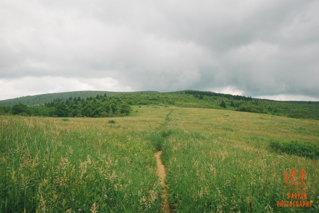
I met the Flat Laurel Creek Loop after dropping down in elevation where I entered the relatively level valley of Flat Laurel Creek. Enough bonus views – I was starting what I thought of as the main event. This section of trail wasn’t part of the portion I’d been able to hike in July before spraining my foot. While I was excited, it had a rather inauspicious beginning. I was hoping for more of an open feel, but I felt very enclosed by a lot of surrounding brush, and wasn’t overjoyed by the watery footpath, either. After walking a bit I started to get some views towards the open valley and Black Balsam to my left. Eventually things open up a bit more, and while there wasn’t much to see in front of me, looking back I started to get a view of Sam Knob to the right and Little Sam Knob to the left.
A view to the back, featuring Little Sam Knob and Sam Knob.
Ahead, I crossed a shallow creek. While there was a fair amount of brush outside the trail, by this point there were almost no trees of consequence. This wasn’t exactly the open meadow I had been envisioning, but there was at least a sense of the surrounding area to be had at all times. The trail, which roughly resembles a square on the map, began to turn to reorient itself towards the imposing Black Balsam ahead. I encountered a small clearing which appeared to serve as a campsite, and I took advantage of the clearing to get the best view of Sam Knob and other peaks to the West. From here, Sam Knob had a conical shape, while every previous view I’d gotten of the peak showed its trademark double hump look.
Creek crossingLooking back from the creek crossing.View from the campsite.
As I was leaving the campsite I encountered a small crowd of search and rescue personnel heading along the trail towards me. They were gradually spreading 10-20 yards apart on the trail, preparing to all go off trail into the interior of the valley in line to canvas the area. Here I felt a little awkward and guilty, for while I knew that the Black Balsam parking area, just a short distance ahead, was their headquarters for the search efforts, I hadn’t really envisioned that I’d be getting in the thick of their search efforts, with news articles indicating they were centering their efforts on areas on the other side of Black Balsam from where I’d be hiking. On top of that, I was a solo male hiker of a similar age range, and though I didn’t really resemble the missing hiker, from far away that might not be easy to see. I couldn’t do anything about that now, and it’s not like I had entered any officially closed areas or anything. I just tried to be as unobtrusive as possible as I slinked by the people doing their job.
As I finished the segment leading to the Black Balsam parking area I was in the high point of the valley, and thus I had better views that I had gotten so far. Most of these views were of Sam Knob, which while nice, they weren’t near as good as the views to be found on the portion of the loop I had gotten to hike heading to Sam Knob in July. I had already gotten to hike a fair share of what I had left undone when spraining my ankle, and I was beginning to find that maybe I hadn’t really left an untapped gem when I had to short it months ago. But there was one thing I knew along this hike that was as good as anything anywhere, and that’s Black Balsam.
Black Balsam, or at least the path to it, lied just on the other side of an awkward parking lot crossing from me. I wasn’t 100 percent sure I would be doing Black Balsam, not because I didn’t want to, of course. I was sorely disappointed I hadn’t been able to re-visit three months ago. But Black Balsam would be crossing a Rubicon of sorts – once I did that, I was committing myself to making the longest single hike I’d ever done in the mountains. It would be out and back spur from where I was – there was no shortcut to get back from Black Balsam to my car along NC 215. But, as far as anyone can everyone feel with two bad hips, I didn’t feel that bad – at least I didn’t feel worse than I anticipated. And there really wasn’t much in the way of climbs at all on the way back. I had envisioned doing at least Sam Knob or Black Balsam to add some “wow” to my hike. I had done Sam Knob three months ago – it had been three years since Black Balsam, three years in which I had nostalgic memories of that first visit. I was in.
If I had an invisibility cloak, I would have worn it as I crossed the Black Balsam parking area which had been converted to an emergency operations center. I quickly made my way across to the Ivestor Gap Trail, which I would be on for a very short distance unless I reached the Art Loeb Spur, as the main Art Loeb Trail crossed the road about half a mile up the road from here. This would be a new approach for me, as the first time I had taken ascended the knob via the Art Loeb. The way that path traversed an evergreen forest before making a gradual and easy open ascent to a promontory on Black Balsam was part of the “magic”. I was hoping for a similar experience on the connector trail.
I wouldn’t find it.
Not that the Art Loeb Connector was the worst trail segment I’ve ever done. It’s just that it had the feeling of being a slog to some extent, with a rough and narrow footpath at times traversing nondescript lean forest. It just wasn’t magical. I got winded for the first this day as I made the ascent through steady switchbacks. Finally I began to break out of the ugly dwarf forest and into open area which offered views taking advantage of the prominence of Black Balsam – if I looked backwards that is. But mostly I just wanted to move forward so I could be done with the steady ascent.
The Art Loeb Spur
At some point towards the top several paths diverged and headed towards different parts of Black Balsam’s flat expanse. I would find later that I had deviated from the official path, but no matter – the joy of Black Balsam is that there are endless well-defined paths to take, all in an open area easy to orient in. I finished the final climb to the top, anticipating the same overwhelming sense of wonderment that I experienced on my first trip. But I experienced something very different.
View towards the Blue Ridge Parkway
Everything on Black Balsam was if I’d never left three years ago. I had come at the exact time of year, and the color of every single piece of foliage and every flake of grass might as well have been the exact same. When I looked through the camera viewfinder, a much nice lens and camera setup than I had in 2017, it was like I was looking at pictures I had already taken. Because by and large, I had. It was like being in a dream, but the thing with a dream is that you aren’t always supposed to experience them in real life. I had come here three years ago with my wife and had a life-changing experience. Here I was, alone, and while the views hadn’t changed at all, the person whose eyes were beholding them had changed a lot.
Maybe it wasn’t that I was ever hoping to return to Black Balsam at all. Maybe I was just hoping to return to what I was and how I felt in 2017. But I wasn’t that same person anymore. I had come here in 2017 having experience few mountain hikes, and certainly nothing with the views of Black Balsam. And I had at the time returned to normal health and unrestricted physical activity after spending that entire summer dealing with my initial hip injury. But I wasn’t ever going to be that same person again. I was a man who took every step with the knowledge that I had prematurely entered into the phase of my life where I’d be living with permanent affliction.
While I felt very alone not having anyone to share this experience with again, I wasn’t necessarily alone on the wide summits of Black Balsam. The activity and closures surrounding the search for the missing hiker had lessened but not eliminated the crowds. Still, it was a far cry from the usual torrent of people – and a far cry from Hawksbill Mountain the day before. I looked at the other people with envy. Maybe they were having their own life-changing experience. Maybe they were as blown away as I was. on first visits.
Maybe they hadn’t wrecked their hip at 32 and ended up with a dysfunctional hip by 35.
Looking from the tall mountain I was on towards other tall mountains which I was not on.
I wasn’t about to pick up and leave just because I had found that being on Black Balsam just brought my current life crisis to the forefront. I had come a long way to get here – both just the journey from Florida, and also the long hike I had taken. I still made my way across the expansive summit area to take in all those great views. And from this I was able to reframe a bit of what I had experienced in 2017, where I had come away amazed at what I had seen without necessarily remembering the blow by blow of the hike. So for all the weird feelings this brought back, at least I had that little benefit.
Tennent Mountain
I did feel like I was reconnecting with an old friend when I laid eyes upon Tennent Mountain, a peak not as easily seen or identified from afar like Black Balsam as it is tucked away behind the other peak. For as much as Black Balsam provided in 2017, my favorite part of that hike was ascending the comparatively narrow but open spine of Tennent Mountain, with massive views on either side. My brain flirted with the possibility of re-visiting this one, and my hips were so accommodated to pain at this point that adding a few more miles would have been just a little more. But the bigger investment would have been time – and it seemed ludicrous to spend so much time on this when I had no idea what nice sections of trail might lie ahead where I would want to spend more time.
The ridge of Black Balsam
I retraced my steps along the ridge of Black Balsam, a little taken aback at having had such a lukewarm experience despite being on one of this part of Appalachia’s best wonders. I no doubt would have felt a bit different had my wife and I returned here in July as anticipated. The different season would have provided a different spectacle. But in my rush to make up for failing to complete that hike, I had overlooked that it might not fill me with the warmest feelings to experience the same exact views, or how coming back would influence that. But like a lawyer who accidentally attended a zoom court hearing with a cat filter, I was prepared to move forward. And I was not a cat.
Approaching Sam Knob
I was eager to get back to territory that felt far more fresh. After returning along the Art Loeb Connector to surreptitiously hike through the Black Balsam parking area. I met up with the Sam Knob Trail. If I needed any confirmation at how different seasons could result in a very different experience along the same trail, here was my reminder, for I was now treading a path I had taken 3 months ago, only instead of a wealth green foliage seemingly racing towards the sky to be the first to grab energy from a sun ray, there was sparse brown vegetation and a feeling of openness. Sam Knob’s welcoming double humps created a striking backdrop as the wide trail navigated a gentle curve past a campsite.
The meadow.
Up next was one of my favorite parts of the hike in July, an area I call “the meadow” (not just “a” meadow) which you approach on a descending boardwalk which empties you out into the open area at the foot of Sam Knob. If anything, this area was even more impressive with the multiple shades of the season providing a romantic feel. In summer the thick grass lining the pathway had wanted to rip my trekking poles from my hands as I traveled through the area. Here, my only impediment to quick travel was the sometimes eroded channel. In no time I found myself where the trail to Sam Knob’s summit veered off, and unlike Tennent Mountain, I was much more seriously considering re-visiting this one. It was a far quicker and easier ascent than might seem from the ground below, and I had more than enough energy to get up and back. Unlike Black Balsam, there were actually paths at the top here which I had yet to explore, leading to viewpoints that had been just too overgrown to reach in summer.
It was an easy decision to make though. I knew that, by visiting a peak I’d just been on three months prior, I’d be trading in the opportunity to attempt high end photography along moving water somewhere. I moved forward.
Reverse view of the meadow.
I didn’t have the greatest memory of the next section of Flat Laurel Creek Trail, and I wanted to get it done quickly – but not too quickly, because my bad memories came from spraining my foot trying to move through it too fast. I took careful steps, marveling at how I had managed to traverse this (in reverse, uphill) with an acutely sprained foot, considering I still found it a bit of a challenge even with two good foot. With great relief I passed ground zero for my July foot sprain and a short distance later came across the object I was most curious about in Flat Laurel Creek.
Laurel CreekUp Flat Laurel Creek
The crossing of Flat Laurel Creek is a notable part of this trail. The creek contains a rather impressive flow for being at such a high elevation. In some instances the creek can reach a level where the unbridged crossing here is difficult, but that was not a problem on this day. I was thankful I had turned around before trying to cross this one after spraining my foot, but it gave me no issue crossing its rocky course now. While in the middle I beheld its course. It was not really the type of course I wanted to photograph in depth, at least not with the current light and foliage, but it was pleasant enough.
Flat Laurel Creek
At the far end of the creek was essentially a T-intersection. To the right was the trailhead where I parked my car, but at least for a bit I was heading left. The Little Sam Trail had come in uptrail of here, thus I hadn’t hiked some of the Flat Laurel Creek Loop. The trail, which was almost a forest road here, held close to the creek for a bit, only a small line of trees between us. I periodically peered between the trees to get an up close view of the creek. I walked down to a confluence of two creeks, with the trail following to the right of the smaller branch which flowed down a very gradual slope. I walked to the middle of Flat Laurel Creek to get a better look. I walked a but to where the trail crossed over the creek, then proceeded a bit further. I hadn’t walked all the way to where the Little Sam Trail had come in, but it began to be apparent I was probably not going to have another close creek interaction before the junction. I felt like I wasn’t missing anything monumental, so I decided I was ok with turning around here, though as I wet my feet a second time I wished I had come to this conclusion before I crossed the creek.
Creek crossing on the Flat Laurel Creek
By now, save for that small portion I had essentially completed the regular Flat Laurel Creek Loop. As it turns out, what really makes the trail stand out was stuff I had already done in July, so there wasn’t much “wow” left, at least not after the leaves of summer and fall wer egone, it was all just a pleasant walk. I think what makes the Flat Laurel Creek Loop so interesting is the meadow in front of Sam Knob, and combining the hike with an ascent of Sam Knob, Black Balsam, or both. As a standalone, it doesn’t really belong in the echelon I was hoping for. But I still had the actual Flat Laurel Creek Trail, which operates as a several mile connector from 215 to the loop.
Flat Laurel Creek
I passed the T junction next to the creek and entered unfamiliar territory along a low-set, muddy path, with the peak of Sam Knob soon looming just to the right. There were lots of nice creek interactions ahead, and as the light from the day started to fade a hair the spruce trees along the creek in the foreground of Sam Knob made quite an exotic view.
Creek in front with Sam Knob in the background
As I went further the creek began to drop elevation. I was nearing Flat Laurel Cascades, where the creek plunges out of the high elevation Flat Laurel Creek Valley to the elevations below. The trail was still running essentially right next to the creek, but I wasn’t sure what type of view I’d be getting. As it turns out, that would only be a very partial one, and not one that I could photograph. What I could see though was fairly impressive. Its plunge height was much larger than I had imagined, and I know understood why some took treacherous paths either down from the trail or hopping up the creek to get here. From the trail, there weren’t any obvious scramble path, and the height was well beyond what I would have been trying for a scramble path from this height to begin with. I was sad to go past the cascades, for after this the creek would be out of view. For at least a short time getting to peer across its gorge towards the back side of Sam Knob, which appeared quite different from this angle. The section between the T-junction and just after the cascades was actually my favorite new part of the Flat Laurel Creek area.
The backside of Sam Knob
It was around this time that I realized that my GPS tracker wasn’t going to be much help. I really hadn’t gotten any trail guidance since the T junction, but I hadn’t much needed it with the creek just to my right. But now my navigational tool was gone, so if there was well defined unofficial trail somewhere (which I had come across at times) I wouldn’t have a great way to tell which one was the right one. I felt GREAT.
View along Flat Laurel Creek Trail
Fortunately for me, almost the entirety of the remainder of the trail was essentially a forest road. Unfortunately for me, almost the entirety of the remainder of the trail was essentially a forest road, so there wasn’t much to look at. There was a where the trail ran next to a dropoff, and the rhododendron broke a few times to give a bit of view. Aside from that, without much in the way of leaves on the trees, there wasn’t much to look at until I reached the next point of interest in Wildcat Falls.
Wildcat Falls
When I had skipped Sam Knob, I had imagined spending time photographing a waterfall in the late afternoon light. It didn’t take me long at all to realize that wasn’t going to be any part of Wildcat Falls. It was an interesting moment along the trail, being a tall fall, but its height left it half exposed to the sun still, meaning I’d have to wait for better light. With a lean, low flow it wasn’t worth waiting for – I had already envisioned a fall to head to that would be a lot more photogenic, and if I hurried, I’d have enough time to see both upper and lower Dill Falls. I upped my pace.
The forest road didn’t offer much to see, but at least it allowed for quick passage. I knew I was getting close when an another small creek came into view, for the last step before reaching the parking area was a small creek crossing. As I crossed the creek, I was putting the finishing touches on an 11.2 mile hike, .7 miles longer than I had gone before on a single mountain hike, but I took little time pondering what I had done, for I was in a hurry to get to Dill Falls, a short drive away but one that involved forest roads of unknown quality.
Creek crossing at the end of Flat Laurel Creek Trail.
The one lane forest road off NC215 that led to Upper and Lower Dill Falls might have at one time given be anxiety, but I was well past that now. Nevertheless, it was quite tucked back, and I was surprised when the narrow road gave way to a parking area that was already occupied by a handful of vehicles. For a second I worried that people would obscure my ability to photograph the falls, but as I was readying my camera gear a rather sizeable family emerged from the trail to Lower Dill Falls, and all the vehicles belonged to them. There were separate trails to both Upper and Lower Dill Falls leaving from the parking lot, but I opted for the lower first, as it appeared to have the most easy access.
Lower Dill Falls
The short trail emptied out at a flat creek, but looking to my right was a beautiful fall set behind a smaller cascade covered in some pleasant driftwood and fallen leaves. And for the first time in the four days I had been in North Carolina, it seems like I had finally arrived at just the right time for perfect fall color, at least in my eyes. Shades of orange and gold highlighted the fall nicely above an understory of more lush green foliage. I had to do the hard part of actually photographing the fall, but I kind of felt like a great weight had been lifted on my shoulders having finally found fall I could photograph again with only a day left in my trip.
Lower Dill Falls
I really enjoyed the spectacle of Lower Dill Falls in person. I ended up being a little underwhelmed when looking at my pictures later, though, for my pictures tending to severely understate the size of its main tier. A Florida resident, I’ve been trying to get 1-3 mountain trips a year since 2017, and naturally I try to get a good selection of waterfalls when possible. Photographing them only intermittently, there are a few mistakes I’ve made a couple times, and one of them is photographing tall falls in such a way that their size is made underwhelming in pictures. Worse still, I would be in such a time crunch between my adventure days that I wouldn’t have time to review my pictures and see my mistake, and I’d repeat it the next day at another fall. Oh well.
Lower Dill Falls was so simple to get to that I had plenty of daylight to get to Upper Dill Falls, which was more challenging. The path from the parking light was a moderate climb for a short distance, but that wasn’t the issue. What was the issue was the very steep, leaf covered scramble path that was necessary to really get a photographable, unobstructed view of the fall once I got close to it. This is exactly the type of trail that in the past I would have taken one look at and said “bad idea”. Especially since I was having hip surgery in just over 10 days. But I had taken a big gamble by taking this trip in the shape I was in, and I had done some crazy things. I navigated an unmarked hike in Linville Gorge of all places, including a trail segment so steep it was laughable. I had just done the longest hike of in the mountains of my life, and done it solo with two bad hips. I had driven on mountain roads an entire day on a tire going flat. I had used an Amazon hub. I stopped at stop lights. There were a lot of firsts this trip. So I wasn’t going to let another stupidly steep slope stop me again, even if it was getting dark and I was having to go down first, uncertain of how difficult it would be to get back up, especially with a camera bag and tripod on my back.
I had one more day in the mountains, and after that I didn’t know if I’d ever have the physical ability to hike in the mountains. So I was beyond caring, and I went for it – sliding down on my butt, of course.
Upper Dill Falls
I was immediately glad I did. Upper Dill Falls was just beautiful. It’s the type of fall that the real waterfall guys seem to get to, but that don’t seem to be found along your every day trail – at least not since such a gorgeous, natural state, sans boardwalk viewing platform (was I now a real waterfall person?). It would have been a beautiful sight any type of year, but of course the fall color around it made it real special. It didn’t matter that, had I gotten different weather this trip, I may have gotten to visit countless other falls like this one in good photography weather. I was here now, and in this moment I was happy, and the thought that I’d be having my hip taken apart in a short time was the furthest thing from my mind. I tried a couple frames before making the difficult climb up the steep slope. It took all the energy I had, but the climb was just short enough that adrenaline seemed to carry me, and I was up and over before I knew it.
Upper Dill Falls
My hike had had as many disappointments as nice moments, so it was nice to feel like I ended on some good fortune. But my good fortune wasn’t quite done. I hadn’t taken to observing the road too closely on the way in, being preoccupied with getting to the falls, but I really enjoyed the way it looked on the way out. I commonly take pictures of roads in fall – their canopy often offers better fall color than you’ll see on the trail. But other than a nice snapshot to show people there wasn’t much to do with them. I had no idea that this would be any different when I got out to take a couple shots of the road here. But somehow I ended up capturing the shot I’ve been looking to get for years – a shot that had beautiful curves, lines, and color. At least to me, it was finally a shot that really showed the magic of driving a forest road in that season. I wouldn’t have much time to see this shot for some time, but I’ve grown quite fond of it.
This had been a long day with a lot of happenings, good and bad. As long as this day was, I only had one more day in the mountains – maybe my last day for a very, very long time. I had wanted to do so much more this trip but the weather just wasn’t ideal for following the rivers and creeks I wanted to do. The weather wasn’t going to be any different the next day. What I was going to do was both work with the weather, and do what I wanted to do in spite of it. It was going to be a heck of a day….
Short but brutally steep. That’s how the hiking guide described the path up the side of Sitting Bear Mountain. And that had lived up to the description. Getting up had been the type of hands and knees in the dirt, grab the next root type of ascent, more of a climb than a walk, which was not for the faint of heart. But getting up hadn’t been the real problem. When it comes to a path this steep, it’s getting down that will be the time that tries a man’s soul (female souls are apparently unflappable).
I peered over the edge, trying to figure out which route which cause a slightly marginal decrease in the likelihood of severe injury compared to the others. So too were close to ten others, hikers who had come from the other direction on a loop hike, not the out and back I was taking, and thus had not yet experienced this thrilling trail segment. I had come across them on my return trip, and had discussed strategies for how to handle this tricky section. My preferred method was the butt method, where you don’t run the risk of having your feet fall out from under you since you aren’t on them in the first place. This tried and true strategy is idea for Florida flat-landers, especially ones with bad hips, and it’s the exact strategy that I decided to employ here. Soon I was sliding down foot by foot, my hands gripping for patches of firm dirt, tree trunks, and roots, whatever would help me make a controlled descent besides the friction between my butt and the ground below which had long since caused the back pocket oy my pants to lose its functionality. And soon, most of the folks behind me had joined in, so there were a near dozen of us sliding ungracefully down the slope, all on our butts. From below, we might have looked silly for those not in the know. For others, they know that’s it’s just another part of hiking in Linville Gorge, one of the most rugged hiking areas in the East.
I was supposed to have hiked here the day before, and after a series of unfortunate events caused me to arrive after parking had already filled up, one of the last things I had in mind was returning to the scene of my great shame the very next day. But I ended up not really being given much of an option, due to something much more tragic than me not finding parking at the trail I wanted to hike. When I envisioned my 4 and a half days of hiking, I knew whatever sunny days there were I was going to focus either on the Linville Gorge area or the Blue Ridge Parkway north of Brevard (Graveyard Fields and Black Balsam area). The day before I had returned to my hotel room to reconnect with civilization and found that Facebook was abuzz with news that there was a missing hiker in the vicinity of the Shining Rock Wilderness and Black Balsam. This was a little unsettling, for the trail system I had hiked two days prior (during which the hiker would have been missing) was part of the same local trail network. Since I was at my closest only 2-3 trail miles from where the person’s vehicle was still parked in the Black Balsam parking area, they could have very well gone missing on the same trail I was on, for all I knew. Authorities were requesting that people stay off the Parkway in this area so as not to impede the search efforts. That basically took every hike I wanted to do in this area off the table.
The Mountains to Sea Trail between Silvermine Bald and Devil’s Courthouse, where I had hiked on Wednesday, and just a handful of miles from where the trail goes to the Black Balsam area where a hiker had gone missing.
I wasn’t going to settle for doing a mediocre, second tier slate of hikes from the second day in a row. Nor was I going to do a hike that wasn’t well suited for an entirely cloudless today. With that in mind, the only thing left I hadn’t yet done were the hikes along Linville Gorge. I wasn’t sure if I wanted to try Hawksbill Mountain again, not just because of my shame at missing it the day before, but also because that hike was far from a full day hike, and I had dipped into my pool of secondary stops in the area the day before. As I was trying to think things through, I decided to take a look at the Sitting Bear Trailhead I had passed the day before. Even as people were parking illegally at the Hawksbill Trailhead as if it were a restaurant serving the last slices of bacon on Earth, there had been parking at Sitting Bear. I was pleasantly surprised but also mildly embarrassed to find that the Sitting Bear Trailhead is almost as good of an access point to Hawksbill Mountain as the actual Hawksbill Trail, being only marginally longer but yet being a more gradual and natural ascent. But on top of that, the trailhead actually connected to the Jonas Ridge Trail between Hawksbill and Sitting Bear Mountain, with the latter being essentially off the radar of the general public, but offering an interesting series of views on its own, in addition to a distinctive rock from which it derives its name.
After being shamed the day before, the idea of returning to the Gorge just to hike one of the overwhelmed “tourist” trails hurt my pride a bit. But being able to do a “real” hike in the Gorge, one that required some navigation and took me off the proverbial beaten path, well that felt a little bit redeeming. It would enhance my “street cred”, especially since I would be doing this as a solo hiker less than two weeks before having hip surgery. It would also take up a lot more of the day, so I wouldn’t be focusing my day around a short hike that would only take a few hours and leave me without much to supplement. I found a great guide outlining step by step how I would need to navigate my way first to Hawksbill and then Sitting Bear. I normally prepare all my hiking resources, like guides, maps, and emergency driving directions, prior to leaving home on a long trip, but for this hike I created a PDF which I transferred to my phone to follow. While downloading maps I also found something else interesting – I saw that the Spence Ridge Trail provided a pretty short journey from a roadside parking area to the Linville River, to an infamous spot that used to be crossed by a bridge which, after being washed out, has required backpackers to make a sometimes tricky water crossing. I didn’t know that there was a spot with such easy access to the Linville River mid-gorge, so I saved information about that as well.
I successfully set out before dawn this day, and the colors of early morning floated over the western part of the Gorge as I dodged hunters also stirring this early morning. Driving from Asheville to the East Rim of the Gorge actually involves the a circuitous route outside the West Rim of the Gorge, but I was quite familiar with the turns of route, having missed some of them the day before. With no flat tire warning to slow me down I arrived at the Sitting Bear Trailhead around sunrise, where I had no difficulty parking. The woods were still doused in the blue hues that dominate prior to the arrival of the sun as I set out on foot to begin what would be an incredible journey.
Starting out on the Sitting Bear Trailhead.
It was a cold morning, floating close enough near the freezing point for me to feel pretty decently chilled. Most of my body had suitable cold weather gear to fight off the cold. Unfortunately that didn’t include my face. As I felt the searing chill reach through my cheeks it occurred to me that I had something that might help; my cloth covid face mask, currently in my pocket in the event I ran into any crowded trail sections where close contact was briefly unavoidable. My mask fit snugly on my face, and also held the warmth of my breath in, so soon I felt very warm.
Picking up the Jonas Ridge Trail.
Simple things on a map aren’t necessarily so simple in person. My first trail junction was where the trail from the trailhead approached a campsite, where an unmarked trail referred to as the Jonas Ridge Trail ran laterally in either direction, the left heading towards Hawksbill. When I reached the junction there were several diverging paths, everything running over a forest floor that was carpeted by fallen leaves, with much of the forest having reached the “fell” stage of fall. Not 100 percent sure which trail to take, I took what appeared to be the best path in the direction I was hoping to go. Keeping a close eye on the path I was making on my hike tracker, and comparing it to the map, I soon felt comfortable I was on the right path.
The trail took a journey over a knob that, compared to the fullsize peaks around it, constituted barely a speed bump, but it was enough of a climb from the campsite to start getting my blood pumping this morning. As I crested the knob the bright rays of the sun, penetrating in sharply between the rather barren trees, greeted me at the top. Everything was golden, the fallen leaves appearing to be on fire from the strength of the sun rays.
Heading towards Hawksbill.
There was no view from the top of the knob, and I was shortly descending again. The descent was shorter than the ascent, and I was soon at yet another campsite where I would be picking up another trail, this one the Hawksbill Trail to lead me to the summit. This time, I made the wrong decision – at least at first. I continued straight on the trail I was on, but knowing I was near the base of Hawksbill, and that the Hawksbill Trail should be making its ascent in earnest, I grew suspicious when my trail started dropping elevation. This mistake was easy to make – the trails actually diverged a few feet from the campsite, not the campsite itself, and from the angle of the junction one was naturally inclined to continue forward on what for most people would be the wrong trail. I doubled back, and when the other trail started ascending fairly rapidly I was certain I was heading up Hawksbill.
Looking below from the first available view at Hawksbill.
The ascent up Hawksbill wasn’t as long as I thought it would be. Heading up peaks like this can often seem this way, where you have enough teases of views and anticipation to shorten time. I knew blue skies awaited me at the top, as well as one of the finest views in the Carolinas, and I climbed vigorously to reach a view that for me had several times appeared as a bridge too far. The trail snaked to the left, barely clinging to the east edge of the mountain, before it doubled back upon itself. Where there was a rock that gave one just enough height to peer over the descending rhododendrons I was treated to my first view from Hawksbills. Here I gazed mostly towards the east-northeast, over a jumble of small peaks that likely included some of the Lost Cove viewpoints I had begrudgingly taken in the day before. This was not “the” view – in fact, it hardly held a candle to anything I’d see the rest of the day. But that first time of the day when you set your eyes upon a host of peaks below is always a special moment.
The flat space near the top of the Hawksbill summit.
The trail spilled out at a wide flat area. This was obviously the summit area, though there weren’t any views immediately available to me. My natural inclination was to go to the left, where trails were much more obvious and in view. This is where the “real” Hawksbill views started to promulgate as I made my way between boulders and small groups of pine foliage that mark the top of Hawksbill. I could see the distinctive round peak of Table Rock as wound my way towards the first unobstructed views on the other side.
Teasing views of the gorge await behind the pine trees.
And finally, a huge stretch of the Gorge sprawled out in front of my eyes. A hurricane in 2019, then an immense day of misfortune the day prior, I was wondering if I’d ever get to return to this place that had so enthralled me in 2017. Finally, I was here.
Viewing the West Rim of the Gorge from Hawksbill.
It’s hard to describe the majesty of the Gorge to those who have never been there. It is truly one of the most incredible singular sights that southern Appalachia can provide. It’s the type of place that when you are viewing it in person, you’re almost not sure of what you’re seeing. And when you see pictures of it later, you’ll scarcely believe that it’s a place you’ve actually visited. Even knowing what to expect, I was no less impressed on my second visit than I was on my first. And it’s all the easier to appreciate since all the signature hikes on its West Rim (Hawksbill, Table Rock, The Chimneys, and Shortoff) offer ample open rock upon which to relax and enjoy its spectacle.
Peering towards Table Rock
The day, like much of the rest of my trip, was brilliantly sunny, absolutely perfect for a view-laden place. The only downside this morning was that the unfiltered early light made facing directly towards Table Rock somewhat harsh and into the sun. But no matter, I was going to enjoy the scene and experience regardless, and there was no such hampering of the view towards the opposite side of the Gorge. Everytime I viewed that opposite side I tried to make sense of the myriad of rock formations that create sharp, definitive walls, but my mind was never able to make much sense of them.
The East Rim of the Gorge, with the flat summit of Shortoff Mountain closing the west side of the Gorge to the left.
One very interesting and distinctive feature of Hawksbill’s south side is the way the rocks stair step lower and lower. Each time you reach a rock you think will be the last you savor a few from before turning back, there’s another that is reachable below. Curiosity runs rampant, as it always seems like you may be able to see more from the next rock than you are from where you are at now. You certainly don’t want to stop and then find out later that you missed something grand, and Linville Gorge always seems to offer a promise of grand from any rock or side trail you see.
A look down the Gorge.
This south view from Hawksbill may be “the” view of the Gorge. It’s really hard to say if the view I had was truly better than that of Table Rock, or maybe it had been so long since I had seen the view from Table Rock that the majesty of seeing the Gorge again was clouding my evaluation. At any rate, the view from both is fantastic, though hiking Table Rock and the Chimneys is a more complete hike. From here, I was able to take in the same East Rim of the Gorge, but I also had a view of the West Rim that included the odd shape of Table Rock, whose distinct peak clinging above the rim of the Gorge seems to defy logic. You don’t get a view of Table Rock when you’re on Table Rock, which is one clear advantage Hawksbill has. I could also see the flat expanse of the summit of Shortoff Mountain, which acts like a sentry at the end of the Gorge. That was another hike I was hoping to complete in the Gorge this trip.
Awkward obligatory selfie of me on the South side of Hawksbill.
I never reached a point where it was obvious I couldn’t continue downward to more rocks, rather it was the thought of diminishing returns and the fact that I’d have to climb back up all these rocks I was descending that finally turned me the other way. I had a few talks with others as I was making my rock scrambles, and I did confirm that the side of the mountain I was exploring was only half the experience. As hard to believe as it was for how much awesomeness as I had already taken in, there was still a summit area with views towards the opposite direction I had yet to explore.
I slowly worked my way up and then passed through the flat camping area where the trail had come in, and I found a path past a large boulder which went the short distance uphill to the actual summit of Hawksbill. A large expanse of craggy, mildly uneven rock marked the actual summit, where there was at least some extent of 360 degree views, though from here you could head in every direction and get a better view. My natural inclination took me slightly towards the left, where there was an impressive view of the West Rim, with a nice ridgeline from the East Rim providing a pop of red and orange fall color. Behind the West Rim and several other peaks was the tallest of them all in Mt. Mitchell and the Black Mountain Ridge, which I take great pleasure in identifying. I wasn’t sure if I was going to have a close passage of the Black Mountains this trip, so I wanted to savor that once (as it turns out, I would not ever get closer to them).
Looking towards Sitting Bear and Hurricane Wall/Hurricane Ridge.
Wandering right upon the summit area, I found my next view squarely ahead towards Sitting Bear. I hadn’t yet committed to doing that portion of the hike just yet, so I looked upon the adjoining mountain, behind the small knob I had gone over earlier, with kene interest. To the right of Sitting Bear and well to the rear was the large shape of Grandfather Mountain, though after my disappointing day prior, where one of the only things I accomplished was a seeing Grandfather multiple times, I was a bit less enthused about this.
The big of rock I found looking towards the Sea of Mountains.The Sea of Mountains, with Grandfather Mountain towards the back left.
Naturally, on a peak fall weekend on one of the area’s most well known mountains, there were certainly a fair amount of people spread out across the wide expanse of available rock. I was quite pleased, however, to find to my right a small area behind a copse of foliage with an interesting view towards the Northeast, one in which everyone else seemed to be overlooking. It wasn’t the awesome view of the gorge that the other areas provided, but it provided quite a pleasing and photogenic frame down towards what I’ve thought of as the “sea of mountains” south of Grandfather which I had first seen from Rough Ridge in 2017.
I amaze myself sometimes at what I can do. I had spent most of the last few months on a couch after work, unable to walk much on my failing hip. I was going to be having surgery in less than two weeks. Yet here I was, having pulled my way up to one of the most inspiring views anywhere in Appalachia. It had less to do with not being in pain, and more to the fact that at least for a brief period of time, you make a truce with your body that you are going to be in a little bit more pain than normal, but at least you are going to do something worthwhile with that pain, instead of still being in pain for mundane everyday life. I couldn’t be sure what I was going to do the rest of the trip or even the rest of the day, so I spent an extra moment digesting this view that I had yearned for years to get back to.
Hawksbill invigorated me, and I hurriedly made my way down the trail and began working my way towards Sitting Bear Mountain and the trailhead I had parked at. I had tasted awesomeness today, the day was still fairly young, and I wanted more. I reached the campsite where the trail to the parking area diverged and I paused a moment to consider my options. Really, the only good alternative I had was to try and venture to waterfalls like Harper Creek and Upper Falls, but with the immense sunshine, this just wasn’t that appealing of an option. As Robert E. Lee had said at Gettysburg, the enemy was here. I was going to attack it. I was going to head to Sitting Bear. Not that the steepness didn’t concern me – that’s the reason why I hadn’t fully committed before now. But the multiple trail guides I had consulted were very clear that while it was an epic trail segment, it really was only a couple hundred yards. I was ready to try that.
I regret that the steep portion of the trail is essentially not covered in my pictures, but the sunlight was so intense coming into the woods that it was washing out large portions of any pictures I could take anyway. It was best for both my safety and my camera to put it in the bag.
This part of the ascent certainly didn’t pull any punches. It was grueling but just below the need to grab roots to pull yourself forward. The trail seemed to undulate left and right, grass to one side of you with somewhat of a dropoff to your right. Trekking poles did little good here. I was anticipating a small flat section with a side trail to the left. At one point the trail at least moderate its ascent, and there was a rough hint of a trail to my left. As it turns out, this was premature, and I doubled back and pushed uphill ever so slowly.
A view from Cummens Overlook.
Finally I found a much more obvious trail to the left, and I took it a very short distance to where there was a small rock outcropping with just enough purchase for a couple people to safely sit. This, and another viewed obtained on another side trail just a few feet away, constitute what is called Cummens Overlook, and the views from here were one of the highlights of my entire trip. While it was far from encompassing like the views from Hawksbill, there was a feeling of connection of closeness to the Gorge and the things you were viewing that just didn’t exist from those high perches. There was a fantastic view of the opposite rim, of other parts of Sitting Bear, but perhaps most impressively a view down the gorge form farther up than I’d ever been previously (save for Linville Falls, which doesn’t really look down the main portion of the gorge).
Looking down the Gorge.
The upper part of Cummens Overlook was no less accessible than the first. Sitting Bear Mountain doesn’t have an obvious summit area like Hawksbill, and every view you take in will come from a side trail. Nevertheless, there’s an impressive series of views to be found here. This upper portion of Cummens Overlook was a little larger, though the rock was a little more unsettling, so I tread very carefully here. Some trees between here and the previous overlook made it a slightly lesser view up the gorge, but it was an even more inspiring view of the West Rim and of Hurricane Wall.
The upper part of Cummens Overlook, Hurricane Wall to the right, the West Rim towards the left.
Outside the overlook stood the monolith that gave Sitting Bear its name. To me, the odd tall rock outcropping much more resembled a trojan horse than a bear, but that’s just me. I can’t confess to have gotten the greatest view, for I’ve scarcely encountered a day with a brighter sun, and the rock was mostly enshrouded in the woods. To me this rock was more of a curiosity than that much of a trail highlight. The greatest benefit I got out of it was just to be able to say I had seen one of many identifiable oddities that define the Gorge.
Sitting Bear
My respite at Cummens Overlook had lured me into a false sense of security. While the previous ascent had been among the steepest I’d ever done on anything outside of a goat path to a waterfall, the upper portion of the journey to Sitting Bear was just ridiculous. My guide had indicated that there had been a series of switchbacks installed there, but nothing really fitted that description, for there was nothing that could provide for anything close to normal hiking. This last portion was legitimately a climb. I pulled myself root by root, for while I wasn’t in danger of falling back towards my starting point, it was impossible to get higher without climbing. Luckily, one could practically see the end of the ascent from the start, so I knew I would eventually reach the end after a few grueling minutes.
Up at the top there was almost immediately a path to a rock on the right. There was a young man with two ladies currently enjoying that rock, a group I had also seen at Cummens Overlook. I patiently waited for them to finish before crowding them on the rock, and I had a brief discussion about the mountain with them before the moved on. The man was a local who regularly visited the mountain, and I wanted to make sure there wasn’t going to be a hidden treat that I missed, so I picked his brain briefly. I can only hope that, in exchange for guiding the ladies to the awesome views of Sitting Bear, that the man was able to enjoy intercourse with one or both of the ladies that was with him afterwards.
Sitting Bear’s first overlook.
Getting the best of this first overlook wasn’t easy, for I had to haul myself up and over the side of a boulder to get the unobstructed view of the Gorge. Once I got up there I had a very interesting view, where you could see Hawksbill, Table Rock, the Chimneys, an Shortoff in succession. It wasn’t as natural a view as others I had seen, but it was somewhat interestingly framed by the trees around it.
Looking towards the “Sea of Mountains” from Sitting Bear.
There was also a small rock with a view towards the “Sea of Mountains”. The rock here was ever so narrow, and not really large enough to sit comfortably, so I got my picture before moving ahead on the trail, happy that every view I got from here wouldn’t involve another murderous ascent.
Looking towards Grandfather Mountain from Sitting Bear.
Further on there was another overlook in this direction, but truth be told, the view from it was so similar that, if not for the timestamp on my pictures, I’d hardly be able to tell which overlook I had taken the picture from.
The turnaround point for my hike was a place called Celestial Point. Getting there from where I was required no less than three unmarked trail junctions. If I did not have directions to this spot, there is no way I would have found it in the non-descript past-peak forest. As it was, at one point the distance I had traveled seemed far greater than indicated in my directions, and I began to get just a shade nervous. I wasn’t worried I couldn’t find my way back, as much as that I wouldn’t find this final highlight. Luckily, I passed a couple returning from Celestial Point, and they confirmed that I was about to reach its side trail.
The main peaks of the West Rim of the Gorge lined up from Celestial Point.
There was a time when Celestial Point was said to be the best view to the south in the Gorge. I knew enough to know that description was a bit overblown, however it was still an interesting view. While part of the East Rim, the way Hurricane Wall pushes into the Gorge, you are practically getting a view straight down the center of the Gorge from here. All of the major peaks of the West Rim lined up in perfect succession. Having now visited all the major peaks along the West Rim except Shortoff, I was already looking forward to getting that one completed as I viewed its distinctive flat plateau from here.
Looking towards the West Rim from Celestial Point.
I carefully retraced my steps back to the Jonas Ridge Trail from here. As uniform as the past-peak woods were here, it would have been easy to pass some of the side trails that led me back, so I carefully marked my progress on my hike tracker so I knew exactly when the trail junctions were coming. Once back on the main trail, I was just ahead of a large group of hikers. They were coming from one of those trails that approached Sitting Bear from up the Gorge, and hadn’t yet experienced the steep section. I warned them about it, for it hadn’t escape my mind that I’d have to navigate it going down, which is a much more dangerous proposition than going up. I had texted my wife from Celestial Point, letting her know that my return trip was going to involved a rather dangerous section.
A great way to minimize the inherent danger in a steep decline is just to eliminate the high probability of losing your footing and possibly falling uncontrolled down the incline. Going down a descent in fall is probably about as bad as it gets aside from pouring rain, for the multitude of fallen leaves are pretty much guaranteed to cause lost footing. So I had no shame in riding my butt for the long haul, working slowly and using everything I could, including rocks, roots, and tree branches to control my descent. To the relief of both my butt and my pants, I made it to the bottom of the worst section without incident. The rest of the descent past the sitting bear wasn’t devoid of danger either, but at least did not require the butt method to traverse its several hundred yard section. I did eventually reach my car, a little worse from the wear from the current day’s travels, but at least alive.
Once finished, I decided to continue in the Gorge and take the Spence Ridge Trail I had just found out about. It would be well less than a thousand feet elevation change and just a few miles total to get down to the river and back. There was basically only two trail junctions, so even without a guide I would easily be able to find my way. This trailhead isn’t one of the major ones in the gorge, so even though I was a bit nervous I was still able to find parking even during one of the busiest weekends the gorge will see. As I prepared my supplies and gave a moment for my phone to recharge in the car, I had a few discussions with fellow hikers. Everyone else was using this trailhead to hike to Table Rock. I didn’t even know there was an alternate day hike to Table Rock besides the Table Rock parking area. If I could guess, it probably involved a lot more elevation changes than I’d like to do, but it at least would cut out one of the scariest mountain roads I’ve ever driven, so that’s a trade off I guess.
The beginning of the Spence Ridge Trail.
There might not be a flatter, straighter section of trail in the Gorge than the first part of the Spence Ridge Trail. That made it easy to traverse, but aside from the occasional nice corridors of foliage, it also left the trail devoid of much to see. Being at a lower elevation than I had been the rest of the day, there were more leaves on the trees than I had seen previously, but the woods were still looking towards the barren side. The only advantage was that I could see through the trees from time to time towards the sharp peak of Hawksbill towering above. There was a bit of added dimension to this since I had hiked it this morning. But it was a mostly non-descript journey to my first trail junction, where a sign notated clearly the Spence Ridge Trail branching off to the right.
Crossing a creek which would run parallel to the trail the remainder of its journey to the river.More colorful woods available at this elevation than I had seen prior.
After the junction the trail dropped much more consistently and got a lot more rocky. The sound of moving water came to ear, and seen it became apparent that the trail was dropping towards a creekbed, which it traversed easily with a small set of rocks. I’m quite the creek fan, but given the harsh light coming in, I saved myself from taking any offshoot to the creek until the return trip. Though the trail was essentially all downhill towards the river, it was the type of trail that made you concentrate on each of your steps, lest you end up turning an ankle on a rock.
Linville River with the remains of the Spence Ridge Bridge on the left.
I reached my destination of the river after many careful steps. This place was both a decently scenic spot yet one that also disappointed me a bit on the same time. I had hoped by getting to river level I’d be filled with wonder at being at the foot on such a spectacular gorge, with those incredible rock walls surrounding me. Unfortunately, it turned out that you couldn’t get much view of the greater Gorge while being down here. The river here was nice, maybe not as nice as I imagined it could have been, but still nice. There was a set of large rapids or a small cascade upriver of where the trail came in. The trail used to cross the river on a bridge here, but the bridge washed out years ago and there are no current plans to replace it. I was hoping to uncover a goat path or informal trail that would allow me to follow the river a bit, but the best I could find was just to hop along the rocks towards that small cascade upstream.
I setup to take a long exposure of the rapids. There was still a lot of light coming in, so I didn’t have an ideal setup. As I did this, a group of hikers emerged at the opposite side of the river. I watched with one eye on my camera, one eye on those crossing. For backpackers, crossing water like this is supposed to be no big deal and is practically a right of passage. That said, the care they had to take to do so, having to get themselves and a lot of gear they would prefer to stay dry across the river, was a challenge I’m not sure I’d like.
The creek
I was hoping to see more interesting aspects of the creek, both at the river itself and along the hike. Unfortunately, where it joined the river there wasn’t a tumbling little fall, just gently descending rapids blown out by the sunlight. I was open to stopping at spots along the creek on my return trip, and I did stop in one spot that I thought looked promising from above. As it happened, once I got to the creek there was a large rock that blocked the bottom of the fall, and I ended up having far more difficulty setting up around the creek than I would have imagined. After that disappointment, I ended up feeling pretty overwhelmingly tired. Part of the reason for this is that, while I had set out prepared for the cold weather in the morning, the day had warmed up quite a bit, and I hadn’t shed any layers. So I was both a little too warm, thus sweating out a lot of energy, and also carrying extra weight. My hips were both in sore shape at this point. The Spence Ridge Trail had seemed rather inconsequential, but in the shape I was in, I had legitimately never moved at slower pace than I did on the rather monotonous journey back to the car.
Returning along the Spence Ridge Trail.
I hadn’t necessarily known that Spence Ridge would definitely be my last trail of the day when I started it, but both time and energy meant I wouldn’t get any other hiking done. Prior to starting my trip I had scope out some spots where I might be able to find something worth photographing in a pinch, and one of those was the Linville Picnic Area along the Blue Ridge Parkway upstream a bit from the well-known Linville Falls.
Linville River
Upon reaching the picnic area, there was neither the water features (rapids/rocks etc.) I was hoping for, nor the solid fall color. There was just a trace of both, so I squeezed out everything I could in getting two shots, mindful of the fact that I had come up to North Carolina during fall and had scarcely gotten much fall color in my pictures. First I started at a small hint of rapids where the surrounding trees hunt over part of the river. By and large the trees were barren, but a small slate of them still held some leaves which showcased the extreme colors that come just prior to the leaves falling. The picture I made makes the leaves that are there far more prominent than the barren branches. Next, I headed downriver to where there is a view of an historic bridge upon which the Parkway crosses the river. Here again there was only a trace of color left, but what was there I was able to use to frame the stone structure of the bridge nicely. Had I arrived a few days prior I’m sure I could have gotten something better, but I couldn’t do anything about that, and I was happy with the picture I got, as well, as the skill it took to make either picture under the current conditions.
Linvile River, with the Blue Ridge Parkway crossing on an historic bridge.
Though I wasn’t blown away by the Spence Ridge Trail, I had a fantastic day. I had gotten Hawksbill Mountain, another one of Linville Gorge’s signature hikes done, and it had lived up to its (Hawks?) billing. I had gotten off the tourist paths and done a hike to unheralded Gorge overlooks that required a bit of navigation to complete, and those provided views that were a great accessory to my primary hike. Table Rock and the Chimneys was still by far my favorite Gorge hike, but there was a reason I had chosen to do that one my first visit. I had satisfied my curiosity in taking the Spence Ridge Trail to see the river mid-Gorge. And I had ended the day taking pictures at a spot I had taken the time to research so I could find a place in a pinch. This was a day full of accomplishment, one good for anyone. But it was even more awesome realizing that I accomplished a challenging hike like Hawksbill and Sitting Bear despite barely being able to walk approaching this trip. I had rebounded from a disappointing day prior, now I was wondering how much else I could accomplish with two days remaining in this trip.
My car said it had a flat tire. Driving down Interstate 40 in the ballpark of towns preparing their application for a second stop light, this wasn’t exactly an opportune time (I will say that I have yet to find an opportune time for a flat tire warning). It was early on a Saturday morning, though not as early as I would have liked. Out of practice, for the second year in a row I had underestimated the time it would take to put on cold weather gear, or how long it would take to get out of a hotel parking lot the size of a dumpster with windows fogged up on a vehicle I wasn’t familiar with. While saying a Ford was nice seems like an oxymoron, in this case it at least had fancier electronics than my 2015 Rav4. And in this case, those electronics were telling me my tire was flat.
If the interstate I was on was desolate, I was hardly going to feel much better once I got on the county roads and eventual dirt roads where I was heading. I couldn’t imagine much worse than than having a flat tire on a forest road, except for maybe my wife locking the keys in the Rav4 in a back area of Great Smoky Mountains National Park, so I certainly didn’t want to take my chances. That would be out of my hands though. There were exactly two gas stations between myself and my hopeful destination, the Hawksbill Parking area, and neither of them had an air pump. At the first one, I got out and surveyed the tire. It didn’t look bad to me, so I made the executive decision to take my chances, but all the challenges of that morning added up to me being over an hour being schedule. That was going to be an issue.
It turns out, I needn’t have worried about having a flat tire on a empty forest road, for there were no empty forest roads to be found on this peak fall color Saturday. Once I finally reached my intended destination, the Hawksbill trailhead on the east side of Linville Gorge, even farther behind schedule for my GPS failing multiple times to give me instructions at a road split (which is common in this area), the parking area was akin to Disney World, only with slightly more children. There simply wasn’t a legal parking spot to be found. I’m willing to do a lot of things to maximize the value of my trips, but one thing I won’t do is be “that guy” and park in an illegal fashion at a trailhead. I do the responsible thing and get up early early to find parking, or I find somewhere else. Unfortunately, some things this morning were out of my hands. I was hardly capable of the vehicle acrobatics needed to find an adventurous parking space that day, in an unfamiliar vehicle that was also a Ford. Nevertheless, some acrobatics were needed just to turn around on the narrow forest road containing the trailhead, and in the roughly 20 minutes that elapsed after I had turned around, dozens of vehicles had parked blocking an entire lane of the narrow two lane road, and it felt like a disaster movie trying to get out, only I didn’t have any popcord.
Table Rock from my 2017 trip.
This wouldn’t have been my first visit to the gorge. I had an absolutely magnificent hike there at Table Rock/The Chimneys in 2017, and ever since then I had deigned to return. But a second trip to the Gorge was seeming like an impossible ask. I had made plans to take two hikes there Labor Day weekend of 2019, only to have to cancel them for the likely landfall of Hurricane Dorian in Florida, but by the time I actually flew home that weekend the storm had decided to ride off the east coast of the state instead. Now this…I was beginning to feel like a second visit would just never happen.
A view of the Gorge from Table Rock in 2017.
It might be hard to understand the allure of the Gorge if you’ve never been. While all of Appalachia is nice, the Gorge is one of those places, along with the Smokies, that give you magical scenes far above the others that you just won’t ever forget. The depth of the beauty is so great, sometimes you see the pictures afterwards and wonder if it was even a real place. But the Gorge comes with a caveat. While it plays host to a handful of hikes that are enjoyed by the general public, once you get away from these hikes you’ll find an adventuresome collection of hikes running through the federal wilderness area that are the sometimes lethal combination of extremely rugged and poorly marked. The adventuresome hikes here were generally beyond my physical or navigational ability, and that of many others as well, so it’s not as easy to find easily available (aka free) maps online for the area, and I didn’t come prepared for alternate hiking in the gorge. Therefore, when I saw something called the “Sitting Bear” trailhead on my way out, it definitely piqued my curiosity, but I wasn’t about to go pathfinding blindly with two bad hips into one of southern Appalachia’s most formidable hiking areas.
Rough Ridge along Grandfather Mountain
So what now? Well, that was going to be a challenge to figure out, and I was under the gun trying to figure it out, since other trailheads were similarly going to be filling up. I didn’t even have anywhere I could stop to try to get my bearings, so I made a beeline for the nearby Blue Ridge Parkway, where I knew trailheads by memory without needing directions. There isn’t much more lovely than the area of the Parkway around Grandfather Mountain in peak fall, but in terms of crowds, it was like I had just left Epcot to go to Magic Kingdom. There would be no reprieve, and I was under no illusions of it.
At least my tire hadn’t gone flat yet.
Approaching Grandfather Mountain along the Blue Ridge Parkway.
Having been several years since I had seen it, I was sufficiently impressed by as Grandfather Mountain came into view. That mountain is just massive in every way for this part of Appalachia, and there’s many reasons why this rugged collection of peaks should be considered one of the signature mountains of the range. While I knew time was of the essence, I simple had to stop at an overlook to gawk when this thing first came into view. It’s an impressive mountain from far away, although its jumble of varied peaks at the top makes it a rather unshapely thing. Before my day was done I’d be seeing quite a few more views.
The stairs from the Wilson Creek parking area to the Tanawha Trail.
Though I wasn’t thrilled about it, the idea from here was that I would park at the Beacon Heights Overlook and take a hike along the Tanawha Trail, which while working its way parallel to the Parkway along lower elevations of Grandfather Mountain, traces under the famous Linn Cove Viaduct, crossed some creeks, and visits the awesome views of Rough Ridge. Unfortunately, after a comedic series of errors, I drove the Linn Cove Viaduct exactly three times while obtaining zero spaces at the Beacon Heights Overlook, which had filled up. I finally was able to obtain shaky parking near Wilson Creek. My enthusiasm was already a bit waned at being past the Linn Cove Viaduct, part of the selling point of the Tanawha Trail, and I sunk even further upon reaching the bridge over Wilson Creek and finding it just a collection of non-flowing shallow pools at the time. The sun was blistering, and given the lack of creeks, really the only notable sight along the Tanawha Trail would be Rough Ridge, a long out and back hike away. I had already done Rough Ridge in 2017, so there would be nothing new except all new people to rub shoulders with, something that limits enjoyment even in non-plague times. I didn’t like not having a real idea of what to do, but I liked even less the idea of hiking the Tanawha Trail on this apocalyptically busy, abominably sunny day, so I begrudgingly retraced my steps over the portion of the Tanawha Trail I had already done, where I had to dodge traffic to return to my vehicle.
What’s supposed to be Wilson Creek.
In the moment I took before starting off again, I had my wife text me the number for our roadside service, just in case. And then I set back down the portion of the Parkway from where I had come, this time heading towards the Wilson Creek ranger district, a new to me area where I had information on nearly a dozen hikes, ones whose greatest ability might be availability at this point. I felt a great sense of relief when my turn off the Blue Ridge Parkway led me to a quiet dirt road that seemed a million miles from the chaos that was ensuing just a turn away. This felt like the first good moment I’d had all day, and I savored it by stopping the car and grabbing a few cell phone pics of the rural scene.
My rural road off the Blue Ridge Parkway.
Not to worry – I soon started making bad decisions again. I had what, at the time, appeared to be unassailable logic for the hike I would do next; it had available parking. I couldn’t count on that happening anywhere else, and it was with that in mind that I set out on the Big Lost Cove Cliffs Trail. This trail is essentially a one trick pony, a 3.3 mile round trip out and back to a nice, large slate of open rock with a great view of Grandfather Mountain. While many people are perfectly happy with hikes that don’t have much besides a single signature moment, I vastly prefer hikes that consistent deliver scenic splendor, especially when those are so plentiful in the mountains. Hikes like Big Lost Cove Cliffs are what I consider “bonus stops”, something to be done to augment your day after already doing a more complete hike. At the time, though, I was happy just to be setting out on any hike.
Big Lost Cove Cliffs Trail
The trail would start by navigating a series of switchbacks. Like most others of their ilk, there wasn’t too much to look at as they climbed steadily upward. I did enjoy that the path was nicely carpeted with fallen leaves, and while there was a lot less deciduous forest than you might expect, as some some of it was decently colorful as I worked my way upwards. The path alternated in width between wider than forest road-passageways and others where the foliage heavily encroached upon me as I went past, though it never was what you would call overgrown. I passed groups and other hikers every now and then, enough to make me feel like I wasn’t alone in the woods while never making the trail feel all that busy, either.
Big Lost Cove Cliffs Trail
Unfortunately, there wasn’t much in the way of signature moments along the journey. The woods were consistently nice without every offering much variation to pique your interest. It continued this way for much of the mile and a half plus out to the cliffs. Now, there are worse things to be found than woods that can be consistently nice but unchanging, but I had gotten up early this morning thinking I’d be taking in one of the most awesome natural wonders in the eastern United States, so you’ll have to forgive me for feeling a little underwhelmed.
The only real deviation from the norm came about 2/3 of the way in, when there was a small rock to the left which offered a partially blocked but still pretty good view out, with Grandfather Mountain clearly identifiable in the background. I had little conception of what the surrounding area was like, so I enjoyed this little teaser of what was ahead. The rock would have been easy to miss, and many people did. It was big enough for someone to get on without fear of falling off, while not being much larger. I grabbed a snack at this point, happy to have had at least something worthwhile today.
The rock got my hopes up that I was getting close to the end. I was a lot further from it than I thought I was. Much to my dismay, the trail started going downwards, and kept that way for longer than I would have thought possible. Certainly it wasn’t near as far I had traveled upwards to get here, but generally when you hike an out and back to an overlook, its almost always a continuous climb until you reach the end. This is nice because you get to enjoy the overlook with the satisfaction that everything from there is downhill. In this case, I’d start the return trip having a bit of a climb.
A view towards Grandfather Mountain.
There was quite a large rock slab that greeted me at the overlook once I actually reached it. Maybe a dozen people were spread out across its surface, which was plenty large enough for you to practically leave everyone else out of view if you so chose to. The primary view was towards Grandfather Mountain, its distinctive peaks clearly identifiable even though we were quite some distance away. One could also clearly trace the path of the Blue Ridge Parkway, which was the same path I had taken a short time ago. As impressive as Grandfather Mountain is to view up close, I wouldn’t say where I was at provided the best vista I had ever seen. Still, the rock slab, which I guess I could call Big Lost Cove Cliff, was a cool spot since it did offer a view and a great deal of space to enjoy it.
Rock crags at Big Lost Cove Cliffs.
I walked around a set of craggy rocks and under pine trees and shrubs to reach the far side of the cliff. There wasn’t much new to see on this side of the rocks, for the mountain encroached pretty quickly and blocked any possible view in that direction. From here, I was left to peer upon Grandfather Mountain again, with the signature radio tower identifying Grandmother Mountain in front of it. After spending a relaxing moment refreshing myself with some beef jerky, I retraced my steps back towards the other people who were enjoying the slab.
I struck up a conversation with some older folks that were savoring the view. Pretty much everybody I talked to this trip I had to brag a little bit about the fact I was working through bad hips two weeks before my surgery. Since I hadn’t been in the area, and they were local, I discussed some of the other local trails with them. Naturally, they recommended Harper Creek Falls, which is pretty much the signature hike of the immediate area I was in. I had every intention of getting both the main Harper Creek Falls and Little Harper Creek Falls in, hopefully during this trip, but I wanted better waterfall weather. It’s the debate every hiker/photographer has to make with every trip. Do you want to a signature hike even if the weather won’t allow you to photograph it properly, knowing that you’ll just have to re-do it later if you want to photograph it? Or do you want to do hikes that are probably a lesser experience, but in which the weather is optimal for their signature feature?
I wasn’t writing off doing Harper’s Creek Falls. But I didn’t want to head there in the middle of the day, either, with a lot of time between myself and late afternoon light. I shared my plan to next hike Little Lost Cove Cliffs, which had been recommended to me, and in which I assumed would be a superior hike so I didn’t feel at the time would be redundant. An older lady recommended I do Harper Creek Falls, since I had already done a vista hike, and I would wish I had taken that advice later.
I had lumped the hike Big Lost Cove Cliffs in the “short” category because I knew it wouldn’t be prohibitively strenuous, but there is still a big time difference between a 2 mile round trip and a 3.3 mile round trip hike. Without anything interesting to stop for I attempted to go as fast as my dual injured hips could take me and, upon completing the hike, I moved forward to my chosen trailhead for Little Lost Cove Cliffs (it has two trailheads roughly equidistant to the cliffs), one which also shared a trail to one of the Harper Creek Falls.
Little Lost Cove Cliffs Trail
Little Lost Cove Cliffs was a much shorter journey to the main event, being roughly a mile, but it was a much steeper ascent than its big brother. While I had found its predecessor somewhat bland and repetitive, Little Lost Cove was even more so, since a good portion of its ascent was done on a wide, featureless forest road. Well, I wasn’t here for the trail anyway, and I tried to hurry as best I could, but I didn’t get the response from my out of shape, Floridian body that I was hoping for.
The benefit of the forest road setup was that at least there was ample area for spacing, for this was a busier trail than the last. In particular, there were several vans parked at the trailhead, which each dumped large contingents upon the trail. One load composed of youth and councilors was coming down as I was going up. I watched with amusement as practically ten people in quick succession hit a steep patch of trail covered with nuts, and each one of them lost their footing, some falling down completely which others merely lost their footing. Well, that wasn’t going to happen to me.
The trail leveled off after some time, mercilessly ending what had thus far been a constant ascent. Here the trail narrowed, passed through a small meadow, and then entered another patch of woods. In these woods the main trail went straight, but an offshot went uphill to a campsite. Having learned about hidden bonus vistas, I reluctantly climbed the extra little bit and found another trail behind the campsite, which led to a completely uninhabited, wide rock slab that was as large as the main overlook on many trails. This would have been a huge “win” except for one simple problem:
It was almost indistinguishable from the view I had hiked to earlier at Big Lost Cove Cliffs.
The bonus view at Little Lost Cove.
I had hiked 1.7 miles back from Big Lost Cove, driven to another trailhead, and then hiked basically a mile uphill only to get to an extremely similar view. Now I know why the older lady had recommended I not do this trail. Now, I must say, the view I was at was clearly a better view than the one at Big Lost Cove. The presentation was more balanced and pleasing, giving better shape to the mountains in front of Grandfather Mountain. But still, in the grand scheme of things, I was looking at a view from roughly the same distance of Grandfather Mountain from the south. Despite being better, it wasn’t a bit enough distance to feel like I added anything more to my day. To my left lie the main Little Lost Cove Cliffs, and I hoped that they would offer something different than this first.
Looking left from the first Little Lost Cove overlook.
Down I went, feeling a bit smug from having found a vista that was, no pun intended, overlooked by so many, but otherwise feeling a bit discouraged. I reached the main overlook a short time later, where a massive tall rock dominated the scene and seemed to split it into two different areas, one to the right which offered rocks showing the standard Grandfather Mountain view, and another facing forwards towards a valley and opposite peaks which were mercifully not Grandfather Mountain. For obvious reasons, I visited the latter first. The rock here was a little more sloped than the places I had visited before, so I had to take very careful steps with my shaky bad hips.
This was clearly a superior place than Big Lost Cove, but naturally I had been super anxious to get on a trail with something worthwhile. Since these were so redundant, yet Little Lost Cove in a different category, I would have been well served to just visit the latter. As it was, even though this place was better, I definitely felt like I had cheated myself a bit. I certainly savored the views – I was there of course. But I didn’t spend too long, for I was feeling guilty for squandering so much of my rare time in the mountains, just 13 days before I’d be losing the ability to hike for a possibly very long time.
View form Little Lost Cove Cliffs.
As you might imagine, I was in rather of a hurry once I started making the all downhill trek back to my car. So in a rush was I that I completely forgot about the nut-covered slope partway up. That was brought to my attention when my feet slid out from under me and I took a tumble, my hand caught in the strap of one of my trekking poles as I and my bad hips fell to the ground. I was fine, but I knew with the way my hand got caught I was lucky (for once) that I didn’t get hurt. Even more fortunately, despite it being a busy trail, nobody saw me fall. My dignity wasn’t hurt either.
Once I got back to the car I had to evaluate a lot of things. Ultimately, I came to the decision that Harper Creek Falls was just not going to get done today. With my poor hips, I just wasn’t moving that fast, especially when laden with a camera bag with supplies and a tripod attached. I knew that if I visited the falls I would be wanting to stay their late photographing moving water of some type, which could only be photographed in late afternoon/early evening light. I was going to end up staying later than I should, not only risking having to make a decently long trek on a possibly rough trail as it got dark (I had packed my head lamp for the trip but forgot to have it with me for hiking) and there was still the matter of a suspect tire on the car. The trailheads were a long way down a narrow forest road, and I could possibly end up in need of help without cell phone range or other vehicles coming along. I wasn’t willing to risk that.
I felt like I had an alternative though. Part of my rationale for missing the falls was that I’d at least get to see more of the Wilson Creek area, unknown to me before today. And it seemed like there would be a way I could do it and double back to Upper Falls, which wasn’t near as far off a main or that long of a hike.
Cell shot of Wilson Creek upstream.
I ventured down the road till it crossed Wilson Creek, which was pretty much river-sized at this location. And boy, did Wilson Creek look gorgeous! While I later found out that there IS a trail that covers some of the upper reaches of Wilson Creek, I hadn’t been able to find information about it in my trip research, despite hoping I would find it. Wilson Creek here is the type of exotic looking shallow mountain waterway that I absolutely dream about. I had to park the car near the bridge and then carefully walk the bridge to see of it, for the bridge was one lane. Not knowing what I would find, and trying to keep up a hasty pace, I left my real cameras in the car. Had I known what a beautiful scene awaited me I probably would have grabbed my larger cameras, but my Samsung S10 did a fine job capturing the scene anyway.
Downstream Wilson Creek.
I wasn’t done seeing Wilson Creek, though I’d see far more than I imagined. From here I would follow a road that ran parallel to the creek, before hitting Craig Creek road, which would loop me back towards Upper Falls. As I turned down the road, which ran alongside the creek that gave it its name, I came across a few very nice scenes. I got out and took a few good long exposures where I could frame a shot. This was an unexpected, pleasant surprise, though I’d soon run into a less pleasant surprise.
Craig CreekCraig Creek
The road was closed a short distance ahead. And I’m not sure if this road is always closed, or if it was just a temporary closure. Several large boulders were placed to block traffic, so it certainly seemed it could be a full time thing. What I can tell you is that google definitely thought the road was open for traffic when it clearly. Boy, now I was REALLY dejected. No Upper Falls. Nothing nice to photograph to cap off what had been a pretty lousy day when I could ill afford to waste time.
Or so I thought.
Brown Mountain Rd.
I had accepted that there was nothing else I could do but keep driving the road I had bene on south, till I eventually reached civilization. The road seemed quite pretty, and I stopped to take a few photos with my phone, but I was completely oblivious to the fact that it would a bonafide scenic drive ahead, with countless overlooks of a burgeoning Wilson Creek, complete with rapids and fall color. I was absolutely thrilled at my unanticipated good fortune as I found my first frame of a gorgeous small rapid, bathed in even light as the ridgeline on the opposite side of the gorge blocked the sunlight. Wilson Creek was an incredibly appealing photographic subject, and yet I hadn’t even known this scenic drive existed until stumbling across it through an unfortunate series of events.
Wilson CreekAnother angle of the first set of rapids along Wilson Creek
From here on I’d be presented with numerous opportunities to photograph the creek, as there were frequent parking areas and pulloffs with trails of varying degrees of formality heading down to the creek. My biggest challenge would be the occasional visiting family and fisherman getting in what would otherwise be nice frames.
Wilson Creek
The road I was on was Brown Mountain Beach Rd, referencing nearby Brown Mountain, which gives rise to the famed Brown Mountain lights, so named because they are lights that emanate from Brown Mountain.
Wilson Creek was a different beast here than what it had been upstream. It’s gorge was deep, it’s channel flowing with a lot of power through an imposing channel flanked by stone walls and large boulders. It made a great photographic subject, and while I didn’t get a huge volume of pictures as I cruised the road, after the hellish luck I’d seemed to have the rest of the day, I was happy to have a couple that to me seemed like pretty high caliber.
Wilson Creek
As I headed for my hotel in east Asheville, I had a couple things to be thankful for. First, I had at least ended a disappointing day on a high note. Second, that my low tire had not gone flat. I call that a win.
I’m not sure if the ridge that the Blue Ridge Parkway rides west of Asheville through Mt. Pisgah and to the Great Balsams is actually the Pisgah Ridge. I saw that name on a sign once, though, so I’d like to think it is. Maybe its name is Gerald. I like to learn a lot about how gorgeous the views from mountains are, and spend a lot less time learning what to call them and the things I see from them are. What I do know about that glorious ridge west of the Asheville and north of Brevard is that, whatever its named, its got some of the most gorgeous views of some of the most interesting peaks (like Looking Glass Rock) in the southern Appalachians. And you can usually enjoy them shoulder to shoulder with 20-40 of your new best friends and, since its North Carolina, always their compulsory hiking dog as well. I thought that this was always the trade off for these amazing views, until I able to take in a view about as good as all the rest, only without the hordes of people.
I found this view along a portion of the Mountains to Sea Trail, which, much like its name implies, runs from the mountains to the sea. The exact location was called Silvermine Bald, which likes its name implies, contains neither silver, nor a mine, nor a bald to the best of my knowledge (at least none available along the trail). That notwithstanding, this would be the centerpiece of a very enjoyable hike, one which, in addition to a trip along the Big East Fork, completed a nice afternoon of visiting under the radar locations in an otherwise busy area.
I had always planned to do a hike in this area in the afternoon, but I kind of surprised myself by opting for Silvermine Bald over Graveyard Fields or Black Balsam, which are among the cream of North Carolina hikes. I think I imagined that I would have the opportunity to do both, which were on my must do list, before the end of the trip, and wanted more time to do longer hikes stemming from those places. I also didn’t want to have to contend for afternoon parking spaces. So not wanting to shortchange any of those key places, I thought a nice low-key hike to views at Silvermine would be great, though I wasn’t as well versed in the trails along this route as at the other locations.
This particular under the radar hike started in a place that was decidedly the opposite, which was the Devil’s Courthouse parking area. I felt like I had just been here and, perhaps in the grand scheme of things, I had. Just three months earlier I had been there with my wife as we finished our weeklong mountain trip with a solid cruise along the Blue Ridge Parkway. Though we had cruised or otherwise been in the area a few times, we had never had a hearing at the Courthouse until our July trip. We were thoroughly impressed with the view form the parking area then, but owing to a badly sprained foot I had hiked over ten miles on in the last two days, I was barely able to hike from my car to the hotel elevator by that point, much less a half mile uphill to the viewing area. The Courthouse was just an almost incidental bonus to my longer hike, but it would turn out to be a nice bonus. I soaked in the view a bit before heading uptrail.
The start of the way to Devil’s Courthouse.
In this instance, heading uptrail actually means following the Blue Ridge Parkway a short distance. Fortunately, this didn’t involve walking along the roadway itself. A trail led to the right of the road for several hundred yards. The Parkway soon disappears in a tunnel, while the sidewalk deviates into a pine forest that lines the sides of the Courthouse. Coniferous forest lines most of the higher elevations of this part of Appalachia, and it’s a pretty sure sign that you’ve gotten pretty high up. I definitely wasn’t in Florida anymore.
The path stayed paved for a moment as the trail began climbing towards the observation area at the top of the Courthouse. While this climb is pretty negligible compared to doing a real hike, these observation area trails often have steep enough ascents to get your breathing heavy, and this is no exception. The pathway eventually gave way to a rocky trail, and as you got closer, pretty much bare rock with railings on either side to help you navigate to the top. As I was ascending I was keeping my eyes peeled for a pathway to the left, which would be my connector to the remainder of my hike. I spotted it, a rather unassuming pathway just before the railings began which would be easy to miss if you weren’t looking for it. For now that could wait – I definitely wanted to take in the views from the Courthouse, which wasn’t far away.
Looking from the Courthouse towards the Parking lot we began at.
For anyone used to hiking to views, its hard to admit just now fantastic the views from these sterilized general observation areas can be. And its true, its hard to really compare a view that you haven’t won the honest way to one you had to build up towards via hiking. But man, the views from the Courthouse are genuinely fantastic. Not that this was much of a surprise. I’ve taken in the views from numerous nearby places, including the parking lot below, and they are all generally very good. That’s why this area of the Parkway is such a treasure. There were a small handful of people here, but my good luck was that on this Friday afternoon the crowds hadn’t really gotten to this point. All that would come later.
While my first view was towards the parking area, once a few people dispersed I was able to get a view out towards the Pisgah Forest towards the Southwest. This was a top caliber view. It wasn’t just that you saw a great outline of a sea of peaks ahead. It was also that the downward slope of the courthouse, with a nice rock face and several trees to highlight the scene to the left, made a truly perfect natural frame. One of the nice things about the viewing area is that your only impediment is a small stone wall, and you genuinely feel as if you’re somehow in one of the clouds you see lingering around the mountaintops (this has the unfortunate effect of some people choosing to leave the viewing area and trample upon sensitive habitat).
Wider shot of the Courthouse below.
I stayed long enough to really experience the scene, but I definitely had to get going to the rest of my hike. I had a 4-5 more miles of hiking I wanted to do, and daylight wasn’t going to last forever. Though I wasn’t quite sure what awaited me, I knew that at least some views were supposed to await me at my destination of Silvermine Bald. Down I went, making careful use of the railing to aid my unstable hips.
The path and overlook at the Courthouse are so curated, its funny to imagine the juxtaposition that awaits as you take the unassuming connector to the Mountains to Sea Trail, which has a way of making you feel immersed in the untamed wilderness. And if there was any doubt, the fact that the pathway which diverted from pavement just a short time ago becomes a veritable mud pit just yards in really brings that point home. On the other side of the mud, however, things evened out a bit, and I was soon greated with an exceedingly pleasant Though I was practically walking on top of the Blue Ridge Parkway in a tunnel below, I couldn’t have felt farther away from the hustle and bustle of vehicles. In short order the Mountains to Sea Trail came in from my left while the path I was on became the Mountains to Sea Trail going forward. At least on the larger trail there were small boardwalks to escort you through the muddy passages, where weren’t exactly scarce.
The Mountains to Sea Trail shortly past where it joins the connector from Devil’s Courthouse.
Not far past where the Mountains to Sea Trail came in there was another trail that diverged to the left. In this instance, I hadn’t anticipated the junction. I actually knew the rough route of the Mountains to Sea Trail, and that it would eventually take me to Black Balsam (where I had hiked before). I knew the Sam Knob and Flat Laurel Creek Trails nearby because I had hiked part of it before spraining my foot in July. I didn’t know all the trails though, and so I was caught off guard when the Little Sam Knob Trail came up despite not being listed on my guide or really visible on my map. On top of that, a campsite was right near there, and campsites are about the #1 place to lose a trail in the woods as you can easily take a spur to a campsite without even realizing you’ve gotten off the main trail (they are pretty much always as well trod as the main trail, and sometimes more so). And I did, in fact, get off the main trail and onto a campsite trail at one point here. While the Mountains to Sea Trail is blazed white, that doesn’t always mean the blazes are plentiful. I did eventually get headed in the right direction, but I still felt concerned that I was somehow not on the right trail, and would walk a long way without ever really finding my destination.
The Little Sam Knob Trail junction, where I took the MTS Trail sign a bit too literally and followed a campsite trail behind it.
The area I was hiking in was fairly high in elevation, and as such what wasn’t coniferous had already lost it leaves, making for some barren stretches mixed in with nice patches of pine forest. This did lead to a little bit of a bonus view I caught to the left. Not enough to be really notable, but its still nice to get a pop up view every now and then to give you a sense of place amongst the mountains.
Bonus view brought to you by barren woods.
For quite some time afterwards the trail made a narrow path partway down a ridge, with the peak of some type of knob to your right and a slope dropping off to your left. The muddy pits made a return, and this was a bit unfortunate, since I had taken my shoes and socks off to walk in the near freezing water of the Big East Fork, and had never put my socks back on. This mean for every muddy morass I walked through, it caused quite a bit of shoe rub, so I was developing quite a blister. I didn’t want to stop until I reached the bald, though, partially because my hip problems made it a challenge to reach my feet without a good location to do so. So I trod onward. As I did, the woods took on somewhat of a blueish hue, with the woods being rather sparse and on the north side of a sloping ridgeline which was heavily shaded at this point of the day.
The woods take on a blue hue late in the day.
As I neared the end of the ridgeline the trail began to drop a bit in elevation. The woods to my right thinned quite a bit, to the point where it seemed somewhat tempting to try and walk a bit off trail. To my recollection, I found out later that quite a few people actually do this, heading to an area called Chestnut Knob or Chestnut Bald. Late in the day, and not exceedingly familiar with everything around me, I wasn’t really tempted to jump off trail when my existing destination seemed sufficient – and I seemed to be getting close to reaching it.
It wasn’t long before I came across an obvious rock face to the right. Though I wasn’t ever quite sure what Silvermine Bald was supposed to be, but it seemed pretty clear that wherever I was it was probably the main event. I stepped out onto the rock face, a common feature of the greater area I was in, and found there was plenty of safe purchase for me to enjoy the spacious views without much danger (something a person with shaky hips had to be mindful of). As I had been forced to rush to make sure I took advantage of cloudy weather at Big East Fork after arriving in NC, and then I had to rush even more to make sure I had time to get in a “bonus” hike at the end of the day, this was the first time I had gotten a much needed moment to relax in quite some time. I quickly delved into my beef jerky supply as I soaked in the views of one of my favorite mountain areas.
Looking down from the first overlook at Silvermine Bald.
Ultimately, this wasn’t the best view from Silvermine I would get, but it was still a pretty solid view for the first one. I could see the familiar and distinctive rock face of Looking Glass Rock all to the left, a pretty identifiable beacon for the entire area, and one in which I’d had a disappointing hike in 2017. Less clear was the face of John Rock, where I had done my last big hike that summer even though I had badly sprained my foot. For as big as the rock seems when you’re on it, and it looms even larger over the parking area, its barely a blip in the greater mountains near Brevard. I could only spot it by identifying the larger rocks behind it. There was also the distinctive peak of Cedar Rock, which absolutely towers over the rest of that area, and one in which I’m determined to conquer at some point after finding out it’s not as crazy of a hike as I thought.
Behind me a slate of college age hikers emerged, discussing their camping location which they were needing to reach soon. Being a solo hiker, I had a moment of reflection which watching them go about their journey. Maybe in another life I would have connected with a group of similar-minded people at an early age, but I didn’t discover my love for hiking until years after I had finished college, and at any rate most people going to college in Florida rightfully believe you’re as likely to have a heat stroke or get struck by lightning as have a good hike in Florida. If you engage in outdoor activity in Florida that’s not hunting or fishing, you’re one of those radical liberal socialists and not to be trusted. At any rate, that ship sailed for me, and now I’m just lucky to get to hike with some buddies every once in a while or take longer trips with my wife. I engaged in some quick conversation with some members of the group as all of us moved on to the next view-laced rockface.
The second view from Silvermine Bald.
This next view was probably the most superlative here at Silvermine, with the opposite mountain ridge (name unknown to me) squarely in view and nicely framed by fir trees. If one looked far below, the Blue Ridge Parkway could be seen winding its way along a lower elevation, though if one didn’t concentrate on finding it, they wouldn’t even remember that it’s there. Again, the rock gave ample room for rest and relaxation. I wouldn’t say that this view was quite as stellar as what I had seen at the Courthouse, but that was made up for in the absence of wide pathways and large groups of people (well, other than those campers who had marched along with me, who shortly moved forward). It seems so rare these days that you can get to any overlook where there isn’t a small crowd, at least on all but the weekiest of weekdays in offseasons. But here I was pretty much left to my own devices, like my smart phone, which I used to send a picture to my wife which served the dual purpose of sharing the nice view I had found while also letting her know that I had not died yet, nor had my hip impeded me from getting about today.
View from the last overlook I reached.
While the first two overlooks I was looking for were extremely obvious, at least for one who knew they were looking for one, the next one was just a bit more challenging. Fortunately there were some men camping along the trail, and when I inquired as to where the next overlook was, they pointed me to a trail on the opposite side of their campsite. The first two overlooks had been really fantastic, and I was hoping for more of the same. Once I actually navigated the very rustic goat path from the campsite (it turns out that there was a much closer way from the trail which ran very close by), I found there wasn’t a wide rock face here as in the other places. Instead, there was merely some small openings between brush that let you get out to a very narrow rockface, one which scarcely gave you standing room in from of the bushes. Being both by myself and also weak of hip, I only very carefully worked out to the rock to the extent that I was comfortable.
Last overlook area at Silvermine.
While I was to be disappointed that this wasn’t a wide, relaxing viewing area like the first few I’d reached, the actual view was no less impressive, even if it was at times just a bit encumbered by the foliage in the area. I used the foliage to my advantage, however, when I used it to nicely frame the vista below as well as to create sun stars, or sun flares (sun flares really resonate with people, and take a normal shot and make people think its extraordinary. When I look at pictures they don’t do a ton for me, but I recognize that it’s something that people appreciate, and it’s also something I have some lenses that do real well). Though this spot didn’t have the same space for relaxation, I still did my best to take a few moments of slow time here. Though I wasn’t operating on an itinerary as much as a list of prioritized places I wanted to get to, I knew that much of what I wanted to see was on a veritable greatest hits list – known to locals, myself, and everyone who has ever wanted to hike from Atlanta northward. And while it would turn out having moments worse than even I could imagine, I had no illusions about what a peak leave season weekend would be like around Asheville. It was nice to get a quiet moment on a quiet trail, for I wasn’t likely to get many quiet moments coming up.
My last overlook at Silvermine.
The guide I had wasn’t super explicit on where all the overlooks were, so while I was fairly confident I was likely at the last of the easy overlooks, I moved a bit forward on the Mountains to Sea Trail just to be sure (I’ve all too often completed a hike, only to find out one of the best things along the trail was an overlook or fall I had just missed). I moved far enough forward without encountering another view to feel comfortable turning around, knowing that I had maximized what I could do with this hike. While it wasn’t that early, I knew exactly how far it would be to return to my vehicle, and so I had ample time before dark to take a rather leisurely pace back. Though I was only retracing my steps on the return trip, I enjoyed it a bit more since the light had dropped enough late in the day to really bring the color out of the woods (coniferous forest has a lot of color regardless of season).
Working my way back along the Mountains to Sea Trail.
As part of my journey back I had to pass that junction with the Little Sam Knob Trail that had caused me so much anxiety before. I actually decided here to dip my head down the trail just for a short distance. A main reason why was because of the very large rock face that sat not far off trail and within view of the trail junction. I wondered if there was a way to get to the top of this rock and if there were any views from it. I could see only the roughest of goat paths leading to the rock, and I couldn’t see any way of easily scaling the rock once I got there, so I decided it was better left alone than to try and do something unsafe at this hour (preferred hours to do unsafe things are between 10 and 2).
Shot from the Mountains to Sea Trail near the junction with the Little Sam Knob Trail.
After passing the trail junction, I entered a lot thicker forest. When I had been here previously, I had both been in somewhat of a hurry, and also the sunlight had kept me from really seeing all the shades of the forest. This wasn’t an uninteresting segment of trail through the coniferous forest, and occasionally small high-elevation creeks were crossed on small bridges by the trail. There wasn’t a creek I could tripod and photograph, but it was interesting enough to walk past.
The trial crossing a small mountain creek.
As I reached the Devil’s Courthouse again, the sun was just beginning to shine through the understory as I made my way down its paved trail towards the parking area. We weren’t that far from sunset, but I knew I had enough time before complete darkness to get one more small bonus stop in.
The sun about to set along the Blue Ridge Parkway.
Not far to the west of the Devils Courthouse, the Blue Ridge Parkway intersects with NC 215. A whole host of waterfalls lies not far from that road (one waterfall even goes under the road) and, with good directions to all of them, I had visions on visiting a lot of them this trip. For now, I’d only have time for one, and the best bet seemed to be Bubbling Spring Branch Falls, which lied just a couple hundreds yards off the road a bit north of the Parkway. As I hurriedly drove to the pull-off for the falls I tried to observe the surrounding hillsides, for I was hoping to hike again here maybe as early as tomorrow. The hillsides here are quite steep and some of the peaks much closer together than you would normally see in this part of Appalachia. NC 215 seems to barely squeeze between towering ridgelines as it works its way northward. Some slopes were completely filled with orange, which gave me some hope that if I hiked here again, my hike wouldn’t be so devoid of color as the strictly high elevation hike I had just completed.
There is no designated parking for Bubbling Spring Branch, just an area where a rough path travels steeply under the guardrail. It’s obvious if you know what you are looking for, and completely innocuous if you don’t. There was a camping area setup near where the trail leveled out, but I walked right on past to get close to the waterfall. I didn’t have enough daylight to worry about alternate angles of attack, so when I was separated from the rock at the base of the waterfall by a small creek, I didn’t even hesitate to walk through the creek to get to the rock.
Bubbling Spring Branch Falls
Bubbling Spring Branch Falls isn’t my preferred type of waterfall to photograph. The falls between here and Graveyard Fields are very open falls flowing over orangish-brown rock, with only sparse, dry vegetation along their immediate flow. I definitely prefer more verdant falls which a different type of channel. But a waterfall is a waterfall, and it certainly had its own unique appeal which was even more apparent in person. Viewing the pictures later, the fall appeared quite small, when in fact it was a decent sized fall, all things considered. It had a curving flow which had such a small gap in the middle that one might be able to say it had two tiers. I didn’t see a way for one to reach the middle tier of the fall, and was more than happy just to get some shots from where I was. As I was letting the camera take some time exposures a couple returned to the campsite nearby. I exchanged some pleasantries as I completed the task of photographing the fall as the last light of the day expired.
I had had a very nice first day in North Carolina. I had started out with a nice river walk, seen some high caliber views, both at a popular observation point and also at a more quiet location, and I had gotten my first real waterfall photography done at a new to me fall. None of the stops had been bucket list stops or top hikes really, but they were plenty fulfilling, and aside from the blister on my foot, everything had gone reasonably well. I had come to North Carolina not knowing if I could walk more than a few hundred yards without breaking down, and I’d ended up getting in 7 or so miles of hiking. I’d definitely call that a win. I was looking forward to getting a little rest at my hotel in Asheville, and then looking for a “best hike” type of day tomorrow, since it seemed that I was going to make it physically. Little did I know that due to a cascading series of unfortunate events the day I hoped for and the day I got would end up being vastly different.
I couldn’t feel my legs. That might have been a little more disconcerting than it was, for at least it had a rational explanation. I had been standing in near-freezing water for nearly a minute (I have it on good authority that I could tell it wasn’t freezing because it wouldn’t have been water anymore). I was standing, barefoot, in the Big East Fork, a river that drains an area flowing from the Black Balsam/Graveyard Fields area of the Pisgah National Forest. It wasn’t for no reason that I was doing this. I didn’t recreationally try to catch hypothermia. It was the only way I had found to get a good picture of the river containing solid traces of fall color on this brisk fall day.
The Big East Fork
I could hardly believe I was there. Not necessarily the water part. I had long since shed my reservation for wading in even near-freezing water if it’s what you’ve got to do to get the shot. After all, you came all this way, why let a temporary inconvenience stop you? No, it was just being in North Carolina in general. I was going to spend a whirlwind five days cruising areas around Asheville, chasing trails and photographic opportunities. It wasn’t under the best of circumstances though. My hip, after going bad at the end of February, had simply never come close to being right. I was living every day in pretty significant pain, and thus I was having surgery exactly two weeks after my visit to the Big East Fork. As I had a feeling, rightfully I would find out, that my hip wasn’t going to endure surgery without complication, I was going to take my whirlwind solo trip to enjoy a last foray before I would be unable to hike for months and months. Not that hiking on a bad hip was going to be easy; there was a reason why I was having surgery, and as I visited the Big East Fork that day I legitimately didn’t know if I’d maintain an ability to do much of anything. It would turn out that I would make it through my trip ok, albeit with a hip feeling like it had a dirty dish rag wedged inside it and at a slower pace than I’d ever managed before.
I had gotten into Asheville just before noon, and after grabbing supplies at a gas station I would quickly embark upon the Blue Ridge Parkway. I had to be in a hurry, for at present the weather was delightfully cloudy and gloomy, but the weather was predicted to shift to abundant sunshine and stay that way for the duration of my trip. Some would consider this a godsend, and while it’s never unpleasant to be high up on a mountain under a flawless blue sky, I would have preferred it to be mixed with moments of cloud cover that would allow me to photograph creeks and falls. As it was, the only guaranteed cloud cover I had was going to last for a select few hours after my arrival in North Carolina, and I’d have to make the best of them.
With glee I entered the Parkway’s winding course, exulting as I climbed elevation and obtained both moments of views and patches of fall color. This was the reverse course from what my wife and I had taken just a few months prior, where we ended a nice hastily planned mountain trip with a cruise along the Parkway from Richland Balsam to Asheville. Color seemed to be pretty good not too far out of Asheville. Nice as it was to witness, this worried me a little bit, for these elevations were a lot lower than the ones I was likely to be hiking in most of the trip, which were going to be 4500-6000 feet. As a Floridian making only his fourth ever trip to the mountains in fall, I don’t claim to understand it all very well. In fact, the stress of trying to plan and predict where you can hike in fall color just makes me long for summer, where everyone you can hike will contain amazing patches of greenery. If you make a wrong decision, you can end up an area that not only lacks good fall color, it may be in “fell”, where the trees have become barren, resulting in sometimes lackluster hikes, especially considering that somewhere there’s a hike laced with abundant color.
Overlook along the Blue Ridge Parkway.
I wanted to be quick to my trailhead, but I couldn’t resist stopping a few times to take in the rather ethereal day happening along the parkway. The first place I stopped had a good view, but my reason for stopping had more to do with the fact that I had spent the last moments of my last moment trip taking in the sun as it set here. These moments are also poignant for a Floridian, when you have to soak in one last mountain experience and return to a land of mind-numbing flatness and monotony. I was sure to snap a cell phone pic for my wife and send it to her, knowing she’d recognize the spot. The road was painted with shades of brown and orange as I moved forward to another overlook, this one of the opposite side of the parkway.
The Blue Ridge Parkway in fall.
I made another stop here, for I could not resist gathering in the surroundings on the opposite side of the parkway. I promised myself, though, that I wasn’t going to stop at any more overlooks on along the Parkway before reaching my trail. Good light was only going to last so long; there’d be plenty of time for overlooks later.
A view to the north of the Parkway.
I was heading towards the Parkway’s intersection with U.S 276 coming north from Brevard. South of the Parkway I was decently familiar with 276, but the spaces to the north seemed like the untamed wilds, possibly filled with dragons. Until this trip, that area had just been a mysterious region of the map. Today, I would start filling that in. I hadn’t been given a compelling reason to go there until, while searching for tranquil creek walks, a nature friend of mine just happened to share some images from the Big East Fork Trail. With a low-key trail mostly following a rapid-filled river, it was exactly what I was looking for. I began to feel the fog of war lifted as I turned off the Parkway to head north on 276, and an illusory place on the map began to become a real place.
US 276 winding its way north of the Blue Ridge Parkway.
The Blue Ridge Parkway was carefully constructed to avoid steep grades and sharp turns. Not so all the connecting highways, and 276 was no exception as it sharply wound its way down from the ridgeline where it had met the Parkway. The road was closely enshrouded in trees as it bore it’s way on a curvy course downhill. I carefully selected a spot to pull off to get a few snaps of the road, for its not everyday in Florida that we encounter a road running downhill through a fall forest.
276 near the Big East Fork Trailhead.
The scene appeared somewhat magical as I pulled into the Big East Fork Trailhead. The trailhead was close to where the road crossed the river, and naturally it was a low point between the surrounding ridgelines. The cloudy sky brought out the thick patches of orange, while collections of water vapor, somehow not quite cloud or fog, quickly traversed the valley before colliding with the ridgelines that captured and collected the vapor. I walked down the road a bit to get a better view of the scene before I assembled my supplies for my short foray into the forest and along the river.
Entering the Shining Rock Wilderness, so named because it’s a wilderness that has a shiny rock.
Starting out a big hiking trip out of state is always a rather surreal moment, and as you set out for the first time, not quite in the swing of things just yet, always afraid that you’ll forget something among your camera equipment, food supplies, rain gear, etc. In this case I did forget something I would have preferred to have, which was mail trail directions and map. The Big East Fork Trail wasn’t a place where I was worried about getting lost. After all, I was just taking an out and back that mostly followed a river. Still, there were moments were the trail diverted from the river, at one point for good, and not knowing exactly where I was on the trail’s path was going to complicate things at a certain point. I set out on the path, quickly passing a sign that denoted I was heading into the Shining Rock Wilderness. This area is so filled with different wilderness areas, I could scarcely keep track of them. I’m pretty sure my hotel room had a bathroom located in a wilderness area while the rest of my hotel room was also in a completely different wilderness area. Such is this part of North Carolina.
Looking downstream from the first river spot.
I was hiking this trail for one purpose only, so I took the first offshoot I could find which led me to the river. In a short time I was there. Well, not quite at the river, but I could see it. Between me and the river was a small field of smooth rocks of all sizes which had obviously been shaped over the century by the flow of the river as it undulated. Making navigating a rock field one of the first things you do while hiking with a bad hip that left you with shaky footing wasn’t idea, but there wasn’t really any clear terrain between me and the river, so I had no choice but to carefully find my footing through the rocks to get a better view if I wanted to see the river. Surrounded by its field of rocks, with more large orange rocks within its flow, and even more orange found on the canopy along its banks, the river made a striking scene here. The riverbed was quite wide here, and one could look downriver and see the opposite ridge towering overhead, something not always common in Appalachia where surrounding ridgelines are often obscured by the trees nearby. It’s rockstrewn banks were not easy to navigate nor find a good place to setup a tripod or frame a shot, and I could tell that while the hike was going to have ideal scenic splendor, capturing that in a photograph was going to be a challenge.
My first river spot.
I did my best to capture this first river spot, and I came away with a few decent shots that don’t really bear witness to how tough it was to move around. I moved up and down river for a short distance as best I could, but there wasn’t quite that “it” shot that was really bang up. Getting that first “portfolio” shot is something I always want to get accomplished early in a trip. Until you do, there’s always quite a bit of anxiety and a sense of failure. I was enjoying my time here, but the good light was going to be short, so I didn’t linger too long.
While the first portion of this trail was near the river, the river wasn’t in sight like it would be later, so I had to take every offshoot I could to get close to the river. The next offshot I came to brought me to a spot where one could barely find footing between the brush and the river. I was tantalizingly close to a nice set of rapids, but getting a nice frame of them was going to be just out of reach. The rapids weren’t close enough for me to consider getting in the water here, and that was less to do with the temperature of the water and more to do with how difficult navigating a lot of slippery, uneven rocks in a moving current would be, especially while trying to keep my camera dry. Still, I was really beginning to like the way the river was looking, and getting very excited as to what lay ahead.
This nice set of rapids was just out of real camera range.
Moving on, there was another really cool spot accessible. Coming out there was enough space to move along the left side of the river. On the opposite side of the river a small creek tumbled in and made a small waterfall. These small waterfalls don’t really make for much in a picture, but it definitely adds a sense of ambience and mystique to an in-person experience. I enjoyed seeing the waterfall as I tried to make my way past to work upstream, but I again met an obstruction and was stymied yet again.
Opposite the small waterfall, working upstream.
At the next opportunity to reach the river, I came across the most photogenic spot yet. This spot was in a nice where the river went from a tight channel to a wider one as it headed downstream (I was hiking upstream), and the foliage framed it rather nicely as its path narrowed when you looked upstream. I paused to take in the scene here, pleasant enough, while keeping one eye upstream to see if this would finally be the place where I could get a nice front shot of a set of rapids from downstream. Intrigued as I was, I was entranced by the view downstream from this spot. Downstream shots are rarely as pleasing to the eye without the intrigue of the water moving towards you, but I couldn’t ignore how interesting it was seeing the river with a towering ridgeline in the background as mist flowed over it. The picture didn’t quite come out as well as I was hoping, but the scene was so striking in persons I’m glad I captured it.
Looking upstream.A mystical view downstream.
I headed upstream until a set of slick, steep rocks impeded my passage. The nice set of rapids lay just ahead, and a subtle river bend behind it meant the canopy of highlighted the rapids from behind. The canopy was especially nice, for while there were pockets of orange here and there, it was also a bit inconsistent, with a fair number of trees already being rather barren and past peak. Chances are, many of the places I wanted to visit this trip, which were higher elevations than I was currently at, were probably going to lean towards the barren side. I wasn’t thinking about that at this point, instead I was trying to get a nice shot of these rapids.
Nice rapids spot.
Thus far I hadn’t really gotten the frontal view of a set of rapids with color in the background I was looking for. Here, though, the river was relatively shallow, and its clear water I could see the bottom was relatively flat and devoid of the slick rocks which could make my journey a rather unpleasant one. Given that I hadn’t had much luck thus far, I had little hesitation about what I would do next; hop in the creek, tripod and all, for a shot. I knew the river would be very cold, but temporary inconvenience is just the cost of doing business. I was 700 miles from home, and letting a little brief coldness and possible hypothermia stop me from getting the shot after I’d come so far would be silly. In the blink of an eye I was removing my shoes and socks, the only concession I’d make to the cold water. That had as much to do with the limited number of shoes I had with me on the trip; once you submerge your shoes, they don’t really dry out in the course of a 5 day trip. Not when you’re arriving late and leaving early from a cheap motel room, anyway.
My toes entered the water and almost instantly went numb. If Jack from the Titanic had been with me, he’d certainly not last more than a couple minutes. I wasn’t going to let him on my raft either. I took each step carefully, for not only is walking in water with your camera always a treacherous proposition, with my hip preventing me from normal walking for months, I was far stable on my feet. But I took careful steps, and went out to as far as I was comfortable which, to my chagrin, still wasn’t quite close enough to really zoom in on the rapids. Curses, I still had my wide angle on, and 35mm on a full frame camera doesn’t get you very far. But my hands were wet and freezing, and I wasn’t going to be repeating what I had just done a second time, so I zoomed that thing as far as I could. As far away from the rapids as I still was, I would have loved what I could do with my nd1000 and a 30 second exposure. But the water was so cold, and my legs still so unstable, we were gonna have to get the best out of my nd8 right now. With each long exposure I took I counted down the seconds that seemed to move in slow motion. Time couldn’t have moved slower if I was being forced to listen to “A Horse With No Name”. Finally I was satisfied I had done the best I could, and carefully moved back towards the bank where I hoped I would eventually be able to feel the lower half of my body again.
Shot from the ice cold water of the Big East Fork.
The river had started to get really photogenic, and the orange trees behind the last set of rapids really had me anxious to move forward. In my mind there was a clock ticking down to the clouds dissipating and my beautiful cloudy day becoming abundantly sunny. I hastily grabbed my gear and, feet still being wet, I shoved my socks into the closest camera bag pocket I could find and moved forward as if I were a cat in a court hearing on zoom.
The next spot I got to was even better, and I couldn’t believe that what I had set out to find in this trip I had found in the first few hours at a place I hadn’t heard of until my Facebook friend randomly posted a picture of just weeks before the trip. A beautiful set of rapids, amazing orange fall color behind, with rocks decorated with fallen leaves, I was currently living a dream. At this next spot I was finally able to setup without venturing far into the creek, though it took some work to balance on uneven wet rocks and get my tripod setup. This time I was able to unleash the nd1000 in its full fury, dialing up 15 and 30 second exposures which caused the water look I really consider my trademark.
Long exposure shot.ND1000 unleashed.
By now the trail was beginning to follow the river, really just an oversized creek, fairly closely. I didn’t have to take offshoot trails hoping that the spot it took me to would be photogenic, instead I could climb down where I could see fit. And in some cases I got a nice window between the trees to the river. While I like to balance things out with beautiful vistas and elevation that really highlight the fact that you’re in the mountains, and not Florida, this was my ideal trail; a nice walk along a rapid-filled waterway. The trail itself to this point was a nice, pleasant walk through the fall forest, but that was little more than an afterthought compared to what was happening in the river.
The Big East Fork Trail rolling through the Shining Rock Wilderness.A “window” shot of the Big East Fork from the trail.
My biggest obstacle now wasn’t access to the creek or nice spots, it was the wind. A light breeze was rolling through, making the leaves jump back and forth. This made taking a long exposure a bit of a challenge, for at best with a breeze you’re going to get a shade of motion blur that make leaves appear out of focus, and at worst your trees are going to turn into patches of blurred color. Seeing as the leaves were a pretty integral part of capturing the season, that was going to be a challenge. At my next spot I really tried to time my shots to where the breeze would calm down, but as there is a two second delay before every long exposure starts (to avoid you hitting the trigger causing camera shake), and then however long your exposure is, it’s hard to time things right. There were no 15 second exposures here, just trying to capture a single second of relative stillness took work.
Big East Fork, complete with moving leaves.
Streaming light was starting to become another issue. I was getting to a point where the ridgelines weren’t blocking whatever sunlight there would be, and the sun was beginning to peak out. Every time I shot upriver, which is my preferred way of shooting, I had to deal with a lot of light in the background, and carefully frame everything to minimize it. That was a bit of a shame, as the river was at its narrowest here, sometimes being just 15-20 feet wide, a far cry from where it was further downriver.
Big East Fork. Shot framed downward a bit to try and hide the incoming sunlight.
By now the trail was clinging tightly to the bluff hanging over the river. It made for a really fantastic place to walk. I was quite amazed that this trail I was hiking was just miles from some of the busiest hiking along the Blue Ridge Parkway and in the Pisgah National Forest, and that it featured such great sections, yet it was so under the radar that even a person who is decently well researched on hikes in the area and who dreams of creek and river walks had only found out about it by random chance of a friend posting it on my Chasing Carolina Mountain Creeks facebook group. I’ve hiked much more popular trails that had just a fraction of the beauty of this one.
The Big East Fork Trail clinging to the river.
While along the bluff I came across one of my favorite spots, where there was a perch above the river that let me photograph an elevated view of some rapids from above. I had to frame carefully but I managed to get a good 15 second exposure with my nd1000. As you are probably aware from reading, I spent quite a bit of time using filters, which you have to remove from the camera after usage if you want to do general shooting while walking (sometimes I hike with two cameras around my neck so I don’t have to remove the filters). Whenever possible I hike with a pocketed jacket where I place my glass filters, often without a protective case, for easy access. Its hard to cover much ground without taking some expedient measures, and covering ground quickly was necessary when you are only gonna get a few hours of ideal shooting weather over an entire 5 day trip. Without much thought I got my best shot and then placed my filter in my pocket, hoping to access it again soon.
Shot from the bluff with my nd1000.
Ahead was a split in the trail. It seemed obvious the actual trail went to the left, but another fairly well defined path kept along the river. Naturally, I followed the path along the river, and it quickly led to maybe the most beautiful spot along the trail, which was were a small cascade tumbled into a wide pool outline by rocks before the river flowed away to the left in a small channel. The pool was not only photogenic, it also seemed like an idea spot to enjoy a summer swim. I’ve no shame in my enjoyment of summer swimming holes, as being able to safely swim in just about any body of water is something us Floridian’s, who always have to be conscious of gators, and whose water (aside from springs) is often brown and fetid, is a luxury we don’t get to enjoy. As this spot was roughly a mile from the trailhead, I could totally imagine returning here with my wife on a trip during the warmer months just to enjoy the swimming hole.
By this point the sun was coming in off and on like a strobe. I was going to have to wait for the light to dim long enough to get a good shot, and in the meantime I’d try to perfect my frame. As I explained before, I didn’t have to greatest balance on my feet at the time since I’d been largely immobile due to my hip problems. Thus, instead of trying to navigate the rocks on foot, I tended to “scooch” a bit on my butt and go from rock to rock. While doing so here and I heard a dismaying crack as my jacket pocket drifted under me. In my efforts to be sure I didn’t break myself, I had forgotten not to break my filter. I wouldn’t be taking any shots with an nd1000 for a few days, not until a new one arrived, though with the way the weather looked, I might not be taking many ling exposures coming up anyway.
The pool, which would make a nice swimming hole in the summer.
From here, I retraced my steps back to where the trail had diverged from the river. And here was where leaving my trail information in the car was going to hurt me. See here I could tell that the trail left the river for a bit. What I couldn’t tell was where it was actually going. I followed the trial for a bit but it kind of disappeared for a while, being replaced by a creekbed which, for some reason, seemed to make more sense than whatever trail disappeared somewhere that I couldn’t even tell. After a combination of creek and whatever path seemed to make sense I ended up at a larger creek the one I had been following, which tumbled downhill for a bit. I wasn’t as close to the river as I would have liked. And I wasn’t even that sure where the right trail even was at this point.
The Big East Fork Trail as it leaves the river.The tributary creek that would serve as my turnaround.
It was here that I decided to start heading back to my car. It wasn’t that I was ending what was supposed to be a long hike due to not being able to find my way. Inability to find my way just confirmed what I should be heading back, for I never really intended to spend the entirety of my hiking day at Big East Fork to begin with. The sun that I knew would show up eventually had arrived in full force. I was just about ten miles from some of the best hikes in North Carolina, ones that would be perfect for the unblemished sunlight that would be occurring for the rest of the day. So I was always planning on heading to one of those hikes to finish off my day, and losing my way a bit just reinforced that.
I was very satisfied with my short time spent along the Big East Fork. Had the day promised a more cloudy weather I could imagine having a very satisfying longer journey along its southern bank. In an area where trailhead parking lots are regularly at capacity, it’s a nice option that remains under the radar and hassle free. In the summer, it offers at least one good place to have a dip, and in the fall, there’s definitely some nice pockets of color. It wouldn’t hurt, though, to remember to grab whatever trail directions or map you planned on bringing with you from the car.
I wasn’t sure I could go. I was pacing, or at least the best approximation I could do, back and forth in our hotel room, testing out the injured foot that would need to have far more than the 20 hours I’d give it to recover from the nasty turn I had given it on the Flat Laurel Creek Trail. It really wasn’t good. My foot had swollen so much through the gaps in the compression sleeve that I was wearing that the edges nearly cut my skin. I wasn’t sure I could walk down to the car, and was half hoping Jess would push me a luggage cart. I could barely make it from bed to bathroom, and yet in less than an hour I was hoping to tackle a 7 mile, 1100 foot elevation gain hike.
In normal times I might have heard the fat lady sing. But these were covid times, and the fat lady’s performance was canceled as it was against CDC regulations.
I made the decision that we were gonna try it, backed by the power of 800mg of ibo profen. It’s not that I had any great assurance or confidence that what I wanted to do was the least bit feasible; I wasn’t even sure I’d make it out of the parking lot (to be fair, the Pisgah Wildlife Education Center parking lot is massive compared to your average trailhead). But I had two really great reasons for at least giving it a shot:
I was ill prepared with an alternative for how to spend our last vacation day in the mountains and, quite frankly, a little stressed at the prospect of ending our trip on a dour note.
I really wanted to do it.
It’s hard to argue with that unassailable logic.
I wasn’t being quite as reckless as it might seem. I felt from my past experience with athletics and injuries that if I was able to go a certain distance on a bad foot it wasn’t likely to leave me physically incapable of completing the hike, especially since we could support it well with wrap and lighten the load by using trekking poles (already a necessity due to my injured hip). And, as I told Jess to make her feel more comfortable about the whole thing, if I was really having issues we could always just do the loop around John Rock without taking the offshoot to the rock. In this I was being a little duplicitous. Yes, what I was describing was a very real possibility – there is a way to loop the rock without going out on it – it just wouldn’t have really saved us all that much exertion as I kind of implied it would. By the time we would reach the offshoot for John Rock, we would have already climbed much of the hike’s overall elevation. It would be a fait accompli by then.
I’m a sneaky bastard, I know.
Looking Glass Rock from the Blue Ridge Parkway.
John Rock is one of several prominent plutons (large, formerly volcanic rock formations that tend to over wide, rounded areas that make for perfect viewing areas) near Brevard, NC., with the most famous of these being Looking Glass Rock, which just so happened to be almost immediately beside, and eminently viewable, from John Rock. We had hiked Looking Glass Rock in 2017 and found the view was outstanding but the overall hiking experience was rather bland since the hike offered no other point of interest other than the terminus over more than three mile one-way trip. Equally frustrating was that you never once caught a glimpse of the entirety of rock you were hiking on, which as Looking Glass Rock is so distinct, was disappointing. John Rock seemed to solve all of these problems. The hike offered far more than just continuous switchbacks trying to reach a single point of interest. In other words, it would be a complete hike.
That’s why I had wanted to do this for so long.
The Looking Glass Rock Trail offered not a single view of the namesake rock. John Rock rectifies this by being viewable before you even begin hiking. As we made the left turn into the large parking area I was filled with excitement and anticipation seeing the rock just absolutely tower over us from far, far above. While this experience is probably very common in the west, and maybe even in other parts of Appalachia, from what I’ve seen it’s just not something very common in southern Appalachia, where heavy foliage, less prominent peaks, and more circuitous paths seem to make the experience rare. Other than Table Rock in Linville Gorge, whose bulbous peak was faintly visible through the trees, I hadn’t previously done a hike where your ultimate destination occupied an imposing position high above your starting point. Looking up, it was hard to imagine that I’d be able to scale that monstrosity with a bad hip and freshly injured foot, but I was going to try.
For the sake of my mental health, I had to.
Mountain laurel over a creek.
We opted to take a space in the expansive parking area far from the beginning of the trail, but right next to where we would finish (it’s the worst to have to walk through a big parking area when you’re tired or worse at the end of a hike). Being a loop, you can start going either direction, but the directions I had were counter clockwise. Being that this way takes you by several waterfalls early in the hike, and it also gets the high point in the hike done before the halfway point, this way certainly seemed to have its advantages and we were glad to have taken it. The trail started by crossing a creek. We took a moment to ponder this creek on this pleasantly cloudy summer morning. Like the creeks in the Smokies where we had been, the creekbed was surrounded by a path of immensely green foliage and mountain laurel. Somehow though, the character of the foliage was different, in ways that are beyond my capability of describing.
Our route took us to the right just on the far side of the creek, where we picked up the Cat Gap Loop. From here we would begin following a fairly wide path through a forest that often had a carpet of ferns surrounding a variety of tall hardwood. For my money, I don’t think there’s anything more fantastic than a mid-elevation forest in the Smoky Mountains, which has a truly exotic feet, but I certainly found a lot to like about the forest along the trail here. Everything was made more beautiful by the unique morning conditions we were having. Not only was it a bit cloudy, there was also a touch of moisture and the least hint of fog hanging in the air, which really made the trees glisten and made the green all the more resplendent. And we were only just beginning.
We had some brief climbs in this early section, but in general the climbing was very gradual. At times here the foliage packed in tightly on the trail, we had to avoid small bits of sticky mountain laurel. Other than some understandable weakness and discomfort, I was keeping enough strain off my wrapped foot to keep everything manageable, and the path was very good quality. A small creek began run parallel to the trail. I would have liked to have walked down the small bluff to get a better view of the creekbed, since creeks of any type always pique my curiosity, but the only way I was going to complete a strenuous 7 mile hike with two different injuries was to be smart, which meant not taking unnecessary side excursions.
An immensely thick forest along the trail
Fortunately, I would get a better view of the creek up ahead. Soon we came upon a spot where the trail bent to the right and embarked upon a bridge. This bridge had a railing on one side but was open on the other. It was built on solid, standard planks which thankfully weren’t slippery on this somewhat wet summer morning. While on the bridge I enjoyed the view upcreek, where one could see it bearing a serpentine path through the mountain laurel.
The trail crosses the creek on a bridge.A look up the creek.
With this trail being so close to Looking Glass Rock and having obvious similarities, the two hikes are intrinsically linked, and hard not to compare. With its two creek crossing and the nice patch of forest we had already traversed, even in its infancy we had already seen more interesting (non-overlook) features than we had on the entire passage out to Looking Glass Rock. And like the Carpenters, we’ve only just begun.
Climbing on the Cat Gap Loop
Climbing in elevation began again after we passed the creek. While this would be some of the most significant climbing we would do on the Cat Gap Loop, it still offered no significant duress. Our only difficult moment came from a small clump of deadfall containing multiple tree trunks bunched together. This took a bit more concentration and effort to get past than your usual single tree trunk, but we made it past without being any worse for the wear, and we encountered no more obstructions on the entire hike.
Climbing along the Cat Gap Loop.
It was getting to be the point where we should encounter our first waterfall on the hike. This wouldn’t be located along the trail itself, but on a short side trail we had to keep our eyes out for. We came across one side trail that seemed promising. We began following it with some trepidation figuring that, in the worst case scenario, we would die. The vegetation hugged the trail closely, and being an unofficial path it wasn’t free of obstruction, but it was heading towards the sound of rushing water growing louder as we approached. For much of its course this path was fairly level, and it was eventually joined by a very steep path on the right, coming from further up the Cat Gap Loop. The final ascent to the waterfall was, however, very steep, and even worse, it was over very moist clay soil. The only saving grass was that it had a lot of roots, which provided some much-needed stability.
Cedar Rock Falls
I carefully made my way out to a set of rocks where I could get a frame of the fall, called Cedar Rock Falls. In my physical condition I had to be content with just getting a shot, and really couldn’t lament over not getting a perfect frame. Jess assisted me with the gear as best she could. Cedar Rock was a nice little fall, especially considering it was just a bonus to the main focal point on a hike. There were some nice patches of rhododendron in bloom around the fall that I wish I would have gotten in frame, but with the sun beginning to come on I was satisfied just ensuring I got the fall in even light. When it was time to return after a few minutes of photographing, we opted to return on the same rustic path we came, rather than try the more direct, but much more steep route.
Jess on the way back from Cedar Rock Falls.
Just upstream of Cedar Rock was another waterfall, though we had to take a circuitous route to reach it. This one way also not located directly on the trail, but being at the back of a campsite was much easier to locate. I’m not sure of the exact name of this fall. It certainly wasn’t quite as notable as Cedar Rock, being far smaller, and it’s rounded shape meant it presented a much less pleasing frame for the camera. It wasn’t as deep as its downstream brother, so there was much more sunlight streaming in here. I snapped a couple pictures of this before we continued on.
Just past the campsite we encountered an intersection with the Butter Gap Trail our first intersection in a while. Our route took us left, where a rickety bridge made of three small logs provided a little bit of a nerve-wracking crossing over the creek. The bridge had no railing, just a cable strewn between trees on either side of the creek which only loosely ran parallel to the bridge itself. The creek had been significantly wider at the two waterfalls, but just upstream it was a corralled in a tight channel that formed a very small slot canyon in the vicinity of the bridge. This was not a place I wanted to fall in, for I doubted the sunlight streaming in would allow for appropriate video of the incident, and I was surprised by the challenge navigating this short bridge presented. Much to my relief, we both navigated the bridge safely.
Ferns along the trail.
Upstream of the waterfalls the creek changes in character from a tumbling, rocky creek, to a placid, meandering, boggy creek. The next trail segment scarcely ever went all that far from the creek, and it was a marvel to see the immense contrast. That contrast extended beyond the creek itself, for it shifted the entire habitat into one completely different. We were in a high elevation bog area, where the terrain was remarkably level. In some areas the entire forest floor was carpeted in ferns. We had seen some ferns earlier, but not in the same abundance. While if anything the vegetation was thicker than previous sections, the canopy had become less dense overhead. Thus streaming sunlight made capturing all the shades of this forest a bit of a difficult proposition. Nevertheless, I loved the variety along the trail, and even though the sunlight made photography difficult, seeing its rays shine through a shroud of mist in the varied foliage added an air of magic to the hike. I wouldn’t have wanted it any other way.
Creek crossing
The only think that wasn’t magical about this section was an even more exciting bridge crossing than the one we had just endured. This one was very more slippery, and also lacked a substantial railing. Fortunately, the creek was fairly inconsequential here, unlike the rocky morass that we had crossed prior. We made it over this one without incident as well.
We encountered a small campsite which we had entered following the sound of water running over rocks. Though we weren’t able to find the source of the sound in the creek behind the campsite, several logs made for convenient seats in which to have a moment of reflection under the sun rays softly penetrating through the trees. There was something vaguely reminiscent of the Pacific Northwest here, and I was reminded that if this year had gone to plan, Jess and I would have been starting our trip to Washington State around this time, a true dream trip we had concocted. Of course, this year hadn’t gone to plan. First, Jess’s mother fell seriously ill and then passed a few weeks later. Pretty much concurrently my bad hip had inexplicably gone south, never to recover in the months ahead. And then, of course, covid provided a dramatic shift in everyone’s lives a few weeks later.
We should have been driving the North Cascades in at that very moment. Instead, we were back in North Carolina, and I was damaged goods to say the least. But all we could do was make the best, and that we would, for the hike we were one was still measuring up to be one of the most satisfying I had taken.
Ahead we had an unbridged creek crossing that was about 15 feet wide or so. The creek was but a few inches deep, and we both managed to successfully rock hop across. I was happy to keep my feet dry, for while I normally don’t bother expending that much energy to keep my feet dry, all the other shoes I had brought on the trip were still wet, and I didn’t want to get my wrap wet either if I could possibly help it. Mission accomplished.
Climbing in the Cat Gap Loop
Here we encountered a new phase of the trail where the Cap Gap Loop climbs consistently for some time. This was the park I hadn’t really told Jess about – the fact that we’d be doing a lot of the climbing for John Rock while on the Cat Gap Loop. By this point though there wasn’t much concern that my foot wouldn’t hold up anyway, painful though it was. While there is a lot of climbing here, and the trail zig zags just a bit, there’s nothing quite in the usual pattern of monotonous switchbacking to dull the brain either. It wasn’t exceptionally steep, but this was still probably the steepest bit of trail that Jess and I had yet done on this entire trip. Neither foot nor hip nor poor fitness gave me any undue trouble through here, thankfully. Once the trail leveled out again we began to look for the Cat Gap Bypass, a mostly level shortcut to the John Rock Trail that is standard for people looking to hike the rock.
Climbing on the Cat Gap Loop
The Cat Gap Bypass was probably my least favorite portion of the entire hike. While it was fairly level, it didn’t really offer any distinguishing characteristics either. We also were a little frustrated by a separate group of hikers who looked akin to the surviving members of Lynyrd Skynyrd. When behind us, which happened multiple times, they constantly digged at our heels, as if we weren’t going fast enough, but when we would let them pass, their pace reduced and they would obstruct our own passage. I’ve got no problem allowing faster hikers to get ahead of me, it’s proper etiquette and I do it all the time, but for this group it was not about pace at all, they just didn’t want to hike behind anyone. Fortunately, this section of trail was short, and when we reached the a 4 way junction which included our left hand turn for the John Rock Trail, Lynyrd Skynyrd apparently had to wait for another member of their band to arrive before continuing.
The climbing on the Cap Gap Loop not long ago had left me winded, but what we encountered at the beginning of the John Rock Trail was in a completely different category. For several hundred yards we were treated to a climb of sheer, unrelenting brutality, easily of the steepest primitive trail segments I had yet to come across. The climb was of such a steep nature and the path narrow enough that I really couldn’t photograph it with any hope of showing its steep gradient. I wasn’t thinking much of photography anyway, I was just trying to push myself forward the best I could, and stick and stone feet thrashed for purchase as I did my best. This section is what I dub a “little ass kicker”. Luckily, brutal as it was, the climb had the mercy of being brief. I had motivated myself to push through with visions of the fantastic rocky outcrop I just knew had to be waiting ahead, but as the trail leveled out it became apparent that we had quite a bit to go.
Around this point is actually the high point of the trail, which means that we would predominantly be going downhill from this point forward. I was surprised by how much we actually went downhill before we reached the primary overlook, another great reason to do the hike in counter clockwise fashion, for it would be much less relaxing to be at the primary overlook, knowing you still had a bit of climbing (plus that brutal stretch we had taken as a climb but was steep enough to be challenging as a downhill, too) to go. Once we hit the high point on the trail, there really wasn’t another bit of significant difficulty we encountered the rest of the way.
Though we were not that close to the overlook, we could clearly tell that we were on a prominent ridge with sheer drop offs to either side. At certain points I took a variety of goat paths leading towards the edge, trying to ensure I wouldn’t miss one of the unheralded bonus views that always seem to litter hikes such as this. At least with summer foliage present I didn’t find any unobstructed views, though at times I caught of a bit of a glimpse through the trees. One side path to the right brought a partially obstructed view of what was clearly Looking Glass Rock. Now I really couldn’t wait to get to the overlook.
Initial view from John Rock.
Finally we emerged at the overlook proper. Us, and many others who were out enjoying Saturday. Unfortunately one other group kept us pinned rather close to where the trail came out for the time being. The rock in front of us sloped down rather quickly, it was more gentle and flat to our left, but our way there was blocked by an oblivious few who blocked our passage to the rest of the rock. Fortunately they were not long in parting, and from there we were able to enjoy the view in its entirety.
Far below sat the parking lot we had begun our day at. To the left, the crest of the Pisgah and Blue Ridge Parkway, which was faintly visible in places, rode from its lofty perch nearly 3,000 feet higher than our current elevation. And to our right was Looking Glass Rock, partially obstructed by a copse of trees. I knee from pictures that the view of Looking Glass should have been unobstructed, and I began to see that there were people on a lower tier of the rock, behind the trees. The rock face was steep but not excessively so, and I decided I needed to see what was done below. Jess, ever on the edge of vertigo, wasn’t willing to take her chance on the steep surface. I made my way down carefully, and after do so I realized that was a trail access point to this portion of the rock, so I made my way around to retrieve Jess, since the views were far superior being on the unobstructed section farther below.
Looking Glass Rock
From here Looking Glass Rock really dominated the view. I would venture to say that the view from the end of Looking Glass Rock was better, with it facing directly at the Pisgah Ridge, but seeing such a detailed view of it from John Rock was a really interesting experience too. I was able to observe its every curve and crevasse, imagining the path the trail we had taken three years ago would fit on the outline we were seeing, and where we would have been helicoptered out had we been injured. I had always know that a close view of Looking Glass would be a highlight of the hike, but even my imagination wouldn’t have allowed for how close the rock actually felt to us. Looking Glass Rock is one of North Carolina and the Blue Ridge Parkway’s most famous icons, and it may be one of the most identifiable and easily recognizable peaks in Appalachia. And there it was, right in front of us. And since the rock face we were on had a very gentle slope for quite a distance before it fell off, one could work fairly close to the edge without it being unduly dangerous.
Closer view of Looking Glass
It was here that I allowed myself to feel a certain sense of triumph. I had begun our weeklong odyssey with the dim hope that pushing my torn hip would be the thing it needed to make the symptoms go away (this had happened once before). That didn’t happen, but not only was I able to manage my way through a number of hikes and outings without having my hip become completely dysfunctional, even the injured foot just the day before didn’t keep me from my goals. I knew that most likely my hip was beyond salvaging without surgery, and that I’d probably be able to push my foot without causing permanent injury. With both, it was a matter of pain tolerance, and I didn’t let that hold me back. So while the trip didn’t work out the best case scenario I envisioned, in the end when I had spent the months prior nearly being brought to tears every workday due to the mental and physical I was having to endure, I would have considered it a major accomplishment just to do a single hike the level of a John Rock. I had been so distraught when I had hurt my foot the day before because that goal had just begun to be attainable when it was seemingly snatched away from me.
I had triumphed anyway.
Jess ponders the view from John Rock
With nearly every “view hike” I had done previously there was very little of note to see once you got past the signature views, partially since a lot of view hikes are out and back hikes. With this hike we were far from over, so while it’s always hard to say goodbye to a stunning vista, at least in this instance something made it easier than most. And from here we would only be almost entirely going downhill, a relief to my injured joints.
Heading counter-clockwise again a nice forest awaited as we began to drop elevation pretty quickly. We bottomed out in an area that featured several muddy pools. It was obviously the beginning of some creek, though there was little to give it much flow at this elevation. Several sections of boardwalk navigated the trail through the worst sections, including one which snaked through the trees for some 30 yards or so. In other places the trail was the only thing in sight which wasn’t entirely consumed in greenery. The forest in parts had more of “wet” feel, featuring foliage that is usually found around creekbeds. We had only dipped into this briefly on the trail before now, so this was yet another new bit of habitat that provided even more variety to the hike.
Thick forest on the backside of the loop
We did cross a few small ones which didn’t even require a bridge. This may have been why the foliage developed the look it did.
Jess walks over a creek.
We encountered quite a few trees with had an impressive girth. These escorted us on our way as we worked towards a junction with the Cat Gap Loop again, where we would take a left. The path was easy to follow, but oddly enough I never noticed the trail we were supposed to turn on. Somehow we just ended up on the Cat Gap Loop heading in the right direction. Never a neglectful navigator, I made sure to verify we were heading in the right direction on the map, which was easy to see since at this point we were making a beeline towards the Davidson River. It was in this area we crossed a creek with another rickety log bridge. From here on we would be interacting a lot with this or other small creeks, something that made the second half really enjoyable.
Creek crossing
After the creek crossing we entered a remarkably beautiful stretch of hardwood forest. The trail alternated being the huge trunks of majestic trees, which were all showing well in the cloudy weather that had emerged overhead. It didn’t surprise me that this section of what may have been rather standard hardwood forest showed well. Almost everything along the this trail was the best version of itself, more than the sum of its parts. I was pleasantly surprised to be finding this second half so interesting, for I just didn’t think about it, assuming the other half would be the superior side owing to the waterfalls. In truth, neither half was superior because both were good.
The special creek spot.
One of my favorite moments along the entire trail was the next creek crossing we came across. This one was another unbridged rock hop, and I had to try much harder to balance on the rocks here than I had on previous crossings. Once I got partially across, I realized I’d be doing a lot more balancing, for there was a stunning set of rapids framed by a bit of lush foliage, some of which was in bloom. I carefully setup the tripod here, adding the challenge of controlling my camera gear to my mission of keeping my feet dry. Fortunately, I successfully achieved both, and got a picture that makes me happy in the process because the view of an unheralded seems to capture the experience of hiking the trail this day even more than the overlook views or the waterfalls. It was the unexpected little things that added up to something fantastic. Where I had stopped was only partially through a rather lengthy and actually somewhat confusing crossing, for it wasn’t quite clear where the trail actually went from here. Jess went ahead and found the continuance of the trail just a tad downstream in an area not eminently viewable from where we had started the crossing.
Jess crosses the creek.
We pushed onward, creek to our right, until we heard the telltale sound of water flowing over rocks. I followed an easy goat path towards the sound, hoping to find a small waterfall. There was a bit of a downhill flow in a lovely little spot, one in which I really enjoyed taking in. The sound of rushing water is always soothing to one’s soul, and this spot was even more relaxing being tucked away off the main trail just enough for the frequent traffic to drift on by repeatedly. I should have taken the time to get a bit better shot here, but I was definitely beginning to tire out just a bit, not to be unexpected considering my physical condition.
We were getting to the final leg of the hike, and the sun began to reappear and bathe the woods in harsh light. The final portion of the trail ran parallel to the Davidson River, and running close to the river resulted in occasionally rough terrain as the trail had to find purchase between the river and a sharply ascending ridgeline. A substantial bridge crossed a creek not long before it entered the river. This was the last creek crossing on the trail.
Creek crossing
Though we were walking close the river, there weren’t many open views of it either. In some places there were short trails that got closer to the river, but on this busy weekend campers were making use of those areas, and we didn’t feel like mingling. We had actually been at the end of the trail, where it follows the Davidson River close the parking lot, the day before when we were looking for a spot to get in the water. I was relieved when we began to see familiar territory, where a path diverged off the main trail to run directly along the river, with entry points every ten to twenty yards. I again took the scenic route, but I didn’t need to linger there today, having already taken in the splendor of the river and captured in the day before. I continued on to the car, thankfully parked near where the trail emptied into the parking area.
The Davidson River along where the hike concludes.
As I began to unload my pack and trekking poles I was left in awe of what a great hiking experience we just had. I had known that at a minimum I’d be seeing good views from the rock itself, and just being up on that rock that loomed so majestically over the parking area would bring some satisfaction. But I never anticipated just how wonderful the other parts of the hike would be. While there was the occasional dull moment (rare is the hike that doesn’t have those) by and large it was just one fantastic moment after another. And the fact that was so much variety in those moments was a great boon. “Habitat variety” is rarely the thing that draws the hikers out, but when you’re doing a hike that already features some waterfalls and a phenomenal view from a pluton, adding a different type of woods every so often just escalates the quality of the hike. When I look back on this hike, I think as much about the nice creekside moments and the interesting tracts of woods as I do the looking out from the rock. The weather was also a great boost to this hike. While it could have been a better sky at the overlook, in general it was sunny in the right moments, and cloudy in the other moments, and that bit of mist that hung in the air through much of the morning just made things feel special.
Maybe I appreciated the hike more than I would have otherwise just because of the context I was hiking in, having been injured and having to fight for everything, while it was a shining moment in what was otherwise a pretty tough year for all. But this hiking experience definitely falls in my top 10 for sure, and I’d have to think very hard about where I would place it among my second tier of favorite hikes. I’m confident that anyone hiking the John Rock Trail would really enjoy it, for its a complete hiking experience that offers almost everything you’d want to see in an Appalachian hike.
Looking Glass Rock at left, John Rock right of center from the Parkway.
This one tends to be overshadowed a bit by the Looking Glass Rock hike which starts roughly a mile away. Indeed, I myself wasn’t even aware of the John Rock hike until after I had completed Looking Glass Rock and been underwhelmed. I’ve come to realize that a lot of people can hike a trail that offers little outside of an outstanding overlook and really enjoy that. Of course, that is ok – everyone has their preference. Those people would probably prefer Looking Glass Rock. And there is a certain joy that comes from summitting an iconic mountain. For me, a nice highlight only means so much. I want there to be a complete journey with things along the way besides just the highlight. In this, there is no comparison – John Rock is just vastly superior to Looking Glass Rock. I would say that this is the hike that I would recommend to people, but these days I’m not going out of my way to change people’s opinions and send more people to my favorite trail in our forests which are becoming rather crowded. If the masses want to continue venturing to Looking Glass, I’ll let them, and I’ll enjoy watching them from vantage point not far away on a hike I like more.
Twilight along the Blue Ridge Parkway.
John Rock was the exclamation point on our surprisingly good summer trip, but we weren’t quite over. We still had an afternoon to spend, and while my injured body parts were spent, we still had the phenomenal Blue Ridge Parkway nearby. It’s so nice when you’ve gotten your hikes done to just relax with nowhere to be and just enjoy the expansive views spread out ahead. We cruised to Richland Balsam, which we hadn’t even stopped to appreciate before, then meandered all the way towards Asheville. Enjoying a sunset on the parkway was the absolutely perfect way to cap off our trip, and not even the hordes of flies that prey relentlessly upon unsuspecting tourists enjoying the overlooks could change that.
We weren’t going fast enough. Sometimes that can be more of an issue than others. Today, it was. Flat Laurel Creek hadn’t proved as flat as we hoped. At least not yet. The footing had been very bad, even if the elevation change hadn’t, and consequently we were moving about the same speed as a tourist who had just seen their first bear on a one lane scenic drive. We were trying to make haste because of ominous storm clouds that loomed overhead. Storm clouds that threatened to rain down on my non-waterproof, light-weight camera bag when we were still at least a mile in any direction from the car. Trying to hike as light weight as possible due to my injured, I didn’t have an umbrella either.
I always try to be prepared, but we wouldn’t even have traveled two and a half hours that morning if the weather report hadn’t advised a 0 percent chance of rain in the first place. We had options that were far closer to where our cabin had been in Wears Valley, TN., but when the weather looked absolutely perfect to hike in the Great Balsam Range, I knew it was finally time to return to an area we had enjoyed so much in 2017. I have a feeling I wasn’t going to look back this day with that same fondness if all of my camera camera gear got soaked by the storm clouds which were moving fast overhead despite the weather report.
Reaching a relatively flat area, I kicked it into high gear and moved as quick as I possibly could, poles and feet crashing in furious and uncoordinated fashion into the grassy ground along the trail. And that was when it happened. My right ankle in foot erupted in pain as I had misstepped and landed with my foot sideways on the uneven ground. I couldn’t tell what was actually hurt, foot, ankle, pride….I just knew that it was NOT GOOD. Now, as somebody who has been hiking for years, I’m quite used to the run of the mill twisted ankle. On longer trips I usually get a good twist about every three days. Sometimes, like at Grandfather Mountain in 2017, that ankle twist will be with me for weeks. Twisted ankles are quite common for Jess as well, to say the least. As a former cross country runner, I’m well accustomed to just dealing with your run of the mill ankle twist. But nothing about this felt run of the mill.
In a single moment, it felt like our weeklong trip to the mountains had come to a crashing halt, with the two days I had most looked forward to left in the dust. For someone who had been through so much to get here, it was a bitter, bitter disappointment.
A shot from Black Balsam in 2017, a “life moment”
Hiking at Black Balsam in 2017 was one of my life’s definitive moments. It wasn’t just a hike for me – it was the culmination of triumph over many challenges just to have gotten there. That visit was featured in one of my previous posts. Knowing that Black Balsam was part of an interconnected trail system featuring some other outstanding highlights, I was desperate to get back. Not to repeat the same hike we had already done, but to have a similar experience at one of the multiple adjoining peaks. More than once we were close to making it by, but there were always circumstances like severe weather or the return of the McRib that kept us away. But this 2020 trip seemed like the perfect time to get back to it, if things lined up right. We knew we were going to be spending 5 days renting a cabin in the Smokies, but we intentionally left a few days at the end of the trip unplanned so we could be flexible and go to whatever place would be best, dependent upon a few circumstances. One of those would be weather, and as I alluded to earlier, weather in the area of Black Balsam was supposed to be spotless – perfect for an open vista hike like this area offered in droves. Another variable was my health and hiking ability. As we started the trip, I wasn’t sure if a torn hip labrum in the midst of a bad episode would let me walk 100 yards, much less do a legitimate hike. During our drive up, I just hoped and prayed that I’d get a single hike in to hang my hat on. Much to my pleasant surprise, I found that I could manage my way through some moderate length hikes, even if hiking injured wasn’t ideal.
Even with sentimental reasons set aside, the Black Balsam area was perfect, considering my current physical state. We planned to hike the Flat Laurel Creek Trail, which was devoid of any significant elevation changes, and take the spur trail to Sam Knob along the way. Sam Knob had a bit of a climb, but even that climb was very gradual. Just doing that would make a really nice morning hike. But there was a world of options for us to extend our hike as well if we felt like. We could take the trail to Black Balsam’s multiple peaks along the way, even connecting to Tennent Mountain again (we had done those two before but during barren late October). Or we could take the Ivestor Gap Trail into the Shining Rock Wilderness. Since even the elevation gains in this area aren’t strenuous, the opportunities were almost limitless. Or so I thought.
The biggest challenge to hiking in the Black Balsam area has nothing to do with hiking, it’s the parking. With outdoor activity being at a peak due to covid, the problem became even more acute. There are several parking areas that lead to the immensely popular Black Balsam, neither with space for very many vehicles, and only one of which connected directly to the Flat Laurel Creek and Sam Knob Trails. I knew of a parking area on the far side of the Flat Laurel Creek Trail, but as this would add 3.4 miles total just to reach the Flat Laurel Creek Loop, I was crossing my fingers that we wouldn’t need to use it.
The Blue Ridge Parkway
We left our cabin in Wears Valley as early as practicable when checking out, and got out the door before the sun began coming up at 6. Our drive took us into the Smokies and over Newfound Gap Rd. as the sun began to share the hopeful rays of the new day. That in and of itself was quite a spectacle, and it was no less a spectacle when we took the final leg of our two and a half hour drive on the Blue Ridge Parkway. We zoomed by stunning overlooks as the full force of daylight began to set in over the mountains. As inviting as the overlooks were, we had no time to stop and enjoy them in our rush to secure parking. I spent part of my time glancing out upon the mountain ridges below the parkway, and part of my time calculating the minutes it would take for us to reach our destination. Finally we reached the turnoff to mile-long Black Balsam Knob Rd, and were pleasantly surprised to find an open parking space in our ideal lot at the end of the road.
A Blue Ridge Parkway Overlook Nearby
So far so good. And the stench from the pit toilet, which is among the worst smelling things I’ve ever encountered, wasn’t going to spoil my mood. That would come later.
I had the bathroom to thank for one thing – if not for it, I might not have found the beginning of the trail, which was almost completely obscured by weeds along the parking area. There was, however, a larger opening right next to the bathroom, and it was through that opening I actually first saw the trail. We began our journey after I confirmed it was the right trail by locating the trail sign sticking out of the weeds. It was an inauspicious start, but the trail was actually so wide and smoothly graded here it may have been wheelchair accessible. At least to this point the weather was exactly as expected. The sun was so bright that after we had traversed a couple hundred yards, Jess doubled back to grab her sunglasses, since she tends to get migraines from direct sunlight. I myself had worn my sunglasses from the get go, having had a couple occasions in similar locales where I needed them to protect my eyes from a continuous batch of small flies that displayed a distinct preference for flying into my eyes.
Early part of Sam Knob Trail
Aside from occasional partially obstructed views into the valley to our right there wasn’t much to look at along the trail at first. That changed quickly, however, as we rounded a bend and the brush opened up to a clear view of the distinct sharp twin peaks of Sam Knob thrusting majestically into the air. At least at this moment, the trail bore a direct path to the knob, and the mountain beckoned to approaching hikers. After a few days of hiking in the Smokies, often shrouded in mystery and with open views hard to come by, it was an interesting contrast to see a peak so open and available (the best of the Smokies is less about open views and more about the sense of wonder contained within those wooded peaks that ooze mysterious fog).
Sam Knob Looms ahead
What happened next was one of the best parts of the entire trail. We worked our way over the easy path towards Sam Knob, eventually reaching a boardwalk that gave off the sound of a miniature railroad as our combined sets of trekking poles clicked on its wooden surface. Near the boardwalk was a small camping area currently being enjoyed, the first of many we would see in such a state as the holiday weekend approached. The boardwalk periodically dropped a few steps at a time, revealing more and more of a large, grassy meadow framed by Sam Knob in the background.
The boardwalk dropping towards the meadow.
Eventually the boardwalk dropped off to the meadow, where the trail dissected the grasses as it bore a straight line towards the south corner of Sam Knob. This placid meadow, a bit of flat land nearly 6,000 feet in elevation on its own, and framed by the distinct peak of Sam Knob on the far side, is one of the most unforgettable scenes I’ve ever encountered. I wouldn’t necessarily say best – though it was sure good – just unforgettable. I’ve seen lots of nice views in my time, but I can’t necessarily remember all the shapes and contours I saw in those views. Sam Knob, with the meadow in the forefront, is so distinct a shape that it’s easily etched into my memory. I remember the details of this view far more than the much higher sweeping views from Sam Knob itself. And this meadow view is encountered merely by hiking the loop. It’s important to note that the loop could be be hiked in either direction from the parking area. We took the quickest route to Sam Knob, helpfully called the Sam Knob Trail (if you can find the sign) until it reaches the Flat Laurel Creek Trail, where you take a left to loop back to the parking area. I highly recommend this route so we can get the meadow view while hiking. While one can always turn their head to get any available view along a trail, that doesn’t compare to experiencing a magical view while you are actually walking, and to my knowledge there is nothing that quite compares if hiked in the other direction.
The Meadow View at Sam Knob
As we began crossing the meadow it was apparent to me just how different an area like this was during the summer than it had been during the fall/winter. Aside from the obvious difference in vegetation color, it amazed me just how thick and encroaching the grass was. This was not a lightly trafficked trail, and yet the path through the meadow was at times not much wider than myself. During our weeklong mountain odyssey I had enjoyed the benefit of my trekking poles to alleviate the burden on my hip, but to my dismay my poles were almost a hindrance here. The thick grass grabbed my poles and threatened to yank them from my hands as I passed. Also, the trail carved a deeply eroded channel anywhere from 6 inches to a foot beneath the surrounding terrain, making finding purchase for my poles a difficult proposition. I had imagined a flat valley area would be the easiest area to use trekking poles, but in fact it was one of the hardest.
Partway through the meadow, looking towards Sam Knob.
At the far end of the meadow we would pick up spur to ascend Sam Knob, if I could find the right trail that is. At one point there was an unmarked but decently well trod path through the grasses that split off at an angle to our right, heading in the direction I knew we needed to go. As it was unmarked, I had reservation about taking it, and we paused for a minute to allow another group of hikers to catch up. They weren’t sure if that was the correct trail either, and a decision was made to continue forward on the trail we were on. It turns out our fears were unfounded. Some 50 yards further we found the signed official trail to Sam Knob, and the unofficial trail we had seen was merely a brief shortcut.
Though most all of our projected hike would be in the open, the Sam Knob spur begins by traversing a thickly wooded section. Surprisingly, this would actually be the most difficult and time consuming part of the ascent, not because of any significant elevation change, but because the soil was muddy, slick, and filled with roots. While there wasn’t significant elevation gain here, there were very brief moments of steep ascent that were a challenge to traverse. This section was also drawn out, as with nothing exceptional to this particular batch of woods and no views it didn’t maintain that much scenic splendor. As we climbed higher towards more open air we did find something interesting, which to my untrained eyes appeared to be a small bunch of flame azalea which generally only occurs in any significance within the Smoky Mountains. Navigating a small stairwell, we began to encounter small pockets of rhododendron as the trail popped into the open air again. One of the reasons I had wanted to get to this area was to catch a glimpse of the blooming rhododendron, which I had barely gotten a taste of despite numerous mountain trips up to this point.
Rhododendron along the ascent, with some adjoining peaks in the background.
From here on, the Sam Knob spur would stay in the open. While it seemed as if this ascent would be grueling when viewed from the Meadow, in actuality it went marvelously quickly. The trail made a curved, gradual ascent, first beginning on the East side, then the South side, before finally approaching the twin summits from the West. A narrow patch of rhododendron clung to the outside of the trail, shielding it from having an open drop, but rarely did this provide more than a brief obstruction to the views, which were beginning to be fantastic. Occasionally there was a rock or two to scramble up and over, but there wasn’t anything exceptionally challenging, and to be able to complete this ascent while experiencing impressive views meant one hardly even noticed any exertion in getting to the top.
The trail navigates its way along the edge of Sam Knob.Peering out from the Sam Knob ascent, only partway up the mountain.
I had seen reference to overlooks from both peaks of Sam Knob, which has a north and south summit that one can see in pictures. I was expecting to encounter a fork in the trail at some point. I was surprised to find us on a grassy area not far from the north summit and having still not seen anything that amounted to a rough goat path diverge from our current trail, which was clearly working towards the north summit. I figured we would go ahead and enjoy the obvious overlook and then see what we could find later as far as the other.
North Summit
A nice rock with ample surface for sitting sat along the north summit, which offered an outstanding view of several green ridgelines in the distance, in an area which is criss-crossed by NC-215 heading towards Canton. It was a great view, and it was a nice spot to relax and enjoy a refreshing snack, since we’d been on the go for hours even though only part of that had been spent on the actual hike. There were patchy summer clouds hanging over the ridgelines we peered out on.
The view from the rock towards the north.
There was a second rock some 30 yards from our current perch and a little lower in elevation. Nothing but open ground stood between us and it, so I headed down to take in the view from here, which was primary to the west and south and featuring the peaks of Devil’s Courthouse and Mt. Hardy and, as I was to learn later, Little Sam Knob. This was another enjoyable vista but it was marred by an unexpected cloudy sky that cast unsightly shadows through much of the scene. That we were supposed to be getting almost entirely clear weather made it doubly disappointing, but for the moment all it amounted to was a slightly less pleasing vista view than it otherwise might have been.
View from the lower rock.
After spending a short duration enjoying the second rock I began to explore some of the goat paths, both out of worry that we might miss a standout view available somewhere else, and also hoping to find the path to the opposite summit. I first tried to take a path through the rhododendron opposite the first rock we had stopped at. It didn’t take long for me to realize getting much of anywhere on a barely defined path through rhododendron was going to take immense effort. The brush grabbed at my clothing, camera, and limbs with little give as I tried to push through. Every shrub seemed to fling up its own personal collection of bugs and bees. Even though I’m allergic, I’m little bothered my your run of the mill bees these days. Nevertheless it didn’t seem like a good idea to antagonize them by pushing through the brush, either. I got far enough on this path to see that there really wasn’t much to see on the east side of Sam Knob. Though I had envisioned it as a place of 360 views like Black Balsam and Tennent Mountain, in fact looking east from Sam Knob just reveals the hulking mass of Black Balsam, and what little I could see was about as pleasing of an image as a concrete wall.
We backtracked a little and took another better defined side trail, but this merely led to a campsite with no views. Another trail continued in a different direction (in fact, towards the other summit) from the campsite, but the brush was even thicker than the previous goat path I had been unable to complete, so I knew that was a no-go. Finally, I examined the first side trail I had come across on the way up, and for a short distance it had a pretty clear path. But not too far up it again became another rhododendron hell. I pushed a few feet in before being reminded of the difficulty of the task, and decided to turn around again. If I would have been certain that any one path was the one that lead to the south summit and more good views (I wasn’t sure if there actually was an overlook there) I may have been physically capable of pushing through. But as it stood, none of the paths I had seen obviously lead to the south summit, so it hardly seemed worth the effort. I couldn’t be sure that there wasn’t a side trail I had just overlooked on the way up, but as it turned out, this trail was the last possible path.
Working downhill on Sam Knob
The fun wasn’t over just because we left the summit of Sam Knob. Although we were merely retracing our steps, there were great views going downhill, far better than what it had been going uphill, since we were now looking over the shrubs in our sightline virtually the entire way down. Partway down I noticed something peculiar while looking into my camera, which was the large of a large bug appearing in my viewfinder. Upon inspection, I found the bug was not only inside my camera, but actually on the inside of the mirror itself. It was impossible to reach that portion of the camera at that moment, so I could do was hope for the best and that it wouldn’t interrupt me getting an important shot.
The opposite view of the Meadow, looking towards Black Balsam.
It took us a bit to navigate the wooded area again – it was actually tougher navigating the mud going downhill (especially with a bad hip) than it was going uphill. By the time we emerged, the sky had started to take a much more ominous tone. No longer were parts of it merely cloudy, instead it was beginning to be filled with burgeoning grey storm clouds. It was difficult for us to get an accurate assessment of the full picture since being next to the base of Sam Knob, a large portion of the sky was shielded from view, which just so happened to include the area of interest. We weren’t on high alert yet, for if we had been, it wasn’t that far simply to return to the parking area. But with the Flat Laurel Creek Loop being only 2.5 miles total (without the spur we had just returned from), and with us under the impression it was all rather easy to traverse, it wouldn’t necessarily take us that long to complete the loop, so we thought.
I had little appreciation for just how difficult the next portion of “flat” trail would be. For a long time after leaving the Sam Knob Spur there would not be a single easy step. Rocks, roots, creek crossings, presidential elections, there wasn’t much the trail didn’t throw at you as our pace slowed to a crawl. I had imagined the first part of this trail would be navigable in a wheelchair, while the part of the trail I was on now was liable to leave careless hikers in a wheelchair. I’ve found in my time that quality of footing has far more of a bearing on how quickly you can navigate a section of trail than elevation change in any direction, but even knowing that, I just hadn’t expecting on encountering such rough footing here. Normally I wouldn’t have given it much thought, but in this instance, I was trying to move quickly, and it just wasn’t happening.
Creek crossing along the trail
There were some nice moments in this section. There was a campsite along the trail which provided a nice view of a small stream flowing past. Back on the main trail, we soon crossed a section of boardwalk which descended through wet terrain that included the aforementioned stream. My appetite was merely getting whetted for the upcoming Flat Laurel Creek itself that I had been so excited to see. I didn’t know that I would never reach it.
Finally we began to break into the open in an area where much less of our view was blocked by Sam Knob, whose narrow side now faced the trail. And what I saw in the developing storm clouds really concerned me greatly. By this point though, we were nearing the halfway point on the loop, at least from what I thought. If we truly were running on borrowed time before weather hit, I didn’t want to waste time digging out my maps and trail guides. I just wanted to finish the loop which I knew to be not that long. So that’s where I was at once the footing at least reached a level where I didn’t feel I needed to concentrate with every last step. I was going as fast as I possibly could, faster, in fact than I could safely account for my feet. And down I came on the side of my right foot, the same side of my body as my bad hip (hiking on my bad hip had no bearing on me hurting my foot on a bad step).
I had never injured myself on a hike before and was a little shocked when it finally happened. As clumsy as I can be in my regular life, I usually maintain pretty good awareness while out on the trail, and I don’t take unnecessary risks. But here I was, and there wasn’t much I could do but stand there for a second while I waited for Jess to catch up so I could tell her the bad news. Some hikers passing by noticed I was injured and offered some wrap and inquired if we needed more help. Jess at least had some rudimentary wrap, and while I wasn’t confident that I wasn’t seriously hurt, I at least felt assured that I could “power through” to get back…or at least I was going to try.
My trekking poles had thus far served to help take the load off my hip. Now they were going to be my crutches.
Though we went far from halfway, there was no question that the best thing to do was turn around, and that’s what we did (and it’s a good think we did too. I found out later there were some creek crossings ahead that would have been impossible to navigate with one foot). It stunk to have to repeat the arduous section we had just completed, especially while trying to not put weight on a now-injured foot, but at least I knew exactly how long the difficult section lasted. It was just a question of getting through it to get to the easy portion of trail on the other side. So up we went, through the wet creekbed, over the roads, slowly but surely. For the most part I managed to use the trekking poles and my left foot and press forward, though I found I wasn’t completely unable to use my wrapped right foot (thanks, adrenaline!) when it was necessary. I was agonized, for I had to take it on good faith that Jess was getting appropriate video of my ordeal, which is a key part of wilderness injury management. I hadn’t ever taken my camera off my neck, so upon reaching the meadow again (which also happened to be the end of the difficult section), I snapped a picture of the view back towards Black Balsam. Even injured, I never cease to be a photographer. The trail wasn’t devoid of other hikers, and nearly everyone expressed their concern, but if I could endure living in Central Florida in general, I wasn’t going to be taken down so easily.
Reverse view of the meadow overhead.
Once we reached the meadow, I had little doubt that I could make it the rest of the way back, and I did exactly that, one labored step at a time. It never did rain on us, though the sky continued to get worse every minute we were out. We had planned to hike the Flat Laurel Creek Loop with Sam Knob and then hike for as long as we felt physically able afterwards. As it turned out, I wasn’t even able to finish the Flat Laurel Creek Loop. Even with the injury aside, it was a horribly bitter feeling to have been so excited to return to an area after 3 years and several aborted trips, only to have that occasion marred by injury. It wasn’t so much that I didn’t get to re-visit actual Black Balsam Knob, but to have not finished the simple loop I wanted to do at bare minimum was tough. And while getting to Sam Knob and the views from the top were really nice, getting injured and leaving the hike so incomplete made it feel as if my return trip to the area never happened in the first place. It was almost blocked from my memory and made to feel as if it were only a dream.
I wasn’t sure what state the foot was going to be in or what was going to happen as we left Black Balsam. For the moment, I just wanted some food, and there was a familiar Pizza Hutt in Brevard that had served as a rallying point for us before, so it seemed fitting to try it again. I couldn’t even hobble on the foot as I made my way in, adrenaline having worn off (it took us quite a bit more time than expected to get into Brevard, as holiday weekend traffic led to devastating traffic on US-276 getting into town). I enjoyed a meal as I surveyed my notes and maps of the surrounding area, wondering if it was all in vain since I couldn’t be sure I’d be able to really take another step again this trip. I hadn’t brushed up on the stops right around Brevard just yet since I hadn’t expected to be around town until the day after. We picked up some more substantial wrap at Walgreens in town, and I decided that, being unwilling to give up just yet, we’d try to find a swimming hole that I could at least hobble too. Mountain water had done my hip well this trip, and I hoped it would do well for my foot too.
The Davidson River
As it turned out, we had quite a bit of success with swimming holes that day. We first visited a small one along a dirt road, then visited the Davidson River near the Pisgah Center for Wildlife Education. The latter stop was kind of bittersweet for me, for it sat right in front of John Rock, another hike I had missed out on for years that it had been our plan to hike the next day. It loomed over both the river and my mood. The water there wasn’t deep enough anyway, so we moved to find Cove Creek, where I was able to stay on my feet for about two miles to walk to two different waterfalls. I even took in a half dozen trips down a sliding rock for good measure. Everything hurt, but I had begun this whole trip injured to begin with, and as long as I could physically tolerate it, I figured the greater pain would have been having to return to an endless cycle of painful workdays feeling unrequited.
A sliding rock on Cove Creek.
All had seemed lost, but at least for a moment I had persevered. Only time would tell, however, what the next day- and it’s day-after injury pain- would bring.