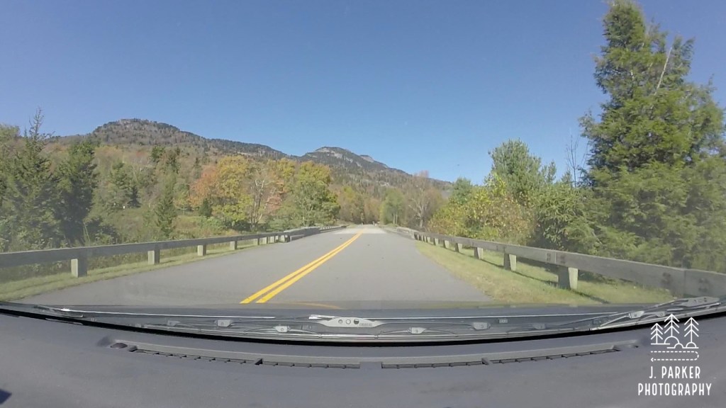
We were stuck in traffic. This may not have been uncommon if we were back in Orlando, where we have the happiest congestion on Earth, but that’s not where we were. We were miles away in rural Tennessee, waiting on the entrance road to Cades Cove in the Great Smoky Mountains, an entirely new opportunity to inhale carbon monoxide fumes and allow your middle finger to get some exercise. It seemed apocalyptic; cars stretched in either direction as far as we would see. They were releasing women and children only. The vehicle in front of us had long since resorted to cannibalism. That’s just the situation we were in.
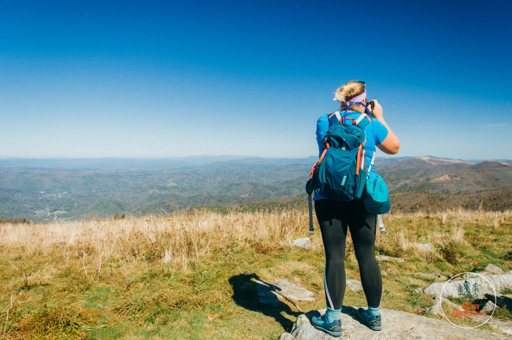
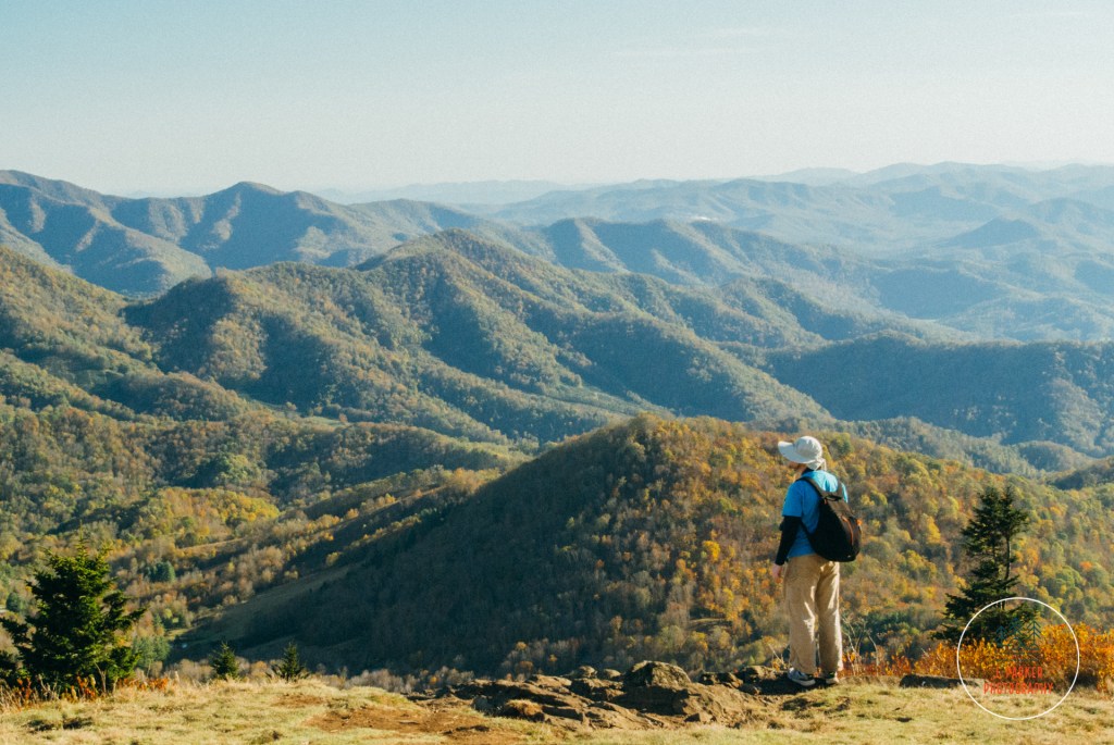
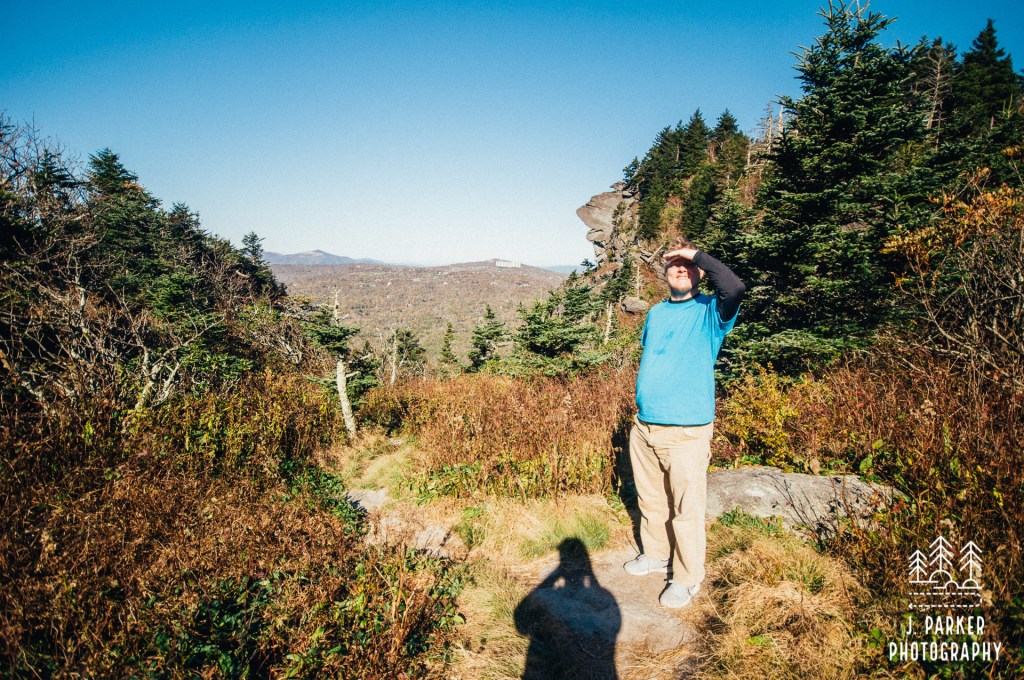
A shot of Jess’s back from Cades Cove 2019. Cades Cove offers great back picture opportunities.
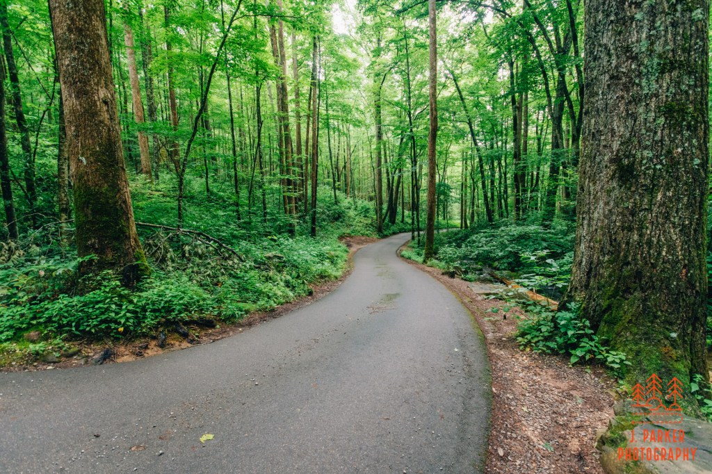
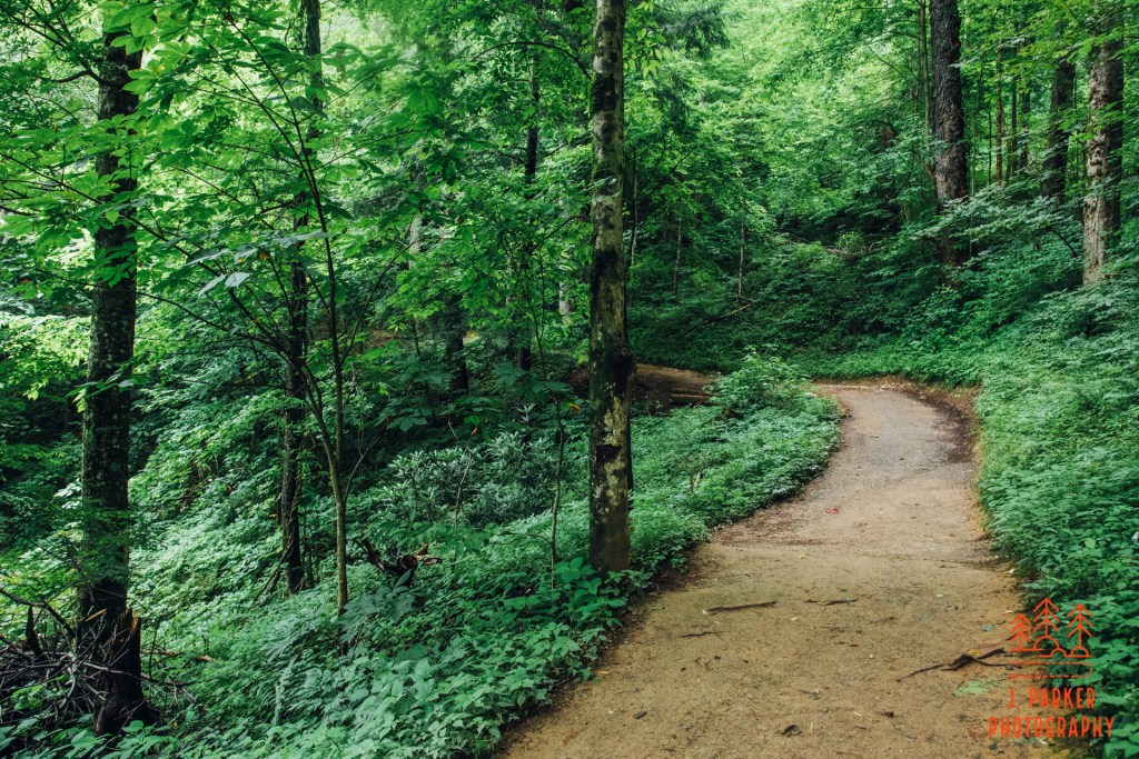
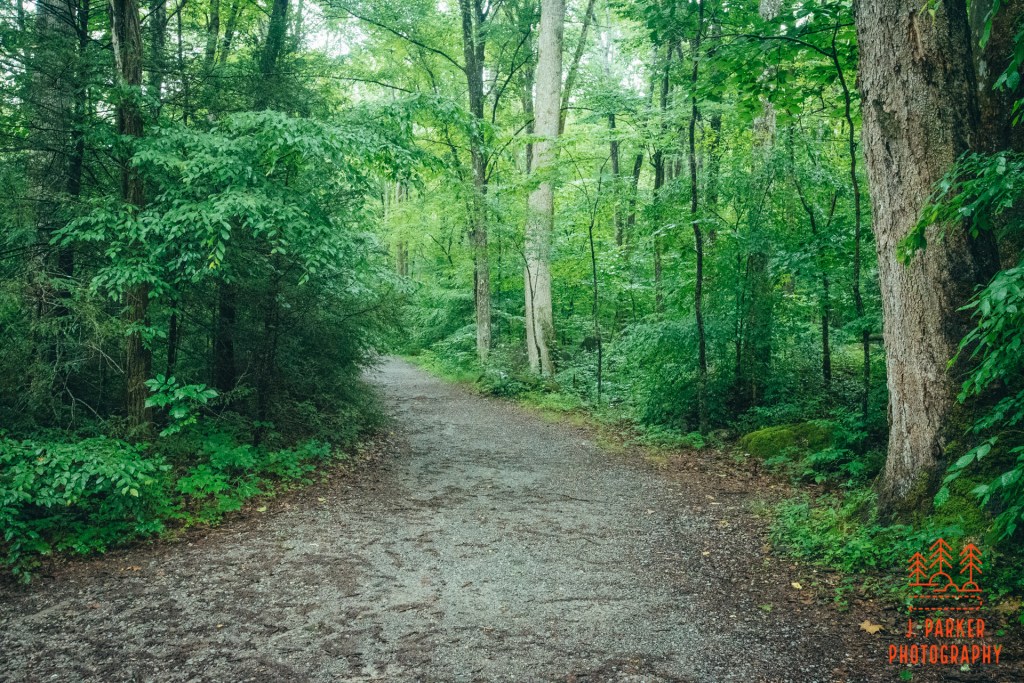
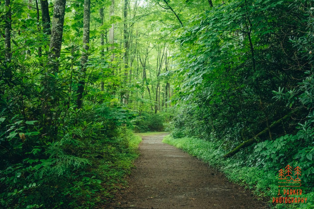
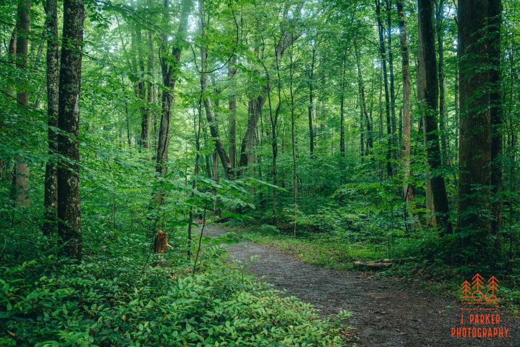
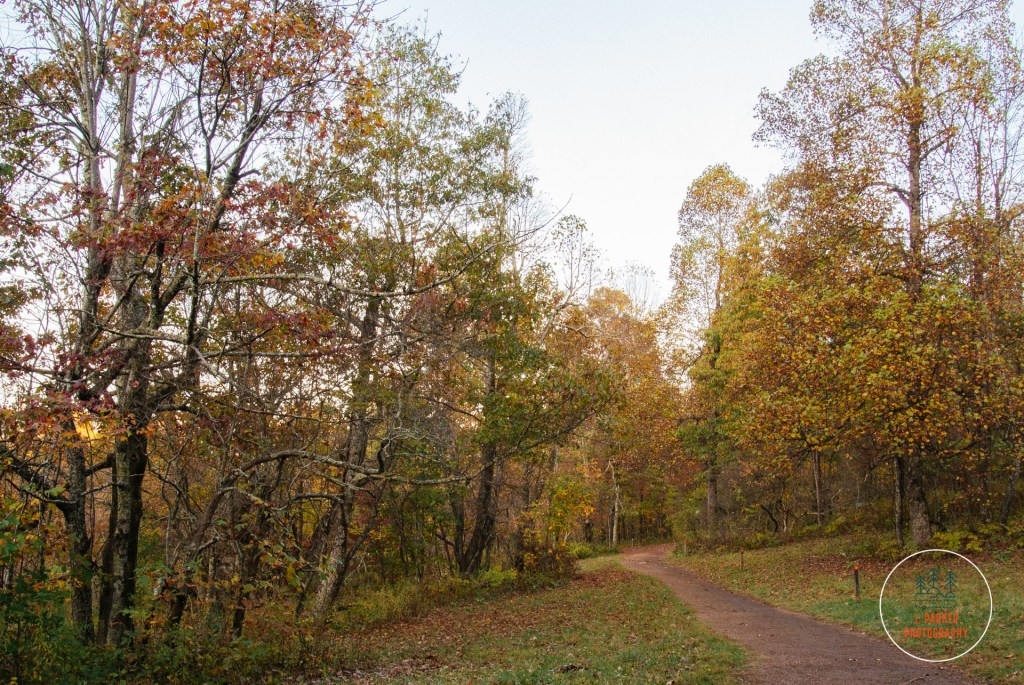
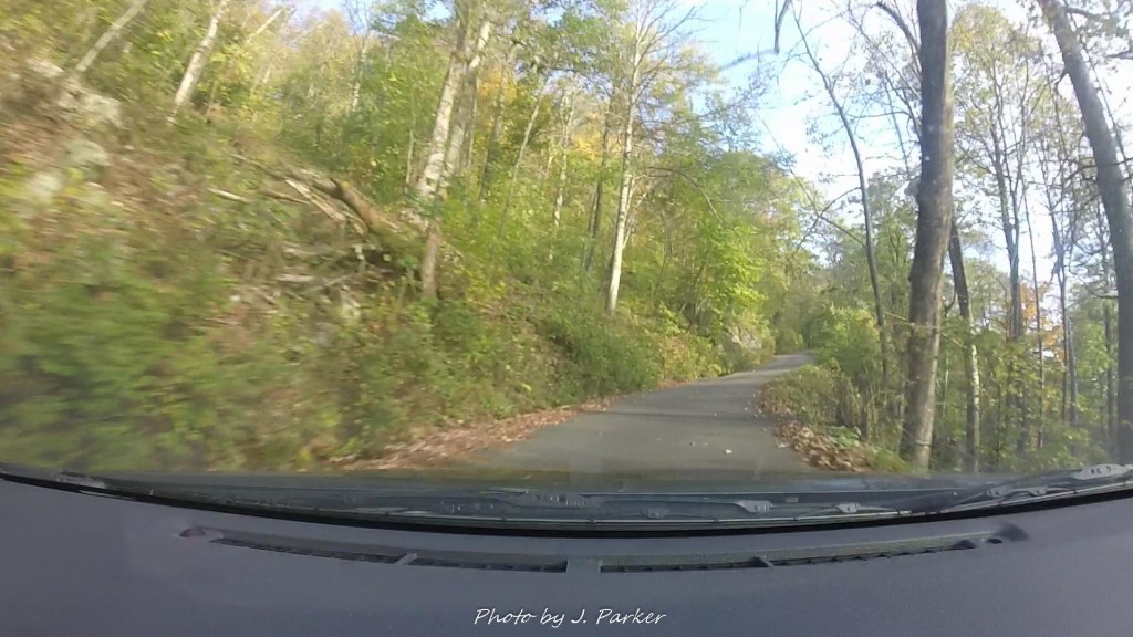
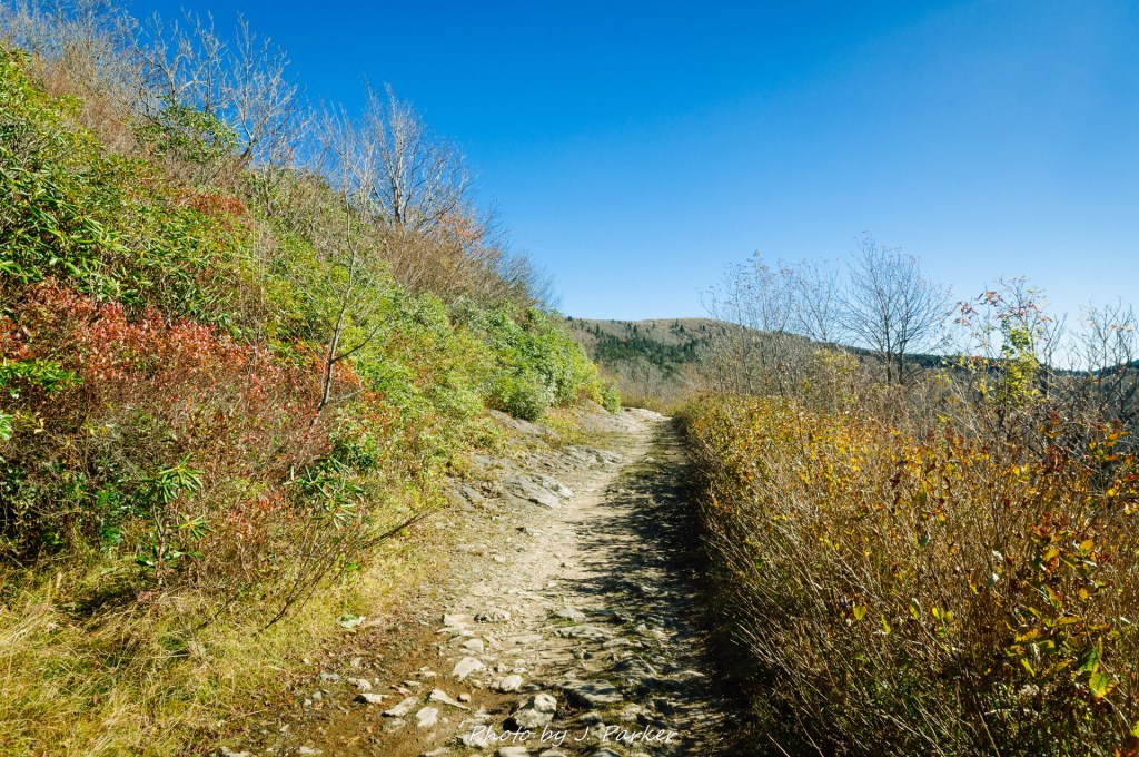
We weren’t necessarily there to see Cades Cove. At least not anymore. We had given some thought to stopping to enjoy the scenery if it looked nice, as we had previously explored the 11 mile, one-way drive on a rainy day, when it still had too much traffic for us to really feel at ease enjoying it, but those thoughts clearly dissipated once we realized that things were going to be exponentially more crowded on this summer morning. As it was we ere going to have ample time to enjoy the scenery from the car, as we would be enduring true stop and go traffic for more than 6 miles, as we worked our way towards the Abrams Falls Trailhead. As the cove wasn’t opened till around 8AM, we weren’t able to just get up early to beat the crowds. And apparently, lining up for the gate around 7:30 didn’t even grant you a good place in line. I had to wonder how early the people up front had gotten there, my guess was that they had camped out for months, just like people did the for the Phantom Menace. It took us nearly an hour of laborious travel before we were parked and ready to enjoy the hike.
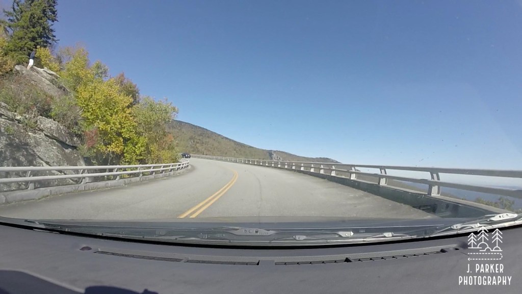
A solitary cell shot taken out the window. For the most part I was too disheartened to take pictures.
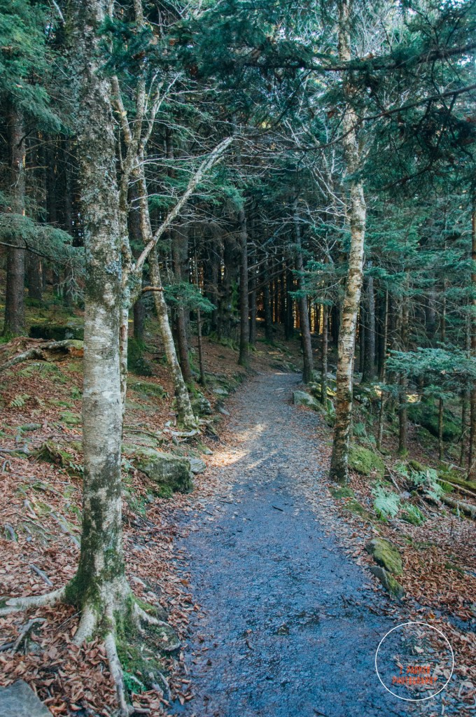
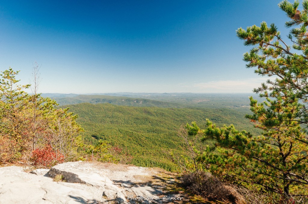
The Abrams Falls Trails is one of the most popular in the Smokies, leading with an out and back path of a bit over 5 miles that leads to a roughly 20 foot tall waterfall that is the most powerful in the Smokies. It was mostly for the sake of being a completist that I wanted to get this done; it being a notable hike means a repeat visitor to the park should get it done at some point. But other than that, I wasn’t overly excited for the hike. High flow, wide but short waterfalls don’t really appeal to me that much, neither in person nor photographically. And from the pictures and video I had seen, I didn’t necessarily think the trail there really had a spectacular forest like the rest of the national park, more resembling the type of forest you would easily find in other mountain locations. That doesn’t mean it wouldn’t be pleasant, it’s just that so much of the Smokies have otherworldly forest that is just a step beyond anything you’ll see elsewhere in Appalachia. When everything you see is far and away exceptional in the national park, it feels like quite a step down to see something more standard, as if it defeats the entire purpose of visiting the national park.
The Abrams Falls Trail has a peak elevation of 1758 feet. This makes it much lower than most of the other trails in the national park, which reaches elevations of over 6,000 feet regularly. That elevation range is also common with what you’d find for trails spready all across southern Appalachia, hence why the forest comes off as more “standard”. On the plus side, the hike had a total elevation gain of 675 feet, which is a big reason why I felt comfortable giving this one a shot despite my acute hip problems.
Regardless of whether or not I felt a trail would be “standard” or if the fall wouldn’t be my preferred type, it’s impossible not to feel a little thrill as you get your hiking gear ready to set out on a trail, knowing your curiosity will soon be satisfied and you’ll still enjoy a nice walk in the woods.
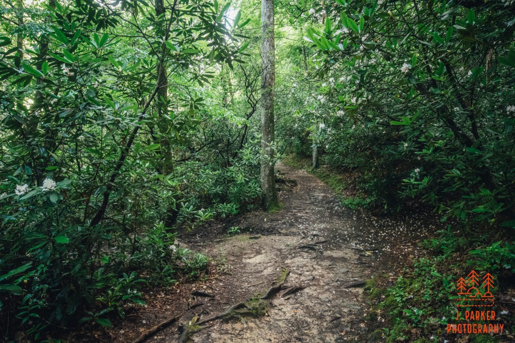
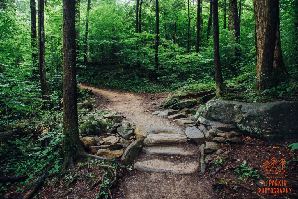
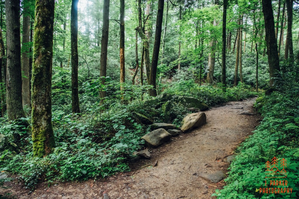
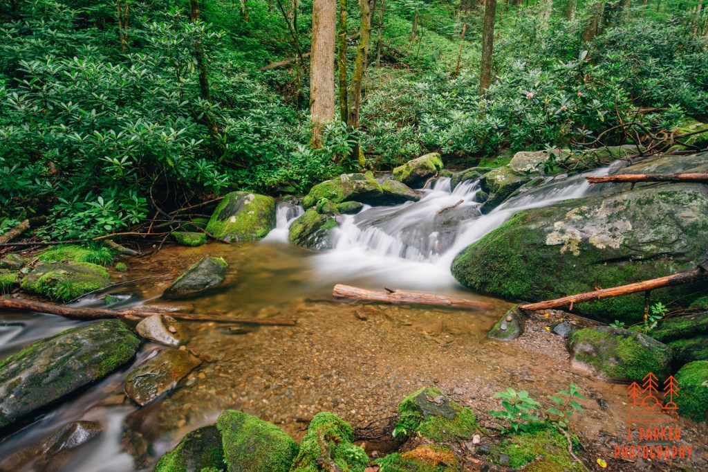
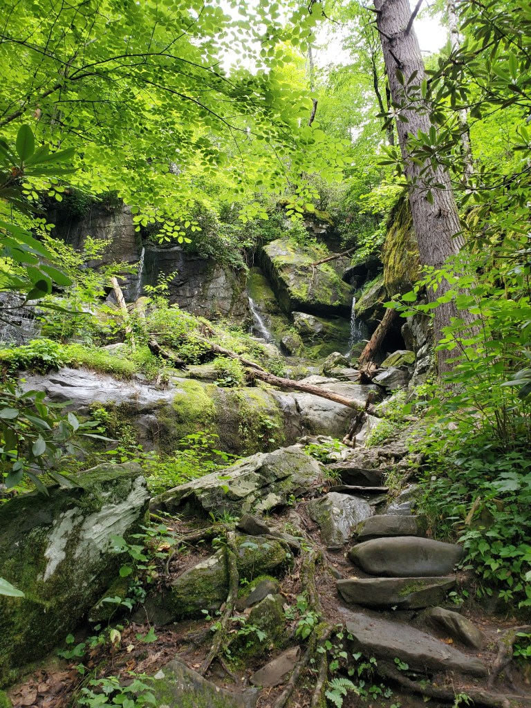
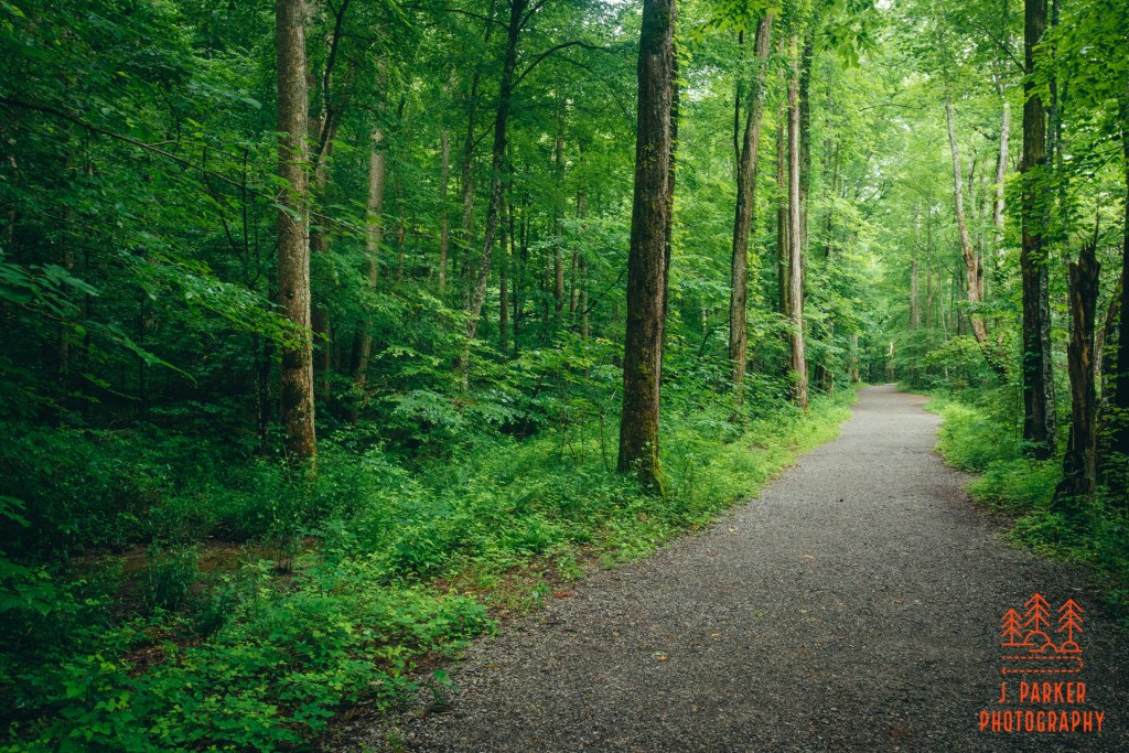
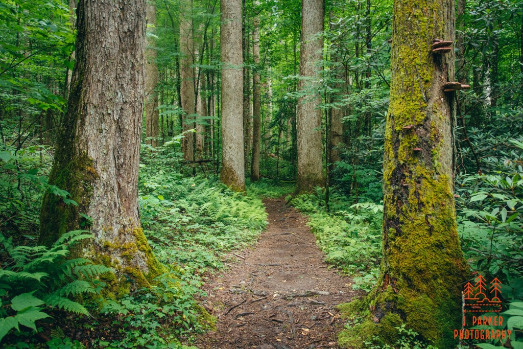
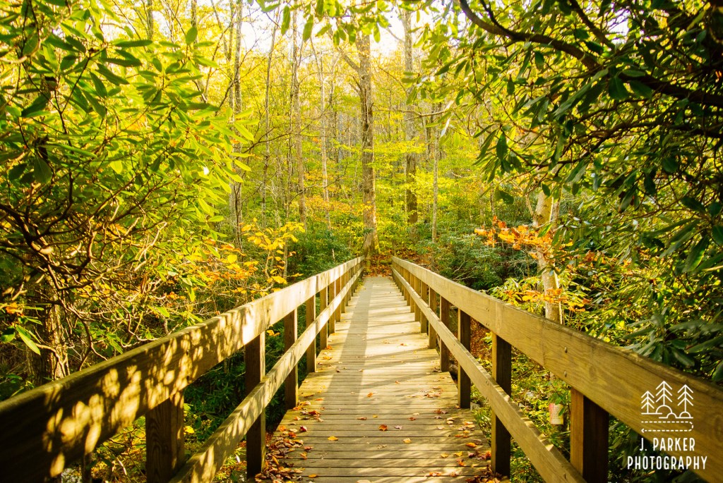
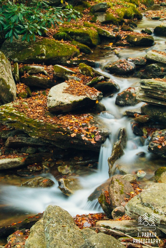
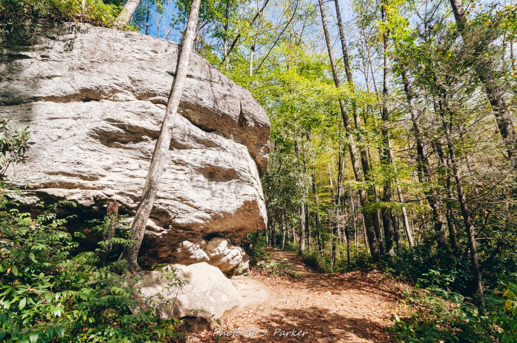
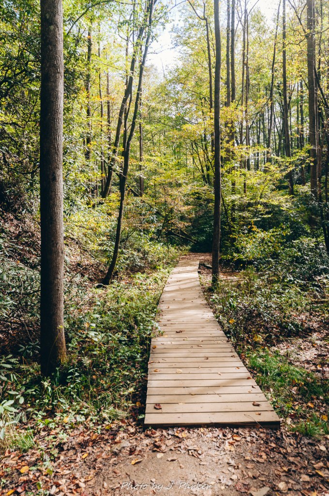
Crossing Abrams Creek
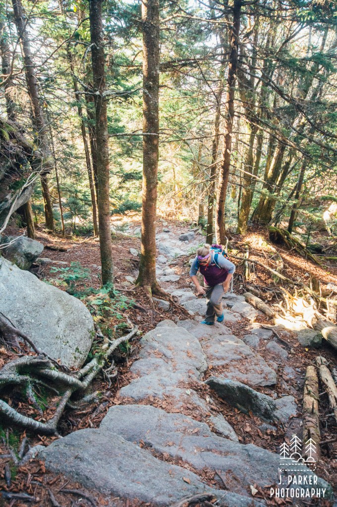
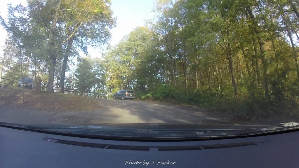
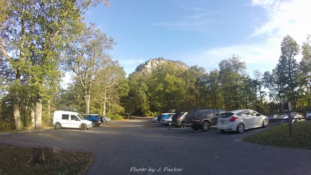
We pulled into the gravel parking area, which was quite large. There wouldn’t be the same issue that we had faced at Grotto Falls two days earlier, where the paltry number of spaces offered led people to make parking spaces where nature, and the park, had clearly not intended. There were many spaces still open as we finally pulled in just a bit before 9am, but owing to the large lot there were a lot of vehicles already parked. We definitely would not be alone on this trail – not that we expected.
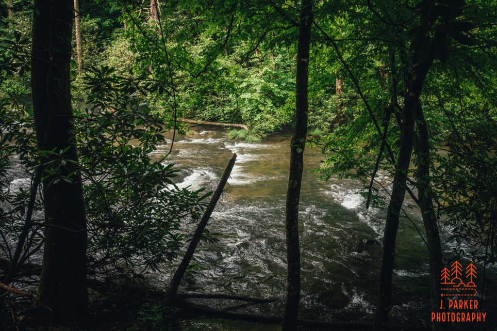
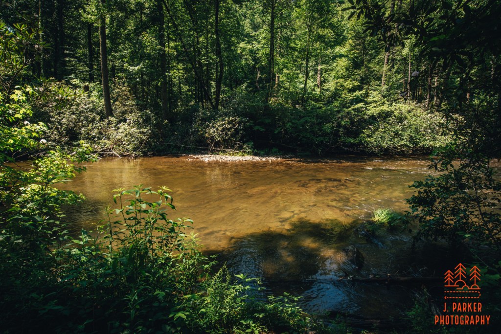
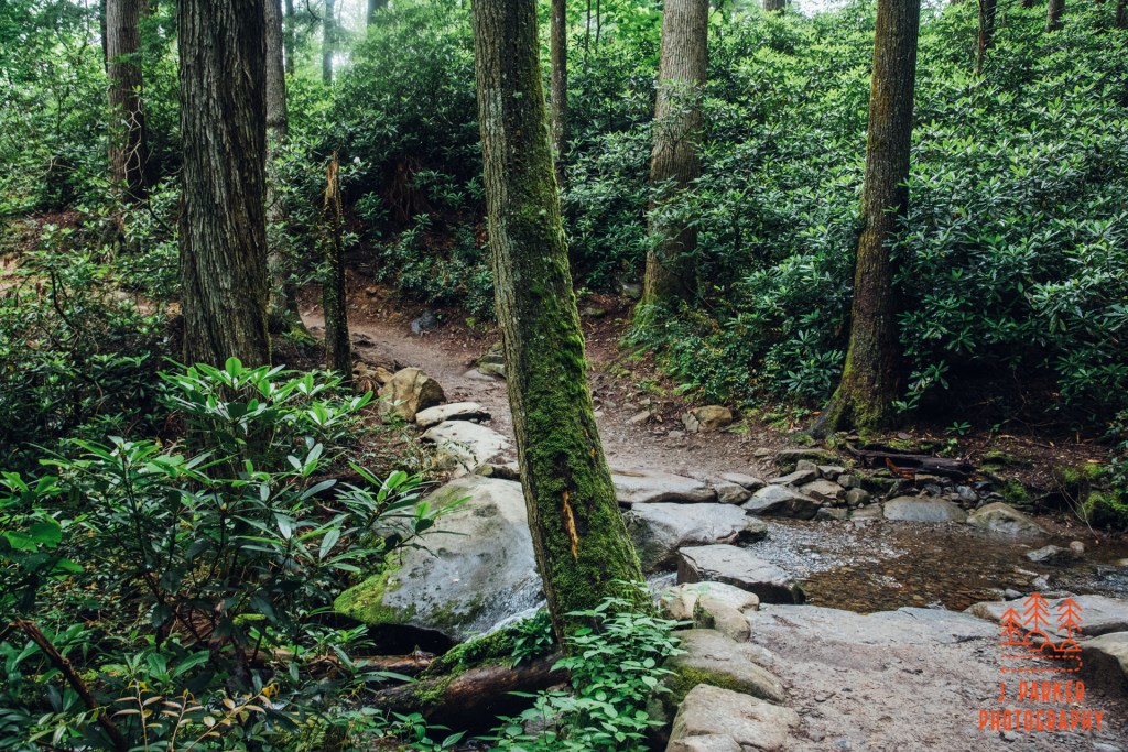
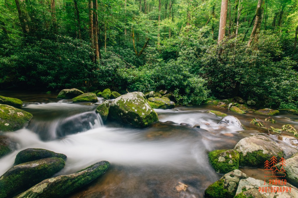
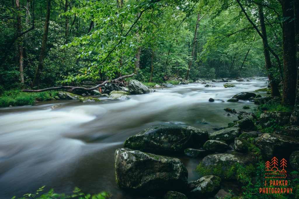
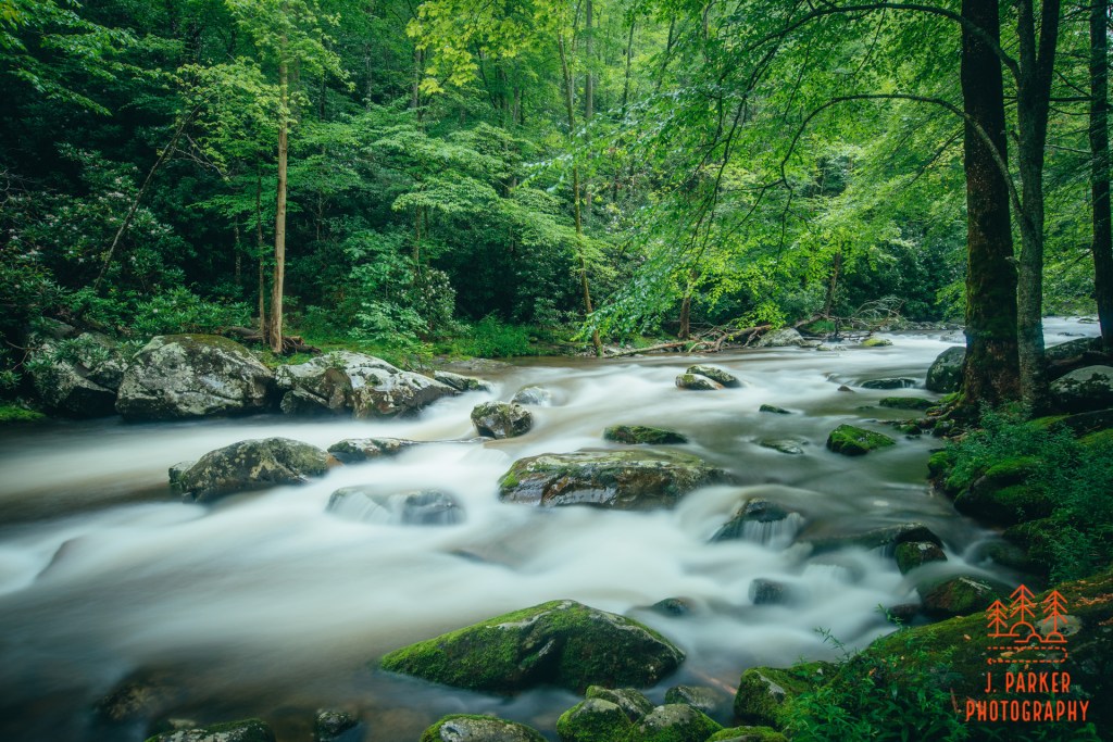
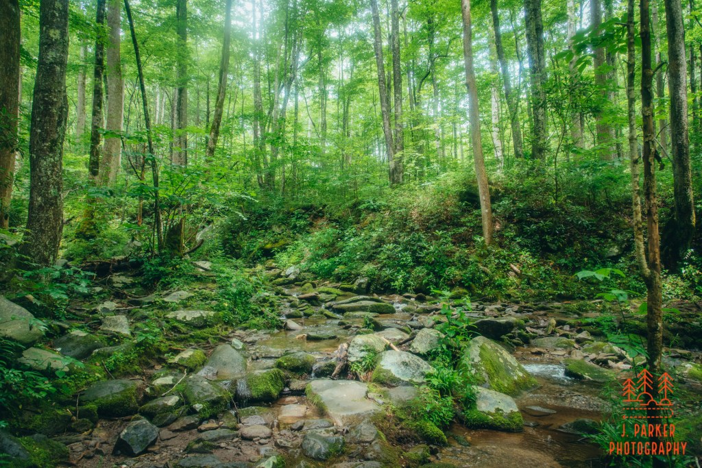
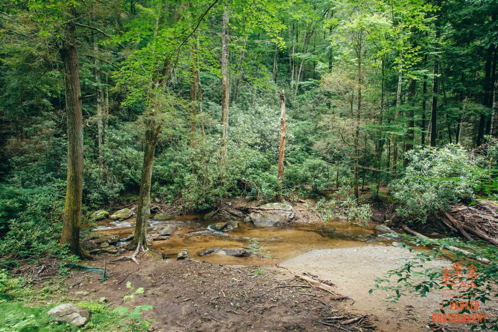
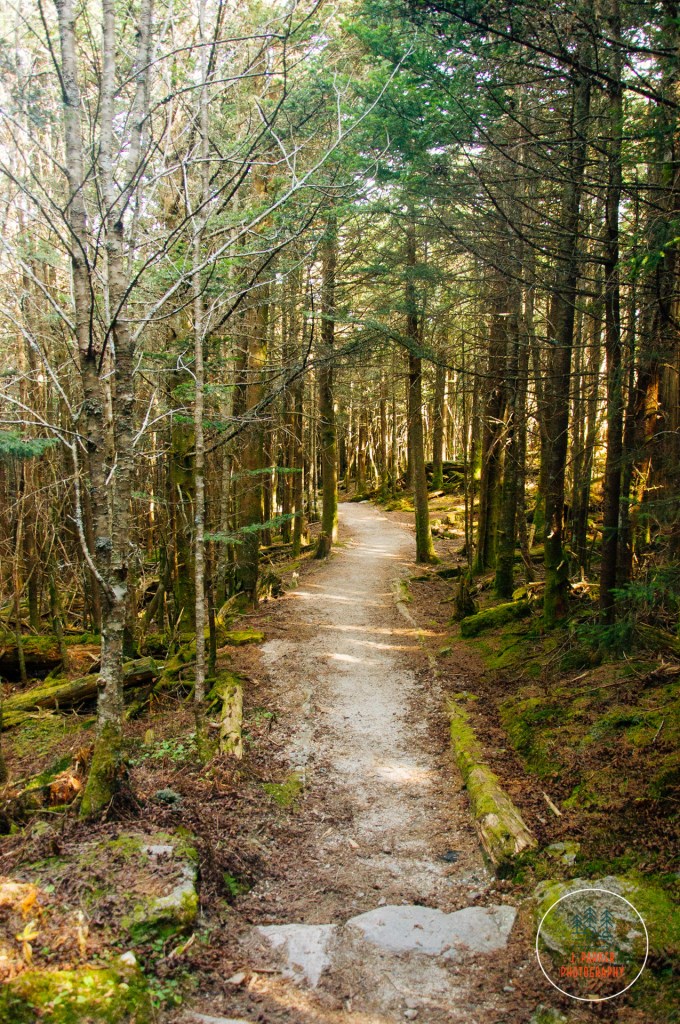
The trail almost immediately crossed wide Abrams Creek on a narrow bridge. I was surprised when we crossed the water to find it flowing in a different direction than I anticipated; not having ever traced its path on a map, I had always imagined the creek flowed into the cove in this area, to exit somewhere on the eastern side of the cove, where creeks do flow out to join up with Middle Prong near Townsend, one of which (Laurel Creek) lends its name to the road heading to the cove – that same road in which we spent over 1/2 an hour stuck in traffic this morning. In fact, Abrams Creek actually drains pretty much all the cove to the west, where it carries the water to join up with the Little Tennessee River very close to the southern terminus of the Foothills Parkway. The narrow bridge actually caused us some issue on the return trip, for it was far too narrow to provide space for social distancing when people were going both directions, and a constant stream of people were beginning the trail as we were leaving. Thus we had to wait a few minutes before an opening was granted for us to cross.
For now, on the outbound trip, I spent a moment looking out at the creek in both directions. While it locked a bit foggy and mysterious upstream, complete with a dark bottom, it quickly adopted a predominantly sandy bottom downstream. I’m sure people who wanted to could enjoy a nice wade or shallow swim in parts of the creek, though we didn’t see a standout “swimming hole” (and the fall itself shouldn’t be used as a swimming hole – more on that later).
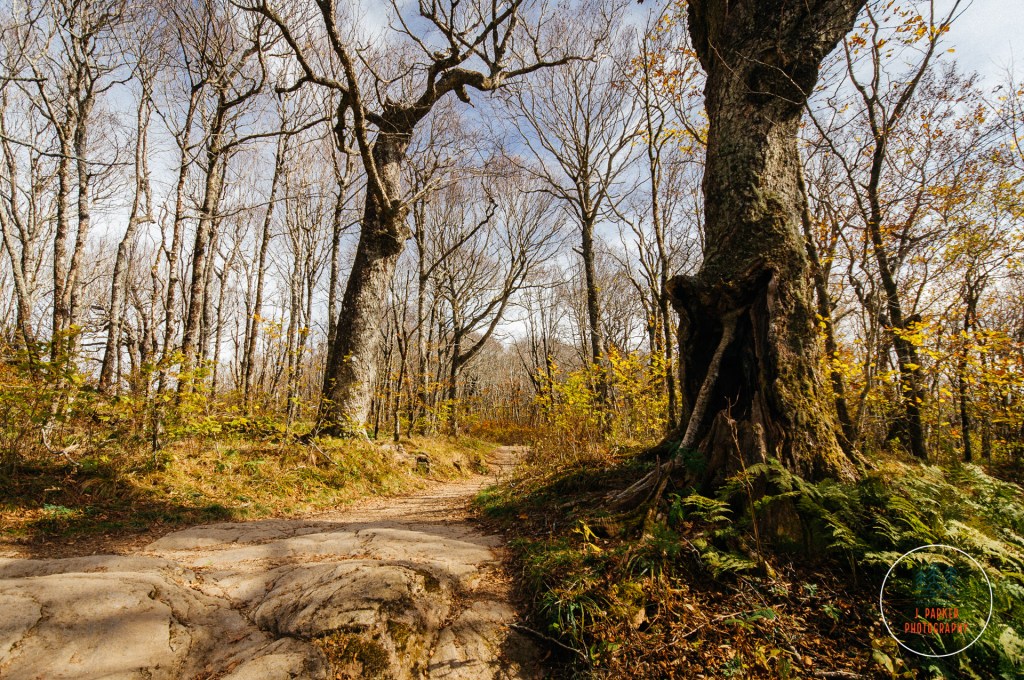
Understory of the Abrams Falls Trail.
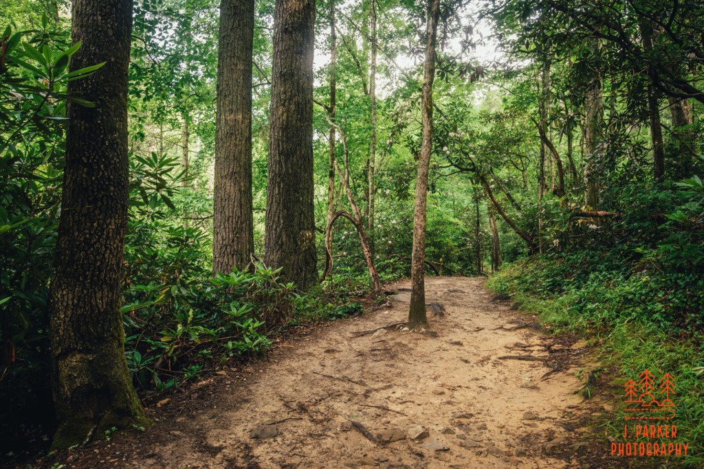
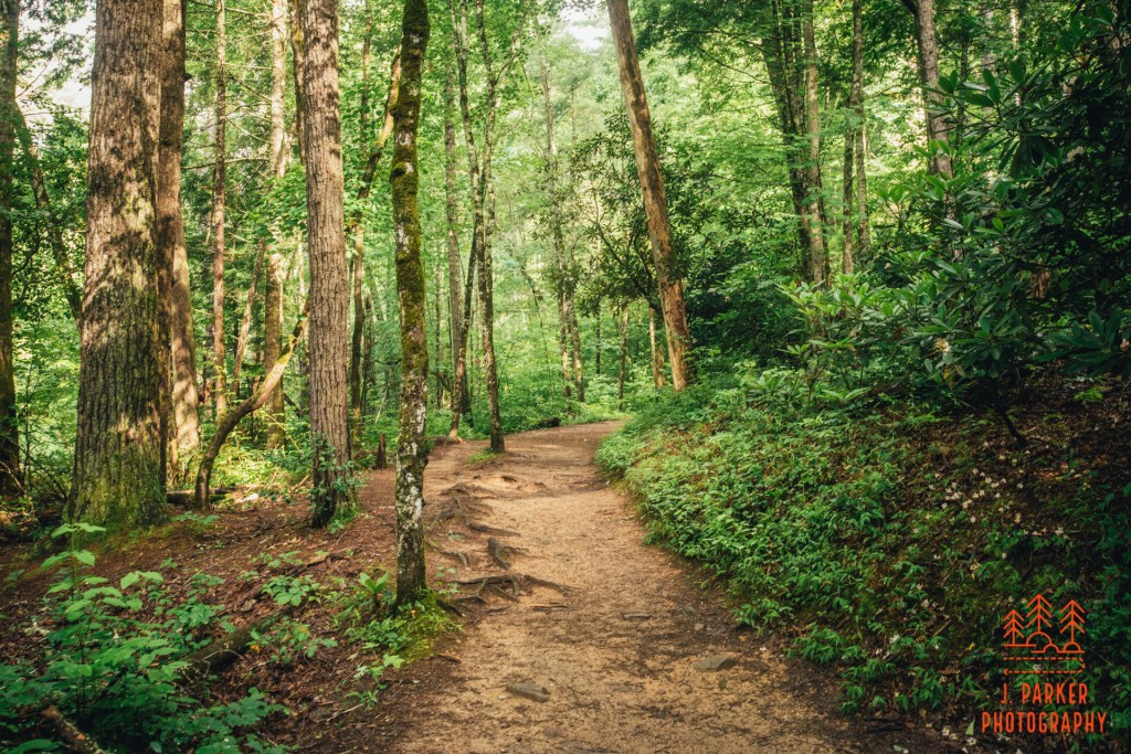
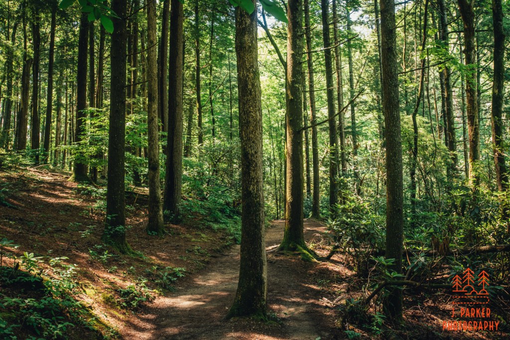
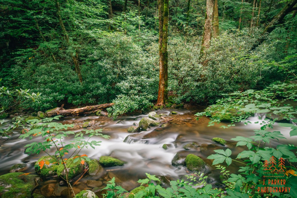
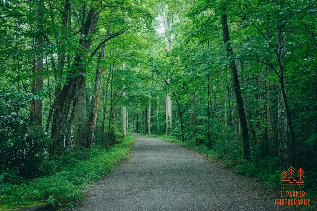
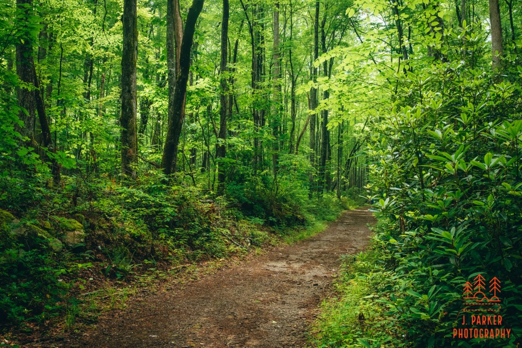
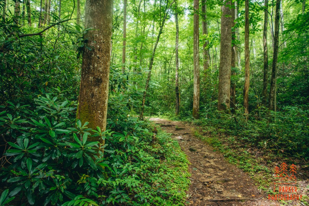
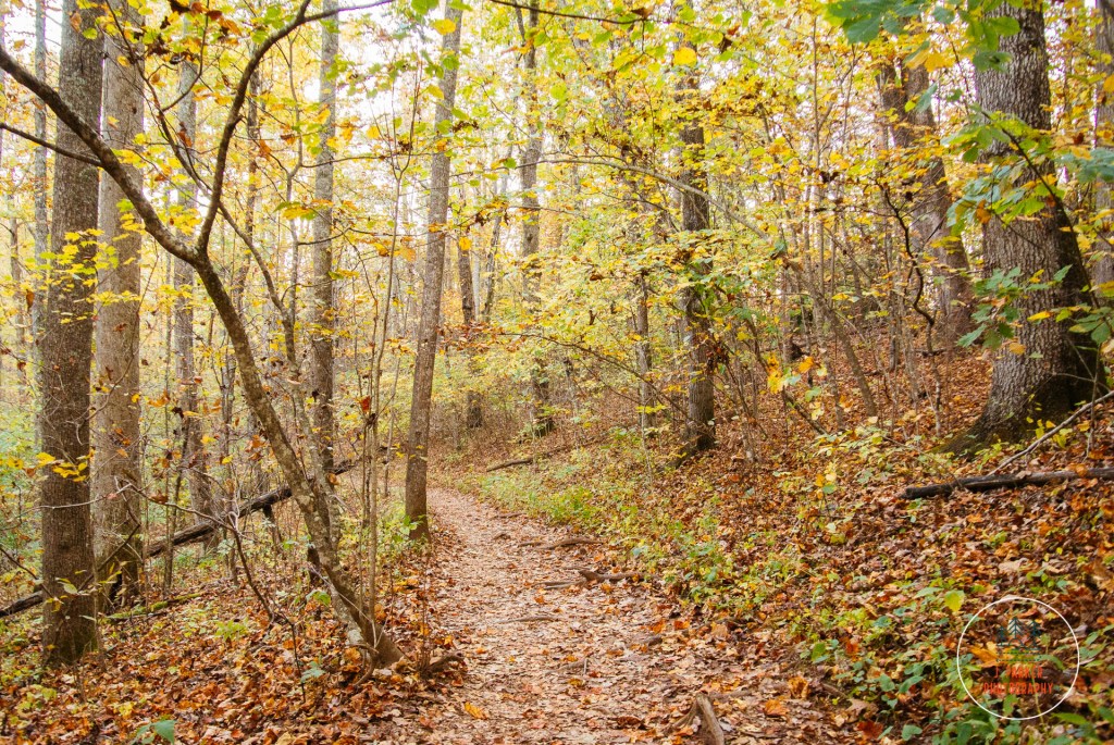
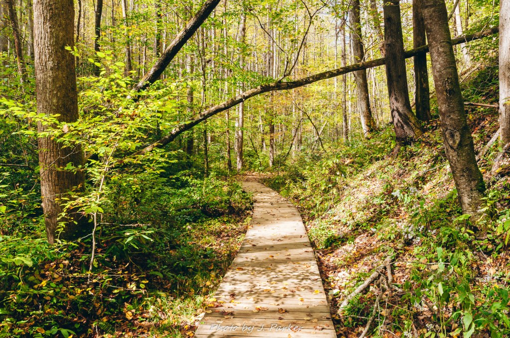
Starting down the trail in earnest, the creek was to our left, which would be a regular occurrence throughout the hike. Our feet made soft steps on the soft, almost clay-like soil. Our surroundings, a bit nicer than I expected, reminded me a bit more of upstate South Carolina than it did the rest of the Smokies. At the start of the trail especially the sides of the trail were dotted with the large trunks of hardwood trees whose tops stretched far above the trail, and did a good job of minimizing the sun rays piercing through to the forest floor.
Hardwood lining the trail, looking back towards the parking area.
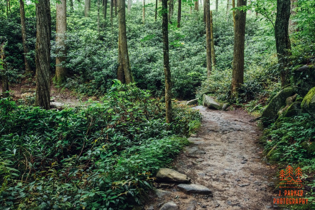
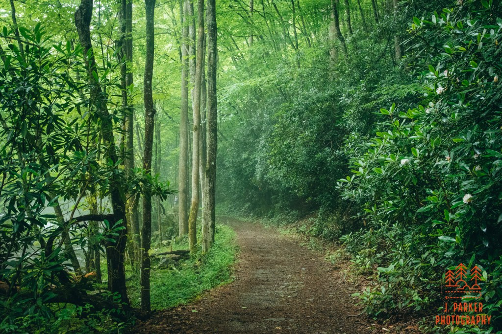
In places the vegetation encroached upon the trail as it dipped into the lush foliage growing from the moisture-rich soil along the creek. This formed a tight cocoon which sometimes was just above your head as you maneuvered down the pathway. With the niceness of the woods, and the interesting tunnel-like sections, the early parts of the trail here were my favorite.
A cocoon section of the trail.
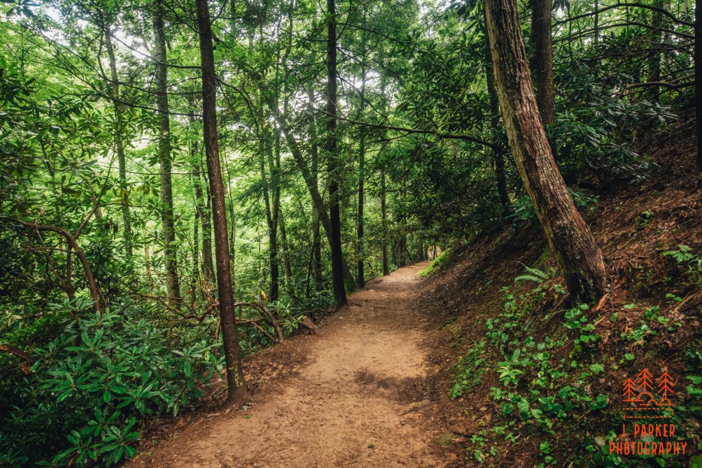
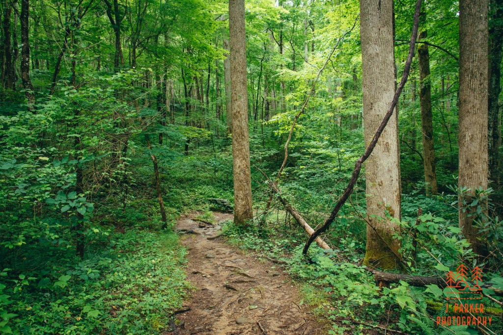
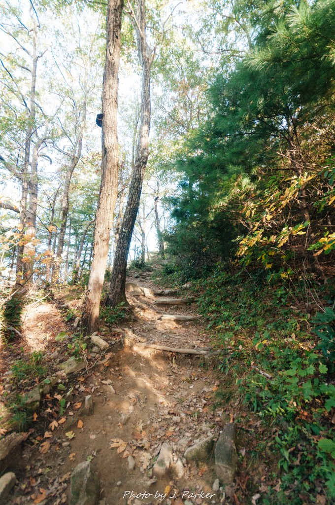
The trail only had a couple notable climbs. One early section of trail featured a short climb. This section was less notable for the climb than it was for another nice bit of woods along the trail.
A gentle climb.
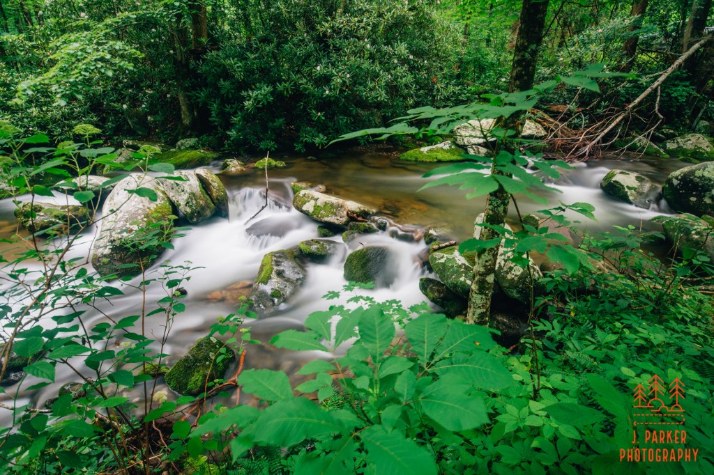
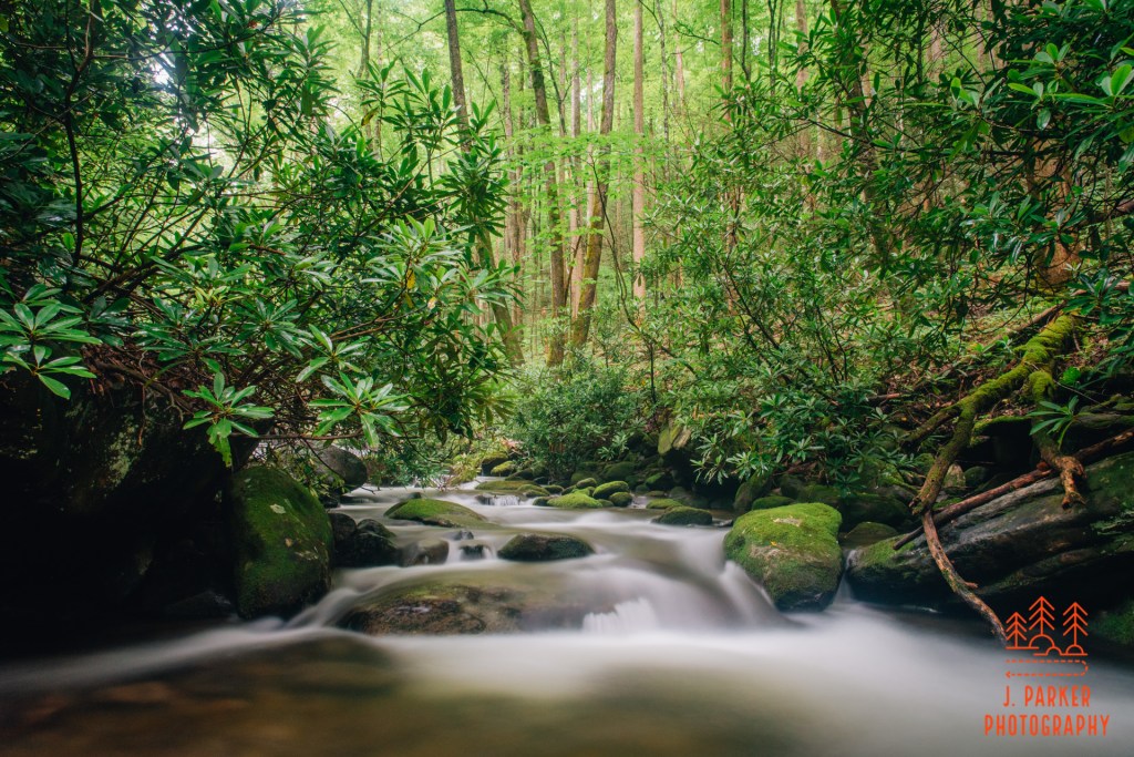
We soon came across the first of several crossings of small tributaries via trademark narrow, open-sided Smokey Mountain bridges. I took in the beauty for a second, but the popularity of the trail in this covid summer meant that there was a pretty steady stream of people behind us, so I didn’t even get a picture of the creek or the footbridge before we moved forward, not wanting to obstruct traffic on the narrow footbridge. The crowds would also be a problem shortly ahead. We encountered frequent gaps in the trees with rocks alongside the creek, but nearly all of these were occupied by trail goers usually taking advantage of the good opportunity for a commemorative photo. I would have liked to enjoy these rocks myself, but they weren’t worth waiting in line for either, so we continued ahead, hoping that by passing these people there’d be that many less people at the falls where we got there. The creek itself looked pleasant, though with just occasional rapids it lacked the drama and intensity of other waterways in the park.
A view through light brush towards Abrams Creek.
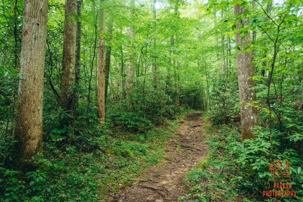
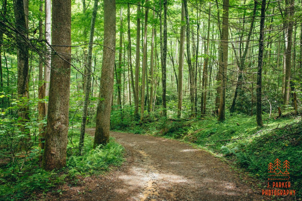
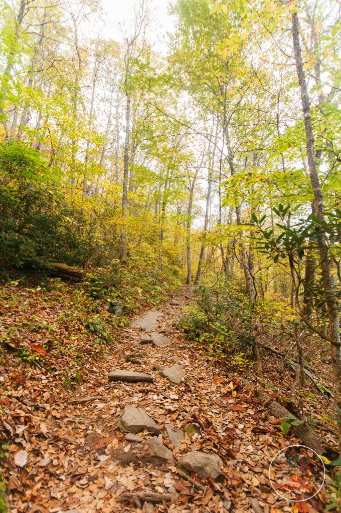
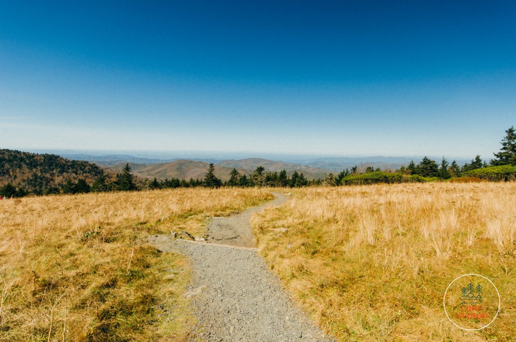
For quite a while here the path towards the falls maintain a consistent character. Always pleasant, never dull, and never offering much difficulty in footing or elevation. Just a pleasant walk in the woods, which were thick enough as well to at least dilute the effect of the crowd that was dissipated along the trail. The soil always maintained a very brown, clay-like quality. I wondered what consistency it would be in the event of a rainstorm, though that was much less of a worry than whether or not the soon would pierce the canopy with intensity.
Another pleasant stretch of trail.
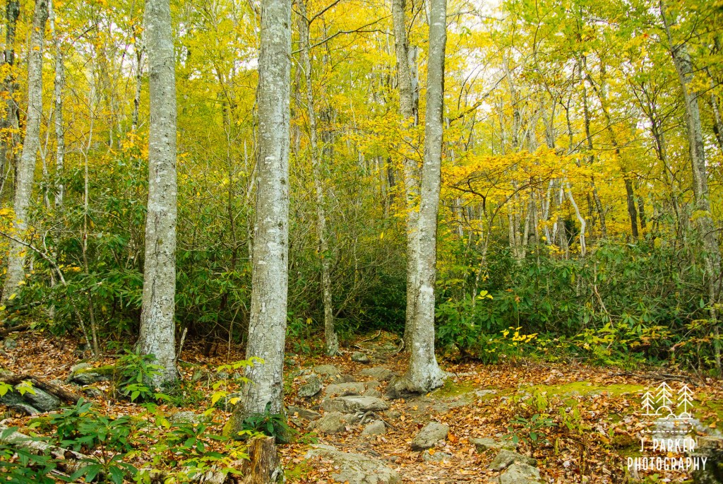
Gradually the vegetation and canopy began to thin out. Once it began thinning, it never again adopted the thick canopy of the early sections of trail. I wasn’t sure if I was confusing it with a different trail, but I thought I remembered that part of this trail had been struck by a tornado at some point a few years prior, something that’s actually not uncommon along mountain trails. It certainly looked as if that would have been possible. Whereas normally the sun creates what (to me) ss quite an unpleasant effect on the woods, here the canopy thinned out enough that the sun bathed the entire woods in a pleasing golden hue.
The golden woods.
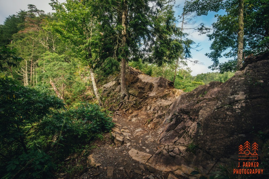
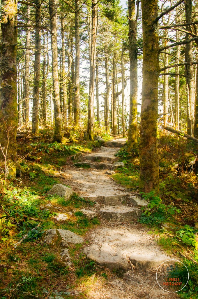
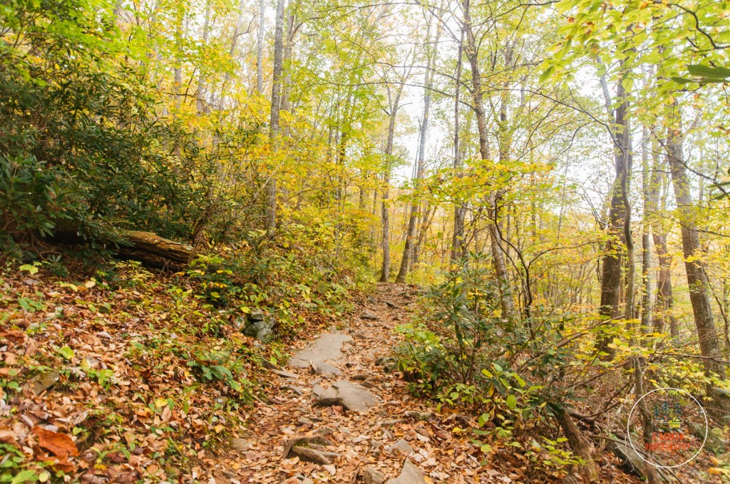
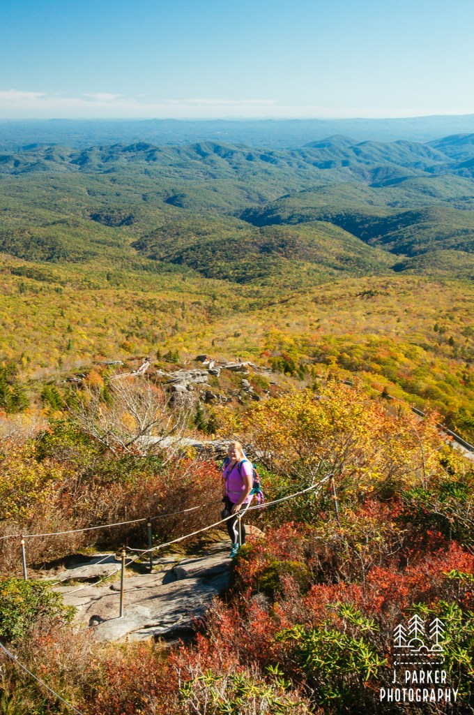
About halfway to the falls we began the most significant climb of the journey. Being an ascent of only a couple hundred feet at most, it was just enough to get one’s blood pumping without being all that strenuous. The ascent had stable footing all the way to the top, though at its apex there was an odd rocky section that one had to briefly climb up and over in the process of making a 180 where would descend on the other side. What made this stand out even more was that some of the rocks had dozens, or even hundreds of bees. As somebody who is allergic to insects, in years past this may have exceptionally unnerved me. I’ve come to realize that, as long as they don’t get too curious (which happens on occasion), bees are rather oblivious and innocuous, quite different than other, more nefarious insects. I passed through without incident, and we’d have to repeat this process on return trip.
The bee-heavy rock turnaround.
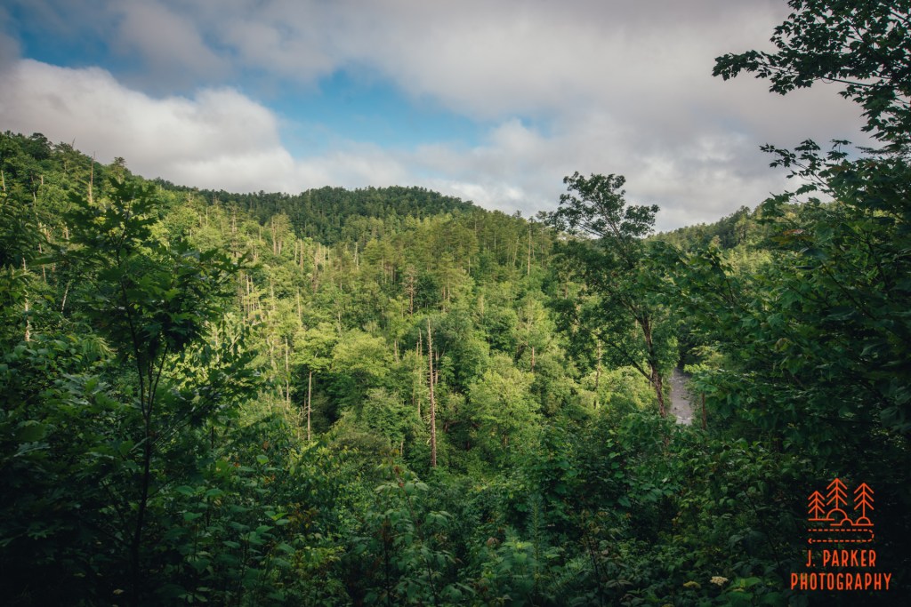
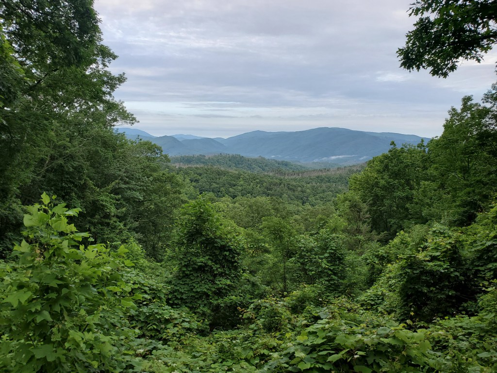
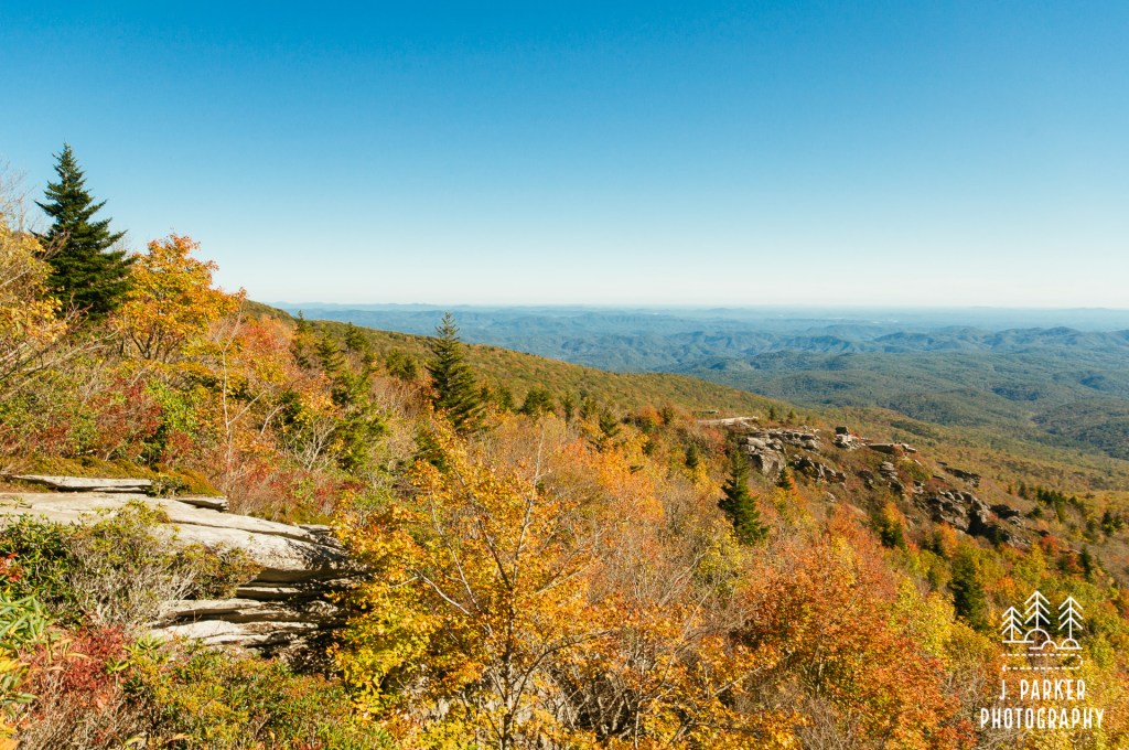
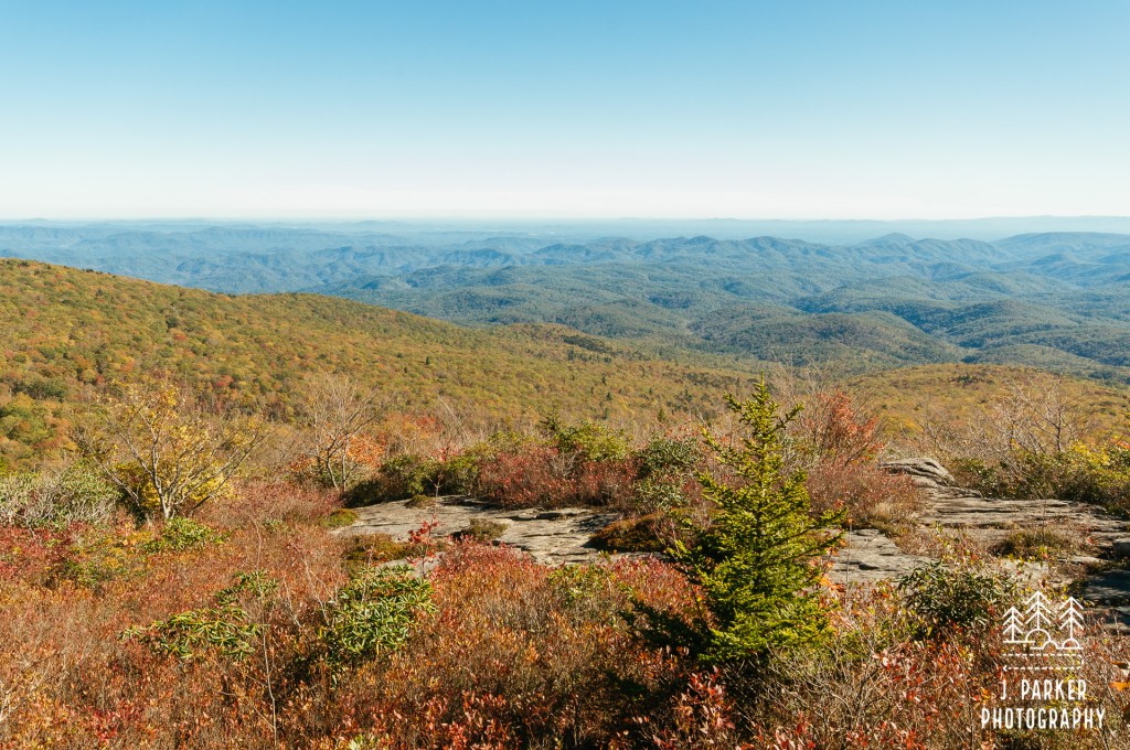
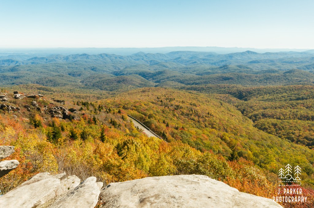
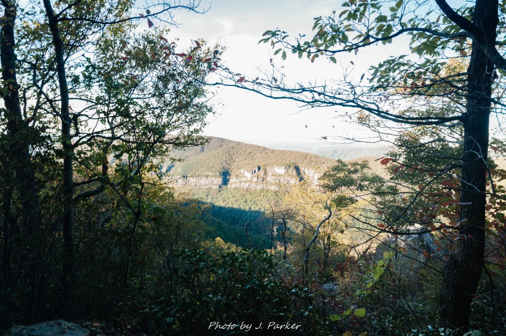
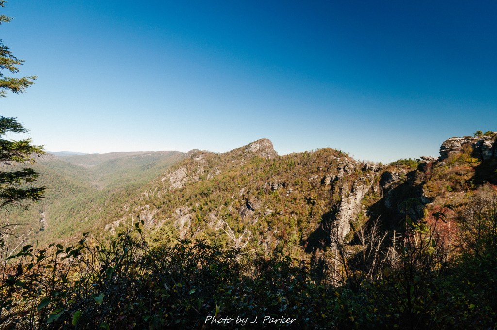
After the turnaround was one of the more interesting sections of trail, where one got a brief section of unimpeded vista from a couple hundred feet above the creek far below. Now, this wasn’t the standard panoramic view for miles. It was merely a view to the ridgeline on the opposite side of the creek, with a single peak standing out behind that. However, it was quite pleasant to see an intimate view of thick, green ridges. It made that one moment on the trail feel much more wild and exotic than otherwise possible along a quite busy trail with an immensely congested access road.
Scenic view along the high point in the trail.
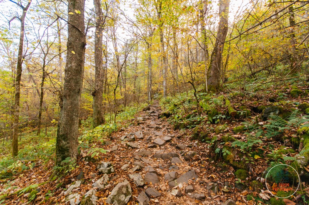
We plunged down along the opposite side of the ridge. Again, the footing was quite good, though we occasionally encountered stretches of rock poking through the floor of the trail. Our climb up and down the ridge over, the next section of trail was a bit less distinct, being just a constant, mostly level passage through the woods. Most everything we were encountering was simply a lesser version of what we had seen prior on the trail, and I certainly began to get anxious to actually reach the falls. I’ve rarely not been anxious to reach a waterfall while hiking to one, but this trail had a bit less variety than most of the non-forest road waterfall hikes I had done. It was also beginning to get warmer, which made the summer woods a bit less pleasant than they might have been.
A short ascent along the trail.
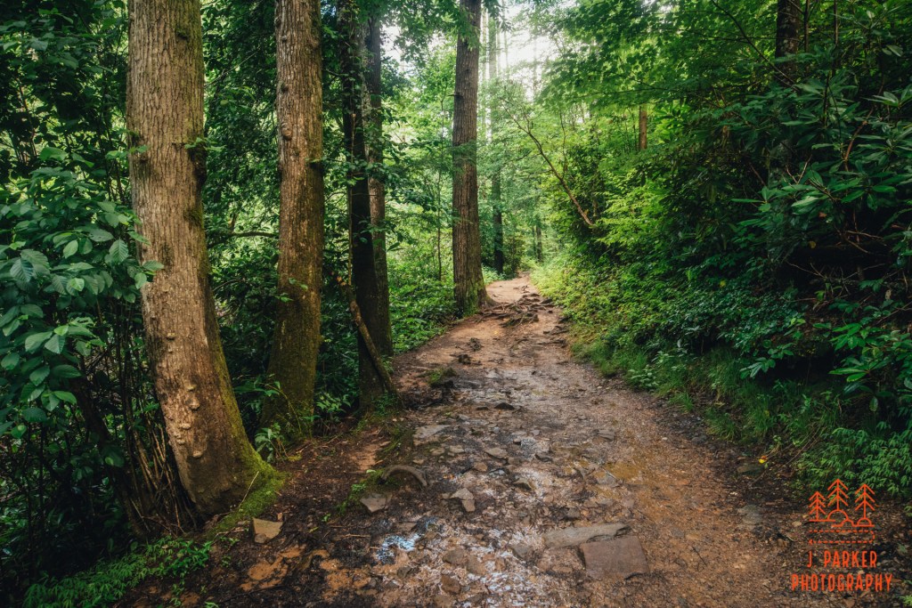
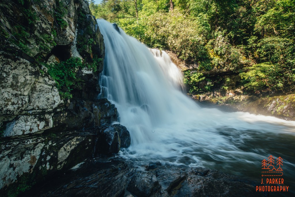
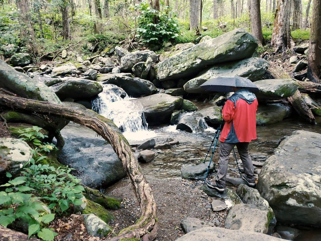
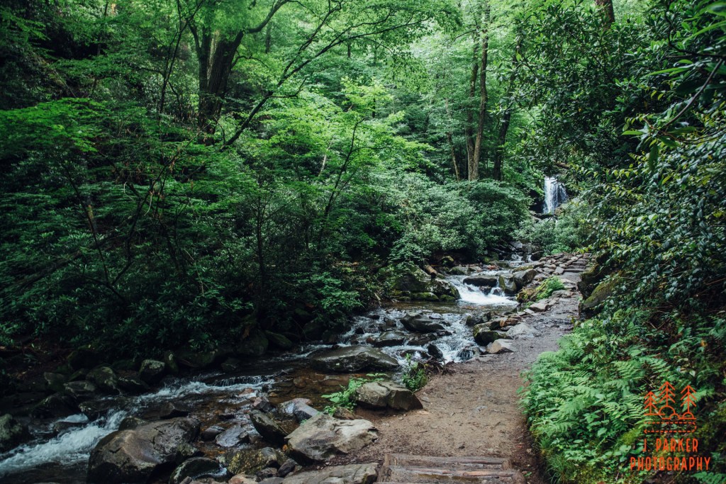
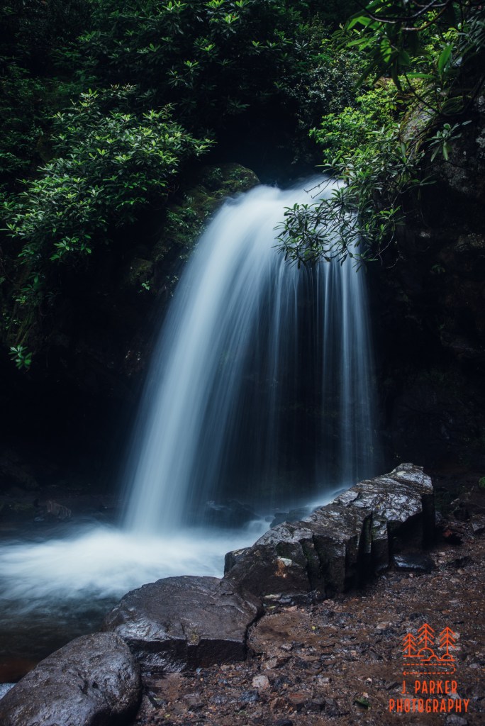
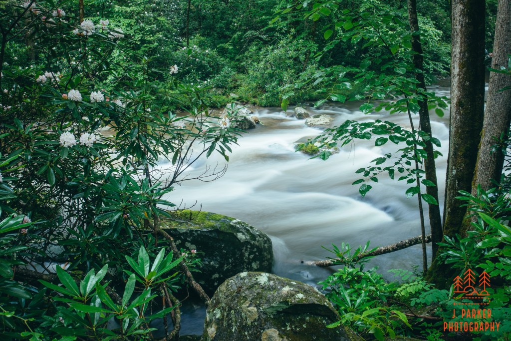
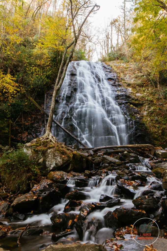
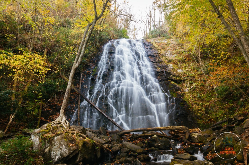
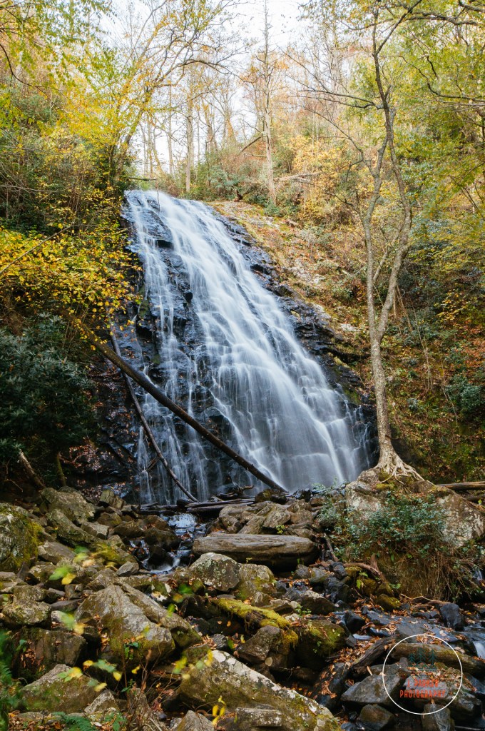
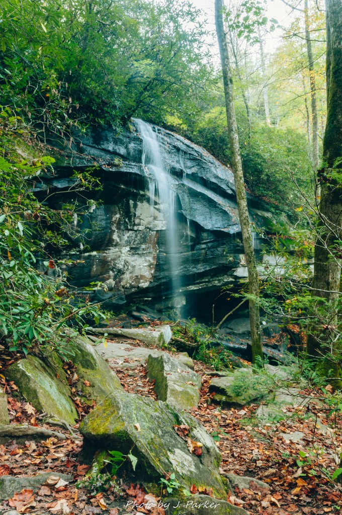
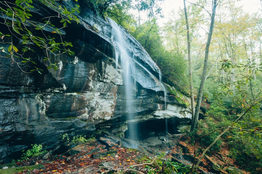
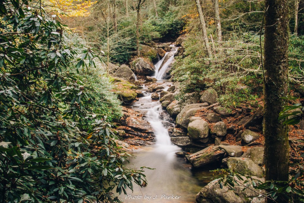
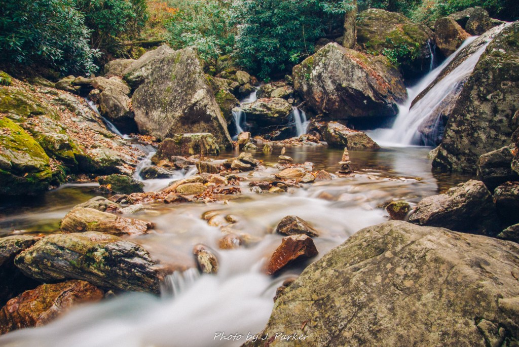
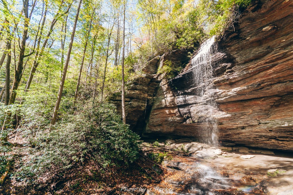
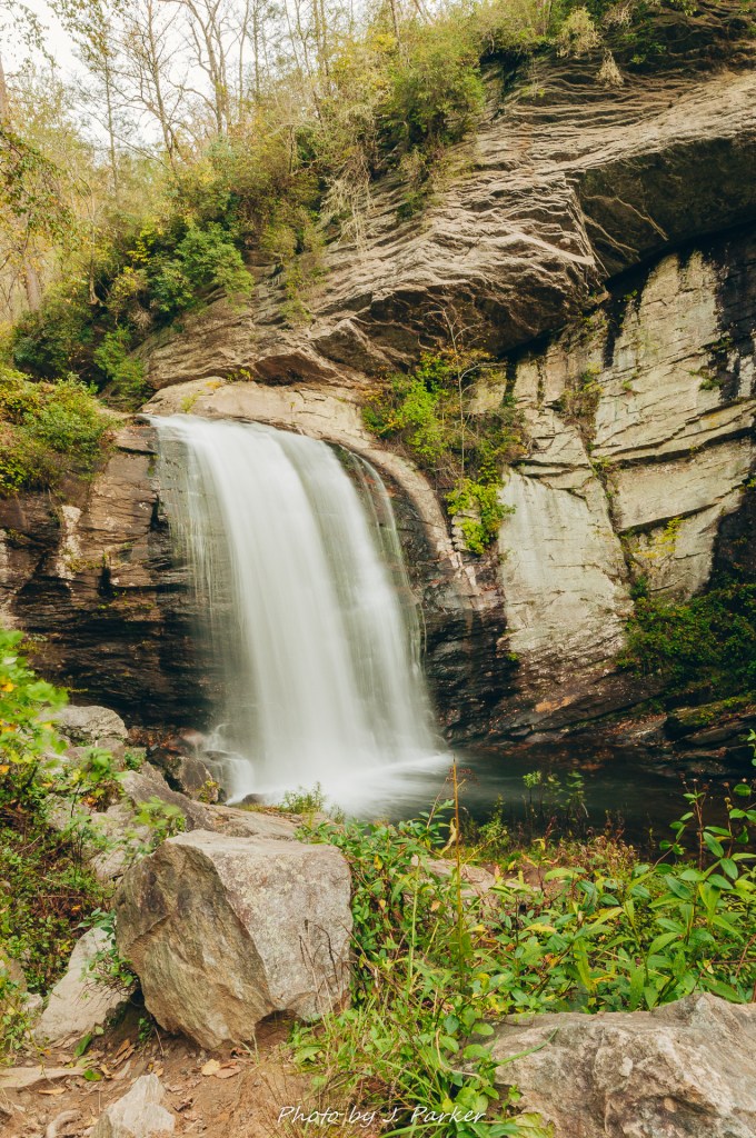
We welcomed the obvious final descent to the falls when we reached it. Unlike almost all of the trail prior, there were some portions of the trail that were a challenge here, as the smooth footpath gave way to rocky passages. This part was probably made a bit harder by neither Jess or I being that comfortable using our trekking poles for such a section as of yet, but it was still no significant challenge. At the bottom of the descent was a bridge over another tributary. The sound of moving water was loud, but that had little to do with the tributary. Instead, it was the sound of the Smokies most powerful waterfall some one hundred rocky yards further down the trail.
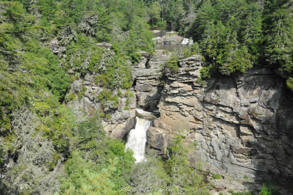
We were finally there. So, of course, were a lot of others. The falls were on the far side of the viewing area from us. The viewing area featured a rock-strewn open section in front of quite large, and also quite turbulent, pool. The falls themselves, being only a bit larger than twenty feet tall, and not much wider, were much smaller than the pool. A series of boulders curved around the side of the pool, and could be used to walk right alongside the cascade. There were currently some children along the boulders, so I figured I would find a good angle to shoot the falls until they were done. I worked my way along the rocks to what appeared to be the best view, setup my tripod among a few other photographers, and I waited. And waited. And waited.
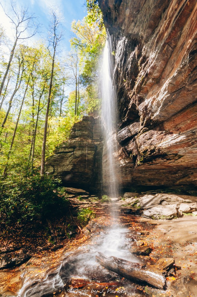
To my frustration, it seemed as if the children weren’t going to be leaving the area of the fall anytime soon. Losing the photograph, I wasn’t really that concerned, for the sun was so bright that any photo I was going to take would scarcely be portfolio quality anyway. But in the position they were in, I couldn’t even take a video clip of the waterfall that I’d be able to post on youtube. The children were using the boulders to jump into the pool in pretty close proximity to the waterfall itself. I could understand the sentiment to get in the water, for the day had gotten warm enough that I was feeling the itch to enjoy mountain water myself, but what they were trying to do, swimming so close to the raging waterfall, and not in the rest of the very large pool, was immensely dangerous.
You’ve probably noticed that nothing in the trail I’ve described so far has sounded as if its the least bit dangerous as far as trails go. Nevertheless, the Abrams Falls Trail is actually among the top 10 most dangerous trails in the entire country. This has everything to do with the waterfall itself, where many, many drownings occur. Apparently most people don’t realize the forces that can occur around the base of a waterfall and many drownings occur here. No doubt, the traffic this trail enjoys from inexperienced hikers exacerbates the problem here.
Abrams Falls
I decided to take matters into my own hands. Rather than waiting for the children to leave the waterfall area entirely, I waited until they gave me an avenue to squeeze behind them and setup my tripod between them and the fall. I had to be very, very careful here, even more careful than I normally am on the edge of the water, because the boulders weren’t exactly dry and the raging current below meant that if I or my camera fell, we weren’t likely to be found in working order again. In this spot I was practically right on top of the waterfall, and I could only go so wide with my lens, but there wasn’t much opportunity for a creative frame to begin with. I did the best to take a long exposure as well as a few quick video clips, and then I vacated the area, happy for myself and my camera to both be intact. The children had left before me; apparently the rock was no longer cool now that I was out there as well. As I got back to the other photographers, I told them they could thank me for driving the children away. At least briefly on this busy day the rocks around the fall were devoid of people, but I scarcely felt the need to take a different angle of a rather featureless fall in the scorching sunlight.
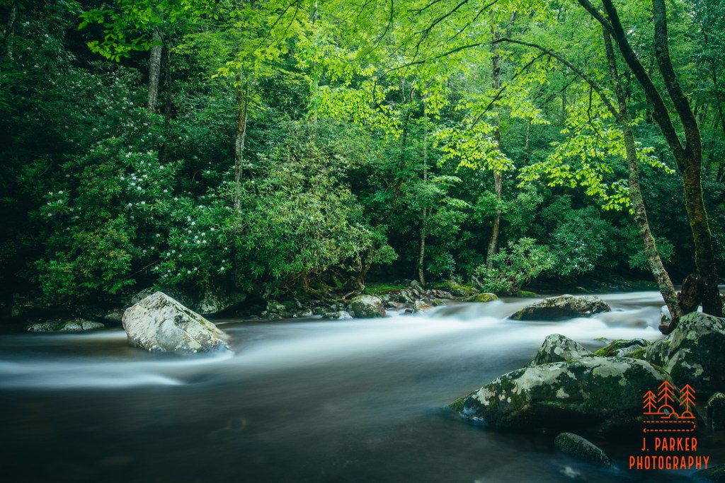
Other than crossing the bridge next to the parking lot we had a rather uneventful return trip. The only think that changed on the way back was the creek, which grew to be very inviting as its sandy bottom shimmered in the direct sunlight. I would have liked to enjoy the water here, but at the same time, never seriously considered doing so, for with as many people as there were along the trail, and with little opportunity to disappear in the woods off trail, we wouldn’t have had an easy time trying to change into swimsuits. Besides, there are other easy and quiet swimming holes to be found in the Smokies, and we did in fact enjoy several of them later on this day.
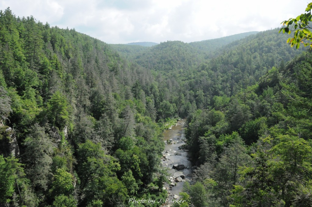
Abrams Creeks
In some ways the hike to Abrams Falls exceeded my expectation. The woods, especially towards the beginning of the trail, could be quite lovely. I’m sure any nature lover could find something to enjoy along its canopied corridors. However, in other ways, the trail was exactly as I expected, in that it was nice enough but I just wasn’t blown away by it. Some waterfalls look one way in pictures but end up far more exciting in person, but Abrams Falls wasn’t in this category. Of course, any fan of the spectacular national park should eventually get to this one – it isn’t a bad hike, and the fall is one of the park’s more well-known features, even if I personally wasn’t overwhelmed by it. For my money, though, it’s probably not even in my top 10 hikes just in the national park, and I’ve still just scratched the surface of it myself. It’s also worth noting that there isn’t a way to get to Abrams Falls except via Cades Cove, an immensely frustrating proposition that offers absolutely no opportunity to get in and get out quickly, making a trip there more of an investment in time than other hikes in the area.
This was the last hike we did in the Smokies on this 2020 trip. We were looking forward to spending the next two days on a triumphant return to an area of the mountains we held very dear. Unfortunately, things wouldn’t work out quite like we planned.
It never stopped raining. Not entirely. Sometimes it was only a drizzle. Other times it was heavier, though it never became a full-on deluge. Not this day. But it was bad enough that we certainly weren’t going very far from our car, lest we get caught in a serious storm and end up in a dangerous situation. After all, on this summer afternoon in 2015, we scarcely even done a real mountain hike yet. What we were doing at the time could be better described as surveying. Peaking. If we weren’t going to be able to actually hike deep into a trail, I at least wanted to get a feel for what a few of them offered, as well as get far enough from the car to at least get a few nature photographs to salvage a day that had presented a real struggle in that aspect. First was the Rainbow Falls Trail, where we went just far enough in to see the raging creek and the impressive forest that was absolutely shimmering with all the moisture. Then came Trillium Gap, which was where we were at now. At no point came a baby in a baby carriage.
Rain-soaked leaves along the Rainbow Falls Trail in 2015.
I had heard a lot of great things about the Trillium Gap Trail, not the least of which was one of the Smokies most popular waterfalls, Grotto Falls, well known for having the trail pass behind its cascade. About 1.3 miles from the trailhead, we weren’t going to make it there – not on this rainy day. But we did make it far enough to know that this was a fairly interesting trail. Though it was scarcely more than a mile away from the aforementioned Rainbow Falls Trail, this place couldn’t have been more different. Despite the way it glistened in the rain, there was still something dark and foreboding around the Rainbow Falls Trail. Trillium Gap, on the other hand, had a welcoming warmth, despite the stormy weather. Over small creeks we crossed on a very clay-like pathway lined by beautiful greenery that almost seemed as if it was some ornate garden. We only went so far down, but it was something I knew I wanted to see more of. We spent the rest of that rainy afternoon completing the Roaring Fork Motor Nature Trail, a scenic drive featuring immense amounts of creek interaction that could be well enjoyed even in the rain, though I would have preferred to explore it more in better weather.
The beyond lovely Roaring Fork Motor Nature Trail.
That time wouldn’t come during our week in the Smokies in 2019. For one, the trail was being renovated, and had limited hours when it was open. Also, it rained significantly almost every day of our trip, meaning some places we would have liked to see, like Grotto Falls, were left undone. We did repeated the Roaring Fork Motor Nature Trail on one of those rainy days, but in this instance it rained even harder than our first visit. I began to wonder if we would ever get to really experience the scenic drive, which seem to offer great photographic opportunities if only I could ever get an honest crack at it.
This was out 2019 Smokies trip in a nutshell.
When vacation time in 2020 rolled around, we had to plan around the fact that my hip was going to be in very bad shape, and I wasn’t going to be able to freely hike where I wanted. Things like the Roaring Fork and Grotto Falls meant the Smokies made great sense for us. There was a ton that could be enjoyed and photographed along the Roaring Fork without even having to walk to it, and I might, just might be able to get my bad hip through the 2.6 mile total round trip to Grotto Falls. This being 2020, we knew things were going to be busy, but we’ve always been able to largely avoid the crowds simply by embarking first thing in the morning, which I’ve usually done when visiting a waterfall anyway, as that’s the best way to guarantee good light. So after a rainy evening we got up around dawn to take the journey from our cabin in Wears Valley to Gatlinburg and the beginning of the Roaring Fork Motor Nature Trail.
I wish we could have started the Roaring Fork a little earlier than we did, but there isn’t really a great direct route between Gatlinburg and Wears Valley, so after a circuitous journey we finally passed our way through town to begin the one lane drive that marks one of my favorite attractions in the Smokies. After passing a few places like the trailhead for the Twin Creeks Trail, the scenic drive begins climbing at a pretty steady rate as it works its way up part of Mt. Leconte’s imposing ridgeline (Mt. Leconte rises 5,301 feet from its base in Gatlinburg to its 6,593 ft. summit, making it one of the most prominent peaks in the Appalachians). With this being our third trip on the roadway, this section felt like old hat. We made a cursory stop at an overlook which peers down towards portions of Gatlinburg. The scars of the deadly fires which spread from the Chimney Tops to devastate much of the surrounding area were clearly evident, not only on opposing ridgelines, where there is a distinct line of demarcation, and also around the motor nature trail itself, where there are occasionally patches of nearly barren trees standing like matchsticks. The motor nature trail is otherwise devoid of views, but the creeks are the real highlight here. We stayed just long enough for me to take a quick cell phone clip before moving forward to the trailhead a short drive ahead, where the parking was already quickly filling with early risers like ourselves.
Beginning of the Grotto Falls Trail.
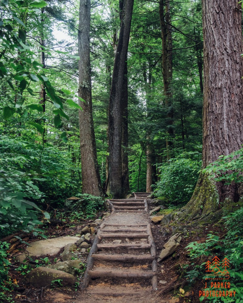
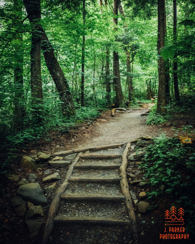
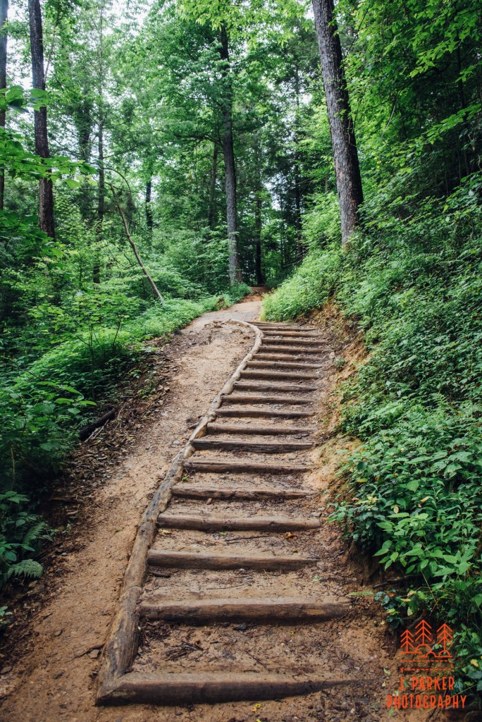
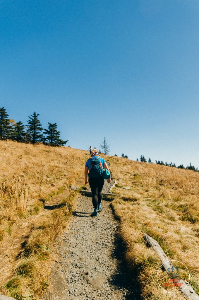
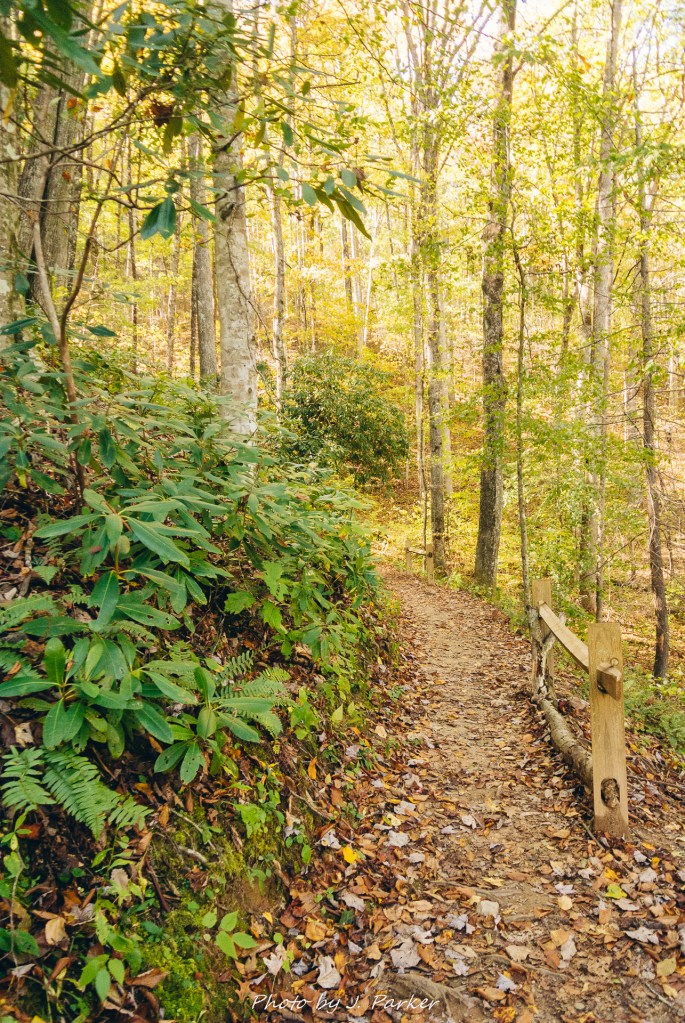
We grabbed our trekking poles, cameras, hiking packs, tax returns, and a mint copy of George Harrison’s landmark solo 1970 LP All Things Must Pass, and headed out on our short journey. We made as hasty a getaway as possible, fearing that crowds would soon overwhelm the area with Grotto Falls being one of the most well-known of the park’s attractions due to its family-friendly length and distinct walk-behind. Right away the work the the trail crews had done was apparent, for where 5 years ago there had been massive webs of tangled, uneven roots that made for tough footing, now there were well-manicured wooden steps and evened out pathways. While not as natural as prior, the new wooden stairs had a charming, rustic look all their own, and it added a bit of character to the already beautiful trail. I wasn’t about to complain about the easier footing either; we had hiked around 6 miles the day before, and my hip was definitely a little worse for the wear.
Some more of the renovated trail.
The trip to Grotto Falls lies almost entirely on the Trillium Gap Trail, one of many routes to the top of Mt. Leconte, with the Trillium Gap being known for hosting convoys of llamas which traverse the pathway to supply the remote Leconte Lodge every few days. The Trillium Gap Trail actually begins near the Rainbow Falls Trail, and then follows roughly parallel to the Motor Nature Trail for a little over a mile, where it is joined by the connector trail from the Grotto Falls parking area that we were taking. The Rainbow Falls and Trillium Gap make an excellent but lengthy loop to Mt. Leconte, but that hike is currently beyond our skill level even when I’m not hobbled.
Stairways leading up a gentle grade.
The trail immediate bestows upon you scenes of fantastic beauty. Large trees, the same ones which formerly made the pathway a root-filled spiderweb, cling closely to the sides of the trail, which maintains a fairly decent width but still more closely resembles a single-wide pathway than a forest road. The woods that line the way here have their own unique character different than most other areas of the park. With elevations going all the way from the 1,000s to the 6,000s, the amount of bio-diversity you can get within the confines of the Great Smoky Mountains National Park is beyond words. Using the word “bio-diversity” might come across as only being significant to “science nerds”, but in practical terms it means that you will come across a staggering amount of different looks without having to venture too far in the Smokies. And they are all beautiful, though some like the area around Grotto Falls seem to stand out even more than the rest.
Approaching the first creek crossing.
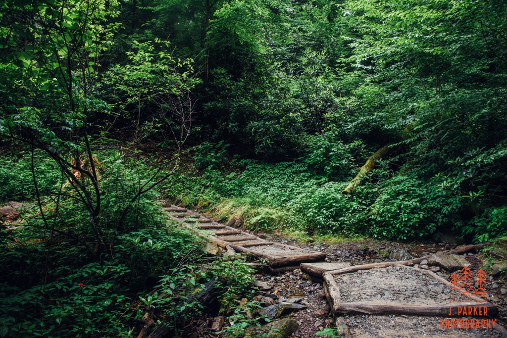
We soon reached our first creek crossing, a small size creek tumbling down a depression in the ridgeline. The creek was easily crossed by some strategically placed boulders that gave little reason to worry about having to get one’s feet wet. The spot was pretty enough, I would have enjoyed grabbing a long exposure here, but the traffic on the trail meant that would be difficult, and I passed on the opportunity.
Jess on the first creek crossing.
On its journey out to Grotto Falls, the trail seems to repeat the same similar element; it works a rough v-shape around the edge of the ridge, then works towards a creek crossing, where it again repeats another v-shape. I lost count of how many times it did this on our journey.
The trail clings to the edge of the ridge.
There aren’t any serious climbs on the way to Grotto Falls, but the trail does work itself uphill, albeit gradually. I aimed to stay ahead of whatever group was behind us, knowing I wanted to photograph the trail and this would be problematic if people stayed ahead. Both Jess and I had picked up our first set of trekking poles at REI a few weeks before the trip, but she had yet to actually assemble hers for use during a hike. Eventually the effort to keep ahead of others got a bit exhausting, especially for Jess who wasn’t using her trekking poles like I was. We finally let others pass so she could spend a moment and set hers up on the trail.
Stairs ascend one of the steeper portions of trail.
Around another bend we came across another creek. This one was much smaller than the former. In fact, the entire flow was routed through two channels on either side of a single log step. This spot looked familiar; we had turned around here in 2015.
Second creek crossing on the trail.
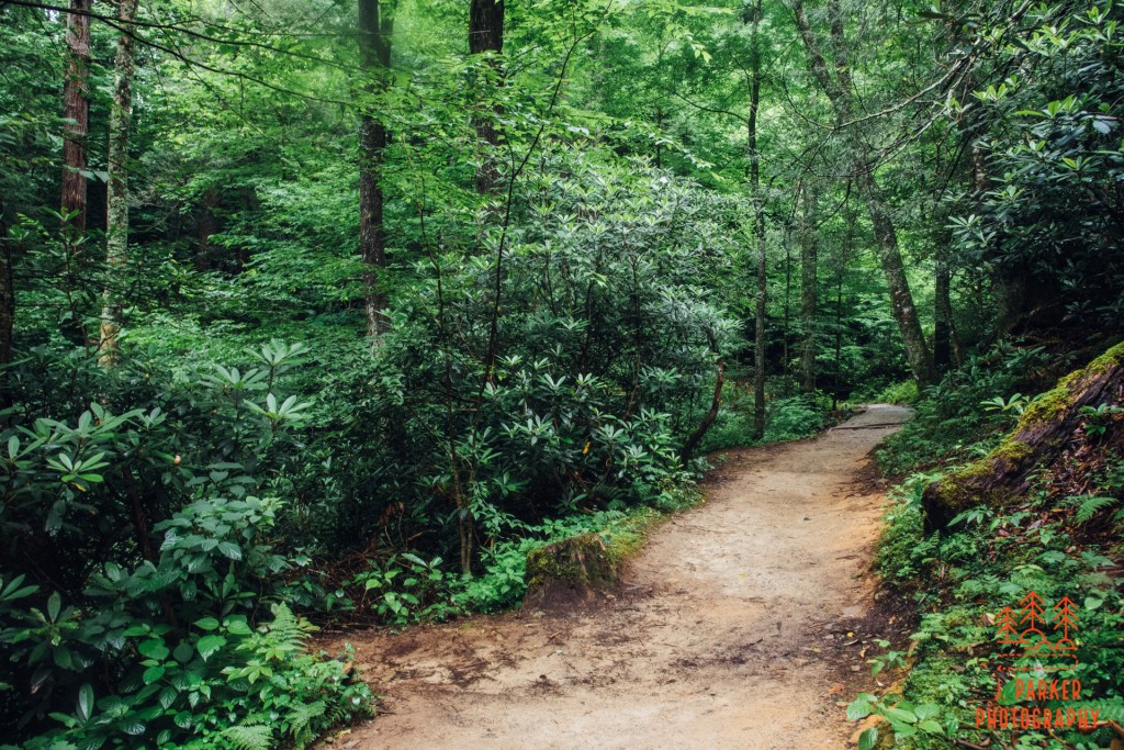
Once again we turned left and began clinging to the edge of the ridge. This was new territory. The woods seemed to get closer and more intimate here, as well as being even more striking than before. The Smokies in places have this ability to feel like they are part of some perfectly arranged garden. Everything just seems to be in its right place as some part of immaculate design.
Beautiful woods along the trail
It took quite a bit of effort to main my trekking poles, take occasional videos with my cell phone for hopeful use on my youtube page (I’ve only edited limited videos since the trip due to trying to avoid sitting outside of work), and also take pictures of the photogenic woods along the way. And almost every section of trail seemed to be worth capturing. I was really in my element, with a new patch of lush trail awaiting around every bend. It’s such a short journey to Grotto Falls, but in that short stretch there was so much worth photographing.
A lush patch of trail.
The canopy seemed to thin out just a bit. We also started to hear the distant sound of a significant flow of water, which has a tremendous ability to carry through a still forest. Were we getting close to the falls?
Possibly my favorite section of trail here.
We weren’t quite to the falls, not yet. Ahead of us was another small creek, though it was too small to be the one making the big noise. Similar to the first few crossings, this one had rocks aligned so one could easily cross with dry feet.
Another creek crossing.
This really was my favorite portion of the trail. It just kept getting better and better the further we went along. While I remembered enjoying the glimpse I got of the trail in 2015, I wrote some of that wonder down to just being new to the Smokies. In hindsight I thought I was just easily impressed. Well, after years of trying to escape to the mountains to hike every so often, I’m still impressed by the beauty of this trail. I might have made a chance to visit earlier if I had known how nice this would be. We hadn’t even yet gotten to the falls…
The trail runs alongside Grotto Falls.
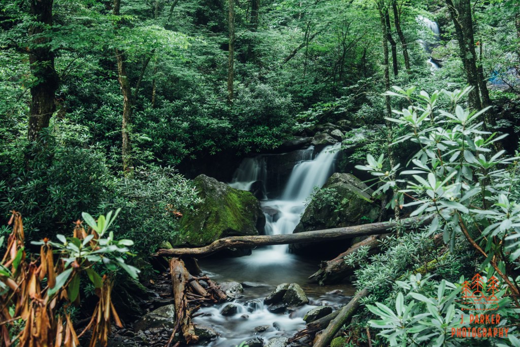
Rounding a bend, and we were there. Except it wasn’t just one single solitary tier as I had imagined. Instead, the whole of Grotto Falls stretches out for a hundred yards or longer, and in direct contact with the trail as well. In fact, there was even a lower tier of Grotto Falls below the trail, though trying to access or view it was something far beyond my imagination on this day. It made such an awesome scene to see the trail run alongside the creek, with the well known main tier lying in the background. A long exposure of this unanticipated scene would have fit right in with some of my favorites in my portfolio, but alas, that was a lot of trail that would have to be kept free of people for far longer than was going to be possible at this time. I was sad, because this is singularly one of the most beautiful sights I’ve come across in a mountain range that is absolutely full of them. I managed to get a snapshot of this view before proceeding to the main fall itself.
The main tier of Grotto Falls, with the trail running behind it here.
There were several groups of decent size milling about the main fall. Naturally, many were taking their turns standing behind the fall. For our part, Jess and I also both sampled the spot behind the fall, which was deliciously refreshing on a summer morning owing to the cold draft from the fall. The main tier, whose look I was well familiar with, was pretty much as I expected. Except for the novelty of walking behind it, which we had actually already experienced a few days earlier at both Dry Falls and Bridal Veil Falls near Highlands, NC., Grotto Falls was not a fall whose main tier I would list among my favorites. I did my best to frame a shot I thought would be pleasing enough yet still have some hope of being people-free. I dialed in my camera settings, waiting for a moment when the fall would be open. Several times I thought that moment had come, only to have people swoop in from one side or the other before my exposure was done. I had to zoom in more than I would like but finally managed to get a shot. It wasn’t among my favorites, but I at least wanted to get a long exposure of the actual waterfall.
Lower than the main tier of Grotto sits another tier which I photographed.
Though the main tier of Grotto Falls wasn’t anything exceptional, the area around the fall in its entirety definitely exceeded my expectations. Before leaving the area I took a shot at a lower tier, which had a more pleasing shape to my eyes. Though it sat some distance between the level of the trail, there was an open brush in front of it which allowed you to photograph it as if you were standing right in front of it. By the time I finished this shot, a lot more people had arrived in the vicinity of the falls, far more than we wanted to be around considering the pandemic. And more were arriving every minute, many with the disheveled look that suggested they weren’t quite accustomed to being outdoors but had decided to explore the fall. We began making out way back towards the car.
On the way back to the parking area.
I had wanted to photograph a bit on the way back, for although we were going through the same terrain we had before, we would be afforded different views going the other direction. There were a lot of people, but knowing that the parking lot only held so many spaces, I figured the crowds would have to taper off at some point. That actually never happened, and it wouldn’t be until we finished the hike that we figured out why. The lack of spaces turned out to be no problem for the general public, who despite the motor nature trail only being a single lane were parked on other side of the roadway for hundreds and hundreds of yards past the trailhead. On the narrow roadway, their vehicles covered brush and rock – this was not an area conducive, nor designed, for any type of roadside parking (the roadway does feature one or more pulloffs every few hundred yards at a minimum). I was aghast at the sheer disregard for the habitat around the roadway, nor could I quite understand the single-minded focus of the public who just HAD to see the waterfall at all costs. We knew places in the park would be busy, but we at least imagined that the limited amount of parking spaces would put a ceiling on things (we showed up as early as possible to every possibly busy place we visited in the park), not anticipating the sheer disregard people would have both for the rules and the environment. Not to mention that hundreds of carloads cramming into a 1.3 mile stretch of trail would make social distancing an impossibility.
By no means do I blame people for wanting to get outdoors when its practically the only recreational opportunity. I just question why they had to all cram into a few select areas of the park while other also beautiful areas of the park were almost oddly quiet.
Heading down the Grotto Falls Trail.
The crowds provided a bit of additional trouble as constantly having to stop and start provided a bit of additional rigor on my hip that was not needed. It’s hard to imagine unless you’ve been there how much strain constantly having to adjust your pace can put on your hip, and I definitely felt the effects of the hike we did the day before. What made things even more difficult was that the entirety of the way back was on a downhill slope, which is actually harder on the hip than walking uphill. I was pretty exhausted, both mentally and physically, by the time we got back to the car, even though we had only hiked a short distance.
The Grotto Falls Trail was only the first part of our adventure though. What I was really excited about was being able to explore the many creekside stops along the motor nature trail without a steady downpour (third time’s the charm!). I did worry, though, whether the apparent crowds were going to stymie us – after all, pulloffs were somewhat limited, and we weren’t exactly going to be making our own spots despite others apparently having no qualms doing so.
A small creek along the motor nature trail.
It wasn’t very far from the trailhead before we started with the creekside pulloffs. The first one we stopped at had a view of a larger creek one one side, while a small creek of just a few feet wide flowed downhill on the other side of the road. As there were a few people enjoying the larger creek at the time, I headed up to the small creek and found a nice set of very small cascades to frame. I was very satisfied as I waited for the camera to count down the seconds on my exposure. I was finally able to photograph here like I had always hoped. Not just photography it, but experience it, and immerse myself in it, doing far more than I could just glancing out a rain-soaked window.
A wider creek view.
Across the road we headed to the larger creek, which had several small tumbles close by. It wasn’t long before I was standing in 6 inches of water, shoes still on (with my bad hips the extra stability from shoes was vital) trying to find satisfactory frames. And failing. I was so excited to get the photograph the creek that I was trying to force it when I didn’t actually see a good frame. I probably wouldn’t have spent so much time at this first spot, but I didn’t remember just how many more spots lay ahead, nor could I predict whether we’d be obstructed by crowds. In either case, I enjoyed letting my legs soaking in the creek, even with my shoes still on. Since I couldn’t seem to get things right with my main rig (Nikon D750), nor did I always like setting it up on a tripod actually in the water, I swapped it out for my Nikon D7500 I had gotten earlier in the year as my “beater” camera (despite being Nikon’s highest tech cropped sensor DSLR, I actually got one for a very affordable price). I have a fun superwide lens (Sigma 10-22mm) for it that gets much wider angles and a different feel. I got a couple shots before we moved down the road.
The Roaring Fork
There were many more scenes further down the road. Some of them did have people in the way of potential photographs. Surprisingly though, most places had ample parking and rare interactions with other people. Amazingly, even though hundreds of vehicles just couldn’t bear to miss Grotto Falls, they were completely oblivious to the wealth of other wonders just around the bend. Personally, I find a tumbling mountain creek like the roaring fork to be just as cool as a waterfall like Grotto Falls.
A frame I was working on that was interrupted.
My travels didn’t go entirely uninterrupted. At one point I had worked my way over some fifteen yards of rocky creek (which is far more difficult than it sounds when toting a camera and tripod) before a family with two adventurous boys emerged from the other side of the creek to stand on the bank. I had to backtrack, but found an even better view of the creek on the other side of the road. In another instance I was standing in at least a foot of water, trying to refine my frame, when a woman came up to the bank about ten yards upstream, nodded in my direction, then proceeded to hop in the creek right in front. I was more amused than anything else that she went out of her way to acknowledge me if she was just going to hop right in front of a tripod setup in the water. There were better things to be found just downstream anyway, and I headed on to the next set of rapids.
The next shot after I moved downstream.
Despite the few blips I was really enjoying my time photographing the creek while at the some time enjoying refreshing mountain water on a summer’s day (being able to get in just about any body of water without having to worry about gators is a foreign concept for Floridians). I was doing something that was long overdue – not just photographing the Roaring Fork, but getting to invest myself fully in capturing any Smoky Mountain Creek. I had felt so cheated when pretty much every afternoon in our weeklong 2019 Smoky Mountain trip was robbed by thunderstorms. We did our main hikes, often in rain that limited my ability to photograph along them since nearly all my, but rarely had those moments where we could just take a very slow pace, which I had looked forward to just as much as doing the destination hikes. I was making up for lost time now.
A side shot of the Roaring Fork.
The amazingness of the scenic drive is such that, even though I tried quite a few different frames, I could drive the roadway again and find dozens more unique frames amid creek segments I didn’t really explore. In addition to a few official trailheads on the scenic loop, there are also innumerable goat paths and informal trails that diverge in the woods. Both for the sake of time and also because of health, I wasn’t gonna be able to explore every crevasse of the Roaring Fork. But I explored enough to be satisfied, for sure.
Beauty of the scenic roadway.
I had taken a lot of good shots, but for all my effort I hadn’t quite captured what I knew to be a great shot (and sometimes you just know you’ve got a bangup shot that’s gonna be one of your best). We were near to the end when I came across a dream of a shot. For this spot I had grabbed both cameras, and when I saw the rapid perfectly framed by brush on either side, with ample room beneath the water feature for me to move to get the right angle regardless of lens, I knew I was gonna have to use my best rig (the D7500 does a great job. And its focus system is newer and better than the D750. But the difference in shot quality between the full frame and the cropped sensor is perceptible). I tried a couple different frames of this spot, some with more breathing room than others, and the differences in the shots didn’t even really matter. They all came out looking like perfect frames to my eyes, and I’m usually my harshest critic, so I was extremely pleased.
My favorite shot.
There is more to the Roaring Fork than pictured here. The drive climaxes by crossing directly over a series of waterfalls called the “Place of a Thousand Drips”. As the name suggests, rather than having one main flow, this fall has many, many separate, small flows that seem to come from all directions. It’s quite a spectacle, though it doesn’t really lend itself to great pictures since the small flows barely show up, plus encompassing the entirety of the flows is nearly impossible in a single frame. I took a cell shot here, but it is laughably insufficient to show much of what it looks like in person.
Cell shot of the Place of a Thousand Drips
We had an immensely satisfying half day around the Roaring Fork. As a whole, the short hike to Grotto Falls exceeded my expectations. It was great to get familiar with another patch of magical Smoky Mountain forest. I also enjoyed getting another of the signature Smoky Mountain hikes done, though I still have a few more on my list to be accomplished some day. The scenes around the Roaring Fork were extraordinary. I was already familiar with how great the roadway was, but only seeing it in the rain on two different occasions was certainly a tease. The Roaring Fork is one of two dedicated scenic drives in the park, with the other, Cades Cave, being by far the more popular. While Cades Cove certainly has spectacular mountain valley scenery, I myself am partial to mountain creeks. In three trips to the Roaring Fork I only ever run into temporary traffic. Even on this summer of covid day, with trailheads overwhelmed, the drive itself was smooth sailing. Cades Cove, on the other hand, has been a constant traffic jam, and sometimes entirely stopped for long stretches, on both of the visits I’ve been able to make. The frustration of driving the road is almost not worth the trouble just for the scenery. With that in consideration, I vastly prefer the Roaring Fork, and I highly recommend it as part of your Smoky Mountain experience.
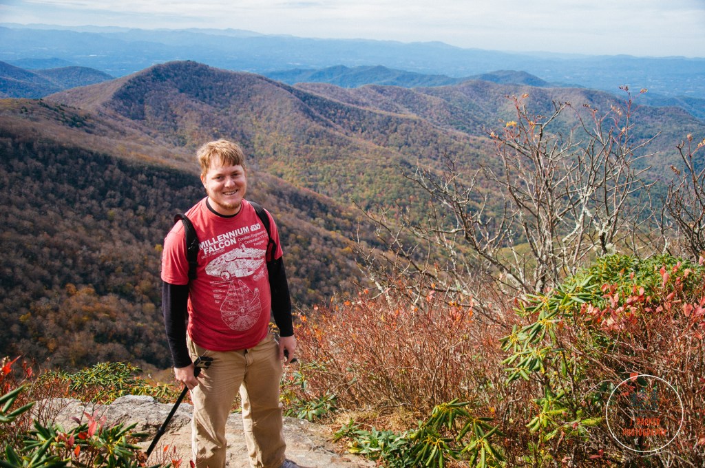
Step by step I worked my way up the gradual incline, trekking poles assisting me to make the burden of each step just a little less. The sound of two feet and the knobby end of two poles constantly pushing off the ground filled the air with the distinctive sound of crunching dirt. There was another sound permeating the air; that of the heavy breathing of the three people enjoying this hike with me, my wife Jess and our friend John and his wife Lauren, making their first trip to the Great Smoky Mountains. I paced onward, practically oblivious to their plight, my overriding concern being to push the group forward to minimize the possibility of us getting caught in a significant thunderstorm, something I had experienced before and wanted to protect my less experienced friends one. If I may be excused for being oblivious to the physical struggles of my group, one must understand that it almost unfathomable that I could outhike anyone; for in the days and weeks leading up to our Smoky Mountain trip, I had legitimately barely been able to walk.
Ah, 2020.
My year went sour before coronavirus was front page news. I came back from a hike in late February feeling an episode in my bad hip coming on, and that was compounded by a trip and fall at home. In the worst of all timings, this occurred simultaneously as the hospitalization and then death of the enduring rock for my wife and I, my biggest supporter and patron, my mother-in-law Karen (a subject which I’ll avoid delving into further in this post because it’s deserving of far more attention that I can give in a hiking-related post). While I was understandably concerned and frustrated at my hip going bad again, I tried to remain optimistic, for I had endured a couple episodes since my initial injury and recovery in 2017 and I had found a way to manage them just by being smart about activity for a while. But despite my optimism, this time was different. I tried resting it. I tried moderate activity. I tried an at-home exercise program. But when I tried to test myself around the end of May to see if I was capable of mountain hiking again, my hip delivered an emphatic NOOOO!!!
What followed were some of the most painful weeks of my life. It wasn’t that I was overwhelmed with a sharp, unbearable pain. It was that I had a constant pain that ate away at my brain and got immeasurably worse when I was working, in which even the covid-19 work from home version required immense amounts of sitting. I couldn’t avoid the pain because I couldn’t avoid working; I’ve found an income a necessity for providing for the basic needs of life. With that came immense anguish, as I had to deal with the mental trauma of causing myself pain. Most of all, I had do deal with the distress of not knowing when I would return to function. And function was something that at times I entirely lacked. Sometimes just walking to the end of the driveway caused the entire side of my pelvis. For some driveways this might not be as big of an issue, but I can assure you that I don’t live in that nice of a house, nor is the length of my driveway anything that should cause someone pain to navigate.
A picture of Ramsey Prong from our rain-filled 2019 Smoky Mountains trip. Taken at the start of an 8 mile hike, we ended up hiking 2/3 of this in a rainstorm that eventually turned into a deluge.
To say my wife and I needed an escape was an understatement. I was so stressed that I got more stressed just trying to find a place to de-stress, especially when you added the closures, travel restrictions, and necessary crowd avoidance that came with the summer of covid (which has had a hard time capturing the hearts and minds the same way the Summer of Love did). On a whim, I finally accepted a cabin in the Smokies as our destination. Though even in two trips I had scarcely found time to explore the many wonders of the area, I could tell you from memory where most of them were. And if my memory failed, I had a notebook filled with hiking guides and directions to waterfalls and swimming holes already assembled from the year before. (It might have seemed an obvious decision to make, but I was concerned about the effect being in one of my favorite hiking areas while I had limited hiking ability would have on my psyche). Not long after we made the decision, we booked the first cabin we’ve ever booked, and as it was a two bedroom, two bath dwelling, we decided to invite our friends John and Lauren to grab the second room. As fate would have it, they had been hoping to take a vacation that week anyway.
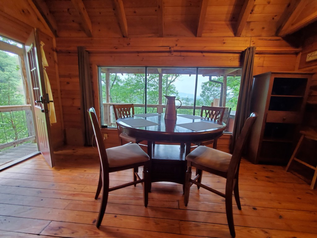
A crooked cell phone shot of the dining room in our cabin, with a view out towards the southwest portion of the Smokies.
Many people in the middle of bad torn hip labrum episode would have chosen not to hike at all. Those people aren’t me. The need to explore and create is my true joy in life. But on top of that, while hiking was bound to be painful, and I was certainly going to have to ration my miles and elevation gain, moderate hiking was actually less physically damaging than my regular workdays. Seeing as rest and recovery hadn’t, and my unavoidable workdays were daily tests in pain tolerance, I was going to do the only thing that made me feel alive if it were physically possible to do it.
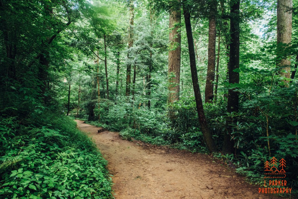
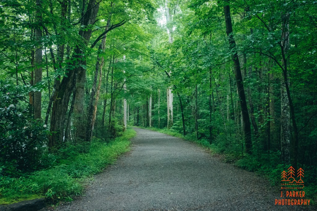
The wide path of the Little River Trail, one of many trails in the Smokies arising from old forest roads.
The Little River Trail was the perfect place for us to start exploring the Smokies this time around. With a negligible incline, its wide, easy-on-feet path followed the banks of its namesake for several miles, beginning in the Elkmont section of the park, which happened to be a fairly close drive to our cabin in Wears Valley. Depending on my physical ability and the weather, we would have the option of doing an out and back hike of about four miles, and could do a longer loop using the Cucumber Gap Trail and finishing off with a return trip on the Jakes Creek Trail to roughly the same parking area. We were taking a chance with the weather; it had rained on and off all night, only letting up a couple hours into the morning, and there was a strong possibility of storms returning not too long into the afternoon (as a rainforest, the Smoky Mountains are the only area I’ve been in whose summer weather is just as difficult to predict as my home state of Florida). In between these potential rainstorms would be a wealth of cloudy, misty weather – the exact type of stuff a photographer dreams of.
I couldn’t have asked for a better convergence of weather and setting than what I was granted along the Little River this morning.
I could hardly contain my excitement as we drove the short distance from our cabin to the park and began following the road that ran parallel to the Little River, one of the focal points of the national park. Jess and I have no designs on having children, but for the moment, John and Lauren got to be our children as we got to experience the joy of exposing someone to a new world of wonder. We had long extolled the virtues of the Smokies; now they were getting to see why it was one of our favorite places. We all marveled at the numerous rapids and cascades it navigated within view of the road. Immensely tranquil on this rainy morning, this stretch of roadway is usually so crowded with people and vehicles that the river comes off rather different.
We parked at the trailhead in the Elkmont area of the park. As we gathered our gear, I tried not to betray to my colleagues just how nervous I was about both the weather and my physical state. Soon we were heading down the pathway, and my trekking poles made a distinct clanking noise on the hard-packed gravel, a sound I was still unused to, as I had only gotten them a few weeks prior to reduce the stress on my damaged hip. (I had long avoided using them, as using them makes it more difficult to use the often multiple cameras I use while hiking). The wide path was escorted by a tunnel of immense mountain greenery, on which moisture glistened. The natural setting would have come across as quite peaceful except for the quiet roar that filled the trees. This was the sound of the river, flowing at a torrid pace not too far away but not yet in view.
Our first view of the river.
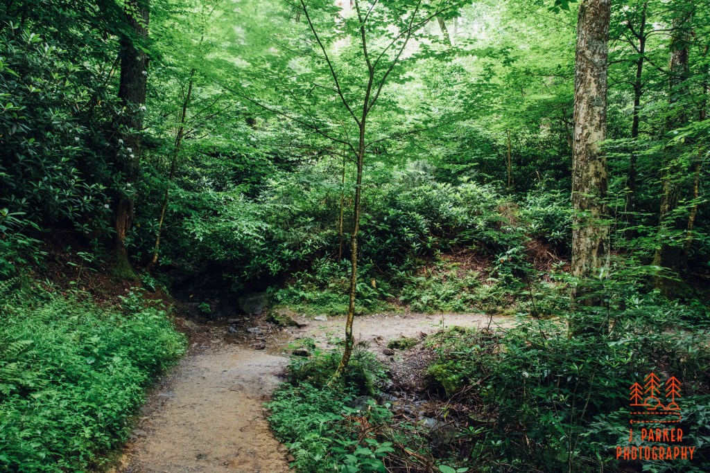
At our first opportunity we took an off-trail adventure to catch our first view of the river on foot. Our path took us through a wide series of clearings, dotted by the sites of many former cabins, their chimneys still standing in a state of disarray to attest to their former existence. Some people find these remains quite interesting, and I can’t find fault in that, but I was little interested in that today. I wanted to see the river that was casting such a noise through the woods.
We swam at this pool in the river in 2019.
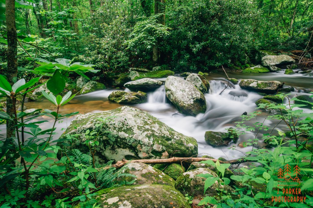
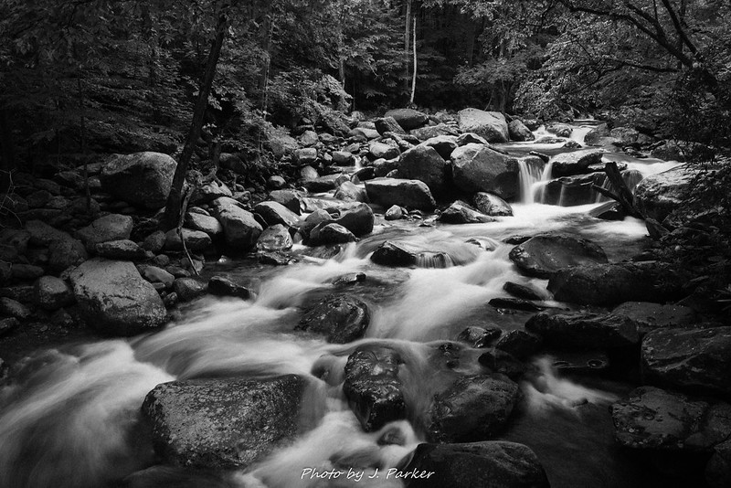
I had seen the river before just a short distance from where we were know. We had used an afternoon the year prior to take the road to Elkmont for the first time, finding a few places to grab a shot before we ultimately landed at a pool that made great swimming hole (an approaching lightning storm had forced us away not long after entering the water). The river today was some altogether different. Angry, thrashing, and….brown? The consistent rain over the last day had done the river clarity little favor; in some places, it almost resembled diarrhea. I setup for my first shots, not quite knowing how the brownness of the water would come out in a long exposure, but knowing that I would never find out unless I gave it a shot (in the event I found the brown was a bit discomforting in the pictures, but could easily be managed with some editing. Some of my pictures in this post are edited in such a way, others aren’t). I was thankful we hadn’t planned to swim here today, for we would have been very disappointed. Sometimes people get so fixated on waterfalls that I wonder if they don’t fully appreciate just how beautiful the unnamed rapids and cascades of a mountain river are. Thankfully, John and Lauren seemed to be enjoying the site of the mountain river, much like I was.
The ruins of the cabins gave something for the others to look at while I was getting my long exposure game dialed up. I would use it quite a bit today. We headed back on the trail, and I was pleasantly surprised that the beauty of the old forest road exceeded my expectations for what a forest road trail would provide. Soon enough the river was running parallel to the trail, and it would remain in view for most of the next mile and a half. This type of trail is great if you’re a photographer. It’s just as good if you’re not.
A favorite view of the river.
June is a great time to come to the mountains, as not only do you get to see the fascinating depth of greenery at its height, you also get to see a variety of flowers in bloom. Some places feature great patches of rhododendron. Other, more select places feature the elusive flame azaleas which are rumored to have been the final impetus for the Smokies becoming a national park. Here along the Little River Trail and in other places on our trip we got to see nice mountain laurel lining the waterways. Coming in close proximity to their wet buds while trying to frame shots, I was surprised to find they are actually very sticky.
Perring through the mountain laurel and trees to the Little River.Mountain laurel and greenery line the trail.
The closures of most recreational facilities due to covid-19 has naturally pushed people into the outdoors in unprecedented numbers. In most cases the newfound outdoors people have gravitated towards predictable places with lots of public exposure, overwhelming certain locations in numbers they are ill suited to support, especially when trying to accommodate social distancing, while some others out of the public eye have remained relatively quiet. Unfortunately, the Smokies belong to the former, meaning there would be a balancing act when trying to explore the park. Fortunately the inclement weather of the morning had kept people from overwhelming the Little River Trail thus far; we encountered but small pockets of people for much of the hike, and the trail was more than sufficient to provide a great amount of space between parties.
A look up the trail on this quiet morning.
Those that had gotten on the trail had ample time to pass us. While by necessity I had to be a bit selective about where I deployed my tripod along the river, there was still a constant barrage of scenes just too perfect for me to ignore. We don’t have wonderful mountain rivers in Florida, after all, and I had little idea if I would even be able to walk at all on my bad hip after today’s activity, so I was going to make it worth it.
A gorgeous set of rapids along the river.One of my favorite shots I’ve ever taken in the Smokies, as it captures the raging river, excellent greenery, and even a wall of mountain laurel to the left.
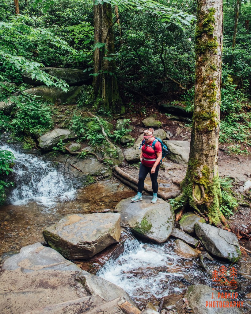
The trail gave witness to the many times the river split around small islands and large boulders. Despite the wet weather which made generally every surface slick, John couldn’t resist navigating a set of rocks and logs which formed a shaky natural bridge out to one of the boulders, which he climbed to enjoy a unique view. I wondered if he knew that it was much harder to climb down a wet rock in the middle of a river than it was to climb up. I grabbed my phone to capture video, anticipating a mishap. To my surprise, he experienced no problems on his return trip. Only much later, long after we had finished our hike and located a post-lunch swimming hole, and also when no cameras were nearby, did he learn about slick rocks the hard way.
John enjoying his mid-river boulder. I had my wide angle 18-35mm, and this still faraway shot is at max zoom.
One great patch of trail and river view ran into the next. I don’t have a story for each beautiful section we went through, other than to say that there wasn’t a single point of this part of the Little River Trail that wasn’t a small sliver of photogenic beauty. In the weeks before, when I couldn’t even make it around the small block in my neighborhood, I could only dream of such a serene walk. Now I was here, and I couldn’t think of any other place I’d rather be.
A small bend through the woods, away from the river.
Even the one very brief section of trail where the river was hidden from view for a few hundred yards wasn’t a disappointment. It provided a great opportunity for the trail to again be encapsulated in that magnificent green forest escorting it on its way.
A patch of trail away from the river.
A typical trail in the Smokies starts in a mid-elevation area where the woods are composed of striking, deep cove forest that provides awe-inspiring beauty. And as you work your way deeper into the heart of the Smokies things somehow get even more breathtaking. The shrubs get bigger. The rocks have more foreboding edges. If you’re lucky, some of the trademark mist rolls through, making it feel as if you’re on another planet, or at least on the same one 300 million years ago. We were blessed with that mist as we got further along the trail, where the magic of everything seemed elevated. To not be able to capture that air of mystery in all its glory makes one feel insufficient as a photographer, though I am not sure a picture could ever truly convey the experience. I’ll never stop striving though.
A Smoky Mountain mystery scene
About two miles into the trail is Husky Branch Falls. You probably noticed earlier that I talked about the Little River Trail not being a waterfall trail, yet I’m mentioning a waterfall here. That’s because Husky Branch is scarcely more than a foot wide as it tumbles down a roughly twenty foot escarpment, which hardly makes it a destination, especially when one considers how it pails in comparison to the river it flows into just on the other side of the narrow trail bridge. Nevertheless it does make a nice waypoint along the trail, and many find it an ideal place to turn around while doing an out-and-back. Quite a few were grouped around the small fall this morning, far more than I had seen pass us as we stopped along various sections of the river. Nevertheless I was able to find a place to deploy the tripod, though it was far more out of a desire to document the waterfall for those curious about it than out of any compulsion to capture its beauty, knowing it was more interesting in person than its small flow would allow in picture form.
Husky Branch Falls
That gaggle of people was something I wanted to avoid, especially as I knew the crowds would only increase the further we got into the day. That was further encouragement to try to push on to make this a loop, which I always prefer over the drudgery of repeating the same section of trail – even a nice section. It was a short distance to the junction with the Cucumber Gap Trail, which we would have to use to make a loop, but upon reaching that point I dithered. I had promised the group a six one way, half-dozen the other length, making our return route negligible. I was surprised to find the just the Cucumber Gap portion of the trail in front of us to be longer than retracing our steps along the Little River Trail would be – and that didn’t include the .7 miles we would also have on the Jakes Creek Trail. Up to this point we’d had a great, albeit short, hiking outing, and I had visions of being caught in a deluge of rain, accompanied by dangerous lightning, completely ruining that. But I also knew I’d feel a little incomplete at not doing the loop, which I was feeling physically capable of doing, and I was also preferring to walk a quiet section of loop back. Nobody in the group seemed to notice my indecision, and as the group leader I decided to push on for the loop, hoping to give my friends a bit more varied experience on the single-track Cucumber Gap Trail, far different than the forest road path of the Little River Trail. Would we be paying for that decision later?
Part of the Cucumber Gap Trail shortly after it diverged from the Little River Trail.
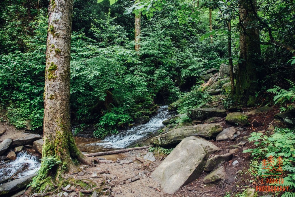
The Cucumber Gap Trail began a slow ascent away from river level and up a narrow ridgeline. I was aware that the trail wouldn’t be flat like the Little River Trail, but I also knew that in mountain terms there wasn’t anything in the way of serious elevation changes either. I was kind of looking forward to the different scenery that elevation changes bring. It wasn’t long before we reached a very interesting creek crossing, what I presume to have been the top part of Husky Branch. The creek spread out in a very shallow flow some 15 feet wide, with no footbridge to cross. This is standard fare for me, but I was excited to show my friends something more akin to “real hiking” than the Little River Trail provided. The three others cheered me on and gave me points on where to place my hiking sticks, then they all slowly followed suit, all without incident albeit without my hiking sticks. Crossing a shallow creek doesn’t offer much danger, but it’s easy to get one’s feet wet, and while I’ve learned to embrace the wetness when its unavoidable, it’s certainly preferable to have dry feet when one has a few miles to go. And its also preferable to not have to write off a pair of shoes on a weeklong trip, at least until you can dry them enough to wear again.
Crossing Husky Branch
The following section of trail served as a great supplement to what we had experienced on the Little River Trail. Thick hardwood trees stood on both sides of the narrow pathway, with much of the forest floor decorated by many small shrubs that provided an immense canvas of green wherever possible. While they were both cut from the same cloth, it was a vastly different experience from following the river.
Green abounding everywhere
The elevation also gradually increased. Utilizing trekking poles for the first time on a real hike, I scarcely noticed. The rest of my group had a different experience. I doubt it was because of any fitness level of mine, though I’m at least somewhat mentally accustomed to climbing regardless of shape. Rather it was because, at least on a gradual incline like the Cucumber Gap Trail, trekking poles really do make the climb almost imperceptible. Consider me a convert, even though I enjoy having my hands free. There’s just around 700 feet of elevation gain to be experienced on the loop, but with none it of the steep variety, and thus most people should be able to manage it just fine – even if Florida flat landers who legitimately go an entire year without having to navigate a legitimate incline will get somewhat winded.
Climbing up the Cucumber Gap Trail
If I had a complaint about the Cucumber Gap Trail, it has nothing to do with any elevation gain. It’s that after a certain point the woods lost their distinctive luster and come to be a little plain by comparison to what you’ve experienced preceding it, and there are long stretches of trail with no creek interaction and certainly no views to break the monotony. I know there are some who are of the belief that there is such thing as a bad walk in the woods, and while I always enjoy the thrill of exploring and experiencing the woods, there are some sections of trail that are better than others. You tend to think differently of these things when you’re hiking with a dysfunctional hip, and every mile could be your last. There’s also so much amazing to be found in the mountains, and there’s only so much time a person from Florida has to experience them. I could feel my group was starting to lose interest as well.
One section that did pique my interest was when the forest flattened out, and we encountered a large expanse of ferns carpeting the forest floor. I’m not sure why, but I’ve always had quite a soft spot for your standard ferns, even though they can be encountered regularly in my home state of Florida, too.
Cucumber Gap Trail
The Cucumber Gap Trail did level off for quite a bit, but one thing it did have for a while was a rather narrow path combined with a fairly steep dropoff to the right. As for the moment the storms were still holding off, they posed little challenge that a bit of concentration couldn’t fix, but I know from experience that hiking a narrow pathway next to a dropoff is quite an exhausting, nerve-wracking experience when the trail gets wet and muddy. We started downhill again and I finally came to another point of interest. This was a small crossing over a very shallow, almost ephemeral creek. The creek wasn’t what caught my attention though; it was the ridge lying just behind it, which was covered entirely in thick mountain laurel seemingly stacked one atop another as the ridge gained elevation. I instantly knew this was something that wasn’t going to be appreciated it pictures, but it made for an interesting sight when we were there. Crossing the small creek presented no challenge, though on the other side we were greeted with more narrow, steep-sided trail.
The wall of mountain laurel behind the creek crossing.
We hadn’t lost much elevation by the time we reached the Jakes Creek Trail. I soon found out why, as far from what I imagined a trail following a creek would be, the Jakes Creek Trail was a steeply descending, serpentine pathway, far steeper than anything else we had encountered on the trail. Like the Little River Trail, it was essentially the width of a forest road. While this made navigating the pathway easier, it also meant the trail lacked the scenic appeal I had imagined I would encounter.
A shot down the Jakes Creek Trail. Pictures don’t show elevation well, especially looking downward.
By this point, I could tell that my hip definitely had enough, and I wasted little time trying to strain to slow myself as I descended, instead letting gravity do the work and not trying to strain my poor hip against it. Thus this downward section of trail went rather quickly for me, though others in my group took longer. Only upon reaching the bottom of this section did I see what I presume to be the actual Jakes Creek, running some 30 yards from a wide pathway we joined up with. At least on the .7 mile section we navigated, there wasn’t an unobstructed view of the creek to be had. With a little work, the creek wasn’t too far away, but I was too sore and the rest of my group too tired to want to put in a little work. There was one bluff behind another set of cabin ruins that provided a somewhat elevated view, and we did take that in before completing our journey to the parking area. In other circumstances I would have enjoyed getting a more intimate view of Jakes Creek, but that was not to be had today.
One of but a few views we got of Jakes Creek.
It was to my immense relief that we reached the car without getting caught in a storm. The area was inundated with severe storms later on that day, so my fears weren’t unfounded. I wanted to give my friends, and of course myself, a positive hiking experience, and for the most part we succeeded. It’s pure magic to get to follow a well-flowing Smoky Mountain waterway in close proximity and great conditions for several miles. My opinions on the Cucumber Gap/Jakes Creek portion of the trail were more mixed. I really liked moments of the Cucumber Gap Trail, but it was quite a contrast to go from the constantly wonderful Little River portion to the long stretches of comparatively plain Cucumber Gap Trail. I was hoping Jakes Creek would offer a similar experience to what the Little River Trail offered, and in this I was sorely disappointed. For what it’s worth, my friends were also not overly impressed with what we got out of the extra mileage on the loop. The Little River/Cucumber Gap/Jakes Creek Loop remains a popular hike in the Smokies, however, and it does offer the benefit of getting away from the crowds that branch out from the busy Elkmont section of the park. I don’t fault anyone who enjoys that, but people who have physical limitations like I did when doing this hike would lose anything “can’t miss” by doing the shorter out and back. Despite my opinions on the loop, this is a very good hike in the Smokies – not quite in the upper echelon with Alum Cave, Ramsey Cascades, or Chimney Tops, but still one offering some national park caliber scenery.
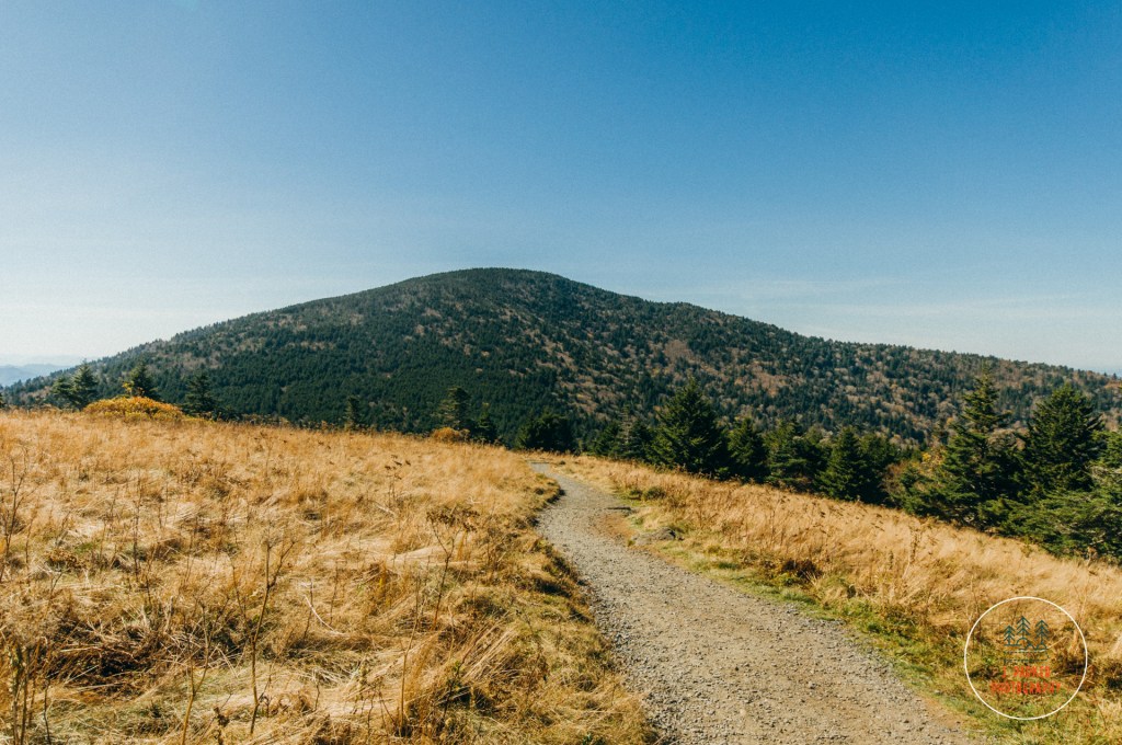
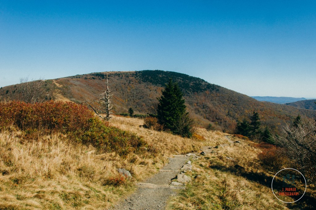
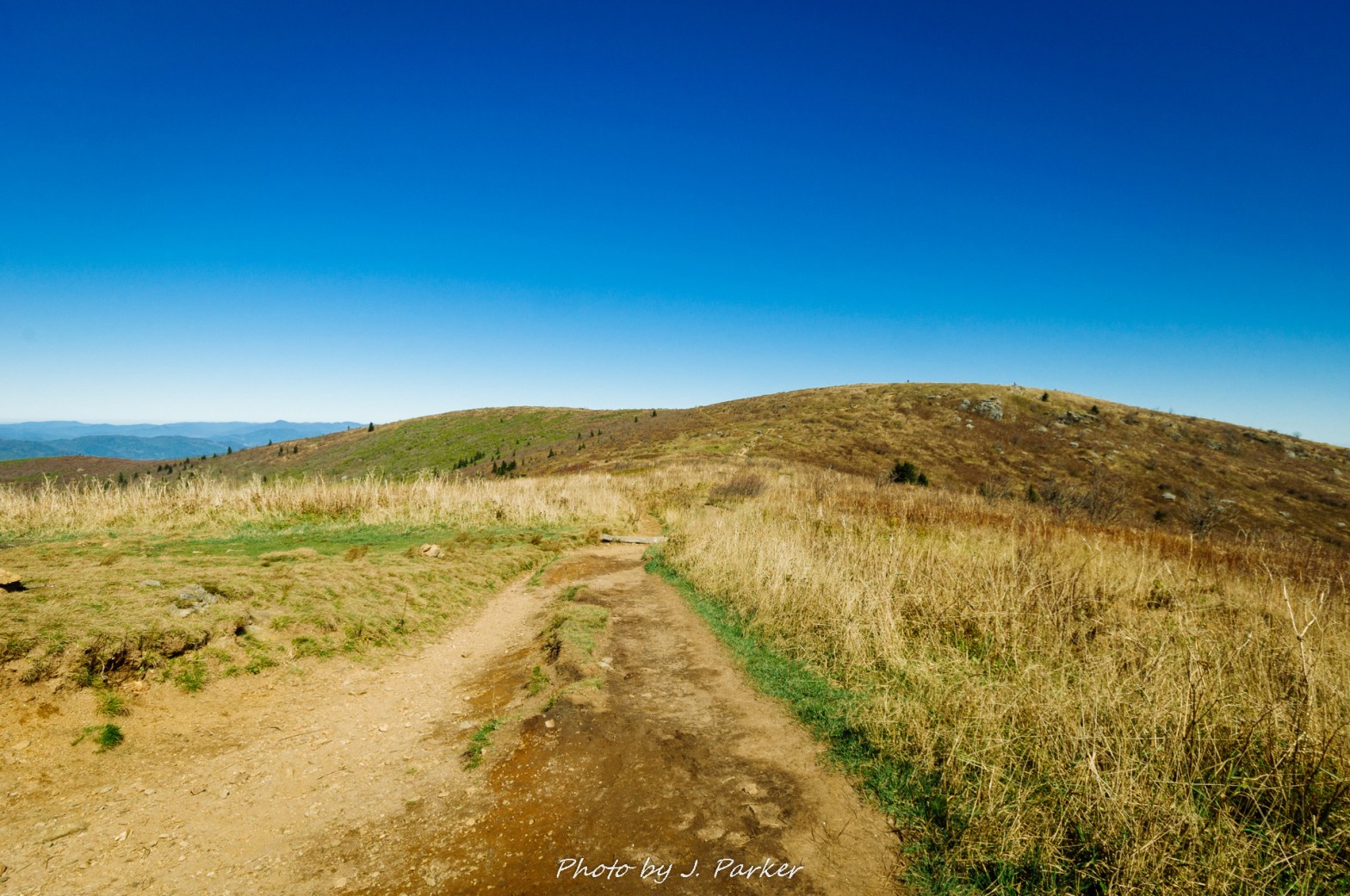
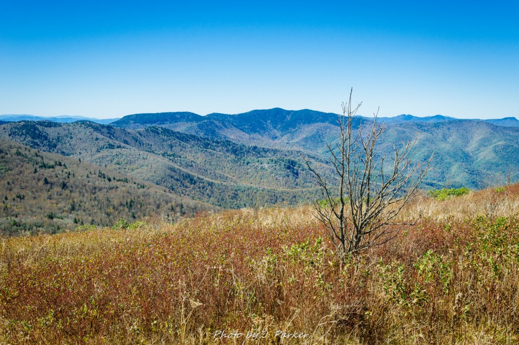
Somewhere in front of us was a mountain. Not that we could see it, but we were taking it on good faith that it was there. I don’t know why, considering the Blue Ridge Parkway signage had been rather inconsistent this summer of 2011, but we were. We could definitely see the base of it, but impenetrable mist shrouded much of the top. And that top seemed to be enormously high – far higher than I had ever imagined could occur in Appalachia. Not that I had ever spent much time imagining the tallness of Appalachia. I was from Florida, after all, where the largest hills nearby are landfills (one might think I am joking. But it’s pretty much true). This massive peak was beyond anything I would have expected. It was mysterious, foreboding, fantastical. For a second I thought I might have been in Alaska, and that was only partially because I would end up in the hospital later that night with a systemic infection.
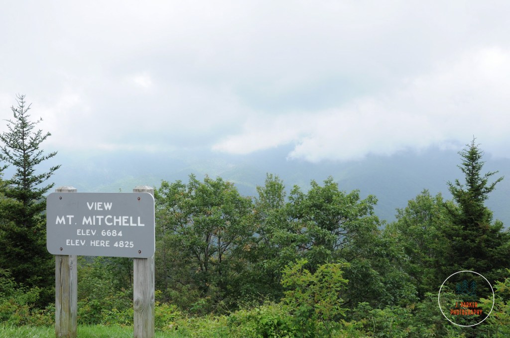
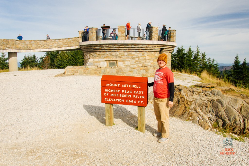
Mt. Mitchell as “viewed” on our first Blue Ridge Parkway tour in 2011..
This mountain was Mt. Mitchell, the king of the Black Mountains and the tallest in the Appalachian range. Like many stops along the Blue Ridge Parkway, we weren’t going to have time to dip off the Parkway to explore it in depth during this 2011 trip. We had given ourselves only three days to explore the length of the Parkway, and there simply was only so much time for sidestops. Like Grandfather Mountain before it (which we had visited the day prior), we earmarked the place for a future visit, not knowing when that would occur. Flash forward six years to the fall of 2017, and it was one of first stops we placed on our itinerary and planned our trip around, as we had to plan our trip around the uncertainty of whether or not my ailing hip would allow us to hike. Mt. Mitchell was a place that could be enjoyed without much walking, as the state park road leads almost to the summit.
This was our 7th day of hiking out of the last 8. We were exhausted. We had already started the morning with a frantic hike to Crabtree Falls, where an assault of freezing air couldn’t make the hike end fast enough. We had no shame about driving to the top.
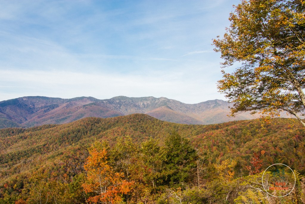
The amazing shape of the Black Mountains from the Parkway.
It was a pleasant drive from the Crabtree Falls parking area to the side road off the Parkway which led to Mt. Mitchell State Park. The Parkway is always beautiful, but on this day it was exceptional, with the mid-elevations still rife with fall color, perhaps a bit past peak but still quite lively with oranges, reds and yellows. We enjoyed the drive, but we were also a bit somber. This was the last day of our week in the mountains, and we were having a hard time imagining how we were going to enjoy flat Florida after the mountainous wonders we had seen – Tallulah Gorge, Dupont State Forest, Looking Glass Rock, Black Balsam Knob, Linville Gorge, Grandfather Mountain, and Roan Mountain, among others. We had done the greatest hits of Appalachia and by comparison Florida barely seemed to offer a decent album track. That was going to be tomorrow’s problem, and we tried to think of what we would lose after this last day in the mountains, but instead what we still had.
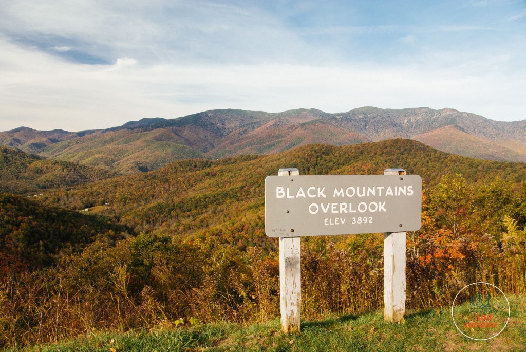
Black Mountains Overlook on the Blue Ridge Parkway.
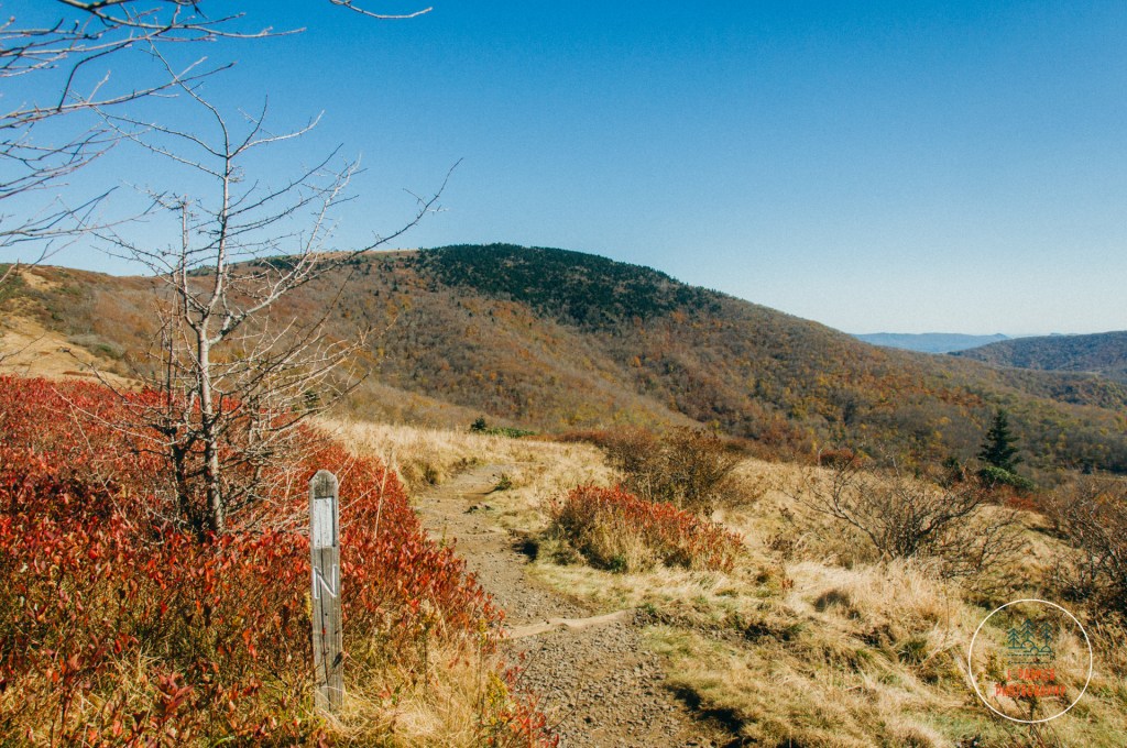
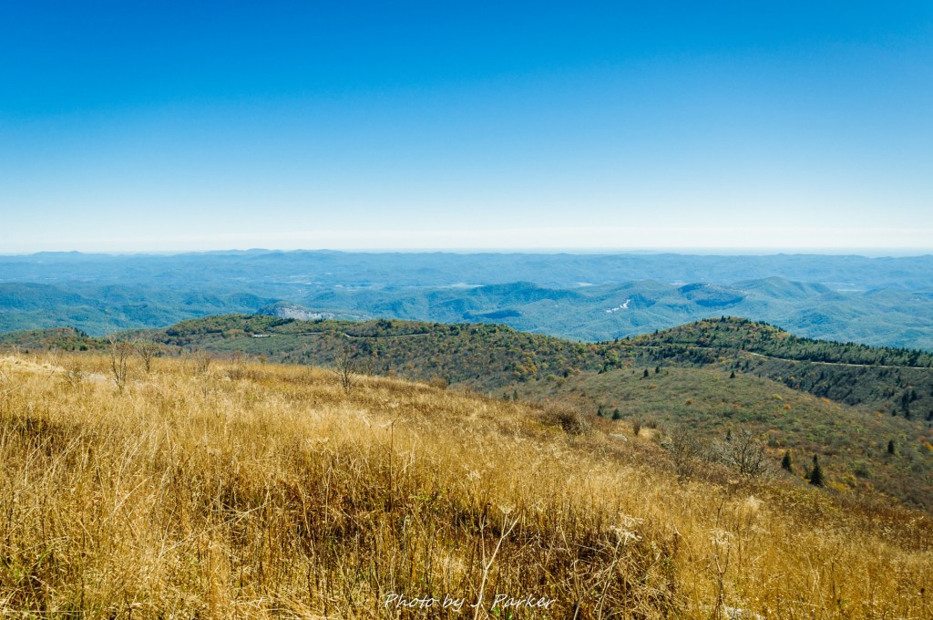
We stopped to enjoy the several overlooks that gave a glimpse of the crest of the Black Mountain range, which towers over this entire part of western North Carolina and had been visible from almost every location we had visited in the last few few days. After seeing this peak for days, we were finally ready to get on with it!
A look down at the road to Mt. Mitchell’s summit.
The Blue Ridge Parkway towers over much of the area around it. It’s very common to find yourself looking down on other peaks so far below that they appear as nothing more than waves in a sea of mountains. Mt. Mitchell, on the other hand, is an exception. Turning off the Blue Ridge Parkway onto North Carolina 128 begins a rather steady climb on what becomes the tallest highway east of the Mississippi River, an accomplishment because many people have difficulty spelling Mississippi. This steep road might have unnerved some lesser folk, but after having nearly lost our Toyota Corolla on a dirt road in north Georgia, then tackled the terrifying drive to the Table Rock Parking Area in Linville Gorge, this drive scarcely registered for us. Disappearing on the drive were the vestiges of fall color we had been treated to, as the higher elevations are inhabited by Southern Appalachian spruce-fir forest, consisting of evergreen trees which scarcely change with the seasons. What did change with the season had long since cycled through its fall colors and was now a dull brown. But never matter; one does not do the tallest mountain in the Appalachians trying to get fall color.
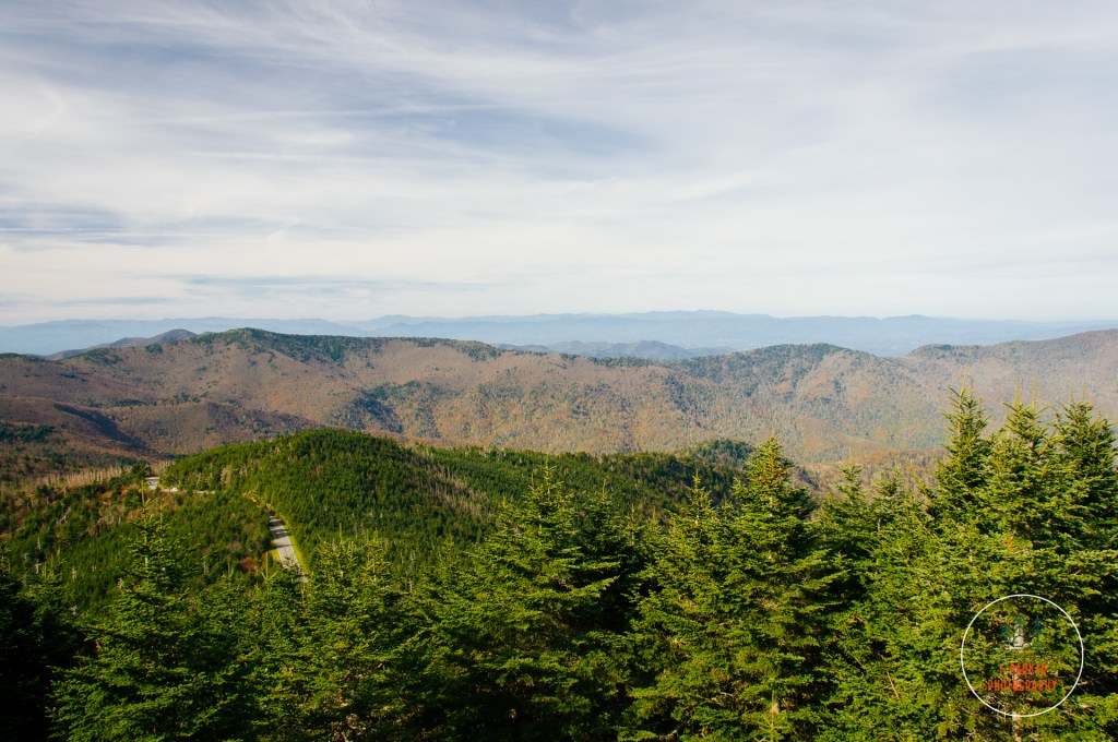
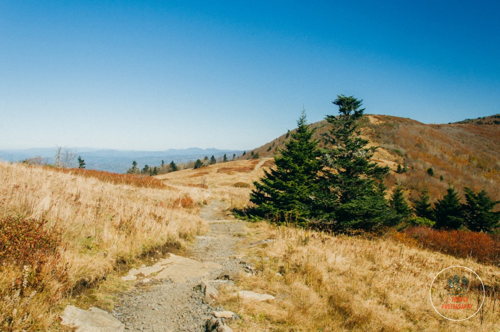
Partway up the Mt. Mitchell summit.
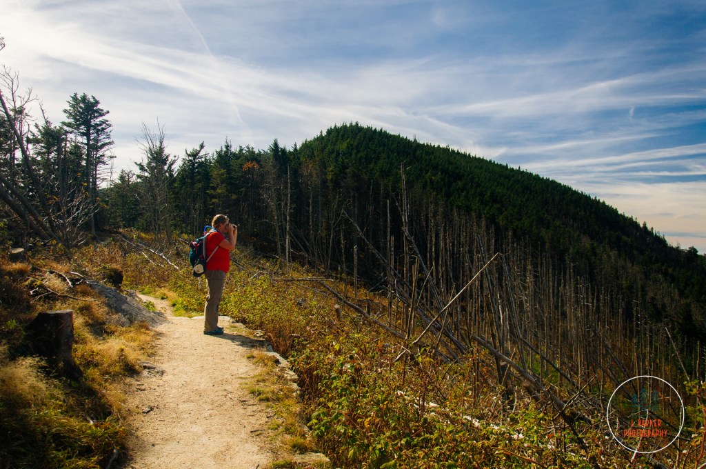
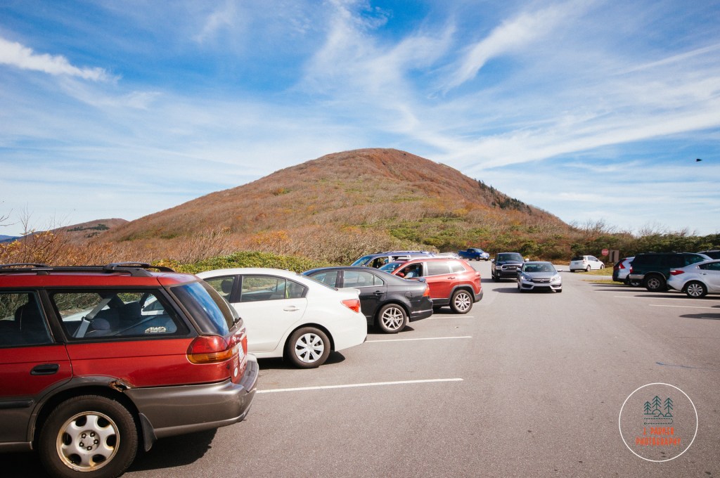
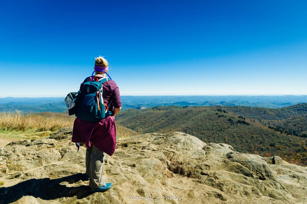
It was only a bit after 10 that we reached the parking area a short distance from the summit, but spaces on this fall Saturday were already getting to be a premium. Not that we had imagined it would be much different, but this certainly confirmed that getting anywhere among the crowds was going to be a challenge. Parking towards the top spoils some of the mystique of a summit view. Crowds, at least not the type that consists of dozens of carloads, doesn’t help either. But one must endure these type of things to experience some notable locations that bear all the hallmarks of a tourist trap, and we knew what we were in for. We trudged our way up the curving oath that led to the observation area on the summit, proud that our tired legs nearly allowed us to keep pace with the hordes of elderly snaking their way to the top.
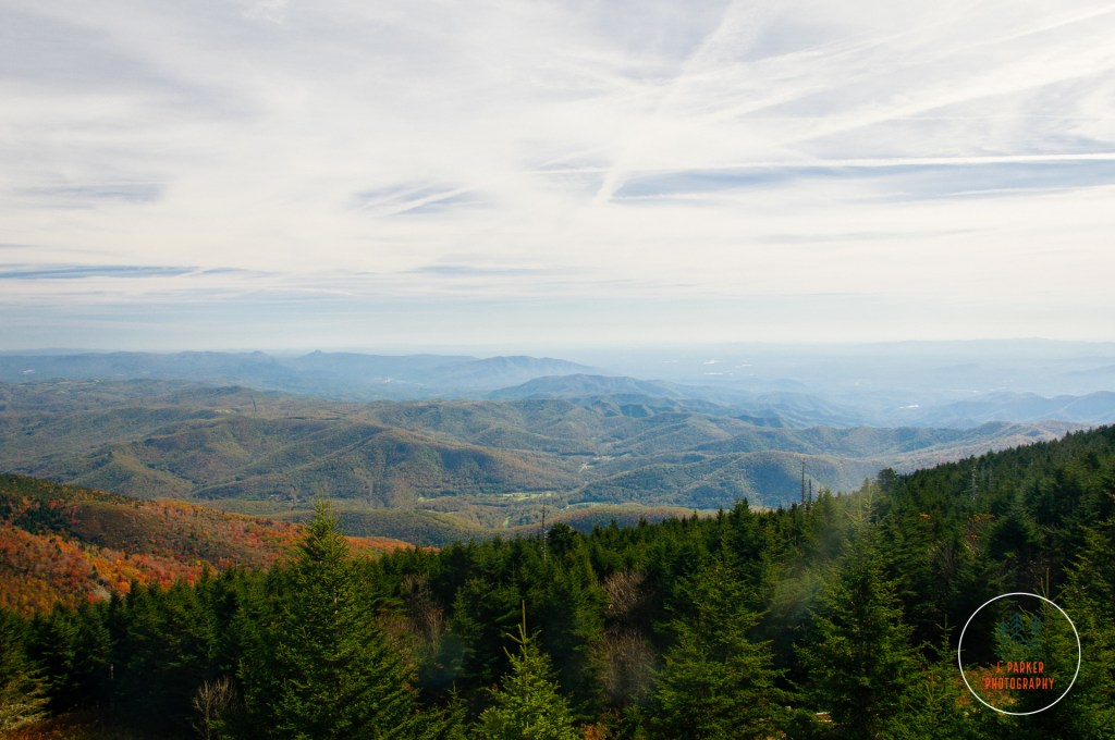
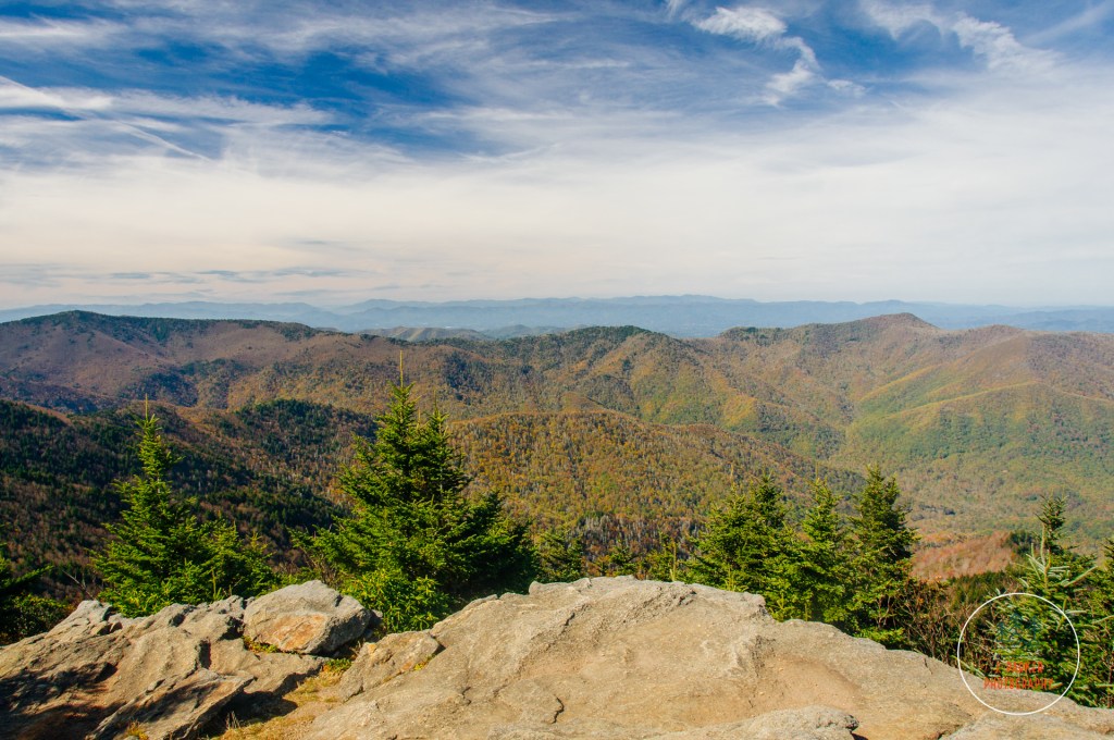
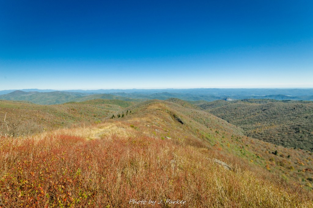
We made far worse time getting up to the top than I would care to admit, but we did reach the platform. We walked our way up the circular ramp before reaching the round platform that was the object of so many desires. At the risk of sounding pretentious, for some will always be a bit prudish about these “tourist trap” type views, for the tallest peak in Appalachia the view was a bit…underwhelming. Certainly one could see quite a bit from this extremely elevated perch, but perhaps not as much as one might imagine. Overall though, the views weren’t quite the same caliber of many of the other places we had been, where there were more interesting sights to actually fill the view, places like Linville Gorge, Black Balsam, and Roan Mountain, where you also had the freedom to roam and enjoy in a more organic way, rather than taking a short concrete pathway from a parking lot just off the summit. And Grandfather Mountain, a similar drive-up summit experience not too far away, was also a bit more impressive. But that’s not to say Mt. Mitchell’s summit wasn’t cool. It was. We just didn’t rank it above that whole slate of great Blue Ridge Mountain views we had already experienced in the last week, enjoyable as it was.
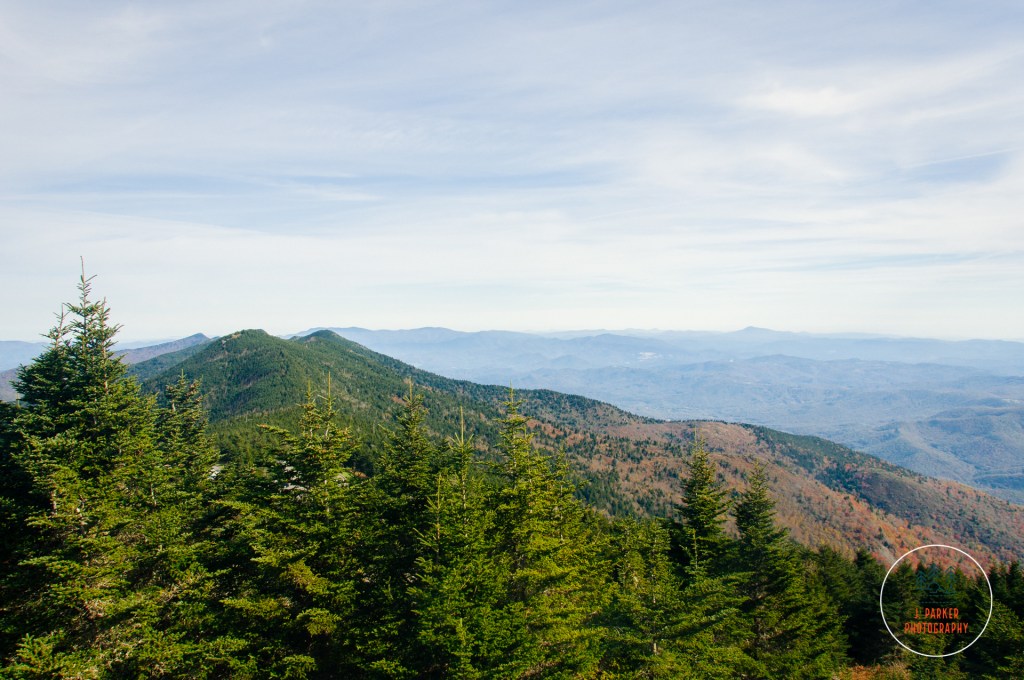
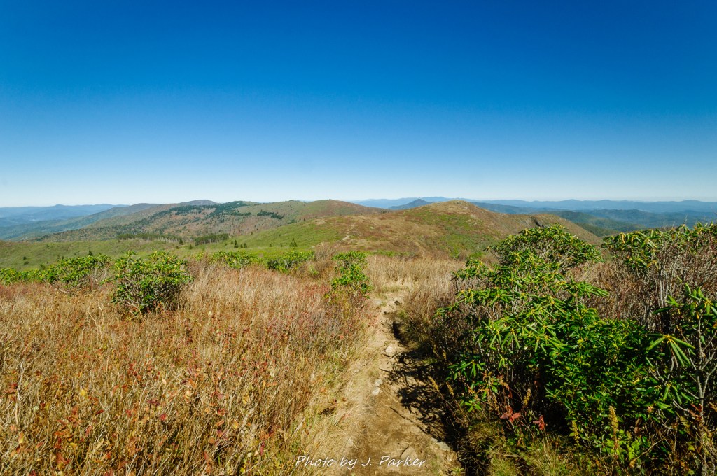
One of the better views from Mt. Mitchell.Looking from Mt. Mitchell towards Mt. Craig. Oddly enough it seemed taller than Mt. Mitchell to our eyes.
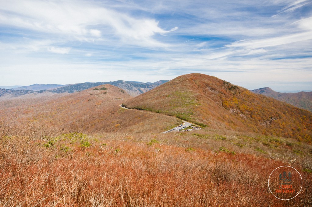
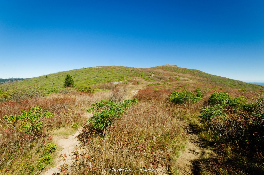
One of the better sights visible from Mt. Mitchell’s crowded platform was the peak of Mt. Craig. Mitchell’s neighbor to the north. Which, coincidentally, was going to be our hiking destination. Most of the hikes along Mt. Mitchell’s peak area were far too strenuous for us to consider when planning the trip around a bad hip, but the Deep Gap Trail to Mt. Craig offered the chance to get away from the crowds for a bit and enjoy a more natural view from the tallest ridgeline in Appalachia (Mt. Mitchell for intents and purposes is merely the tallest peak of many peaks along the massive Black Mountain Crest) with only roughly a two mile round trip. Mt. Craig is the second highest peak east of the Mississippi, thus the the Deep Gap Trail offered a chance to hike between the tallest and second tallest peaks in Appalachia – a cool concept which turns out to be pretty cool in person. After taking the requisite people on vacation shots (of ourselves, not the other people, which would have just been weird) we worked our way back down the serpentine path to the parking area and crossed in to the Deep Gap Trailhead.
We almost laughed at how the Deep Gap Trail was labeled on the sign as “very strenuous”. It’s quite amazing how, even in the same region, the definition of strenuous can vary dramatically. What would be an easy or at worst moderate trail in a genuine hiking area earns the moniker “very strenuous” when in an area that might be overrun with families who must be dissuaded from wandering haphazardly on a genuine wilderness trail (when hiking the out and back to Charlies Bunion along the Appalachian Trail in the Smokies, we came across more than one family who hadn’t realized the trail was not a loop, not taking note of the distance to Mt. Katahdin in Maine (and the fact that this was the Appalachian Trail) posted at the trailhead. Immediately upon entering the trail we left the chaos of the parking area behind and immersed ourselves in the thick evergreen forest that always provides such fine fragrance. I normally enjoy taking in woods under cloudy cover, but the sunrays lightly filtered by the patchy cloud cover of the day illuminated the forest in a soft gold light, bringing out the green of the mossy patches that by and large covered its soil.
A stair section of trail.
As indicated before, nothing on the Deep Gap Trail is all that strenuous, but there is quite a dip down as one works into the gap between the two peaks. On the way out this featured a lot of downward stairs clinging to the edge of the ridge, stairs that would have to be repeated as this was a one way trail. Nevertheless this was actually a quite pretty segment of trail as the sight of the stairs cascading down the hillside was quite pleasant to the eye. Shortly after the trail leveled out we reached a rather curious area where essentially the entire forest had been flattened somehow, with piles of logs appearing as matchsticks on the former forest floor, with the occasional barren tree trunk solemnly pointing towards the sky. While I could conjecture that there was probably some type of storm, either a tornado or strong microburst, that leveled the forest for this roughly hundred yard wide stretch, there wasn’t any official signage to indicate what had happened. While the pile of logs looked rather unsettling, it was certainly interesting to get this open view from such an elevated area.
The flattened forest.
The trail had some other interesting moments. We had a few interesting rock scrambles, the type that required a bit of concentration to navigate, but nothing all that difficult, certainly nothing to the level of Grandfather Mountain, and what was there just tended to make everything feel more fun. Some sections required us to scoot on our butts as we worked our way across the rocks. The Deep Gap Trail is part of the larger Black Mountain Crest Trail, which as one could imagine is known as a tough cookie. From what I saw on this section of Deep Gap Trail, which had some adventurous passages without significant elevation gain, I can only imagine what an ascent up the challenging trail could be like. That is an experience that will never be within my skill level.
Jess navigates a rock slab along the trail.
It wasn’t that long of a distance to Mt. Craig, so the trail didn’t stay in the relative flatness of the gap for long. When we started the ascent up to Mt. Craig’s peak the top was obscured by the forest, so we had little way of judging our progress as our shoes tenuously clung to the sloped, craggy rock. We were teased with a few views between the trees that gave us a taste of what was to come. Getting closer to the top the trail got more and more open, and logs marked the path of the trail over the rocky summit area of Mt. Craig.
Mt. Craig’s summit view.
The view from Mt. Craig wast just phenomenal. I can’t tell you honestly whether or not my view of it is skewed compared to Mt. Mitchell just because of the easiness and business of the latter, but while Mt. Craig didn’t necessarily place anything into view that wasn’t visible from Mt. Mitchell, the framing of it was much more pleasant. My preferred platform for mountain views is from an authentic mountain rock slab, which feels liberating compared to the confining observation platforms. The view from Mt. Craig, along with other aspects of the Deep Gap Trail, make it a very memorable hike despite its short, nature trail-like length. I don’t think any trip to Mt. Mitchell State Park would be complete without visiting Mt. Craig, which feels like the “real” way to visit the Black Mountains.
Jess photographs along the barren section with Mt. Mitchell’s summit in the background.
Mt. Mitchell State Park offers other trails as well as an on-site restaurant. Of those we were far more interested in the latter, but much to our chagrin there was no parking available for the restaurant on this busy Saturday. Knowing we would be hiking every day on this trip and needing to sustain our energy we had made it a point to never miss lunch, but with this being our last day of the trip we decided to just forego lunch and power ahead with our next, and last, planned slate of stops at Craggy Pinnacle and Craggy Gardens. Both of these are short trail segments located along the Parkway between Mt. Mitchell and Asheville. The area gets its name from the stunning display of rhododendron which occurs in late June of each year, and it has long since been a natural attraction in this part of North Carolina. Visiting in late October, we certainly weren’t going to see them at their best, but I still wanted to take in the area in more depth than we had done on our honeymoon six years prior. Aside from these two stops, the area between Mt. Mitchell and Asheville doesn’t quite have the same caliber trails as as the rest of the Parkway, and we wanted something to cap off our trip.
A view from the Craggy Pinnacle parking area on this busy day.
It’s quite the contrast from the massive ridges of the Black Mountains to the ones that make up the Great Craggy Mountains not far away. The origins of their name is readily apparent as you get close, for in the place of large ridgelines are smaller conical peaks that dot the horizon. The Parkway curves between these cones around Craggy Gardens, and several of them overlooked the parking area for Craggy Pinnacle, teeming with vacationers like us, when we pulled in.
A view from Craggy Pinnacle over the Parkway below.
The Craggy Pinnacle Trail scarcely qualifies as a hike, as its really just a circuitous uphill climb to an overlook at the top of the cone, working up several hundred feet of elevation in the process. It certainly was a bit odd going through an area known for its breathtaking verdant displays when it was at this point a rather brown and barren landscape. The trail was packed such so that even stopping to take a single solitary shot along the trail was difficult. The real highlight of Craggy Pinnacle shown through once we were able to reach the top. The benefit of a rather conical peak is that it offers a nearly 360 degree view, and we quite enjoyed the numerous overlooks it offered.
A view from Craggy Pinnacle.
The highest overlook was naturally the busiest, but we actually enjoyed an overlook that was a big further along the peak, which offered a more open viewing area that contained sweeping views in multiple directions. Certainly we weren’t near as high up as Mt. Craig, but it was still another high quality view. We spent more time at this one than at the more accessible overlook.
A view from Craggy Pinnacle.Me at Craggy Pinnacle.
After hiking back down to the parking area our plan was to head to the next one right around the corner, the Craggy Gardens Visitor Center, where we would again navigate some short trail. Those plans were foiled, however, when no parking space could be found. Suddenly I grew concerned that we weren’t going to be able to finish our 8 day trip in proper fashion, as there wasn’t really a stop between there and our lodging in Asheville that piqued our interest. We started down the road to see what we could find, my head in the dumps of the potential of reaching a premature end to our trip, when just a short distance later we found an additional parking area at the Craggy Gardens Picnic Area. There was ample parking here, though we were somewhat dismayed to find that hiking back towards the Craggy Gardens involved an all uphill journey.
The haunted woods of Craggy Gardens.
We piled out of the car and began to head uphill, the beginning of the end of our trip. At this point, we were walking not towards a particular destination, we were hiking to enjoy one last immersion in the Appalachian Mountains before beginning the sad journey back to Florida. I had to make peace with the fact that the most amazing trip of my life, one filled with sights and experiences I never could have imagined before starting, was coming to a close. A trip that began with fears that I wouldn’t be able to make it past Tallulah Gorge before my hip going bad had seen my hip remain stable as I tackled the toughest mountain hikes I had yet undertaken. Craggy Gardens was a rather awkward way to end the trip, for instead of offering sweeping views or pastoral woods, it offered a stark, foreboding forest that even in the middle of the day took on a haunted quality. Only a forest floor which reflected a gold tint seemed to offer some life. We worked uphill and explored the woods for a bit before deciding we were content and making a slow journey back to the car, savoring every breath of fresh mountain air along the way. This last foray hadn’t been about anything but preparing ourselves for the return to reality that would start as soon as we got in the car from our last stop.
Haunted woods at Craggy Gardens.
So ended the last stop of a trip that felt like my miracle trip. Until 2020 and all the terrible that has come with it, there was no doubt 2017 was the roughest year of my life. But in this trip there were moments when I could have cried, for the physical challenges of the hikes themselves and the enormity of the experience overcame me. Until one has been confronted with the possibility that they might not be able to walk without restriction again, one could not imagine what it feels like to have climbed to the summit of a mountain. It felt like a miracle then, and it would feel like a miracle now. When I began writing this series of entries about my 2017 trip it started with describing the long journey with my hip injury that summer. Ironically I ended up aggravating my hip around the same time. While I knew it was the most serious aggravation I had faced since 2017, I could not have imagined that four months later I would be no closer to recovery than I was then. I could not have imagined that I would again be in the position where I didn’t know when the next time I’d be able to hike a mountain without restriction would be, or if that would involve expensive and painful surgery. There are no clear answers right now except to have more tests and work with doctors to find a path, even though one doctor says something different than the next. It’s the most daunting, ominous challenge I’ve faced, and it looms over every moment of my existence regardless of what I am doing. I look at the pictures and video I took on this trip and watch that person who had been so stricken for so long this summer overcome physical challenge after challenge with ease. It was my miracle then – will I get a 2020 miracle now?
Me on the summit of Mt. Mitchell.
Only time will tell, and here in this moment I know little of what the future will hold. I only know that I am confined to the couch with a hip that is scarcely more reliable to cover a mile than an old Ford van, wondering if I will ever be able to do the one thing that makes all the challenges of my life worth enduring.
Every part of my body exposed to the open air was freezing. This included my hands, which I had vainly attempted to cover with gloves through this weeklong trip until I realized it was virtually impossible to setup delicate lens filter setups without having full use of unencumbered hands. Indeed, as had been proven 5 days earlier at Dupont State Forest, where an important filter had slipped out of my hands and cracked on the rocks, it was rather difficult even with fully functional, gloveless hands. The replace for that filter, my preferred ND1000, was in my hands, ready to be unleashed with its heavy handed dose of glassy awesomeness, but I could scarcely think about an ideal composition for capturing the waterfall in front of me in the overwhelmingly hostile conditions I now faced. Wind whipped over the waterfall in front of me at some 20-30 mph, which was odd, considering there had been not a hint of wind on this nearly cloudless morning as we worked our way through the more than two miles of trail to reach the waterfall base. Not being a natural mountain man, I didn’t understand why the waterfall itself provided such a draft, but at that point understanding wasn’t such a high priority. What did matter is that the air temperature was scarcely above freezing, and with the intense wind, it was the coldest I had ever been.
That waterfall was Crabtree Falls in North Carolina, a prize I had long since sought out. This was the last day of our second foray onto the Blue Ridge Parkway. Our first, taken six years earlier, had been a three day whirlwind tour of the full length of the scenic roadway connecting Shenandoah and Great Smoky Mountains National Parks. During my research for the first one, I had found Crabtree Falls to be the most striking of the falls I came across on the rather primitive internet resources of the time. I could remember the stunning shots I had come across browsing the internet, and it seemed to me to be a “photographer’s waterfall.” A three day whirlwind tour didn’t leave us much time for lengthy excursions, however, and the hike of over 2 miles qualified as lengthy for the novice nature enthusiasts we were at the time (plus we endured immensely strong rain as we passed this section in 2011, which would have made a planned hike impractical anyway). As we sat down to hastily plan this fall trip centered around the Blue Ridge Parkway, Crabtree Falls, along with Mt. Mitchell and Grandfather Mountain, were on the itinerary from the get go.
I didn’t just want to get to Crabtree Falls – I wanted to photograph it. The day, like practically the entire week before us, promised to be a very sunny day, meaning we would have to be on the trail before dawn to ensure we got to the waterfall in good light. Crabtree Falls is a rather confusing area to set out on the trail, as it begins in a camping area and travels through the campground before fully immersing itself in the woods. The area around Crabtree Falls, like several others along the Parkway, had been ear-marked to have fully fleshed out recreational areas in the early days of the Parkway before it was found that these were difficult to operate, thus the parking areas here were designed for building access, rather than trail access, and it is still the same 80 years later. It may have been possible to shorten our hike by finding a closer entry to the trail system, but with us already racing a rising sun, and with it being hard to scan parking areas for discrete trail entrances in pre-dawn light, we opted for the safe bet of starting where we knew we could park and access the trail, planning accordingly for the mileage.
The first part of the journey to Crabtree Falls, passing through the campground area.
We hurriedly embarked upon the wide path through the camp ground barely illuminated in the pre-dawn light. Much of this path took us through rather open ground and past an amphitheater within the campground. Without much to see I pushed myself to go as quickly as possible, but my legs were running on fumes after hiking or walking at length for the 8th consecutive day. Nevertheless we made it through this uninteresting bit of walk in rather short order, and excitedly began the next phase of our journey on the actual Crabtree Falls Trail.
Knowing that the way to the falls was rather straightforward, I let myself get ahead of Jess a bit, working my way at a quick pace to give me the best shot of reaching the falls in good light. It was somewhere around 1.25 miles from where we parked to reach the falls. Fortunately, perhaps because Crabtree Falls is one of the Parkway’s most notable attractions, a fair portion of the trail remained wide and smooth, making it easy to traverse safely and quickly even before daylight had fully set it. I was soon immersed in a forest with traces of yellow and gold dominating the trees. As high up and as far north as we were, much of the area we were in the last few days of the trip was technically past peak, but this patch of forest still had quite a luster to it. It was nice to once again feel immersed in fall, as our last few stops in Grandfather Mountain and Roan Mountain, while offering a different type of wonder, didn’t have much in the way of seasonal beauty just owing to the predominantly evergreen forest that dominated their high elevations. For the sake of time and with lack of light I kept the camera in the bag as I worked my way towards the waterfall.
Some fall color along the trail.
I passed a trail junction where another path came in from the left. This trail allows people to hike Crabtree Falls as a loop. Normally a loop hike is preferable to any out and back, but we wouldn’t be making a loop out of our hike today. Although the distance to make this hike a loop did not make it significantly farther compared to hiking it as an out and back, that loop scaled a ridge which the direct path to the falls did not. I couldn’t find a compelling reason for us to add that extra bit of trail and exertion, so with us operating under both time constraints on a busy Saturday and with limited energy after the week’s endless slate of hikes, we opted for the direct path (regardless of what we would have planned for, the intense coldness of the waterfalls would have forced us to take the most direct path back to the car anyway).
A stairway along the trail.
I wasn’t all that far along the trail before I began to hear the sound of the falls emanating throughout the quiet forest. This didn’t mean I was that close to the falls however, for I knew we had to drop quite some elevation and navigate some switchbacks, thus our path to the falls, close as they might sound, would only be indirect. I was excited to reach a stairway which dropped me some thirty feet in elevation in a short distance, meaning potentially less switchbacking would be required than I had imagined. The sun had begun hitting the tops of opposing ridgelines that were visible through the thin forest, and I worried that our intense efforts to reach the falls in good light would be all for naught. Being in the west side of the ridgeline, opposite the rising sun, would buy us a little time though.
A rocky pathway leading to Crabtree Falls.
I was dismayed to find that dropping elevation on the stairway was almost immediately counterbalanced by a trail that had instantly become a rocky quagmire. It was a night and day difference from the smooth, easily traversed path above the stairway to the potentially ankle-turning mess I was currently navigating. Without much light to illuminate the path below, I was going to have to concentrate extra hard to make sure that I didn’t turn one of my ankles. One of them was still agitated and weak from being turned the day before in one of the minefield’s of Grandfather Mountain’s extremely rugged surface. Another set of stairs brought me even lower, but if anything, the trail was even more rough below.
Ankle-turning delight near Crabtree Falls
Having first dreamed of visiting this place over six years before, which with the wealth of changes that had taken place in my life since then made it feel like a virtual lifetime, I would have run to Crabtree Falls, tripod in hand and hefty camera bag on my back, to ensure I would reach it in time to photograph it before the oppressive rays of sun began dominating the scene. But the trail, which was a endless array of small rocks, simply made that impossible. I could only push forward as best I could and hope that would be enough. Finally the trail seemed to straighten out, and the sound of the falls began to get louder and louder. I couldn’t see any trail down the ridgeline beneath me, meaning the switchbacks and stairways were likely done, and it would be a straight, albeit craggy, shot to the falls.
I could first see water from some 50 yards away. My pace quickened as the rockiness of the path seemed to yield to relatively smooth ground once again. My heart pounded with anticipation as it finally seemed like the prize I had sought out was at last within reach. My heart sunk just as quickly before I had even reached the footbridge over the creek that flowed from the base of the waterfall. Somewhere between 20-30 yards from the fall the air intensely chilled, sending cold reverberating through my body all the way to my spine. I had never encountered such a dramatic shift in temperature in a short time frame, almost as if I had suddenly immersed myself in a pool of chilly water. And it only got worse as I approached the fall, for upon first feeling the chill I had been next to a rocky ridge which shield me from the most devastating part of the cold: the wind.
A look at Crabtree Falls
Trees and branches flailed violently in stiff gusts as some of the few golden leaves adorning at this late stage of the season detached and flew through the air. Just as chaotic as the trees was the effect this intense, bone chilling cold had on my psyche. With the wind blowing at such a high rate, the cold was inescapable, and it clouded my brain. Up to this point the temperature during our hike had felt fresh and not oppressive, and given that the day was supposed to warm up rather quickly once the sun came up, I was only wearing a moderately thick jacket over a t-shirt and turtleneck. That was hardly sufficient to combat the barrage of wind chill I was engulfed in, which said nothing for my exposed hands and face. Had I picked one waterfall before the trip that I wanted to photograph well, it would have been Crabtree Falls. I hadn’t imagined that I could reach the falls in good light, with nobody else around to cloud my shot, and still encounter such hostile shooting conditions. My mind had pretty quickly gone from fantasizing about an ideal shot to just getting a shot and getting the hell out of there.
I gave it the good college try though. Freezing as I was (freezing doesn’t seem strong enough to convey the intensity of what I was feeling), and with every ounce of my body just clamoring to be out of there and back in the car with the heather running, I still did the best I possibly could to try and frame this one and get a nice shot. Unfortunately, the best I possible could still wasn’t all that good. Not compared to the multitude of talented photographers who have visited this fall before and after that fateful day. Really getting a top caliber shot of a popularly photographed fall requires an ability to think analytically about a composition and using the best available lens to optimally capture that. Under virtual assault, I had no ability to think critically, and being assaulted by wind and cold didn’t make me feel that safe while working my way along wet, rocky surfaces at the base of the fall either.
A vertical shot of Crabtree Falls.
Normally landscape photographers like myself don’t just seek out stunning natural scenes for their photographic potential. I like to spend sometime, ideally between 7 and 8.6 seconds, taking a quiet moment with the camera put away to just enjoy and immerse myself with the natural scene at hand and the beauty of the world around me. That wasn’t happening on this day. I took whatever half hearted shots I could and then got the hell out of there. Jess hadn’t been in the rush to get down to the falls that I had been in, and she reached them some time after I did. By the time I had left the falls she had long since vanished, scarcely taking the time to take the requisite vacation photos and video shots needed to memorialize our trip. Crabtree Falls was the freaking Titanic; women and children were sent out first. There was no need for her to stick around as I took the necessary time to take my long exposure shots. In some instances I may have been concerned about being left alone while prancing around the rocky, wet base of a waterfall, lest I take a spill and need assistance. But this was a popular spot along the Blue Ridge Parkway on a Saturday in fall; somebody would be along eventually to assist in moving the body, if only for the fact that I would be in the way of their own photographs and video.
An uphill section on the way back from Crabtree Falls.
By the time I left Crabtree Falls I could no longer feel my hands. There was more of a flow coming out of my nose than water I’ve seen flowing down the creeks of Shenandoah National Park in summer. I had imagined that just getting out of that oppressive, devastating cold would be the end of my troubles, but I still had some challenges ahead. I had been in such a rush to get to Crabtree Falls before the sunlight that I scarcely noticed the steadily descending elevation. Crabtree Falls is one of those that hikers dread because the way out is all downhill, while the way back is all uphill. Hiking the trail the way we did only provided some 600 feet in elevation gain, an amount that is often negligible once you’ve done a fair amount of real hiking. On this cold morning in the Black Mountains, our 8th day of strenuous hiking and walking, I felt every foot of that 600 as I worked my tired legs step by step up the rocky pathway. I wanted nothing more than to thaw my chilled bones in the warmth of the Corolla’s heater, awaiting in the parking lot uphill where we had left it, but it took everything I had just to drag myself uphill. After working my way up the stairways and switchbacks pronounced exhaustion began to creep in. I had flashbacks to my lowest moment as a hiker, lying nearly passed out on a log between stretches of over 600 stairs total in a Georgia State Park on a sweltering summer morning.
Cloudland Canyon…Cloudland Canyon…
That refrain echoed through my brain as exhaustion creeped in, but I was going to make it. I was battered but not beaten. Willpower kept me going, as like many I had a strong aversion to dying. I eventually reached the portion of the trail which ran through the campground, and nothing but relatively flat ground separated me from the Corolla, which would provide both warmth and energy-providing snacks, as even on our last hiking day of the trip we were still well-stocked with all kinds of travel food. It was still fairly early in the morning when I reached the car, for despite the slow pace uphill we had still flown through the trail as a whole, what with the rush to get down and then the horrific cold keeping us from basking very long at the base of the waterfall. This was good, because a visit to Mt. Mitchell, Appalachia’s tallest peak, loomed largely as the next item on our itinerary, and we knew we weren’t going to be alone on the Parkway this Saturday in autumn. Despite the cold, and not being able to stay long to enjoy the waterfall, it had been a pretty hike to Crabtree Falls, with scenic stretches of trail flanked by striking fall color, with the fall itself not disappointing at least in actual appearance. Would we have the same experience at Mt. Mitchell?
The scientific description for what is happening in this picture is freezing one’s tuckus off.
“Throw everything for a loop and go to Roan Mountain?” That’s what my immaculately prepared trip itinerary had listed for this Thursday in October 2017, the sixth day of our eight day mountain trip and our second in the vicinity of Grandfather Mountain and Linville Falls, likely next to a notation on a restaurant that had good barbecue and was open late (these notes are as important as knowing where to go at a trail junction, as failure to notate either one is likely to lead to you going hungry). My trip notebook, a three ring binder stuffed so full with notations on dozens of hikes, waterfalls, and anything else we could imagine visiting that the rings scarcely shut, contained not a single other notation on Roan Mountain. The hike, promising pastoral balds high above the surrounding territory, promised a dream. But not all dreams can be realized, and Roan Mountain seemed to be just far enough away that we weren’t going to visit.
We had blown past Grandfather Mountain and Mt. Mitchell State Parks along the Blue Ridge Parkway in 2011 without taking the time to visit either park located along those signature peaks just off the Parkway. We weren’t going to miss them for a second time, not even for a great hike. And we wouldn’t miss them this time (though we did fail to reach Grandfather’s McRae Peak on a hike which I detailed in my last post). What we did miss was South Mountains State Park – I hadn’t realized just how much difficulty we would have driving the mountain roads, and there was just no way for us to do South Mountains on Wednesday as we had planned while still hiking in Linville Gorge – something I wasn’t going to miss. Suddenly we had half a day freed up, and I noticed with glee that Roan Mountain, which I had somehow deemed a bridge too far (starring Sean Connery), was not that far at all from our hotel. We were going to Roan Mountain after all.
I hurriedly spent what little time I had in our hotel room the evening before cramming information about Roan Mountain into my head, needing to know where to park, what direction to hike, how far everything was from the trailhead, etc. (There are two popular hikes starting from Carver’s Gap along the Appalachian Trail. The signature hike heads north, but the southward hike, featuring very different scenery, is also well-liked among hikers). I wouldn’t have worried at all had I known how busy Roan would be and how obvious the layout would be when you got there.
As we exited Grandfather Mountain State Park we were surprised to find dozens upon dozens of cars waiting to make the left turn into the park entrance. We were happy to leave that madness behind, though we’d enter our own as we got closer to the parking area (In my head I imagined that Roan was far more backwater than it actually was. I hadn’t realized just how heavily Carolinians will flock to signature spots, even if well off the usual through routes). The drive itself from Grandfather to Roan was a highlight unto itself, and I enjoyed that we got a traverse a small corner of Tenneesee, a state which had really instilled our love of the mountains on our pass through in 2015. This would be our only dip into that state this trip. Our journey in Tennessee started deep in the valley, one which also (somewhat confusingly) contained Roan Mountain State Park, despite not having the signature mountain peak within its actual borders. The road, lined consistently with the fall-laden woods of the Cherokee National Forest, climbed consistently though not overly steeply. We occasionally got an opening through the woods to views which grew increasingly more elevated over the valley below. A great ridge loomed over much of the drive, and partway up I identified that as Grassy Bald. As we got within two miles of Carver’s Gap, the consistent canopy gave way to mostly open views to the right. The views were awesome, with pine-filled peaks looming alongside a great sweeping valley with waves or ridges below.and it was crazy to think they would be even better from the top of the ridge looming overhead, where we’d be able to walk unencumbered.
A massively busy parking area at Carver’s Gap/
Jess was less enthused about the great views than I was, for they triggered her vertigo. She was driving this leg of the trip because I thought it would have less open ledges to the right. I thought wrong, but it was too late now. The road made a great fishhook around Round Bald, and then we arrived at our parking area. At least it might be our parking area. Lot’s of other people were parked here. In fact, so many that we had no place to park ourselves. We looped around the main parking area, but there was absolutely no space to wedge our Toyota Corolla into. We advanced forward, where cars were parked alongside the road, but eventually the shoulder disappeared, and we were worried about even finding a place to turn around. Fortunately, just as the last line disappeared, another line of cars came into view, parked where space again appeared along the shoulder. There wasn’t much space, but we pulled the Corolla into the slimmest patch of grass still large enough to house the vehicle, threw the emergency break on, and hoped that we would be able to pull out of the sketchy spot when all was said and done.
Some of the first steps upon first entering the Appalachian Trail.
After the short roadwalk back to the trailhead, we walked between the wooden fence posts and prepared to enter another world. I noted as we transitioned from the paved surface of the roadway to the dirt path of the trail that this would be my first hike I could remember along any portion of the Appalachian Trail. For many miles in this area the AT straddles the border between North Caroline and Tennessee, as the border and trail follow the same ridgeline. The trailhead literally sits at the state line, and for much of the hiking here you can’t really tell what state you’re officially in. I just imagined that anything to my left (the northwest side of the trail) was Tennessee and anything to the right (southeast) was North Carolina. After our last few hikes being along Linville Gorge and Grandfather Mountain, territory for which the word “rugged” is an understatement, the wide, flat path of the trail here, well manicured to cater to the multitude of ages and peoples that casually visit this locale, felt like a veritable highway under my feet (in a good way). Large patches of rhododendron lined much of the trail, interspersed with open bald. During some months the rhododendron blooms, creating a spectacle celebrated throughout the area. Not today though. On this day, the rhododendron held onto a faint green, while the surrounding bald reflected not verdant shades of green but instead shades of red and brown while somehow contained both the pallor of death and the romantic life of fall. The trail navigated the hillside with the same care as a roadway would, with sweeping curves allowing one to ascend the ridgeline which loomed majestically above the trail. This ridge, a portion of Roan Mountain known as Round Bald, is the first one comes across on the trail, and it’s wide, open expanse is the primary destination for many of the hordes that fill the parking area.
The sweeping curves of the trail as it works its way towards Grassy Bald.
At this point in the trail we already had an open view to the right, with Mt. Mitchell and the ominous Black Mountains forming the next major ridgeline over. We had been seeing Mt. Mitchell at every stop for days now, and I was ready to get on with finally visiting it tomorrow. This southerly view was partially obscured by the larger Roan Highlands to the south, where the ridge actually towers over the area we would be hiking today. Unlike the area we were hiking though, this ridge is almost entirely covered with trees, providing a much different hiking experience than the open balds to the north. I walked goat path just a bit, trying to look around this ridge, but was dismayed to find the view just opened up to the sun which dominated the view, and I retraced my steps. Nevermind that – there was a world of views to be had ahead.
The larger ridge of the Roan Highlands looms above Grassy Bald, where the Appalachian Trail winds along the state line.
Before reaching the top of Round Bald, the trail spends a brief moment in one of the high elevation spruce pine forests, a type of forest dominated by evergreen which usually finds its home much farther north, but which does inhabit the tallest parts of the Appalachians this area. Grandfather Mountain, with its unique wealth of biodiversity, had provided small patches of this, but other than than we hadn’t encountered such a pure high elevation forest since our trip to the Smokies in 2015. The distinct Christmas tree smell filled our noses as our minds drifted back to falling in love with the mountains in 2015. This type of forest can get rather monotonous if one hikes a long stretch in it (hiking to Charlie’s Bunion and back in 2019 confirmed this), but in small doses its very pleasant, with the forest floor a mix of thick soil, green moss, and sporadic rocks providing a dramatic setting for these trees and their fresh aroma. Emerging from this forest, where views had been obscured, to the open bald again was akin to riding an elevator, for though we weren’t technically that much higher, we suddenly had a lot more in view, as much less of it was blocked by the towering Roan Highlands to the southwest. Here the trail made a fairly direct approach up a gentle slope to edge closer to Grassy Bald.
Some of the spruce fir forest you cross on the early part of the trail.Jess works her way up the trail towards Grassy Bald.
My feet, tired as they were from nearly a week of continuous hiking and walking, one of them lightly sprained from a misstep at Grandfather Mountain earlier, were called towards the top of Round Bald which loomed tantalizingly ahead. My photographer mind wasn’t just called to what was ahead though, for the further we went up the more we could see the pleasant scene of the path as it worked its roundabout course up the hillside. More impressively, we were starting to get our first glimpses above the treeline to a Tennessee valley (I hesitated to say the Tennessee Valley, since that term usually refers to the river which carves its way through the state which shares its name) which sprawled out below, with a small collection of lesser ridgelines punctuating the view. The caliber of a view from a place such as Roan Mountain is just not just by its altitude or prominence, but also by what that view is composed of. The view to the Tennessee side was interesting because of the vast distance one could see as well as all of the small ridgelines that detailed the view. The North Carolina side, on the other hand, was also filled with ridgelines, but one could scarcely call them lesser, for among the many tall ridges in the area were the Black Mountains, higher than anything else in the Appalachians, including Roan Mountain. Yet the North Carolina with these ridges was far from obstructed, as they were all laid out rather nicely and distant enough to make a compelling scene. The views into both states were equally interesting, and it’s wonderful to get two contrasting but interesting views within a short distance of each other.
The Appalachian Trail on the downward portion of Grassy Bald heading towards Carver’s Gap, with a view into Tennessee visible above the treeline of the evergreen forest.
The closer we got to the top of Round Bald, the more families we encountered. There were people everywhere. Other than a crowded summer swimming hole, this was the most people I had seen in a nature location (which could be expected, based on the parking situation). With that said, there wasn’t a crush of people. Round Bald offered an immense amount of space for people to gather without overlapping on one another. In this sense, having a lot of people without having them be obtrusive, the presence of others just added atmosphere and reinforced that you were in a special location.
Looking almost due north along the Tennessee side.
We finally reached a wooden sign which denoted that we were on Round Bald. The Tennessee side was the most available, plus we had been seeing views in North Carolina for almost a week, so we ventured there first to savor the views of somewhere fresh. Round Bald towers over much of the area, offering views so prominent you would imagine they came from something with a sheer cliff, yet in almost every location the land just gradually slipped out of view, never once making you feel like you were risking danger to savor the views. This reinforced the imminently relaxing mood of the area. It was definitely an interesting experience clinging to the side of jagged cliffs at Linville Gorge, but after experiencing that nerve wracking adventure only to follow it up with Grandfather’s boulder-strewn pathways, I was all up for high caliber views that I wasn’t risking death for.
Jess also enjoyed high caliber spectacle without risk of death.
The surface of Round Bald was almost entirely grass, but occasional rocks provided ideal seats to savor the views and enjoy not having died at Grandfather Mountain. A small ideal set lay along the Tennessee side, and these rocks were about the only time we were impacted by the presence of others on the hike, as they attracted a small crowd jockeying for position while we were there. We then crossed to the North Carolina side on a well-worn side trail, evidence that thousands of others had explored Round Bald in the same exact fashion we did. Awaiting us at the end of the path was a flat rock perched directly beneath the sun, which seemed to reach out like the hands of heaven to ensure we did not miss our destiny. Here we enjoyed perhaps my favorite view during the entire hike, as we gazed upon sharp red ridges reaching into the sky, their pointy arches contrasting sharply with the aptly named Round Bald we were presently on. I’m rarely one to repeat experiences, but the view was nice enough here that we stopped by again on the return trip, enjoying the rock once more with the sun having moved on a bit so it wasn’t directly in our view.
The heavenly rock.
After savoring the views a bit on this first time, we ventured onwards towards the next bald up the path, Jane Bald, which lied some distance in elevation below Round Bald but still high above much of the surrounding valley. We headed onward on the trail as it bore an indirect, long curved path down the side of Round Bald, its course designed to maintain a gentle grade as it descended in elevation. Marking the path was clear, but at this point it was hard to tell what was considered to actually be Jane Bald. Terrain has an odd way of flattening out and distorting when you’re a bit above it. We experienced another odd optical illusion while gazing towards the massive round prominence that was clearly Grassy Bald looming largely ahead. Mostly bereft of trees, it was hard to gauge the actual size and distance of its huge form. It was only when we could see the faint outline of people appearing very, very small on its surface could we really appreciate the scale of the thing. As close as it seemed when there weren’t people to quantify its distance, Grassy Bald was a bit further than we were going to make it today (hiking to all three of Round, Jane, and Grassy Bald is perhaps the “classic” Roan Mountain hike).
Grassy Bald looms far overhead. We weren’t sure what was considered Jane Bald.
Though Grassy Bald, and somewhere Jane Bald seemed to be not that far away, the indirect path made this section of trail far longer than the visuals would imply. But that wasn’t a bad thing, for this was a really pleasant section of trail to hike, my favorite section of trail to hike here. The trail was adorned with occasional shrubs, trees, and other red vegetation, which combined with the occasional stairwell almost gave the feeling of being in a well-designed garden, high up in the sky.
Nice section of trail on the back side of Round Bald.Another shot along the nice section of trail. Appalachian Triail marker to the left.More nice trail.Approaching Jane Bald.
As we edged lower on the pathway we could finally distinguish Jane Bald from the rest of the climb to Grassy Bald. Whereas from far away it seemed to be just part of a continuous climb to Grassy, only as one got closer could it be distinguished as a separate entity from its larger neighbor, with its own rise and fall. That was for better or worse, as when one got closer to Jane, one realized that the ascent to it was actually somewhat steep – a start contrast to the gradual trail that had defined the hike beforehand. The ascent seemed to grow taller as one approached, and during its climb the trail was escorted by shrubs which encroached heavily on its path and somewhat obscured vision of what was ahead, a rare occurrence in the otherwise open area. At this point in the trip, my body was running on fumes, and I worked my way up the incline with the same zeal that my four-cylinder PT Cruiser navigated a steep bridge in its final days, with one never too certain it wouldn’t start rolling backwards at a certain point.
Steeper and taller than she appears. Shot with a flattening super wide angle.
Jane Bald had several surprises. Whereas it appeared as if it would reach a distinct point, in fact there were several areas in which one could enjoy. We relaxed at a nice rock overlooking the Tennessee side, affording us the best views into that area. As we took in the views we made fun of ourselves for the snobbery we had developed from over a week in the mountains, as we had the nerve to call the other peaks we were overlooking “small”. While enjoying this spot, we actually thought we were one Jane Bald, but in fact were still a few hundred yards or so from the actual named bald. The area we were on was apparently undeserving of a name, despite being no more a part of Jane Bald than Jane was part of Grassy. This area was more narrow than the other named balds, but it was easy here to savor views of both sides within a very short distance.
Looking along the pre-Jane Bald rock slab towards Round Bald where we had come from/Looking back towards those “small” mountains on the Tennessee side.Looking towards the Caroline side from the sub-peak before Jane.
Awaiting at the top of Jane Bald was another series of views, similar to what had been seen before, but relatively more quiet. It’s more narrow ridge line offered a lot more photogenic rocks with which to make a natural bench and enjoy the scene. Jane was understood to be our stopping point, but as the trail stayed flat for a bit, and there was a nice open area partway up Grassy Bald’s imposing frame, we decided to work our way towards what I dubbed “medium notch”. Again, I’ve no idea why Jane deserved a name while these other areas went unlabeled. “Medium Notch” could be identified from raw away much easier than Jane could.
Jane, Jane, Jane. That name will always remind me of her.Working our way towards “Medium Notch”.
Naturally, the path up the notch began to appear steeper as we inched closer. Fortunately nothing on its path reached quite the steepness of Jane. We were taking a bit of a gamble on this unnamed spot, not knowing if it offered much in the way of open space to enjoy the view. Fortunately another series of great rocks offered more vantage points, though of course the view didn’t differ too much from what we had seen before. One of the most interesting things from here was just the opportunity to look back on where we had come from – seeing the line of ridges from our notch to Jane Bald, Round Bald, and then the larger part of the wooded Roan Highlands looming behind Carver’s Gap.
The line of Roan Mountain and its successive balds, with the Appalachian Trail following its contours.
It had been our fourth straight day of perfect blue sky weather, and fortunately our main hikes every day of that were open, high-elevation hikes that took advantage of it. We really savored the views here, knowing it might be the last time we would get to enjoy such open views in such a free surrounding. With this being our second to last day of the trip, and us being Floridians who didn’t make much money, we had little way of knowing when our next opportunity to enjoy such scenery would be. It was odd to be saying this, what with the largest mountain in the Appalachians looming the next day, but I wasn’t actually certain what caliber views Mt. Mitchell would have, and I was quote sure there weren’t any open balds there to traverse.
A view into the Tennessee side again from Medium Notch.
The larger peak of Grassy Bald still loomed far overhead. While Medium Notch seemed appreciably up it a good distance from far away, it certainly didn’t seem that way when you were there. I had hoped to entice Jess to push on the final ascent to Grassy, but there was no way we were going up an extra peak that large at this late point in the day. We didn’t complete the traditional three bald Roan Mountain hike, but we had traveled quite a bit further than the general public stopping point at Round Bald, and definitely had an experience that didn’t feel incomplete despite not including Grassy Bald. Considering we were never supposed to visit Roan Mountain at all, this was a great bonus.
Looks like I’m standing on a cliff, though Roan Mountain largely has none.
Except for the very gradual ascent up the backside of Round Bald, everything on the return trip was downhill. We made a leisurely stroll back to Carver’s Gap, stopping again at our favorite places to sit and enjoy them again, and photograph the same frames we had gotten before. But how many times do poor Floridians get to enjoy this type of view and experience? Not much.
Roan Mountain is definitely a great hike that deserves its excellent reputation. I myself ranked it as my 4th favorite hike of this absolutely awesome trip we did, but it could have easily been 1st, which is where Jess had it ranked. I myself had Black Balsam ranked first, but I might have felt different had we not done it three days before visiting Roan Mountain, and rank it higher partially for sentimental reasons. Aside from the business, which is more an issue for the parking difficulty than anything else, the only thing I don’t like about Roan compared to Black Balsam is that the former doesn’t have the option for loop hikes, meaning you have to experience on a thru or section hike or else retrace your steps. At a place with constant great views like Roan, this really isn’t that big of a deal, and heck, the back half of the loop at Black Balsam/Tennent Mountain was actually a pretty bland section of trail, but it’s still always nice to be able to use a larger trail system to design your own hike. I’ve heard Grayson Highlands has some similarities to Roan while also allowing for loop hikes, and I was going to find out first hand, hoping to get another taste of that Roan-like bliss, but I had to cancel my planned trip over Labor Day 2019 due to the threat of Hurricane Dorian looming at home.
I was almost through it, the stacks of boulders the size of modern day pickup trucks that tow mobile homes behind them just for the sake of justifying them costing more than my house. I had navigated foot by foot along the treacherous stretch, having to take care to avoid a spill and concentrating on my every last step. And then I heard it, a loud cry broke through the air. Jess was about twenty feet behind me, and she hadn’t made it through quite like I did. That cry was her turning her ankle on one of Grandfather Mountain’s ancient boulders. Fortunately she didn’t lose her footing (she’s practically a professional at turning her ankle), but she was still going to be in quite a bit of discomfort for the remaining two days of our trip. Lesser hikers might have turned around in that moment, admitting that Grandfather Mountain was simply too much for them and returned to the safety of parking lots and swinging bridges with sweeping views, but not us.
The infamous boulder field of Grandfather Mountain.
We had turned around some time ago.
We had come face to face with maybe the most infamous rugged hike in the southern Appalachians and said “not today, Satan” (He shouldn’t have been that upset at us canceling our plans with him. We visited his cellar at Table Rock the day before). I had evaluated the reward of completing yet another awesome mountain hike versus the risk of dying, which seemed to be quite a bit more than normal, and after crunching the numbers I decided that death would probably put a big damper on our trip, for if I died the chance that my pictures from the trip, including the 5 days of hiking we had already done, would likely never get seen. There was no purpose on going on a trip if I couldn’t share pictures, so I had to avoid death for the time being.
My fear of death didn’t just come about on its own. There was a particular moment where I was using a cable to navigate an ascent, and as I reached the top of the ascent I realized that completing it would require a difficult detach from the cable while on a small sloped rock with little safe purchase. Though I’m certain a fair number of people navigate it safely, as I couldn’t spot any corpses nearby in my field of vision, I had doubts about my ability, mostly because a)I’m from Florida and b)I was wearing a camera bag that sat awkwardly on my back. This heavily threw off my sense of balance, which I’ve found to be crucial when trying to perform acrobatics on the edge of a sheer dropoff. And that was just myself. The gentleman in me (there is still good in me. Luke Skywalker can feel it) couldn’t fathom asking my wife to try to navigate that either. So I returned the way I came, not the least bit disappointed that I was going to leave a signature hike unfinished.
I had basically decided beforehand that we weren’t gonna kill ourselves trying to do this hike if it were above our heads. Our plans had changed, as I had had to drop South Mountains State Park from our itinerary after realizing that Floridians who are uncomfortable driving mountain roads after dark simply wouldn’t be able to do that park and Linville Gorge in one day. That allowed us to start exploring the Grandfather Mountain area a day earlier than anticipated. It also opened up the opportunity to visit Roan Mountain, a hike that I was really excited about as it sounded similar to Black Balsam, a magical hike for me several days prior. Our minds were on Roan Mountain before we ever started the trek up to McCrae Peak. We were also really, really tired, having hiked six of the last seven days, with the non-hiking day including just as much walking around the city of Asheville. Tired bodies being placed in higher elevation than they had ever hiked before is simply not a good mix, especially when one adds the very real danger a hike like Grandfather can entail. I considered our foray onto the trail system more of a survey of what the hike was like more than an actual honest attempt at completion.
Our aborted attempt to reach McCrae Peak was actually part of a series of four stops we made along the greater Grandfather Mountain area, starting the day before, after we completed our fantastic Linville Gorge hike. Unlike other parts of the trip, we were on smaller stops rather than one big hike to enjoy the area. Rough Ridge, Beacon Heights, the Linville Gorge Plunge Basin, the Tanawha Trail, and other potential stops were all on the table. We were also looking forward to just getting a few miles on the Blue Ridge Parkway, as the only time we had been on this section of scenic drive (including the iconic Linn Cove Viaduct) before had been on an exceptionally rainy day. The rugged terrain of Grandfather Mountain itself, which is really unlike anything else in the area, gives rise to so many scenic opportunities. I had never heard of Grandfather Mountain before our honeymoon journey down parkway in 2011, but even in intensely rainy weather it was clear there was something special about this majestic mountain which houses many signature curves and views along the Parkway (we had been a little surprised and a little underwhelmed to find a lot less views than we anticipated along the more rolling hill-style Virginia portion of the Parkway. Grandfather Mountain was the first part of the road that really looked like we envisioned, minus the rain of course).
A GoPro snap of Grandfather Mountain looming over the Parkway. Bear in mind the GoPro is a super wide angle lens and thus flattens faraway peaks a lot.
Rough Ridge was the stop I was most excited about, my one “must-do” stop outside of the park itself. My anticipation of Rough far exceeded the short length of the trail (at least the popularly hiked portion of it referred to as “Rough Ridge”, as it’s actually a part of the larger Tanawha Trail). The pictures I had seen of it in fall, with pure red leaves clinging to rocks along a ridgeline that seemed to tower above the numerous foothills below, seemed like something straight out of a dream. The casual hiking sites, of which there are numerous which cover the Asheville and Western North Carolina, had no hesitations about extolling its virtues. It had a romantic look that every Jack and Jill seek out, and that was fine with me, for I wanted that too. As a Florida boy experiencing his first fall, I wanted to step into those travel site moments and had no shame about it.
Zooming along the Linn Cove Viaduct with an open view to the right.
Starting Rough Ridge had the added bonus of being able to cruise that spectacular section of Parkway which traverses the lower stretches of Grandfather Mountain and the Linn Cove Viaduct. The weather was perfect for such a journey, with cloudless blue sky to provide clear views of the peaks towering above the parkway and those lesser peaks which lied to the right, far below the roadway. It was staggering to see the sharp contrast in elevations all within the same field of view. Sunlight glistened off the forest, which provided glimpse of every color nature could offer, from bright green to vibrant yellows to fiery reds. It was a sight to behold, and we were far from alone on this glorious day. Despite being a weekday, the area was filled with tourists like us, seeking the find the best of fall. We had to slow at times to avoid hitting pedestrians filling the roadway itself (at others we simply sped through them, careful to leave no witnesses). We began to worry we might not find parking at our desired spot; indeed some places around the Linn Cove Viaduct left not a space unclaimed, and parking would be a constant concern the remainder of the trip as the weekend approached. Through the entire drive, the enticing, dramatic peaks of Grandfather beckoned from above, with large swathes of its ridge being covered on the brightest of reds. Fortunately there were spaces available as we pulled into the trailhead that would lead to Rough Ridge, which came up not far past the Linn Cove Viaduct.
Another portion of the Linn Cove Viaduct.
We started out on our path to Rough Ridge, but we started in a different direction than I anticipated – up. I had envisioned Rough Ridge being an area stemming off the Parkway downwards, for it seemed it would be that way in the pictures. This would mean a bit more climbing for the day after we had already done a hike at Linville Gorge. Up we went, for the trail started out climbing immediately and while the footing was far from abysmal, I certainly could easily see where the name Rough Ridge came from. Navigating the trail was often times stepping from one rock slab to another, with a myriad of roots thrown in for good measure. It was surprising in the sense that this trail was one heavily used by the general public, so I didn’t expect it to still be so rustic. Crossing a creek bridge provided a little change in scenery, and the trickle of water briefly supplemented the sound of the crowds and nearby vehicles on the Parkway. We really didn’t stop to take it in though, with the sun beaming in through the colorful leaves we were focused on the prize.
It wasn’t long before unfiltered light began to stream in, letting us know that the canopy was opening up as the brush along the trail transitioned from forest to shrubbery. A small flight of wooden stairs lead to a section of boardwalk. We were there – our first view from Rough Ridge.
The first section of boardwalk along Rough Ridge.An early view along Rough Ridge. There would be more views from the rocks to the right ahead.
If it weren’t for some video clips, I may not remember much about the ascent up, and I only remember the tiredness of my body just because I spent the final three days of this trip feeling a fatigue that never left. I didn’t remember us nearly plowing into pedestrians on the Parkway, and hopefully they didn’t either, or at least didn’t get a good ID on the vehicle. But I will always remember how Rough Ridge looked this day. Immense boulders lay clinging to the side of the ridge, gradually escalating in height as the trail moved along. Most vividly, a multitude of shrubs covered the hillside, providing seasonal color that not even a dream would dare to create. Up top, you could see the always striking and distinct peaks of Grandfather Mountain. Looking down, it seemed as if you were perched upon a precipice on the edge of the sky, with so many ridgelines filling the frame below that it appeared you were gazing from a boardwalk out into the sea, with the innumerable ridgelines each being mere waves. Never was the magic of the Blue Ridge more present than this, when a pleasant blue emanated off the mountains, almost merging the beauty of the awesomely blue sky with the land below.
Rough Ridge gives way to a sea of mountains below. The boardwalk works farther up Grandfather Mountain.
Rough Ridge wasn’t a singular outstanding view or point, it was a constant series that kept you in anticipation of what lied at the next rock. The boardwalk opened up many times to boulders, allowing for free walking and in many cases, climbing so you could find your own perch. There were dozens that perched quite naturally on steep rocks. I tried to echo them and found it wasn’t near as easy as they made it look. In fact, sometimes I found my rock perches quite terrifying and not all secure. I enjoyed the view though.
An unknown couple completely at ease on their rock.One of Grandfather’s distinct boulder fields lying far below.
It’s rare that you visit a place at the perfect moment, where the brush, the lighting, and the vegetation match the scene perfectly, and capture the mood that the travel sites want to make you think you’ll see all the time. Believe me, I’m a photographer, and though I plan to catch places at their best, even scientific guesses don’t result in perfect timing. On this day, however, Rough Ridge could simply not have been any better. Everything was optimal, and while the walk to Rough Ridge was indeed short, it packed in more beauty in that time frame than lengthier trails like Looking Glass Rock could do in seven miles. I’ve said more than I imagined I would in regards to what was, in actuality, a fairly quick stop we did. But the tremendous scene merited some time discussing, and I’ll leave Rough Ridge with a few more pictures.
Jess from above working up Rough Ridge.A rocky scene devoid of people and pathways.One of my favorite frames from Rough Ridge.
I can’t remember what less us know it was time to turn around. Did we reach a point where it seemed there were no more rocky slabs to take a view from? Was there a sign that said “Rough Ridge over”? I don’t know, but we did retrace our rocky steps back to the car. It was far closer to dark than one might think from the pictures, and I wanted to find a nice creekbed to photograph during golden hour – hoping some fall foliage would put the “golden” in the term. I knew of one – Boone Fork – for I had seen enticing pictures of it recently. I just didn’t actually know where it was. Oh, I knew where to find the creek. Several places I could find it in fact. I just didn’t know which location provided the cascading rapids surrounded by fall color I had seen. I took a good guess on it being located along another portion of the Tanawha Trail, and not at the actual Boone Fork Trail, but I wouldn’t know if I was correct until it was too late to turn around.
Afternoon sunlight streams across the Boone Fork crossing.
We drove at a fast pace towards the desired trailhead, and kept that pace working our way the short distance to the creek crossing. As we neared the bridge, which provided a wide, elevated crossing of the creek below, the scene was bathed in golden light. I had to work my way ahead a copse of tropical foliage, but once the vegetation had peeled away it revealed the scene I had been seeking out. Well, almost. The pictures I had seen hadn’t contained a frolicking older couple some twenty to third yards upstream. They were going to be a challenge to photograph around, much to my chagrin. But the rest was splendid, with the creek steadily cascading over a series of rocks covered with fallen leaves while striking oranges and yellows shined brightly in the afternoon sun behind. The human activity behind me kept me from capturing the scene fully in an immersive photograph, but I did what I could to capture some nice scenes when I had the chance. Enjoy the series of Boone Fork pictures below.
A small section of rapids.The greater scene at Boone Fork.An isolated rock along Boone Fork.One of my favorite Boone Fork frames.
Before leaving, a walked a short distance on the other side of the bridge, taking note of the varied shades of the woods on the opposite side as the Tanawha Trail continued further along its passage of Grandfather Mountain’s lower reaches. I had no regrets about how we had spent the afternoon, but I knew that where I was at then was a starting point for some great hiking, either hiking the full Tanawha Trail itself, or using a the connecting trails to make an ascent of Grandfather Mountain from below. I wondered what type of experience we would have had if we had done one of these longer hikes and how different it would have been from what we undertook.
Fall color in the woods near the Boone Fork crossing.
After an overnight sleep at a nearby hotel, we awoke to find our vehicle coated in a thin layer of ice. Coming from Florida, we were fortunate to have this be the only time the temperature dipped below freezing in our week in North Carolina, for we were ill prepared for ice. Luckily the ice on the car was thin enough that it melted off rather quickly, which is good, for I discovered on a hiking trip a few years later that I had no idea how to remove ice from a vehicle’s glass surfaces. We were ready to start our second day in the Grandfather area by heading to the namesake park itself, but it wasn’t ready for us – at least not at 8AM. I had gotten the opening time. In the meantime, we were just minutes from Beacon Heights, a short hike to an overlook along the Blue Ridge Parkway. Though this would be our first attempt at it this trip, it wouldn’t be our first try at reaching this popular overlook. Our 2011 honeymoon journey down the Parkway had been marred by poor or non-existent signage at almost every turn, and Beacon Heights became the epitome of that. In between rain bands on that stormy day we attempted to reach the overlook that had been so widely lauded, but we were surprised that our short walk was quite longer than anticipated. Eventually we ran into a group of back packers that confirmed our suspicions that we had gone the wrong direction. I can’t place fault entirely on myself though – only on our return trip did we see a solitary post, missing the sign it was supposed to hold, with an arrow to Beacon Heights literally penciled in on the bare wood, almost imperceptible. We didn’t have time to go the right direction, so we missed this one.
A large boulder along the Beacon Heights Trail.
As we approached the junction on this cold morning I noted with great glee that a beautiful sign had a clearly marked arrow to Beacon Heights (signage was fantastic all along the Parkway in 2017. We seemed to have hit it at a low point in 2011). Onward we walked on the short path which formed the end of the Tanawha Trail, passing large boulders along the way. In a short time our numb bodies upon the flat slab of rock with a steep dropoff on one side which forms the Beacon Heights Overlook. After first attempting to visit the overlook six years prior, I was actually a little disappointed that the view was just average and, except for the fact that you had to hike to get to it, which makes views innately more enjoyable, it didn’t provide anything that couldn’t be seen from the Parkway and its pull-offs nearby. One must bear in mind this review is coming from somebody who just the day before had seen outstanding views from Table Rock, the Chimneys, and Rough Ridge, so I wasn’t easily impressed at this point. We didn’t stay too long to savor the views, for we still wanted to get to Grandfather Mountain when they opened.
Mirnign view fromBeacon Heights.
We returned to the gate for Grandfather Mountain and joined a small line of cars that were waiting for the park to open. As we were stopped we saw a deer conspicuously dash across the roadway into the park grounds. He appeared oddly similar to someone who was in a rush to get to work on time, especially since he made his appearance just before the opening time of the park. With a small grimace we paid the $20 per person to enter the park, but we couldn’t complain, as we made the decision to visit knowing the cost beforehand, having passed through the area once before and left with wonder as to what the park might be like. We started our way up the park roadway to the sounds of the audio tour on CD provided by the park (this CD stayed in my wife’s car for months, maybe years afterwards, piping into remind us of Grandfather Mountain’s virtues at random times. In fact, it may still be in that player, as we’ve progressed to streaming bluetooth from our phones). With great amusement, the CD described the wildlife present at the park right as we passed a very familiar deer having a morning meal just feet from the road. He must have been late for work after all!
On we went along the roadway as it wove a serpentine path higher and higher up the mountain. At first much of the roadway was wooded, but as we ever further, passing facilities such as the park restaurant, eventually there was nothing but sky and open views along the road. We were heading to the very top to enjoy the park’s signature attraction in the mile high swinging bridge, which would be a great platform for sweeping views on another terrifically blue sky morning. As the elevation changed, so did surrounding vegetation (aside from ts unique ruggedness, Grandfather Mountain also features exceptional biodiversity), eventually landing us in an evergreen forest the likes of which I hadn’t seen since visiting the Smokies two years ago.
The roadway works it way towards the top of Grandfather Mountain.
Awaiting at the end of that climbing drive was a parking lot next to a stone structure and stairway that formed the entrance to the swinging bridge. We eagerly walked up the staircase, happy to be practically the first people on the bridge that fantastic morning. Towers, much like you’d see on a notable bridge over (troubled?) water, anchored either side to the ground as the bridge spanned a large chasm between the parking area and another subpeak of Grandfather Mountain. The towers provided an added ambience to the scene. The swinging aspect of the bridge mattered little to me; unless there is legitimate risk of falling I’m not unnerved by heights alone. What did matter to me was how good the view was, though I found the best views weren’t necessarily from the bridge itself, but rather when one looked back towards the rugged peaks of Grandfather’s main ridge with the bridge in front of it. The exposed rock, which reflected a light, white hue from far away, and the evergreen forest framed by the blue sky almost made the scene appear alpine. I can honestly say I never saw anything similar to that elsewhere in southern Appalachia. The subpeak on the opposite side of the bridge was a fantastic place to explore, with a lot of rocks that were flat enough to allow one to comfortably enjoy the sprawling view ahead. Far below there was the view of a lake, behind which stood Grandmother Mountain, and then farther back was a glimpse of the notable peaks and along the eastern rim of Linville Gorge, like Table Rock, which we had visited the morning before, and also the hint of a glimpse into the Linville Gorge itself (the Linville River which forms the gorge traces its source to Grandfather Mountain). And behind that stood the wide crest of the Black Mountains and Mt. Mitchell, tallest in Appalachia. That would be our destination the next morning. For now, we were savoring the awesome view before us.
The swinging bridge heading away from the parking lot.The fantastic view from the rocks at the end of the swinging bridge.
There’s a funny thing with views – when you can drive and/or take a short walk to one, they never really resonate the same as if you had obtained a view in a more organic way. That view from Grandfather, obtained so easily by parking and crossing the swinging bridge, may have been one of my favorite views had it been one I had to hike to reach. As it was, it’s hard for me to judge it compared to views that were much harder won. The only hard thing about these views was having to pay $20 per person.
Looking from the opposite side of the swinging bridge to the main ridge of Grandfather.
It’s a funny juxtaposition, going from a tourist trap style attraction to hike some of the most challenging terrain in the southeast, but that’s what we did. We had to drive back down to a lower parking area, where we were to start on the 1.2 mile journey to McRae Peak. We didn’t find it exceptionally reassuring to have to complete permits at the trailhead, having already adopted the mindset that this was gonna possibly be over our heads. The trail opened up rather flat, but despite that the path mostly navigated from one rock to another, providing a great opportunity for twisted ankles. Never one to miss out, I twisted my ankle on one of them within a few hundred yards of the car. It wasn’t a major twist, and as a former cross country runner I’m quite accustomed to twisted ankles, so I didn’t even mention it to Jess when it happened. It wasn’t going to stop me from hiking, but hitting the trails for the last two days of our trip kept that ankle weak and hurting a bit for a few weeks even we returned home. Still, it wasn’t a very promising start.
At least for the beginning of the trail, as we worked our way up the .6 mile connector to the Grandfather Trail, there wasn’t much in the way of great scenery of offset the difficult passage. That .6 mile stretch felt way too long, with the constant need to watch footing as our tired bodies ascended the fishhook-shaped trail. My pack felt heavy, and it certainly was heavier than it needed to be, as I brought my large DSLR camera bag on a hike that would have probably been well captured by the mirrorless camera. The only advantage to taking the DSLR pack was having room to bring a snack and drinks, but had I thought things through, I would have realized I could have done the trail, which overall was only a couple miles long, without supplies. We weren’t exactly at threat of dehydration on a day that couldn’t have topped 60 degrees and started the morning below freezing.
Jess navigates a section of the connector trail under a boulder.
As we neared the connector we started to get a bit more to see, as the trail navigated along and sometimes between house-sized boulders. We got a little pop of a view as the trail opened to the south, though this wasn’t anything compared to what we had seen just minutes before near the swinging bridge. There was a more interesting view once the trail started angling directly towards McRae Peak, placing its prominent knob in direct line of sight. It had been impressive when viewed from the swinging bridge, but now that you were actually hiking to it the peak became ever more impressive, if a little intimidating.
Angling towards McRae Peak.
After passing that view of McRae Peak and navigating along some boulders, the trail leveled for a a bit, eventually reaching a spot where we got a small opening in the ridges to the north. This was the first view we had gotten of that direction from Grandfather, as until now the crest of the ridge had blocked our view to the north. It wasn’t an overly impressive view, but having the view at all made for a brief respite from the onslaught. That sense of calm didn’t last very long.
Me at the little pop up view. I’m looking right into the sun, and you can see the shadow of Jess taking the picture.
We next embarked upon the rockiest section we had navigated yet, where a narrow path barely made its way between the shrubs as a jagged palette of rocks formed a winding staircase whose end always seemed to be obscured by the shrubs. Perhaps that was a good thing, for the end of the winding path was the beginning of a truly daunting rock scramble – the same one highlighted in the beginning of this write up. A large rock face loomed to the right, and a jumble of boulders of all sizes and shapes sprawled out beneath it. Faint blue markers occasionally visible on the rocks let you know you were supposed to cross these rocks, though how wasn’t always clear. It took a bit of contortion to navigate this passage that I would call a hellscape, except for the fact that it had a certain amount of beauty to it. Us Floridians have found it optimal to slide on our butts through these portions whenever possible.
Jess working her way through the boulder field.
On the opposite of the boulder field was a brief respite, where there was a pleasantly flat section that formed a small meadow enclosed by boulders and evergreen forest. A sign in front of a wooden fence told us that this was Grandfather Gap, a unique and fragile plant community. The flat section was brief, and another significantly rocky ascent reminded us of Grandfather’s true nature. This ascent housed the trail junction where we were to choose our path to ascent McRae Peak. My research had told me it was easier to take the Grandfather Trail up, then return along the Underwood Trail. Easier in this case is relative, for the continually rocky path and massive craggy outcroppings ahead lead us know there would be nothing simple about this ascent.
Grandfather Gap.
Challenging as it was, at least the craggy outcroppings gave some visual spectacle. We passed a sign that let us know we had just completed a mile of trail. We weren’t going to make it much farther. After passing a section of impossibly jumbled rock slabs, some curved, some sloped, some seemingly designed by Dr. Seuss while he was having a bad day, the trail began to ascend steeply, never losing its rocky character and sometimes blurring the lines between hiking and climbing, as you frequently used your hands to pull yourself from rock to rock. This section was steeper than most stairwells, without the benefit of uniform steps. My breath rang heavy with each rock I pulled myself past.
A picture of a rocky section which does little justice to its difficult passage.Jess working her way uphill. This picture, taken from above, does little justice to the steepness of the ascent.
I knew the ascent would involve ladders and cables, and part of me was looking forward to just getting on with that portion of the whole ordeal, so I was excited when I spotted the first cabled section of trail awaiting on that steep ascent. There was nothing all that difficult looking about that cable as I gazed from below, in fact, I thought this would probably me easier than how we had been ascending before getting there. As I began to pull myself up, I marveled at the ease of going uphill.
“It’s really easy with the cable”, I remarked, naively, for I could not see where the cable was leading.
“Well, it gets harder up here” was my next statement as I reached the rock sloped rock slab I – and Jess – both of us with packs, would have to pull myself up and over, somehow not sliding off the edge in the process. I pondered our options briefly. We could turn around, satisfied that we had at least seen why Grandfather was such a unique hike, even if we hadn’t made it all the way to the top of McRae peak. Or we could risk all to experience an additional mile of trail, possibly getting another noteworthy scenic view on a trip where we had experienced one or more a day for almost a week, only risking death in the process.
I turned around before Jess even started the cable passage. There was no doubt in mind that in the shape we were in it was unsafe for either one of us to attempt this. We both had packs far too heavy for the physical obstacle presented, and our bodies were running on fumes in the high altitude after days of hiking on end, battered and bruised from navigating other rugged sections of trail like at Linville Gorge. I wasn’t that far from the end of our trip, and I already had pictures the likes of which I had never taken before, of waterfalls and fall color like I’d never been able to experience. I had seen sights and had stories to tell about them that I couldn’t wait to share. Just a week ago we started northward from Florida with over a weeks worth of hiking planned, not knowing if my questionable hip would let me complete any of them. On top of that I had started the trip sick, and spent moments slumped over a table, wondering if I had the strength to keep going. Despite those looming questions, we had seen countless breathtaking things – Tallulah Gorge, Dupont State Forest, Black Balsam, Linville Gorge, Rough Ridge, and others. I had a great compulsion to share these moments with others, and I knew dying was going to complicate those matters greatly (plus we had no money set aside for a funeral). I decided before we hiked Grandfather that we needed to get home safely so I wouldn’t tarnish all the definitive life moments we had experienced up to that point. We weren’t going to let a malevolent Grandfather ruin that; we were turning around, and we were going to have no shame or regrets about it.
The Dr. Seuss rock field on the return trip.
Grandfather still got the last laugh by making sure we both left with turned ankles; mine at the start, Jess while navigating that complicated rock scramble which we had already ventured across once. Retracing your steps is frequently easier than the outbound trip, but going downhill through a hellish rockscape like Grandfather was even more tough, and it was a laborious mile back to the parking area. Still, batted as we were, or perhaps because we were gluttons for punishment, we found the strength to hit a little bit of extra trail on the opposite side of the parking area so we could see the swinging bridge from below. As the parking lot at the top closest to the bridge fills up quickly, many use this trail to reach the bridge. Not us. We endured the uphill ascent right up to the moment till we caught a glimpse of the bridge, at which point I snapped a picture and was heading down the trail almost before my shutter had finished clicking. After the challenge we had endured, and with the fatigue we both felt, we were ready to leave Grandfather Mountain behind us as quick as possible. Well, maybe not THAT quick.
We still had to get a bite to eat before we left, both enjoying a cheeseburger at the park restaurant. But after that, totally ready to leave. Roan Mountain was waiting.
A glimpse of the swinging bridge from below. This view wasn’t worth the energy.
The car flew through the sharply ascending curve, drifting into the other lane in the process before entering another steep ascent, where yet another frightening switchback turn awaited as we navigated the final stretch of a long journey on forest roads to the Table Rock Parking Area on the edge of Linville Gorge. The engine, set in lower gear in attempt to get every bit of power out of a Toyota Corolla definitely out of its element, strained under the assault, though it scarcely strained more than my hands gripping the steering wheel tightly, wondering how much longer this could endure before the road could climb no more. Thankfully at this time in the morning there weren’t any vehicles coming down, for the only way to navigate these turns without risking rolling downhill was to maintain speed through them. Mirrors placed around each corner gave assistance in theory for cars coming opposite directions, but they were of little help. For one, there was little time to break concentration from the road ahead, and two, those mirrors wouldn’t have added traction to our tires or power to our engine if we had to slow to accommodate a vehicle.
“The last mile to the parking area is very steep”, one of several trail guides I referenced had warned. Well, they weren’t joking. At least it wasn’t a dirt path like the one we had nearly lost the vehicle on five days ago in Georgia, though much of the road through the forest had been of the unpaved variety, the serious nature of this ascent mean that after miles of rustic roadway, you suddenly found pavement again. That made the road feel much safer in much the same way that duct tape always provided reassurance when one was on a poorly maintained fair ride.
GoPro video snap if the harrowing ascent up to the Table Rock Parking Area.
Up we went, through one, two, three, four gosh I don’t know how many frightening switchbacks. Despite my training from the good folks at Sesame Street, my ability to count was disabled when faced with the overwhelming need just to keep my vehicle from plunging off a mountain. I may have caught a glimpse of death hanging out beside the road, on call just in case he happened to be needed, eating a sandwich to store up some injury in case a strenuous extraction was needed. Higher and higher we climbed, but I could pay no heed as I had to give everything I could just steering and providing the appropriate amount of power to a Corolla that I’m not sure was capable of providing the appropriate amount of power. Jess, on the other hand, could clearly make note of the heights we were scaling, a somewhat experience for someone with vertigo. Because of her vertigo I got behind the wheel for roads like this, though I’m not sure its much better being a passenger who has no distraction from the world going by is much better. Had I been more free to notice the scenery going by, I would have taken note of the large, looming white rock face as the impressive rock known as Table Rock visible through gaps in the trees, but I didn’t notice the gaps in the trees. I scarcely noticed the trees.
We navigated a quick left turn and I was almost taken off guard when a full fluedged parking area was slowly revealed, almost getting the same feeling one gets when they ride a short but intense rollercoaster, where one hits the break run unexpectedly and finally gets to process the mayhem they had just endured. The parking area, which was none too small, was surprisingly busy. People in North Carolina didn’t screw around when it came to their mountains. I was amazed at how many vehicles had successfully navigated that trek, and since there were no smoking vehicle ruins that we could see off the side of the roadway, apparently everyone who tried it had been successful that day, much to my surprise. Completing the journey was such an accomplishment that I was almost disappointed that there wasn’t a cheering crowd, composed mostly of hot women in bikinis, waiting to bombard me with adoration at the finish line, much like the old video game Cruisin USA. Alas, we would have to be satisfied with the reward of the hike that awaited us at the end of that frightful journey.
Exactly 0 bikini clad women greeted me in the parking area.
Linville Gorge, which we would be hiking along that day, is one of the most foreboding stretches of terrain in the southeast United States. That led to it being mostly untouched even as logging operations spread through the southeast. Reported as the deepest gorge East of the Mississippi (I hesitate to report such things as fact when I’m not 100 percent sure), it had been in competition with the Great Smoky Mountains to become the East’s first national park. While the delegation from Knoxville won that battle, leading to America’s most visited national park, Asheville folk later devoted their energies towards bringing the Blue Ridge Parkway their way. The gorge, another part of absolutely expansive Pisgah National Forest, instead gave birth to the Linville Gorge Wilderness in 1964, the first year of the Wilderness Act. While it’s unparalleled scenery would have made a great national park of its own, in a way its nice that it didn’t, for instead the gorge stays much more under the radar and allows for a more pristine, natural experience which is devoid of the crowds that national park status would bring. (I would also add that the Smoky Mountains are certainly more than worthy of a national park).
Linville Falls, a snapshot from our visit in 2011.
Like the casual tourists we were at the time, Jess and I had visited the one popularly accessed area along the gorge in Linville Falls, housed in a popular recreation area along the Blue Ridge Parkway, during our honeymoon in 2011. The falls were such a focal point for us that we actually backtracked some distance to see them the morning after a rainstorm had ended our journey to the falls almost before it started. The falls lying at the top of the gorge are nice but they provide little testament to the true majesty of the gorge. As we gazed at the thundering course of water whose plunge downhill vaguely reminded me of a toiler I got the sense that some greater laid behind me in this “Linville Gorge”, but I had little idea what. It seemed like a place that real nature people would enjoy, but I wasn’t sure we were real nature people. Had I really gained a real view of the gorge from that Parkway trip in 2011 I’m not sure I even would have appreciated it, for the scenic road contains so many easily obtained views that they lose their sense of drama. You hop out of the car, see a sign that says something like “Little Big Angry Duck Mountain”, and you say wow and you move forward to the next view. At any rate, we were looking for a different experience.
Looking down the gorge, or what little I could see of it, from Linville Falls in 2011.
On this 2017 trip we were limited to taking our pick of moderate hikes, of which the gorge surprisingly has several signature options. While Shortoff Mountain and Hawksbill Mountain each sounded appealing, the route I chose was one detailed by my friend and skilled mountain explorer Mark Oleg, whose excellent trail guide (https://www.hikingtheappalachians.com/trail-reports/table-rock-the-chimneys-and-nc-wall) provided a detailed outlined for a hike also rated highly by many other outlets. This hike would offer the dual highlight of two spectacular areas on either side of the parking area, first taking the more strenuous path up the round peak of Table Rock before doubling back, crossing the parking area again, and then entering the extremely rugged ridge of The Chimneys on the other side. If we were able to follow the trail guide, we would also have side treks to some notable locations like the Devil’s Cellar (apparently, the devil really likes the Pisgah National Forest, though its hard to blame him) and the Wall, though we would find navigating all these side treks would be a bit above our skill level. The hike was in the five mile range total, and one was never too far from the parking area, something that made me comfortable in choosing this hike before I knew how well my hip would react to mountain hiking.
GoPro video snap of Table Rock looming over the parking area.
As we emerged from the Corolla in the parking area, embracing the feeling of ground under our feet almost as an astronaut returning to gravity would, one could sense the presence of Table Rock’s peak looming over the area, though the exact shape and nature of its ridge was still a mystery. That made the hike ahead all the more enticing. Reaching the summit of Table Rock requires a pretty steady and sometimes steep upward trek. The exact elevation gain eludes me, so I’ll just say that it is not negligible, but it is also not prohibitively strenuous for inexperienced mountain hikers like Jess and I. With the trip from the parking area to the peak being roughly a mile, neither its length nor its elevation gain came close to the hike we had done at Looking Glass Rock three days before, though its a good idea to follow the guides and hit this finger of the hike first, for the Chimneys, while offering their own unique challenge in the form of extremely rugged terrain, were almost flat by comparison.
Upwards we started on the path which navigated rocky stairways immediately upon exiting the parking area. I ran the GoPro video as I narrated, eager to capture our journey upon one of my most anticipated hikes of our week+ long excursion through southern Appalachia. Never one extremely fit for mountain hiking, I was still surprised at how quickly my lungs grew heavy and my breathing grew labored as we worked uphill. We were coming off a “rest day” in Asheville where, despite not liking the city quite as much as we anticipated, we ended up walking as much as we had exploring from our downtown hotel as we would on most of our hiking days. Whether it was walking distance for days on end which had sapped our energy or the higher elevations we were and would be at for the rest of the trip I do not know, but despite making a point to eat at least two healthy meals a day I never seemed to catch my breath for the rest of the trip.
Though the Table Rock Trail challenges you right away, it also starts to reward you right away. Not long into the trail we came across our first window through the trees into the gaping chasm below, and it was a mesmerizing and otherworldly view. Parts of Linville Gorge are at least 2,000 feet deep, and when one is hiking along the rim like at Table Rock, every single view is impressive, even if dwarfed by others on the trail. We glanced through the opening at cliffs of staggering heights forming the opposite side of the canyon. I’ve been many places that look otherworldly in pictures, but Linville Gorge had a beauty which was hard to process even in person. The scale of the place is something that dwarfs nearly everything else in the eastern United States. Appalachia is a place with pockets and pockets of stunning layered beauty, but few places offer such large scale drama as Linville Gorge, and my mind had such a hard time fathoming the depth of beauty that it seemed to give up even trying to process it as real place. It seemed to assume my eyes were lying to me, but I knew it was real because I was there. Much better was to come, and though my lungs weren’t offering me the support I was hoping for, I couldn’t wait to press on further.
Our first view into Linville Gorge, an impressive view that would be massively dwarfed by those ahead. All views of Linville Gorge are good.
Onward we went again, with my lungs not being assisted by the cold air hanging around the north side of the ridge, where the sun’s warming rays were obscured. The trail clung towards the side of the ridge, but with a large line of shrubs and sometimes trees forming a barrier between you and the drop off below. Just two minutes after our first teaser view the shrubs opened up around a large set of rocks with a single solitary tree growing between the boulders. This view was the first one that really the depth of the gorge, for the last had been nearly entirely a side view but this one allowed you to peer down the gorge carved by the Linville River far below. This was truly amazing.
The first true down gorge view.
A large cliff wall to our right let us know that we were still a long way from the top, and it was almost unbearable to know that there had to be unfathomably cool views awaiting at the top, but we would have to finish the uphill trek to get there. The course grew rockier as we diverged from the Mountains to Sea Trail, which worked a path towards Little Table Rock further north, and entered the dedicated side trail to the Table Rock Summit. Sometimes the wide rocks contained many cracks and crevasses which could serve somewhat as natural steps as we made our ascent, but at other times the rock was flat and sloping. Sometimes the sloping rocks were slippery due to moisture which found the trail an easy channel to work its way downhill, while on others a layer of sand gave easy opportunity for slippage. While gravity tended to keep our feet stable on the way up, I felt a little uneasy about having to repeat our steps on the way down, especially as more and more portions of the trail offered no buffer between you and the gorge below as you ventured closer to the summit. I worried a lot about this, for if I fell off a cliff I might not be able to retrieve the contents of my memory card, and this was shaping up to be a hike that I really wanted to share pictures of.
Some of the rocky course up Table Rock.
I envisioned us riding downhill on our butts, a tried and true method that people from Florida use to safely navigate downhill sections, eliminating the risk of falling. I had no great comfort about these trail sections with nothing but a steep cliff to the side, but I was far more worried about how Jess and her vertigo would deal with this. She had locked up before on a trail with exposed edges, though fortunately it was on an optional side trek which she could avoid. There was no way to go up Table Rock without having to go back down, somehow (with falling off the cliff being one of the lesser appealing alternatives), so I savored the unimpeded, panoramic view we got as we neared the top, but with a mind filled with worry about how Jess, who was a few paces behind me, would react. But man, what a view it was. We had already gotten the view downgorge, which honestly didn’t change all that much from us being a view hundred feet higher, but here there was a clear view to the southwest down the sharp walls of the lower gorge, while to our north we saw the upper portion of the gorge in its entirety, with other ridges like Hawksbill Mountain lying further to the north as the outline of the river’s passage between the trees could be discerned far below. I was again to surprised to find the distinct flat crest of the Black Mountains and Mt. Mitchell clearly identifiable in the distance. We had seen the opposite side of that crest two days ago at Black Balsam, and I was beginning to realize that Mt. Mitchell’s tall ridge was visible from much of Western North Carolina. In only two days we would cap off our trip by visiting that highest peak east of the Mississippi, I savored the view for a bit as I waited for Jess to catch up, and despite my concern she seemed to not have any ill effects from the open view.
A section of very open trail near the top, but not yet at the summit, of Table Rock. Mt. Mitchell is the flat, distant ridgeline towering near the center of the frame.
It was only a short distance from here to the top. The rocky pathway became even more chaotic as it navigated narrowly uphill between the brush. Much like we were surprised to find the roadway give way to the parking area on the drive up, we reached the summit of Table Rock without much warning, popping over a set of rocky natural steps and emerging onto a relatively flat section of rock. This section of flat rock was about twenty feet wide on all sides, and it was part of a greater expanse of relatively flat terrain which made up the “table” of Table Rock’s summit. An opening between the shrubs provided another staggering and completely unobstructed view to the gorge below. Flat in this case is a relative term, for although it contained occasional wide boulder faces like the one we were on, much of its terrain was exceedingly craggy and rugged, which combined with patches of shrubs prohibited free movement along the summit; yet many different pathways were open for exploration and access to different vistas. The multitude of options beckoned to us, and I was eager to explore them all, but for now I needed to take stock of what was right in front of us, which in itself was staggering. We were joined on the flat rock by an older gentleman with us dog. I wondered how difficult it must have been for the dog to navigate the rocky ascent to get there, but as dogs can be found in droves on North Carolina Trails (I’m beginning to thing it’s compulsory), and he clearly made it to the top, I suppose I shouldn’t have worried. We would encounter several more dogs before we completed the Table Rock arm of the hike.
A view to the north, with Hawksbill Mountain, another signature and easy gorge hike, to the right, while the path of the river can be traced in the gap of the trees below.
With many side trails available, we took the easiest one first. A narrow but clearly traceable path to our right headed towards the northern end of the summit. We followed this one, eager for another portion of the view to be revealed (at some point from Table Rock’s summit you will be able to see in every direction, though I can’t recall a single point that has a 360 degree view itself). Here we reached a rock with a sharp cliff along its edge but which was flat enough and wide enough to allow us to explore without discomfort. There wasn’t actually too much we could see here that we hadn’t been able to see before, but for a while it felt like our own special, private spot, where we could enjoy the spectacular view without interruption. Amazingly, despite being some distance from the river and the falls, we could hear the sound of running water from far away. Linville Gorge is the only major gorge in North Carolina without a roadway in the bottom; thus, there isn’t much noise pollution, assuming there isn’t some asshat with a drone that sounds like a horde of bees nearby. I know not if the roar we heard was the river, the faraway falls, or some other, much closer waterway, but knowing the falls contain immense power and thunder when close by, I can imagine it may have been the sound of the falls we were hearing.
Here I gave Jess her assignment of photographing with the small, mirrorless camera, with a standard zoom while I photographed with my D90 and a super wide angle zoom. I liked the super wide angle to try foreground compositions but it tended to flatten out opposing ridgelines, sometimes making mountain pictures fall very flat. I didn’t want to miss anything about this awe-inspiring place. Jess likes to live in the moment and doesn’t want to be bogged down with the obligation of photographing, while I live for capturing moments so I can relive them over and over. I only ask her to photograph in special places and only for limited durations. This was a special place. To her credit, Jess enjoys capturing this scenic vistas as well (though she doesn’t share my affinity for waterfalls and the like), and she’s got quite a good feel for composition owing to her lifelong appreciation for art, with her natural instincts probably exceeding my own, and me only succeeding in photography just because of a desire to do so and learning over time how to make shots like which others also seem to like. I was glad to have her help me try and capture the magnificence of Linville Gorge, as in an obtuse way, sometimes the difficulty of capturing a satisfactory shot of a place increases with its real life beauty, where so many opportunities can present themselves that its hard to find select frames that possess that same beauty. Its simple when there are only one or two good views at a place and you only have to frame those views well. More than one time on this trip the best shot of a location would come from Jess.
Jess photograping Linville Gorge below.
We retraced our steps and then began to make a rocky course over the top of Table Rock to catch the southern end of this peak. Parts of this passage were definitely a rock scramble, but made from the safety of the middle of the “table”, without steep drop offs to make one worry a mistake might be fatal. Jess wasn’t sure she wanted to follow me through that rocky course, after navigating some twenty yards I assured her that it was eminently accessible and worthwhile. I took pleasure in standing on what I thought was the tallest rock of Table Rock, thereby “peak-bagging” this notable ridge, and savored the moment as I looked over the precipice to the chasm stretched out before me.
I think this is the view from the absolute peak, but I can’t really tell. The views didn’t change very much sometimes.Me on the tall rock, Table Rock’s summit as far as I could tell.
From there I completed the rest of the rock scramble to the southwest peak of Table Rock. When one looks to the north and east of Table Rock the view includes the massive drop of the gorge below, but it is also filled with peaks of similar or even greater heights. Not so on this side of Table Rock, where instead your view is filled with foothills that are vastly shorter, giving perspective on just how significant the rise of the Blue Ridge really is. From here can see far in the distance, and Lake James, which lies past Shortoff Mountain outside the gorge, is clearly visible. Thin layers of clouds filled the valley in pockets, adding some depth to the scene. The view was magnificent if only it hadn’t been looking directly into an intense morning sun, thus we didn’t get any real pictures of the view from this direction, but I did take a GoPro snap before leaving.
A view straight into the sun.
We worked our way out to another flat rock towards the east side of the summit. Jess captured because the most layered shot of the gorge we would get this day. I was taken aback when I discovered this shot while searching for pictures for this write-up, as I felt like it captured everything that makes the gorge seem otherwordly in one shot. We were far from done with great scenic vistas – in fact we were just beginning. In hindsight though, I really feel like this is the most spectacular we encountered on the entire hike, just for the way it let you view both up and down the gorge. In fact, I would go as far to say as it may be the best singular scenic view I’ve ever come across, though I only realize that now. I didn’t realize this in person on that day just because it came wedged a half dozen views before and another dozen or so after it, many pretty similar and awesome. If one hiked three miles just for this one view, it would stand-out more in the mind.
A shot from Jess looking down the gorge, with the dramatic cliffs of the opposite side of the gorge to the right, the unique flat summit of Shortoff Mountain dominating the left, and before it being the chaotic ridge of the Chimneys, where we would head next.
While savoring the view I had to contemplate how it compared with the Smokies, which are an equally amazing place for different reasons. For the most part, the vistas are much harder to come by in the national park, but they are there and I’ve experienced quite a few that were truly impressive. Yet their beauty lies somewhere different, exuding from mostly green peaks which dot the horizon, sometimes blanketed by ethereal fog which can cause the view to change by second. Linville Gorge, on the other hand, thrives on jagged rocks and distinct peaks. It’s amazing to think of the variety one can experience in a relatively short distance by visiting the rugged area of Linville Gorge and Grandfather Mountain, then the open balds of the Great Balsams, and then the deep drama of the wooded, foggy Smokies, with all these places viewable from or not far off the Blue Ridge Parkway in North Carolina.
By now we had taken in a view from every direction at Table Rock. We certainly hadn’t taken in every social trail, goat path, and rock scramble the peak had to offer. Our visit to the summit felt rather complete without having to explore all of these paths, which seemed to offer a lot of risk with their abundantly rocky, sometimes steep elevation changes, without offering much reward. The best decision was just to retrace our steps, which was also recommended by our trail guides. Our explorations at Table Rock weren’t over though.
Looking out from the rock that houses the Devil’s Cellar.
We also had good directions to the Devil’s Cellar, an interesting rock formation that forms a deep canyon between it and the greater Table Rock. On the way down, we made sure to utilize butt sliding as much as possible, as a fall on this descent could have dire consequences. We both made sure to concentrate through the more difficult downhill areas, but Jess let her guard down on one of the more innocuous downhill rocky sections and lost her footing, fortunately falling on her butt and suffering no more than a pasty stain on her pants. The side trail to the Devil’s Cellar was easily spotted; we had seen it on our way up. The path was somewhat narrow with the brush encroaching but it was an easy passage of a few hundred yards to reach the deep split between the rocks that was the focal point of this side trek.
Peering into the Devil’s Cellar. It can be hard to capture the steepness of terrain from above, and this picture doesn’t really give perspective to how deep you are really looking in this picture.
The Devil’s Cellar was more than worth the short side trek. While peering into the chasm hundreds of yards deep, I thought aloud about how I hadn’t really seen anything like this in Appalachia before. The rock walls towered hundred of yards high while before me the rocks made a steep descent. I wondered it this was something if people tried to scale; it didn’t seem impossible, but wasn’t something I’d be interested in. Looking into the cellar wasn’t the only benefit of this side trek, for the rock to the left of the cellar also made for another phenomenal view. We were certainly hundreds of feet below where we had been on the summit, but in the grand scheme of the gorge that didn’t diminish the view that much. We also got a view of an adjoining ridge line on this section of the gorge, one which sat far below the towering peak of Table Rock. I wondered if this could be Little Table Rock, I am still not sure. The real benefit of this rock is that nobody was making their way out to this side trek, so even on a rather busy day on Table Rock we had an immensely quiet area to savor the views.
Atop the rock that forms the Devil’s Cellar, peering towards Hawksbill Mountain.
This was our last stop on the Table Rock portion, but even upon reaching the parking area our hike was not even halfway over. On the opposite side of the parking area was the trail to the Chimneys, and after stopping to utilize the facilities of the parking area we embarked upon the pathway, passing a sign shortly into the hike that denoted our entrance into the Linville Gorge Wilderness. There were many tents dotting the infrequent open spaces here. The climb up was much more gradual here, and flat, open space was available which simply didn’t exist on the steeply ascending terrain of the Table Rock trail.
I was very excited to take the first side trail which afforded the opportunity of a view from the Chimneys. I had no idea what to expect as I made my way up a series of rocks to an open rock slab looking towards the Northeast. This opened up to a view of Table Rock in its entirety, and what I saw absolutely floored me. We had seen the top of the rock from the parking area, but that did little to truly outline its unique beauty. The rock was round, audacious, sexy, unique. I had never seen anything like it. It was hard to imagine I could have enjoyed the Table Rock section of trail more than I did, but it would have been even more enchanting had I known the true majesty of the peak we were summiting. That’s the only downside to doing the Table Rock portion of the trail first; you’ll appreciate ascending the peak even more if you know what it looks like. There’s nothing quite like seeing a distinctive peak and knowing you’re going to conquer it, and you won’t get that feeling if you hadn’t set eyes upon Table Rock in person. Given the far more challenging ascent up Table Rock, I wouldn’t change how we did this hike, but that is one downside. As the rock we were on had a few trees that somewhat blocked the view, I used ever inch of ground I could to make sure I could get a sweet unobstructed frame of this beauty, one of my favorite peaks.
The magnificent look at Table Rock from the Chimneys. What a cool rock!
Not long after our surprise Table Rock view we began to get views to the right, as there were several flat rocky vistas in quick succession. We chose one of those for our impromptu snack spot, and I savored my beef jerky and ramen noodles with still one of the best views I’d ever seen streched before me. In many places the view to this side was not dissimilar to what we had obtained at Table Rock, but it did offer the opportunity to gaze open the odd rocky formations on either side of us along the Chimneys. The most enjoyable views from the Chimneys were often of The Chimneys themselves, a rare feat.
A view from one of the rocky outcrops with part of the ridgeline visible to the right.
As we emerged deeper into the Chimneys it became evident that this was a completely different animal from Table Rock. For most of the Table Rock portion you were steeply ascending, with the occasional flat vista and the outstanding spots of the top offering pause. There is but a relatively short, gradual ascent to reach the Chimneys from the parking area, and the ridgeline offers but minor elevation changes, yet the tremendously craggy surface makes passage of this area more difficult than its companion on the other side of the parking area. While perhaps falling short of a true rock scramble as a whole, nevertheless there are still times when one literally has to climb up and down the rocks, with sometimes very little space between the boulders one is trying to navigate. The Chimneys can be as little as ten yards wide and rarely more than thirty or so, which means for much of the time you’re navigating its challenging surface you have a view of the gorge to the right, the piedmont to the left, and ahead of you the jagged chaos of the peaks. When viewed from afar, it’s easy to wonder how its possible that people could safely traverse its frantic ridge.
Looking south to north across the crest of the Chimneys. It was hard to capture this chaotic ridge, especially as the sun perched directly in the view the opposite direction.
Table Rock and the Chimneys are so different that it’s hard to imagine doing one without the other. In the absence of physical limitations, first time visitors to the area would do themselves an injustice to not hike both, especially since the two together are still a very moderate hike. Even having done them both, I wouldn’t hike one without the other unless I was doing a much longer hike in one direction. Even then it would be hard to ignore the temptation to add a lot more to the hike with just a little more distance and effort.
We plunged deeper into the Chimneys, which seemed to get more and more chaotic the further we ventured. It’s hard to recount blow by blow each step of the way, as there are countless moments of butt slides, rock climbing, and squeezing through crevasses, all while being blessed with those great views in at least two and usually three directions. While doing all this, I wasn’t too sure how we were going back to the parking area. The directions I had described a loop working its way back to the right, but I had never at any point noticed any sort of real pathway coming in from the right since we had left the parking area. I couldn’t even really fathom where it might come in; for much of the hike nearly sheer drop offs are present to the right (though not frequently right against the trail), and it would be physically impossible to have a trail there.
More craggy terrain along the Chimneys.
I was hoping there was a loop, for there was a particular section I was loathe to repeat. The trail had nothing on the left but a steep dropoff, and one had to climb up on a rock with only a foot or so width of trail to separate you from death below. It was one thing to climb up that, but having to go down with only that small landing at the end was a rather terrifying prospect for people from Florida. Another section of trail was after the bulk of the rocky sections had been passed, where we had to navigate a narrow section of trail. that was only 2-3 feet wide, with rocky uneven terrain and for the most part a sheer dropoff to the right, though sometimes a narrow band of shrubs provided a small buffer. I directed Jess to lean to the left and kept her weight down as she navigated that section. For myself, I uttered some woods I wouldn’t want my nieces and nephews to hear. I let out an immense sigh of relief once I had successfully navigated this 30-50 yard stretch which seemed much longer than that measurement would imply. For better or worse, there was scarcely a dull moment almost from the beginning of the Chimneys portion of the hike, something I couldn’t say about the Table Rock portion, or many hikes for that matter.
Some of the undulations of the Chimeys, note that this is not one of the more treacherous sections I described.
We emerged unscathed from that rather harrowing segment and found more interesting things to view, now with us somewhat below the ridgeline and having a rock wall some 20-30 yards high to our left. We encountered a small cavern to our left, one in which you could climb into and find a vast open space between the rocks. Charred remains left evidence that people had been using this as a campsite recently.
Some of the rocky sections towards the end of the Chimneys.
We were now nearing the end of the Chimneys proper, and I began reading my directions and looking intently for the trail junctions described in my guide. The rock gave way to forest, though this forest was rather barren and open as it had been charred in a forest fire not many years prior. To my chagrin, the trail junctions I was attempting to find to direct my path just weren’t where I they would be. What side trails I did see, which I couldn’t positively identify as the ones I was looking were far more adventurous than I was willing to undertake without knowing definitely where they would go. I did try to follow one down, figuring that any side trial would lead to something truly interesting here in the gorge (as almost everything was truly interesting here), and I figured that it might provide a landmark to give me some orientation, but alas the trail got too steep for me to entertain it any further. I wasn’t crushed by this, for my intention for this day had always been to do Table Rock and The Chimneys, and I knew ahead of time some of the side trails might be beyond my skill level. With the wondrous views from both locations and the awesomely fun cragginess of the Chimneys, my hike felt more than complete, even if there were additional stops that could have added more. As a nature enthusiast, you have to know where your skill level is, and I’ve learned that the hard way on a few occasions.
A view encompassing the ridge if the Chimneys, the iconic peak of Table Rock, and the gorge and riverbed below in one shot.
Getting the reverse view of the Chimneys as we hiked back wouldn’t a bad thing. We would, on the other hand, have to repeat the dicier sections of the Chimneys along with the better ones. This turned out to be easier than expected, since we navigated most of the more challenging sections uphill this time, which is always easier in the sense of keeping stable footing. As for that one narrow ledge you dropped into, I did everything I could to just keep my butt plastered on that rock as I used went down it step by step. It wasn’t near as bad as I thought, and the worst thing that happened was that Jess followed me so quickly I wasn’t able to get a shot of her with the GoPro as she navigated that descent. It would have made good footage.
Southeasterly view from the Chimneys. Certainly not the prime view form here, but it’s nice to frequently get views in all directions.
Knowing it would be our last view of this Appalachian wonder for some time, and certainly for this trip, we grabbed a perch again along one of the rock vistas to savor it for a few more minutes. The rest of the walk back to the parking lot was rather simple, the drive that had been so harrowing on the way up required a lot of careful break work but was otherwise ok. It had been a great half a day so far. We had enjoyed a fantastic hike under perfect, untarnished blue sky, and successfully navigated both treacherous trail and road without incident. It had been the most adventurous hike we had ever done, and by that I don’t mean numerically challenging hike, which it was not, but there was nothing we had yet done which contained the same challenging rock sections of consistent exposure to open cliff face. I had envisioned Looking Glass Rock as a level-up hike for this trip; instead, Linville Gorge was the real leveling up.
Jess gazes upon the beauty of the gorge from one of the rock ledges.
There were hikes from this amazing 2017 trip that I enjoyed more at the time, but years later this Linville Gorge hike looms the largest in my memory. It’s a great hike, one of southern Appalachia’s best, and I would say I wouldn’t hesitate to return if only for the fact that Linville Gorge offers some other signature hikes like Hawksbill and Shortoff that I simply must do at some point. I’ve not yet been able to return to the gorge; I made plans to visit Labor Day Weekend of 2019 but was forced to abandon those due to the threat of Hurricane Dorian. I’ve had a multitude of trip options for 2020, some of which have included the gorge, none of which can be planned for owing to a combination of the coronavirus and a re-injuring of my hip which will render me immobile for uncertain timeframe, much like the year I visited the gorge. Even if I’m unable to make it back soon, I implore anyone who wants to see Appalachia’s best that they must get to this area at some point. And if they do, I can’t imagine a better starting point to the gorge than this signature hike.
I felt like I was walking on air. I knew I wasn’t – in fact I was hiking on the narrow ridge of Tennent Mountain, part of the Great Balsams some distance west of Asheville along the Blue Ridge Parkway. There was but a narrow path that navigated the small bit of the ridge that remained level enough at the top to walk. In many areas the terrain sloped quickly and someone steeply on either side, but still mild enough to provide just the right level of unobstructed views and excitement without the feeling of danger. Straight ahead, one could see far enough to see the distinctive, somewhat flat (from far away at least) crest of the Black Mountains, tallest mountains east of the Mississippi (I hadn’t yet realized how many places this immensely imposing mountains were visible from). To our right, one could see the opposite ridgeline being ridden by the Blue Ridge Parkway, whose image of a road through the sky was perhaps no better exemplified than this stretch of road. Beyond that, one could see the distinctive ball of Looking Glass Rock, though very small and far, far below (some 1,500-2000 feet lower in elevation gain). We had hiked that rock yesterday, and it was hard to imagine one could find a location so dramatically higher, but there we were, looking down on the rock which had struck fear into us at the end, where the dramatic slope of the rock gave us little comfortable place to enjoy the views we had hiked over 3 miles to obtain.
The ridge of Tennent Mountain stretches out far ahead, with the very small round rock face of Looking Glass Rock visible to the right.
Today was different. Tennent Mountain, and Black Balsam before it (we had crossed its distinctive peak with 360 degree panoramic views first) were far more up our alley. I had dreamed of this. I had imagined a place where I felt like I was walking in the clouds, a dramatic view to be found in every direction, beautiful parts of the world far below, just like the shaft and balls of Looking Glass Rock was now. I hadn’t known where I would find it, but in the months previously, when sometimes I had been in so much pain from my injured hip that I was confined to bed for entire three day weekends, I had romanticized the moment I would someday obtain in my head. I had longed for that place every day as I literally worked through pain, not knowing when or if I would get better, not knowing if I would have to have surgery, and not even knowing what was actually wrong with my hip. I had written a song about it, called “Up On A Mountain”, which had a pretty lyric and melody line which wasn’t done justice by the rush recording I had made. This was the moment I had waited for. This was the thing that made all the months of pain, both physically and emotionally, at least make sense.
Jess looks out from the peak of Tennent Mountain.
Many people consider the Black Balsam area a great hike. It is. For me, it was more than just that. It was a life moment. It was reward for my suffering, and it was the world’s way of telling me that sometimes things don’t work out the way you had planned, but sometimes the trials in life cause you to end up somewhere maybe even better than what you had planned. Had things gone well, I would have visited the Smokies in July that year. Things didn’t after my hip injury. I would have truly enjoyed myself in the Smokies, but I had at least had a brief visit there before. Had I taken that trip, I may have never explored these other parts of southern Appalachia, places that have a virtue all their own and have become some of my favorite in the world.
Forest Road 475b
Black Balsam wasn’t our first or last stop that day, but it was the most important. We had begun the day cruising forest road 475B, which becomes a rather rustic path on its path through the Pisgah National Forest after placing important places like the trailhead for Looking Glass Rock. Owing to our harrowing experience at Darnell Creek Road, a one lane road in Georgia where we nearly lost traction and slid off the road, we didn’t enter the forest road without some preliminary research assuring ourselves that we wouldn’t find ourselves over our head again. The road was fine, and in fact was quite a joy to cruise in these early fall days, where its winding path providing a good view of the forest and its changing color.
Slick Rock Falls.
Our first stop along 475B was Slick Rock Falls, a narrow waterfall visible from the roadway which we reached shortly after dawn. We had set out early for a variety of reasons, not the least of which that is was going to be an intensely sunny day, and I wanted to get at least one good shot of a waterfall before light became too difficult. Slick Rock Falls was maybe 100 yards walk from the roadway, and the trail practically crossed its based on its way to the base of Looking Glass Rock I believe. With a narrow flow plunging over a wide rock face, it shared some similarities with Moore Cove Falls, whose nearby location we had visited the day before, though this one lacked the wide cave of Moore Cove. With the plentiful amount of moisture that emanated from the fall and its spray, there was an abundant amount of green to be found surrounding the fall. Photographing it was a simple matter, with the terrain and access dictating the angle. We enjoyed this fall and quickly moved along the roadway.
Alternate view of Slick Rock Falls. Even at the early hour you can see the sunlight start to creep in on the right.
We planned to spend more time at our second stop, where we were going to hike a foot-traffic only forest road with access to 3 or 4 waterfalls. This low-key trail is rather off the beaten path but popular with knowledgeable waterfalls seekers. I was excited to do a little bit of backwoods waterfall seeking myself, but nnfortunately, I found myself not enjoying this trek all that much. The hike was along a forest road which is, well….a forest road. They are rarely the most exciting of hikes and this certainly fit the ball. But more significant than that, the weather was just all wrong for waterfall seeking. There was not a cloud in the sky, which made photographing the waterfalls well a near impossibility, and waterfalls rarely show their best in intense sunlight. We made it to the first waterfall, Log Hollow Falls, where I made a half-hearted attempt to photograph it, and made it to a second fall a short distance away, but I just wasn’t into it. We started following a goat path to a third fall, Discovery Falls, which in the right weather is quite impressive. But partway down the path, I decided to turn back. Not because of any difficulty, I just wasn’t feeling it. I had thought this waterfall hike might end up rewarding, it wasn’t feeling so, and at this point I cared nothing more than to make sure we saved enough time to thoroughly enjoy Black Balsam Knob.
Log Hollow Falls
We cruised the rest of forest road 475B until it joined US 276 a few miles north, enjoying a few peaks through the trees which allowed a fleeting glimpse of Looking Glass Rock, a treat since we had hiked the rock the day before without ever having a glimpse of the shape of the rock from far away. US 276 heading back towards Brevard providing even better views of Looking Glass Rock. I chastised myself for not running the GoPro at this point – it would have been a great chance to take a great shot of the roadway which could be sped up later to make a fun scenic video. The Pisgah was teeming with an energy that just seemed to emanate from the trees and the creekbeds. The forest filling with color was a joy just to drive through, and my views from the road were more satisfying than what I had gotten on the Log Hollow Falls hike.
Along this stretch of US 276 is Sliding Rock, a waterfall known for its use in the warm months for providing a rather large natural water slide. Dozens wait in line to partake in this water attraction during summer, but visiting in the fall meant nobody would be partaking in the water that day. It had a romantic feel with the mix of colors in this part of the forest, and it was the rare waterfall that could be photographed evenly in the midday sun. Since we hadn’t spent as much time hiking at Log Hollow Falls as envisioned, we were able to relax a bit at Sliding Rock. Its angled crescent shape was enjoyable to admire in person, and while I enjoyed attempted to photograph its moderate flow, Jess enjoyed walking the rock around the scenic creek as it flowed downstream from the waterfall. Despite the lackluster hike, being able to visit two waterfalls and enjoy the woods of the Pisgah lit up in seasonal color made the morning very worthwhile.
Sliding Rock
We weren’t going to head to Black Balsam just yet – part of the reason why we had hung around that area of the Pisgah is that there weren’t exactly many food options had we headed right towards the Blue Ridge Parkway. After some days on a long trip in 2015 where we had been unable to locate restaurants, and now wanting to miss meals as we needed to sustain energy through a week+ of hiking, we stayed in close enough proximity to Brevard to return for lunch. The fun started as we returned northward on US 276, repeating sections of roadway we had traversed two or three times already, but this time planning to take it all the way to the Blue Ridge Parkway. Two things climbed dramatically in conjunction with each – the elevation of the roadway as it began to climb, climb, climb, and my excitement levels, both for the hike I eagerly anticipated as well as just returning to the Blue Ridge Parkway, which held a lot of sentimental value for me, having taken a three day journey on it to cap off our honeymoon six years before. On that trip we had cruised almost the length of it from north to south, which understated its prominence above the surrounding territory. Climbing from Brevard on US 276 got the point across a lot more clearly – we were gonna be very, very high up. At a certain point the roadway was a nearly continuous climb, which necessitated a fairly serpentine course as one neared the Parkway. I can’t be sure, but I think there may have been a vertical loop just before the finish line.
I made sure to run the GoPro for this portion of the drive, not repeating my mistake from the morning. Unfortunately, going this direction on US276 didn’t afford the same scenic views as the morning. Upon reaching the Blue Ridge Parkway, scenic views were to be had, but we were driving directly into the sun, which made the video a washed out, imperceptible mess. But that was spilled milk not worth crying about – we were enjoying in person the wondrous experience of being 1,000 feet or more above much of the surrounding terrain. I got nostalgic as we ventured past familiar places we had enjoyed on our honeymoon – Looking Glass Overlook, Graveyard Fields, etc. – but we kept the vehicle pointed forward, focused on the prize, waving at the multitude of overlooks as we passed, but not allowing ourselves to be distracted by we had been before in lieu of ones we hadn’t visited. There was one overlook – The East Fork Overlook – which we stopped at because we couldn’t recall having seen its impressive view in 2011.
The East Fork Overlook.
Throughout this blog I’ve probably referred to the area we were headings towards at the time as “Black Balsam”. That’s how I’ve come to think of it and how I believe many people think of it, for Black Balsam is the premier peak in the area and most hikes starting at the parking area are going to take you over, or at least around the base of, Black Balsam. At the time, this was Tennent Mountain to me – that was our primary destination, and for someone who had done a fair amount of preparation for this trip, I was somehow pretty clueless as to why lied ahead (I don’t want to imply I was, or encourage anyone else to be, unprepared. I had plenty of maps and directions to help keep my way). Being an informed hiker, its rare these days that hikes truly surprise me or catch me unaware, but we were blown away almost from the moment we left the parking area under that glorious blue sky, and we had our blissful ignorance to thank for that.
The path as you immediately exit the parking area.
I had an unbridled feeling of excitement as we entered a small patch of evergreen forest – what would be the only true forest we would see on this hike – but I had little idea that the highlights would start a very short distance into the trail. On the other side of the forest, an incline beckoned. Sometimes inclines provide a sense of foreboding. Even ones which lead to an exciting place usually balance that out with the dread of the physical toll. But this incline was open, and most of the terrain around it was open. Two separate subpeaks called out from above, appearing as small breasts stretching into the blue sky (this is important, for I love breasts equally so as mountains). The incline didn’t matter to me. In my head, physical exertion didn’t exist. Excitement overrode every part of my being.
Ahoy matey, there be breasts ahead!
In my head there wasn’t exertion. My body didn’t quite agree, but I cared little to notice. With every small bit of trail I climbed, I had to look back, taking a new picture every time as more and more of the terrain below was revealed. Lo and behold, in realistic terms I could scarcely see that much more than the last time I looked, but that little bit never never seized to amaze me.
The path is steeper than it felt at the time, but with such enjoyable scenery you will scarcely be thinking of the incline.
At the top of the incline lied a first sub-peak of this impressive mountain whose name at the time I did not know, but whose name I’ll never forget after this day. Here there was a moderately flat expanse of terrain, with odd rock formations dotting the terrain. At the high elevation of the area, the peak of fall had essentially already come and gone. The grasses were brown, but the openness provided by their dead-appearing state brought life to the area. I had enjoyed mountain vistas before, even some on small balds, but this was something different than I had ever witnessed before. I had visited my share of Appalachian mountains before, but had never been on one that wasn’t predominantly forested. One could glance out and see other ridgelines, many of them being only partially forest as well. What I was seeing made me think of somewhere in California, not Appalachia. I hadn’t been expecting to be taken to another world. I didn’t know where to turn or look, so I recklessly aimed both my DSLR and my GoPro at anything I could find, capturing everything while simultaneously capturing very little. But I had entered a dream whose pictures and video could scarcely hope to reflect my own nostalgia-tinted memories. But just in case pictures could I tasked Jess with the mirrorless camera, whose standard zoom lens could capture opposing ridgelines better than the wide angle on my DSLR could (plus I might get the incidental shot of myself existing, which is hard to obtain when you’re the photographer).
Looking ahead from the first subpeak.
The greatness of the area was already apparent, yet we hadn’t even come close to ascending a single summit – much less Tennent Mountain, the primary destination of our hike. Ahead a stretch of bare rock cut through the grasses marked the path of the trail (finding the path of the trail, which at this point was the Art Loeb and Mountain to Sea Trail, was not a given in this area. The aforementioned trails are blazed white, and there are no trees to blazes, so usually one can only occasionally find a hard to spot white blaze painted on the rocky path which as a whole has a white tint in the sunlight. No need to worry though, as its very hard to get lost with open visibility). In my head I waxed poetically to narrate my Go-Pro video as I documented the thrill of climbing every further; in actuality it was silly emotional drivel that would probably be embarrassing to share with other souls, but after enduring the hardest year of my life I, the man who has decided to blog about the mountains, I’m still at a loss for words to truly summarize what these moments meant for me.
A view from the second sub-peak, with the blue Ridge Parkway visible riding the opposite ridgeline.
A second sub-peak awaited. We had thought this might be close to the top, but found that we would be going even higher after this. No matter, getting to climb even higher than we already were wasn’t a hindrance, it was a bonus. This sub-peak naturally provided even better views than the first, for we were finally starting to see not just the opposite ridgelines, but starting to get an unfathomably wide view of vast distances. We savored this view for a moment, but a particularly appealing stretch of trail just ahead called to us, as the path gradually curved to work its way towards a date with the summit. I tried to capture this gentle curve repeatedly; in the end I found that the photos served to capture my experience well but didn’t necessarily capture the ambiance for people who hadn’t personally experienced this hike.
Working towards the primary summit of Black Balsam (I didn’t know the name of the mountain at the time).The curve of the path working towards Black Balsam.
We climbed further into the blue sky to the open expanse ahead, still not aware of the name of this peak but not really particularly caring about names. We were living in the moment, one that I would wish to relive repeatedly. At the top was one of those perfect places in nature, an area where you could walk free and essentially had 360 degree views from a peak which was the highest in the immediate area. Somewhat to the north an unusual rocky ridgeline appeared with a thin top and boulders strewn about its summit. In my own nerdy brain its shape brought to mind a certain Star Wars ship from a video game I had played as a child. Could that ridge be Tennent Mountain, I wondered out loud ? I wasn’t entirely sure we weren’t on Tennent Mountain at the time. I had very little idea of what shape the namesake mountain would have. The odd shape meant of that ridge I had a hard time envisioning its scale or estimating its distance. Whatever it was, it seemed quite exciting, and different than everything surrounding it.
The distinct ridgeline.Opposite ridgeline.
To the east a strong ridgeline rose opposite. To the southwest ran the Blue Ridge Parkway, whose serpentine course appeared even more aesthetic as far more of its course was visible here than previous. Behind it, a big surprise, for Looking Glass Rock could barely be seen. I hadn’t really imagined we would see it during this hike, and I certainly couldn’t have imagined it looking both so small and so low by comparison. The day before we had hike to its summit as the most difficult trek by the numbers we had ever undertaken; now that elevation that we had worried about for months was but a speck on the horizon. This real life comparison was emblematic of how we would perceive the two; ultimately, hiking Looking Glass was just a blip on the horizon, but the hike we were on would dramatically outshine it.
The Blue Ridge Parkway rides the ridgeline, with the rocky slope of Looking Glass Rock appearing half-obstructed from behind the ridge.
That odd ridge to the northeast was indeed where we would be going. And somebody had informed us while on the top of our current peak, which I was “pretty sure” was Black Balsam, that it was indeed Tennent Mountain ahead. So that was figured out. What wasn’t figured out was where exactly to go from the summit we were on. For some unfathomable reason, the Art Loeb Trail had decided not to visit the summit of Black Balsam, even though it seemed to be on its direct path and its not like the summit was strenuous to reach. We didn’t want to backtrack, and there were a myriad of decent quality paths venturing forward. In fact, the unblazed paths seemed to be more well-trod than the blazed trip, almost as if others couldn’t understand why the trail would bypass the summit either. Not being worried about losing my sense of direction in the open area, we ventured forward on the best path, but that unfortunately lead us into a veritable hell.
A well trod path leads away from Black Balsam.
Ok, so the path ahead wasn’t that atrocious, but I believe the scientific term for what we were entering was “rhododendron hell”. Tall, thick bushes lined the path on both sides, encroaching on the walking space and obscuring the view of anything but the sky and the tips of the peaks surrounding you. I was thankful that the colder season was suppressing the stinging insects, as with my phobia I would not have found it fun to share that path with wasps and bees. The going was slow as the bushes gripped at our extremities and our bags, and the sometimes sandy path was difficult to see among the brush. We both slipped and feel on our butts at traversing what I dubbed the “tunnel of misery”. Every delay while navigating this veritable maze was frustrating, as I was anxious to get on with reaching the compelling ridge of Tennent Mountain. Ten minutes felt like an hour, but we eventually broke into an open area where we caught the white-blazed Art Loeb Trail again, whose also narrow path still seemed like a boulevard after what we had just experienced.
Looking towards the Tennent Mountain from the space between it and Black Balsam.
The trail began climbing again, but it was at a fairly gradual pace, and again my excitement for what lie ahead overrode the physical strain of going uphill. Like Black Balsam, the top of Tennent Mountain did not disappoint either, but it contrasted with its adjoining peak in several ways. Whereas Black Balsam had spaces which were wide and one could freely roam, Tennent was more narrow but more romantic, with rocks ideal for doubling as benches dotting its ridge every so often, allowing a perfect place to sit and rest while enjoying the sweeping view. The view from here wasn’t quite the 360 view of Black Balsam, owing partially to the size of the latter, taller peak in its view, as well as Tennent’s own ridgeline being wide and narrow. The positive though was that the ridge never seized to be an interesting view even while you were on it. It was a joy to trace the faint path marking a serendipitous course along the mountain. Though we were far from along at any point in this hike (save for the tunnel of misery), Tennent had a mere handful of people compared to the masses at the first peak. While Tennent is not a strenuous hike at all, Black Balsam is the type of peak that invites casual visitors to take the short trek off the road to take in its sweeping views without venturing farther. And there’s nothing wrong with that – I’ve been that visitor in other places many times. But it was refreshing for Tennent Mountain to have a comparatively quiet feel.
A backwards view along the path taken to reach Tennent Mountain. Not as clean of a view as Black Balsam, but still nice.The ridgeline of Tennent Mountain from Tennent Mountain. The path would work its way towards the end before taking a curving path downward.
We struck up conversations with several people as we enjoyed several vantage points. One pointed out the Devil’s Courthouse nearby. I myself was less impressed by that than just the fact that the Devil seems to take a residence or have a room, or in this case a courthouse, at nearly every mountain location. Apparently even the devil has a soft spot for Appalachia. Another gentleman warned us about the mud on the Ivestor Gap Trail; I thanked him for his help but had to inform him that we were from Florida, and as such we’ve rarely encountered a trail that wasn’t mud. At one point I left my camera open and a dandelion drifted in, whose beautiful seeds were going to bring their charm and a special level of dirt to my camera bag. I marveled at what a first world problem it was to have a dandelion in the bag for your expensive camera.
Jess at one of Tennent Mountain’s great natural benches,.
As we worked our way farther east, I was finally sure that a faraway but very tall and wide peak in the distance had to be Mt. Mitchell. I had no idea that the tallest mountain in the east could be viewed from so far a distance, and I’ve continued to be amazed at how many places you can see Mt. Mitchell from at subsequent stops in North Carolina. Mt. Mitchell is almost double the height of Looking Glass Rock; that was apparent when one could take in that magical view along Tennent’s ridgeline. It was interesting to think that we were now hiking along the spine of that ridge that we had spied from Black Balsam, and thankfully the ridge was just as compelling up close.
Interesting view near the junction with the Ivestor Gap Trail.
It was with a bit of sadness that the trail finally reached the end of the ridgeline and began to take a curved slope downwards, completing an elongated 180. This was to be the last time we would be elevated above the surrounding terrain during this hike, though there were still some views to be found. My trail directions warned us that the following descent was going to be a bit steep and rough, and it was almost disappointing to find this stretch of trail had nothing on the tunnel of misery coming down from Black Balsam. We reached an obvious junction with the Ivestor Gap Trail, which we planned to use as the back side of our loop. To our right lay the edge of the Shining Rock Wilderness, and many people continue on to epic hikes in that direction. Well we aren’t that epic, not with me coming off a hip injury, but we did take a peak at the next peak, walking a few hundred yards to see the next rise up close. I enjoyed getting a bit closer view of this area but we had to make it our turnaround point, and we began making our way up the Ivestor Gap Trail in earnest.
Launch point for greater hikes than the one we were taking.
One would have thought that with one trail going over two summits and the other being an old road bed over relatively flat terrain that the latter would be much easier to traverse, but the Ivestor Gap Trail was just a slog. It was disappointing to find that it had all the negative of being a forest road, lacking the visuals a single track trail traversing the terrain would have, while its exceptionally rocky path was in some ways harder to traverse than the summit paths we had taken previously. A flat trail that is rocky will make you concentrate on every step to avoid turning an ankle (or in the case of Jess, avoid turning your ankle more than 2-3 times over the course of any given hike), while a path that travels the terrain will at least help your feet more naturally find footing, though that’s easier going uphill than down. Knowing the real highlights of the journey were over, we were just hoping for a quick and easy passage, not a long stretch of trail that would force us to focus with every step.
Rocky terrain underfoot along the Ivestor Gap Trail.
At least things balanced out a bit by the Ivestor Gap Trail offering a couple surprising views along its path. Its mostly clung to the side of Black Balsam with a strand of brush obscuring your view outward, but the occasional gap in the brush provided a peak at the adjoining ridgelines which was in some ways just as compelling as those found at the summits earlier in the hike. Having expected no views at all, this was a nice bonus.
A bonus view from the Ivestor Gap Trail.
Hiking as we did, completing the loop involved a short trek up the road to get back to the trailhead we had started at; we completed this without difficulty, and even our little bit of roadwalk was nice. An easy addition to our hike would have been Sam’s Knob, another mountain which can be hiked from the lower trailhead in a relatively short hike; we entertained the idea but I felt a more satisfying use of our time would be to visit Skinny Dip Falls, a waterfall not far off the Blue Ridge Parkway on the way to Asheville where we were staying. It would be getting fairly close to dark by the time we made the drive and short hike to the fall, but this was by design; there would be great photo light at the end of the day. Back we went along the Parkway, and it was another bonus that the parking for this fall was at the Looking Glass Overlook. Having felt cheated by not getting a view of that rock before we hiked to the top the day before, it was great to take in a close view and be like “I tapped that.”
Tapped that.
Leaving the Parkway for the woods ushered us into another world almost immediately. The woods were alive with the deepest shades of gold I had ever personally witnessed. Not far into the trail we passed an iconic tree, bent in such a way it was obvious that humans had sculpted it to be a navigation tool.
The iconic tree.
We reached a trail junction. Not knowing exactly which path to take, I trusted my instinct as to which one would lead to the fall, knowing taking the wrong one would likely leave us without enough daylight to fix the mistake. My instincts seemed correct, for as we ventured farther into these colorful, vibrant woods, we began to hear a mix of running water and people that betrayed the presence of a waterfall. The woods carried such beauty just by themselves that I was aggrieved to have to choose between photographing them or the waterfall; I stuck to the fall, and I was rewarded only a short time later when I reached the flat viewing area which overlooked maybe the most beautiful fall I have personally witnessed. It would be a difficult thing to say flat out that Skinny Dip Falls is the best waterfall I’ve seen. I can simply most accurately say that at this present time I can’t think of a fall I find prettier.
Overview of Skinny Dip Falls.
The beauty of the fall hadn’t gone unnoticed by others, either. A crowd of all types of people enjoyed a variety of vantage points, and I was suddenly faced with the potential agony of not being able to photograph the scene in front of me (the shot above wasn’t taken upon first arrival). A mix of fresh woods and cigarette smoke wafted through the air, and I bid my time while trying to find frames devoid of people. What made Skinny Dip special wasn’t just the beauty of one single tier, it was that there were a thousand small points of beauty along its path. Water seemed to flow through its tiers in non-linear fashion, providing compelling bursts of white water flowing between rocks covered in orange leaves. This was the type of scene that I had witnessed on the travel sights and hiking guides, a bit of perfectly timed color surrounding a dreamlike flow of water. Only I was here in person and capturing it myself.
Middle tier of Skinny Dip Falls.
I would have loved to have been the only one at Skinny Dip Falls on that colorful fall day, though I wouldn’t have gotten my nicotene fix from secondhand smoke without others there. Fortunately, I was able to dash before I left the fall, and setup my small mirrorless camera on a moment’s notice when all the people clogging the rocks had to leave to fetch another cigarette at once.
Walking back to the Parkway.
The walk back to the car was just as striking as the walk to the fall. Darkness was approaching, and my camera was ill setup at the time to capture the woods, but I took a few snaps when I could to try and immortalize this pure fall scene. Skinny Dip Falls was a truly perfect end to an awesome day. It had started with a whimper but ended with one of the most enchanting hikes I had ever taken and a bonus stop at an amazingly gorgeous fall. This was exactly what I had come to North Carolina hoping to see, and I felt extremely fulfilled as we made our way towards a planned day of rest in Asheville, where in exploring the city we ended up walking more miles than some of our planned hiking days.
Where the hell was this rock? I muttered that to myself several times as I continued to slog my way over the rocky path, a path which hadn’t offered much of interest since we left the parking area. Thankfully, the worst of the hiking seemed to be behind me, and it wasn’t physical exhaustion that led to my exasperation. It was that, frankly, I was a little bored, and I felt like I was overdue on reaching the one thing to make this not negligible journey tolerable. And then, after what seemed like many eternities, my question was finally answered, and as I looked out upon the dramatic sloping rockface that dominated my vision, providing a panoramic, elevated, and unobstructed view of the surrounding area, one emotion dominated my brain.
Fear.
That’s right, I had just undertaken what I considered my first “real mountain hike”, ever, a challenging (for me at the time) journey of over 3 miles while climbing around 1700 feet, and upon reaching the main attraction I was so overcome with anxiety I couldn’t properly enjoy it. The trail had a narrow opening to the rock, which conversely was mostly open, save for a set of shrubs several feet down and to my left. There was no safe, flat ground to provide comfort to Florida flat landers like me. There was only abrupt slope, starting out steep and only getting steeper as it arched towards the valley floor over 850 feet below. One misstep here could prove fatal, and that’s not just paranoia setting in; people have literally died falling off the side of this rock (to my knowledge nobody has lived falling off the side of this rock). I figured that problem could likely be solved by simply not taking any steps. This in itself was only a temporary solution, as others were likely to appear at the trail opening soon and be pretty pissed off if their path was blocked by a Florida flatlander with vertigo, having made the same uninspiring journey I had to get here. I had difficulty fathoming how the small collection of people and dogs picnicking on lower slopes of the rock had gotten comfortable walking around here. The only logical explanation is that they were immortal. While they enjoyed a panoramic picnic with all the benefits of a great view and alliteration, I was holding on to a shrub for dear life, finally convinced that Walmart running shoes were insufficient to grip mountain rock. This was my experience upon first reaching Looking Glass Rock.
Sharing Looking Glass Rock with immortals.
Looking Glass Rock is, second to the Linn Cove Viaduct near Grandfather Mountain, probably the most identifiable feature along America’s most popular scenic drive, the Blue Ridge Parkway. A pluton, it’s reverse shaft and balls look, with a rounded, prominent peak connected to a long stem that gradually dissipates into the valley below, is easily viewed from multiple overlooks along a signature section of the Parkway west of Asheville. People who have no idea of its name would easily recognize a picture of it, kind of like people would recognize Clint Howard from many movies despite not knowing his name (google searches of Clint Howard immediately go up). I was flat out tickled to find out that there was a hike which lead to the top of this distinctive peak. A relative novice to mountain hiking, I didn’t realize that nearly every distinct mountain and peak in southern Appalachia has some sort of trail leading to it, if you’re capable of reaching it. Many are outside my capabilities (even today, after I’ve gained a lot more experience mountain hiking), but Looking Glass Rock seemed like something I could aspire to. It was going to be by far the biggest challenge I had yet undertaken, for while 1700 feet elevation game is a mere speed bump to normal mountain hikers, that’s about 5 times taller than the highest hill to be found in mountain-less Florida. Since I couldn’t conceive that the whole of North Carolina wasn’t centered around the Blue Ridge Parkway, I envisioned a trail descending from the roadway to work out to, and then up, this famed peak. I later found that the trailhead was some distance from the Parkway in the depths of the Pisgah National Forest outside Brevard, so plans were made to stay in Brevard to be close to this hike.
The distinctive shaft and balls of Looking Glass Rock, as viewed from the Blue Ridge Parkway.
While I hadn’t envisioned myself clinging fearfully to plants at the top of the rock, just a few hours earlier I couldn’t envision myself doing much of anything. I was hunched over a pizza at a Pizza Hut, trying to contemplate whether I had the strength to do anything from my magic notebook of stops. I had felt really sick after hiking at Dupont State Forest that morning, not because of anything related to that hike or any difficulty associated with it, but because antibiotics were wrecking my stomach and giving me strong bouts of nausea, especially when combined with the Ibu Profen I had to take to keep my hip from getting inflamed. While I’ve always been a fan of pepperoni pizza, asking it to be the solution to my current dilemma seemed to be a bridge too far. Yet somehow, inexplicably I slowly began to feel rejuvenated. My spark re-ignited and growing more with every delicious bite of pizza I took, I got my notebook of fun out and began to start planning our afternoon.
It was an easy decision to pick out Moore Cove Falls to start our afternoon at. A short hike, Moore Cove was one of the stops I planned my trip around. Pictures of its narrow cascade spilling over a rockface strewn with interesting growth evoked the type of mystery one would expect of, well, a “cove”. It just seemed to have an exotic feel that made it stand out from the multitude of options in the area. It teased of the promise of another world within that cove I was interested in seeing. It wasn’t just pictures that few me in; the trail was pretty consistently listed among the best in the area by the multitude of outlets detailing the region. It’s brief length, just over a mile, made it a great option to test my energy. We had always known we were going to visit Moore Cove, we just weren’t sure if it would fall on our first or second day staying in Brevard.
Northward we plunged, bellies full of pizza and anti-inflammatories, into the Pisgah National Forest, a forest which covers so much of North Carolina its harder to find places not part of it. US 276 climbed steadily into a world of deep canopy, creeks, and waterfalls. There was an immense flurry of activity. cars were pulled into sometimes informal pulloffs along the road. Fishermen dipped their poles into waterways along the road. I knew not (and still don’t) know whether the waterway was the Davidson River (the name of the ranger district we were in) or Looking Glass Creek. It seemed people everywhere were having the time of their lives. Maybe they had all endured a year as hard as mine, and were finally getting their much due payoff for their hard work on this early fall weekend.
US 276 north of Brevard, shot at twilight.
On we went past the immense Looking Glass Falls to the right; there would be time to visit this one later, hopefully in good photography light. A bit further up the road we found the parking for Moore Cove. At least we found where you were supposed to park, but every space along the narrow shoulder of US 276 was filled. We had to wait, thankfully not long, for a vehicle to exit before we could occupy their space. We piled out of the vehicle, grabbed the camera equipment, and crossed the bridge over the creek to start the trail in earnest, hoping to find another world on this bright sunny day.
Crossing the creek to start the way to Moore Cove Falls.
Right away I began to get the feeling that my expectations were perhaps a bit unrealistic. Far from being an exotic treat, somehow everything on the way to Moore Cove Falls just seemed exceedingly normal. In the past three days we had seen High Falls and Tallulah Gorge in Georgia, Glen Falls and then the Dupont State Forest. Everything we had seen had met or exceeded expectations and were far from what you could call commonplace. On the way to Moore Cove, there really wasn’t anything of the type that I hadn’t already seen countless times on my previous visits to mountains, which is ironic, considering that Moore Cove was the one I imagined being different.
A large rock on the way to Moore Cove Falls.
There were a few moments that stood out a bit from the otherwise average journey. A large boulder stood just aside the trail. This boulder is probably larger than all the boulders in Florida combined. There was a nice boardwalk section. I don’t know what it is about a boardwalk, but its mere presence makes that part of trail more exciting. I wasn’t quite sure why the section of boardwalk we were walking on through seemingly dry woods was needed, but I enjoyed it being there. Yet my perception of anything this trail and its final destination could offer was already irrevocably skewed by the time I reached the namesake fall.
Boardwalk on the way to Moore Cove Falls.
Normally the sound of the fall alerts you to its proximity as you get closer. With Moore Cove, a very thing waterfall, it was the sound of people that greeted us as we neared our destination. Soon the arch-shaped rock face, split in the middle by the namesake fall, dominated our field of vision, with sheer throngs of people strewn about the wide cave behind the fall. There was an observation area to the right, but with the ability to walk right up to the thin fall, or claim a picnic spot on a tailor made flat rock behind the fall, that area was pretty much ignored. It’s nothing personal, but I don’t much like people when I’m trying to enjoy a waterfall, which is unfortunate since people and waterfalls usually go hand in hand.
By this point there was a lot going against me liking Moore Cove Falls. That’s unfortunate because, in hindsight, the fall is actually pretty darn cool. That distinctive rock face, arising from the woods as it does, is not necessarily another world, but it’s at least a worthwhile stop. The wide area around the back of the fall makes for a perfect relaxation spot, with a nice spectacle to enjoy accompanied by a gentle flow of water. My wife, who is more inclined to relax and reflect than I am, was really liking Moore Cove. I wasn’t, and it’s only in hindsight that I realized its virtues. I also realized that my views were tainted by what we had seen before, and also by visiting at the height of midday sun, which rarely allows small waterfalls to look their best. Despite the crowd I and adverse lighting I gave a tripod shot the good old college try, and much to my surprise came up with something that worked, with good fortune shining on me as bright as the sunlight to allow me a good frame without people in it.
Disappointed as I was, I didn’t want to linger around Moore Cove Falls too long, and we began to retrace our steps towards the busy parking area. Only after returning home did I find out about another waterfall just upstream of Moore Cove that is preferred by those in the know. I had learned from experience spring hunting in Florida that where there is a spring, there is usually a smaller spring or sink connected to the aquifer that’s more pristine and picturesque. Apparently its the same with waterfalls – there’s a usually a smaller one upstream of the bigger, popularly known fall. My mind was little interested in seeing another part of Moore Cove. I had bigger things in mind.
Returning along the Moore Cove Falls Trail.
Looking Glass Rock. Which I’m sure you already knew since I spoiled it at the beginning, but I’ll act like that previous revelation actually carried some dramatic weight. This was the hike that was in another tier of difficulty from what I had done before. I had looked forward to its challenge with both excitement and worry. Now, spur of the moment, after having already done two (albeit shorter) hikes that day, and just a mere two hours or so after I had been slumped over the table at Pizza Hut, I wanted to confront that challenge head on. Jess was a little less enthused than I was, but just months after wondering if my maligned hip would ever let me hike again, I wasn’t going to be deterred. We were going to do it, the toughest by the numbers hike we had attempted to that point. Would it meet my lofty expectations, or would suffer much the same fate as Moore Cove Falls?
We were eager to find out as we made the relatively short drive from Moore Cove to the Looking Glass Trailhead, again passing Looking Glass Falls on the way. Out we climbed from the vehicle again, with me this time having a cord dangling from my camera bag to my pocket below, allowing my cell phone to connect to a portable charging cell. I wanted it to navigate, and we weren’t going to take any chances. Beginning the trail, we were greeted by the same nondescript woods that had dominated the way to Moore Cove Falls. I was less dissuaded this time though; I knew that it was a long out to Looking Glass Rock, with a significant climb. I imagined things were bound to change at some point.
A stretch of trail towards the beginning of Looking Glass Rock.
The Looking Glass Trail wasted little time before entering its switchback, a necessary evil for mountain trails that serves the dual purpose of allowing the scaling of large elevation changes without too steep of a grade as well as testing the sanity of hikers. Then the trail hit another. And another. And another. There were so many switchbacks! One can usually count the number of switchbacks that one endures in the course of a larger hike, for usually the come in short spurts, but this trail was nothing but a sustained series of switchbacks for at least the first mile and a half. I had been expecting the woods to change as we climbed. Climb we did, for we liked scaled the height of a mountain just in those series of switchbacks. But the trees were never changing, always present and encumbering, preventing any view of the outside world even as you ventured further and further up. It was a disappointing feeling to have scaled so much height and not be treated to a single fleeting view to give you perspective to what you had accomplished so far. Instead, the fatigue in your legs, as well as the mental trauma induced by the torture of endless enclosed switchbacks, would be your only barometer for what you had accomplished. At the same time it was disorienting to have no idea where you were in relation to the trailhead, or to the namesake rock, or to anything in the surrounding area.
Some more of the endless switchbacks.
The switchbacks eventually ended, which my research indicated they would, still some distance from the rock itself. My research also indicated that the ascent up the actual rock was supposed to be pretty intense. With that in mind, I enjoyed the relative flatness of the upcoming trail section, but I didn’t much enjoy the lack of anything worth looking at. We slogged our way through more featureless woods before reaching a very large open rock slab to the left of the trail. Known as the helipad, this is named so not just because it resembles such, but because it actually is somewhat frequently used to evacuate endangered hikers. Knowing that beforehand added a cool element of danger feeling to this hike, but unfortunately there wasn’t much element of coolness at the actual rock. It was just bare rock, surrounded on all sides with the same featureless woods and still no views to be found. The helipad brought me some excitement in that at least I knew we would be starting the real ascent soon.
A brief look at the helipad. Sunlight was very strong at this moment, and I didn’t find too much worth photographing, so I only took this one shot.
We had asked passing hikers about when the “real stuff” was going to start, anticipating that infamous climb up the rock itself. Not having had a single view to give us an idea of just where the hell we were, in my head I was imagining we were climbing the entire damn rock as seen from the Blue Ridge Parkway. In actuality, through the series of endless switchbacks, and then a gradual ascent, we were already much further up that rock than I could have imagined. Still, there was a bit of a climb to endure, and it announced its presence by footing along the trail suddenly becoming rather scattershot. The difficulty wasn’t necessarily in the altitude gain, which wasn’t insignificant, but in it being a nearly constant scramble from one small rock to another. Up to that point, even on mountain trails, I had been coddled. Even the trails I had climbed had either stable footing or stairs to ease the burden for fragile Florida flat-landers like myself. Looking Glass Rock didn’t give a shit. You want the view from the big rock? Well you’re gonna have to navigate about 8,000 little ones first. That’s actually the norm for mountain trails, I just hadn’t experienced many normal mountain trails yet.
I advanced rock by rock, irked that the concentration required to advance along the trail just delayed my reaching the namesake of the trail, which it had become apparent would be pretty much the only thing worth seeing on this trail. Where the hell was this rock? I was sick of the bullshit. The trail began to level off. I thought for sure this was a sign that the overlook was close. Not as I close as I would have liked. I advanced for several more minutes, with tunnel vision and eyes of the prize. Where the hell was this rock? Each minute just seemed like an eternity.
It almost caught me by surprise when I reached the overlook with little hint that it was just ahead. Indeed, I was taken aback when I reached it, but not for the reasons I had anticipated. Before I had given little thought to how steep the overlook might be once we reached it, now I could scarcely think of anything but. There was such a sharp, immediate decline that there was no stretch of flat, open rock to provide safe purchase for someone from Florida. I’m not prone to any undue vertigo, but I had no great trust in my feet to not trip either. Adding insult, when I did get the nerve to glance out, my view was marred by the sun which had parked itself directly in my line of sight. This was unexpected; I had thought the view would be facing north, free from any unhelpful sun. All in all, saying that I was disappointed was like saying the Titanic had a pretty bad maiden voyage; that doesn’t really convey the depth of it. How much I had built up and anticipated this hike, how boring it had been getting to the rock, and then having the overlook be too steep to be enjoyable and with the view being marred by direct sunlight was a far greater disappointment than Moore Cove Falls.
The view from Looking Glass Rock.
Let’s give some credit where credit is due though; it is a damn good view. In terms of sheer visuals its quite impressive. You tower very high above the valley below. On the opposite side of the valley lies towering peaks, some of which the Blue Ridge Parkway rides as its works its way through one of its most impressive segments. Being on Looking Glass helps you appreciate the Parkway more, for you know you’re pretty high up just from the sheer elevation you covered in this hike, as well as the valley below, yet the ridge ridden by the Parkway absolutely towers over you. One thing is conspicuously absent from the view from Looking Glass; the rock itself. Looking Glass easily provides the most striking and distinctive peak in the area. It’s shape can be easily identified from the rest even at a great distance. Every view which includes it is better because of it. You get no benefit from that when you’re on the actual rock. That made it doubly frustrating that the hike never once offered any view of anything except the woods. Just once it would have been nice to get a glimpse of what you were ascending. Though I had seen Looking Glass Rock in person before while cruising the Parkway during our actual honeymoon in 2011, I hadn’t once caught a view of this rock during our current trip before we actually ascended it, and I wouldn’t get to see its distinctive shape in its entirety until the next day.
I learned an important concept that day; how cool the rock you are on looks from afar doesn’t necessarily make it a great hike. Sometimes the better hike is one that provides a good view of that distinctive peak. In this case, there was a hike nearby in John Rock that fit that bill, and it also offered access to waterfalls and creeks on the way up that would add some excitement besides just the main view. In my fixation upon Looking Glass from early on, I completely overlooked John Rock. On the flip side, hiking a cool peak gives you the satisfaction of saying “I tapped that” every time you see it. Every time I see Looking Glass, which I hope is many more times, I’ll know that I made it to the top of that beast. That’s worth something, but I’d prefer just to do a great hike instead.
This is nice and all, but I sure wish I could see Looking Glass Rock from here.
Another thing that I learned is that the quality of a view is not just about the visuals, but also how enjoyable it is to be where you’re getting that view. Although I know that there was a sense of spectacular to it, it just wasn’t that “fun” being on the top of Looking Glass Rock. I eventually got over my eventual shock and felt a bit more freedom to move around, though I took measured steps and tried to keep hold of shrubs when moving around, just in case my feet failed me. Enjoyment of an experience like that has its limitations. I’ve had far more entertaining experiences at places like Dupont State Forest and Panthertown Valley even though the views weren’t quite to the same scale just because of the freedom of movement you had over wide, relatively flat rock faces that allowed you to explore every angle and relax in a favorite spot with little worry that a misstep would be fatal. And those other views came on hikes that offered far more than a 3+ mile trek through featureless woods to get there. And that’s not to mention places that can combine dramatic views with freedom of movement, like Max Patch or Roan Mountain. I can’t fault people who really love the view from Looking Glass and really like this hike – it’s a great view. I just can’t rate a one trick pony whose one trick has its limitations to be among the best in the spectacular area it was in.
These girls, who had far less reservations about walking down the rock face than I, owing to their immortality, would probably rate Looking Glass Rock a lot higher.
We began to work our way down, with myself reeling from a second consecutive disappointment. It’s rumored that there are side trails which lead to other views from the rock. That’s eminently possible, but after the harrowing experience at the main overlook, I wasn’t that enthused about taking a rustic goat path that might just lead to another difficult to enjoy overlook, especially as it was getting late. I had mission to finish and hopefully get one more stop done before the fall of night. Unfortunately, it took almost as long to navigate the rocky section as it had to ascend, as going down requires even more concentration on where you’re placing your feet, offering a great chance to sprain an ankle for those who get lax. On the way down, maybe two miles from the rock, we ran into a group of people who had far less concern for the hour of day than we did. On their way up, they asked us how far the rock was. We let them know it was far, and strongly discouraged them from continuing. They thanked us and continued. I don’t recall seeing any reports of people being lost or rescued, so I presume they made it out safely. At least Looking Glass and its endless array of soul crushing switchbacks provided easy footing on the way down. Despite some concern that we would finish the hike before dark, after having started the long (to us) hike in the afternoon, we reached the car well before nightfall, which meant we had time to squeeze in one more brief stop: Looking Glass Falls.
A last view of the Looking Glass Trail, one that offered very few interesting moments.
One of the most popular falls in North Carolina, and maybe the most photographed due to its combination of easy access and stunning visuals, we had twice passed this roadside fall that afternoon. I had played my cards nicely, for now I’d be able to get a shot in the even expiring light, and enjoy the beauty of the falls without feeling the need to move on to a time consuming hike needing to be completed before dark. Other than knowing of its existence and location, I actually knew very little about Looking Glass Falls before we pulled into the parking along US 276. I was eager to learn, so I grabbed the tripod and hurriedly made my way down the stairs.
Horizontal view taken from the main viewing platform.
Looking Glass Falls was a truly impressive sight. It possessed immense power and wasn’t a slouch in the sheer size department either. Framing the fall was a large set of mossy rocks to its left and on the right, the far more dramatic large, sculpted rock that truly defines Looking Glass Falls. This fall could scarcely be confused with any other, and its instantly recognizable in the multitude of artful photographs taken, as photographers hone their craft on this easy to access wonder. I tried to hone my craft as well, but the sheer majesty of the fall overwhelmed me a bit.
Vertical view of Looking Glass Falls.
After the two disappointing hikes prior, Looking Glass Falls was a nice way to end the day. Despite the day’s letdowns, I wasn’t disappointed. I still really enjoyed just being in the Pisgah National Forest. It felt like a special place to be in early fall, even when the hikes didn’t pan out like I intended. Sometimes the thrill in exploring is in the addition of knowledge of new experiences, even when those experiences aren’t as good as you hoped. We still had one more day to enjoy beauty in he Brevard area before advancing to locations east of Asheville (still largely part of the Pisgah National Forest, because apparently everything is), and I was really looking forward to it.