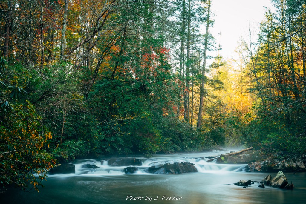
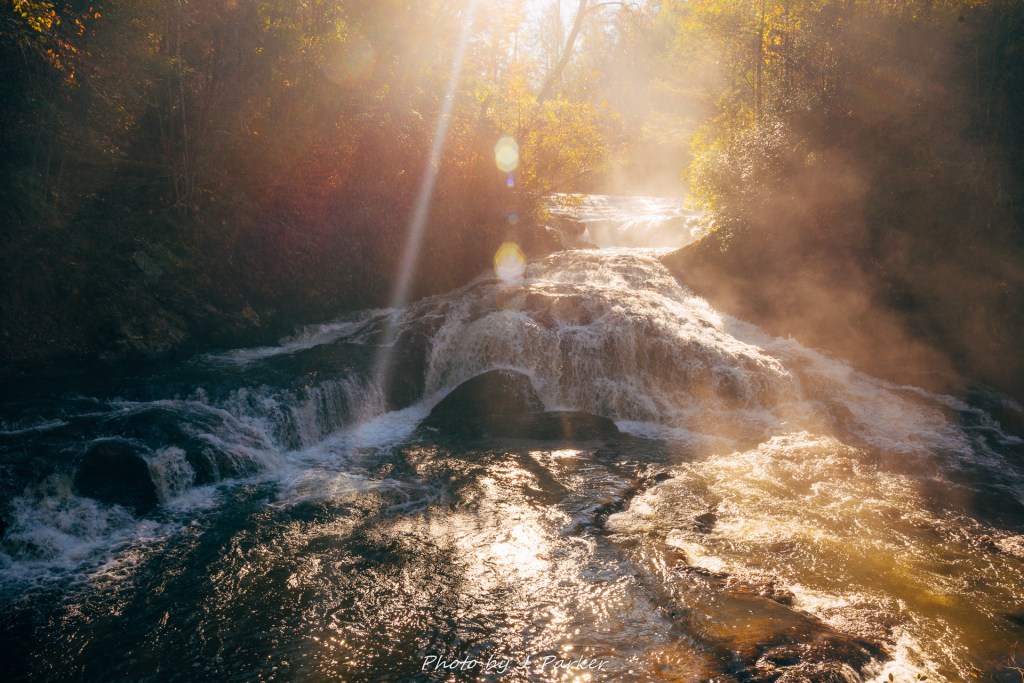
Steam arose from the creek in the freezing weather, partially obscuring the set of rapids I was half-heartedly attempting frame this morning. Steam wasn’t the only condensation I worried about, as every breath I exhaled a cloudy trail from my mouth, which could easily end up in my shot if I wasn’t careful. I wasn’t quite sure how I should photograph this rapid in winding Turtletown Creek, I just knew I probably should. Something told me it was probably the real shot I’d get at this creek on what should be a sunny day. I finally got a frame that at least seemed mediocre and I went to tighten my tripod to look it in. And….the tightening mechanism wasn’t there. Where once a convenient arm stood out on my lightweight travel tripod, there now stood an empty hole. In vain I foolishly tried to tighten every other mechanism on the tripod, hoping it would at least stabilize it enough to allow me to get a few shots. It wasn’t enough. My long exposure was blurred. And I had broken yet another tripod.
This disappointing episode was just one in a constant series of unfortunate events which would result in me leaving Tennessee’s Turtletown Creek with my head held in shame, embarrassed and unaccomplished.
At least this morning I was able to get up in time. I had spent Saturday evening at a cheap hotel in Blue Ridge, which was nice enough, I guess. That is as long as you didn’t drive your vehicle into one of the potholes big enough you’d need a tow truck to get out of it. I was pleased to see that the trailhead for Turtletown Falls, just a bit north of Ducktown, TN., really wasn’t that far from my hotel. The day was yet another projected to be an intensely sunny, cloudless day, so it was paramount to get on the trail early to catch good light for photographing moving water, but it seemed as if I wouldn’t have to get up an hour before dawn to beat the sun. I set my alarm accordingly, and made sure it wasn’t one of my work alarms (Monday-Friday only) before dozing off.
Getting up on time wasn’t an issue. It was everything after that was.
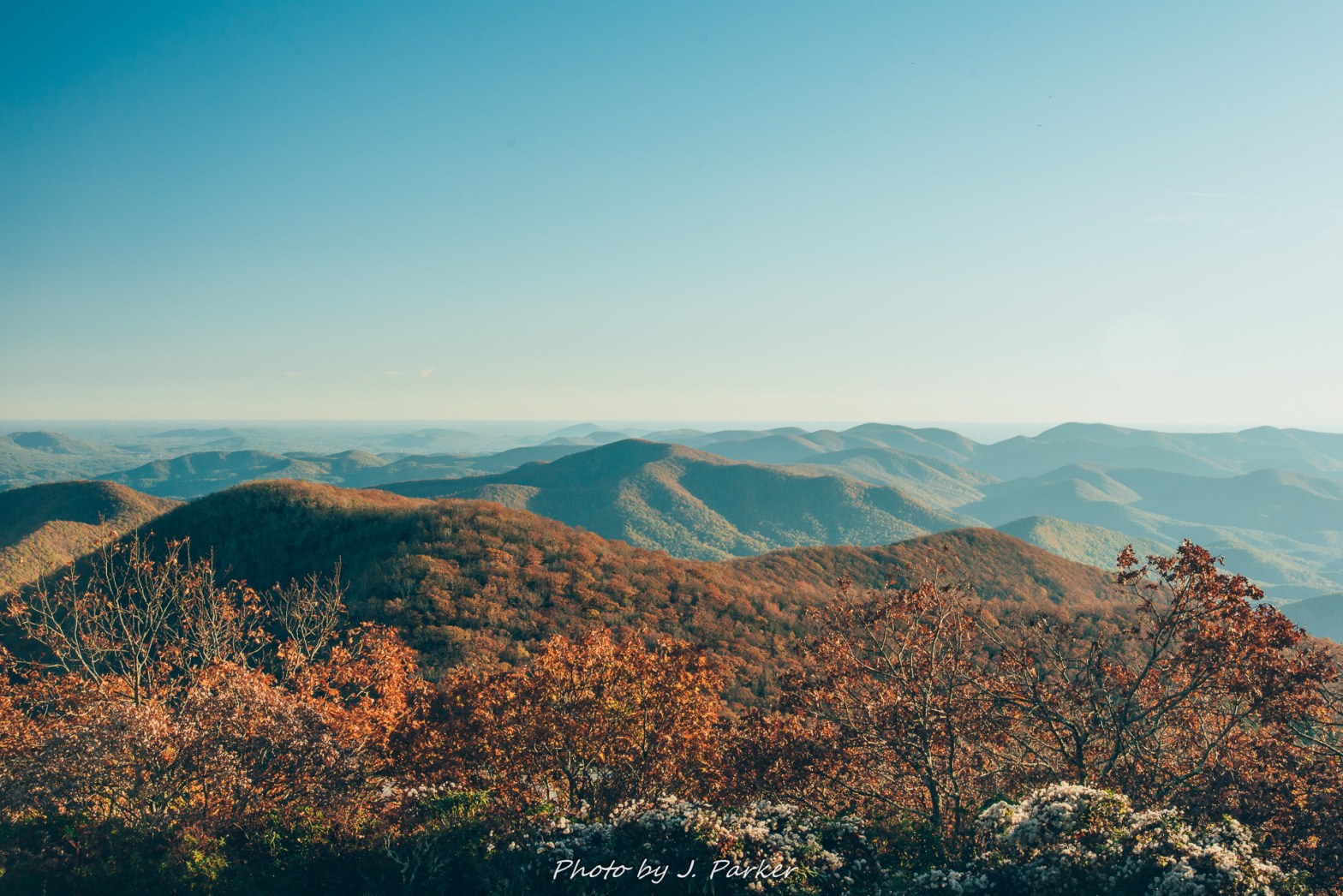
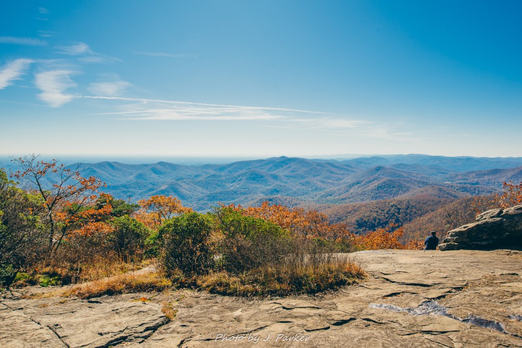
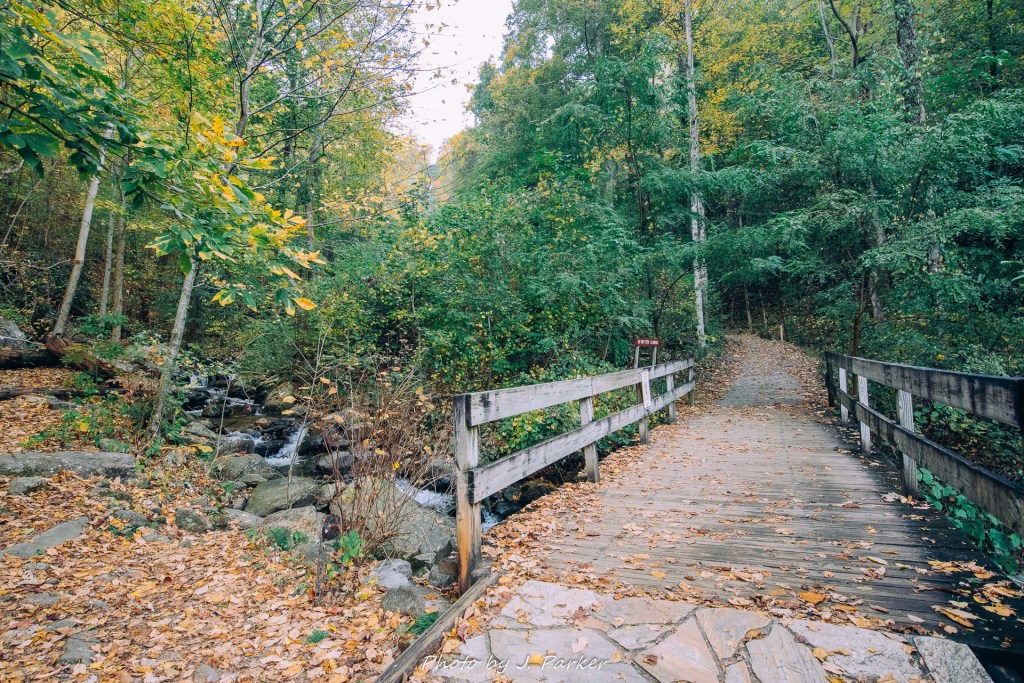
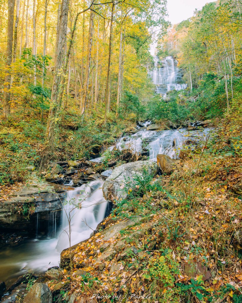
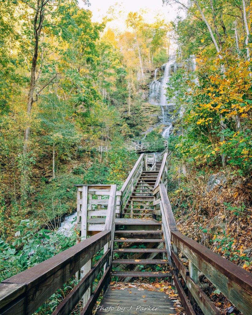
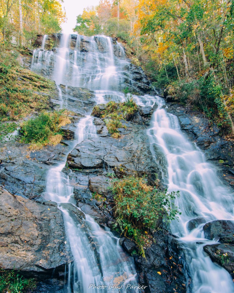
I’d dealt with mornings below the freezing point, even in Florida. It wasn’t my favorite weather to adventure in, but I had good layers that would keep me warm. They had done their job the day before at Amicalola Falls. If there was ice on the vehicle, I’d just turn on the defroster and give it a minute or two to do its work. I could use the time anyway to dial in my GPS, make sure my morning refreshments were accessible, and make sure my wife was aware of that day’s gameplan, just in case of emergencies.
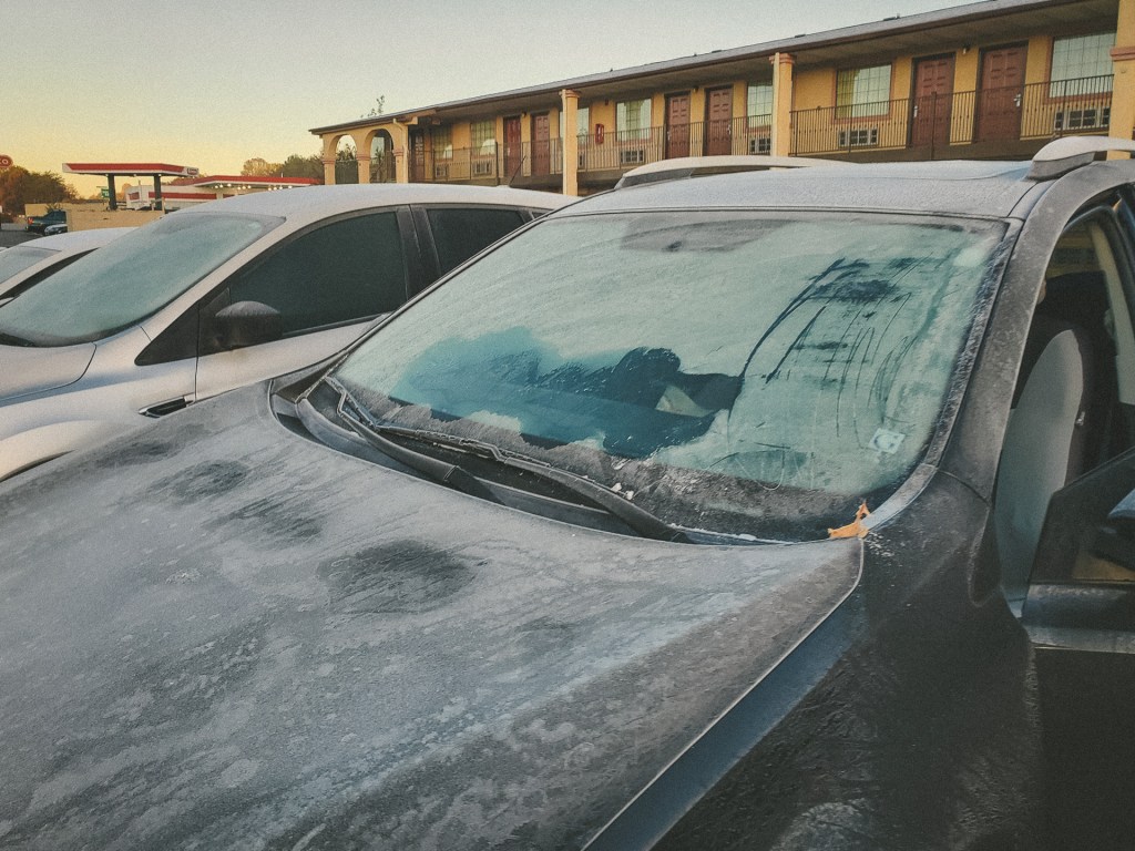
As I exited my hotel room and entered the frigid air, I wasn’t alarmed to find ice caking the windows and surfaces of my vehicle. The amount was a little more than expected, but I had little concern as I started the car and dialed up the front and rear defrosters. All I had to do was sit there and give them time to work. So I sat there. And sat there. And sat there. It didn’t seem like the defrosters were working. I wondered if there was some trick or some thing that people up north do to fix this, something that would be obvious to people from colder climates than Florida. I thought I’d give the defrosters some assistance, so I grabbed a towel from the back of my Rav4, Garth Vader, and started wiping the frozen surfaces. Which did nothing. Hmm. The ice was more than just superficial, it was several millimeters thick. That may not sound like much, but there’s a tipping point where if the ice is so thick, it won’t come off easily. Clearly this was past that tipping point.
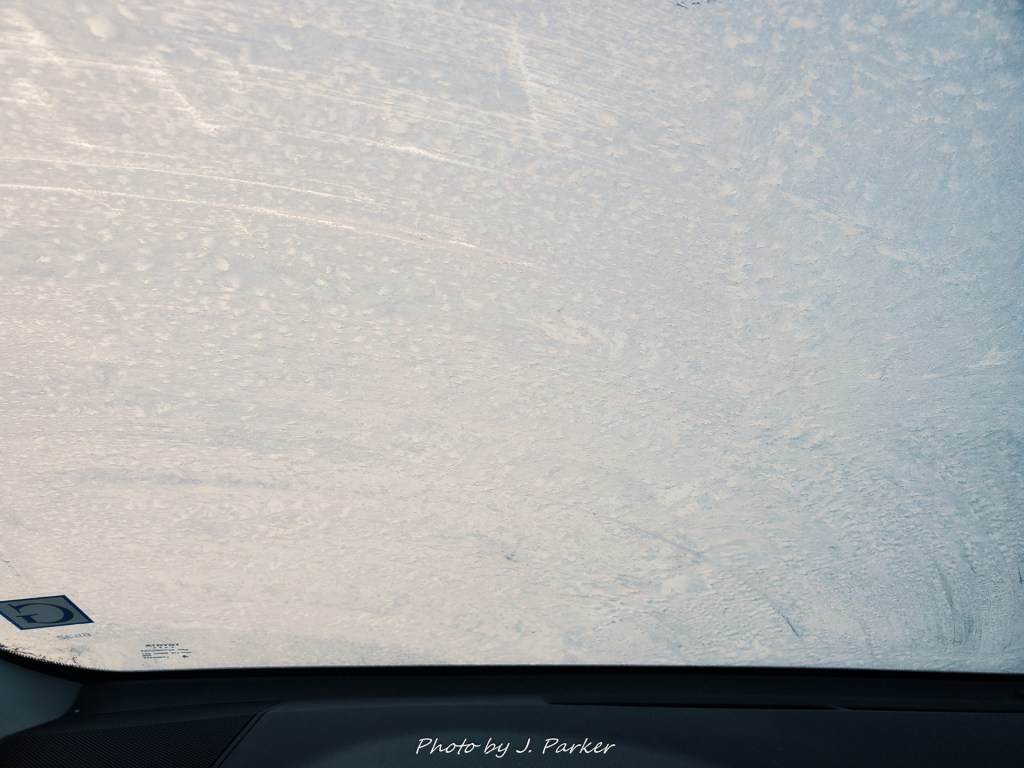
I ran my windshield wipers. They glided gracefully over the surface of the ice. They may have even performed a triple axel. What they never did was move a single particle of ice. So that didn’t work. The towel didn’t work, though I supposed I could have thrown it in. Suddenly, I had an idea. Ever since replacing my phone I had kept the pieces of my old one, including its case, in the pocket of my door. That case practically had armor plating. It needed to be military grade to endure the pounding I put on a phone, and it had held up and protected my first smartphone for years. Thank you for your service. I grabbed its dull red frame out of my door and reached for the windshield. I turned it backwards and gave the windshield one good scrape. And….a layer of ice peeled off with it, clinging to the edges of my old case with the consistency of snowflakes. So this was going to work! Unfortunately, while my old phone had been exceptionally large, and naturally the case followed suit, it still wasn’t actually that large compared to my windshield. So this was going to take some time. Also, my arms aren’t that long. I couldn’t reach every part of my front windshield over the Rav4’s hood. But I could reach enough of it. So scrape away I did, until I had cleared enough of my front and back windshields to make things safe to drive.
I later found out that the actual solution to this problem is not my different than what I came up with. They sell extra large cell phone cases and arm extenders for those hard to reach parts of your windshield. I’m just kidding. Apparently people in areas prone to freezing own scrapers. Good to know. I probably won’t ever need one again, because, you know, Florida.
This whole episode had taken some time. Too much time. I hadn’t given myself too much grace period to get to Turtletown Creek since I’m generally so organized I don’t have trouble getting out in the mornings…assuming I set my alarm right. I was already behind the eight ball and the day had just begun. I set off for Turtletown Creek, a journey which would take me across the state line into Tennessee, but I had to drive rather conservatively since the middle part of my windshield was still covered in ice. I had a small laugh as I noted I had just entered Polk County. Apparently I can never escape (for those unfamiliar, I’m from Polk County, Fl.). I had an even bigger chuckle as I entered Ducktown, which a sign, bird included, proclaimed as “A Quacking Good Place.” I felt guilty for not having stayed there instead of Blue Ridge, but nobody told me about the virtues of Ducktown ahead of time.
At least the sign made me quack up.
I had the trailhead saved in my GPS. Or at least I thought did. It turns out the spot I had saved was only the beginning of the forest road that eventually lead to the trailhead. I might have known this was the case had I reviewed my notes for the hike last night. I print out a physical copy and place a PDF on my phone with directions and guides for all my hikes, both because its important to have that information to safely complete hikes while also being able to locate the points of interest you’re there for, but also because its an additional tool for me to remember the potential stops I have in any given area so I can make the best use of my time. I had considered reviewing the information I had on the hike but decided I didn’t want to do any more “work”, so I deferred, confident that there wasn’t much benefit to reviewing my notes the night before when I would only want to review them again on location.
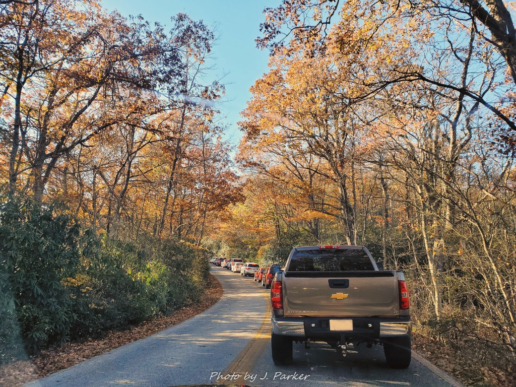
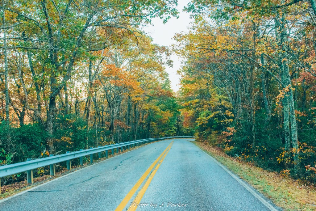
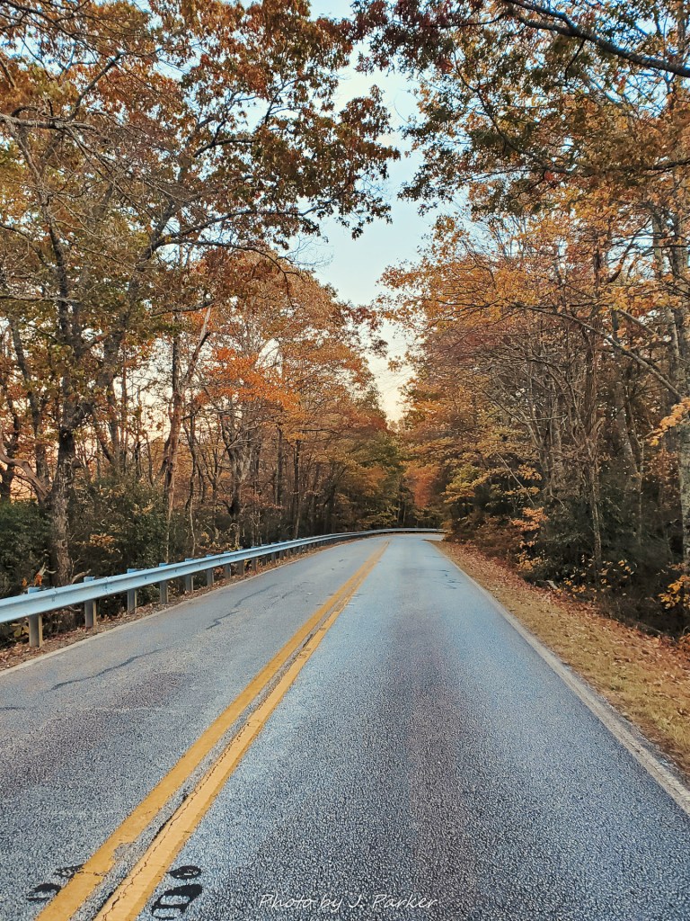
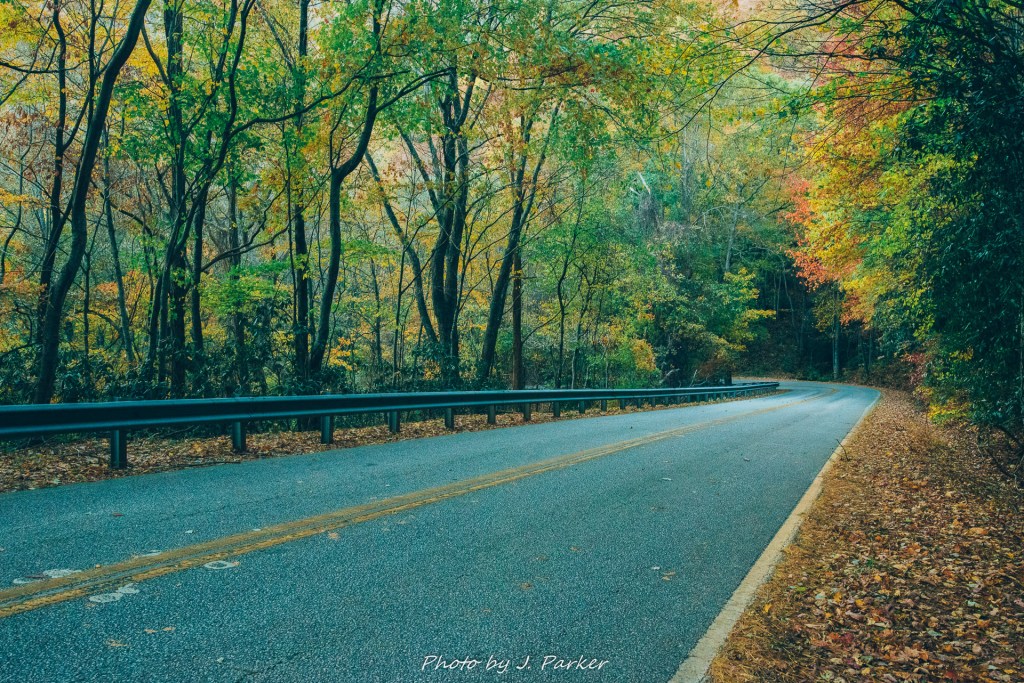
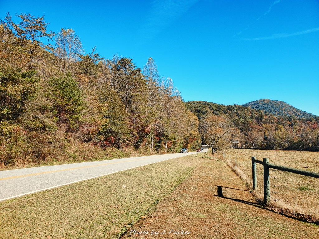
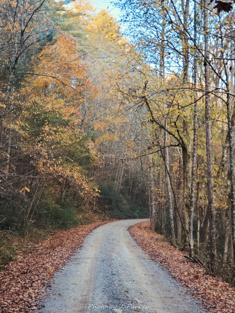
The forest road wound for some distance. Oftentimes one lane forest roads make me anxious, owing to some terrifying experiences I’ve had while needing to move around other vehicles which were not accommodating, to say the least. But this forest road, despite being essentially one lane, was actually a quite pretty drive, providing me with nice scenes of fall color. I made sure my lights were on and kept my hand close to the horn as I rounded blind turns, but I felt pretty at ease as I guided my sport utility vehicle through its natural habitat. And then I reached the creek. Not THE creek I was looking to hike around, but a creek that crossed the road, which dipped down sharply and back up again to allow for the crossing. I hadn’t remembered a creek crossing here. I was prepared to do a creek crossing at some point this trip, for there was a stop in Georgia that was high on my list to visit later, but this one took me off guard. I was a little nervous as I eyed the narrow but swift flow of water, but I figured the road wouldn’t be this way if it were unsafe to cross, so I powered my vehicle through, felt it take the sharp dip, and then it was over. I was through. Only then did I see that immediately on the other side of that crossing was the parking area for the hike. I hadn’t reviewed my notes, but suddenly I remembered that the guides did mention the creek crossing immediately before the parking area, and that if you weren’t comfortable crossing the creek, one could park immediately outside. Oh well, it was done.
Trailheads can be confusing places, especially when they are in remote, undeveloped locations. There are oftentimes multiple paths disappearing into the wood, none of them marked with a sign that says “hike me! I go to awesome places!” (or sometimes, in Florida, they put down signs that make places sound awesome when they are actually wildly inappropriate and inaccurate for the trail they represent). This confusion can be exacerbated by extreme cold, such as the freezing weather I encountered that morning at Turtletown, which was no exception to the law of confusing trailheads. A path ran to my left, reaching towards a rather large and steamy creek. On the opposite side ran some very informal paths which followed the general direction of the creek. To the right of that was a yellow gate guarding from vehicles a rather wide “jeep trail” type path. There was no sign which identified the purpose of the trail and it only vaguely mirrored the path of the creek. Fortunately for me, my notes would help set me on the right trail.
Except I didn’t have them.
I checked my red notebook, stocked with printouts for places spanning northeast Alabama to Upstate South Carolina. No sign. I checked again. Definitely not there. Allowing for the possibility that I may have simply misplaced the printout, I checked the PDF file on my phone. Not there. I scrolled through every entry I had, thinking that somehow Turtletown may have just been misfiled. Nope. I had gotten a delayed start, the drive had taken longer than expected, and now I had wasted a few more minutes as the sun continued to rise in the sky, preparing to bathe the area in picture-killing light.
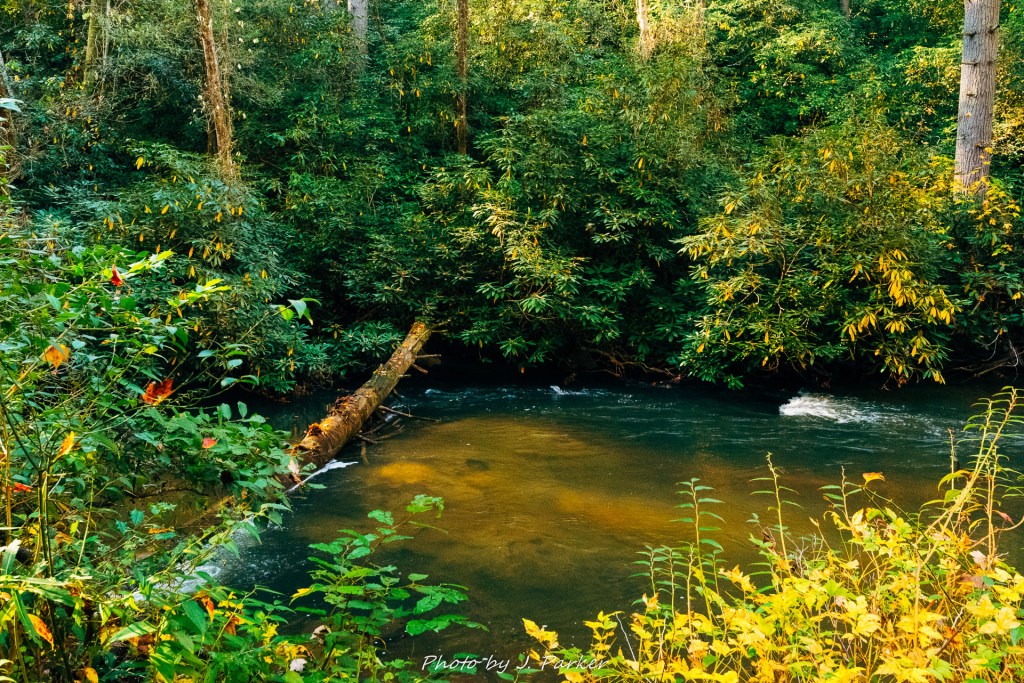
I figured a good place to start would be just having a look at the creek, so I took the short path and was quickly at the banks of its wide, river-like flow. I noted a set of rapids upstream. Though the trail essentially ended where I was at, there was an easy rock hop that lead me to a wide expanse of flat dirt some fifteen yards up. Though I wasn’t particularly inspired by any particular frame idea, it seemed an opportune moment to go ahead and get the ball rolling by trying my first tripod shot. It was after I had setup the tripod and tried to get the camera squared away that I realized it was broken. This wasn’t a fatal mistake; I had two spares in the car, though neither was as easy to operate, and I held out hope that I had merely detached a piece on my journey out to the creek or even in the car. But it was one more dip into a finite pool of time as I retraced my steps and searched in the car for the missing piece. And with all the delays I was starting to feel as if my efforts to capture Turtletown Creek would be futile, a self-fulfilling prophesy.
I took some half-ass shots of the creek and finally got on my way, taking my best guess that the gated trail was going to lead me to the falls, wherever they were, however many there were.
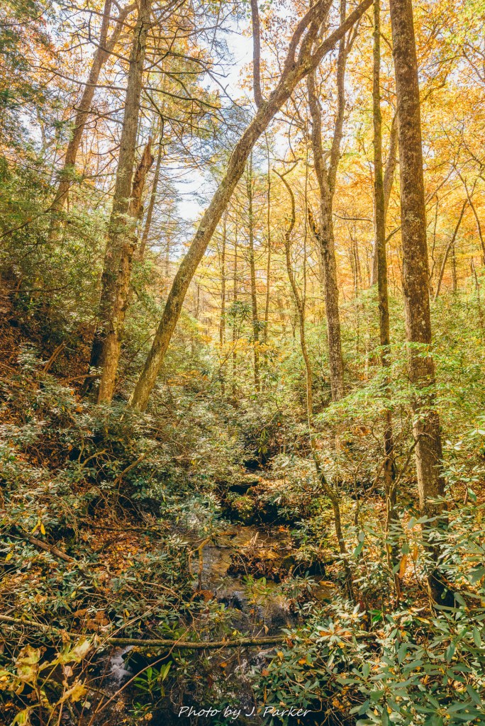
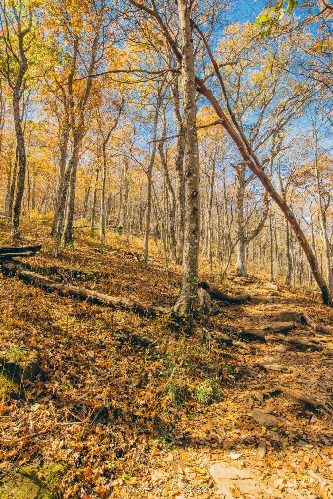
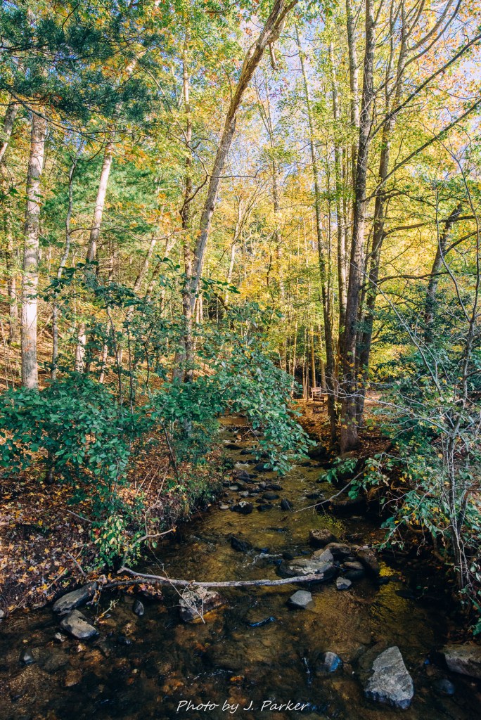
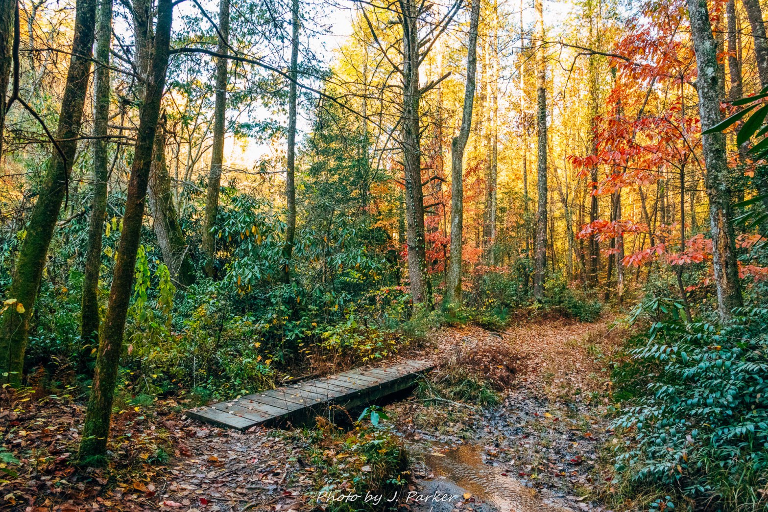
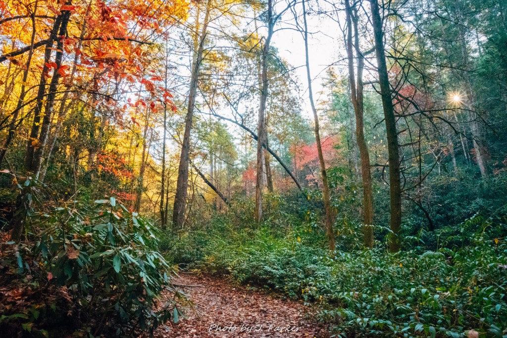
For a trail purported to follow the creek, it started out far from the creek, cresting a small hill before leading down towards the creek. Upon first view of the creek I was somewhat surprised it had a different character than I anticipated. It was less rocky and had more of a lowland feel than many mountain creeks I’m used to, vaguely similar to Dupont State Forest. As someone who enjoys mountain swimming holes, the faint turquoise hue of the water would have been inviting in the warmer months.
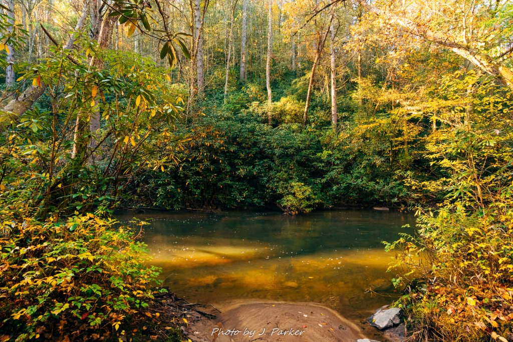
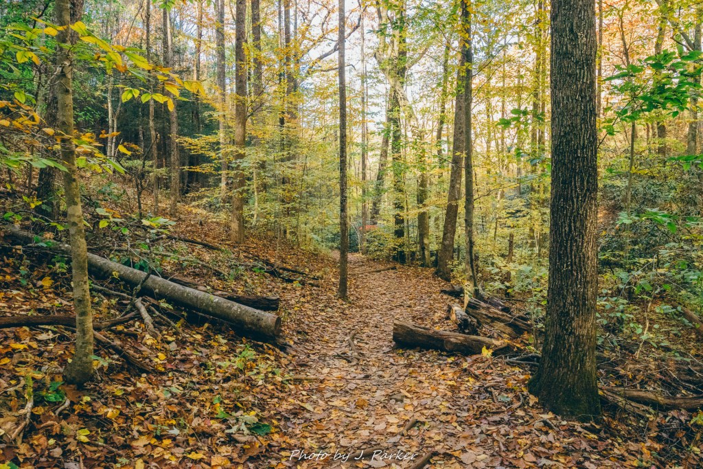
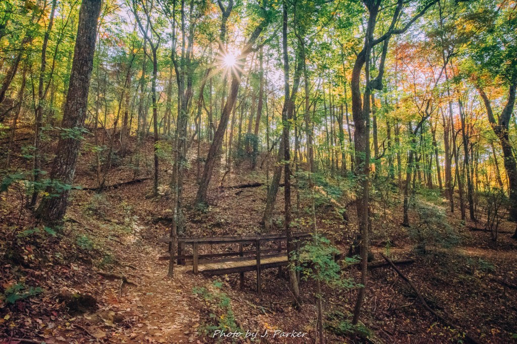
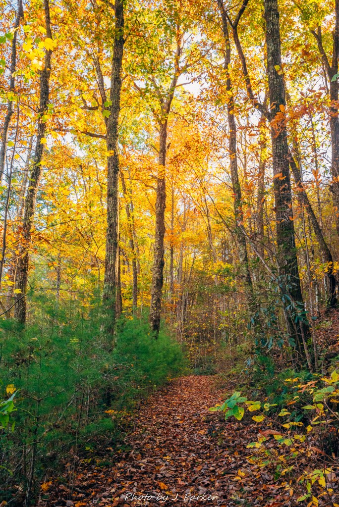
Sunlight began to seep in, and the woods began to have a golden glow in the treetops, accenting shades of yellow and red in some of the trees. The forest was mixed, again rather different than a lot of creek/riverbeds I’ve hiked around in southern Appalachia, and also bringing to mind Dupont State Forest. It was welcome variety.
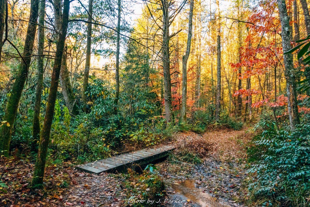
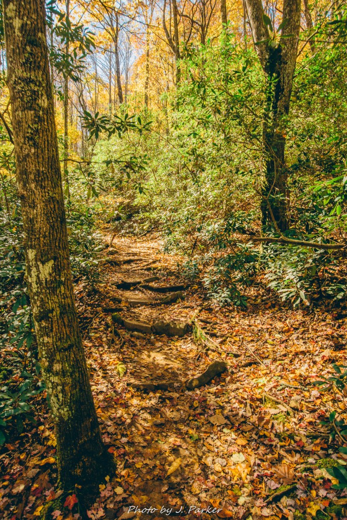
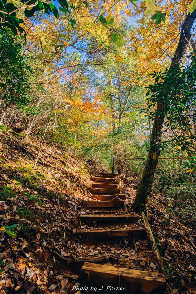
The trail was smooth and easy to follow in this section, though I could imagine some mud developing after a rain.
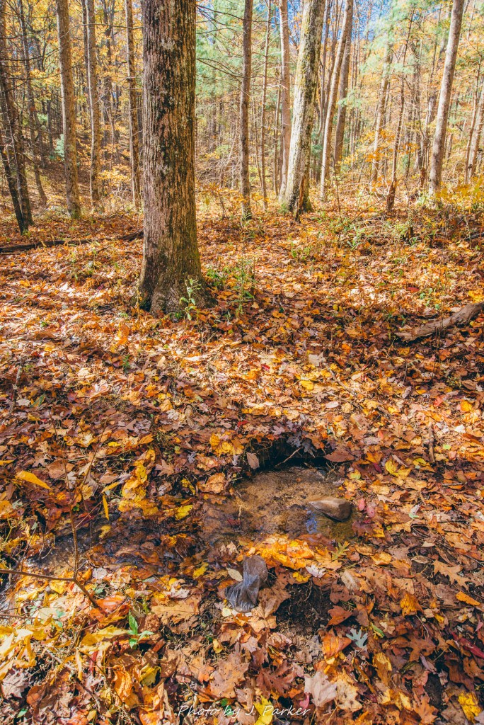
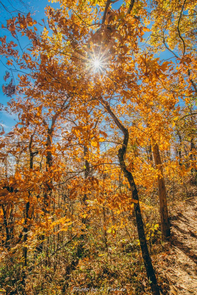
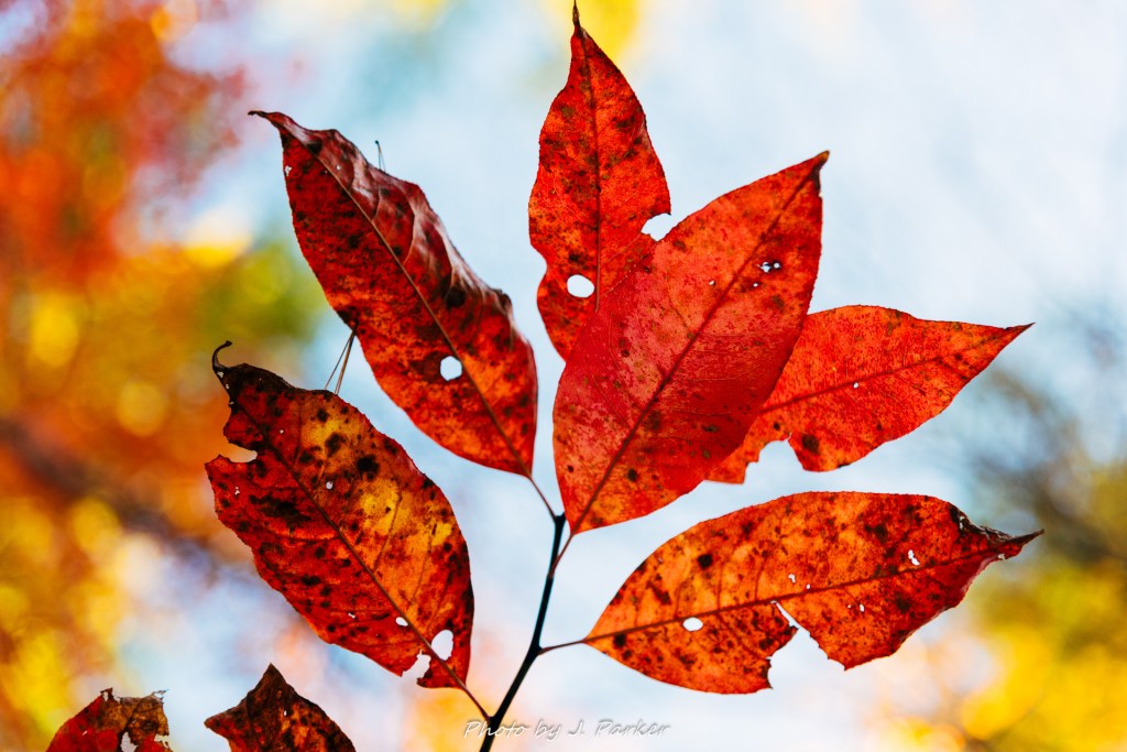
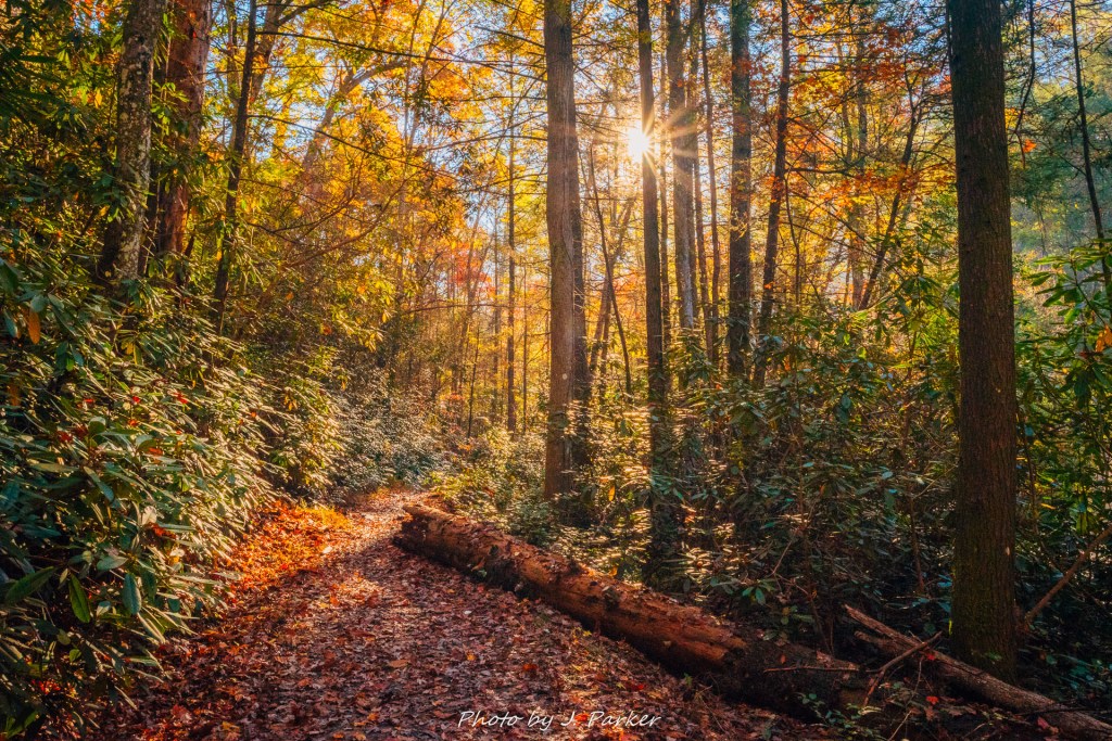
I was beginning to accept that I probably wouldn’t get the waterfall shot I was working for, so I spent some time trying to make the sun and the fall color work to my advantage.
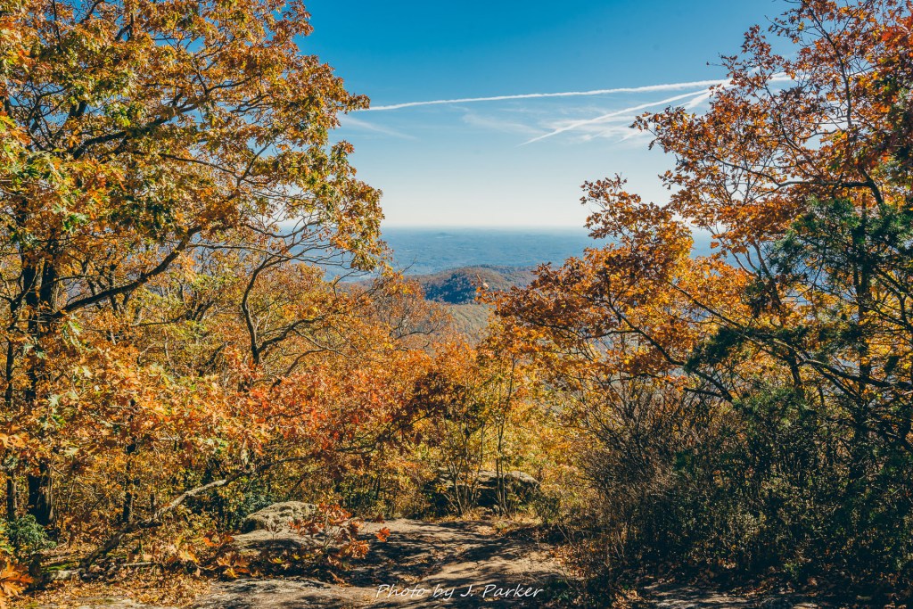
My preference is always to capture full scenes, but us Floridians rarely any true fall color, so I spent some time making sure I came away with shots of the foliage.
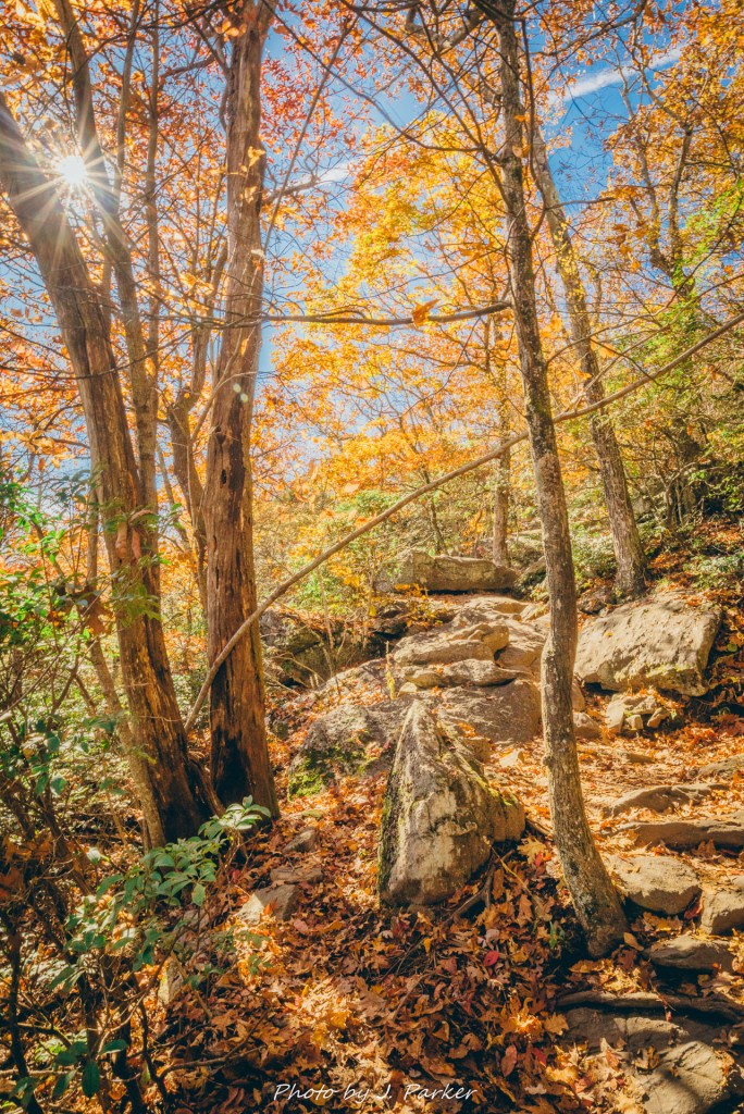
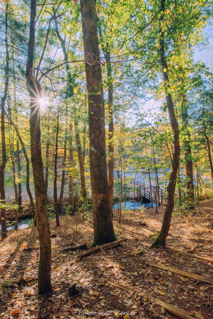
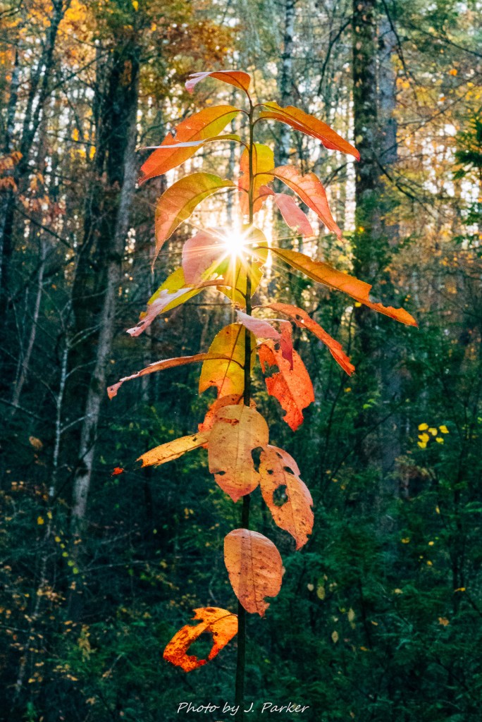
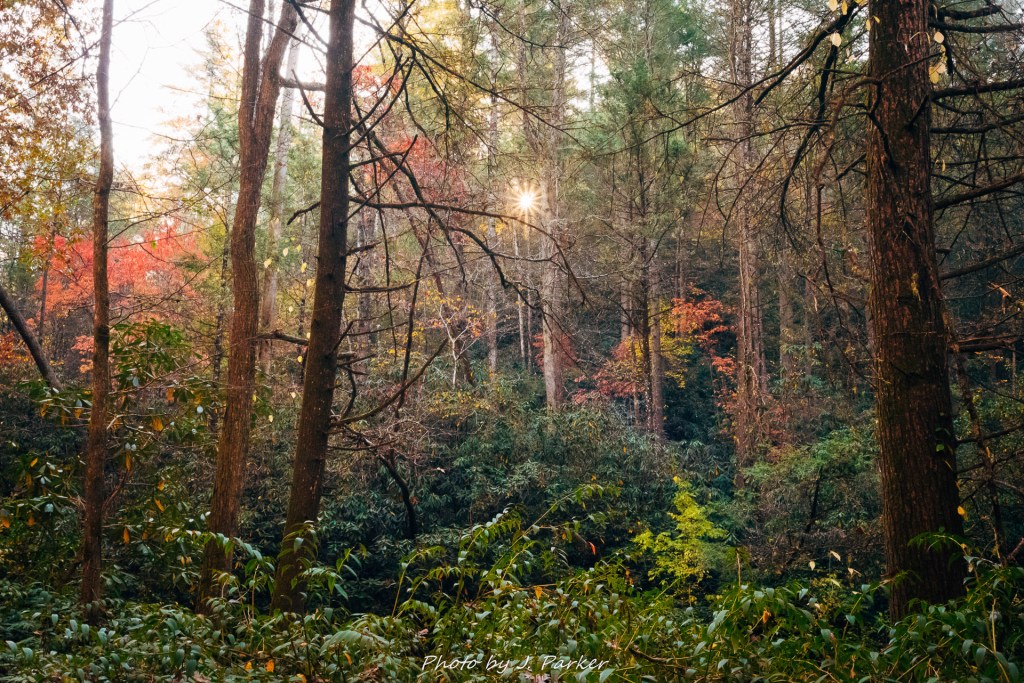
Though I hated to waste more time, I switched lenses to utilize my 18-35mm, a wide angle which doesn’t allow me to zoom in on foliage, but has excellent sun star ability. I’ll always set out to capture moving water, it’s what thrills me and is my bread and butter, but a nice woods and sun flare shot often is more eye-catching and can really resonate with people.
Warning: Multiple Gratuitous Sun Flares Ahead
While taking that last frame I was startled when somebody walked into my shot. It was another photographer, apparently running even further behind than I had been that morning, also out to capture the falls. I was relieved, for I assumed that another photographer would surely have a better idea of the lay of the land than I did. I would find out later that my confidence was misplaced. Glad for the company, I worked hard to keep up with the other photographer’s pace as we discussed the art of photography, the state of fall color in the area, and location information. I mentioned that I wasn’t certain what other locations I would visit that day, but one possibility was the Ocoee River area. He said he had visited the Ocoee recently and the best color he had seen was in that area. I definitely took note.
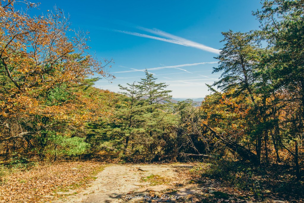
Somewhere just past a mile in a narrow path diverged to the left, following the creek, while the wider path we were on continue straight up a ridgeline. I made mention of the sidepath but the other photographer seemed confident the path to the falls went straight. I continued following him, though this became harder for this out of shape Florida as the trail steadily climbed elevation. Soon we were on top of the ridge with hundreds of feet between us and Turtletown Creek to out left and the river it feeds, the Hiawassee, to our right. I was happy to get a glimpse of the Hiawassee through the trees, for I wanted to explore along this river but ultimately ran out of time. We spent far longer on the ridge than I would have imagined, and it was probably some twenty minutes before we began descending towards Turtletown Creek again.
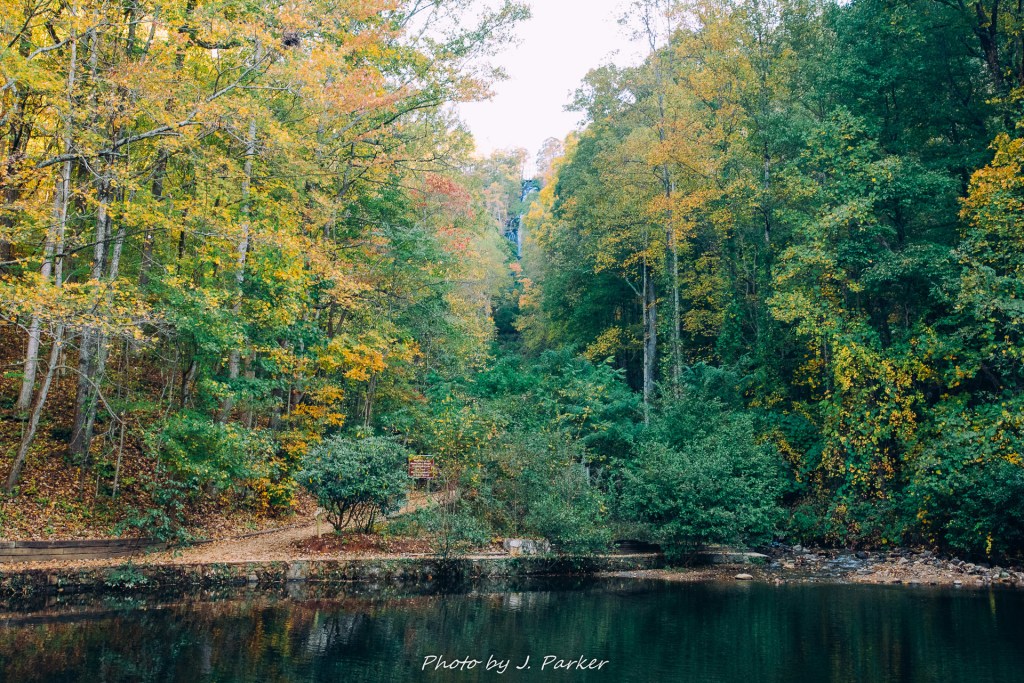
Where the trail met creek level was a confusing series of faint paths, but eventually we located several views of the lower falls. The other photographer recognized the shape. That meant the upper falls had been along that sidepath we had passed up. Unfortunately I couldn’t find where that path would have reached the area we were at. I was later told that there was a blowdown which completely obscured the path and was nearly impossible to safely cross since it was located on an exposed rocky bluff along the creek. My view of the lower falls wasn’t good. In fact, it was a worst case scenario. The sun was perched directly above the waterfall, not only making a good photograph impossible, but even making it hard to see the full contours of the fall with the naked eye. I was disappointed I couldn’t photograph the falls, but I was somewhat relieved to see the light was so bad it released me from the burden of even attempting to setup a tripod shot in bad light.
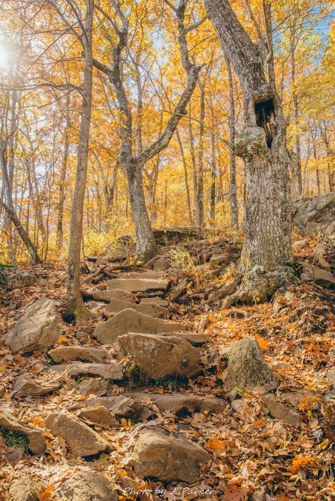
There wasn’t much to do but retrace my path the two miles back to the trailhead. The climb from the lower falls was arduous trek up a featureless, seemingly never-ending gradual slope, which gave me plenty of time to ponder my next moves. With light so outrageously bad, I opted against even visiting the upper falls, which would have involved taking the “side trail”, which actually was just the left part of a loop, some distance downstream. It wasn’t just that I wouldn’t be be able to photograph the upper falls that kept me from visiting, it’s that sometimes you just have such constant misfortune at a place that, knowing you won’t get any more quality photos nor see any non-sun-drenched scenes, you kind of just want to put things being you and pretend like it never happened. And then you write about it so everyone knows what happened and how stupid you were. I took advantage of taking shots of the fall-infused woods when I could on the way back, but naturally that became more of a challenge as the day got brighter.
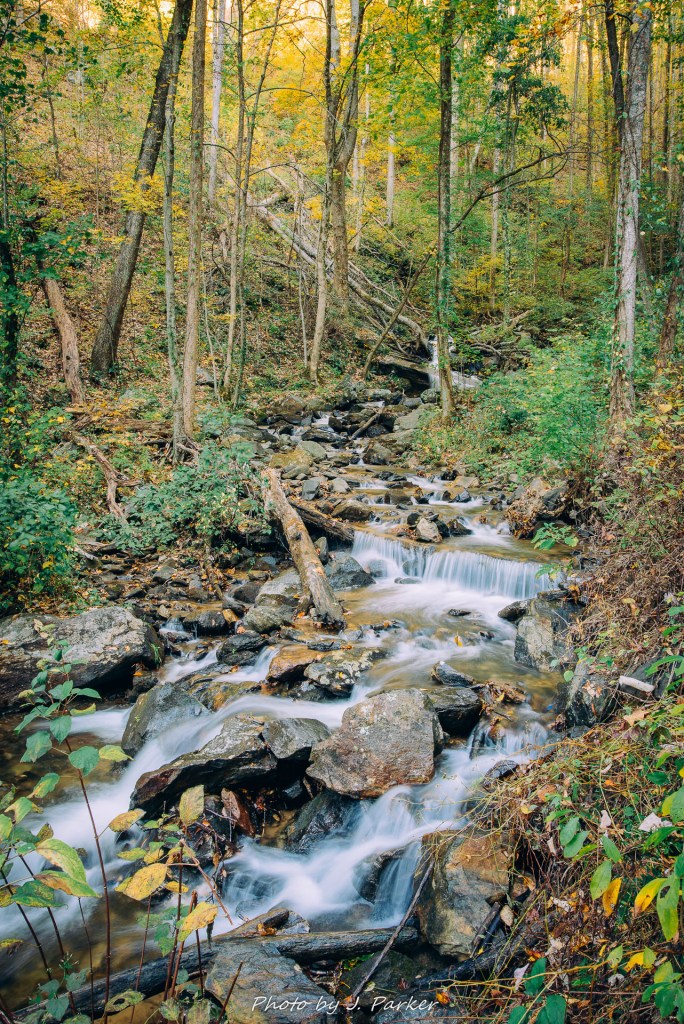
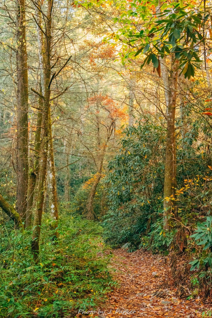
My misfortune shouldn’t detract you from visiting Turtletown Creek. It’s an absolutely lovely location. The woods are truly pastoral, the creek evokes a pleasant feeling as it runs through a varied, thick forest, and the falls are actually nice. Even though I didn’t get the long exposures I was looking for I captured some of my favorite scenes of my four day trip on this hike. The unique character of this Cherokee National Forest hike provides welcome variety from those northern Georgia locations 30-90 minutes away, and I was really glad I incorporated this into my trip. Being that this hike runs along the north side of the creek which flows west, one would benefit from hiking this in the afternoon if they are not able to hike to the falls first thing in the morning. The loop trail, of which I ultimately only hiked a portion (sadly taking the path away from the creek) is around 4 miles, though currently a blowdown might prevent completing the loop, in which case seeing both falls would involve a hike of between 5-6 miles. Ultimately my day in this part of Appalachia was just beginning, and I would have better luck ahead. I’ll leave you with one last shot of the namesake creek.