Yonah Mountain towers over the peaks to its south, being one of the first real mountains rising about the piedmont north of Atlanta. It’s distinctive, prominent peak can be easily identified from numerous vistas throughout the Chattahoochee National Forest, even in faraway locations such as Brasstown Bald. It’s trail, packed with numerous breathtaking scenic views, has become the hikers choice for a vista hike in Georgia, making it a sound place to visit on a multiday hiking trip like the one I was on right now. But I wasn’t visiting Yonah Mountain. Not on this day and not on this trip.
Oh, I thought about it. Part of me still wishes I did. Not aware of how the touch of red from my vista shots at Blood Mountain three days prior would resonate with people, I thought visiting Yonah Mountain, a hike good in all seasons, might not be the optimal choice for a fall day. I thought a better use of the color in the area would be to find water features to photograph, especially since there would be a good chance I would have light more appropriate for canopied shots than open views. So sadly I left Yonah Mountain for another trip, instead planning for a morning visiting a few water locations scattered northeast of Helen, hoping to find shots which really took advantage of the season.
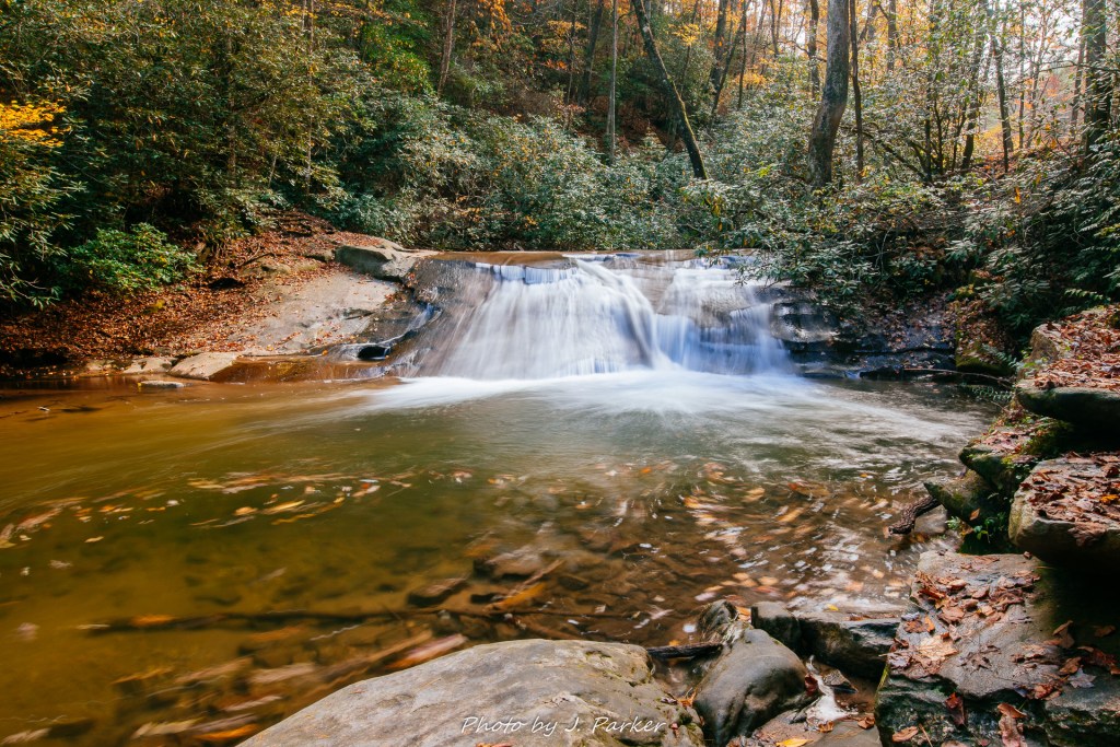
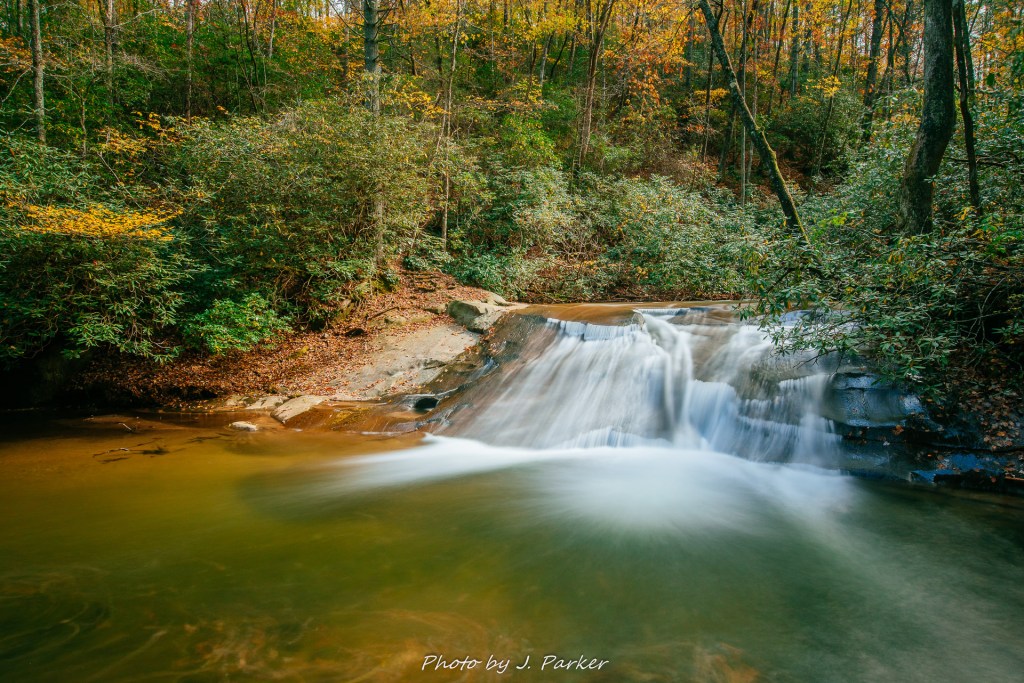
I planned to begin the morning at Minnehaha Falls, a fairly large and well known fall located near Lake Rabun in the Chattahoochee National Forest. While most places identity a visit to this waterfall as a “hike”, the trail to it is so short (.4 miles round trip) that it may as well be a drive-up waterfall. Visiting this fall is so easy, I had been on the cusp of stopping by on multiple trips through the area, but ended up spending my available time on longer hikes. Driving to the waterfall was as adventurous as the walk once you got there. For whatever reason, seemingly every corner I rounded on the winding country roads that Tuesday morning seemed to have a cop alongside the road, waiting to trap an unsuspecting speeder. Fortunately, I’m a suspecting speeder, and I was in no rush that peaceful morning. Though I had GPS directions going, I sped (well, not literally) right past the entrance to the road which led to the falls. This road came up right after a bridge, and the small lane road, scarcely visible running between quaint lake area houses, appeared to be just a driveway in the corner of my eye as I was primarily focused on not ramming someone’s dream cottage (especially not with Smoky hanging about). I only noticed I had missed the turnoff when the road shortly began scaling a ridgeline on a winding course. I found the nearest turnaround point and this time didn’t miss the narrow dirt path that would near the lake shore.
I certainly expected some sort of established parking area for a fall as big as Minnehaha, but I was surprised to find a glorified pull-off along the small dirt road which scarcely allowed room for much more than my Rav4. Luckily, I was once again the first person to park this morning, and fortunately the short trail at Minnehaha Falls leaves little reason for people to linger for too long. As soon as I emerged from my vehicle I could hear the sounds of running water, and I jumped on the trail quickly.
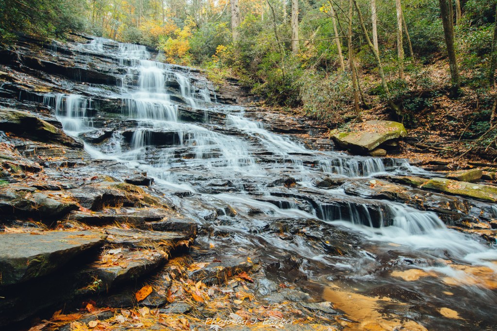
The first few steps of the trail navigated a small set of stairs, but it quickly leveled out. On the short distance to the fall I did make note that this was another location with dense, lush green foliage typical of north Georgia creekbeds. I guess this wasn’t going to be a hotbed of fall color, but it was too late now. My path was set. I was soon at the base of this wide fall. Though it’s a tall fall (taller than it appears in pictures) it appears somewhat obese as it widens steadily towards its base. Though the height is something more impressive in person, I was quite surprised by just how much this one looked exactly as I anticipated from the pictures I had seen. I quickly set out to capture my own pictures.
With its obvious frontal views, Minnehaha Falls doesn’t really leave a lot of room for, nor demand a lot of creative framing. What you see here is what you get, which is probably why visiting this one feels just like stepping into pictures you’ve already seen of it. While I’ve grown quite fond of attacking waterfall shots from the side, but there was little opportunity here, especially without having a super wide angle lens. The biggest question at hand was whether or not to include the tree which stands out from the bottom left of the waterfall. I first started shooting with the tree in the shot, as I wasn’t even sure I had the capability of shooting a wide enough frame to get the full fall without the tree. Since walking there were a lot of flat, dry rocks at the base, moving about was no issue, so I walked past the tree and was surprised to find I could still squeeze the entire fall in without the tree, and I tried a few angles. After my trip was done I ended up being surprised to find that shots of this fall without the tree are actually somewhat rare.
Before leaving I tried my best to get a more angled shot from the side, but there was little opportunity to do so. It was almost a relief that Minnehaha didn’t offer opportunity for a ton of shot variations, as I didn’t feel compelled to spend excessive time trying different angles in hopes of getting a unique shot. As I had to make a rather long drive to Central Florida with work the next morning I only had limited time to explore the mountains, so I wanted to maximize my last few hours.
I was soon on my way back to my car, and as a whole I spent less than half an hour at the fall.
My next stop was also located near Lake Rabun, though this was on the opposite shore. The Angel Falls Trail features two waterfalls on a relatively short hike, with Panther Falls joining the namesake of the trail. These two falls and trail hadn’t earned the greatest reviews from other photographers I had talked to, but seeing as I was in the area, and the trail wasn’t too long, it seemed silly to not visit two more falls along an established trail. The benefit of an established trail is that, in addition to its marked pathway generally providing more pleasing frames while walking than a bushwhack, they are also time efficient in that they are easily found and followed. Only in this case, finding the Angel Falls Trail wasn’t all that easy. I had saved multiple locations as being a potential starting point, and though I am loath to do so when pressed for time I consulted my written trail instructions, which indicated the trail started at a picnic area in the campground.
I zoomed around the lake, though not too quick, for I knew there would be cops positioned somewhere along my drive. My worries about locating the trailhead weren’t unfounded; though my directions very well may have been correct, the aforementioned picnic area appeared to be behind a locked gate. I was dismayed, but I assumed that after seen at least one sign for the trail on the road that it would have to be accessible somewhere. I just had to find where. Eventually I located a small pulloff, which I think was signed from one direction along the road but not the direction I was coming from. This trailhead definitely wasn’t near a picnic pavilion but it certainly seemed to lead where I wanted to go, so I followed as the path disappeared into the woods. It had been an inauspicious start, but at least I was on my way.
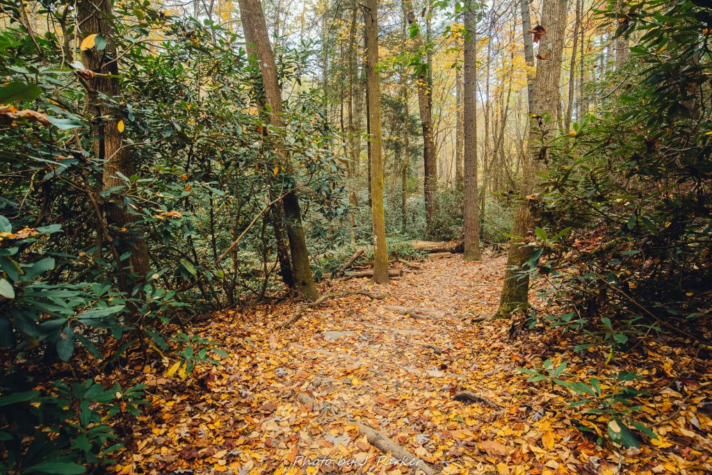
The trail wound a few hundred yards before bridging a small creek in the woods and then turning to run parallel with the road. The early stretches of the trail were nice, but past the creek the woods seemed to be rather dull and featureless. I continued to follow for several hundred more yards before I started seeing clearings in the woods edging close to the trail. It appeared this was the campground I had wanted to start the trail from. It was probably close to a half mile before the trail joined with the campground, with another trailhead visible across a very small clearing. This is where I should have started the trail according to my directions. I was only hiking this trail because it was supposed to be a short journey, not because it held any great scenic appeal that I was aware of. Unfortunately, not being aware that I would be hiking an approach trail before starting the actual Angel Falls Trail, I didn’t realize I’d be adding roughly another mile when I had but short time. But I was here, and I had already sunk that time in. Might as well keep pushing on.
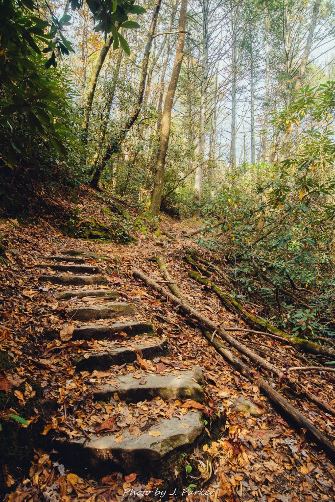
The trail immediately bridged a small creek before scaling a smell set of steps that climbed the bluff along the waterway. This small creekbed again featured that strongly green, distinctly not fall foliage, and the foliage provided a web of branches and root systems which the trail was constantly subject to. This lead to numerous patches of challenging footing, which required far more concentration to traverse than I had anticipated along this short trail. There was nothing insurmountable of course, but it took more time to navigate than I had anticipated, which was another source of frustration added to the extra distance.
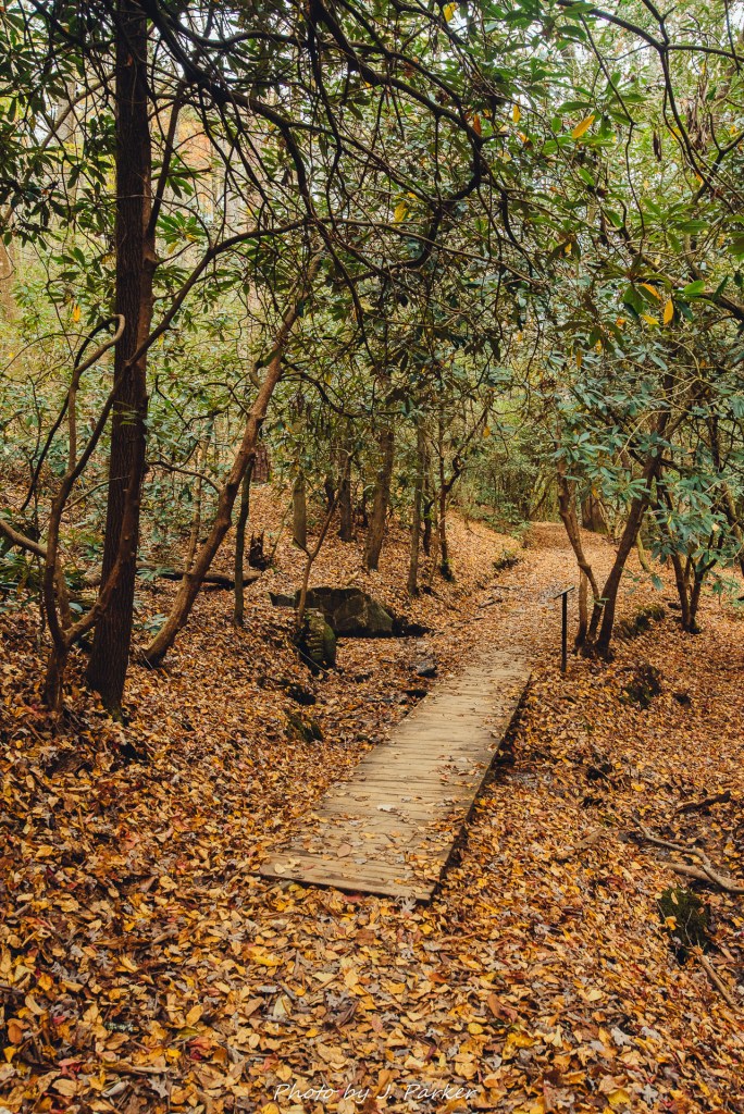
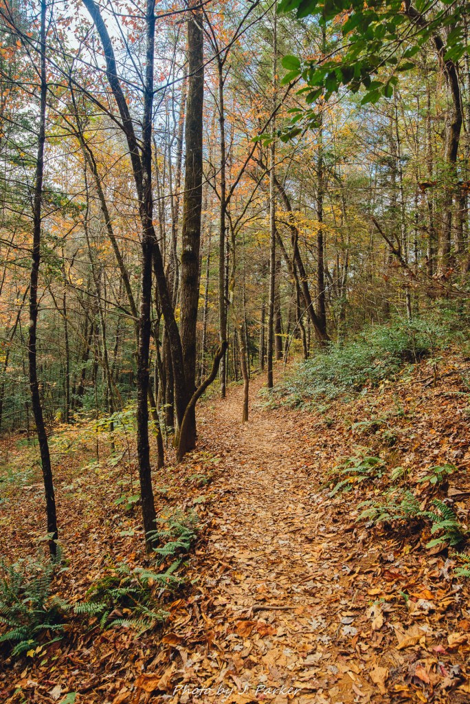
As the trail leveled somewhat briefly a boardwalk escorted it above some soggy ground. To the left was a small spring with a short wall built around it. When the soil wasn’t soggy and the trail left some distance between itself and the creek, pine forest (which had also surrounded the approach trail) creeped in. Though I had seen this forest in upstate South Carolina and parts of north Georgia, this was the first time I was seeing this type of forest on this trip. Unfortunately, it also lacked any seasonal color.
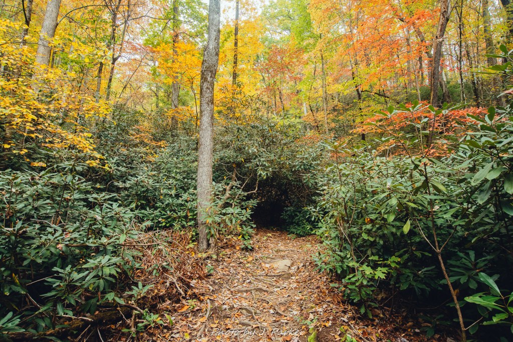
There were several nice moments where the trail crossed the creek on small bridges, with both weaving a serpentine path through the uneven terrain and thick forest. In areas where the canopy thinned out one could see a glimpse of a canopy of red and yellow leaves in nearby treetops, though they weren’t along the trail at present. While the forest was thick, there was evidence that the forest had recently been even more dense. Countless downed trees, their hulks sawed through to allow for passage of the trail, littered the terrain. It was clear that a small tornado or severe storm had at at some point passed through the area in recent years, though thankfully work had been done to clear the trail. This can’t be that rare of an occurrence, as I would have visited Horsetrough Falls northwest of Helen on this trip except for it having been hit by a tornado a few years ago and still having unclear accessibility. I also noted similar downed trees along the Desoto Falls Trail also in the Chattahoochee National Forest but some distance west.
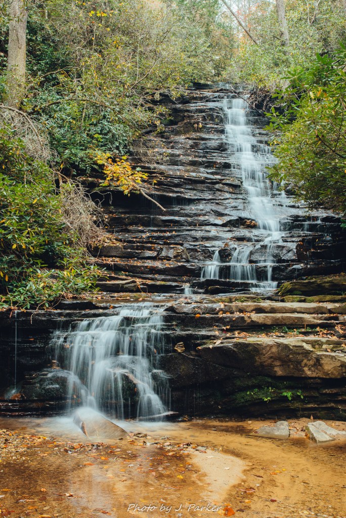
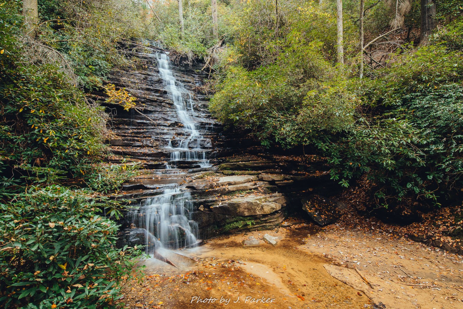
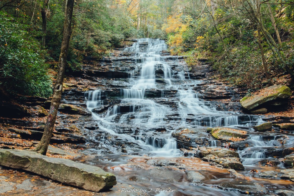
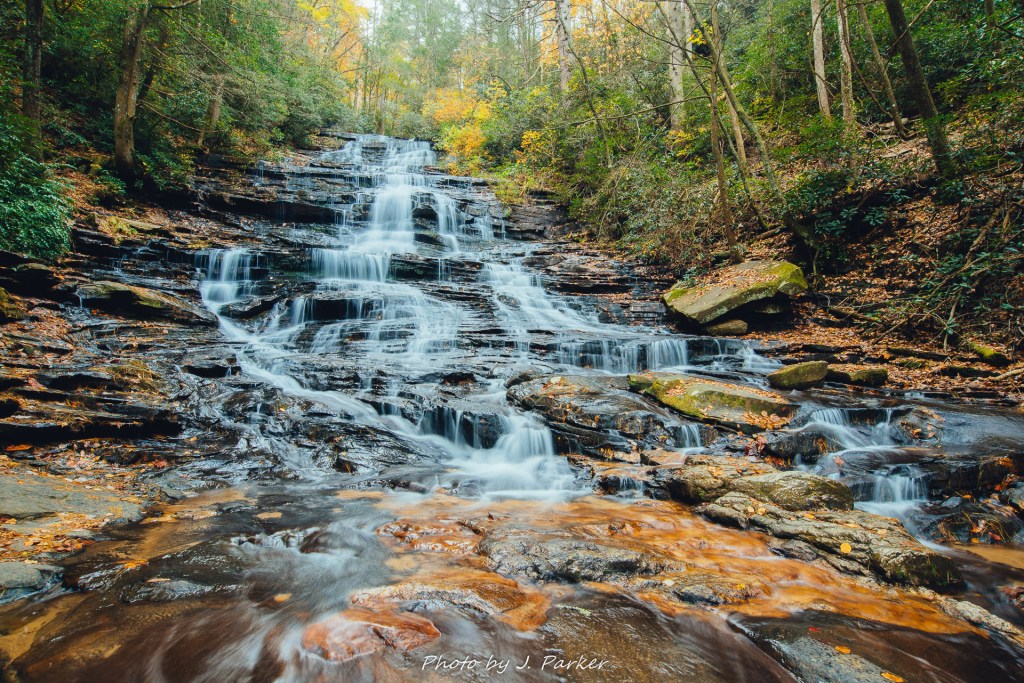
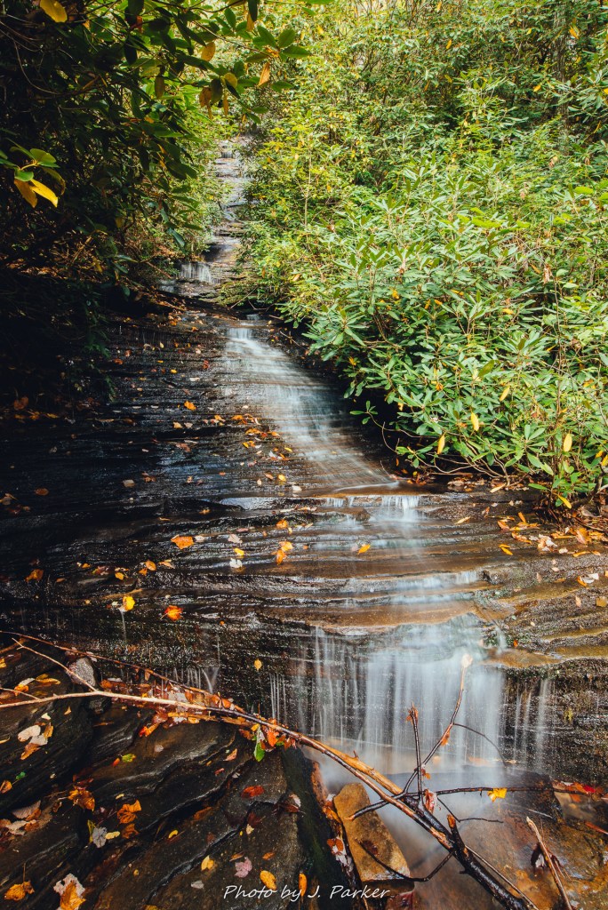
I soon approached the first full size waterfall along the trail, which approaches close to its base. Luckily, though the sun seemed to want to peak out, I was still largely getting good light. I started with a frontal view of the fall, which was so nicely framed by thick green foliage that one could hardly tell it wasn’t summer. I was pretty satisfied with my shot, and I got out my phone to check to see if I may have missed something along the trail which seemed it may have ended here. My instructions indicated that this was Panther Falls, and that the trail continued from the left side of the falls. Only then did I see the trail making a rather steep path up the rocks to the left of the fall. A cable came down to provide assistance to hikers. I was eager to follow the path, for if Panther Falls ended up being such a pleasant surprise, I imagined the namesake of the trail must be even nicer. Before following the path, however, I stopped partway up to take in another view of the falls. I decided to setup the tripod again at finding the new angle, and though I liked the front views of this lush fall, I liked the diagonal angle even more when viewing the shots later.

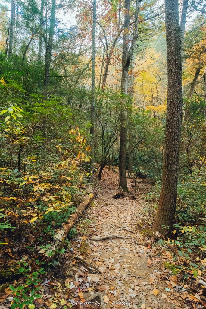
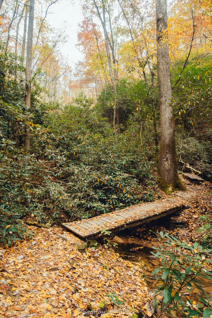
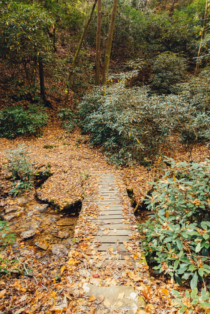
This short section of trail was actually the steepest, most treacherous section of trail I had navigated perhaps during the entire trip, but it lasted a very short duration. Still, it was far from what I had expected on what I thought would be a short foray into the woods. Working my way forward, I soon reached my favorite section of trail, where thick foliage provided a class canopy over a small bridge on the trail. When one emerged from under the shadow of the canopy the understory opened up, revealing for once an unobstructed view of those red and yellow treetops that had been visible earlier. The vibrant tones also seemed out of place in this forest, but I wasn’t one to complain.
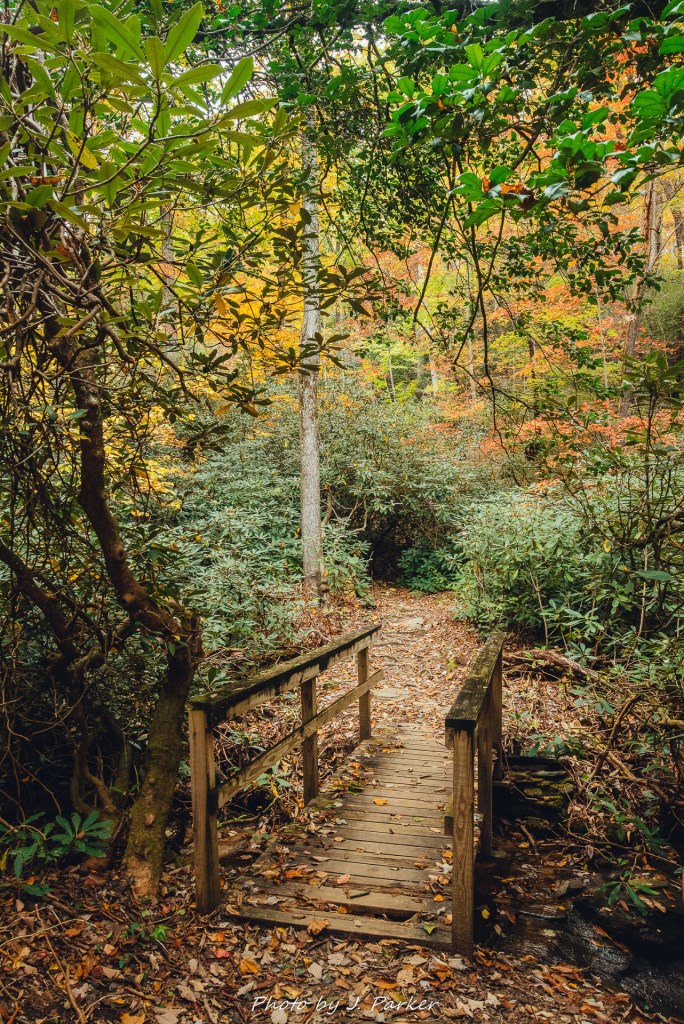
As the trail reached the edge of this forest it made a sharp left turn, and I could begin to see the outlines of another fall up ahead. This also seemed to be the area with the highest concentration of downed trees from whatever storm had passed through. As I neared the falls I was confused by a split in the trail. Not sure why it split, I veered right at this junction, and worked my way up a narrow path before it reached a boardwalk which bridged the creek and provided an up close view of the fall. Unfortunately, Angel Falls didn’t possess a fraction of the scenic marvel that Panther Falls had. In fact, its thin flow scarcely seemed deserving of being a named waterfall. Its flow couldn’t have been more than four feet wide at its largest, and much of the fall was obscured being thick green foliage. It was baffling that they had named this trail after this fall, though I could imagine that its beneficial to not have a Panther Falls Trail relatively close to the Panther Creek Falls Trail, which provides what is sometimes called Georgia’s most popular hike just a few miles away. Since I was here, and it was after all the namesake of the trail, I took a long exposure before leaving, but there wasn’t anything really compelling to frame.
From here, I retraced my steps, anxious to finish the trail which had taken much longer than I had anticipated, and which, while it provided one nice fall, had ended with such a disappointing namesake. As I neared my vehicle along the approach trail I suddenly encountered a sizeable group of rather elderly hikers who seemed to have somewhat limited mobility. I briefly discussed the trail ahead and advised them there were sections that may be tough to navigate, especially after the first waterfall. I told them my honest opinion that this trail didn’t hold a candle nearby locations like Anna Ruby Falls which, aside from providing outstanding season beauty, were also a much easier passage. They thanked me for my advice and I hoped they took it, for I’m sure they would have found Anna Ruby quite magical.
Wanting to pack in a lot of locations on this trip I hadn’t done a lot of bushwhack, offtrail type visits. With the multitude of locations I had gotten to the last two days I had seen pretty much all of the easy access sites I had been aiming to see. I was finally liberated to find a few lesser known roadside creeks and falls I had researched, hoping to get some more unique shots in my last few hours. There a special amount of pride and bragging rights you get from shots in lesser heralded locations.
My hopes were quickly dashed. I rounded a corner to find the road was blocked by a police car which had someone detached itself from speeder duty to dash my hopes. I had no information on why the road was closed, how far it was closed, or whether the locations I was hoping to access were part of the closure. I could have taken a circuitous route around to find out for certain, but I took the road closure as a sign that I wasn’t destined to visit my spots along this road today.
If not those spots, then what? I make it a point to never end a trip or an adventure outing on such a sour note. There had to be something worthwhile to end the trip with. Without much time I put Garth in gear and headed towards the only nearby place I could get to without directions in Moccasin Creek State Park. I had hiked the Hemlock Falls Trail before but hadn’t been able to make it down the unmaintained path to Upper Hemlock Creek Falls. I wasn’t super excited about this prospect, as I would have to do over two miles of trail I had already done and photographed well a year ago. It would be a lot of wasted time and I would probably not be able to resist the urge to photograph spots I had already photographed. Therefore when I got to the turnoff for it and saw that park road was under heavy construction I considered it a sign. Fortunately, Wildcat Creek Rd. was just a mile away.
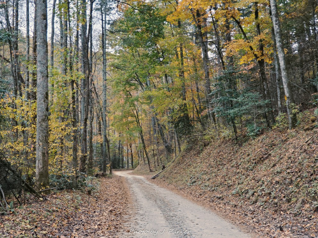
Wildcat Creek was another location I had visited a year ago, but I was able to absorb much less fully than Moccasin Creek. I knew there were small pull-offs along the road that would allow me to bushwhack down to the creek for some shots, and there were even several small waterfalls along the road. I was excited as I navigated the narrow dirt road, ready to explore as leaves actively fell on my vehicle and the roadway. I stopped to get out a few times just to take pictures of the nice roadway, trying to savor a bit more of fall before I had to return to Florida in a short time.
Finally I found my first place to pulloff with creek access. I carefully worked my way down the bluff to the creek level. The creek sure was lovely, though mostly green with only fallen leaves on the rocks to indicate the season, but there wasn’t a way to frame it from the shore (a reason why I hadn’t photographed here on a previous visit). But I half expected that. I wasn’t going to be deterred. I needed some shots. I returned to the Rav4, swapped out my shoes and pants for ones I was willing to get wet, placed everything electronic either into my waterproof camera bag or just the car, and headed back to the creek, where I plunged my feet into the cold, fast water.
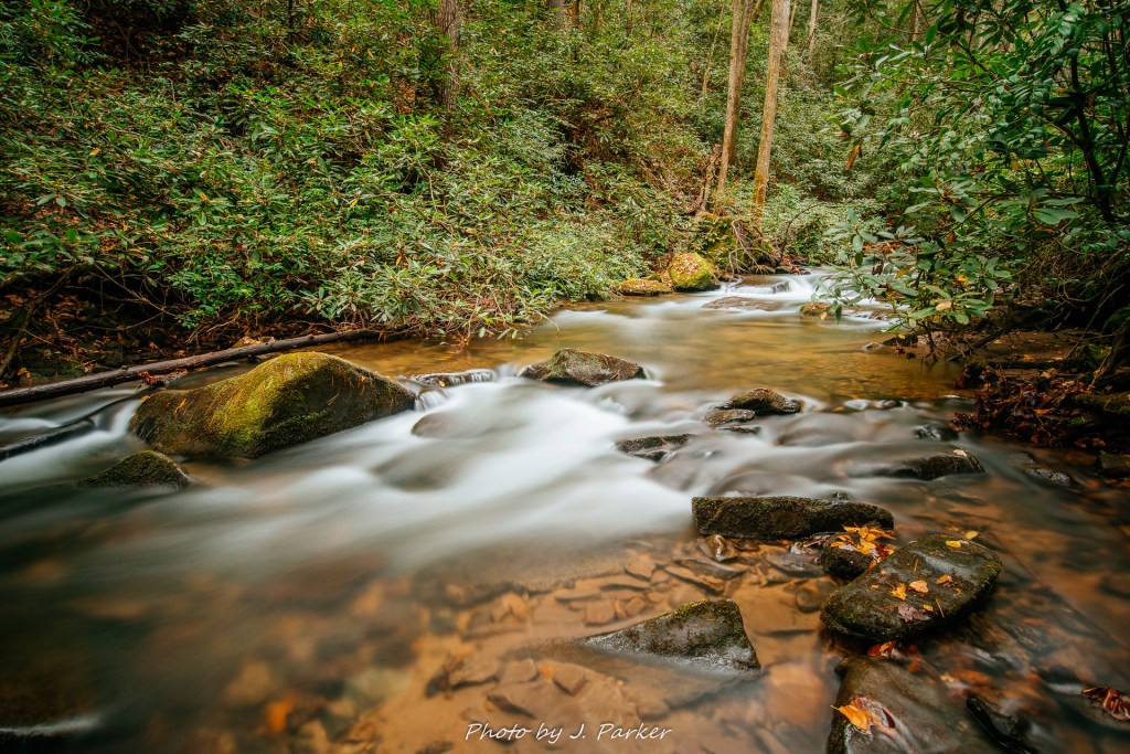
The creek was just deep enough to give me cause for concern, but I found solid, safe purchase next to a rock. I made sure the tripod was as secure as possible before removing the camera from the waterproof bag (ironically, the most difficult part of the whole process) and locked it in place. The spot was secure, and I got my shot before moving further up the creek along a path I had scouted before moving forward. The first angle was good, but the next angle I found was great. I really love shooting creeks, and I could tell right away my composition was banging, and the water was going to look mesmerizing when slowed down.
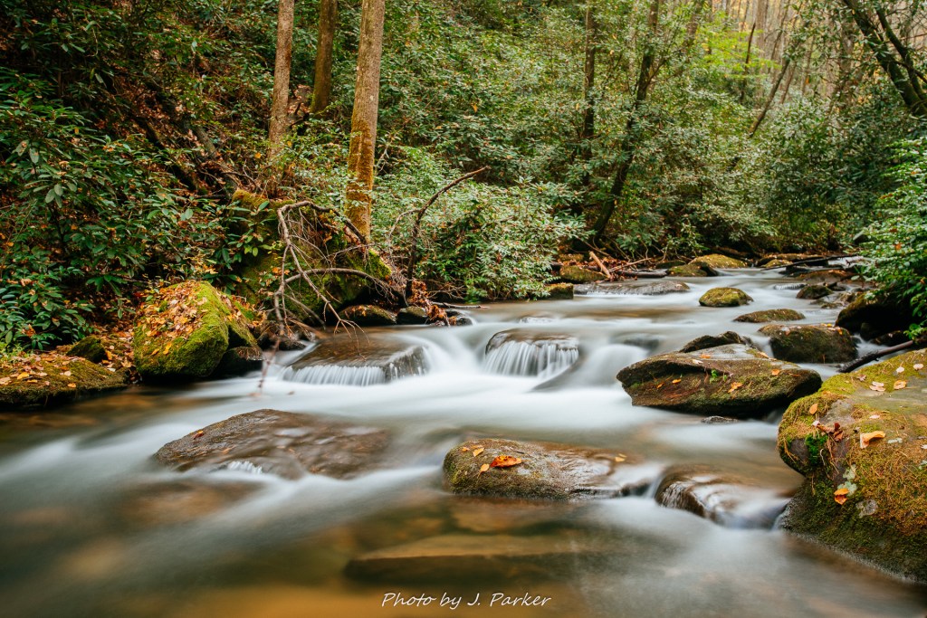
Unfortunately moving farther along this section of creek on foot was untenable, so I had to retrace my steps, satisfied when I returned to the Rav4 that I got some good stuff. Farther along the road I found another pull-off. Without reservation I headed towards the creek and plunged my feet right in again, eyeing a small cascade on the opposite side of the pool. To my dismay, I found that the best frame didn’t require dousing my feet in the cold creek water at all, but it was but a minor inconvenience which paled in comparison to the challenge of the sun which had decided to come out intermittently. It took a few attempts to get a long exposure which wasn’t comprised by the sun. I got the shot, but I could tell that the sun was going to be an ongoing challenge going forward.
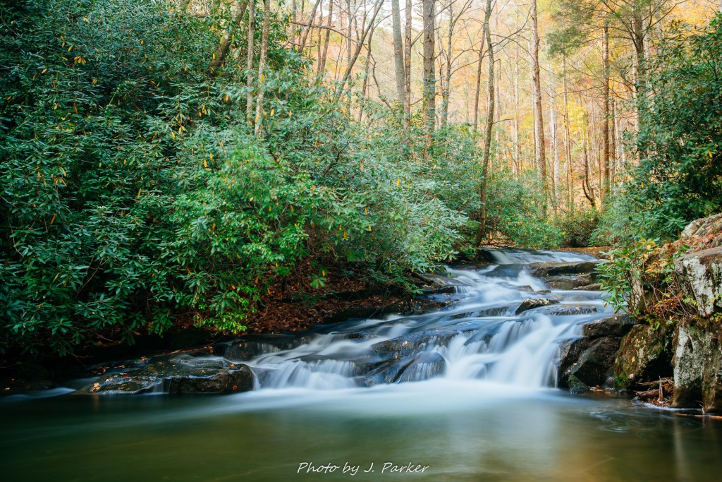
My next stop was at a legitimate waterfall in the creek, one which had to be viewed from the road as there was no way down the bluff here. The day had gotten quite windy, and it was a challenge to try and get a shot of this fall without distracting moving brush in the shot. The water was also flowing very forcefully, making this fall less visually appealing than the rapids on this day. I got the best shot I could before moving on.
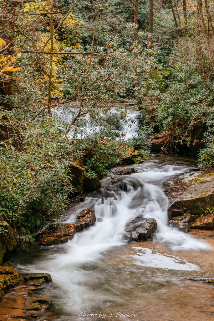
I was now appearing a spot I was quite familiar with known as Wildcat Sliding Rock, a small waterfall which serves as a natural waterslide. During my visit here in 2018 my wife and I attempted to swim before leaving, but the early September day ending up being surprisingly frigid, and our swimming attempts were further frustrated by people attempting to fish in the same stretch of water. I attempted a shot before leaving that day but didn’t really have the right lens to get a great shot. Now I could get a better caliber shot, with some traces of fall leaves to add to the scene, except the sun and wind both combined to frustrate my efforts. I ended up having to frame my shot and wait for the right conditions to take the shot, sometimes taking several minutes between shots. It was becoming clear that, with good photography conditions disappearing, this was going to be my last setup of the trip, as my return trip to Florida needed to begin soon.
Waiting for the right conditions and then taking 30 second exposures gave me plenty of time to enjoy the ambience of this my final mountain scene. The sound of the water, the gently falling leaves, the myriad of colors from vibrant green to red, brown and gold, and the lush woods that filled the gorge where this little creek flowed, I immersed myself in every last detail. I love the mountains, with their vistas, creeks, waterfalls, balds, and mystical forests. For me, Appalachia is the nearest faraway place, one so distinctly different from home, yet oddly enough sometimes the only place I feel truly at home in. I know not when I will be able to visit again, for I have big plans for 2020, but none bringing me here at present. If I do not find myself here again soon, it is not for lack of love, but opportunity. Not every part of this fall 2019 trip went swimmingly, and not every place I visited delivered on its promise, but the trip as a whole was yet another enjoyable, enchanting visit to those places which fill my dreams, and which I’ve made it my life’s mission to immerse myself in as much as possible.
I hope you enjoyed sharing this journey with me, and let me know if you would like to see more trail stories.
