2017/10/16 – Three Falls at Dupont State Forest

The spray from the fall towering high above me reached towards the rock outcropping I stood on alongside the Little River. The spray would make any long exposure tough, for it threatened to hit my camera lens long before the exposure completed, but I was willing to (no pun intended) take a shot. I focused the camera up and attempted to quickly screw the high powered ND filter onto the lens. In my haste I allowed the filter to slip out of my fingers in the wet conditions, striking the rock with a force no filter was designed to sustained. One look at it confirmed its days of usefulness were at at end, and in a moment of anger and frustration I chucked it as far as I could see. Jess saw what I had done and raced over to scold me, and she was right. I had littered the forest, though that wasn’t my intention and the consequences of what I had done didn’t even pop into my head at the time. But as I said before, I was angry. (There’s a popular saying that it’s impossible to hike in the woods and be angry. That person clearly never hiked with a photographer).

It’s easy to assume I was angry at breaking my filter, and that’s not incorrect. I was. But there was more to it than than. That filter had sat in my camera bag for months, waiting patiently to be unleashed in a way that Florida provided laughably few opportunities. As I had established the day before, this filter really was my “secret sauce” that thing that could take a picture and really look magical. Here I was, finally in the filter’s natural habitat, where it could be fully unleashed and where the only limit to its usage was the amount of hours in a day, and I had broken the damn things after waiting half a year to use it. But my anger was greatly added by the fact that I was sick. And I was damn tired of being sick on most of my vacations. Our schedule vacation the year before had been centered around seeing many springs and doing many paddles; in the event I fought a cold that kept me from swimming much for fear of cramping that was never too far away. I had been taking antibiotics for an infection; at this point, I scarcely worried about the infection, but antibiotics just grow in ferocity the longer you take them. I’ve never handled them well, and I wasn’t handling them well either.

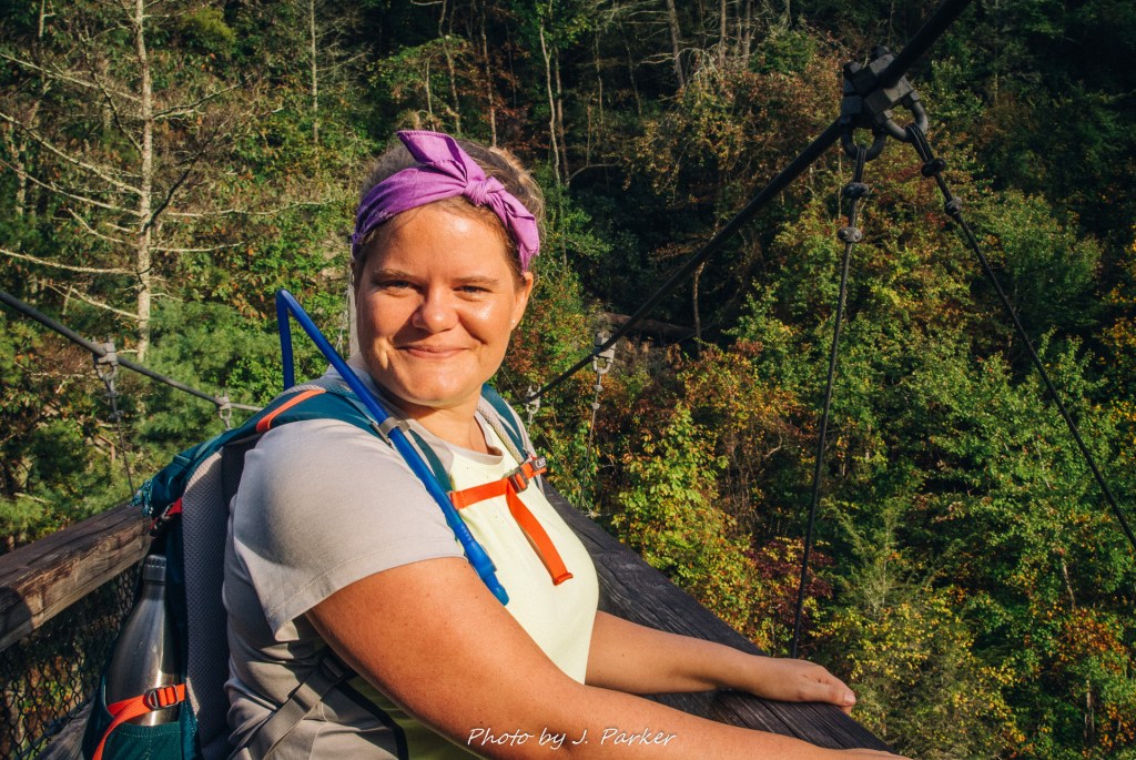
I politely informed Jess of my frustrations and why I had done what I did. Well, I don’t know if either one of us was really that polite in this situation. At least I understood what she was saying, and I was able to communicate my cocktail of frustrations. As it turned out, thanks to Amazon Prime I was able to have a new one shipped to one of our hotels in short time, and I only had a single day of vacation without it – one in which I actually wouldn’t have had much opportunity to use it anyway. And while this was one disappointing happening towards the end of our hike, it in no way overrode the absolutely enchanting experience we had on the Triple Falls Trail at Dupont State Forest.

Dupont State Forest

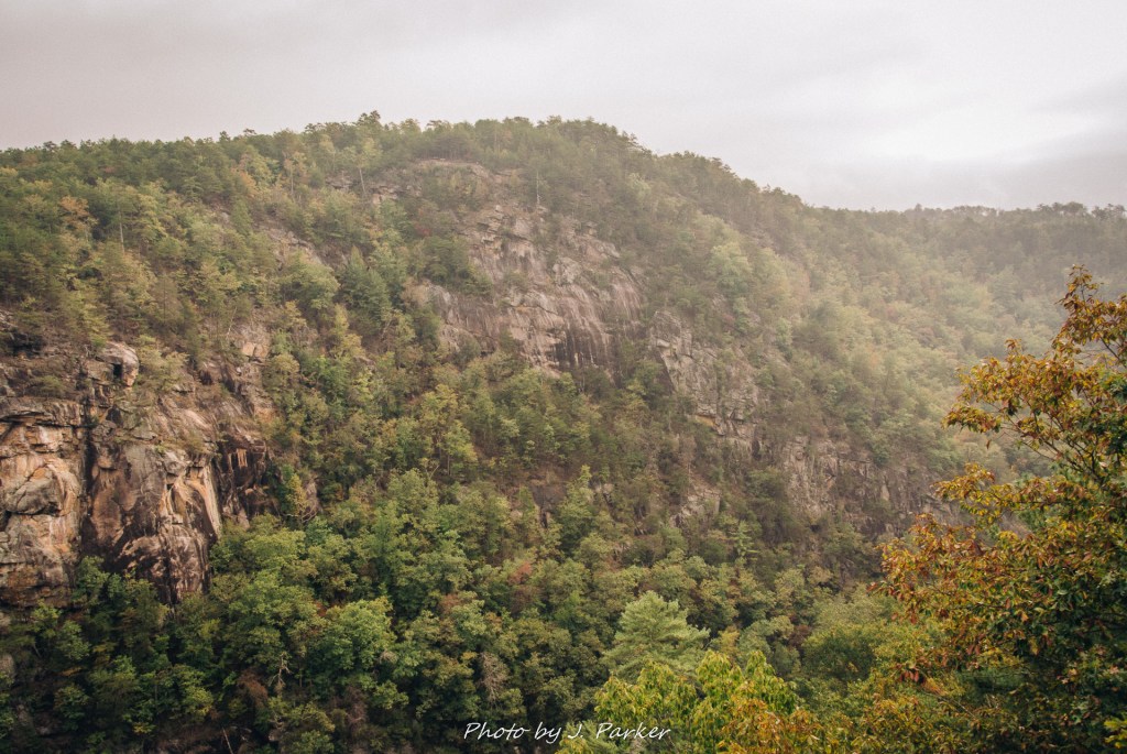
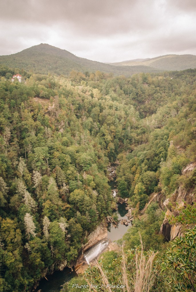
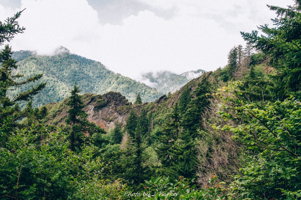
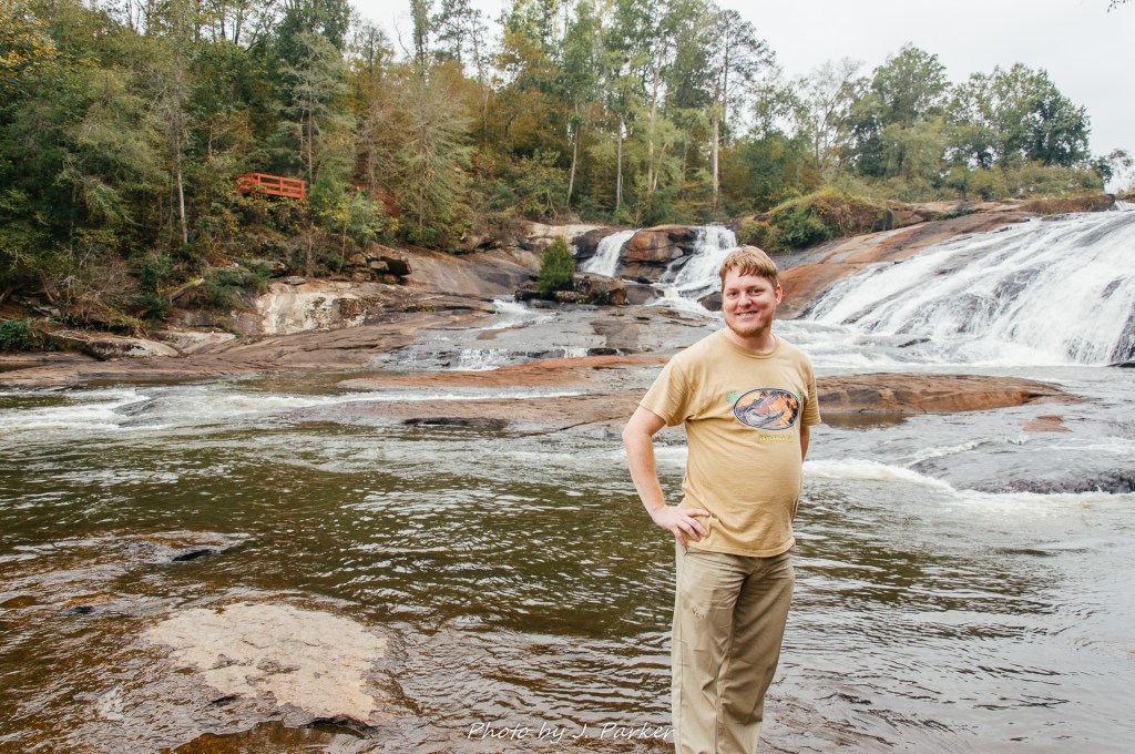
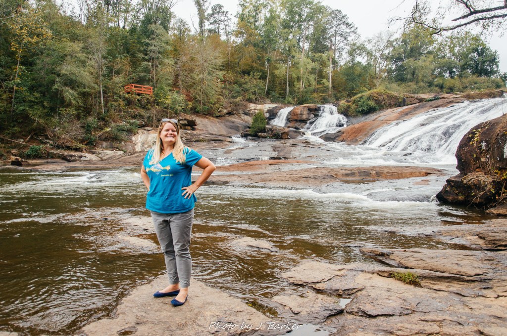
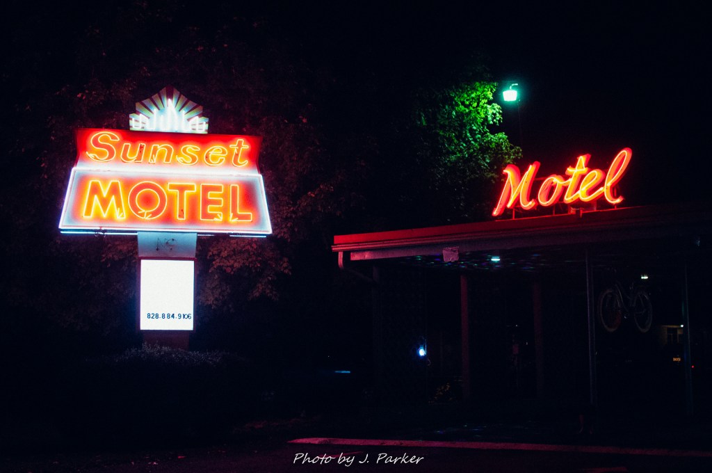
A rather newly created state forest south of Brevard, North Carolina, Dupont State Forest repeatedly popped up as a recommended hike in my trip research. I couldn’t quite fathom why. While the Triple Falls hike naturally offered the chance to see three waterfalls in a relatively short distance, I wasn’t overly impressed by images of any of them. There weren’t any vistas along the trail to supplement the waterfalls, so if the waterfalls weren’t that great, how could a waterfall-centered trail be a top hike? Skeptical as I was, it made sense for us to visit, as we had found lodging in Brevard for two nights (no easy feat to be able to book two nights a row during the busy fall season) at a fun-looking retro-themed hotel, and the state forest was just minutes from town, quite a treat when you’re visiting mountain locations. We were going to have find out for ourselves whether this state forest met the hype.

Our hotel in Brevard.

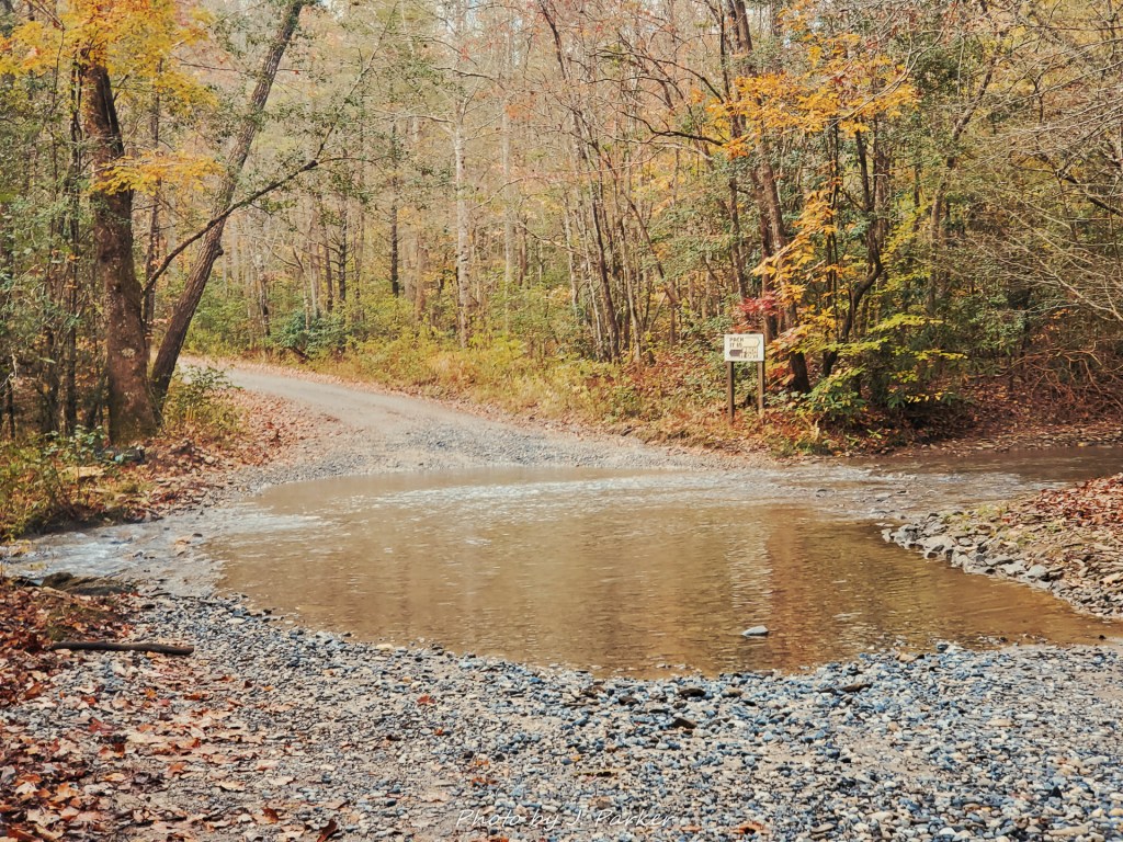
We set out fairly early that morning. The weather was delightfully cloudy, with some light drizzling happening on and off, but it was supposed to get sunny later in the day, perhaps before we finished this morning hike. Dupont was only a moderate hike of a few miles, with elevation change not really being a factor all things considered (this was a boost when planning the trip as my hip’s ability to be hiked with was truly in question). Though Dupont offers a wealth of hiking opportunities, the three falls route we were doing, visiting Hooker Falls, Triple Falls, and then High Falls, is the signature hike of the park, and garners the bulk of visitors who enjoy the casual hike. There are several different ways we could do this hike, but we opted to visit Hooker Falls first since my research advised that one tended to get busy quickly and I wanted to photograph before others arrived.

The beginning of the Hooker Falls Trail.

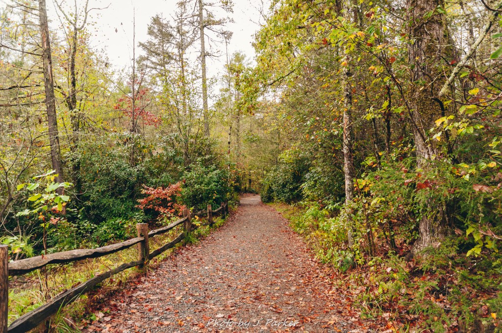
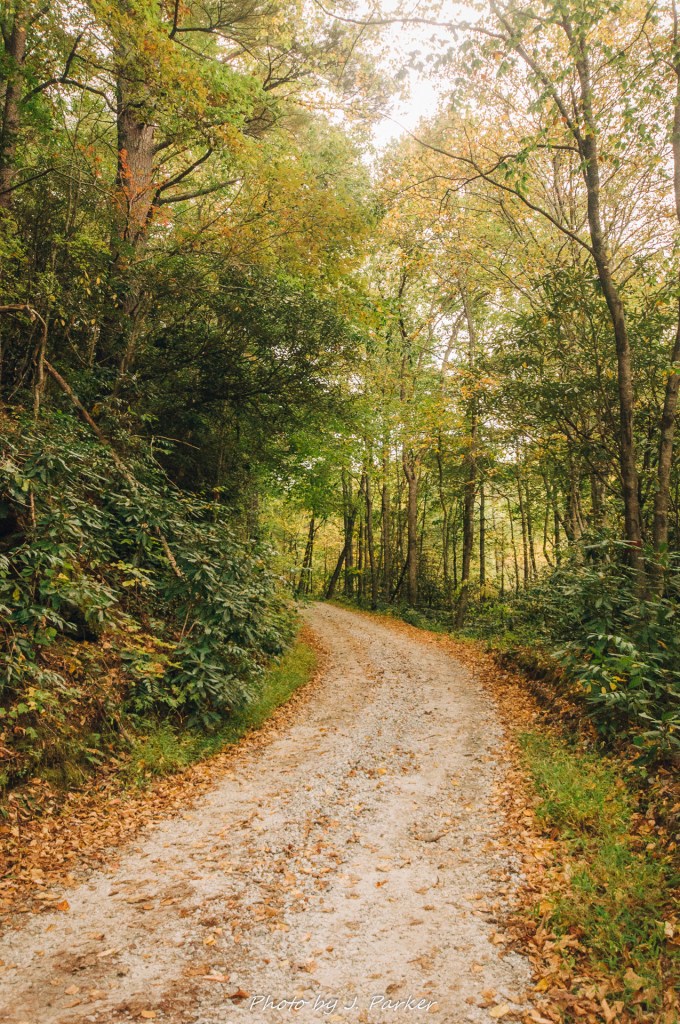
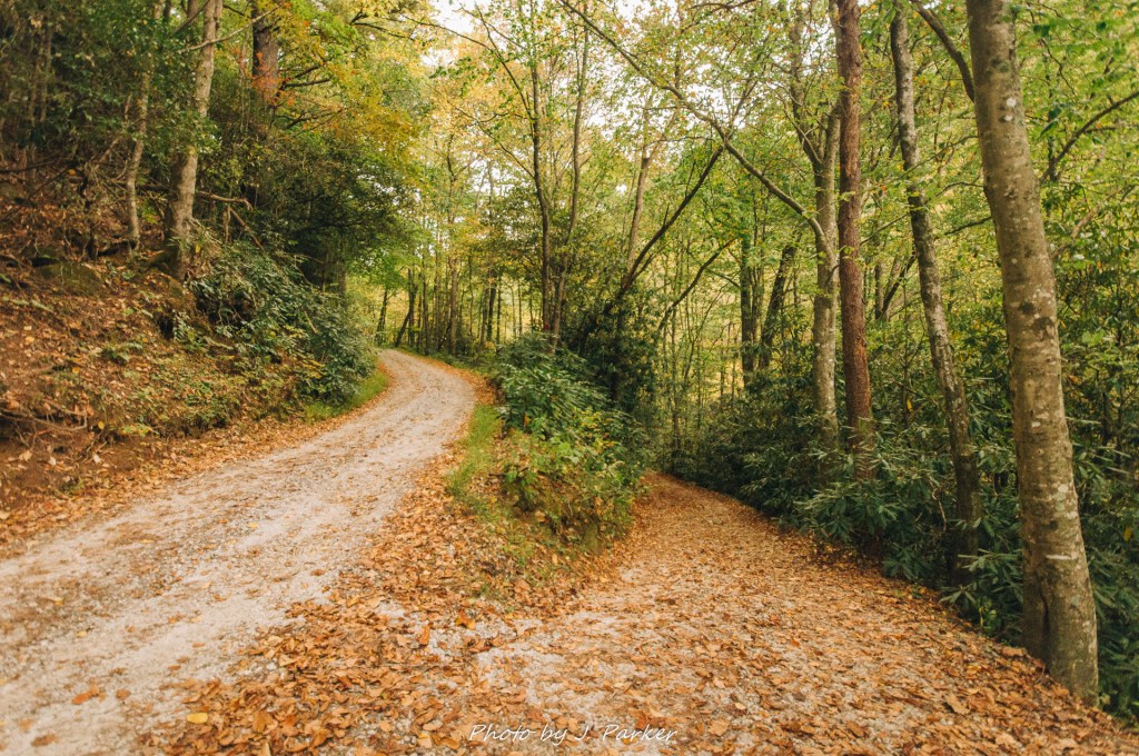
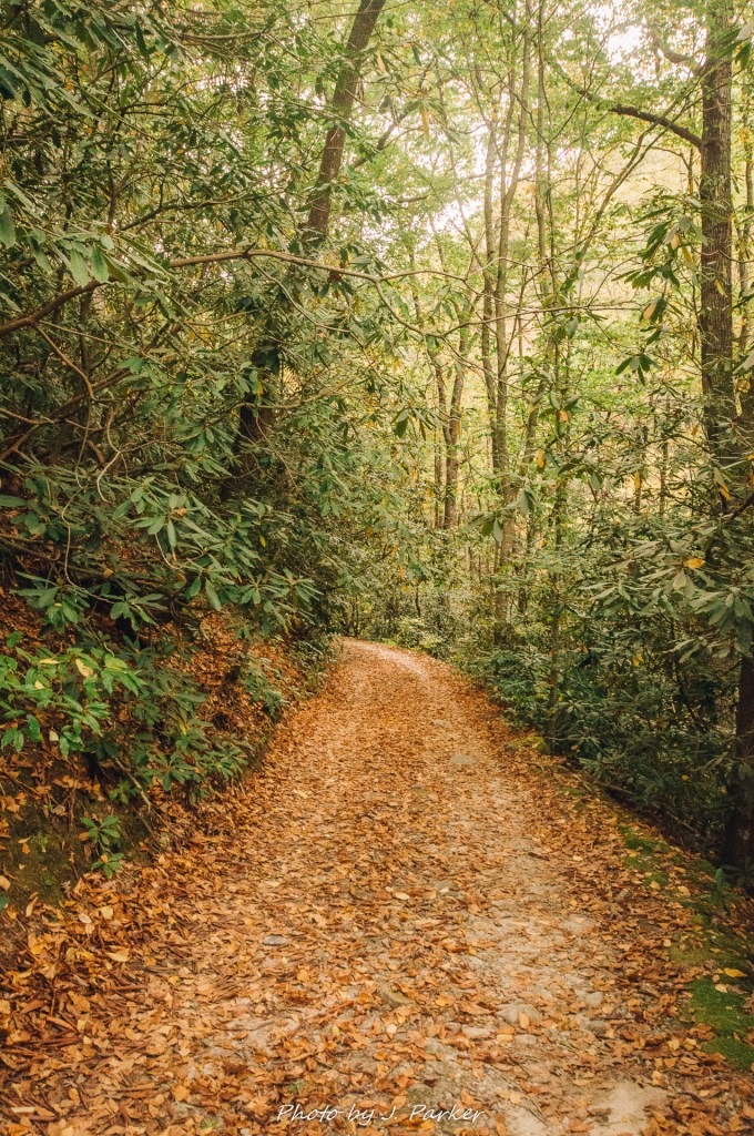
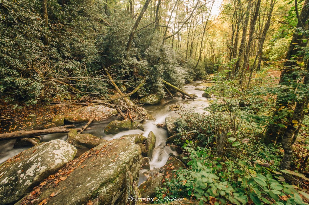
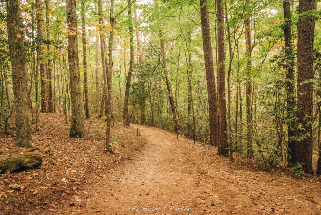
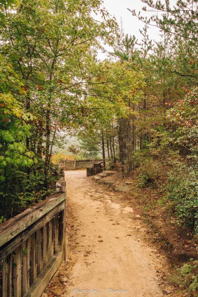
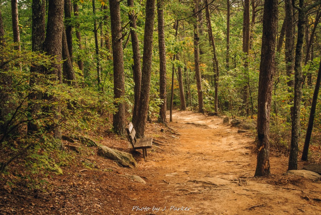
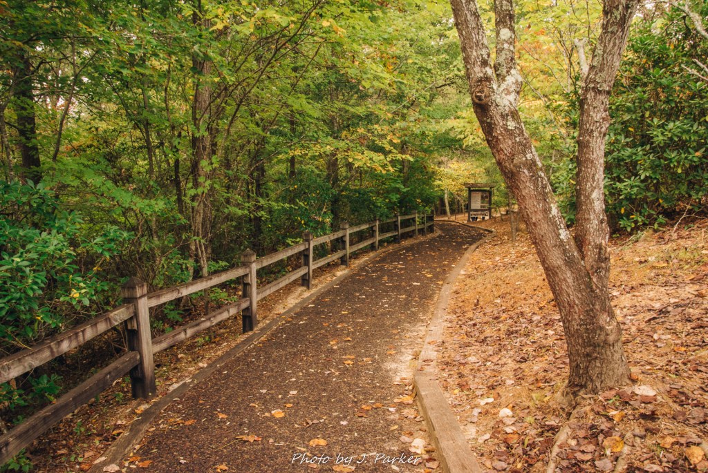
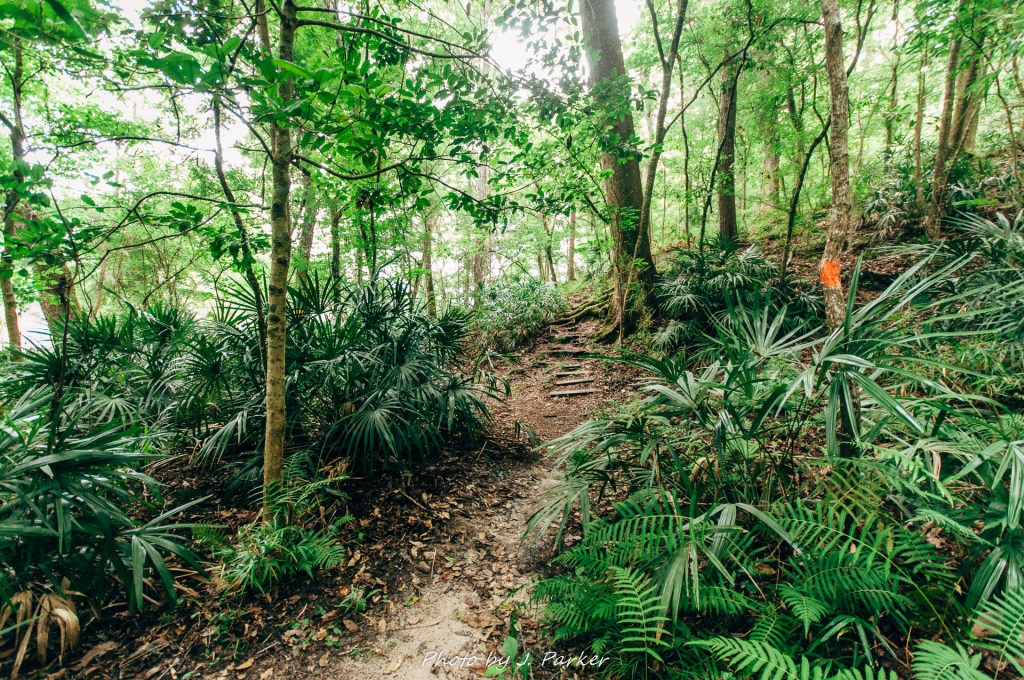
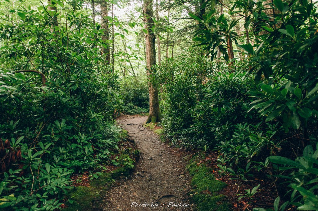
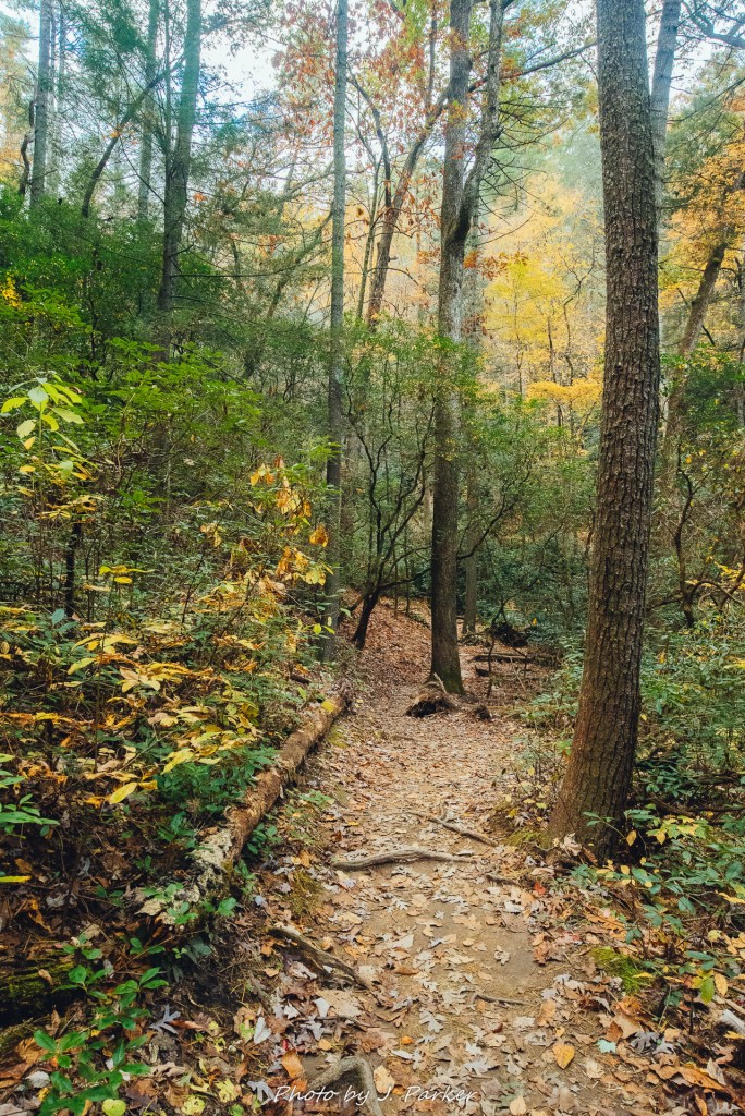
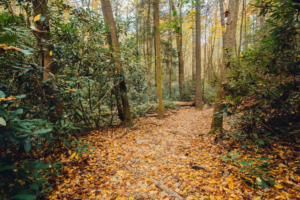
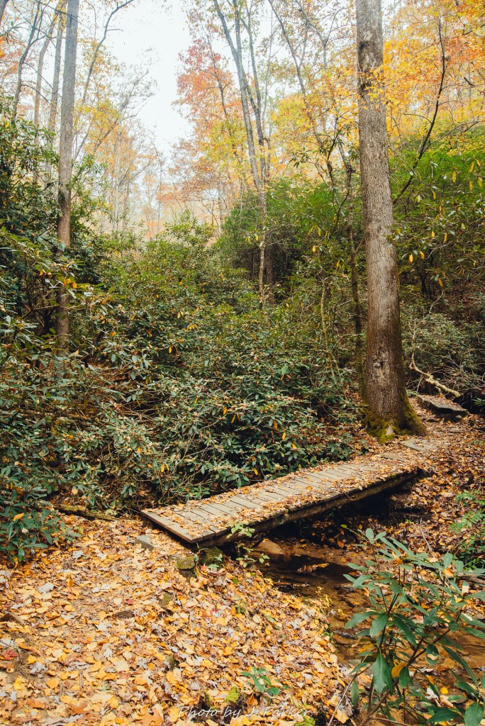
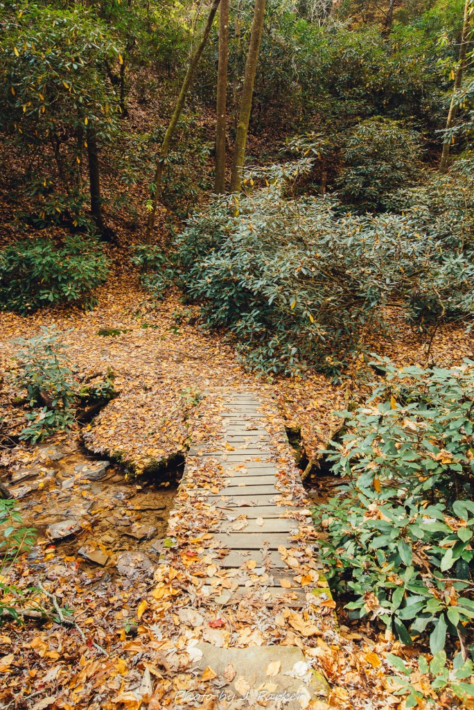
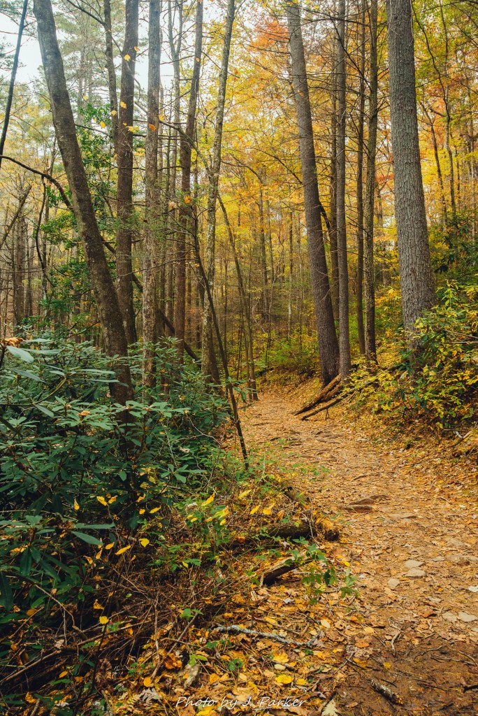
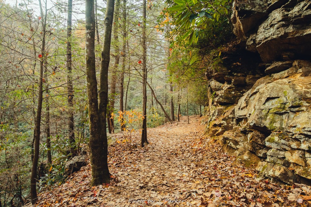
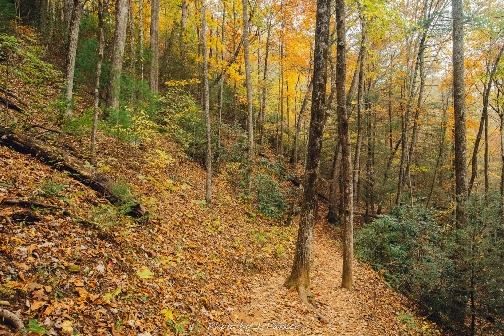
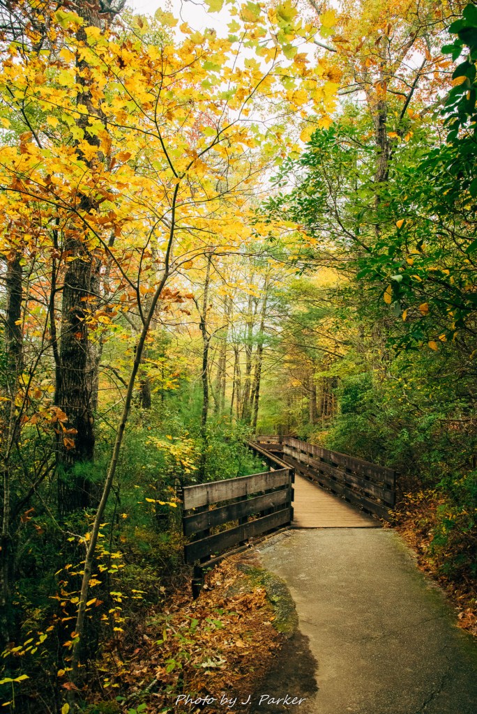
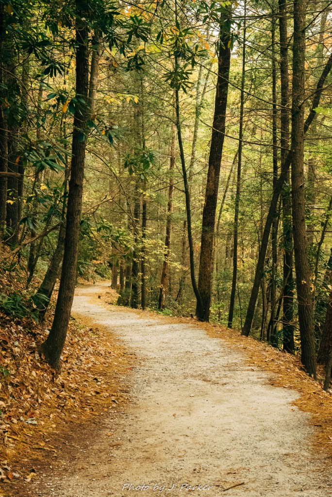
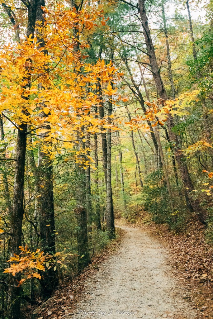
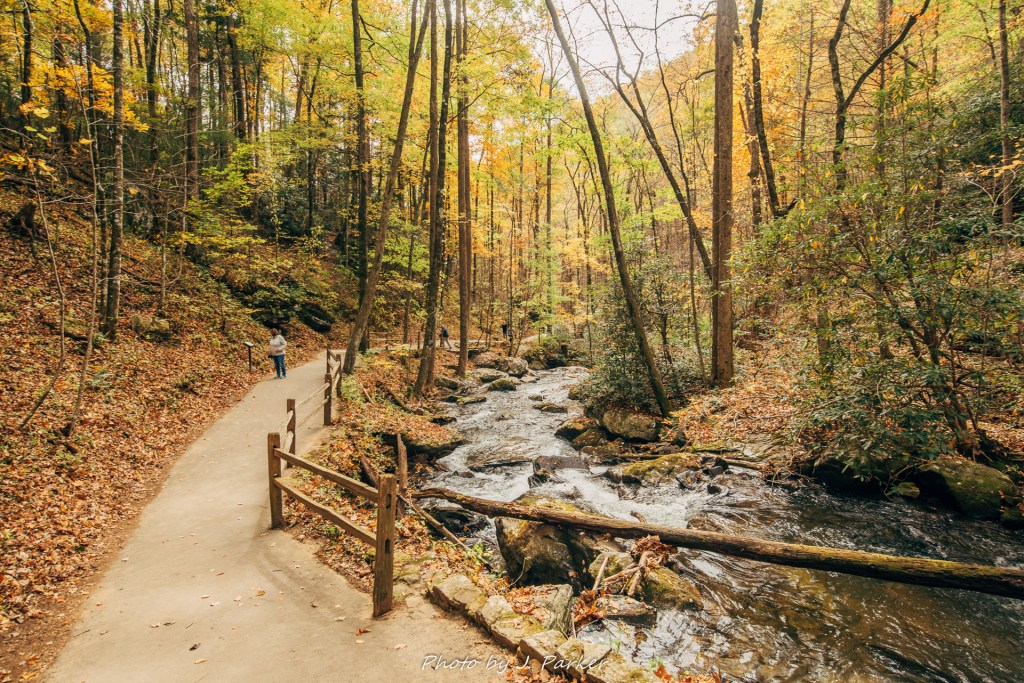
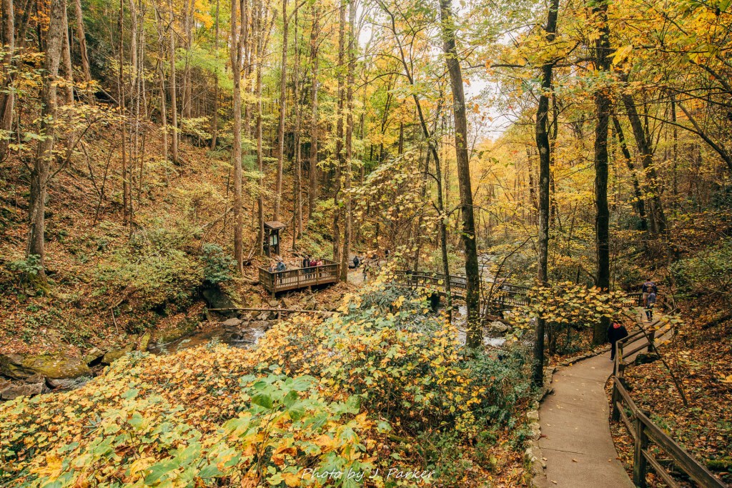
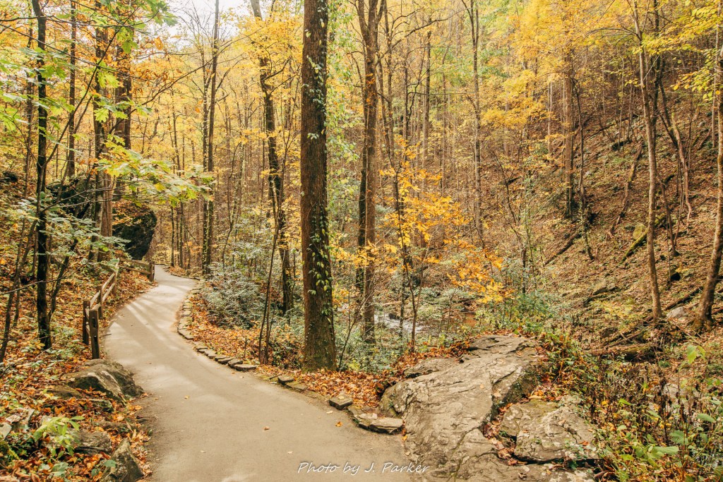
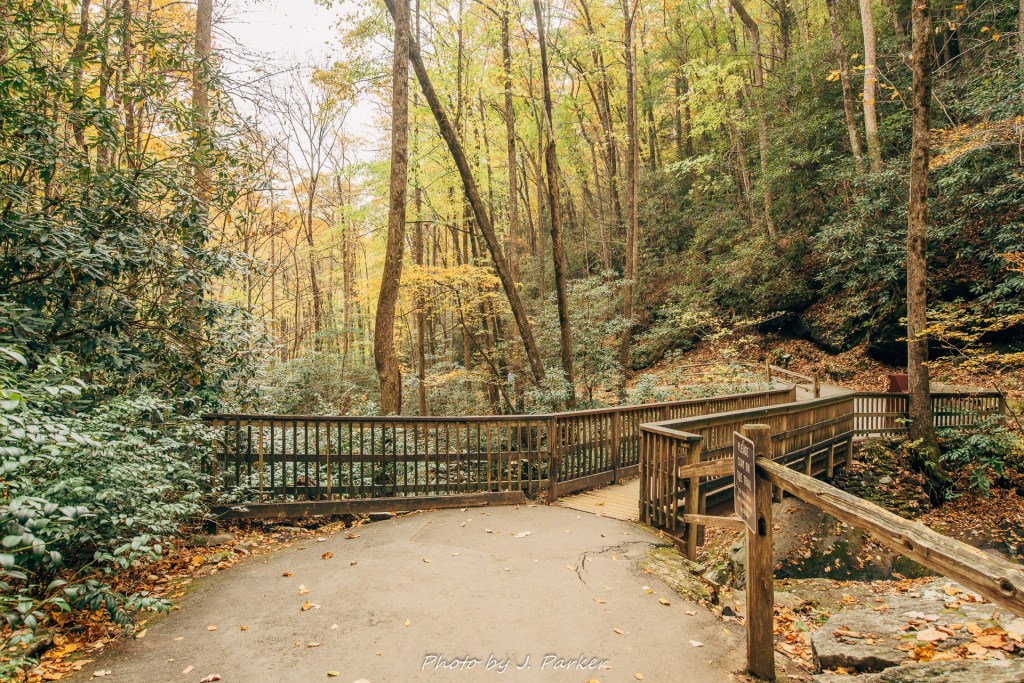
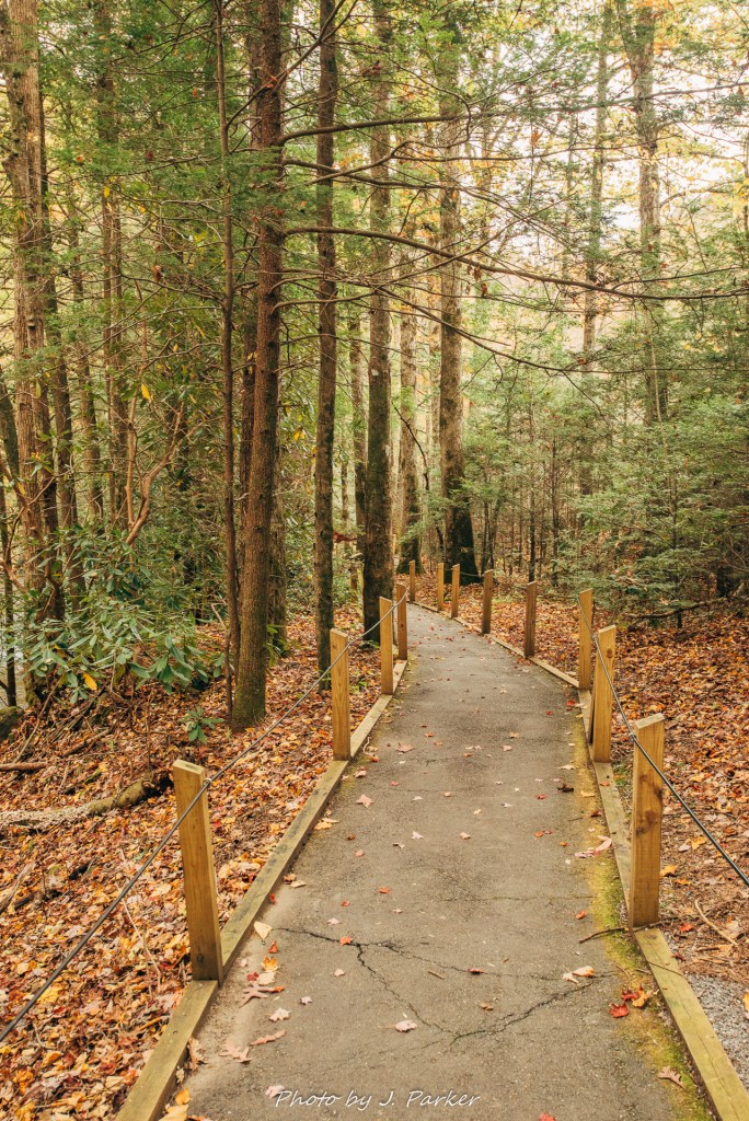
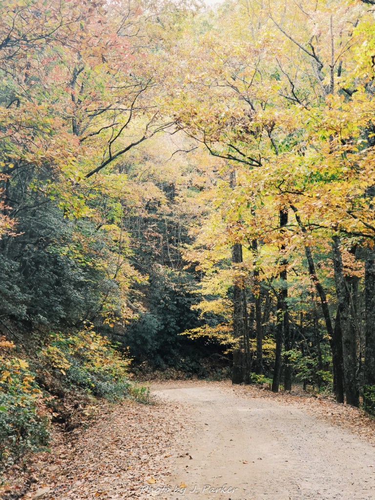
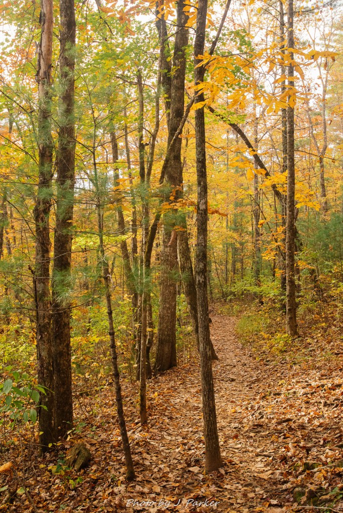
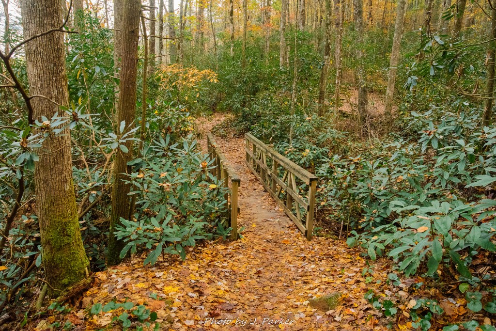
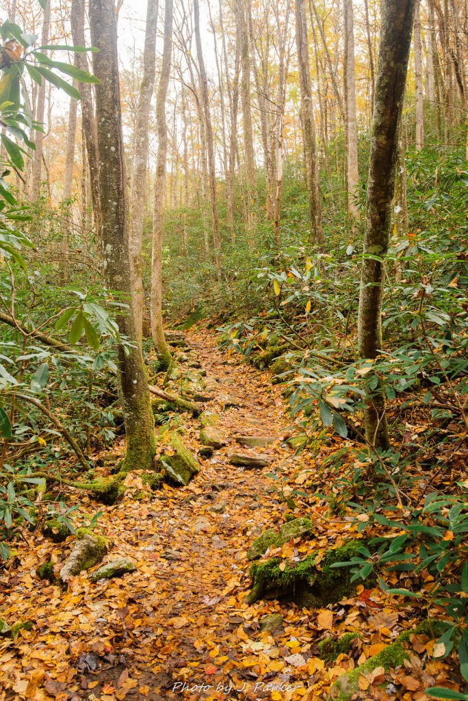
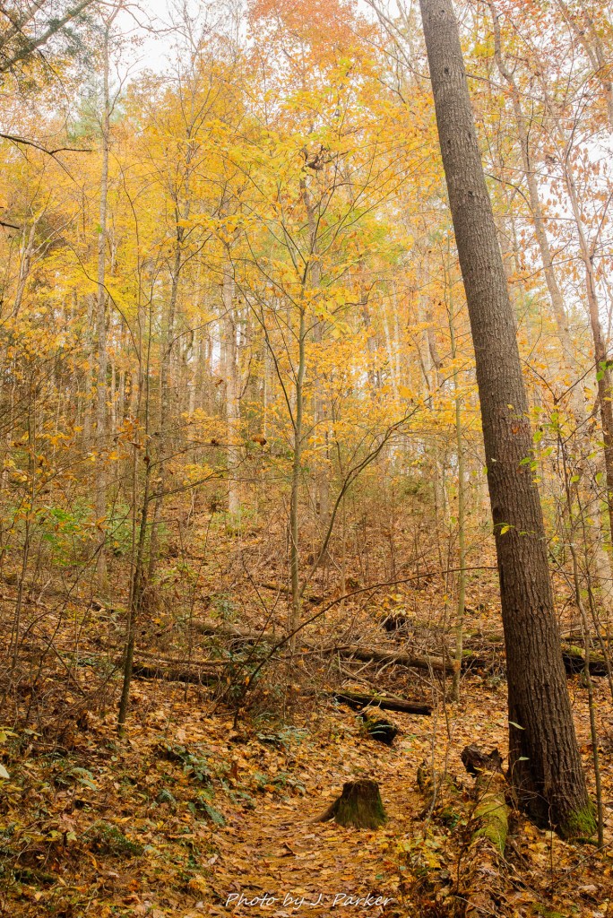
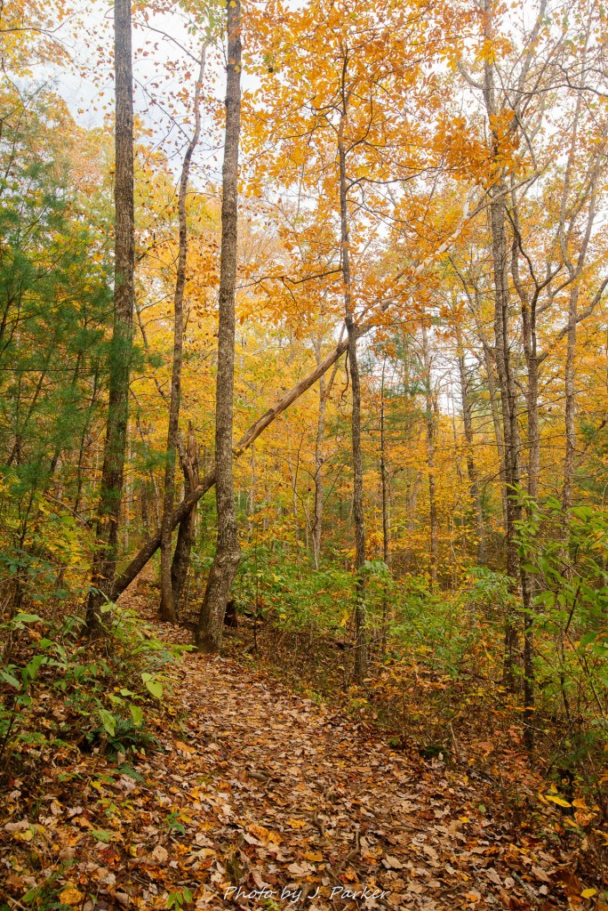
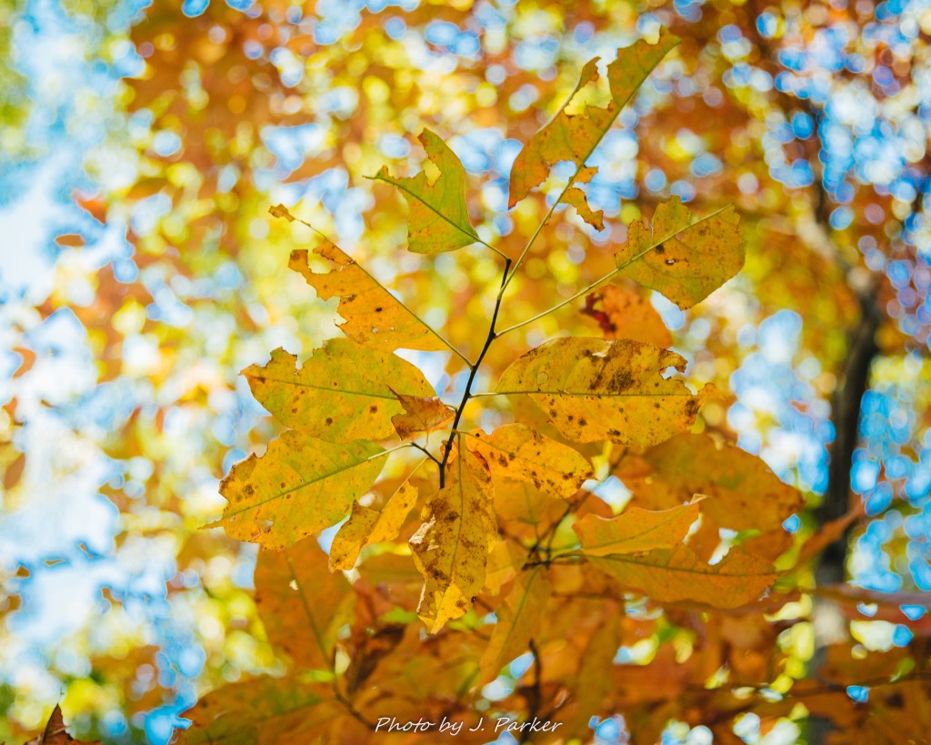
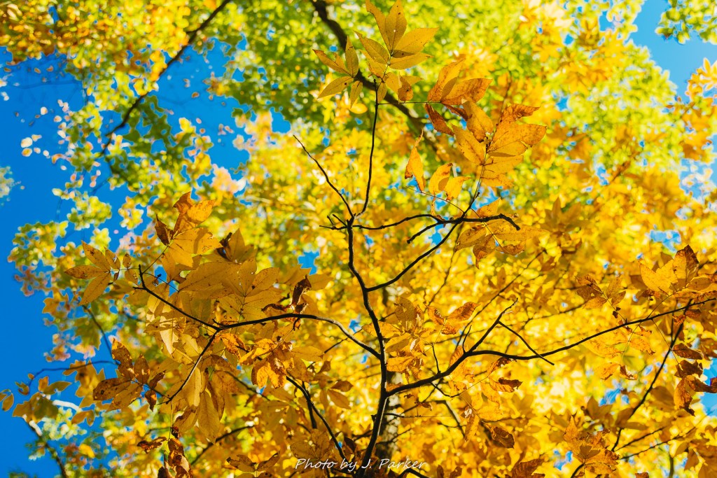
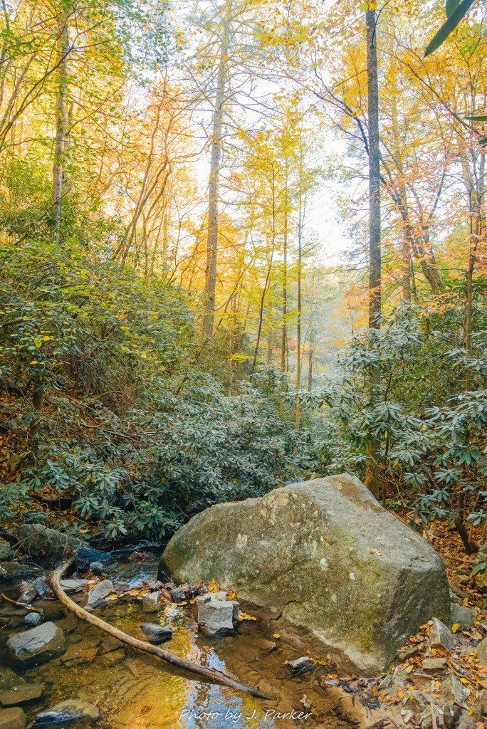
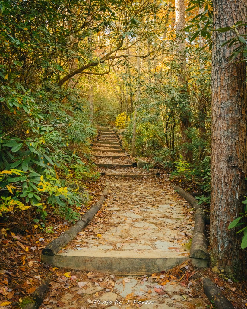
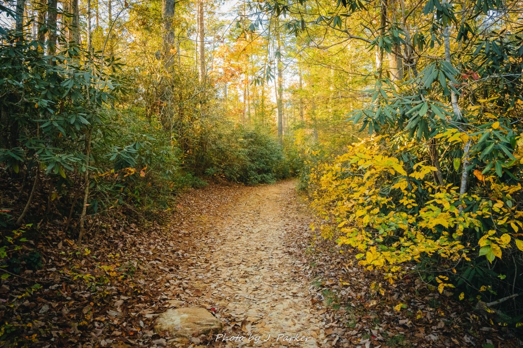
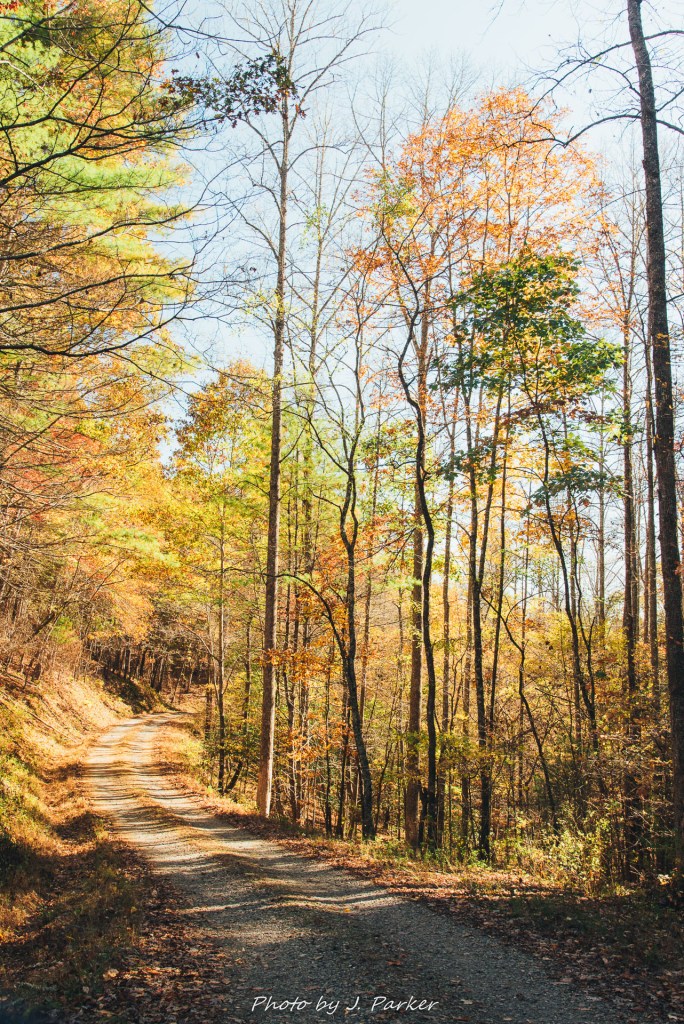
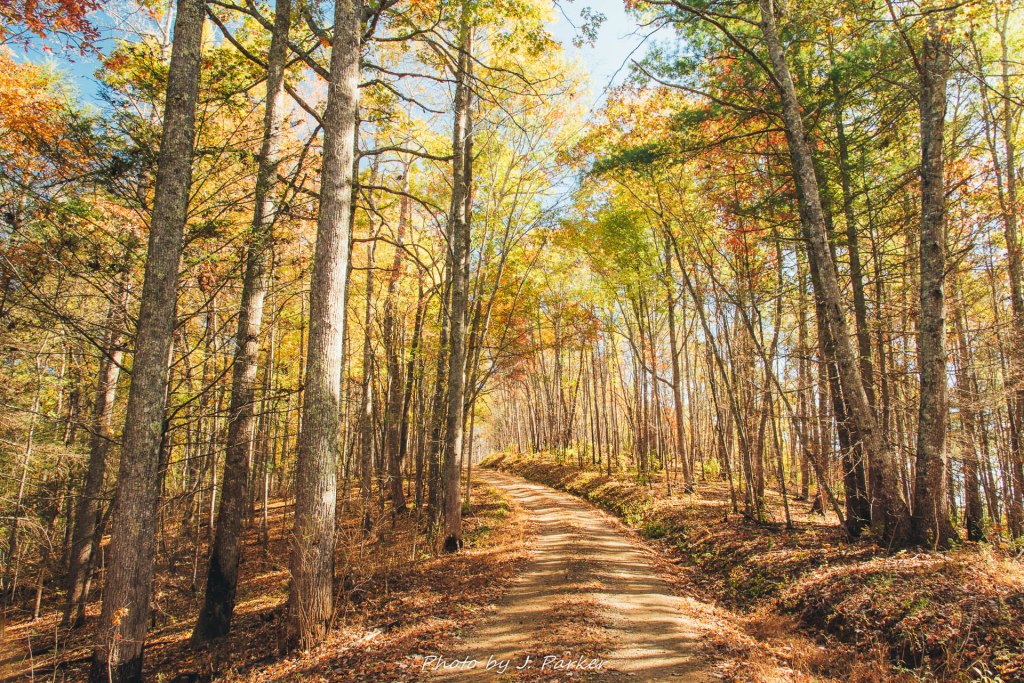
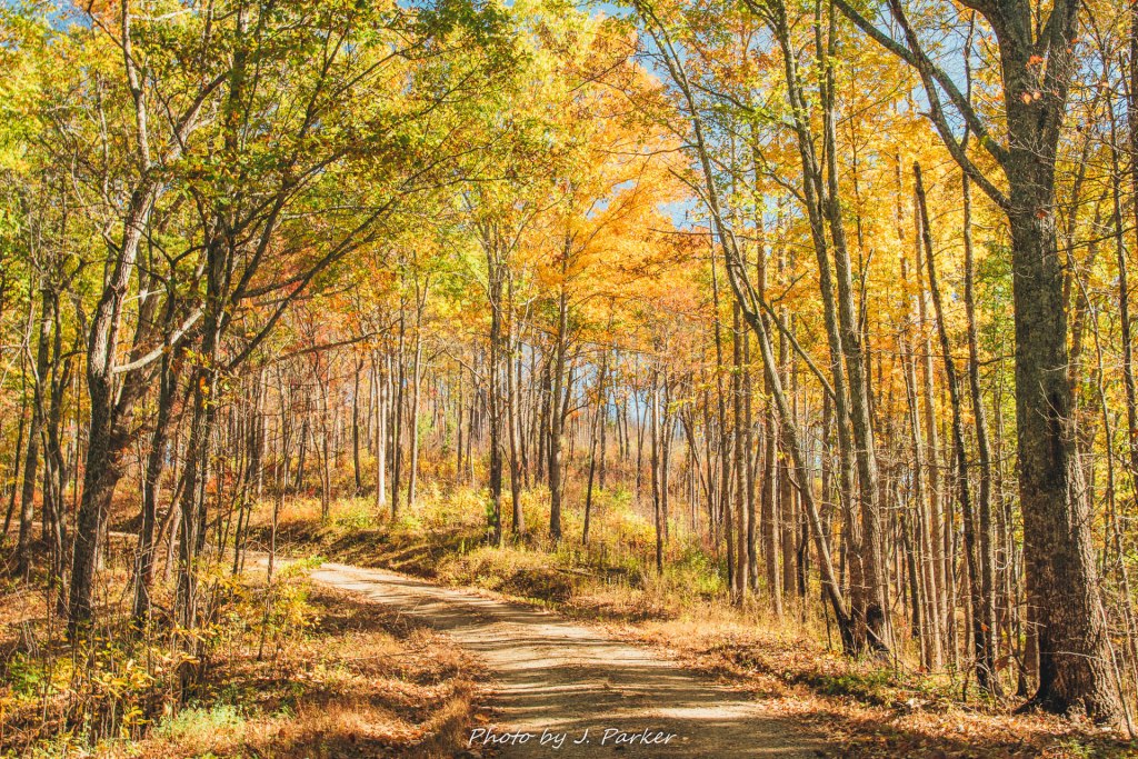
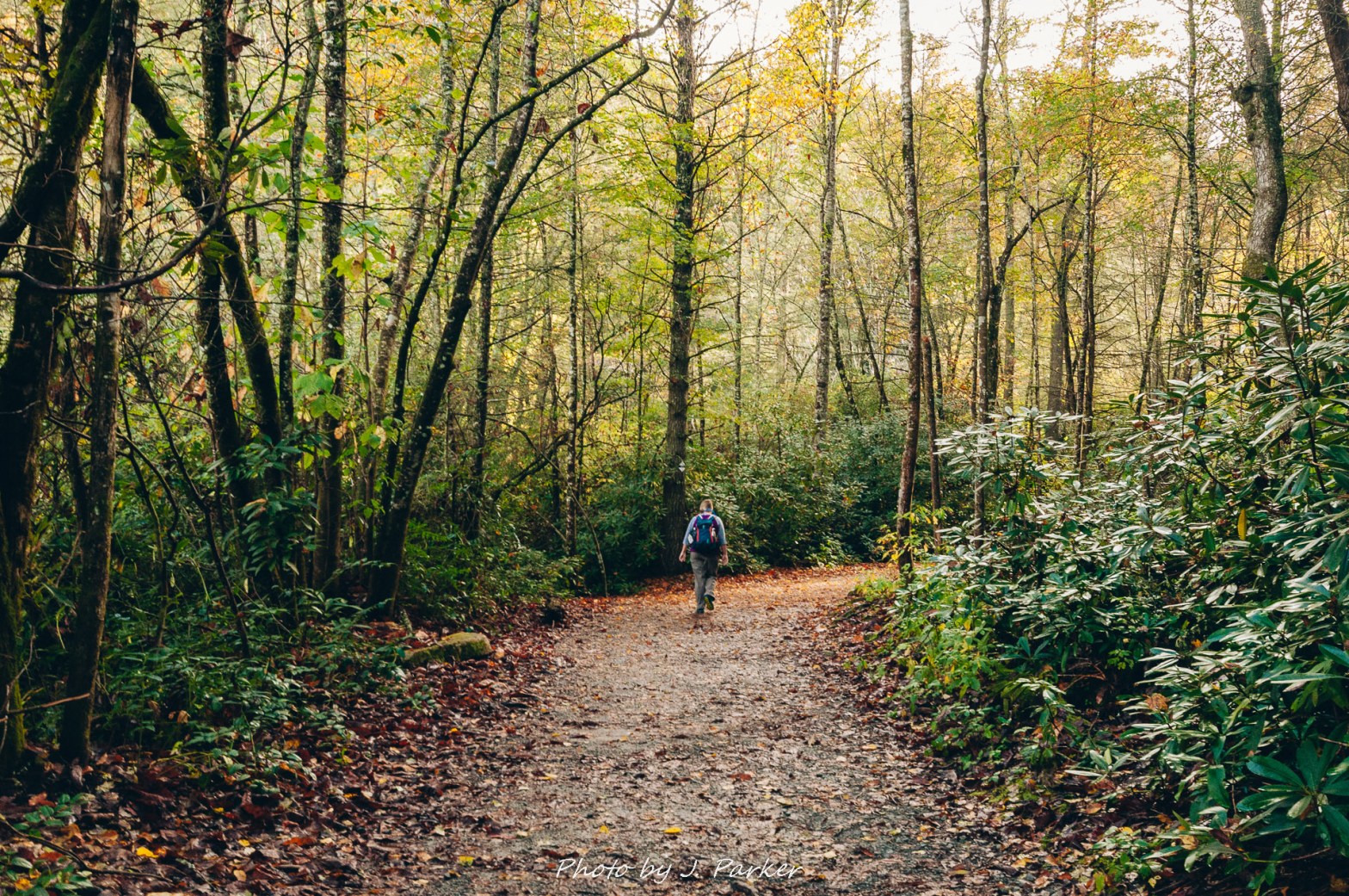
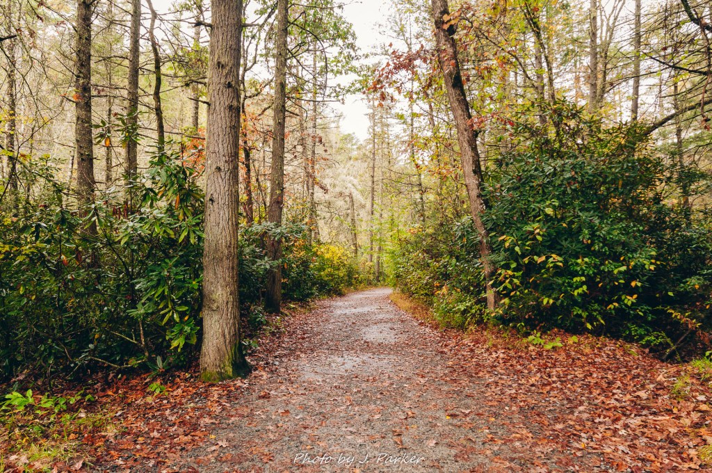
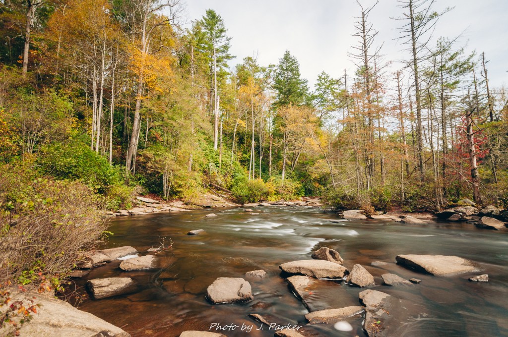
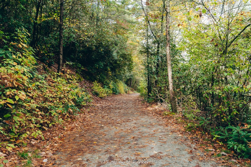
The car was parked in the gravel lot and we set out on the path, trail guide in hand, cameras having to be a bit protected as the leaves were still wet and dripping from the recent rain. The path was wide here, and in fact would stay wide for the duration of the hike to accommodate a high volume of traffic, sometimes for cyclists and equestrians as well. It wasn’t long before we started seeing some of what made Dupont standout; absolutely gorgeous forest. Where we were at was a fairly low elevation, Appalachian rainforest type area, so there wasn’t an overwhelming amount of seasonal color to be found at this point, but what there was mixed very well to provide a stimulating, full palette of reds, greens, and yellows as you hiked through the lush forest. The path was strewn with red leaves, which made the color more encompassing, as even the ground reflected the color, rather than just containing a dull pathway.

Forest on the way to Hooker Falls.

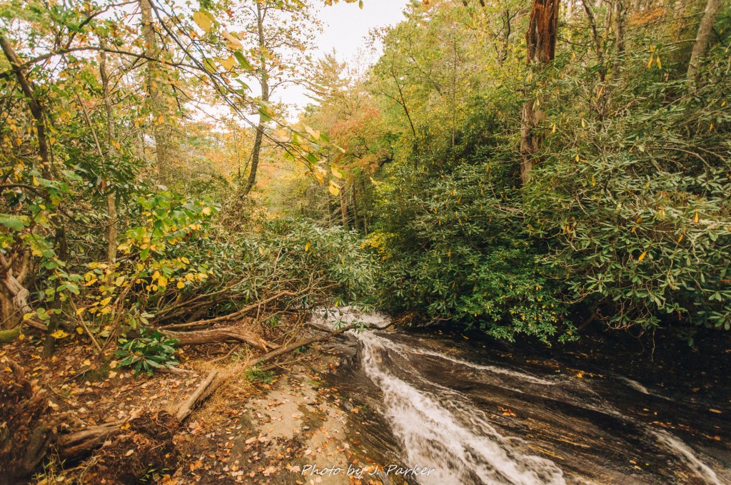
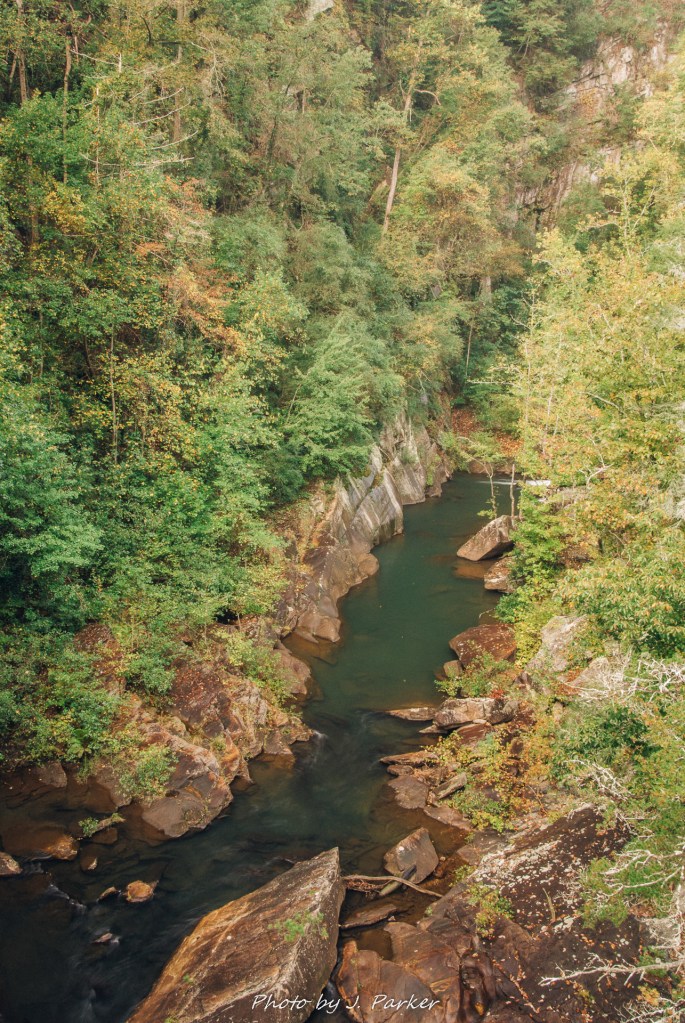
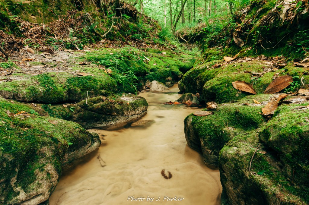
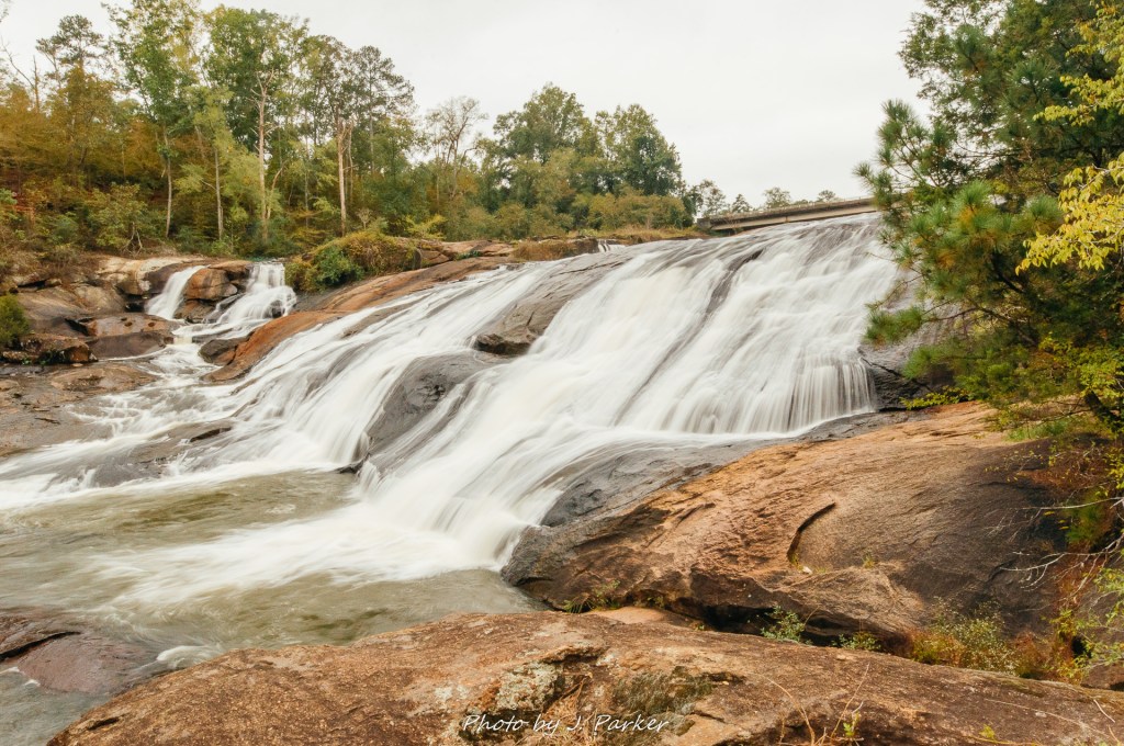
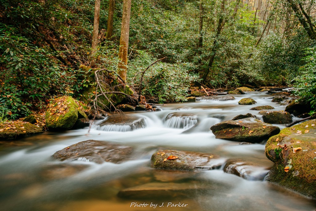
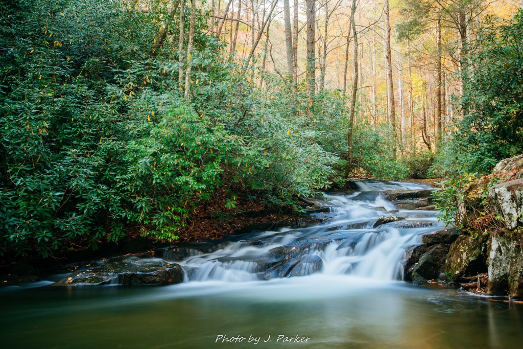
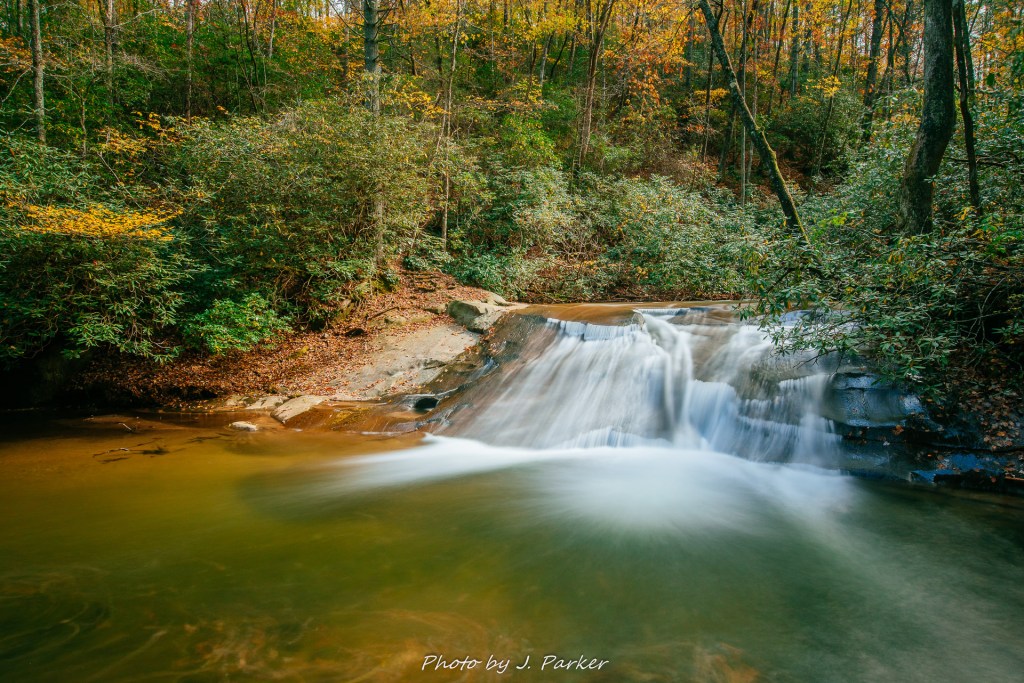
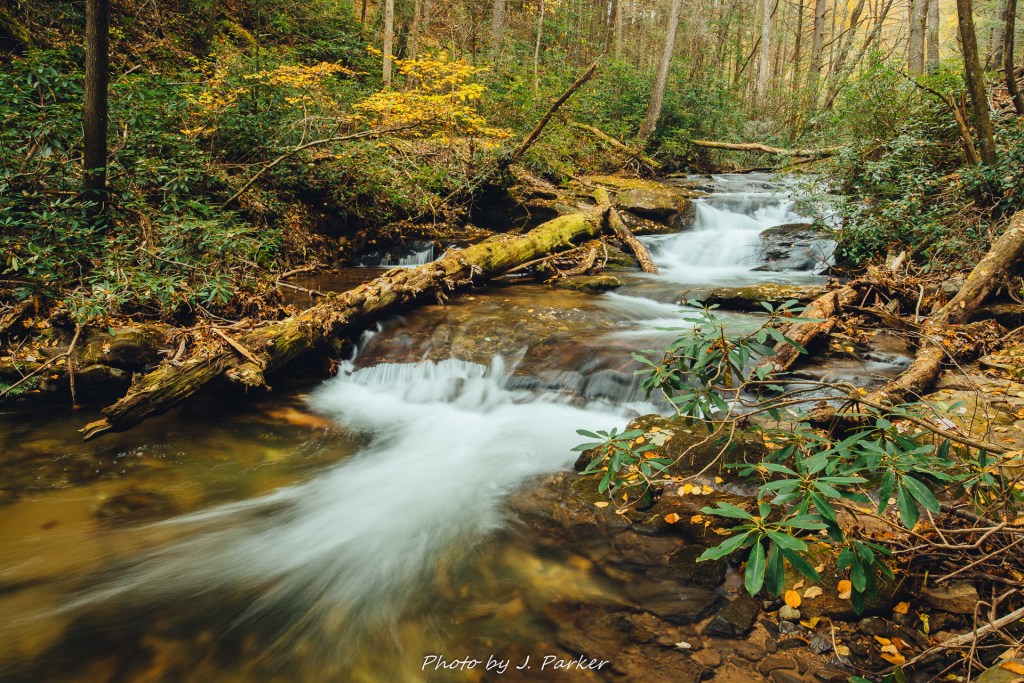
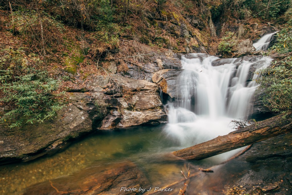
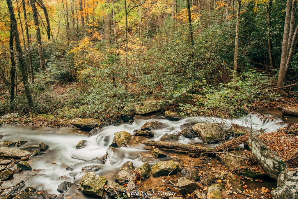
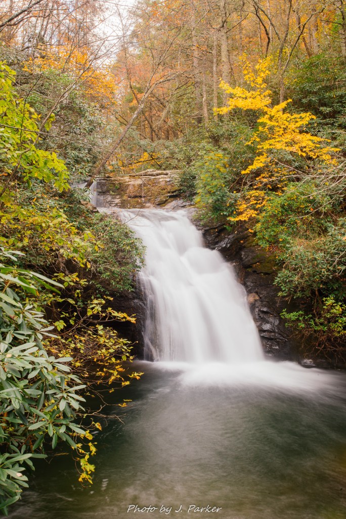
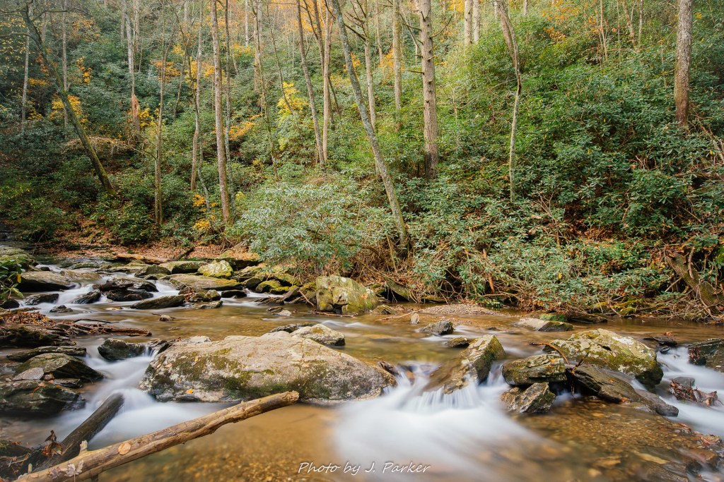
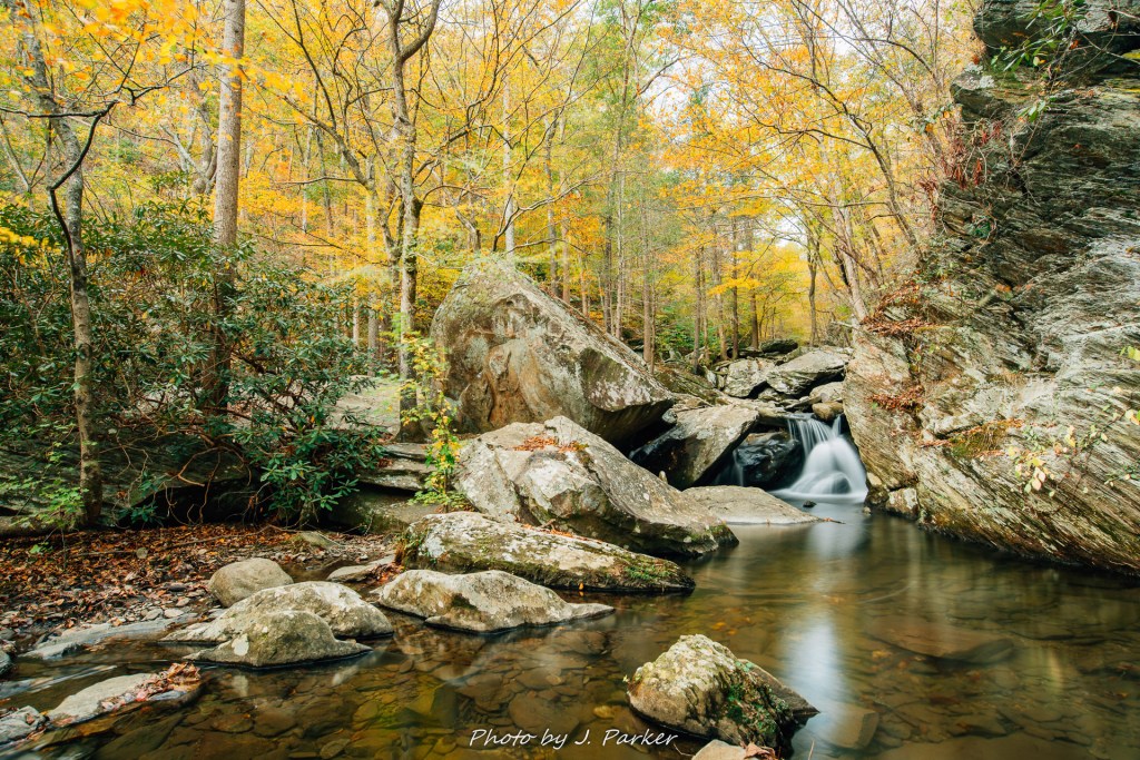
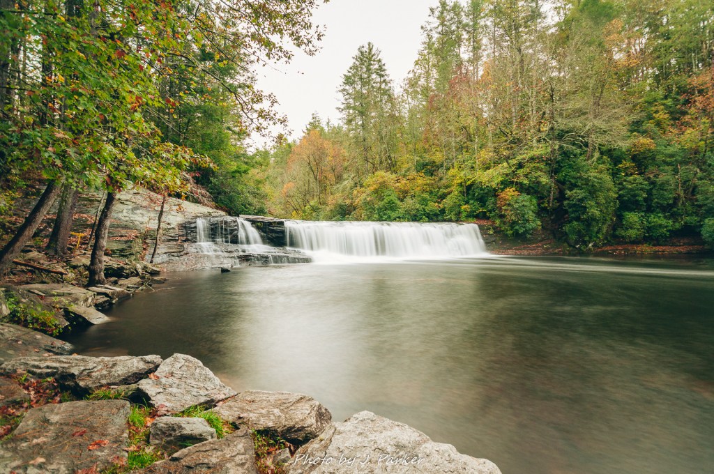
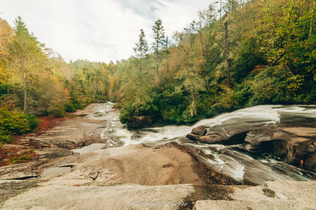
Hooker Falls was scarcely a few minutes down the path. Our first view was a lateral view, and a barricade prevented us from getting closer at this point. Moving down a little farther, however, lead to a wide, flat rocky area which provided the perfect vantage point for a downstream view of this fall along the Little River. Hooker Falls itself wasn’t all that impressive of a fall. It had a single tier of 15-20 feet which was so flat and straight it resembled a dam. Nor is its wide plunge pool, a rare non-descript section of the Little River which provides a swimming hole during the warm months, much to right home about. Yet somehow the spectacle of Hooker Falls in this forest made it more scenic than such a basic fall had any right to be. It was nicely framed by the varied forest surrounding it, and I enjoyed photographing it as we were the first to visit on this day.

Hooker Falls long exposure.

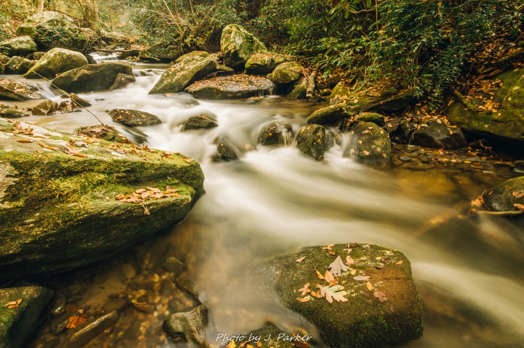
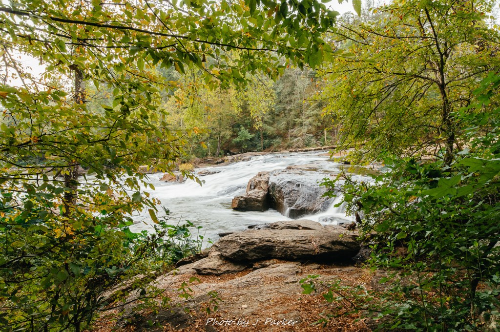
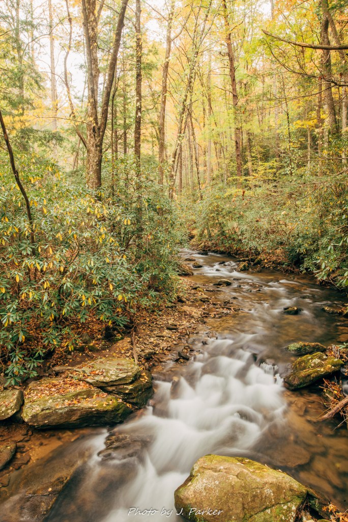
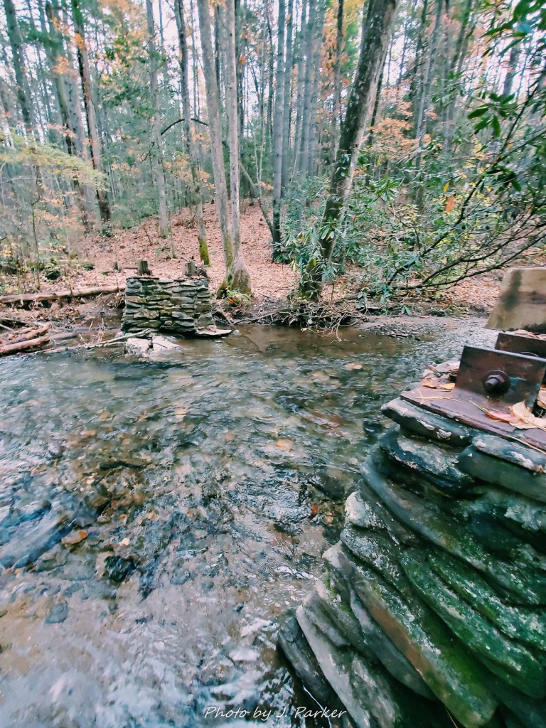
Leaving Hooker Falls meant returning towards the parking area, where we we cross the river and pick up the Triple Falls Trail. We had made the short trek to Hooker Falls with the sound of rapids from the nearby river escorting us. I had resisted the urge to explore them for want of ensuring I got a shot of the actual waterfall, but on the return trip I decided to explore the side trails. There were nice sections of smooth rapids, and as I had not yet learned that seeing something nice in person doesn’t mean it makes a good photograph, I attempted to snap a few long exposures. I resisted the urge to spend too much time however, and we soon pushed forward.

Perhaops ill-advised long exposure.

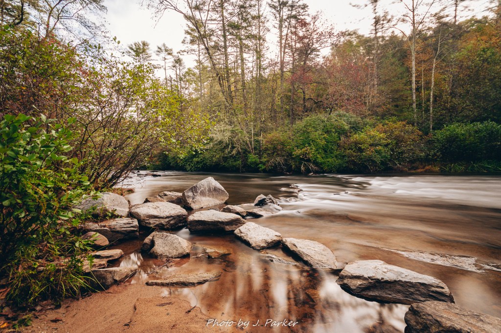
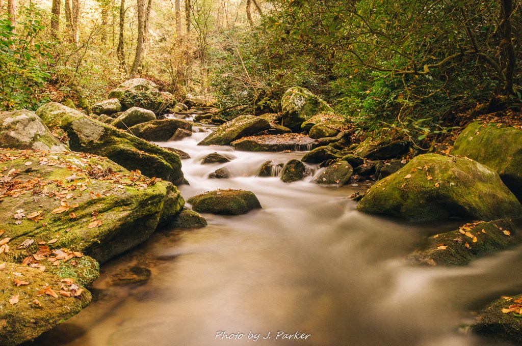
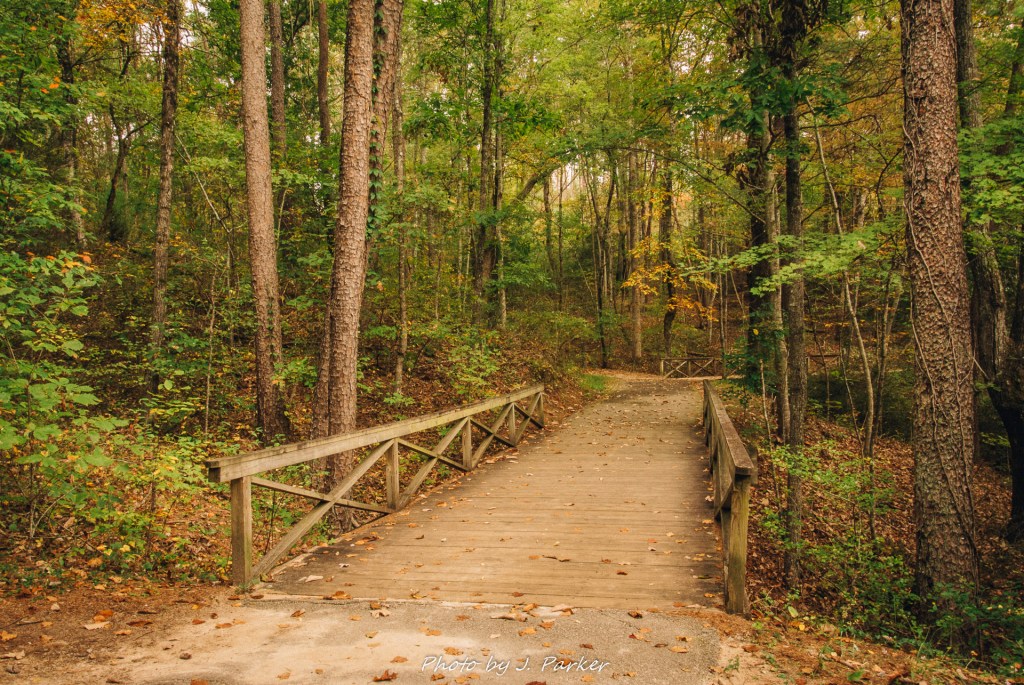
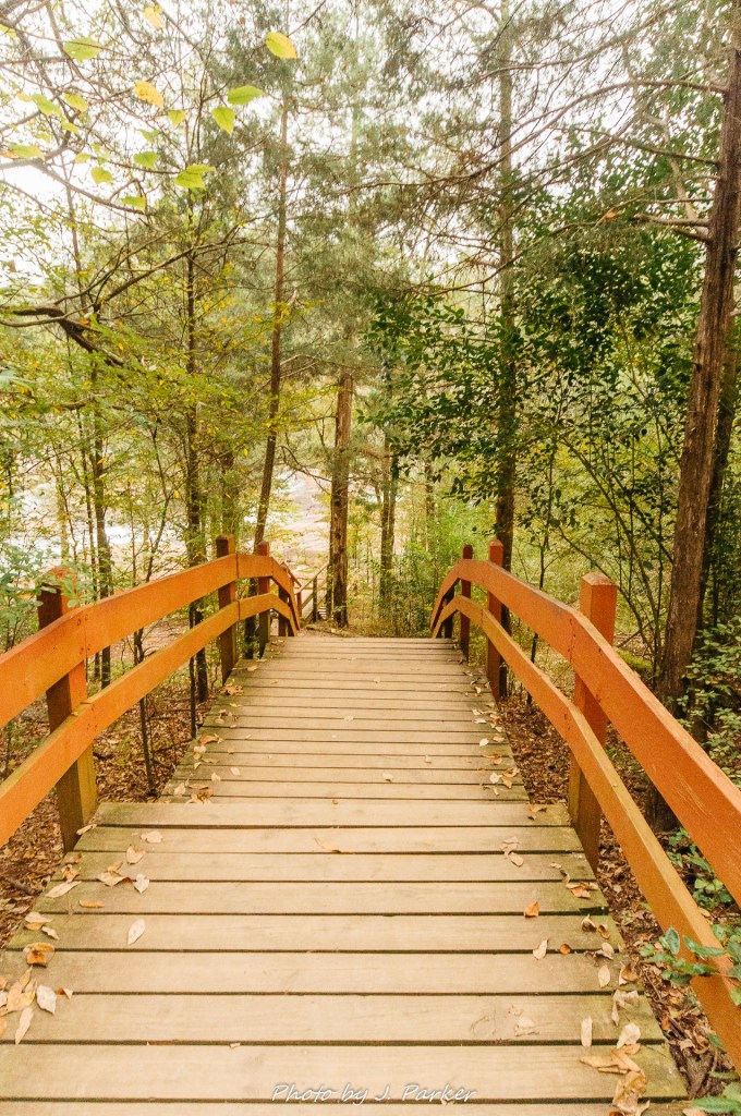
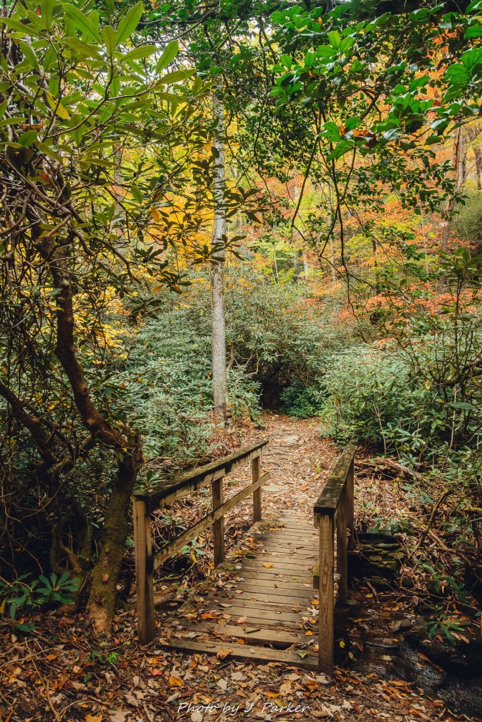
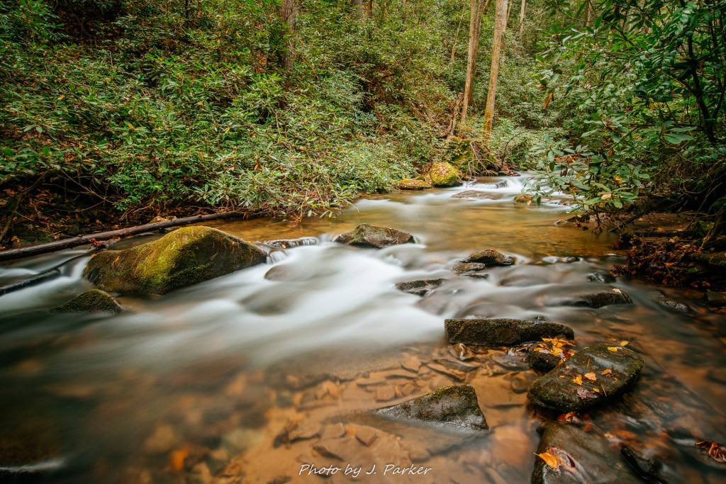
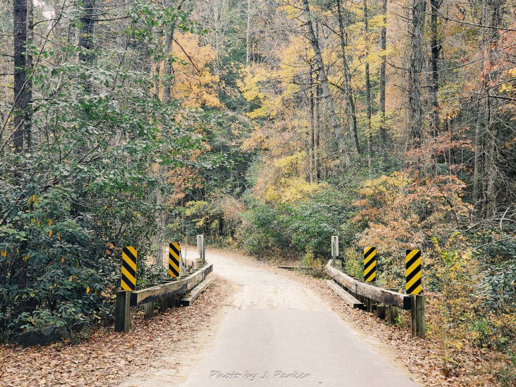
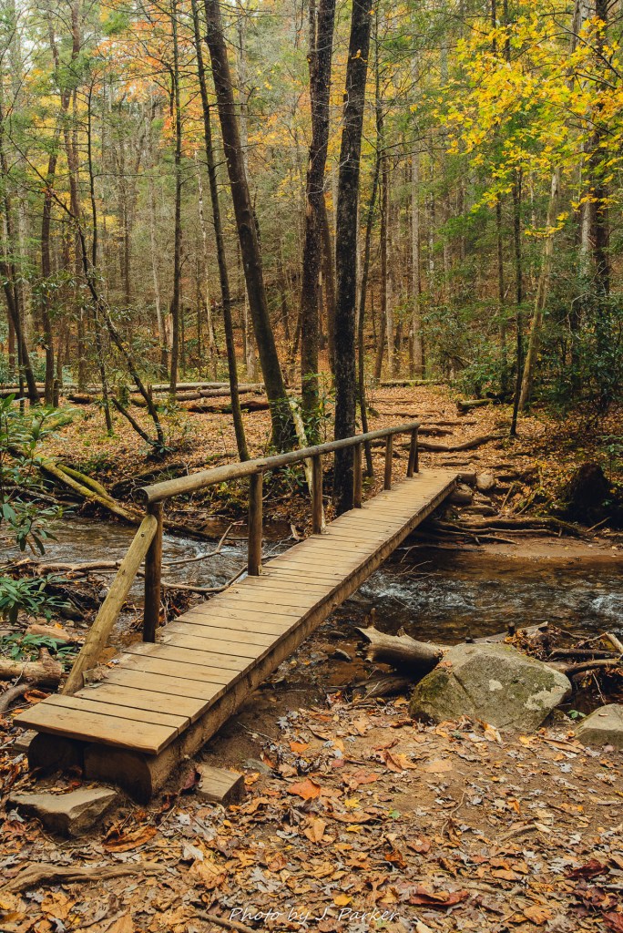
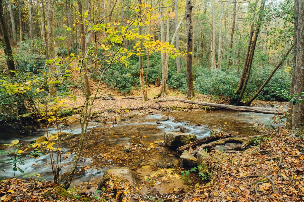
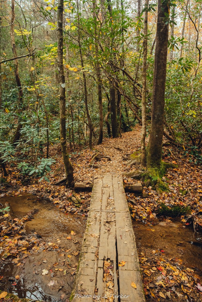
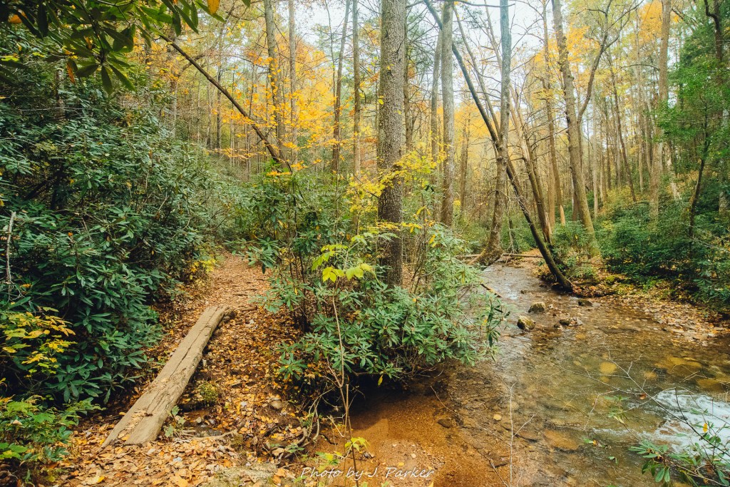
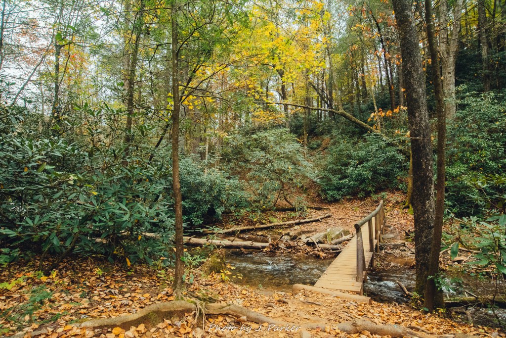
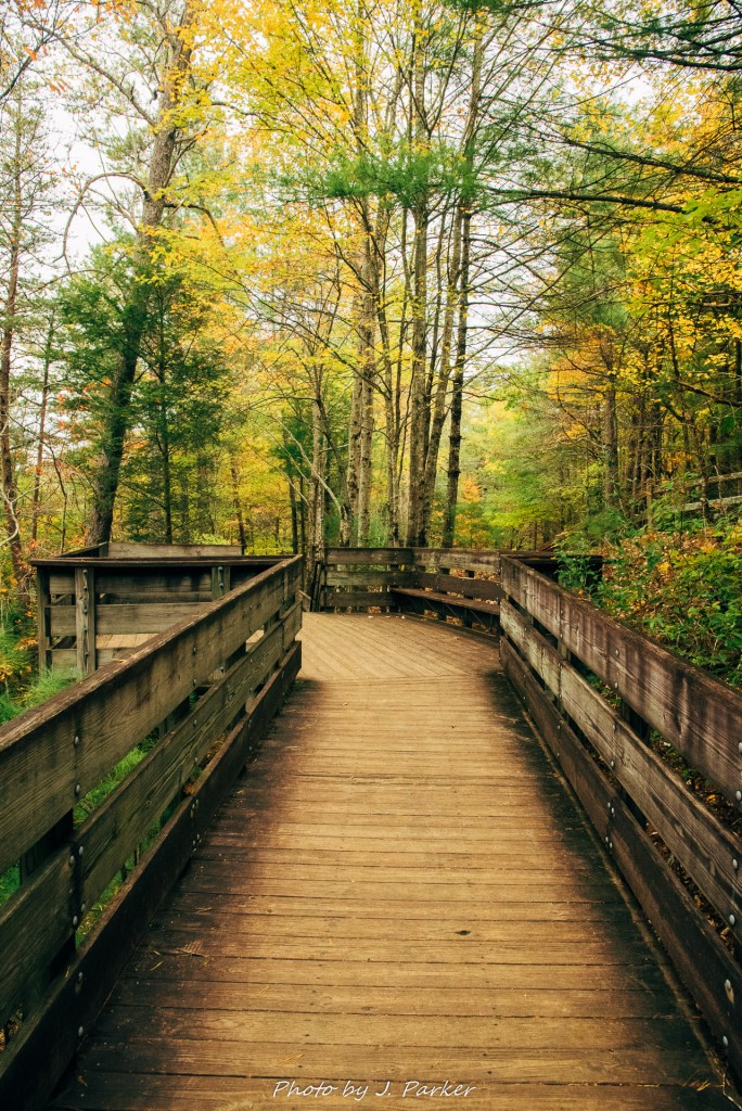
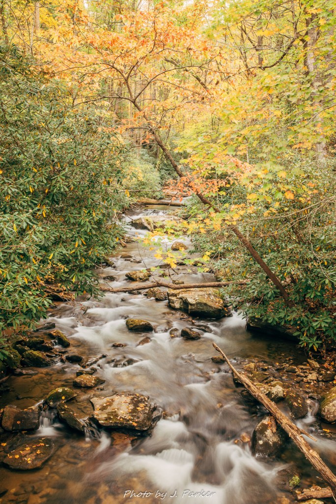
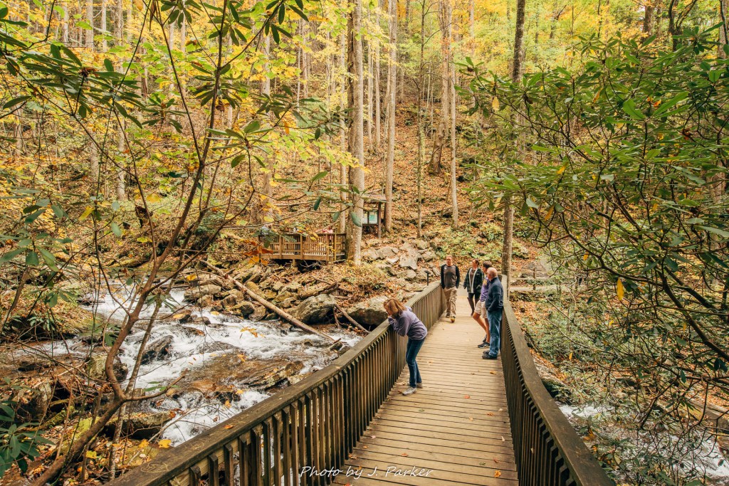
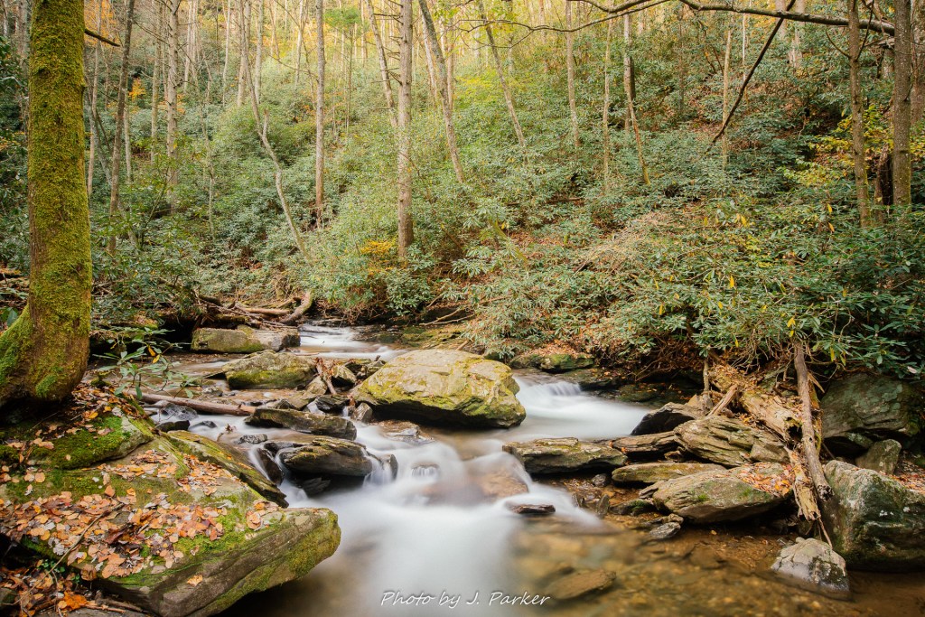
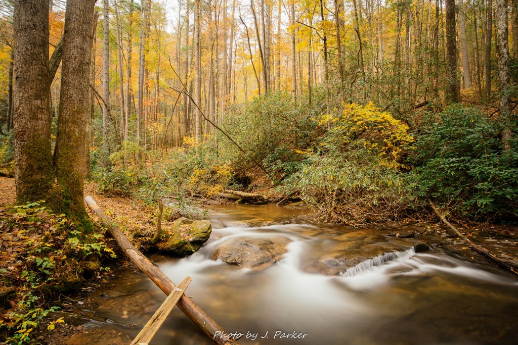
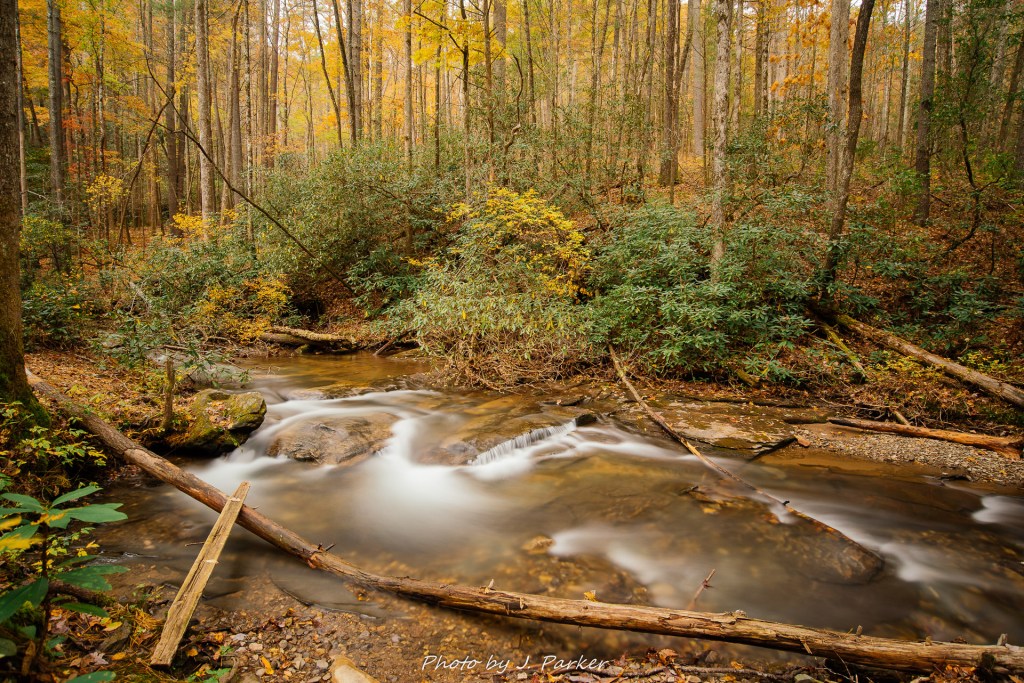
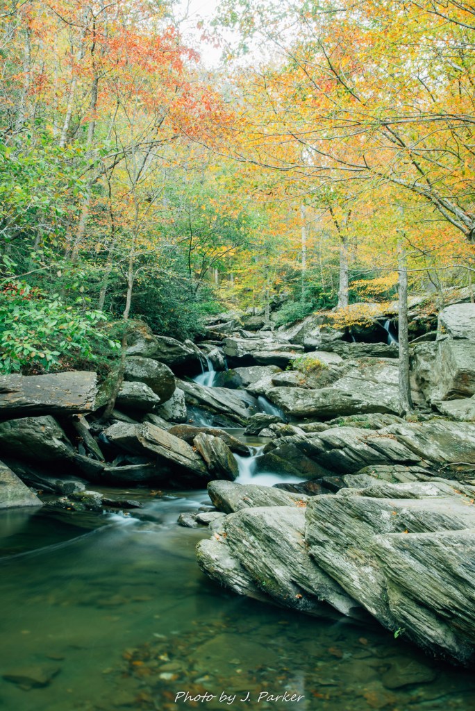
Crossing the river on a wide bridge offered a great view of what was an absolutely gorgeous section of river. With the foliage somewhat stripped back and the rapids being small and sharp, it somehow reminded me of a scene either up north or out west. We followed the river upstream along the trail, and I really admired the glances I got of it but was a bit saddened that a truly unobstructed view for a photograph really wasn’t obtainable.

This image has an empty alt attribute; its file name is 2017_10_16a-dupont-sf-91.jpg
The lovely stretch of Little River as we crossed the bridge. It may have been changing light levels, but looking at this I’m not sure why I didn’t try a long exposure from here.

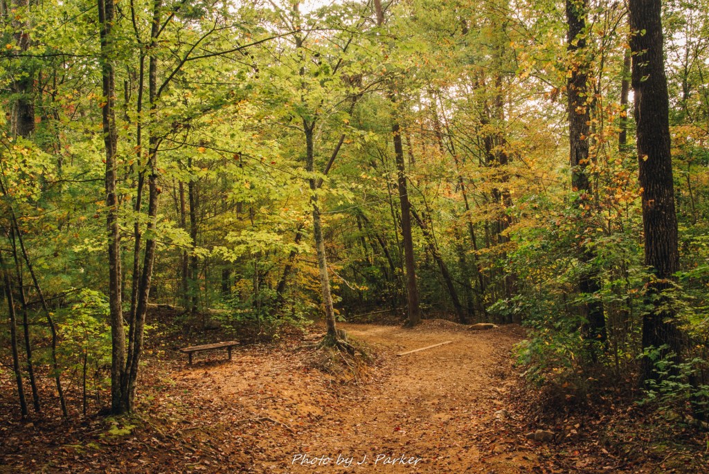
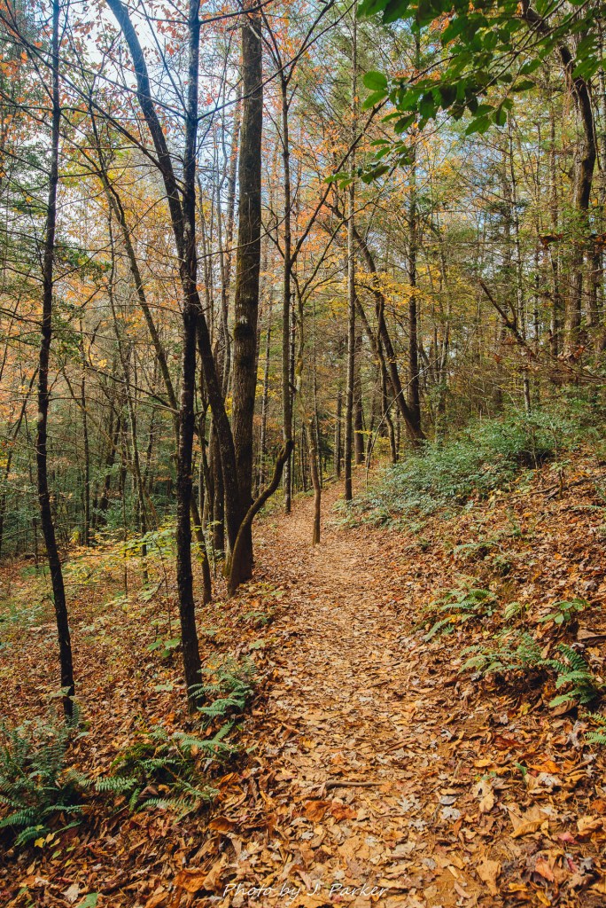
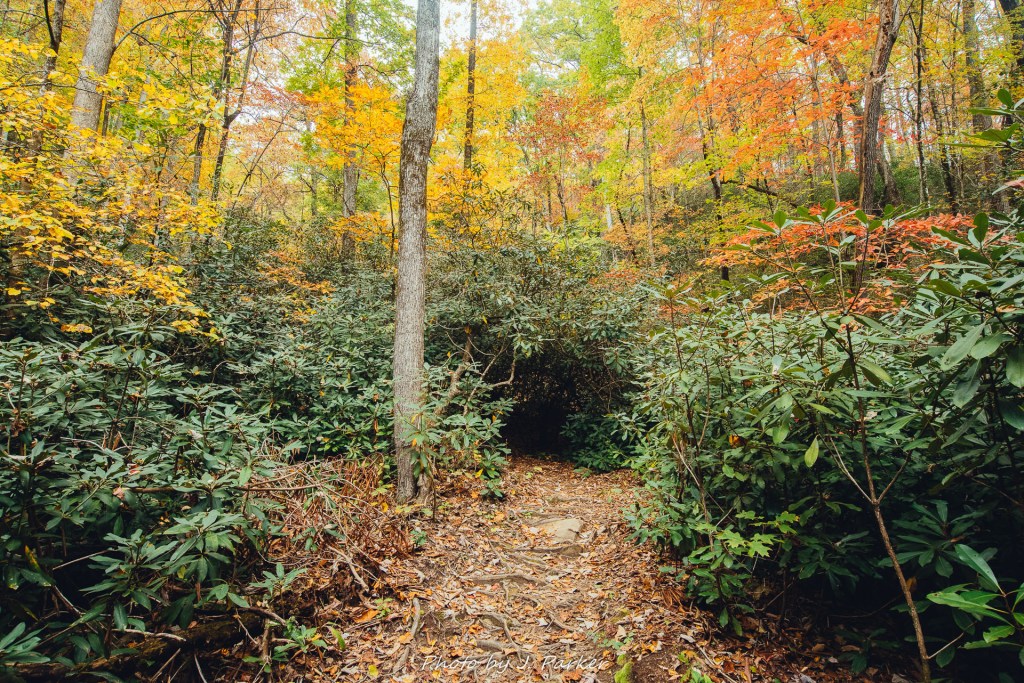
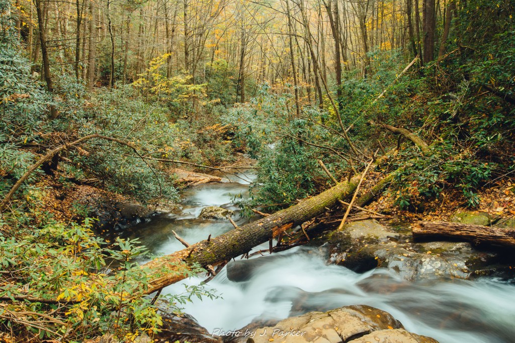
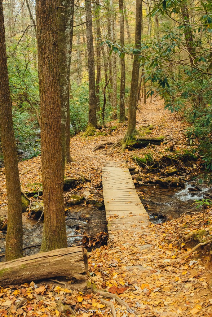
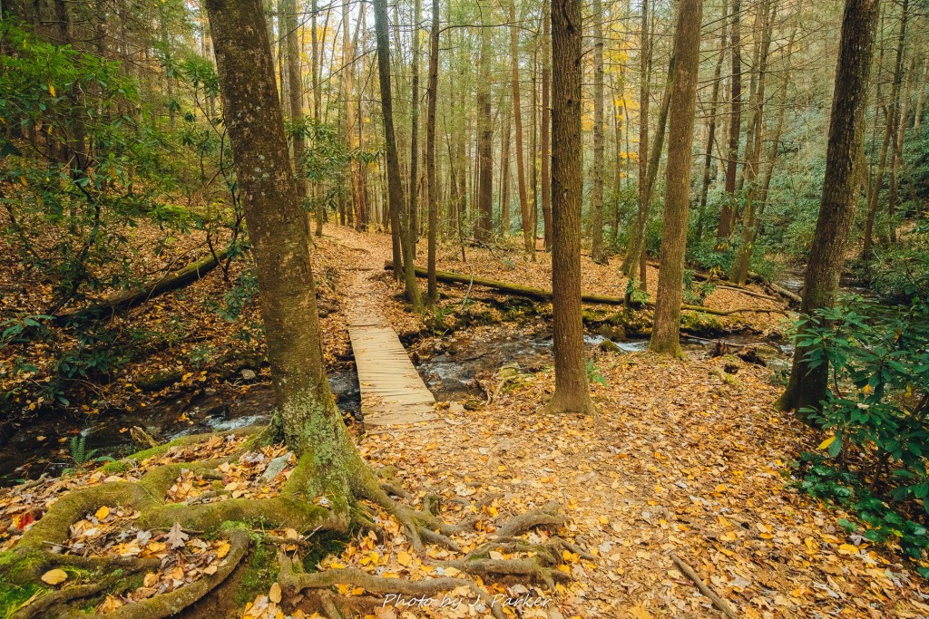
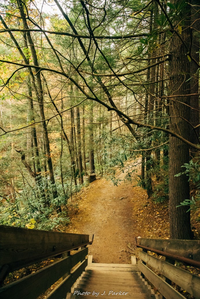
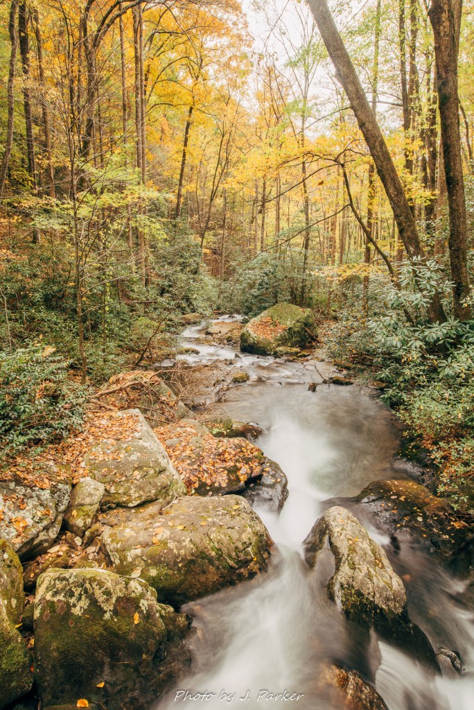
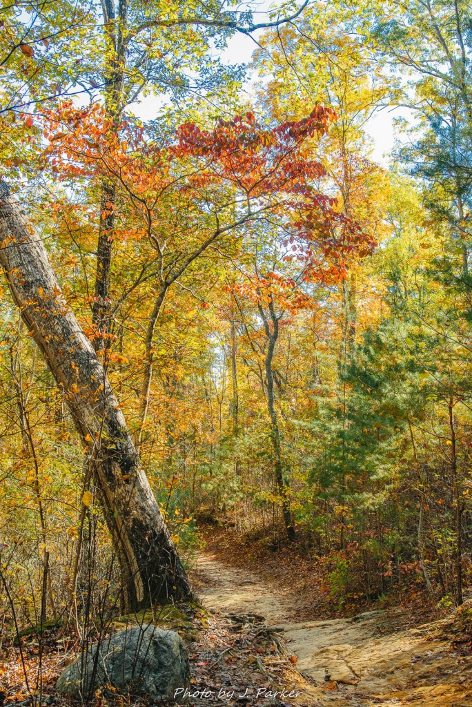
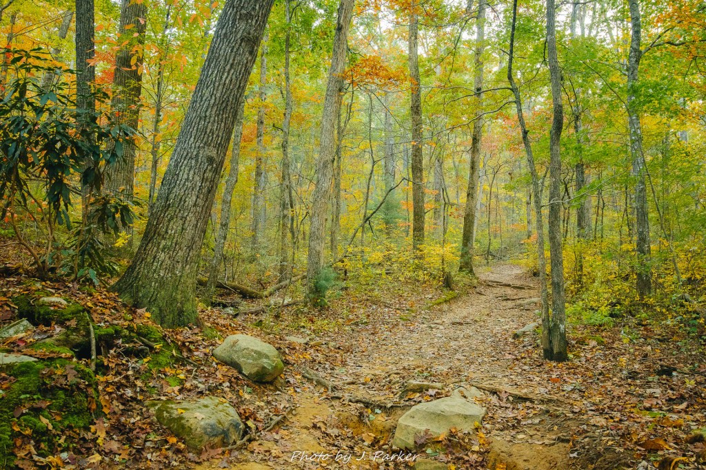
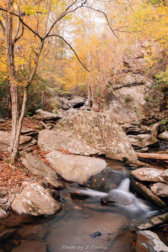
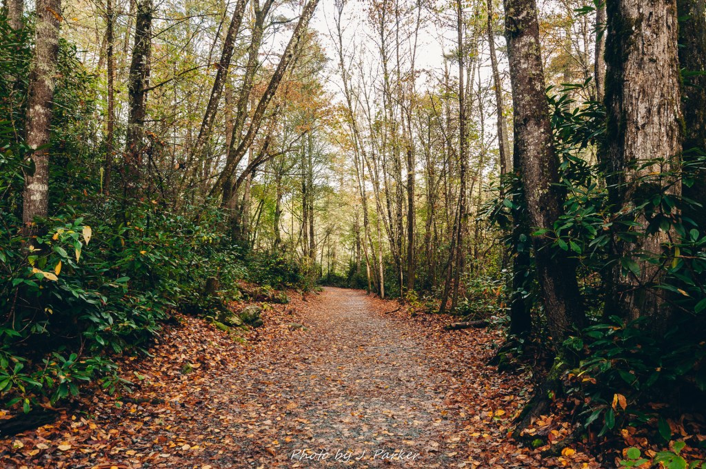
By now, the sun was already beginning to peak out from behind the numerous but thin clouds, and as we plunged back under the canopy of the forest everything was illuminated perfectly. Somehow, there was a perfection to the woods too. Everything just seemed to be in its right place, organized but wild, something that its hard to believe could have developed over time, somewhat at random. It was just magical. I was really beginning to understand why Dupont State Forest was a popular place. The trail continued to follow close to the Little River, and I took a couple more very short side trails out to the river, looking for compelling long exposures but failing to find any.

One of the most perfect forests I’ve ever walked through.

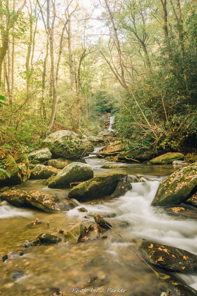
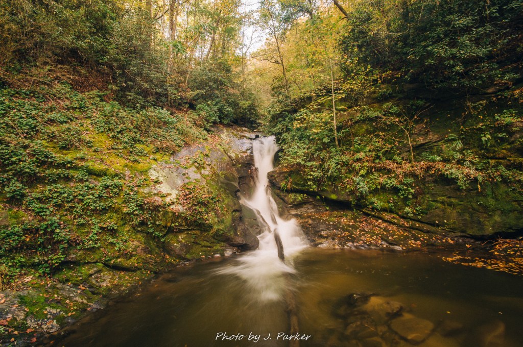
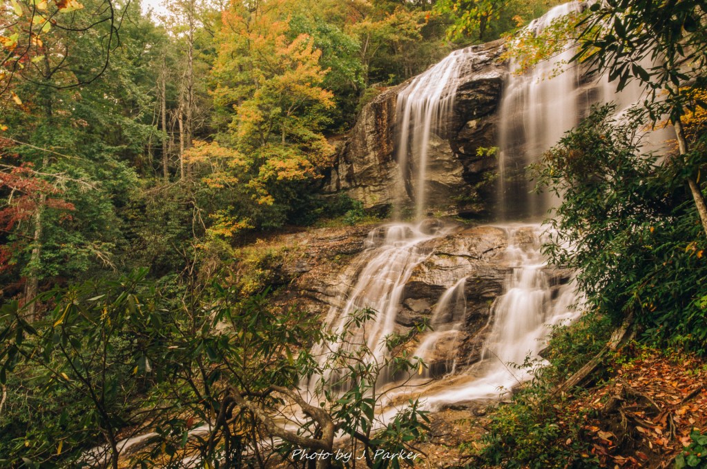
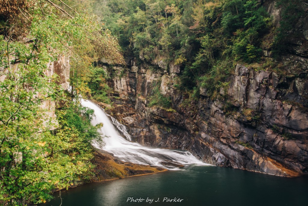
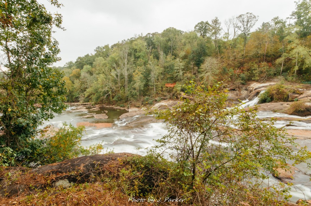
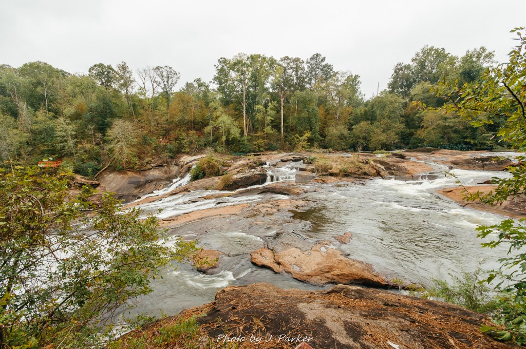
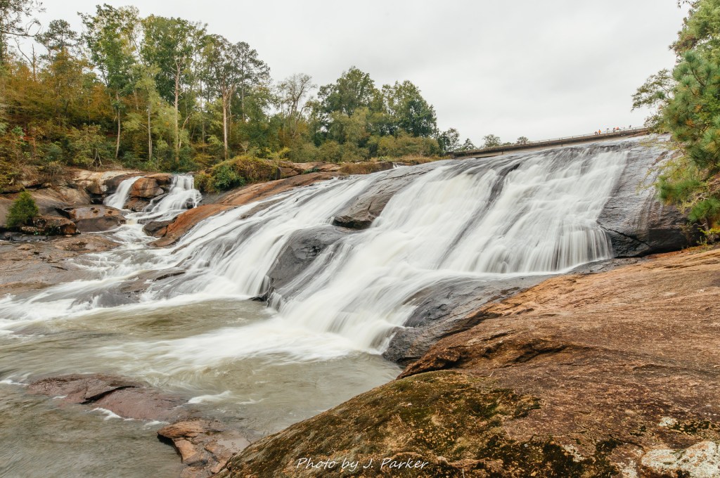
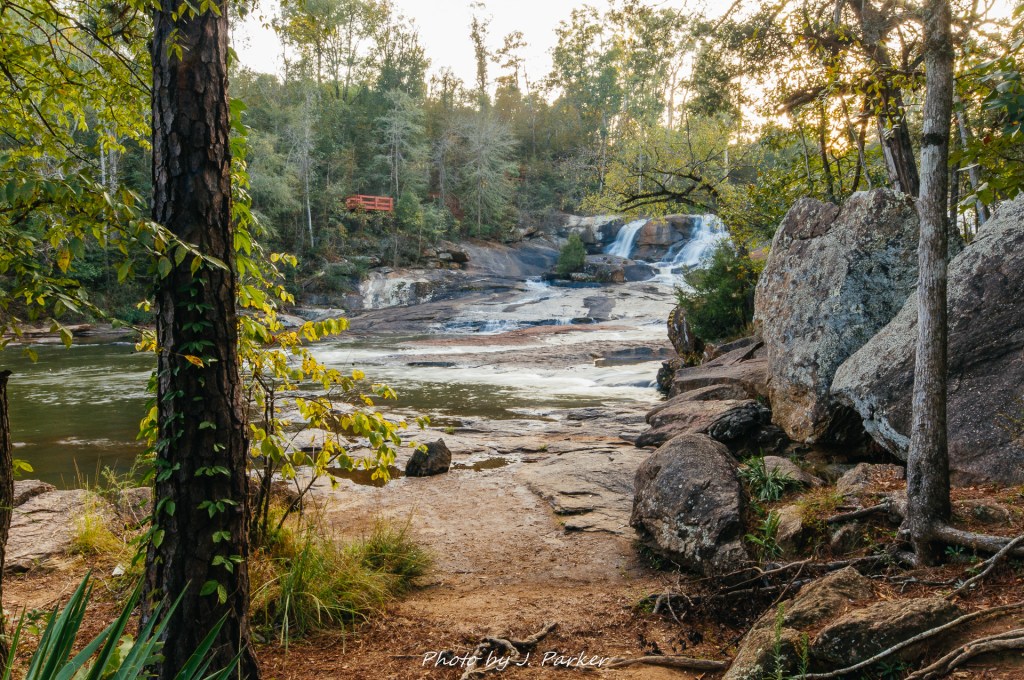
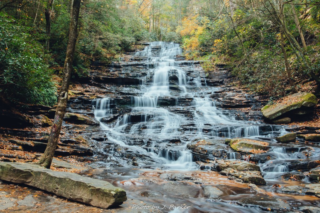
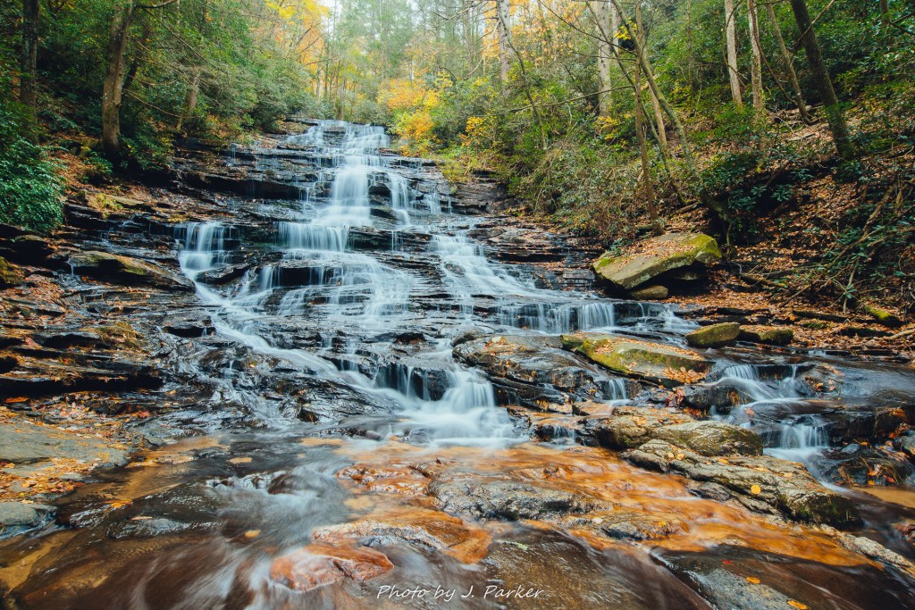
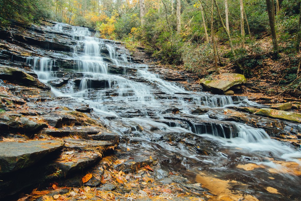
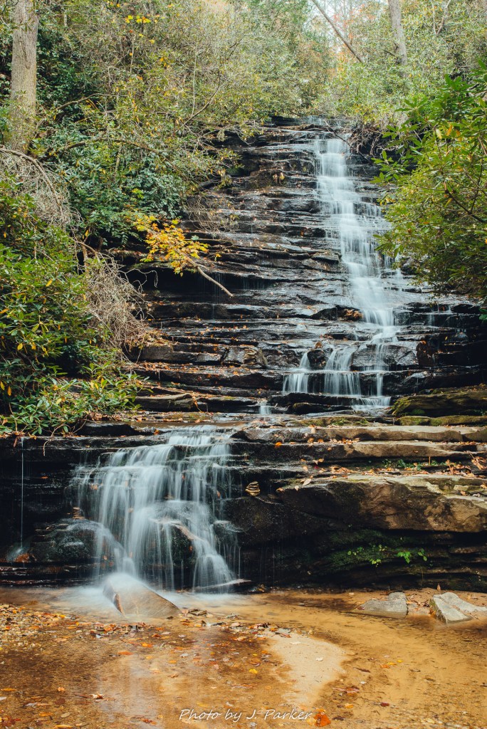
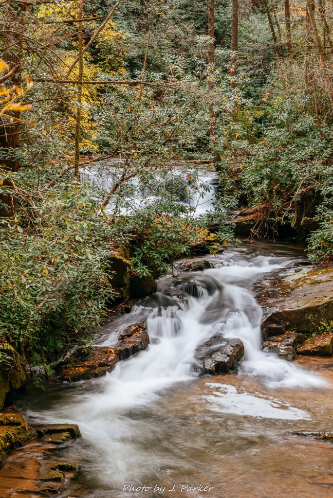
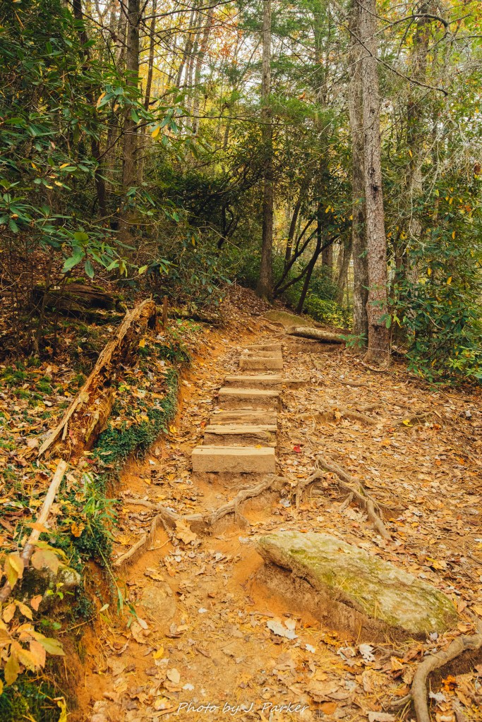
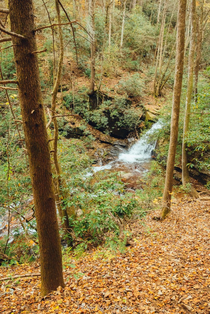
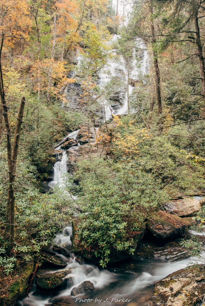
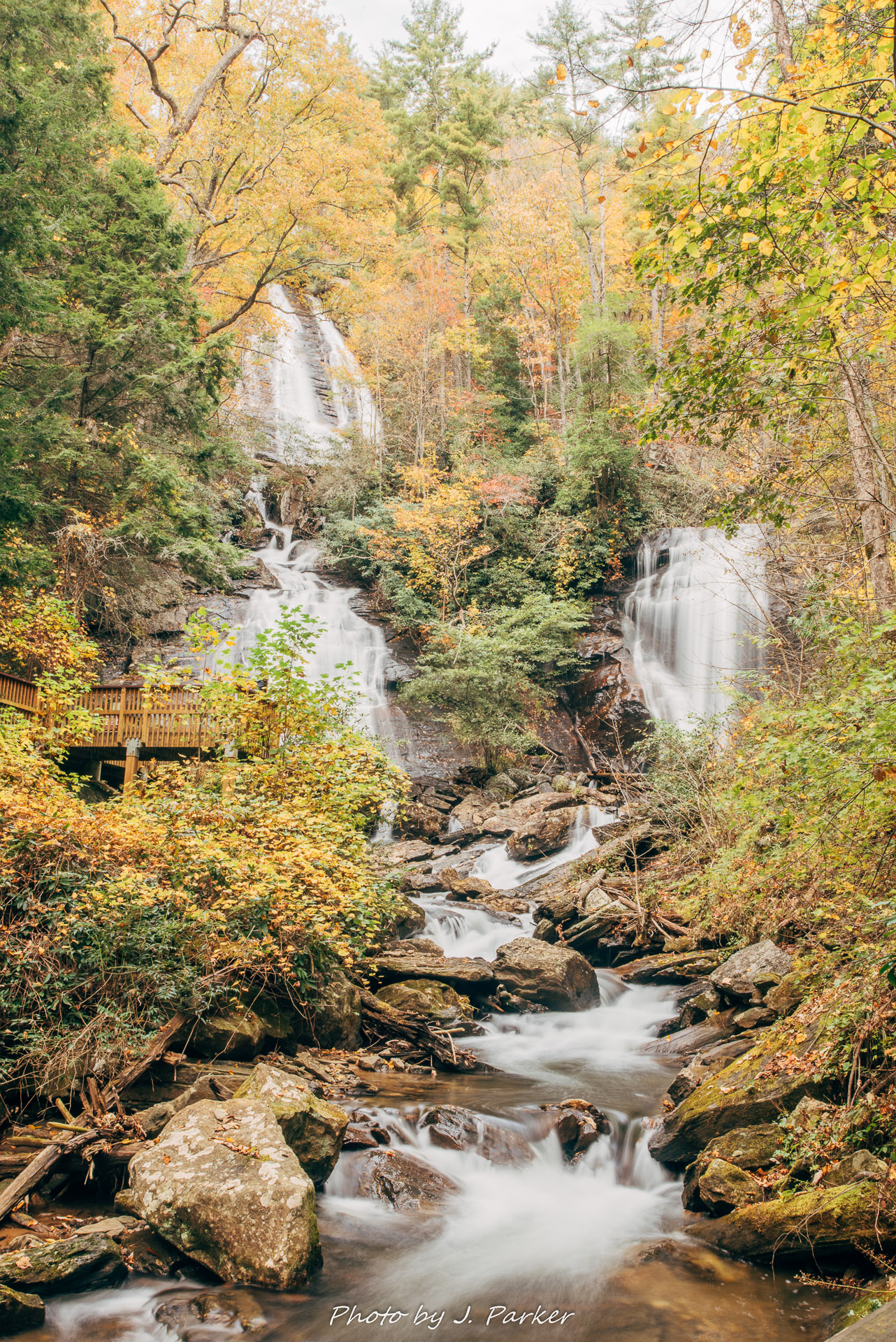
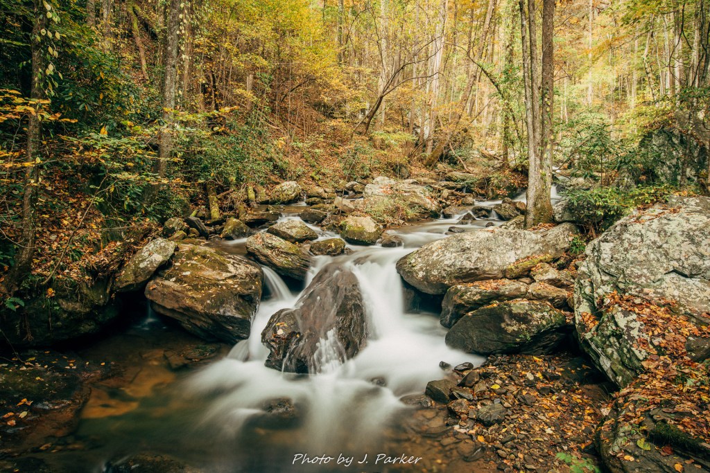
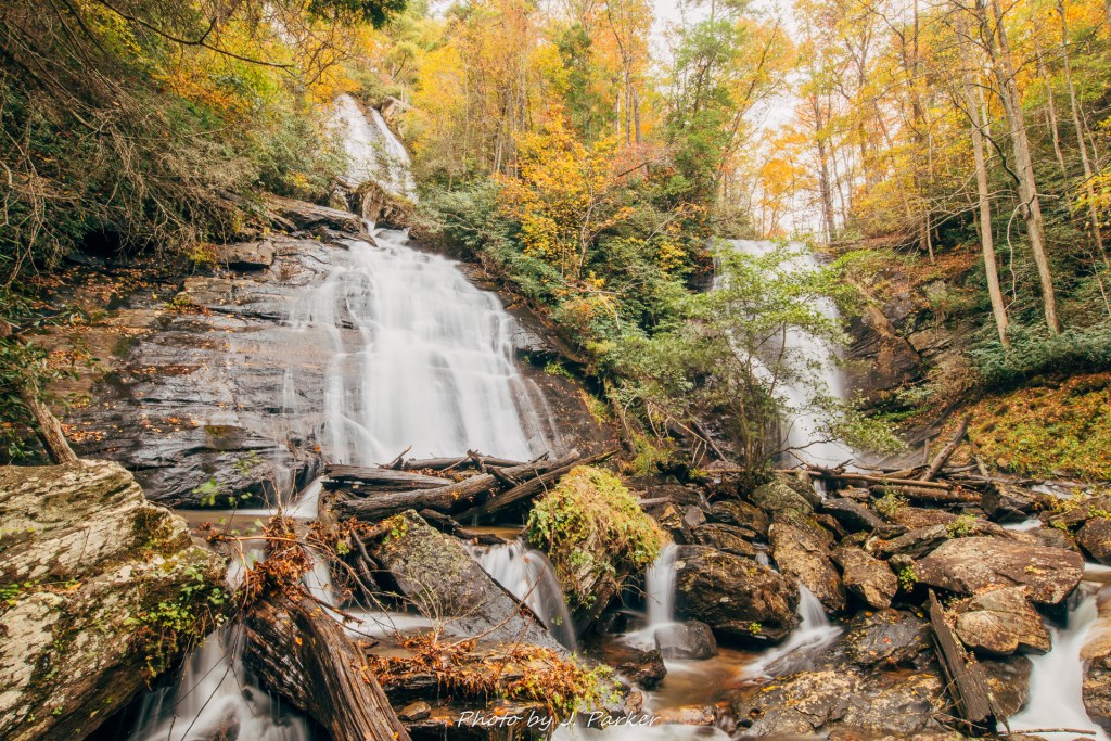
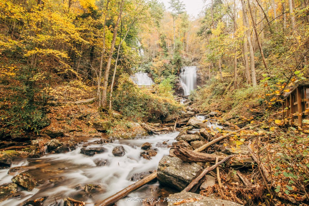
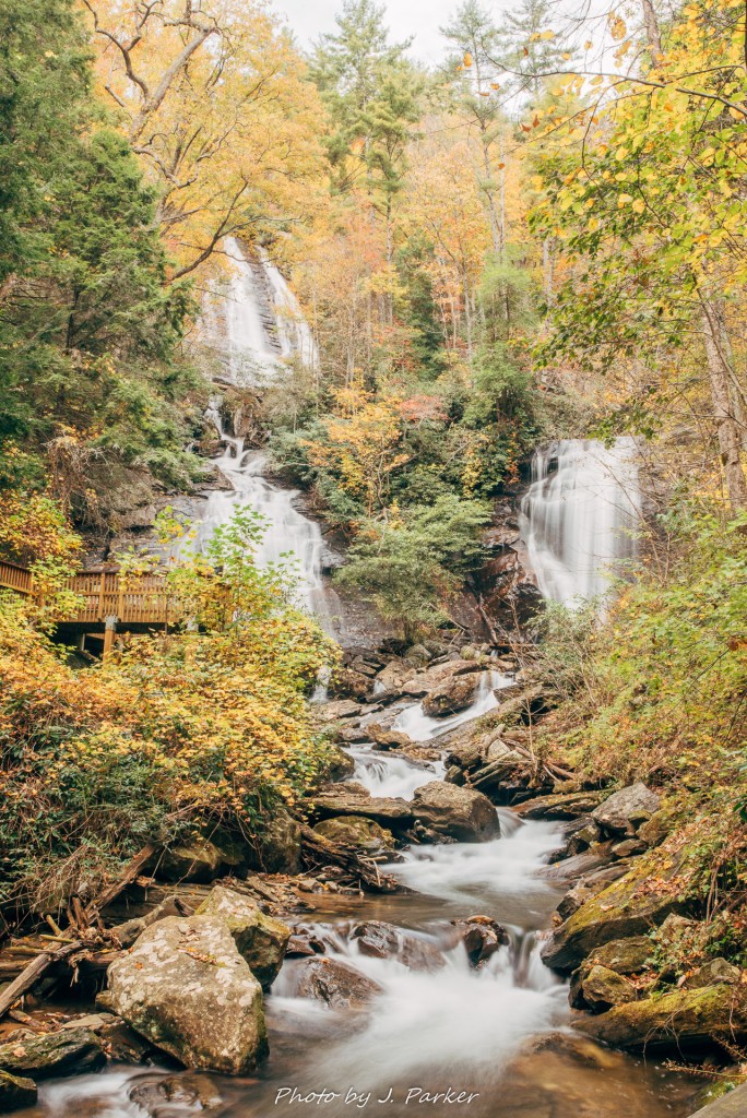
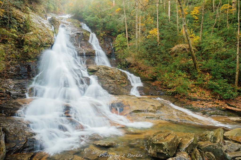
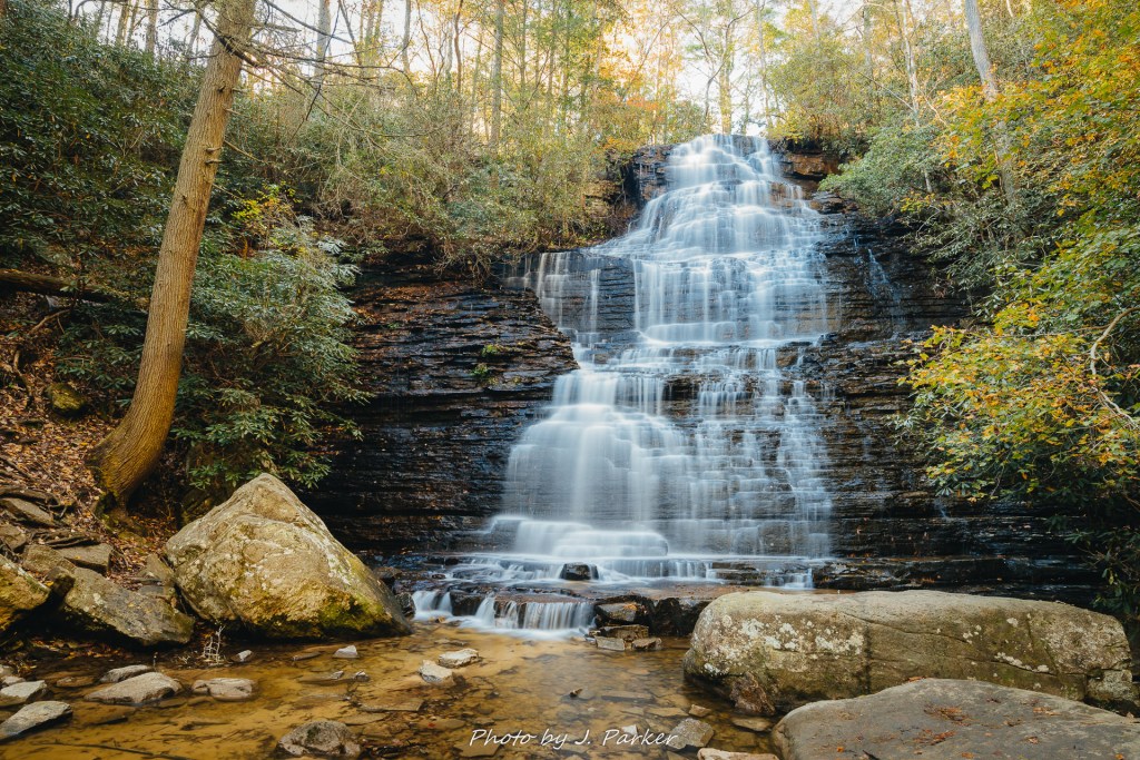
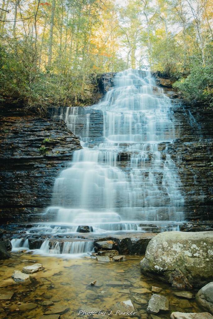
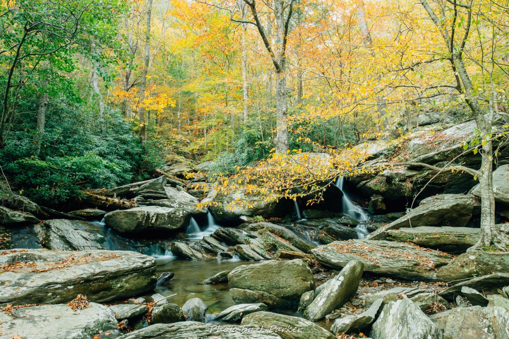
While in mountain terms Dupont State Forest had pretty negligible elevation gain, that didn’t mean it was entirely devoid of uphill climbs. In fact, on this hike, the elevation seemed to come all in one uphill burst, which we started as we approached Triple Falls. We began the falls with the loud sound of three successive cascades beckoning us, and I was a little taken aback by how impressive my first view of these falls was. Halfway up the hill, the trees opened and provided an unobstructed of the top two tiers, with part of the bottom tier visible below.

Triple Falls from the trail.

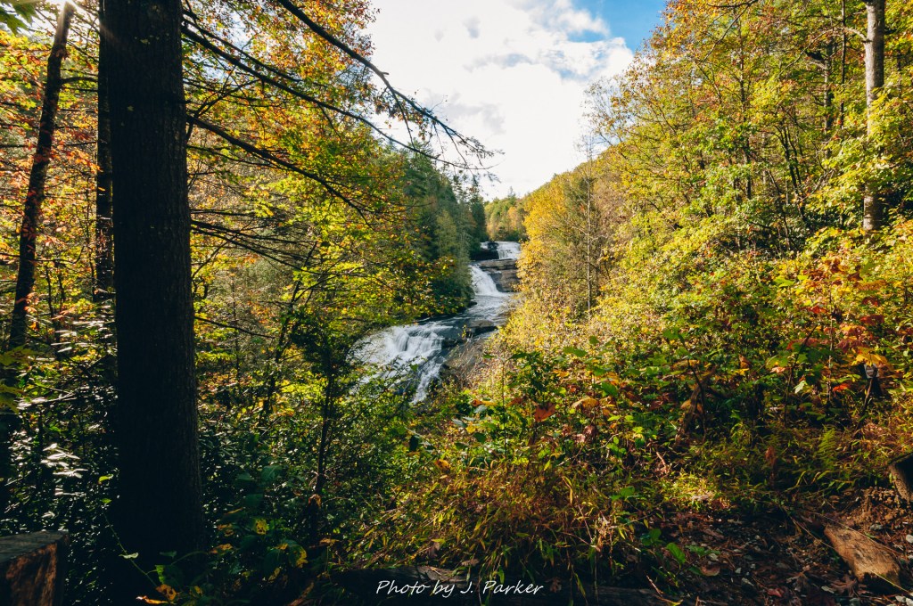
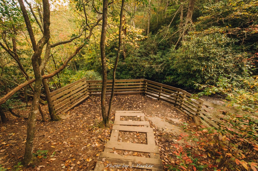
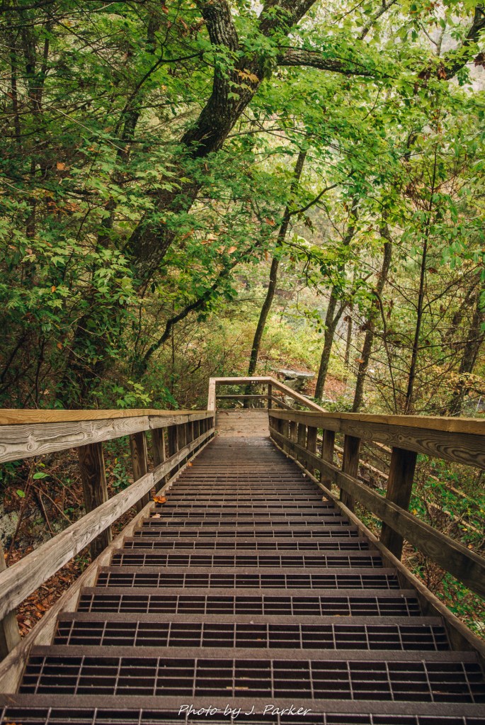
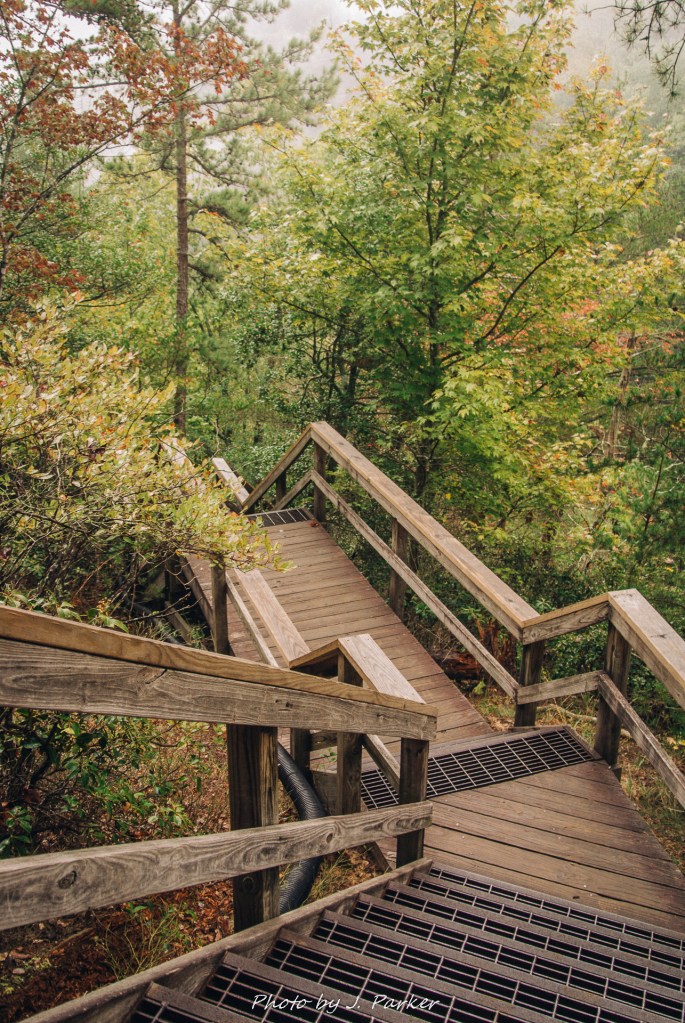
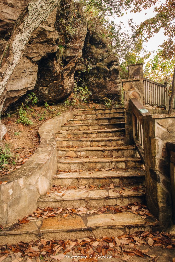
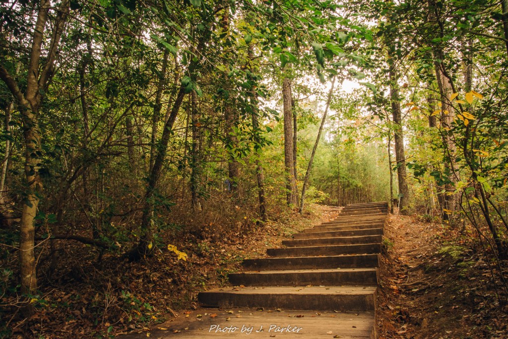
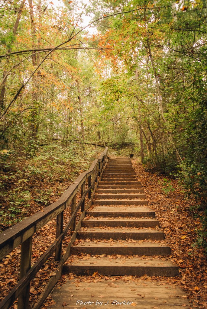
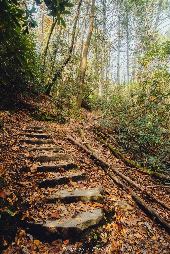
A bit further up the climb I was happy to see a set of stairs branching off from the left of the trail to provide access to the middle tier. And when I say that, I don’t mean a viewing platform – it dropped you off right onto the flat rock expanse that made up the middle tier. There was a very wide area to walk, with the rock being maybe 70-100 yards at its longest between the two falls. I was able to walk right over to the top of the bottom tier, which was entirely safe as the water was not close to this section of rock. Peering down, I was a little surprised to find someone was walking around the bottom tier, leashed dog in hand. I hadn’t recalled seeing any kind of real trail branching off as we had passed that area. I tried to shoot the water running downhill from here, but I never seem satisfied with shooting waterfalls from above, and this was no exception.

The lower tier of Triple Falls.

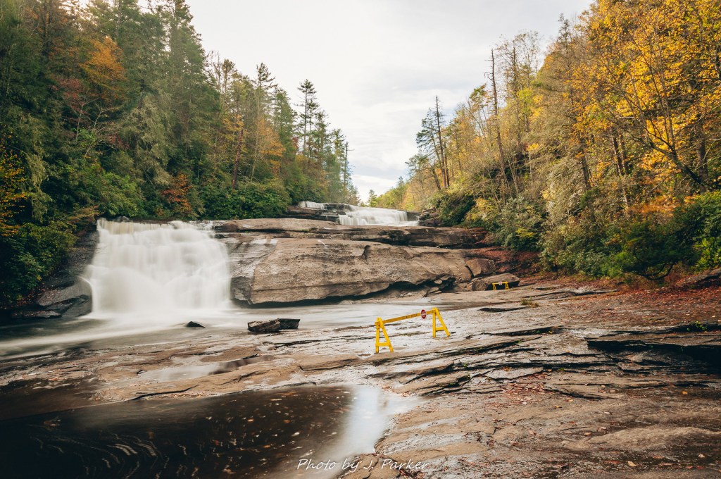
By now we were far from alone in the forest, though there weren’t too many people packing onto Triple Falls just yet. What was there, however, were several barricades, providing a guideline for how far one was allowed to venture out onto the fall. This was an issue for me as there wasn’t a way to get a shot of the upper two tiers, my best opportunity for a good shot, without a barricade in it. Try I might, but I was never able to successfully remove those barricades from my shot. That’s just the way it is.

Triple Falls, complete with barricade.

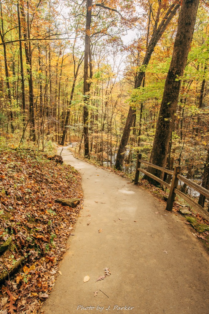
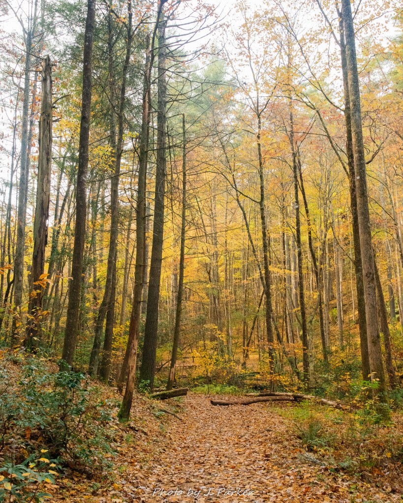
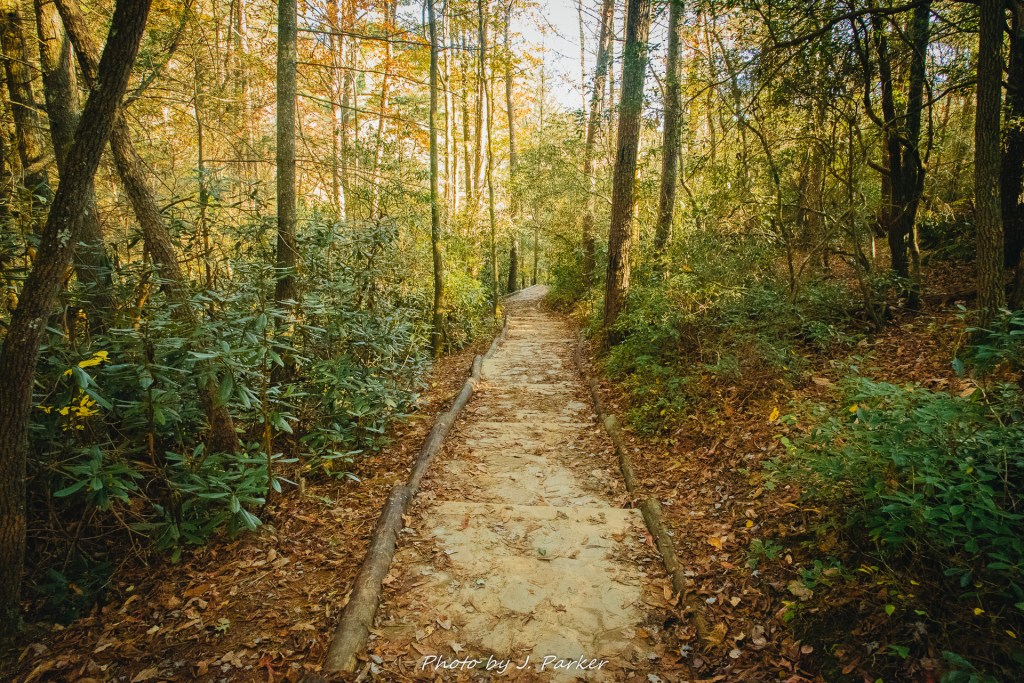
Two waterfalls down, one more to go. The stairs down to the rock at Triple Falls hadn’t seemed like much when the promise of a waterfall view awaited on the way down, but they seemed much longer going uphill. Finishing them only led to more of the uphill on the trail. And in all, this wasn’t a huge elevation gain, but my legs were still a bit tired, having done Tallulah Gorge and Glen Falls the day before while also being on medication. I was pleased when the trail flattened out again, with the level trail being host to more of that perfect forest we had seen earlier.

On the way to High Falls.

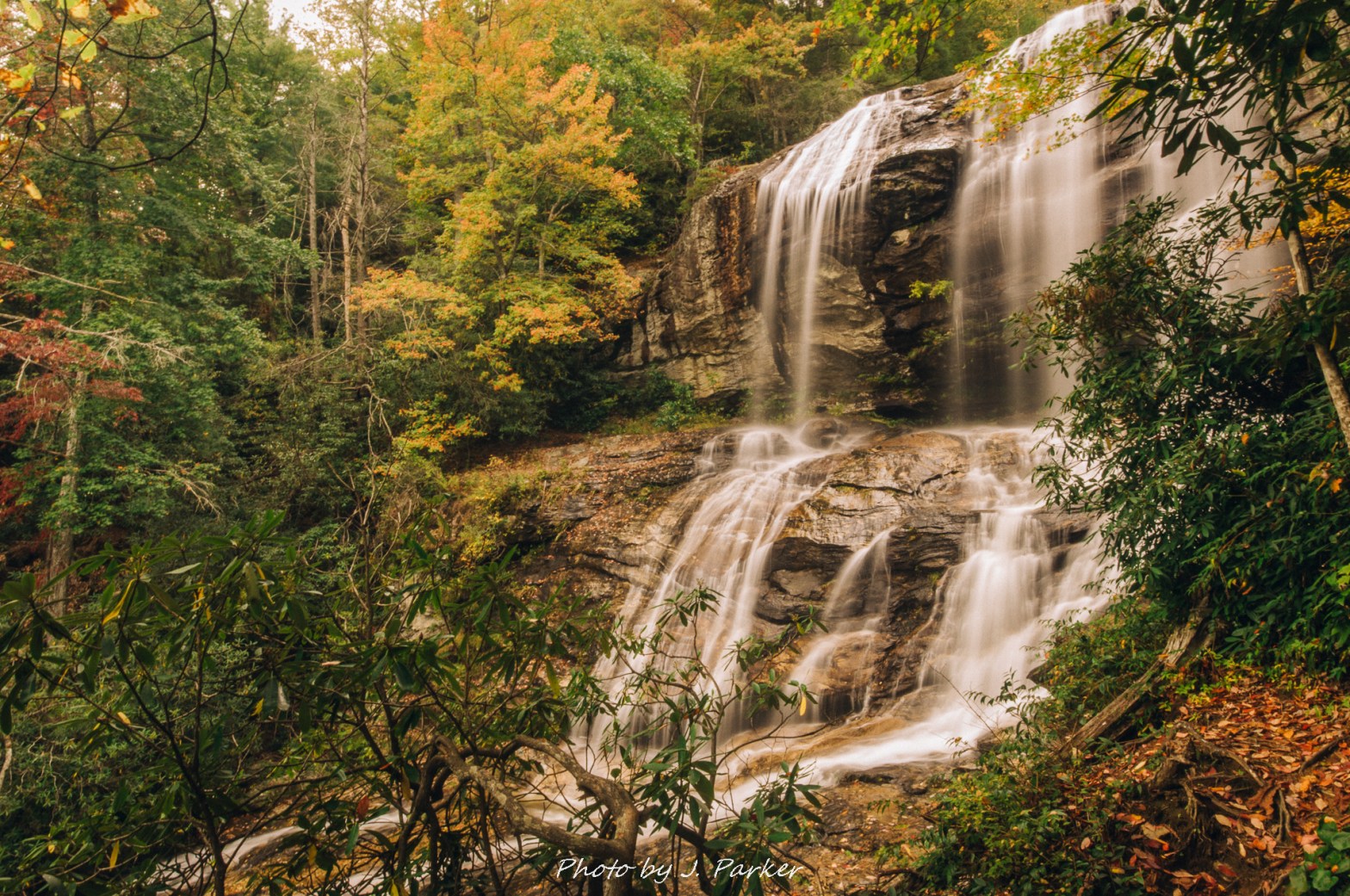
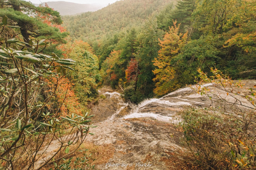
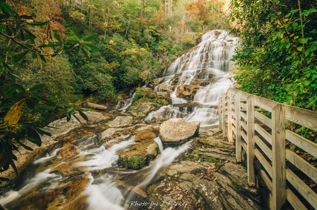
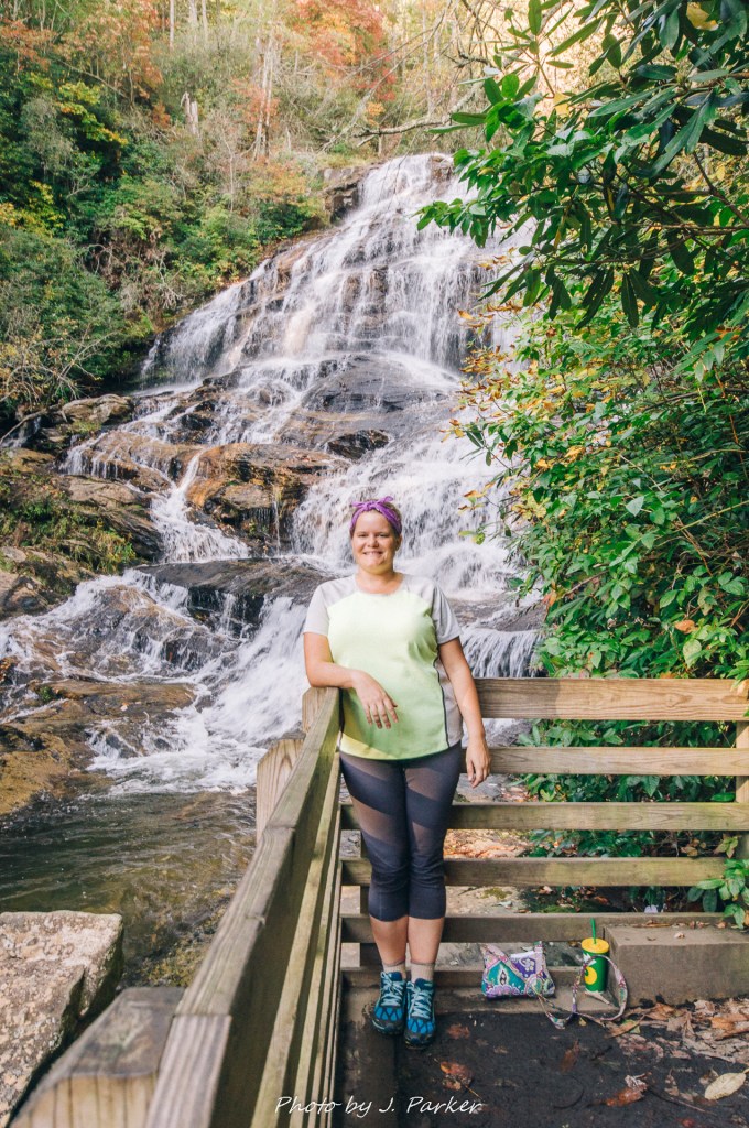
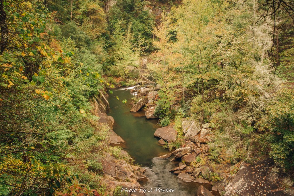
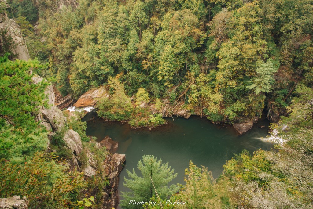
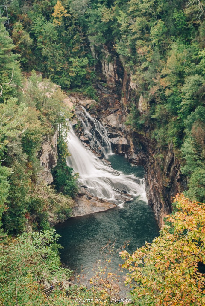
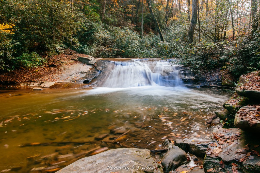
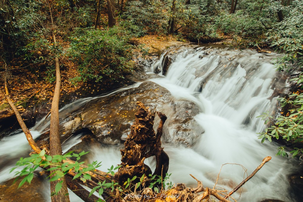
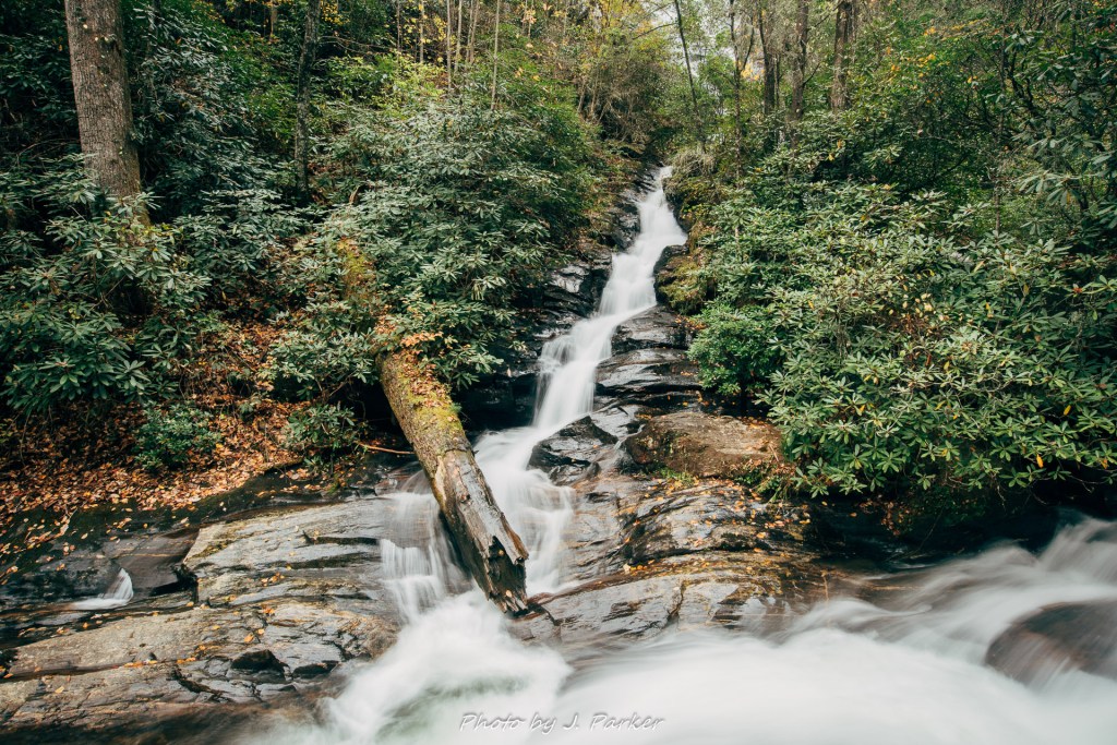
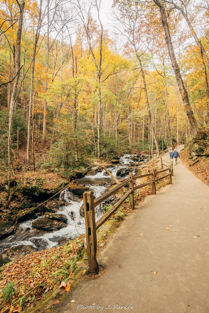
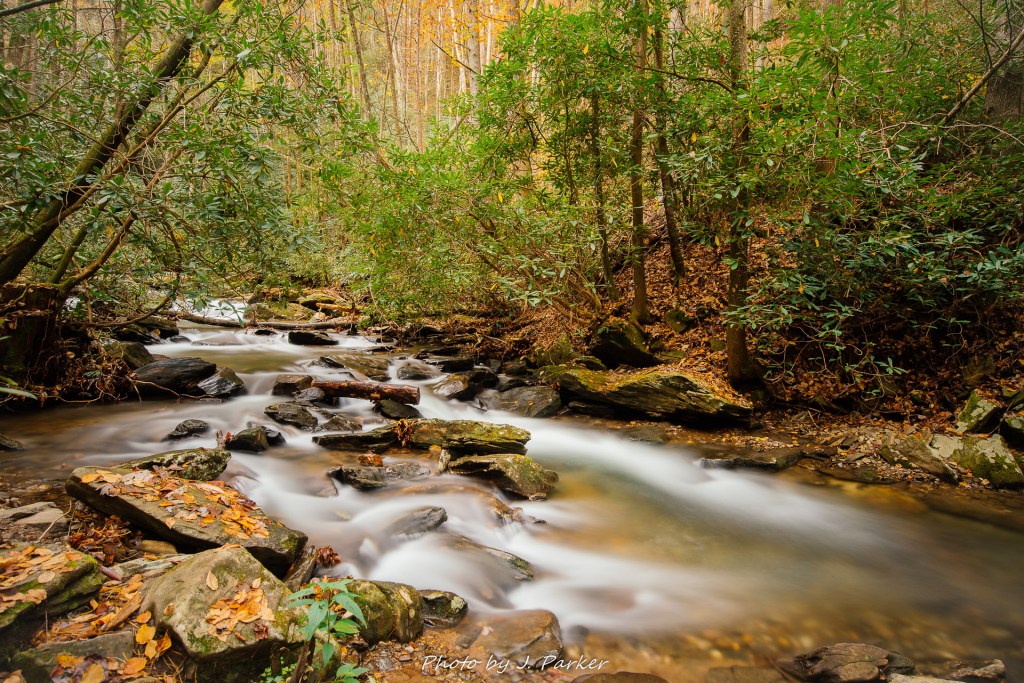
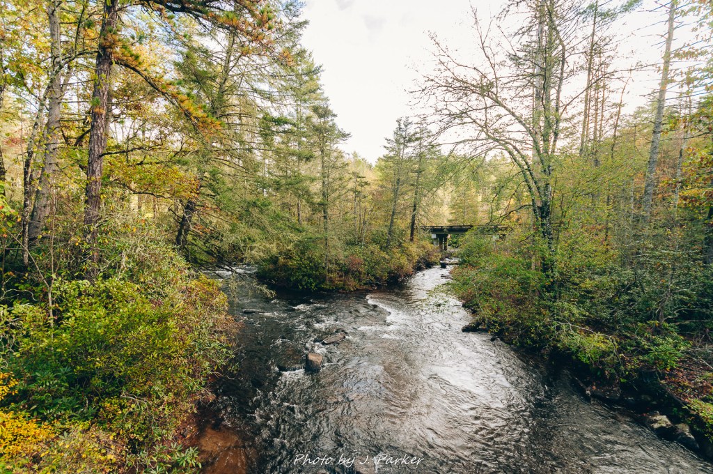
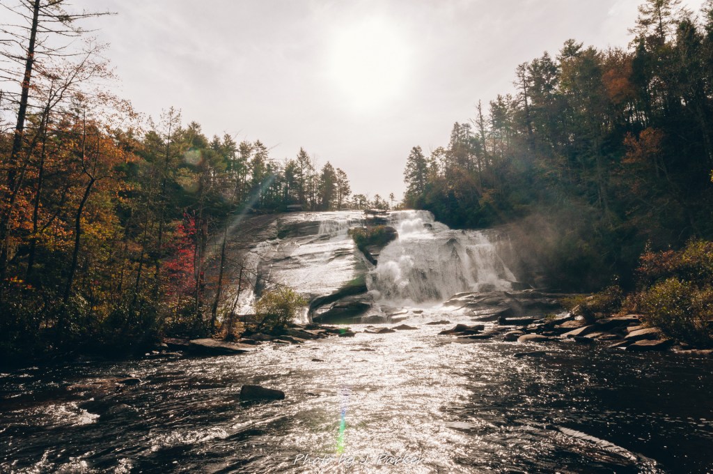
Soon we were greeted by a sound much louder than even the three-tiered Triple Falls. This was the roar from High Falls, which I found quite aptly named on first glance. There were several alternatives for seeing High Falls, but where the trail split, with one going uphill towards an elevated viewing area (and also a covered bridge), while the other stuck to river level and worked towards the bottom. This trail divergence actually occurred some distance from the fall. I prefer falls from the bottom, so we stuck to river level. Our approach meant our first view of the falls actually came around a river bend, which was in itself quite striking. I wasted no time getting a shot of this.

The river bend.

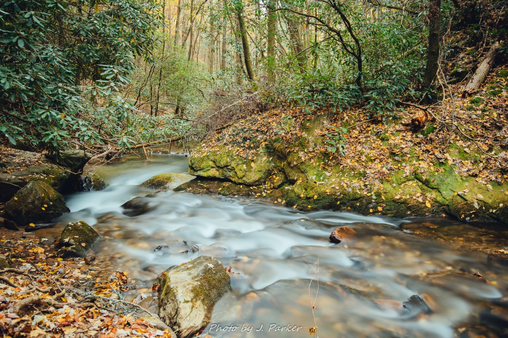
I worked my way along the flat rocks of the river towards the fall, and after a short distance I looked behind me to discover another nice view. I grabbed this one as well.

Looking downriver.

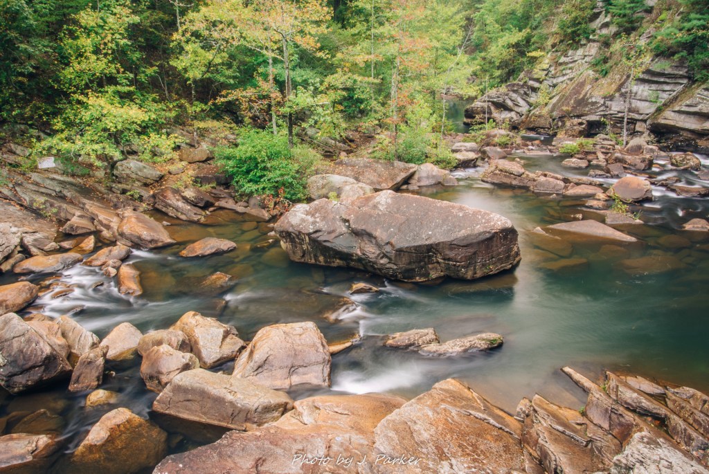
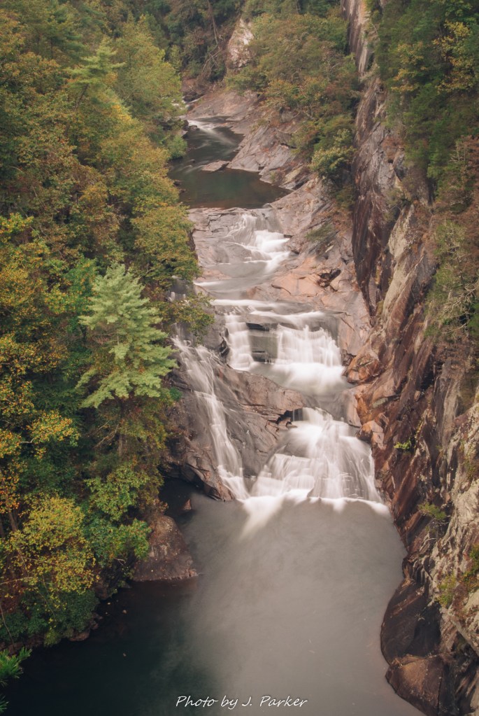
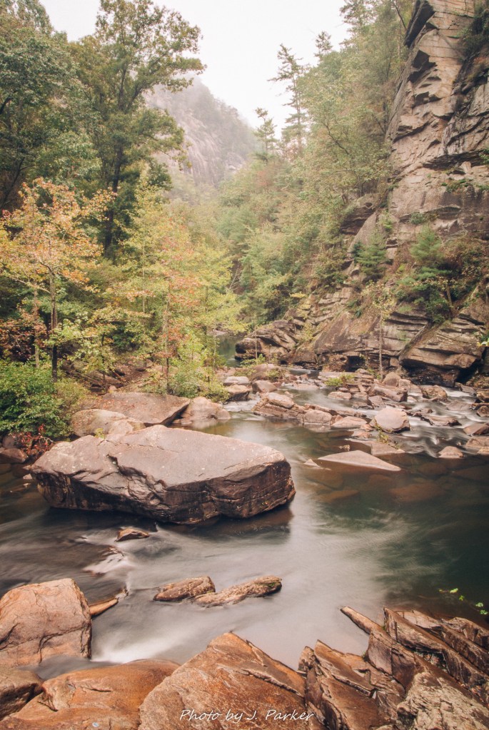
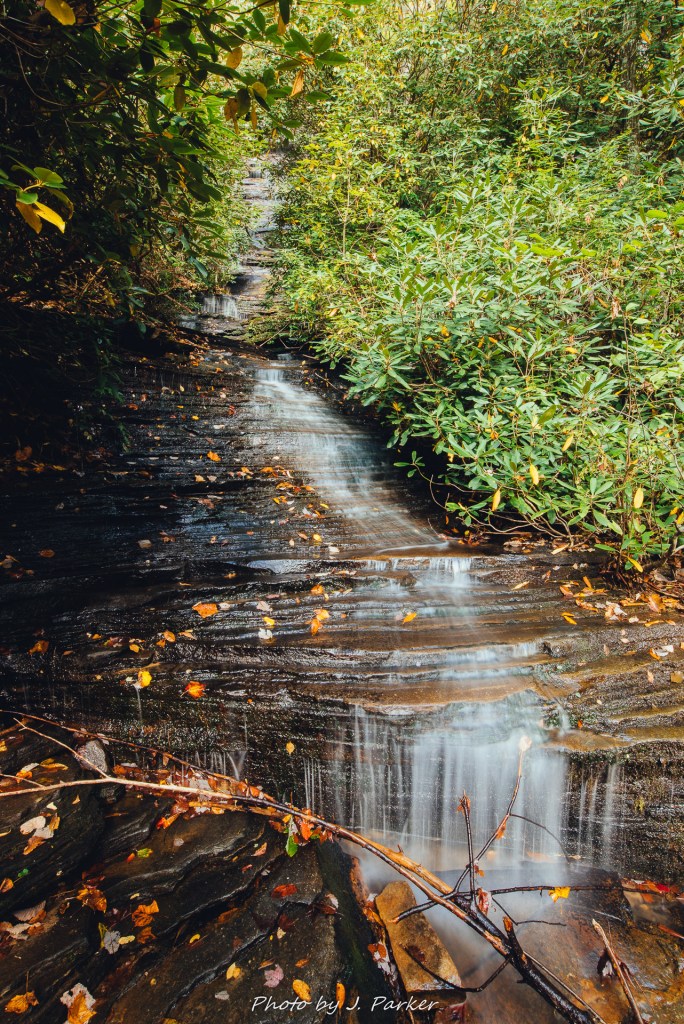
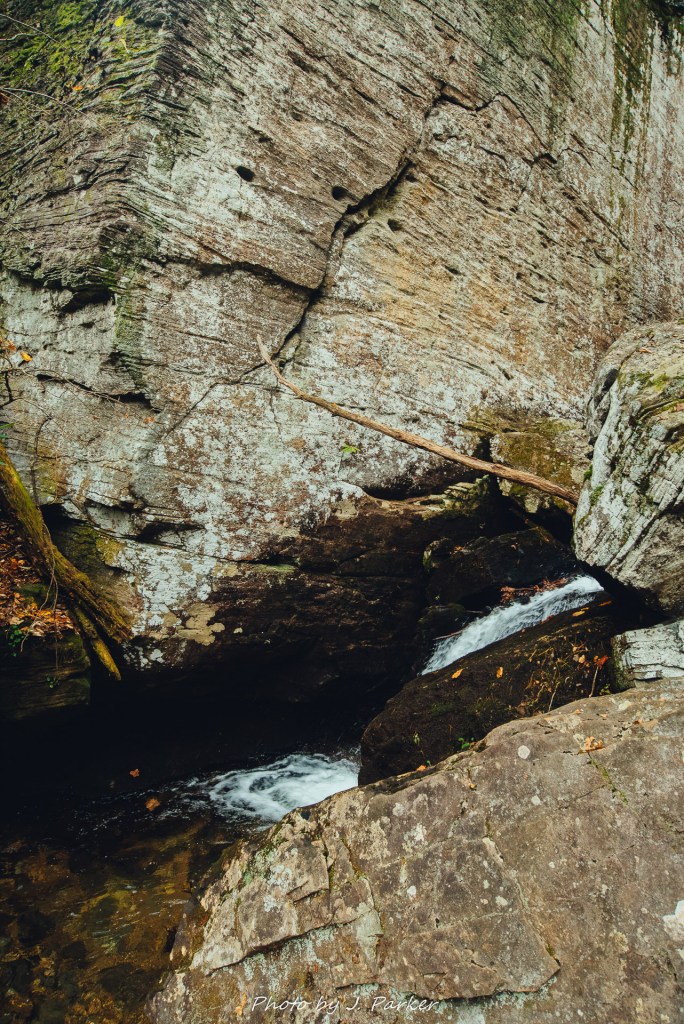
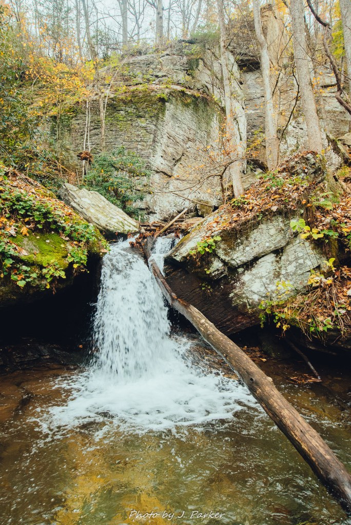
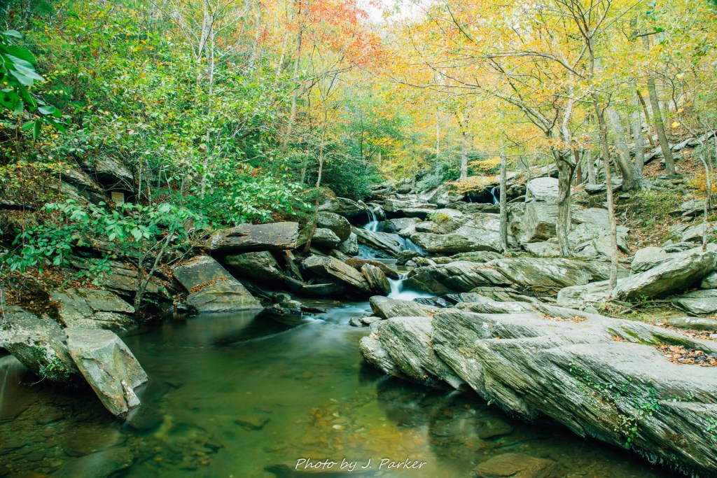
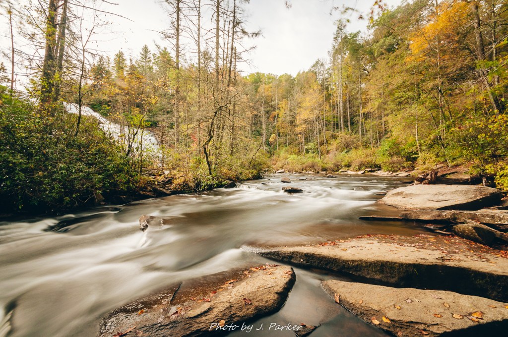
Unfortunately, the trail which had been so clear before essentially dissipated into several paths which can scarcely be called goat paths. So close to the falls, I was going to make it there, but the path proved very challenging. Tripod in hand, I worked my way through brush, under trees, and along rocks precariously perched along the edge of the river. Finally, I made it to a long, wide rock outcropping I had spotted, which reached all the way from near the bend to the base of roaring High Falls. The fall absolutely roared as it towered overhead, but its imposing height was not enough to block out the sun which was at this moment perched directly above the fall in such a way that photographing it would be next to impossible. With that in mind, I focused again on the river bend we had just navigated. Here, with the trees somewhat stripped back, the river again looked something like a scene from a western or northern area, not Carolina. I used the big guns to capture a frame I was very happy with before I would turn my attention back to the big fall. As its very easy to knock the camera out of focus or have other technical issues with a long exposure, I wanted to take the shot again to try to ensure I had a clean version of it. That was when my filter flew out of my hands, and that open rock which had seemed so convenient a few moments ago was suddenly far less convenient when my filter was falling right towards it.

The last shot my ND filter ever took.

Thankfully, I had gotten the shot on my first attempt, but I wouldn’t be taking any more long exposures on this hike. As it tends to be, the death of my ND filter was a bit of a buzz kill, and I didn’t even try to do a futile long exposure with a waterfall that was both directly in front of the sun and also roaring at a higher rate than would be pleasing to photograph. I had to retrace my steps following the rough path through the brush along the river bend before picking up the more established path. Taking the sun angle and the loss of my filter into account, we really didn’t care to add the extra mile+ it would take just to get the view from the High Falls overlook or walk to the renowned covered bridge which had remained out of view from our angle at the base of the falls. (We would see the covered bridge on a future trip, and I’m glad we didn’t waste steps taking this side trek, as it was a very modern looking structure that lacked the character I though a covered bridge would have.)

High Falls with the sun directly above.

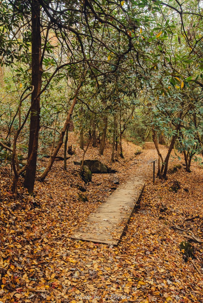
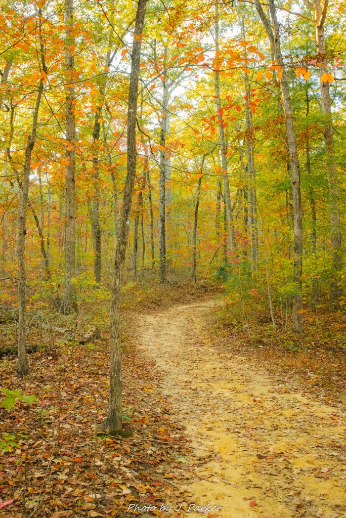
Given a choice, I always prefer to do loop hikes, but there is some benefit to retracing one steps, at least in places like Dupont State Forest, where you get to see different views of that same awesome forest. And I savored every view of the forest I got.

The forest on the return trip, working our way up a short incline near Triple Falls.

As we walked the moderate distance back to the car we talked about how we could replace my now-departed filter. But more than that, we also marveled at just how much we enjoyed this hike. Even though I found High Falls more impressive than I anticipated, I wouldn’t say that any of the falls alone are necessarily top ticket items among the wealth of opportunities that North Carolina provides. Rather, Dupont State Forest is greater than the sum of its parts. The greatest feature it offers, absolutely stunning, pastoral woods, isn’t one that stands out when evaluating potential hikes, but when you can combine that with multiple waterfalls and a picturesque Little River, all while not being very strenuous, it makes for a very good hike.

Another small uphill stretch of trail.

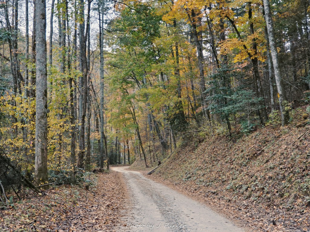
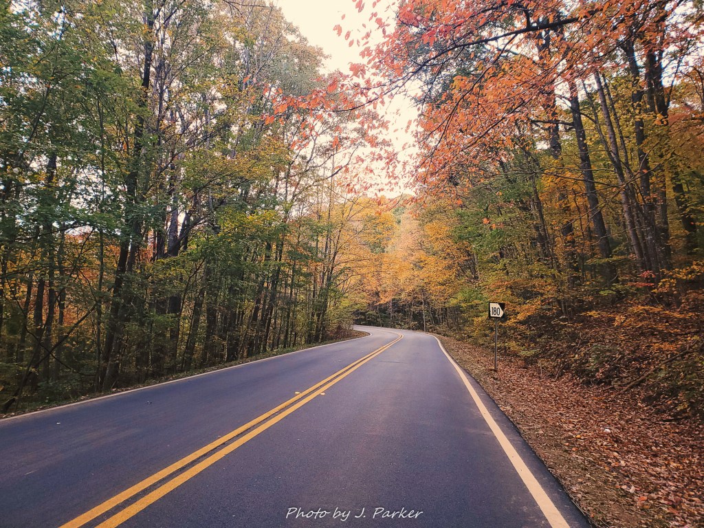
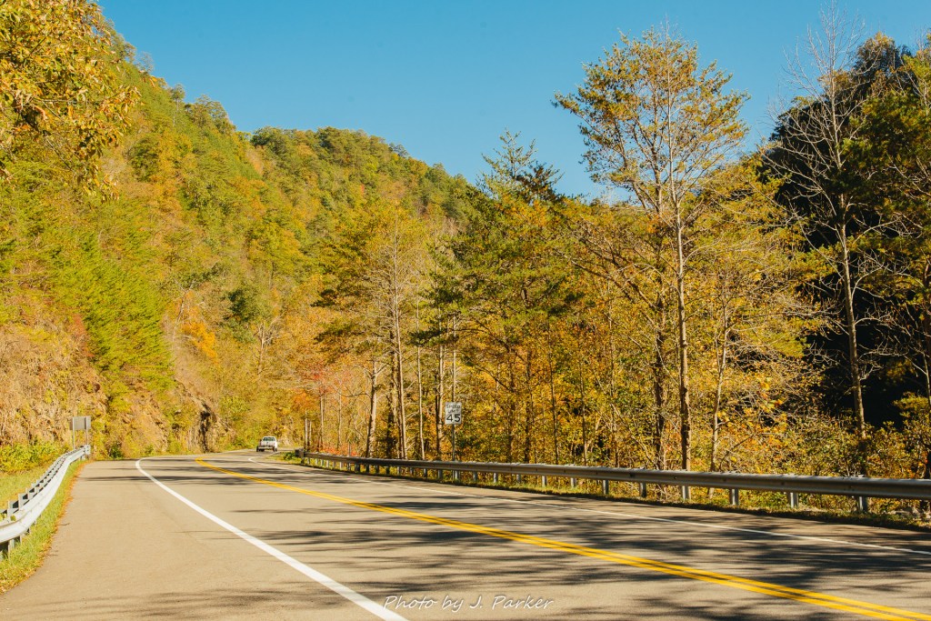
I felt good about what we had experienced that morning at Dupont, but overall, I felt kind of rotten. I might have anticipated having problems with my hip at this point, but my hip couldn’t have reacted better. Somehow, it was a total non-issue, and felt better today than it had done the day before (something I would find happened regularly on our longer trips, as it reacted well to getting stretched out.) Instead, I just felt miserable from the antibiotics I was on. We still had more than half a day left, and I had a notebook of potential stops we could make in the area, but my brain could scarcely conceive of doing might right now. Thus far everything in our trip had met or exceeded expectations. Would I be able to overcome this latest hurdle, and would things work out for this as with everything we had done before? These were valid questions as I struggled to keep my head up on the curvy, scenic road back towards Brevard.

2017/10/15 – Darnell Creek and Glen Falls

I was nervous. Scared. We were in our distinctly non-four wheel drive Toyota Corolla (though I scarcely think I would have felt comfortable in any vehicle). We were on a narrow, gravel, one-lane road heading up a mountainside to God know’s where. And we were in completely over our heads.

I knew where we wanted to go. I had good directions to multiple waterfalls located on short trails at four different parking areas along this road. We had already found one, though I had a sneaking suspicious than I had passed the second without positively identifying it, despite being on the lookout The young man on the four-wheeler who had been zooming repeatedly through the area had passed us and we asked him if there was a turnaround point up ahead. He said something along the lines of not really. I said something along the lines of shit.

A decision was made. We were going to back down the roadway, back to the most recent place where we knew we could turn around. Difficult as it is, backing down a fairly steep one lane gravel road in the mountains, I had nearly successfully attained my goal when we were thwarted by the appearance of another vehicle. No problem. We were almost there, they should see what we’re doing and back up the short distance so we can turnaround. The Florida license plate on the back should clue them in that we were struggling on this mountain road. If that was too small to read, the Toyota Corolla that had no business being on this type of road surely wasn’t. But he kept coming, slowly but surely. If I continued on my path, we were going to collide. I made a quick choice.

I hit the brakes and quickly switched the car from reverse to drive, but this process was accomplished much easier than getting the car to actually go forward on the steep, unstable surface. The wheels merely spun in place as the air took on a slight burning smell. Warning lights blared on the dash, most of which I couldn’t identify and haven’t seen since. It felt for a moment as if the car were going to slide of the road, and while it wasn’t a super steep, deadly drop off the road, it was farther than I was interested in plunging our Toyota Corolla at that particular point in the trip (I usually try to save the vehicle plunging into the woods moments for later days of a trip, after I’ve already accomplished a bit). Finally the car lurched forward, and we were again heading back uphill, under control but practically shaking from the stress of the moment.

The road where all the trouble occurred.

I can’t tell you how we got off that damn mountain road. Perhaps I blocked it from my memory due to traumatic stress. All I know is that eventually we emerged from the woods, shaken but otherwise ok, with the trusty Corolla showing less long-term ill effects than we did.

The road was Forest Road 150 in the Chattahoochee National Forest. The creek was Darnell Creek. The drink was Mountain Dew. After visiting the fascinating Tallulah Gorge and enjoying some boiled peanuts from a roadside stand (I can’t tell you what excites me more, nature spots or good homemade boiled peanuts) we had some time to kill as we worked our way towards Highlands, NC., where we would visit Glen Falls, and I put my months of research into use.

There was a good trip report and guide written by my friend Mark Oleg of Hiking the Appalachians and Beyond (https://www.hikingtheappalachians.com, a resource I consulted frequently in my research for the thorough informative guides, despite the fact that the author’s comfort and experience level with both mountain hikes and driving far exceeds my own) for a place called Darnell Creek, which seemed to offer great bang for your buck (free) by allowing access to four waterfalls with negligible walking and in a quiet, secluded setting to boot, far different from nearly every other packed waterfall we had or would see over this week+ in the mountains. I looked forward to stretching my legs photographing mountain waters. Though the four falls were an allure, I was more focused on enjoying one or two to the fullest before leaving with enough time to enjoy Glen Falls, which was our real goal for that afternoon, before dark.

The first pull-off for Darnell Creek.

We first turned off the highway onto a paved road, before navigating a series of intersections that lead us to the small dirt road that would be our launching point for all four falls. I didn’t have undue concern at the narrow roadway as the way to the first pull-off for Darnell Creek was rather tame and level, and we didn’t encounter any other vehicles on the remote roadway. Only some 100 yards of easy pathway separated us from the creek and the first fall, actually called Darnell Creek Falls, and we could hear the flow of water as we exited the vehicle and made our way to the water. The way was framed by the bright green foliage typical of southern Appalachian creekbeds, and our feet touched softly on a carpet of fallen leaves as we walked. The day continued to be delightfully partly cloudy, which prevented harsh dapple light from causing contrast in the understory but whose subdued rays illuminated the golden hues that were beginning to fill the treetops. There was a divine feeling to this pleasant afternoon at this secluded spot.

The path towards Darnell Creek falls.

Our first view of the creek was not of the fall, but instead a small set of rapids 50-70 yards downstream of them. This was actually the first small mountain creek I came across with my full complement of camera gear and able to fully photograph, and this started an enduring love affair with mountain creeks and their water features that has continued on every subsequent mountain visit. I had been using neutral density filters and working on long exposures when the opportunity presented itself for almost two years. Unfortunately, the opportunity doesn’t present itself very often in Florida, so despite moving water becoming my favorite photographic subject, I was still rather a novice. Being at that quiet spot in good light with nobody else around but me and my wife allowed me to experiment with the craft in a situation truly befitting it. I had several different filters of varying strength, with the most powerful ones being somewhat of a pain in the butt to use, as the camera can’t focus with them on. This requires the delicate balancing act of focusing the camera and then screwing the filter on without knocking it out of focus or moving the tripod, which can be quite a challenge as filters rarely snugly fit in the threads on a lens upon first attempt, which can and has resulted in many a broken filter as dropping them during this process is frequent (more on that in a future post). Sometimes putting on the filter is, quite literally, a balancing act, as oftentimes the best area to photograph a waterfall or waterway is on a treacherous slope or rock, as nature didn’t always design itself for easy access.

Our lovely set of rapids on Darnell Creek.

After some experimentation I found that, much to my chagrin, the longer exposures from the most powerful filter just gave a “wow” to the pictures that wasn’t present in the shorter (but still technically “long”) exposures I got with other, easier to use ones. Bummer. From then on, I knew that getting the most of a long exposure involved the tedious act described earlier, plus having to let the camera sit for a long time taking the shot. On numerous occasions I’ve tried to cut corners and get away with using less the less powerful filters and easier method, but I’ve been unsatisfied with the results. I could take four lesser long exposures compared to the time it takes for my standard, but that’s usually the difference between getting one great shot or no great shots (merely good ones end up forgotten). Ironically, in addition to being lighter and easier to maneuver and setup, my lower resolution mirrorless camera, brought along on the trip only to be a backup camera, got used a lot for its ability to get exposure times into that “wow” range while still being able to focus without having to screw on a filter, owing to its newer, less light sensitive sensor.

A closer composition of the rapids.

We spent a really long time just enjoying this stretch of rapids, the sights and sounds of the place as well as the thrill of being able to unleash my camera and filters. I gave little care to the fact that us spending so much time here would likely prevent us from getting to all four falls before having to leave; what mattered in this particular moment was that we were two Floridians getting to enjoy a mountain creek in fall for the first time. I did have some care about something that happened while we were there. The lens cap for my 18-105mm lens, which had been with me since receiving my first DSLR in 2011 and whose strengths I was beginning to appreciate more after getting a complementary super wide angle, fell in the creek and disappeared. Not down the creek, as one might anticipate, but instead getting sucked upstream and under the rock at the top left due to some current. We tried our best but could not located the filter under the rock. This seemingly minor inconvenience lead to big consequences; for while I also kept filters on my lenses for extra protection at all times (filters are more easily replaced than lenses), by the end of the trip the turbulence endured by my camera bag on mountain hikes caused the filter to pop off, which then left the lens surface exposed in my bag, resulting in something causing significant scratches on the lens surface. It was effectively done for. We pass the entrance turnoff to Darnell Creek regularly, as US23 is the gateway to just about everything in that part of Appalachia, and I always joke that I have to go back and retrieve my lost lens cap from Darnell Creek.

Trying (and failing) to get the falls in the background of a rapids shot.

We slowly inched our way upstream towards the fall. There were several places where sets of rapids made a pleasing sight with the fall in the background, but I wasn’t able to capture this in person. The fall itself was of course, pleasant to see, more interesting in person than it was in pictures. It contained a narrow but surprisingly powerful flow, plunging maybe some 20 feet into a wide pool below. A wide but uneven rock sat opposite the fall and almost as tall, effectively preventing access to the plunge pool below. I again experimented with filters and exposure times, but this time I never really came across a satisfying “wow” setting for a waterfall. And I’ve never actually really been able to find that on subsequent visits to waterfalls either. I just liquefy them and hope for the best.

Darnell Creek Falls

I wasn’t very good at composing this waterfall, and I’m honestly usually not the greatest at them. I found a much more pleasing look could be found looking downstream from that flat rock.

Downstream from Darnell Creek Falls.

We spent the requisite time enjoying the fall before deciding there was enough time to venture on to the next fall up the road before advancing to Highlands to visit Glen Falls, still a bit of a drive away. I gave far more thought to reading the description of how to find the next pull-off than I did to the way the road curved at a pretty steady uphill pace. Not really having experienced many Appalachian mountain dirt roads, I hadn’t really given much thought to them and how terrifying they could be before now (they seemed more reliable than our Florida sugar sand backwoods roads). That was when our unfortunate episode listed at the beginning of this blog happened. And let me tell you, after that, I am a changed man. I will never haphazardly hop on a mountain dirt road again without having conducted research and assuring myself that it will meet me quality standards by not offering ample opportunity for near death experiences. If I can’t verify it, I don’t drive it. But we did make it, and soon, after assuring ourselves that the car was ok despite the burning smell emanating from it, we were on the curvy path to cap off our day at Glen Falls.

The trip from north Georgia to Highlands involved our first ascent to Sky Valley on Georgia 246. Before rising in elevation there are quiet expansive views of the valley around you, but the road then begins a serpentine path that dazzles by briefly entering North Carolina, then re-entering Georgia. Cool trick bro. A waterfall towered about the scene off in the distance, and while I’ve seen tall waterfalls plunge off the side of a mountainside many times, I’ve rarely seen a normal size waterfall start and end on the mountainside well above you. I wasn’t sure what fall that was, and I later found it was likely Estatoah Falls, which is fairly close to the roadway but on private land. After the not another state fake out there’s a large, obvious pull-off for a scenic overview to the right. We stopped here and took in views of the valley now well below us, but unfortunately the sky was beginning to be overtaken with storm clouds, some of which could be seen dropping rain in the distance. Suddenly we were concerned that our visit to Glen Falls might be marred by rain, and we doubled our efforts to reach Glen Falls quickly.

Weird weather at the Sky Valley overlook.

A slight drizzle was in the air as we made the turnoff from US 64 to the road which lead to the Glen Falls parking area. Seeing the brown national forest sign excited me, for not only did it remind me of summers in my youth spent in the Nicolet National Forest of northern Wisconsin, but I was also truly excited to see Glen Falls itself. Highlands and the surrounding area offers a wealth of great natural locations, but the opportunity to see the stunning triple features of Glen Falls won out over all the others. The road was rather pleasant heading to the parking area, but I had little time to dwell on that on the way in.

The road form US64 to the trailhead, taken on the way out.

Fear of missing out on this stop caused us to pile out of the vehicle rather quickly. I grabbed my camera bag, an umbrella, and my tripod, hoping for the best but fearing that rain would overtake me before reaching the fall. It was scarcely over a mile to reach the three overlooks of Glen Falls, a distance which feels further when one knows there is weather in the area but can’t see the sky through the forest. I headed out ahead of Jess, knowing she would catch up with me at the falls themselves. On this fall Sunday there were many people heading up the trail, but few were heading down like we were. I had to keep my camera in the bag to keep it protected from the occasional raindrops, and in my haste of making my way down the trail, I can scarcely recall much of what it was like, save for a gradual descent with a continual mix of slopes and stairs.

Perhaps it was because my nerves gave me speed, but I reached the first view rather quickly. Unfortunately, the viewing area was itself more photogenic than its actual view. The foliage was nice here, and a wooden fence kept the trail and viewing area separate from the think but swift creek flowing by. With seemingly no time to waste, we (Jess had caught up rather quickly) advanced to the next viewpoint.

A snapshot of the creek flowing by the first viewpoint.

We were somewhat further north here than where we had started the morning at Tallulah Gorge, and though the woods were as yet approaching peak, they were distinctly more full and yellow than what we had seen before. We made our passage through a short patch of woods to the next overlook, and this is where Glen Falls began to reveal itself. Where the first view delivered little, this overlook had views in multiple directions. To the right, one could see the absolutely gorgeous wide middle tier of Glen Falls, while to the left, one could see the top of another tier dropping over the precipice, with slight visions of the valley behind. It was a remarkable view, especially with the fall color, but if anything the threat of rain seemed to be getting worse. Without time to think, I found a window between the fall, hastily plopped by tripod down, and took the best long exposure I could without time to use filters to enhance the shot. The shot I got was fantastic, everything I could have hoped for, leaving me to wonder if I would have taken a worse shot had I tried to think it through. Regardless, the light flow of water framed by a mix of green and light fall color was more than satisfying.

Side view of Glen Falls from the middle overlook.
Looking down to the lower tier of Glen Falls with the valley behind. What is likely rain looms behind the peak to the right.

I had no time to rest and savor the good fortune, for there was still more to be seen of Glen Falls, if only I could get there before the rain, and I was not sure whether the next tier of the fall would be ever more impressive. As it happened, I did prefer to middle tier to the as yet to be seen lower tier. But that is not to say that the lower tier was unimpressive. It too offered its own scenic splendor, with a better, more frontal view to be had as well. While it wasn’t quite as pleasing of a view, it made up for it by offering more framing options. Now that I knew I was pretty much at the penultimate view, I felt less rushed and was able to spend more time trying out different viewpoints, both for the camera and for my own in-person enjoyment.

The lower tier of Glen Falls.

While I was playing around with the various views of Glen Falls’ lower tier, a funny thing happened.

The sun came out. And not in one of those little rays peaking out, providing a slight golden glimmer to an otherwise even scene. No, this was full-on super dappling, soul-crushing, scene-stealing light, the kind that causes real camera folks to put their camera away and say “that’s a wrap.” In a matter of moments we had gone from practically running downhill to beat an incoming rainstorm to sun that was too legit to quit. But I was very happy. Glen Falls met expectations, Tallulah Falls had exceeded lofty expectations, and we didn’t lose our vehicle on Darnell Creek. I had now done a strenuous stair-filled journey and then a moderate hike on top of it and I hadn’t even had to think much about my injured hip all day. It was a spectacular feeling and the best of all possible outcomes.

There was one last additional moment that capped off our day. Exiting Highlands, we were taken about by a stunning roadside pulloff on US 64 that gave a staggering view of a valley below, with a very unique, jagged peak framing it on the right. This peak was Whiteside Mountain, which offers a short hike that I had put on my shortlist of options for the trip, but one I had chosen Glen Falls over. I was happy with my choice of Glen Falls, but Whiteside looked cool enough that I knew I would have to take the opportunity to hike up its distinct rock face to savor the views at the top (and we would on our next trip to the mountains 9 months later). We pulled off to enjoy the roadside view, something that Florida rarely offers, and it really hit home that just some 30 hours ago we were in flat Florida, and now we were in a land of wild peaks. What made this moment most amusing however, is that another couple joined us with the same idea. Lo and behold, they were from Florida as well, and they were roughly doing the same type of itinerary we were, just in reverse.

Us at the US 64 pulloff with the view of Whiteside Mountain. Man did my gut get big from those sedentary months during my hip crisis.

And, save for a sometimes harrowing drive along a dark curvy road to our lodging in Brevard, that was finally a wrap for the first full day of our Honeymoon 2017.

2017/10/15 – Trial at Tallulah Gorge

Jello leg. That’s what you call it when your legs are so tired the soft tissue has lost all strength and has simply become a gelatinous mass, and you rely on the structure of your bones, any assisting devices such as railings, and sheer willpower to ply your way up the remains of whatever incline has reduced you to such extreme exhaustion. It’s not something that occurs from a day of hiking, it occurs from a relatively short but sustained, steep climb, the likes of which are found on rustic trails or, more likely, stairways that stretch as far as the eye could see. I had jello leg that day in north Georgia. I was on antibiotics strong enough to tranquilize a horse. For good measure, I was also on a generous dose of nsaids, for I was only beginning to discover their important in reducing harmful inflammation before it starts (something pretty useful for people hiking with hip problems). I was tired, but I was happy. For I had just descended the near 1,000 feet from the top of Tallulah Gorge to the bottom, successfully ascending the other side, hip injury be damned.

Tallulah Gorge had fascinated me when I first glimpsed it on a road trip with a high school buddy’s family to North Carolina. Without such features in Florida, I thought anything with the name “gorge” sounded pretty cool, and what view I could catch from the road called for me to one day see more, even though I didn’t know at the time I would grow into the nature enthusiast and photographer I would be as an adult. When I started researched what that place was like in real life, and not just my idyllic view, I got even more intrigued, as it was highly recommended by everyone I knew who had visited.

North Georgia is a nice place. For us Central Floridians, as the first real mountains we come across, it’s the nearest faraway place. There are plenty of nice waterfalls, creeks, and vistas to amuse oneself with. But I mean this as no disrespect to this fine area or fans of it; many north Georgia locations, aside from those special ones that true backcountry folk can get to, have a more dramatic version in nearby states. And again, that’s no insult, for within a few hours drive one has the mystical peaks of the Smokies, the mindblowing and rustic Linville Gorge, the ominous Black Mountains, the ruggedness of Grandfather Mountain, or the pastoral balds of the NC-TN line. These are some of the finest places in southern Appalachia, and it’s no shame that the lowest stretch of the Blue Ridge Mountains doesn’t have quite the same caliber locations all over. But Tallulah Gorge, at least when one takes into account the tremendous sights to be had from the excellent trail system leading down to the gorge floor, where national park-worthy scenes can be found, is one place in Georgia that rises up to that standard of one of Appalachia’s best.

Some of the wonder of the Tallulah Gorge floor which, to me, at least in the right setting, is like a scene out of a national park.

There was no way I was going to miss Tallulah Gorge. Though I researched a wealth of north Georgia locations to serve as potential bonus stops, there was never any doubt that Tallulah Gorge would be the first stop on our itinerary for our next visit to the Smokies. And when our plans to visit the Smokies that summer got canceled and we re-imagined our trip as a Blue Ridge Parkway centered fall excursion, it was still always the first stop, for it lied alongside the road (US-23) that was the primary route to both the Smokies and pretty much all of western North Carolina. We had to visit Tallulah Gorge, but make no mistake about it; I was terrified. This was no soft opening to our trip. It was a brutal ascent to go down to the gorge floor and back up, and anyway you want involved either a number of stairs or an otherwise very steep ascent. This would be challenging under any conditions for someone coming from Florida, but I wasn’t just anybody. I was a person who had been almost sedentary for months, as for much of them doing pretty much anything but lying down caused pain in my injured hip (before I hurt my hip, we were doing stair training at least twice a week in preparation, but when I tried to resume training in the weeks before our trip, my hip reacted negatively). I had visions of Cloudland Canyon, where a similar staircase-heavy hike had left me nearly passed out on a log, though that was under challenging circumstances in immense summer heat. And my god, how was my hip going to hold up when presented with a genuinely strenuous hike, and not just the walk in the woods that was High Falls the day before?

Tallulah Gorge doesn’t pull any punches.

Ideally I wouldn’t have had to place such a strenuous undertaking at the beginning of the itinerary, but you can’t change the physical location of places to suit your needs. Either we did Tallulah Gorge first, or we didn’t do it at all. And while I wasn’t taking longer, more strenous hikes than necessary on this trip (I was fortunate to find a huge slate of North Carolina’s best trails which fell into a certain difficulty spectrum), I was going to see what I wanted to see. I was going to push until my hip told me not to, because I needed to know whether I could hike in the mountains without having my labrum surgically repaired. And I wanted to see Tallulah Gorge. So I willingly but nervously embarked upon this endeavor, knowing full well there was a high potential that my hip could “go nuclear”, filling my world with pain, causing the side of my hip to inflame and for my groin muscles to lose the ability to lift my leg, rendering further hiking on our planned eight day trip impossible. Considering that, saying I was nervous is an understatement, as so much of my future (not just this trip) rode on whether or not my hip would pass the test.

It was a foggy and cloudy morning (with a hint of rain) as we drove the hour from hotel north of Atlanta to the state park entrance. I couldn’t have asked for more perfect weather for this type of hike if I tried. There was one potential major disappointment that greeted us at the park. Everyone I know had implored us to get a gorge floor permit, for it was necessary to leave the boardwalk to hike along (and across) the river, something required to reach some special locations within the gorge. Getting the gorge floor permit, of which only a certain number are allowed each day, was part of the reason why we were arriving early. So when we found out upon entering the park that they wouldn’t be offering the gorge permit that day we were….

Relieved! So freaking relieved. Could you imagine, me crossing the cold river, tripod and camera in hand with no camera gear, hip untested, and having to make a steep scramble back up the gorge after all was said and done? I was actually going to do it, or at least fabricate some type of explanation for my friends about why I couldn’t do it, but the option to potentially make that bad choice was completely removed. Now I wouldn’t have to embark on an adventure that was above my ability at the time or else feel the guilt for not having gotten the full Tallulah Gorge experience. Now I could just enjoy the gorge from the still physically challenging boardwalk, and without the potential thrill of falling in the river with camera equipment, I would have to survive on the excitement of potentially wrecking my hip again and needing surgery.

My okayness level with not having to walk through this was 100 percent.

We set out on the trail along the north rim of the gorge, with me carrying a bit lighter load than usual as I had opted for taking my small mirrorless Nikon V1 and its miniature camera bag, both weighing a fraction of what my DSLR and associated camera bag weighed. While the V1 lacked some resolution compared to my DSLR, I had grown very comfortable with using it in lieu of the larger camera at times, as its negligible size and weight on a tripod, plus a very functional rear screen that allowed for easy focusing, allowed me to compose shots in a fraction of the time as the larger, bulkier camera. Sometimes the ease of framing allowed me to get compositions that would have been tougher to dial in with the bigger camera. At other times it allowed for extremely quick tripod setup in an area laden with people, which was a repeated occurrence on this trip where we were hitting some of the most popular spots in southern Appalachia to see fall color at near-peak time.

First gorge view.

We soon caught our first glimpse of the gorge, with fog providing an air of the ethereal as it drifted past the rocky outcroppings and thick woods along the sides of the gorge. It was at this point that I realized I had forgotten my tripod mount, so I had to backtrack through the woods back to the parking area to retrieve it from the car. Upon my return trip, I made a point to take a few pictures of the beautiful forest. Though the woods hadn’t yet really adopted shades of deep fall color, even the hints of yellow and gold scattered about the trees was enough to bring excitement to this Florida couple who had never experienced fall before. While we had intentionally chosen a trip during autumn, naturally hoping to see the color during our trip, I had mostly planned our trip just seeking out well rounded hiking and scenic experiences, not necessarily obsessing over catching peak color in the prime location, though we would certainly run into that in at least one instance. I found it much less satisfying when I tried to seek out fall color in particular two years later.

The wooded path, with the trees having just the slightest hint of fall.

Breaking out of the woods lead to overlook three, which provided a sweeping view of the gorge as well as the river far below. I did my best to point my camera downward into the gorge, hoping to get a shot containing both waterfalls within view at that point. Even with the more agile V1, this was a bridge too far, though I’m glad I attempted to capture it as it was nice to have the shot to put things in perspective later on.

Peering down at the Tallulah River from overlook three, with waterfalls to the left and right.

I took way too many photos of top down views, far more than the difficult viewing angles were worth. One must remember, I had taken several mountain trips without giving myself a chance to tripod up a waterfall. Now I was a beast unleashed. A reckless, inexperienced beast, who showed no restraint. Fortunately I took less time taking the shots than might be imagined since the little camera was so easy to frame and shoot with.

You’re really gonna blow them away with this one.

But it wasn’t the top down views of the gorge we were most interested in. No, the whole point of visiting Tallulah Gorge is to be in Tallulah Gorge. And for that we had to go down. WAY down. Enter the stairs. An endless, inescapable onslaught of stairs. They greet you from the gorge rim and beckon you to follow them as they disappear in a flurry of leaves. One feels a great deal of excitement when entering these stairs, as you know there are visual treats lying out of view just waiting to be enjoyed. One also feels a little bit of nerves (especially those with hip problems), for what goes down Tallulah Gorge must come back up. Onward we went, and this was the moment, plunging downward towards the first real signature highlight of our trip, that it felt like I was finally realizing that dream of experiencing something I had yearned for over the last two years.

Taking the plunge downward.

It’s at the bottom of that long stairway that lies maybe Tallulah Gorge’s single most distinct feature; the suspension bridge spanning the river well below, despite the fact that you’ve dropped hundreds of feet in elevation in a short time to get there. The look of the aqua river flowing below like a scene out of the Pacific Northwest was a view worth savoring. So excited I was to get the view from the bridge that I really didn’t get a good shot of the bridge structure itself, a bit of a bummer.

A view from the suspension bridge.
Jess on the bridge. At this particular moment the sun had peaked out a bit, though it would thankfully tuck itself away again and keep the gorge in even, dramatic light.
Me on the bridge. The straps on my back are because I’m wearing the GoPro bra. Sadly, I somehow ended up losing all of the footage from that entire day, and I’m still not entirely sure how. I’m bummed about it to this day.

Taking all those steps down to the suspension bridge doesn’t mean your journey has ended. Soon, an even more impressive sight awaits, as you follow the boardwalk to a viewing platform with an absolutely astounding view. To one side is Hurricane Falls and a gorgeous plunge pool, while looking the other way displays a picturesque, dramatic river bend, with immense rocks and shimmering water. Here I was finally able to get a satisfactory waterfall shot with Hurricane Falls as my subject. I wanted to take a view showing the platform in the foreground, but the amount of people out enjoying this day meant my best course of action was just to tripod at the end of the platform and get what I could. I seem to remember old people waiting impatiently for me to finish, but they could wait. I had come a long way and been through a lot for these opportunities. Their two minutes played to my two years.

Hurricane Falls, just an immensely beautiful plunge.
The beautiful river bend. I believe this is where you enter the gorge if you have a floor permit, and may need to cross here. Yeah, no.

It seems like there was so much more to the bottom of the gorge than the select few spots I’ve gone through (and if you get the gorge floor permit, there is), but those select few spots fill a big space. Now, though, the real challenge came. The stairs. Oh so many stairs. An absolutely incomprehensible amount of stairs for those who have not been. The only similar place in the area would be Cloudland Canyon, but even that tends to break up the stairs into several different sections. Going up the stairs on the south side of Tallulah Gorge is practically one sustained, brutal push. One that I wasn’t sure my hip, which would be asked to do more than it had in 5 months, could do. Time to find out. Up we went.

I can only imagine I was making this face because of the stairs that loomed immediately ahead.

On and on the stairs went, but I kept pushing. My legs began to get that jello feeling, but my heart was best continuing on in one push. On my legs went, as the words Cloudland Canyon began to run through my head, with flashbacks of being bent over that log, ready to pass out, as my motivation to just keep moving at all costs. The top was within sight (this site keeps the stairs in much more plain view), and despite the fact that my legs seemed to lose all structure, I kept moving. The railing assisted me when I needed it. Pushing, and pushing, I was almost within arms reach of the top, and if I needed to, I was going to pull myself over the threshold. There was no need though. I emerged over the edge of the last stair, and after eyeing my surroundings suspiciously, I confirmed that there were definitely no more stairs in the immediate area. I scurried off to find the nearest bench to finally give my body some rest. Medicated and unsure of my hip as I was, I had just climbed more stairs than I had in the last five months combined. Jess, whose cardiovascular system responds better to a different pace than myself, arrived safely a minute later. We rested for a minute, but thankfully we soon regained the energy to move forward. While circumstances dictated I wasn’t able to prepare by getting my body in shape before the trip, we had at least learned from mistakes on our previous trips and made sure our bodies were as well nourished as possible.

The general area of where we found to rest from our journey upstairs.

The north rim, at least the part that we had hiked before reaching the stairs, had rationed out just a few select tantalizing views through the trees to the gorge below. The south rim, however, was a completely different story. Everything was extremely open, and views into the gorge were essentially unimpeded as you walked with the giant ravine on your left. The closed nature of the gorge on the north side were part of what made looking in from the south side so special, as the rock features jutting out from the opposite side of the heavily wooded gorge were truly exceptional.

Looking roughly northeast from the south rim towards the fascinating opposite side of the gorge.

The path along the south rim undulated as it gripped the edge of the gorge. The occasional rises were an afterthought compared to what had been done before. It does reach a terminus not too far from where the stairs from the suspension bridge comes in. Here was where the most fascinating, sweeping view of the gorge could be had. The remainder of our hike lie behind us, and we began to retrace our steps back towards the stairway, which we would pass and continue on to the complete a loop hike, crossing the river on the dam lying at the top of the gorge.

The undulations along the south rim.

While doubling back on our tracks I came upon what was to be my favorite view and photograph at Tallulah Gorge. Down below was Hurricane Falls, which we had seen up close at the bottom of the gorge. While that view was certainly impressive, the profile of it from high above was even more jaw-dropping. My fortunate choice of small camera paid big dividends, as there was just a select space between the railings in the gorge. Much too small for a normal camera lens to fit through unimpeded, the opening was just enough to allow the tiny lens opening of my V1 through. I doubt many people doing serious photography have something so small, so the angle I got is probably not always replicated like a lot of waterfalls, where many good photographers take similar frames. I was in heaven, getting to photograph such striking scenes that would have wide appeal.

Peering down to Hurricane Falls, my favorite view at the park and one I only got thanks to using my small Nikon V1.

Continuing on to the dam, where the trail would cross the river in conjunction with US441, there was an occasional overlook that provided a view into the gorge. Every welcome view of the gorge provided another stunning spectacle. Crossing the river provided another excellent view. Immediately past the damn, the river is far below. It was very interesting standing at the top of the gorge, peering between the forested two walls that contained the cascading river below.

A view into the gorge on the way to the dam. You can see the suspension bridge (almost appearing as power lines) crossing the river well below.

I attempted a shot facing sharply down towards the river as you crossed it. The frame I could get wasn’t exceptionally pleasing from a photographic perspective, but it is great just as a way to document the sight of the dramatic riverbed below.

Down towards the river below.

After crossing the river we were now on the northern side of the gorge again, with the views mostly obstructed as you walked through a thick forest. And while it must seem unfair to the rest of the locations in Georgia, what with the wealth of spectacles Tallulah Gorge has already presented, but the stretch of woods along the north rim is really the prettiest forest I’ve seen in Georgia. It was just perfect, and was a great supplement to the wonders we had already seen.

A pleasant spot in the woods of the north rim.

I’m a sucker for nice woods. While the wonders like waterfalls always stand out, I get as much satisfaction at taking an exceptional woods shot. They weren’t that hard to find here. The soft light, with the sun providing some illumination for the woods but mostly being behind the clouds, was a Godsend. The shades of green, gold, and glimpses of red stood out so well.

I don’t know where this stairway goes but I want to find out.
I don’t know if we had a seat on this bench, but the setting is so pretty I’d like to think we did.
Another scenic bench.

The walk was so pleasant that it seemed like no time had passed before we had crossed the point where we started, as the trail from the visitor’s center and parking area reached towards the stairway into the gorge we had taken early. We weren’t done yet though.

Woods in front of the visitor’s center. You can see the trail kiosk behind us where the trails meet.

There was another nice view to be had in front of visitor’s center, this time showing a reverse view to the trademark suspension bridge far below.

A look into the gorge from the north rim near the visitor’s center.

We ventured onward, and the good forest views continued. Sadly, my camera battery did not. I cannot recall if I either forgot my spare camera battery or if the one I brought decided to pick that inopportune moment to decided it could no longer power through. At any rate, we were farther from the parking area than would be practical to return once I discovered the problem. I probably would have been much more careful to conserve power by not recklessly snapping power-devouring long exposures had I known I would only have one good battery, but that’s life. Every photographer knows, however, that you can always milk a few more shots out of a drained battery simply by turning the camera off and then back on. And so it would be, with every shot following being taken living on borrowed time.

I was at the bottom of the staircase when the battery died. I was’t content to let this nice shot of the leaves covering the stairway pass me by.

Our final destination at Tallulah Gorge was known as Inspiration Point, which is the highest overlook to be found along the gorge. We had some debate about whether to venture on towards it, as the trek towards it contained an uphill climb of several hundred feet. That’s a fairly negligible amount when discussing mountain hiking, but for people who hadn’t been able to adequately train for getting out of flat Florida, and who had already walked several miles including the stairways in and out of the gorge which drained as like I drained my camera battery, it didn’t seem that negligible, and we certainly felt like we had gotten a pretty complete picture of the gorge. Still, we couldn’t pass up the opportunity to see what may be the best view in the gorge, so we toughed it out and slogged the circular path which led to a wide viewing area. On this day, as it was approaching the later hours of the morning, this area was crawling with people, but that didn’t detract from the great scenery. I milked a couple more shots out of my camera, and the view certainly delivered. To our left, we could look downstream as the opposing ridgelines alternated reaching towards the river. On the right, we looked upstream to where we had came, getting an encompassing view of the park and for the first time getting a sweeping view of the surrounding area, including a few standalone peaks nearby.

The downstream view, where fingers from the ridges look to reach out and strangled the gorge.
Upstream view, surrounding peaks included.

After enjoying the view from Inspiration Point we ended our hike at Tallulah Gorge. We weren’t entirely done with the gorge, however. We decided to check out another “brown sign” (the type that usually leads to attractions) nearby and head down a side road of 441 south of the gorge. We didn’t find what we were expecting, but we did find a neat country store and restaurant clinging to the south rim of the gorge not far outside the park. We ordered sandwiches and headed upstairs to the open air dining area, where we got to enjoy our basic meals with another sweeping view of the gorge. The meal was basic, not much to write home about (or write a blog post about?), but the experience of savoring a meal on the edge of the gorge was an enjoyable experience. Sadly (or perhaps not, depending on how much you like my photos) I left the camera in the car, and thus I didn’t capture this view for posterity.

After downing our sandwiches we were able to digest both our food and the great experience we had just had. Places that you have high expectations of don’t always deliver, but Tallulah Gorge met or exceeded everything I hoped for. Descending the stairs through the thick forest towards the gorge floor below was like descending into another world, one exceeding even the otherwise nice area around it. Hiking the gorge rim lead to some terrific views, and even the forest at times just seemed special. As amazing as it was and the high praise I’ve offered, it might be amazing to know that I don’t even place it among the top three locations on our trip, almost all of which was yet to come. And that’s not a knock on Tallulah Gorge at all, but instead a testament to the amazing things still ahead. The most amazing thing about Tallulah Gorge was that I was able to descend and ascend its steep walls without any adverse affects to my hip, when scarcely more than a month before I had been at the doctor discussing surgery, wondering if I could ever hike strenuously again. It was my miracle.

We still hadn’t finished our stops for the day, and looked forward to at least one more location in Georgia before heading on to explore North Carolina.

2017/10/14 – High Falls State Park

I felt a pop in my hip as my right leg hit the ground with a lot of force. Clumsy me, I had tried to get out of my chair quickly and tripped over the mobile home sized box of Gold Fish I had left sitting on the floor. With my cat-like reflexes, I kept my balance and managed to avoid tripping. Unfortunately, I didn’t have cat-like joints, and I placed far more force on my hip joint than it was designed for according to the owner’s manual. I didn’t feel any pain, but I knew from the pop and knowing how hard I had landed that I might have an issue on my hands…er well..hip. But as I stated before, I’m clumsy, and I combine that superpower with what doctors have told me is a high pain tolerance. At any given time I generally have between 2-5 potential injuries, none of which ever really hurt that acutely, and I can usually only tell the bumps and bruises from the tears and fractures after 4-6 weeks of things kind of hurting for a bit. I logged that pop and new weakness in my hip in my mental inventory of potential injuries and moved on with my life, knowing that a genuine injury was bound to find a way to distinguish itself and make its mother proud.

Me in my usual state.

That pop I felt would change my life, and certainly shape the rest of the year that followed. This is the beginning of that story which ultimately lead to some of the worst, but then some of the best moments of my life. A story of tragedy, trials, triumph, and a vengeful snack cracker box. A story involving canceled plans, shattered dreams, the European and GFS spaghetti models, and unexpected destinations. With heavy demand (one person) for more stories, the ones that I most want to tell are from this episode of my life. But to put it all in perspective, I have to tell the backstory, and the destination for this starting chapter is far from the most exciting, nor will it be the most extensive trail account. But this was the new beginning, and it will lead to more exciting things ahead.

After feeling that pop, I trudged on for several more weeks. I even took a few hikes with a hip that was a little weak but still fully functional (there weren’t other hips available for me to take hikes with). I managed to hide the potential malady from my lady, and only fessed up when she was trying to get me to dance and I had to explain why I couldn’t. And that, in hindsight, was pretty silly. I’ve never been able to dance regardless of the health of my hip. Everything was going swimmingly until I decided to go swimming.

When I hiked 6 miles at Big Talbot Island with a weak hip.

Taking advantage of low water levels, I met up with a friend of mine at Blue Springs State Park for my first visit in about 18 months. I had been waiting for the right conditions to revisit this spring, one of my favorites in Florida, as during my wife and I’s previous visit we ran into much higher than expected water levels, which was quite disconcerting at this spring run which shortly links with the St. Johns River. We took a single float down the 1/3 mile spring run before deciding that we were creeped out and left the water. Just a week or two later a gentleman was attacked and killed by a gator, thus proving that paranoia is justified and that people really are out to get you. On this early May day, summer rains had yet to set in, and we were assured of low water that would keep the spring run narrow, clear, and relatively safe.

Blue Spring, which is easily identified by its trademark green water.

I had just gotten a selfie stick for my GoPro which I really wanted to use for underwater photography, as the stick would allow me to keep the image more stable and avoid motion blur (though with the GoPro not having a view screen, it would do nothing to help me compose under water, which I still haven’t gotten comfortable with). We were visiting on a week day, which meant that crowds would be low, especially early summer, so I would have pretty free roam of the long spring run to try to photograph. We spent hours swimming up and down the long spring run, sometimes downstream, but other times going against the stiff current, which is necessary to reach the headspring. The spring run to not have much underwater scenery for me to explore photographically, for it has long been devoid of underwater vegetation, but I found the massive fish population to be an interesting pursuit. I contorted and exerted myself chasing large schools, and at one point nearly caught two manatee who just happened to slip out of the designated swim area before I got in range. I scarcely got a shot all day that was worthwhile, but I enjoyed the pursuit, and I would soon have a bigger problem than shot quality.

The smile of a guy who is oblivious to the fact that he is obliterating his hip.

“I probably shouldn’t go swimming until this hip problem clears up”, I texted my wife from work the next day as I was noticing increasing levels of pain radiating from my hip. Gradually my texts got more cryptic, as the way things felt, it seemed like there were going to be a lot of things I shouldn’t do for a bit. I wasn’t entirely stupid. I went to the doctor pretty quickly after that, having a real sense that something was very not right, but after unremarkable X-rays and a round of manual tests which weren’t very revealing, since a person with high pain tolerance doesn’t necessarily respond normally to moving this or that way, or feel the same type of pain as others when injured (when I broke my wrist in 2014 and had already been X-rayed clean once, I learned where I was supposed to hurt for a specific fracture it seemed like I had, so the doctor would run the particular type of X-ray needed to confirm it, which they did), I was diagnosed with the classic hip/groin strain. I knew that wasn’t right, and I was dismayed. For I had plans. Big ones. And I was going to need a hip to do it.

A lush floodplain forest in Torreya State Park.

The first of which was a planned hiking and camping trip over Memorial Day weekend to Torreya State Park, a place that I got as excited about hiking at as kids used to going to Disney World. With more than 15 miles of trail featuring drastic elevation changes (not just for Florida), stunning clear creek beds, waterfalls, and magical floodplain forest, I practically got giddy every time I made plans for the park. We had already paid for the cabin, and since I was raised by Republicans, I hated the thought of wasting money more than I did the thought of hip pain, so on we went with the trip. And I lugged my bum hip over 12-15 miles of undulating terrain over two days, by the end of it barely being able to lift my right leg as my right groin felt like there was paper wedged in it. It might seem foolish to some that I would trudge through with legitimately rigorous hiking on an injured hip, and for good reason; it was. But my hip was going to be in pain regardless, and it’s a good thing I took that hike and explored a trail at my favorite park which I had never done before. That was the last time I visited the park before it’s beautiful forests were entirely flattened by Hurricane Michael in 2018, and a hole in my heart exists knowing that a very special place is gone, at least for this generation. I can only imagine how I’d feel had I canceled this trip and never gotten to experience roughly half of the park.

Rock Creek, the highlight of the back loop of the park which I only did that Memorial day Weekend.

I had something much bigger on my mind than Torreya State Park. Something that had been two years in the works, and which I had looked forward to every sweltering Florida day in the meantime.

The Smoky Mountains have entered the game.

Jess and I had just fallen in love with the Smokies when we had basically passed through for a few days during a whirlwind tour of amusement parks and hiking locations across the Southeast we took in 2015. I had always liked the mountains, but what I experienced in the Smokies far and away exceeded what I had seen before. Nothing prepared me for the depth and fullness of the forests, the drama of the mist shrouded peaks, and the fact that you start a half mile hike in perfect sunshine and end up in the middle of a cloud mere moments later.

A view from Clingman’s Dome, highest point in the Smokies.

That 2015 trip taught me that there was nothing I enjoyed more in the world than finding great hikes, and hiking Alum Cave in the Smokies was the top moment of that trip. It was more than just he natural wonder of the Smokies that drew us in; there is a sense community around the Smokies that makes you want to hike there just so you can be a part of that community and share your own experiences. Ever since our short visit, where we basically had 2 1/2 days, with half of that time being lost due to circumstances, we knew we would have to do a more extensive exploration of the park. We didn’t make much money then, so we would have to bide our time to save enough money to take a long trip. In the meantime, I researched trails and waterfalls, saving notes every time someone shared a picture or hike that looked worth doing, and creating my own google map of all the places I wanted to visit. We trained on stairwells at the local college campus to do all we could to prepare for elevation gain in flat Florida. All that was left was to figure out which hotels we would stay at, but then I hurt my hip.

Smoky Mountain magic, with scenes of green that I sometimes can’t believe I actually got to experience.

I eyed the upcoming trip with trepidation, knowing that with the pain and dysfunction I was feeling, it was going to be a stretch to do a big hiking trip in less than eight weeks. Having dreamed and prepared for two years for the hikes I would take, I wasn’t willing to endure the expense without being able to hike. At first the trip was postponed. And then, it was canceled. And I was crushed.

There were doctors visits, physical therapy sessions, upset phone calls, stretches, consolation trips to Savannah (which was actually quite fun, but it wasn’t the mountains). I was in pain constantly as the doctors still struggled to give me an adequate explanation for my injury. As the hip hurt when doing anything but lying down, I struggled to find amusement in any bit of life at all. Injuries are always a bummer, but most of them run in linear fashion with some expectation of timeline. Broken wrist? Should be fine in three months. Incorrectly diagnosed hip problem? Who knows? Not only could I not hike that summer, but with the difficulty surrounding hip injuries, I wasn’t sure I would ever hike at all. And hiking and exploring was my life. There was a time I tried to get a view of a creek just 100 yards from the car. And with a bit of mud on the ground, I just couldn’t make it. I had reached a new low.

A Savannah street. Savannah, although different than I anticipated, was a nice consolation visit when we had to postpone our mountain trip, but it definitely did not equal the mountains.

There was gradually some marginal improvement. The paper wedged in my groin feeling went away. The most acute pain, which was in my buttocks, was alleviated by an injection that I implored the doctor to give me (I’m not sure how much longer I could have endured that pain while working 45 hours a week). But I still felt like there was concrete in my hip, and I knew that whatever it was causing that feeling would cause all the others to come back if I pushed things too far. After physical therapy didn’t result in recovery, I finally got an MRI and it showed what I had anticipated ever since first hurting months before; a torn labrum. My doctor recommended a procedure (one which would have to be paid for with that saved up vacation money) and I was referred to a surgeon, nervous about the upcoming process but absolutely ready to take the drastic step that would finally start my road to recovery.

Not so fast.

Much to my sheer dismay, the surgeon I had finally defeated several bosses to get get to implored me NOT to have surgery. And I was a little pissed. Here I had wrapped my head around there being a solution to end my months of agony and failed conservative care, and here this asshole surgeon just couldn’t understand what I had been through and that all that other SHIT just hadn’t worked. He said surgery wasn’t guaranteed to fix my problems, and could actually make them worse, and he wanted to try another injection before considering surgery. I had no choice, so I reluctantly let him do it, and much to my surprise, after a day I began to feel real improvement. Whatever had caused that concrete in my hip was dissipating. The doctor’s argument about potential harm was starting to have affect, especially after I talked to my sister, whose fire fighting career ended after having to undergo multiple shoulder labrum surgeries. Suddenly, for the first time in several months, I was envisioning not having to have expensive and time-consuming surgery. As swimming had been the spark that set off the bomb in my hip, and was an important part of my life living in miserably hot Florida, I decided to test out my improved hip at Wekiwa Springs. If I relapsed, there would be no doubt that I would need the surgery. But I need not have worried; while I refused to put my hip through excessive strain (and still have yet to swim with abandon since the initial incident), I had reasonably good functionality. It seems I would have been free and clear except….

Testing out the hip at Wekiwa Springs. I used to say the friends don’t let friends go to Wekiwa, but honestly, it’s nice when you just need to take a quick dip. With high capacity and a large (though mostly shallow) swimming area, it’s a far less stressful ordeal getting to this one on a summer weekend than some other Central Florida springs.

Hurricane Irma. That disgusting, vile thing, which was on our minds as we swam at Wekiwa despite the fact that it was still well out to sea and only a fractuion of its eventual peak. Somehow, even well over a week away, we just knew it was coming. I can’t dwell on this subject for too long, for I could write many dedicated posts about what it was like having one of the strongest storms ever known to man barreling through the Atlantic like a bowling ball straight towards you. We Floridians called it Irmageddon, and the stress of this one coming was flat out one of the worst episodes I’ve had to endure. In a worst case scenario, we had the money for our insurance deductible, but that was my vacation money. And after the hell I wasn’t sure I was done enduring with my hip, I so, so desperately needed that. It was only seemingly sheer luck that a storm which had been an unstoppable category 5 with bath water in front of it inexplicably plunged into Cuba, then began ingesting dry air once it got back out to sea. It felt like watching the computer virus take down the aliens in Independence Day, saving your civilization from the bring of destruction. But even Irma in reduced form was still an unfathomably wide storm which made landfall on mainland Florida at category 3 intensity, and went directly over our house at category 2 strength. When all of Irma’s storm bands had passed, and it became apparent that our house had not suffered damage worth an insurance claim, I could have cried. That cruel horror thrown in after my hip had finally turned a corner ended up a footnote compared to the all time disaster it could have been here in Florida. Just to be safe though, we actually had to leave our storm shutters up until Irma’s boytoy Hurricane Jose finally deviated from following the exact same path, and we certainly felt none too safe when Hurricanes Maria and Nate lurked off our shores.

Thankfully this was the worst of our Hurricane Irma damage. Except for the leaky roof, which we wouldn’t really figure out for months.

At last, having survived Irmageddon, I was finally ready to plan a return to the mountains, which was the only real way to test whether not I could live without having surgery. But this wasn’t going to be to the Smokies. Not anymore. That Smokies trip had been geared towards summer, and I still wanted to eventually take that trip that I had planned before all drama surrounding my hip. I didn’t want to take a trip planned for summer in the fall when I could instead take a trip planned for fall in the fall. Besides, I wanted some fallback option in the event I found I couldn’t hike on my hip, which was a very real possibility. A trip centered around the Blue Ridge Parkway, which offered so much scenic opportunity even in the event I couldn’t walk, just made too much sense, and soon I was furiously researching the best hikes one could do within range of spectacular scenic roadway. My disappointment at missing the Smokies was replaced by excitement at visiting an absolutely mindblowing slate of attractions I had found, and the thought of experiencing my first fall ever out of Florida galvanized my mind. Hotels were booked for mid-October, and hiking notes and itineraries were prepared. All was go for launch except for one final hurdle.

I got sick. The day before we were supposed to leave I got an ear/throar infection, as one with an immune deficiency tends to do. I’ve rarely ever been able to take a vacation without being sick either just before or during the trip, and this seemed to be no exception. This had a hidden advantage though, for instead of leaving after work that Saturday I was going to have to take a legitimate sick day to visit the doctor that morning to get antibiotics. My second in charge insisted it would be no issue for me to have to miss work, and I knew she was telling the truth, for she was ambitious and relished every opportunity to run the show in my stead, hoping to prove she could replace me. If I had left after work as planned, we would have gotten into north Georgia late that night, with just enough time to catch a couple hours sleep before embarking on our first planned hike. With the doctors visit and gargling near boiling salt water behind me, we set our earlier than planned, and I had something in mind;

Bonus stop!

High Falls State Park sits seductively close to Interstate 75 just past Macon in Georgia, and having taken 75 north past this place for almost every vacation I’ve ever taken in my life, I certainly wanted to visit this one at some point. It was just hard to make it when it didn’t seem to be worth a dedicated stop compared to spots in north Georgia, and including it on an itinerary when it was so far away from anything else I wanted to do was impractical. But in this instance, with unexpected bonus time on our hands, it would make sense stop by and see what it was about. That is, if we could get there before dark, which was far from certain given that we were leaving mid-day and would have to cross large half the length of both Florida and Georgia to get there.

Onward we plunged, and our excitement at taking our first fall trip grew with every mile northward we traveled, noting the gradual change in foliage color during our journey (fall doesn’t really happen in all but select pockets in Central Florida, and what little happens occurs far later than mid-October). The miles went by, and my mind was constantly calculating our possible ETA and trying to decide at what point the cutoff time would be as far as when it would become unfeasible to visit due to the impending time. We tried not to get too distracted by actually getting to see southern Georgia in the day for once, though that wasn’t too difficult owing to the fact that, as it turns out, southern Georgia just isn’t that interesting. Partially thanks to interstate 75, which in the absence of congestion features an average speed of around 90 MPH (in the slow lane), we pulled into the parking lot at a time I could not remember, but one which was obviously before my cutoff time (I know because we wouldn’t have visited otherwise).

We had made it somewhere, and even though it was a stop I was visiting more for curiosity than genuine anticipation of it being nice (the falls had always appeared somewhat like a dam in photos I had seen, which in hindsight I realize may have just been photos of the actual dam just upstream of the falls), we were here. Something had finally gone right.

Working our way down the steps to reach a first overlook at High Falls, confirming that we had made it somewhere.

Out of the car we went, though we weren’t particularly sure where to go as I had done absolutely no research on the park beforehand since I hadn’t been anticipating a stop. There seemed to be trails going different directions, where some of them went I still cannot tell you. We figured heading in the general direction of the giant ass waterfall, whose roar was audible from the parking lot (even over the sound of unmuffled trucks driving by) would be a pretty good idea. Before leaving the parking area, I was just so excited to be where I was that I snapped a few pictures of the dam, just for good measure. It was partway through our visit that I realized in our hasty exit from the vehicle I had forgotten to change out of my slick bottomed dress shoes into something outdoor appropriate (I’d like to imagine I was going to save the formal wear for the bigger signature hikes planned later on).

As we edged closer to the falls, I was overcome with the moment. I had fallen in love with the mountains and their world of scenic beauty and photographic, yet I hadn’t been able to visit them in well over two years (and yes, I’m aware that High Falls might not technically be in the mountains, but being a waterfall located along the fall line, its certainly close enough for someone from flat Florida). It was a deliciously cloudy day, giving the woods (mostly still green, for we weren’t all that far north all things considered) a chance to shine. And whereas Florida was still pushing high 90s, the air had a refreshing coolness that I can still feel to this day. It wasn’t just air temperature; it was the feeling of being someplace else. I practically danced as we worked our way downhill over a combination of slopes and boardwalks, though I had to be careful for two reasons. For one, we’ve established I can’t dance, and two, I had no Earthly idea how my hip was going to react to moving on real slopes. Since we weren’t going a huge distance or elevation, our short foray at High Falls wasn’t going to be enough to give me a green light on my hip even if I suffered no issues, but I sure as hell would have known things wouldn’t work if my hip really acted up from that first excursion.

Holy shit it’s not Florida.

High Falls wasn’t large enough to constitute a real test for my hip, but with that said, it was far larger than I anticipated. Less one big, wide fall that I had imagined would be from seeing the pictures (which, again, were probably actually the dam), it was a series of continual cascades stretching for hundreds of yards. The trail, whichever one we were on (I never found out), offered an overlook at the bottom of every single cascade. I got out the big guns (my neutral density filters) and setup the tripod for what would be my first “real” waterfall long exposures ever (I had photographed some of our select Florida waterfalls, and of course water features along creeks and rivers before, but never a genuine cascade like appears further north). Owing to time constraints on previous mountain trips, I had intentionally not brought gear for long exposures, allowing me to live in the moment and just enjoy and immerse myself in the scene. I promised to never let that enjoyment happen again, and so excited to end that misery I began rolling off long exposures even though I hadn’t the faintest idea of what kind of composure to aim for. Jess, in the meantime, amused herself with the comics that locals had drawn on the red railings, thankfully providing entertainment opportunities for those who can’t be bothered to look at giant ass waterfalls.

This image has an empty alt attribute; its file name is 2017_10_14-high-falls-park-19.jpg
What I presume to be one of my early attempts at a waterfall long exposure. I mean, it’s not really good enough to tell.

It was great just to be using my camera for what I imagined was high caliber work, even if I found out later my pictures were pretty crappy. I had scarcely taken a “real” picture all summer, which was a double bummer as I had gotten a super wide angle lens (Sigma 10-20mm), my first non-stock lens which was suitable for landscape, and I had been anticipating I could take my photography up a level. Six months later I hadn’t even gotten to use it enough to really learn its quirks, so this trip would be a true breaking in for it. I was reminded of a little kid we once saw riding his bike past us while we were taking a stroll in the park. In his excitement, he said “I’m riding my bike! I’m riding my bike!” Jess and I have never forgotten this moment, and I made homage to that by exclaiming “I’m using my camera, I’m using my camera!”

This image has an empty alt attribute; its file name is 2017_10_14-high-falls-park-21.jpg
I didn’t know how flat and far away a wide angle would make things seem, and didn’t know what situations were appropriate for a wide angle and what was best for a standard zoom.

We worked our way further down the fall, through a forest of pine that seemed exceptionally beautiful for that type, with their striking stems coming out of a carpet of leaves and rock covered brown, orange, and red (fortunately not too slick to walk on in my dress shoes). It was a sight we don’t have in Florida (both the woods and people wearing dress shoes for much of any activity). The next overlook was really impressive, surrounded by giant boulders and featuring an unobstructed view of the definitive cascade. By waterfall standards, it was far from the prettiest thing, but when you haven’t visited the mountains in over two years you have the same standards for waterfalls as someone just getting out of prison has for companionship. Inexperienced as I was photographing waterfalls, even I couldn’t screw up this obvious composition.

This image has an empty alt attribute; its file name is 2017_10_14-high-falls-park-67.jpg
The definitive view.

We worked our way down the trail even further, hoping than an even more spectacular view would be waiting. We were somewhat disappointed to find that the next views merely offered a scattering of rocks and small cascades (apparently we had quickly become waterfall prudes). We found more amusement in looking the opposite way towards rocks and boulders along the edge of the woods. Those things don’t just happen in Florida. If there’s a large rock somewhere, we would build a state park around it. This things are commonplace in the mountains or almost anywhere with normal geology, but Florida just doesn’t live by those rules.

This image has an empty alt attribute; its file name is 2017_10_14-high-falls-park-171.jpg
The trail around the base on the falls, showing the beautiful woods, as well as how much wide angle is too much wide angle.

We celebrated being at the base of our first waterfall by taking pictures of each other, gladly wearing our cheesy Savannah tourist t-shirts we had bought on our consolation trip a few months ago.

My shirt featured a gator because we’re from Florida and, you know, irony.
Jess in her Savannah tourist shirt. As you can see, she also didn’t remember to change into appropriate shoes. I would have discussed them during the actual text, but to be quite honest I have to idea how to categorize and describe women’s shoes. That’s probably not a bad thing.

We had shown up with not too much daylight left, and we didn’t want to get into our hotel all that late if we could help it, so began to retrace our steps uphill and back to the parking area. Much to my surprise, I found the most satisfying shots I took at this location weren’t of the full fall, but instead some shots I caught just peeking through gaps in the foliage.

My favorite High Falls shot, though I would have enjoyed a bit more long exposure effect.
I’m not sure I ever noticed this shot before today, but its one I really like.

Before leaving the park, we wandered over to the road bridge over the falls to get a glimpse from the top of the waterfall. It was neat getting a pretty far reaching view of the full river as it works its way downhill and into a valley. I don’t usually seek out the top of falls anymore, but I enjoyed this more than the usual top down view since it was the only place in the park you could really get an elevated view that showed the changing terrain in the area.

Me on the bridge.

A short visit to High Falls it was, but the enjoyment I got at finally seeing a natural location out of the realm of what I could get in Florida, after so many trials and tribulations, far exceeded the natural wonder at High Falls. With that said, I was surprised that a place which hadn’t seemed to offer much in pictures was actually filled with beautiful woods, interesting geology, and a waterfall that was more worthwhile a spectacle in person than its limited photogenic appeal would imply.

Walking back to the car though, I was a little worried. Not only had I been wearing inappropriate shoes, but the pants I was wearing were work khakis, more suitable for Jake from State Farm than hiking. They only provided limited flexibility, and constraining the movements made my hip a little agitated. I didn’t think it was agitated enough to “go nuclear”, but I certainly wasn’t encouraged about my prospects of it enduring a longer hike. I was willing to try it out, however, the next morning at what may be Georgia’s finest natural wonder. Stay tuned!

2019/11/05 – Minnehaha Falls, Angel Falls, and Wildcat Creek

Yonah Mountain towers over the peaks to its south, being one of the first real mountains rising about the piedmont north of Atlanta. It’s distinctive, prominent peak can be easily identified from numerous vistas throughout the Chattahoochee National Forest, even in faraway locations such as Brasstown Bald. It’s trail, packed with numerous breathtaking scenic views, has become the hikers choice for a vista hike in Georgia, making it a sound place to visit on a multiday hiking trip like the one I was on right now. But I wasn’t visiting Yonah Mountain. Not on this day and not on this trip.

Oh, I thought about it. Part of me still wishes I did. Not aware of how the touch of red from my vista shots at Blood Mountain three days prior would resonate with people, I thought visiting Yonah Mountain, a hike good in all seasons, might not be the optimal choice for a fall day. I thought a better use of the color in the area would be to find water features to photograph, especially since there would be a good chance I would have light more appropriate for canopied shots than open views. So sadly I left Yonah Mountain for another trip, instead planning for a morning visiting a few water locations scattered northeast of Helen, hoping to find shots which really took advantage of the season.

I planned to begin the morning at Minnehaha Falls, a fairly large and well known fall located near Lake Rabun in the Chattahoochee National Forest. While most places identity a visit to this waterfall as a “hike”, the trail to it is so short (.4 miles round trip) that it may as well be a drive-up waterfall. Visiting this fall is so easy, I had been on the cusp of stopping by on multiple trips through the area, but ended up spending my available time on longer hikes. Driving to the waterfall was as adventurous as the walk once you got there. For whatever reason, seemingly every corner I rounded on the winding country roads that Tuesday morning seemed to have a cop alongside the road, waiting to trap an unsuspecting speeder. Fortunately, I’m a suspecting speeder, and I was in no rush that peaceful morning. Though I had GPS directions going, I sped (well, not literally) right past the entrance to the road which led to the falls. This road came up right after a bridge, and the small lane road, scarcely visible running between quaint lake area houses, appeared to be just a driveway in the corner of my eye as I was primarily focused on not ramming someone’s dream cottage (especially not with Smoky hanging about). I only noticed I had missed the turnoff when the road shortly began scaling a ridgeline on a winding course. I found the nearest turnaround point and this time didn’t miss the narrow dirt path that would near the lake shore.

I certainly expected some sort of established parking area for a fall as big as Minnehaha, but I was surprised to find a glorified pull-off along the small dirt road which scarcely allowed room for much more than my Rav4. Luckily, I was once again the first person to park this morning, and fortunately the short trail at Minnehaha Falls leaves little reason for people to linger for too long. As soon as I emerged from my vehicle I could hear the sounds of running water, and I jumped on the trail quickly.

The trail to Minnehaha Falls.

The first few steps of the trail navigated a small set of stairs, but it quickly leveled out. On the short distance to the fall I did make note that this was another location with dense, lush green foliage typical of north Georgia creekbeds. I guess this wasn’t going to be a hotbed of fall color, but it was too late now. My path was set. I was soon at the base of this wide fall. Though it’s a tall fall (taller than it appears in pictures) it appears somewhat obese as it widens steadily towards its base. Though the height is something more impressive in person, I was quite surprised by just how much this one looked exactly as I anticipated from the pictures I had seen. I quickly set out to capture my own pictures.

Wide frame of Minnehaha Falls.

With its obvious frontal views, Minnehaha Falls doesn’t really leave a lot of room for, nor demand a lot of creative framing. What you see here is what you get, which is probably why visiting this one feels just like stepping into pictures you’ve already seen of it. While I’ve grown quite fond of attacking waterfall shots from the side, but there was little opportunity here, especially without having a super wide angle lens. The biggest question at hand was whether or not to include the tree which stands out from the bottom left of the waterfall. I first started shooting with the tree in the shot, as I wasn’t even sure I had the capability of shooting a wide enough frame to get the full fall without the tree. Since walking there were a lot of flat, dry rocks at the base, moving about was no issue, so I walked past the tree and was surprised to find I could still squeeze the entire fall in without the tree, and I tried a few angles. After my trip was done I ended up being surprised to find that shots of this fall without the tree are actually somewhat rare.

Framed without the distinctive tree to the left.

Before leaving I tried my best to get a more angled shot from the side, but there was little opportunity to do so. It was almost a relief that Minnehaha didn’t offer opportunity for a ton of shot variations, as I didn’t feel compelled to spend excessive time trying different angles in hopes of getting a unique shot. As I had to make a rather long drive to Central Florida with work the next morning I only had limited time to explore the mountains, so I wanted to maximize my last few hours.

A more side-style shot of Minnehaha.

I was soon on my way back to my car, and as a whole I spent less than half an hour at the fall.

Walking back towards the parking area from the waterfall.

My next stop was also located near Lake Rabun, though this was on the opposite shore. The Angel Falls Trail features two waterfalls on a relatively short hike, with Panther Falls joining the namesake of the trail. These two falls and trail hadn’t earned the greatest reviews from other photographers I had talked to, but seeing as I was in the area, and the trail wasn’t too long, it seemed silly to not visit two more falls along an established trail. The benefit of an established trail is that, in addition to its marked pathway generally providing more pleasing frames while walking than a bushwhack, they are also time efficient in that they are easily found and followed. Only in this case, finding the Angel Falls Trail wasn’t all that easy. I had saved multiple locations as being a potential starting point, and though I am loath to do so when pressed for time I consulted my written trail instructions, which indicated the trail started at a picnic area in the campground.

I zoomed around the lake, though not too quick, for I knew there would be cops positioned somewhere along my drive. My worries about locating the trailhead weren’t unfounded; though my directions very well may have been correct, the aforementioned picnic area appeared to be behind a locked gate. I was dismayed, but I assumed that after seen at least one sign for the trail on the road that it would have to be accessible somewhere. I just had to find where. Eventually I located a small pulloff, which I think was signed from one direction along the road but not the direction I was coming from. This trailhead definitely wasn’t near a picnic pavilion but it certainly seemed to lead where I wanted to go, so I followed as the path disappeared into the woods. It had been an inauspicious start, but at least I was on my way.

An early stretch of the Angel Falls Trail.

The trail wound a few hundred yards before bridging a small creek in the woods and then turning to run parallel with the road. The early stretches of the trail were nice, but past the creek the woods seemed to be rather dull and featureless. I continued to follow for several hundred more yards before I started seeing clearings in the woods edging close to the trail. It appeared this was the campground I had wanted to start the trail from. It was probably close to a half mile before the trail joined with the campground, with another trailhead visible across a very small clearing. This is where I should have started the trail according to my directions. I was only hiking this trail because it was supposed to be a short journey, not because it held any great scenic appeal that I was aware of. Unfortunately, not being aware that I would be hiking an approach trail before starting the actual Angel Falls Trail, I didn’t realize I’d be adding roughly another mile when I had but short time. But I was here, and I had already sunk that time in. Might as well keep pushing on.

The first stretch of the actual Angel Falls Trail.

The trail immediately bridged a small creek before scaling a smell set of steps that climbed the bluff along the waterway. This small creekbed again featured that strongly green, distinctly not fall foliage, and the foliage provided a web of branches and root systems which the trail was constantly subject to. This lead to numerous patches of challenging footing, which required far more concentration to traverse than I had anticipated along this short trail. There was nothing insurmountable of course, but it took more time to navigate than I had anticipated, which was another source of frustration added to the extra distance.

As the trail leveled somewhat briefly a boardwalk escorted it above some soggy ground. To the left was a small spring with a short wall built around it. When the soil wasn’t soggy and the trail left some distance between itself and the creek, pine forest (which had also surrounded the approach trail) creeped in. Though I had seen this forest in upstate South Carolina and parts of north Georgia, this was the first time I was seeing this type of forest on this trip. Unfortunately, it also lacked any seasonal color.

One of several bridges the trail crossed on the way to the first fall.

There were several nice moments where the trail crossed the creek on small bridges, with both weaving a serpentine path through the uneven terrain and thick forest. In areas where the canopy thinned out one could see a glimpse of a canopy of red and yellow leaves in nearby treetops, though they weren’t along the trail at present. While the forest was thick, there was evidence that the forest had recently been even more dense. Countless downed trees, their hulks sawed through to allow for passage of the trail, littered the terrain. It was clear that a small tornado or severe storm had at at some point passed through the area in recent years, though thankfully work had been done to clear the trail. This can’t be that rare of an occurrence, as I would have visited Horsetrough Falls northwest of Helen on this trip except for it having been hit by a tornado a few years ago and still having unclear accessibility. I also noted similar downed trees along the Desoto Falls Trail also in the Chattahoochee National Forest but some distance west.

Frontal view of Panther Falls.

I soon approached the first full size waterfall along the trail, which approaches close to its base. Luckily, though the sun seemed to want to peak out, I was still largely getting good light. I started with a frontal view of the fall, which was so nicely framed by thick green foliage that one could hardly tell it wasn’t summer. I was pretty satisfied with my shot, and I got out my phone to check to see if I may have missed something along the trail which seemed it may have ended here. My instructions indicated that this was Panther Falls, and that the trail continued from the left side of the falls. Only then did I see the trail making a rather steep path up the rocks to the left of the fall. A cable came down to provide assistance to hikers. I was eager to follow the path, for if Panther Falls ended up being such a pleasant surprise, I imagined the namesake of the trail must be even nicer. Before following the path, however, I stopped partway up to take in another view of the falls. I decided to setup the tripod again at finding the new angle, and though I liked the front views of this lush fall, I liked the diagonal angle even more when viewing the shots later.

Angled view of Panther Falls.

This short section of trail was actually the steepest, most treacherous section of trail I had navigated perhaps during the entire trip, but it lasted a very short duration. Still, it was far from what I had expected on what I thought would be a short foray into the woods. Working my way forward, I soon reached my favorite section of trail, where thick foliage provided a class canopy over a small bridge on the trail. When one emerged from under the shadow of the canopy the understory opened up, revealing for once an unobstructed view of those red and yellow treetops that had been visible earlier. The vibrant tones also seemed out of place in this forest, but I wasn’t one to complain.

The canopied trail bridge.
An unexpected burst of fall color along the trail.

As the trail reached the edge of this forest it made a sharp left turn, and I could begin to see the outlines of another fall up ahead. This also seemed to be the area with the highest concentration of downed trees from whatever storm had passed through. As I neared the falls I was confused by a split in the trail. Not sure why it split, I veered right at this junction, and worked my way up a narrow path before it reached a boardwalk which bridged the creek and provided an up close view of the fall. Unfortunately, Angel Falls didn’t possess a fraction of the scenic marvel that Panther Falls had. In fact, its thin flow scarcely seemed deserving of being a named waterfall. Its flow couldn’t have been more than four feet wide at its largest, and much of the fall was obscured being thick green foliage. It was baffling that they had named this trail after this fall, though I could imagine that its beneficial to not have a Panther Falls Trail relatively close to the Panther Creek Falls Trail, which provides what is sometimes called Georgia’s most popular hike just a few miles away. Since I was here, and it was after all the namesake of the trail, I took a long exposure before leaving, but there wasn’t anything really compelling to frame.

Angel Falls, a sad disappointment compared to the fall which came before it.

From here, I retraced my steps, anxious to finish the trail which had taken much longer than I had anticipated, and which, while it provided one nice fall, had ended with such a disappointing namesake. As I neared my vehicle along the approach trail I suddenly encountered a sizeable group of rather elderly hikers who seemed to have somewhat limited mobility. I briefly discussed the trail ahead and advised them there were sections that may be tough to navigate, especially after the first waterfall. I told them my honest opinion that this trail didn’t hold a candle nearby locations like Anna Ruby Falls which, aside from providing outstanding season beauty, were also a much easier passage. They thanked me for my advice and I hoped they took it, for I’m sure they would have found Anna Ruby quite magical.

Crossing a trail bridge on the return trip.

Wanting to pack in a lot of locations on this trip I hadn’t done a lot of bushwhack, offtrail type visits. With the multitude of locations I had gotten to the last two days I had seen pretty much all of the easy access sites I had been aiming to see. I was finally liberated to find a few lesser known roadside creeks and falls I had researched, hoping to get some more unique shots in my last few hours. There a special amount of pride and bragging rights you get from shots in lesser heralded locations.

My hopes were quickly dashed. I rounded a corner to find the road was blocked by a police car which had someone detached itself from speeder duty to dash my hopes. I had no information on why the road was closed, how far it was closed, or whether the locations I was hoping to access were part of the closure. I could have taken a circuitous route around to find out for certain, but I took the road closure as a sign that I wasn’t destined to visit my spots along this road today.

If not those spots, then what? I make it a point to never end a trip or an adventure outing on such a sour note. There had to be something worthwhile to end the trip with. Without much time I put Garth in gear and headed towards the only nearby place I could get to without directions in Moccasin Creek State Park. I had hiked the Hemlock Falls Trail before but hadn’t been able to make it down the unmaintained path to Upper Hemlock Creek Falls. I wasn’t super excited about this prospect, as I would have to do over two miles of trail I had already done and photographed well a year ago. It would be a lot of wasted time and I would probably not be able to resist the urge to photograph spots I had already photographed. Therefore when I got to the turnoff for it and saw that park road was under heavy construction I considered it a sign. Fortunately, Wildcat Creek Rd. was just a mile away.

Wildcat Creek was another location I had visited a year ago, but I was able to absorb much less fully than Moccasin Creek. I knew there were small pull-offs along the road that would allow me to bushwhack down to the creek for some shots, and there were even several small waterfalls along the road. I was excited as I navigated the narrow dirt road, ready to explore as leaves actively fell on my vehicle and the roadway. I stopped to get out a few times just to take pictures of the nice roadway, trying to savor a bit more of fall before I had to return to Florida in a short time.

Wildcat Creek Rd.

Finally I found my first place to pulloff with creek access. I carefully worked my way down the bluff to the creek level. The creek sure was lovely, though mostly green with only fallen leaves on the rocks to indicate the season, but there wasn’t a way to frame it from the shore (a reason why I hadn’t photographed here on a previous visit). But I half expected that. I wasn’t going to be deterred. I needed some shots. I returned to the Rav4, swapped out my shoes and pants for ones I was willing to get wet, placed everything electronic either into my waterproof camera bag or just the car, and headed back to the creek, where I plunged my feet into the cold, fast water.

Wildcat Creek. Shot taken from the water.

The creek was just deep enough to give me cause for concern, but I found solid, safe purchase next to a rock. I made sure the tripod was as secure as possible before removing the camera from the waterproof bag (ironically, the most difficult part of the whole process) and locked it in place. The spot was secure, and I got my shot before moving further up the creek along a path I had scouted before moving forward. The first angle was good, but the next angle I found was great. I really love shooting creeks, and I could tell right away my composition was banging, and the water was going to look mesmerizing when slowed down.

The shot upstream.

Unfortunately moving farther along this section of creek on foot was untenable, so I had to retrace my steps, satisfied when I returned to the Rav4 that I got some good stuff. Farther along the road I found another pull-off. Without reservation I headed towards the creek and plunged my feet right in again, eyeing a small cascade on the opposite side of the pool. To my dismay, I found that the best frame didn’t require dousing my feet in the cold creek water at all, but it was but a minor inconvenience which paled in comparison to the challenge of the sun which had decided to come out intermittently. It took a few attempts to get a long exposure which wasn’t comprised by the sun. I got the shot, but I could tell that the sun was going to be an ongoing challenge going forward.

A small cascade on Wildcat Creek.

My next stop was at a legitimate waterfall in the creek, one which had to be viewed from the road as there was no way down the bluff here. The day had gotten quite windy, and it was a challenge to try and get a shot of this fall without distracting moving brush in the shot. The water was also flowing very forcefully, making this fall less visually appealing than the rapids on this day. I got the best shot I could before moving on.

Waterfall along Wildcat Creek.

I was now appearing a spot I was quite familiar with known as Wildcat Sliding Rock, a small waterfall which serves as a natural waterslide. During my visit here in 2018 my wife and I attempted to swim before leaving, but the early September day ending up being surprisingly frigid, and our swimming attempts were further frustrated by people attempting to fish in the same stretch of water. I attempted a shot before leaving that day but didn’t really have the right lens to get a great shot. Now I could get a better caliber shot, with some traces of fall leaves to add to the scene, except the sun and wind both combined to frustrate my efforts. I ended up having to frame my shot and wait for the right conditions to take the shot, sometimes taking several minutes between shots. It was becoming clear that, with good photography conditions disappearing, this was going to be my last setup of the trip, as my return trip to Florida needed to begin soon.

Wildcat Sliding Rock

Waiting for the right conditions and then taking 30 second exposures gave me plenty of time to enjoy the ambience of this my final mountain scene. The sound of the water, the gently falling leaves, the myriad of colors from vibrant green to red, brown and gold, and the lush woods that filled the gorge where this little creek flowed, I immersed myself in every last detail. I love the mountains, with their vistas, creeks, waterfalls, balds, and mystical forests. For me, Appalachia is the nearest faraway place, one so distinctly different from home, yet oddly enough sometimes the only place I feel truly at home in. I know not when I will be able to visit again, for I have big plans for 2020, but none bringing me here at present. If I do not find myself here again soon, it is not for lack of love, but opportunity. Not every part of this fall 2019 trip went swimmingly, and not every place I visited delivered on its promise, but the trip as a whole was yet another enjoyable, enchanting visit to those places which fill my dreams, and which I’ve made it my life’s mission to immerse myself in as much as possible.

The last shot of the creek at Wildcat Creek.

I hope you enjoyed sharing this journey with me, and let me know if you would like to see more trail stories.

2019/11/04 Raven Cliff Falls and Duke Creek Falls

“Huh.” That’s all I had to say as I reached the namesake and terminus of the Raven Cliff Falls Trail. Huh is not exactly a ringing endorsement.

It had been a good trail. In some respects it had been a really good trail. I enjoy good creek walks in the mountains, and much of the Raven Cliff Falls Trail had followed in decent proximity to the creek flowing from the namesake falls. But as humans we are biologically conditioned to judge things based on endings. We place an unbalanced weight on finales. It doesn’t matter how good things were leading up to it. A TV show can deliver deliver eight seasons of captivating, acclaimed programming, and then become subject of derision and ridicule over a lackluster final episode. The New England Patriots can go 18-0 leading up to the Super Bowl and everyone will still think its hilarious when they lose the last game of the year. To Eli freaking Manning. We expect endings and signature moments to help make sense of this cold, cruel world.

I was left in inner turmoil as I sat on the rocks among what I can only imagine we should call Raven Cliff. How was I supposed to say that the Raven Cliff Falls Trail was a really good trail even if I was unmoved by its main attraction and finale? I would be an outcast, ostracized, treated with the same suspicion that most of America treats people who actually like the New England Patriots with. Should I try to pretend like it never happened? Should I just pretend like I was impressed by Raven Cliff Falls, therefore it would make sense for me to like the rest of the trail?

No, I could not live a lie. I once had to tell my hardcore heavy metal friends that I actually liked Norah Jones music. If I could do that, I could do anything. So I can be honest with the world and admit that I liked the Raven Cliff Falls Trail even if I don’t care for the namesake fall. Let’s look at what led me here, and I mean that in the story sense, not my own feet.

It had been a good day in north Georgia’s Chattahoochee National Forest. I had started the evening with a quiet, peaceful visit, to colorful High Shoals Falls, before having a visit to Anna Ruby Falls which was anything but quiet but which contained absolutely spectacular beauty. Anna Ruby was so chock full of color that I had a hard time pulling myself away, but the centerpiece of my entire day was supposed to be the Raven Cliff Falls Trail. In fact, my whole trip up to north Georgia was centered around doing Raven Cliff Falls as my one “must do” hike that trip (presumably I envisioned a much better reaction than “huh” to the signature fall. Maybe something a little stronger like “neato”, or if its really great, the much vaunted “neato speedo” designation). The weather couldn’t have been more ideal for a waterfall hike that afternoon, so even though every corner of Anna Ruby Falls was covered in fall color I would have felt absolutely stupid to not do my “must-do” trail when the weather was ripe. Besides, both Anna Ruby Falls and Raven Cliff Falls were in the same general area, both lying just outside opposite sides of Helen, GA. Because apparently I still don’t understand mountains, I thought Raven Cliff would deliver the same color. I found, like the disappointing finale, the color wasn’t one of Raven Cliff’s enchantments, but there was a lot this trail did offer.

Hanging out along the Raven Cliff.

I thought the weather was perfect as I pulled into across the rustic one lane bridge into the unpaved but sizeable parking area. Most people wouldn’t agree with my assessment. It was cold, grey, and a little windy. Though it couldn’t have even been three’o’clock in the afternoon, the overcast sky already made it seemed like it was getting dark, the time change having occurred the day before. There was an almost ominous feel in the air, one that brought me just the slightest doubt before starting the moderate length trail on my own without much light to the day, but I knew I would have ample time to get back and forth along the trail, and maybe even visit nearby Dukes Creek Falls, a roughly two mile excursion almost just around the corner. I would keep this in mind. The parking area was unpaved, but it did offer a naturally composting restroom. I thought it would be a good idea to stop at it before starting the trail, but this seemed like less of a good idea when the horrid smell forced me to hold my breath for the duration. At least that gave me incentive not to waste time before getting on the trail.

I stopped to take a picture of the charming little bridge over the creek which most of the trail would follow.

I felt a little twinge of excitement as I hopped on that narrow path disappearing into the wood which marked the beginning of the Raven Cliff Falls Trail. At five and a half miles this was to be the longest trail I would do on my four day Appalachian excursion. I’m well accustomed to doing longer trails, even by myself, should a good one present itself, but on this trip I didn’t find any one trail that seemed to offer the variety on that length of path which would make it worth the time investment and loss of flexibility that would entail. Seeking out fall color and photographic highlights, I thought it would be more worthwhile to maintain freedom of movement doing a series of short to medium hikes at good photo spots, and before the trip started north Georgia had a wealth of these spots I had still yet to visit. Embarking upon my longest trek of the trip, I had great anticipation of what I would see over this longer course. It’s that anticipation and the need to quench it that makes one a hiker.

The opening steps of the Raven Cliff Falls Trail.

The trail quickly made way up a small ridgeline, utilizing a set of wooden steps laid into the clay, before descending along the other side. Though the trail begins with a short uphill, overall the trail features relatively minor elevation gain over its journey, with practically no steep or difficult climbs throughout its course. It does gain nearly 600 feet throughout its course, but when spread over two and a half miles this climb is negligible. For the most part, footing was rarely an issue. Though it had its share of roots and a couple narrow passages along drop offs, it was nothing to cause a hiker undue concern, and many footbridges and steps throughout the course of this developed national forest trail helped one navigate what otherwise would have been obstacles. As the trail dips back down from its initial uphill, the creek comes back into sight, first bending away from the trail before coming in again from the right. The trail crosses the creek on the first of many bridges along this trail. From this point on the trial rarely loses sight of the Dodd Creek, following it uphill to eventually reach the namesake falls.

The first trail bridge.

Normally I have a memory for impeccable details, and I can usually recount trails fairly well. This trail, on the other hand, is somewhat of a blur to me. Normally one remembers hikes based on the standout moments one encounters. Raven Cliff manages to have less of these than normal, though that’s not necessarily a bad thing. The truth was, almost every stretch of Raven Cliff Falls was consistently good. There were few moments that felt like a slog because there wasn’t something worthwhile within view. Since the highlights weren’t set apart by lesser moments they tend to get blurred, especially since the scenic appeal consistently came from the creek. But, there weren’t a huge amount of highlights that greatly separated themselves from what I had seen before. My memory is typically assisted along trails like this in areas where I stop to take long exposures. For a trail with as much creek mileage as this one had, I didn’t stop as frequently as one might think. For one, there were many times when the creek was in view but not accessible to setup a tripod. Two, I was hoping to do roughly seven miles of hiking in the last few hours of a cloudy fall day, so I was looking for select spots along the creek that really set themselves apart. The scenes were consistently nice, but few were significantly better than what had come before.

I didn’t entirely avoid setting up tripod shots, of course. Raven Cliff features several smaller, unheralded cascades on the way to its namesake fall, and the first comes up on the left not far along the trail. It is easy to stop from the trail but more difficult to get in frame, as the trail skirts by it along a moderately steep bluff with a faintest possibility to find a moderately flat purchase for a tripod a few feet down. I jumped at this opportunity and tried to balance and hold my breath as the tripod narrowly clung to the uneven surface above the small fall. My setup was close to the water, providing extra excitement with my setup, and I had to squeeze every last millimeter out of my wide angle lens. 18mm had seemed sufficient when I first made the jump to full frame and got the widest lens I could obtain cheaply, but there are moments when I lament not having my old cropped frame D90 with a 10mm ultrawide (which owing to crop factors would be 14mm on a full frame). That extra bit of zoom is huge when one is afraid to move for fear of tumbling down an embankment into a waterfall, all with nobody there to witness it and hopefully take pictures and video to remember the moment by. In my precarious position there wasn’t ability to put the optimal filters for long exposure on the camera; I was happy to get the best frame I could and scramble back up the base unscathed.

My hard won frame of one of Raven Cliff’s early falls.

Other falls popped up in short time along the trail, some quite impressive but few in an area which I could safely reach to photograph. I did find another challenging frame which demanded a risky but manageable scramble to get. This cascade was of a curving variety, and I cursed that 18mm just wasn’t wide enough to get the real contours of this one from where I could actually setup.

The curving cascade.

Eventually the steep bluff to the left of the creek disappears as the creek pulls even to the trail, providing much closer access to this peaceful mountain waterway. In the areas where the creek wasn’t enduring one of its multiple waterfalls or cascades it maintained a moderately level path without large, significant rapids. I enjoyed the sights and sounds of the constant flow of this stream nearby. Much of the trail was surrounded by that trademark lush southern Appalachian growth which follows creekbeds in rainy areas and tends to maintain some green year-round. Its scenic any time of year, though it unfortunately tended to keep the fall color at arms length.

Close approach to the creek here.

Except for when I was stopped to photograph I tried to maintain a brisk pace, which was easy to do through this level area of trail. The only obstacle was the occasional root patch or muddy soil made slightly more slippery with the falling of leaves.

A somewhat level section of trail with seasonal color in the trees above.
A section of rapids along Dodd Creek.

Numerous flat areas along the creek seemed to provide ideal camping spots, and the presence of burned out fire pits confirmed that other people shared my view. I’ve never hiked to camp, in fact I can’t really remember camping outside an established campground with drive up access, for I lack portable camping gear and would certainly have a hard time managing to carry both photo and camping gear with a bad hip. Maybe someday I’ll figure out a way. More scenes presented themselves as the trail worked its way along the creek, all of them lovely, few standing out dramatically from the rest.

Setting up for a long exposure along Dodd Creek.

After an extended duration of relatively flat trail one begins a moderate climb, with a few rocky outcroppings lining one side of the trail. Here the creek is often far to the left, with larger but harder to access cascades withing view to the eye but not really the camera.

Peering down the embankment towards a small fall.
Except for the namesake of this trail there are few actual rocky spots like this along the path.

The next section of trail was defined by frequent side streams joining Dodd Creek, most (but not all) being bridged by numerous small plank bridges along the trail. With the multitude of streams the soil was generally wet, providing the base for lush vegetation which frequently encompassed the trail. The downside to this vegetation was that it was scarcely optimal for the actual season at hand.

My favorite moment in the trail came when I approached a Y-junction of Dodd Creek and one of its larger tributaries. The rickety, uneven boardwalk was easily recognizable from trail pictures I had seen of this one on Atlanta Trails, a good resource I use when trying to scout out hikes in an unfamiliar area of Georgia.

The easily recognizable trail bridge over the tributary.

From this notable bridge it wasn’t too far to the namesake waterfall and the end of the trail. The suddenly steep terrain and large looming rock face overhead made the approaching end evident, which is good, since most waterfalls become evident by, I don’t know…actual waterfalls. Several paths diverged over the rocks, and it wasn’t quite clear where the best views were obtained. I was just content to set my bag down, grab a snack, and chat a bit with the small crowd that had taken up places along the rocks. Having had nice creek views consistently for two and a half miles of trail, I certainly was underwhelmed by the small state of creek and flow at actual Raven Cliff Falls, which seemed less enjoyable to me than just enjoying the beauty of the creekbed once it had picked up a bit more flow downhill. I decided that I wasn’t really needing to setup to take a long exposure that didn’t really thrill me, but I didn’t realize that I hadn’t even taken a snapshot which included the fall. Even though it wasn’t hugely impressive to me, it still would have been nice to come away with my own image of the namesake.

A snapshot I took from the rocks near Raven Cliff Falls. I relaxed on this rock in the creek for a bit.

Not realizing my folly, I began working my way steadily downhill towards the trailhead some two and a half miles away. Now knowing I didn’t get any long exposures of the waterfall, I kept an extra eye for shot opportunities on the way back that I might have missed while I was outbound, but none really presented themselves. Instead, I just got some nice snapshots from the reverse angle.

The trail works a bluff above the creek, which allowed the color in the trees to shine through more.
A tributary crossed by the trail right beside Dodd Creek.

A reverse image of my favorite trail bridge I had seen earlier.

I was amazed at how quickly I made the return trip. Even repeating the trail on this out and back course, always having something interesting to look at, along with a lack of difficult terrain or elevation, meant there was never a stretch of hiking that felt laborious. I had reason to have a spring in my step too, for I knew if I finished quickly enough I would be able to fit in Dukes Creek Falls right around the corner before it got too dark. Getting that stop in today after having already done High Shoals Falls, Anna Ruby Falls, and Raven Cliff Falls would be quite the coup, as I wouldn’t feel the need to return this way to get in Dukes Creek, and would have freedom of movement the next morning before I had to drive home to Central Florida.

The last trail bridge before the ridge and the parking area.

It was a bit after 4:30 that I reached Garth, my Rav4 on the parking area, and I hurriedly tossed my gear into the car before making the roughly 5 minute drive to the parking area for Dukes Creek Falls. I thought I remembered that the path to Dukes Creek was none too difficult, but I wasn’t sure, and I had scant time to refresh myself. All I knew for sure was that the path out to the falls couldn’t have been more than 1.2 miles, a distance I was comfortable with even this late in the day. I grabbed my head lamp, imagining that for once I might have to use it for its intended purpose of hiking in the dark, rather than just reading in a tent. Thankful to have even the faintest cell reception, which I scarcely had for much of the Raven Cliff Falls Trail, I shot off a quick text to my wife to let her know the gameplan before locating the trailhead and beginning the circuitous path to Dukes Creek Falls.

A parade of yellow foliage surrounds the Duke Creek Falls Trail.

Even had Dukes Creek Falls been a standard surface, rustic path, I probably would have managed fine on time, but at any rate I had to worry none about that, as the trail featured a straight path whose combination of paved, boardwalk, and hard packed surfaces was easier to walk than some sidewalks I’ve been on. The foliage was nice, often featuring distinct bursts of yellow. Unfortunately, the almost invariably straight trail, which switchbacks a select few times as it descends some distance go from ridgeline to creek level, lacked a “wild” character to make the woods really pop, but there were still frequent opportunities to capture frames along the pathway.

Yellow foliage overhangs this boardwalk section.
The boardwalk ends among a nice patch of hardwood.

Not far from the beginning of the trail is a nice section of boardwalk. This boardwalk worked its way through a cocoon of various shades, and at one point the view opened up to provide a quick tease view of the waterfall, which was MUCH higher than I imagined. As I walked down the stairs at the end of the boardwalk, I was greeted by a female hiker on the return trip who was struggling to make her way back up. Knowing that I was going to consistently descend downhill and have to work my way up on the way back, I was thinking that’s what I have to look forward to. But that’s a problem for the way back up. For now, I wanted to get to a full view of that sweet looking fall.

Approaching the first switchback on the way down.

The first switchback came after a nice stretch of hardwood, and the trail descended on a set of stairs. These stairs ended at a stretch of trail along a bluff with a creek some distance below, and the sound of rushing water overtook the quiet woods. A sign directed one towards the falls, but a trail also seemed to follow the path of the creek as well. Without much time, I couldn’t explore that creek path now, but the sound was inviting. Eventually the sounds of that creek died out but were soon replaced by the sound of the actual falls. They seemed very close, but eventually that sound eventually disappeared as the trail worked an agonizingly straight path as it slowly descended while clinging to the edge of the ridge.

A single solitary bend along this stretch of trail.

The straight, nondescript path made this journey feel a lot longer than it should have (quite a contrast compared to Raven Cliff Falls), though eventually it did turn and took a more severe angle downward as the sound of the falls got close. This time, there was no turning way from the falls. I was soon walking the wet planks of a boardwalk as one waterfall absolutely towered overhead with another small but powerful waterfall off to the right.

This was a day of being surprised by the size of waterfalls. I started my mornign at High shoals Falls, where I wasn’t even aware that the fall at the end of the trail was of the large variety. Then I visited Anna Ruby Falls, where I was well familiar with the look of the falls but had no idea of sheer height of the larger tier there. The larger fall at Dukes Creek, however, was the biggest surprise of them all. The ironic thing about that fall, which is surely the most memorable of the two at this location, is that the towering fall is actually on Davis Creek as it plunges to join Dukes Creek. The small fall is the one that is actually on Dukes Creek. One wonders why the trail bears the name Dukes Creek Falls and not Davis Creek Falls, except for the fact that Davis Creek terminates at its confluence with Dukes Creek.

Dukes Creek Falls…the one that actually bears that name.

Though Davis Creek Falls created the much greater impression in person, I decided it would make a lot more sense to photograph Dukes Creek Falls first. Its single tier provided one concise focal point for photography while the taller fall provided a multitude of options while I wasn’t sure any of them would be good. Though my comments might seem disparaging to little Dukes Creek Falls, that’s only in relation to its much larger brother. It was an enjoyable view in person, but its powerful flow took away from some of its appear in pictures. I made quick work of a few angle of it before attempting to attack its big brother.

Davis Creek Falls, which somehow does not give its name to the trail despite the obvious disparity in size.

As I suspected, Davis Creek Falls made quite a challenge to photograph. I actually managed to get all of it in a frame, but with the sheer height and with much of it being partially obscured behind thick foliage I don’t feel this shot really “pops”. Still, one can clearly imagine how impressive a fall like this would be in person. The fall seemed to diverge into a couple channels as it got closer to Dukes Creek. I tried to zoom in on the one closest to the platform, was was able to get a full frame of it. For some reason I never seemed to satisfy myself with partial shots of falls, though many photographers don’t share the same reservation. I guess its because I like to capture places and full scenes, and I think of waterfalls as one complete thing that should be expressed in their entirety.

It hadn’t taken long at all to get down to the waterfalls at Dukes Creek, and since the boardwalk and viewing angles dictated that there were only so many shot variations I could take. Getting back to my car before things got too dark wasn’t going to be a concern, even if going uphill would be somewhat more challenging than reaching the falls. The Dukes Creek Falls Trail pays for that easy access by lacking real wild character. Of the four spots I had visited that day, Dukes Creek was easily my least favorite, and it wasn’t even close. Anna Ruby Falls was also not wild, as it featured a paved path and was rather crowded while I was there, but that paved path has bends and bridges as it follows the awesomely beautiful Smith Creek downstream of the namesake falls. Dukes Creek features a mile of trail that has a nice tree canopy but is otherwise featureless, and when combined with a boardwalk viewing platform at the end its an all too sterile experience. It’s fine when used as a bonus stop, as I did for the nearby Raven Cliff Falls, but would make a poor choice as a destination despite the immense size of Davis Creek Falls.

A view of colorful woods on the way uphill.

I found no great trouble working my way back uphill towards the parking area as light faded. I had just enough light to follow the trail along the creek which I had bypassed earlier, but light wasn’t sufficient to do any shots, nor did I find anything worthy of framing on my quick survey. As I reached the parking area I could faintly see between the trees that the sun was just now setting, providing for a colorful sky which bathed the mountains surrounding ridgelines in purple light. Ending such a good day with some purple mountains majesty was a fitting end to a very enjoyable series of exploits.

2019/11/04 – Experiencing Anna Ruby Falls

Fall is special, there is no doubt about it. There is something in humanity that makes us flock to it so we can revel in its myriad of colors. How is it that the colors of death provide such a breath of life? Maybe it’s because the death of the leaves occur but the tree still lives on, ready to endure the cold and then emerge in a burst of green as spring and summer warmth returns. The air itself paradoxically provides a feeling of warmth with its chill, much welcome after the assault of summer heat waves. All in all, there is a romantic quality to the season, and when you find a special place illuminated in fall color, it feels like you’re walking in a dream.

Maybe I wax so poetically about fall because it is such a rarity for a Floridian like myself to really be able to fully immerse in the seasonal bliss. But I certainly find that I am not alone in my reverence for the season. In fact, locals anticipate and celebrate the approach of fall far more than a seasonal tourist does (I grew quite frustrated over the summer when I returned from mountain trips bearing shots of spectacular green, only to have everyone distracted by the allure of fall approaching). I’ve never had to experience fall knowing that it was soon going to yield to cold winter, where almost all the trees lay barren in the months before spring returns color to the woods, so I know not how a local would feel in this situation.

Fall is just…special. I can remember the select few times I’ve been in an area that was really and truly fully overtaken with fall color, with cloudy weather to bring out every varied shade of the woods. One was visiting Jones Gap State Park in South Carolina, where a small pocket of impressive fall color held out till very late into November of last year. The other was at Anna Ruby Falls on this November day in 2019.

Fall color abounding at Anna Ruby Falls.

So far during my trip the fall color was mixed, but I had seen nice patches near Brasstown Bald, along the Ocoee River, and at High Shoals Falls just that morning. All of that paled in comparison to the vibrant world I entered as I navigated the road which lead to Anna Ruby Falls in Unicoi State Park, or not in Unicoi State Park, or in the Chattahoochee National Forest, I’m not sure. There were so many signs advising what pass for what lands was accepted at each individual parking area that I just decided not to park for a while. It wasn’t just confusion at the overlapping fee system that kept me venturing onward. The layers and layers of colorful woods surrounding me as the road traced along the path of a serene creek below was a virtual wonderland, and how does one start to explore a wonderland? I thought the easiest thing to do was not to start at all until I got to the end of the road, which was at the visitor’s center for the namesake fall. From here a relatively short, paved trail traces the creek uphill towards the massive double cascade that is one of north Georgia’s iconic locations.

Anna Ruby’s paved uphill pathway.

I felt a sense of immense pressure as I grabbed my gear from Garth, with beauty surrounding me from all sides and knowing that I had to find some way of communicating and sharing that with others. The whole scene had a romantic aire, but a lot of good that did me being on a solo journey, hence even more need to create something from this visit. My biggest challenge that day wasn’t an unwelcome sun, though it did pop out a few times to provide unhelpful light as I was setting up shots. The problem was…well…Anna Ruby Falls. It’s a busy place. It’s a “tourist fall”. It’s a place that is impeccably manicured and manufactured to allow as many people as possible to enjoy it, regardless of physical ability or whether or not they think that the pass interference in the 2003 Fiesta was one of the most egregious bullshit calls in sports history (Miami was robbed!). And that’s fine. It’s great that these places exist for all ages to get out and experience nature’s wonder. I myself have had to plan a few trips around limited mobility concerns. But understanding wasn’t going to help me get people free shots.

Looking downhill along the trail.

I normally solve the people problem at these busy places by visiting at first light, before most sane people begin stirring on off days. That doesn’t always guarantee you’ll find your spot uninhabited, but at least it gives you a fighting chance. I would have shown at first thing at Anna Ruby Falls if it had been possible, but it wasn’t. It had more gates than Bill, more security checkpoints than the airport. Outside of hiking like 8 miles one way, you weren’t going to see Anna Ruby Falls before 9AM, which is right when the mostly elderly park goers hit their full stride, having just enjoyed a hearty breakfast at the local country kitchen.

Smith Creek from behind the visitor’s center.

I started my trek by peering behind the visitor center for my first view of Smith Creek. And what a tantalizing view it was! Snowy white patches of moving water underneath a canopy of red and gold got my mouth watering for what might lay ahead. The angle was quite a bit sharp for me to capture an optimal angle, so I ignored doing a shot in that moment, but I would do so on the return trip. There were similar scenes of beauty as I worked along the early sections of trail. Smith Creek was closed to being my ideal type of mountain creek. It had a significant white water flow, enough to make pictures really pop. Rocks, with colorful leaves strewn about their surfaces, provided the right type of shape to make for compelling frames. And of course, the fall color which adorned this creekbed far better than most others I had come across. But there was one key trait that kept it from being perfect. And that was accessibility.

Smith Creek was so tantalizingly close, yet so far away as the path traversed some 5-10 yards from its banks. Close enough to be able to see all its splendor, far enough away to rule out getting a real creek shot. Now, I could have “cheated”. I often do, straying from defined pathways and platforms to get optimal angles, and I’m not alone. I used to not do this much until I saw numerous well respected photographers and natural stewards getting lauded for shots that required crossing a barrier. That’s when I figured out that you ain’t cheating, you ain’t trying, as the saying goes. I’m comfortable doing that in many places, but Anna Ruby is not one of them. The path is so well defined, being paved and often fenced. There are so many signs directing you to stay on the path that it’s almost impossible to not have one in your field of vision. This place was crawling with park rangers who may not have taken kindly had I strayed off path, but more important it was also packed with families. I didn’t want to set that kind of bad example for the younger generation (I find more creative ways to set bad examples), especially with it already being hard enough to find a waterfall bereft of what I call jackassery.

One of the better views of Smith Creek.

It would be unfair to act as if the trail is devoid of great creek views. On the contrary, there are a few absolutely fantastic views, one in particular being the first of two times the trail bridges the creek. The caveat is that this beautiful view is also obvious and thus almost as frequently photographed as the falls themselves. I saw the incomparable wonder of Smith Creek on this fall day and I wanted it all, not just a couple select views that the trail provided.

It would be wrong for me to focus solely on what wasn’t at Anna Ruby, when in fact there was beauty around every corner. Every bend in the trail seemed to provide another welcome opportunity to capture the pleasing curves of the pathway as it weaved between the fall forest. It was like an idealistic painting having come to life. For me, this wondrous walk was worthwhile regardless of whether there was a waterfall at the end.

Peering down the trail from near the waterfall.

For its part, the waterfall also delivered its own magic. Anna Ruby Falls is actually two separate waterfalls, as the waters of Curtis Creek and York Creek join together just beyond their respective plunges to form Smith Creek. I was well familiar with its contours as its easy access (as long as its not before 9AM) makes it one of Georgia’s most photographed locations. Still, for the second time this day (and not the last) I was taken aback by just how tall a waterfall was in person. Curtis Creek falls an impressive 153 feet, making it tower over you like a skyscraper in the distance. It is so tall that the upper reaches are almost imperceptible.

A wide angle shot from the closest viewing platform.

Amicalola Falls, which I had visited two days prior, is technically a larger fall, but it lacked the sheer majesty of this double tiered fall. Several viewing platforms and a bridge over the creek offer visitors a chance to get safe, unobstructed views. On this fall Monday, several dozen people lumbered about, taking selfies and snapshots to commemorate the moment.

Anna Ruby shot from the bridge.

I was satisfied with views from the bridge and close observation platform that I almost ignored the viewing platform to the right of the falls. I thought better of it, and I was rewarded with a pleasing view of the falls perfectly in line with the creek.

The view from the right side observation platform.
A small crowd enjoys the view of the falls from the bridge over Smith Creek.

I had now reached the turnaround point of my hike, but I certainly wasn’t finished attempting to capture the impressive sights around me. Walking the trail in reverse provided all new angles worth capturing. I attempted a few more long exposures on the way back, but for the most part the angles I could actually capture from the trail were somewhat awkward.

A hard to come by side view of Smith Creek from the trail.

To avoid being repetitive extolling the virtues of Anna Ruby Falls in this moment in time I’ll simply let a few more pictures tell the story.

Looking downhill on the Anna Ruby Falls Trail.
The winding pathway leads down to the first crossing of Smith Creek.
The bridge where the best views of Smith Creek are obtained.

I wrapped up my walk back at the visitor’s center and had a decision to make regarding what to do next. I had wanted to hike part of the Smith Creek Trail, just to get a feel for it, though I had word it didn’t really follow the creek as the name implied. The problem was that I had no idea where the hell the Smith Creek Trail was. Nor would I ever. In my attempts to find it I stumbled upon a short nature trail along the bank of the creek, so I figured what the heck. Unfortunately, when I say short, I really mean short, as it could not have been 100 yards in length, and I didn’t stop for shots because they had paled in comparison to what I had seen of the creek above the visitor’s center. The end of the trail could not have been separated from the parking area by more than ten feet, but two fences meant I had to retrace the entire path of the nature trail.

The short and relatively unimpressive nature trail.

I felt like I had only been teased by the beauty of Anna Ruby. It was something I could see but could not own forever. I’m a photographer. I specialize in owning the best of things I see. I didn’t feel like I had found a way to own Anna Ruby even though it had tantalized me from the moment I first laid eyes on its parking permit signs surrounded by its luscious color. In vain I searched a bit more for around the parking area, finding an attached picnic area which the creek flowed through. Somehow Smith Creek didn’t seem to possess the magic it had upstream, or so I thought. The picnic area was far larger than I could have imagined, but I left after having taking a single solitary shot from a bridge across the creek.

Smith Creek from one of the picnic areas.

The drive up had been fantastic, I thought surely some of the other picnic areas would be more promising. I pulled into a couple, risking my parking permit being improper for that particular area, but none seemed to really offer a shot worth stopping for, or at least promising enough to risk taking time away from another stop that I was sure would deliver similar spectacle. So with that, I made a decision that was to guarantee I would never tap Anna Ruby to its fullest potential.

I left.

I took the most beautiful fall color spot I had seen and I left feeling like I hadn’t gotten it to its maximum potential. My reasoning was solid in my ignorant brain. I thought that the entire area would be basking in the same glorious peak fall color, so I headed out for other trails in the vicinity of Helen which I was very excited to do before nightfall. And good trails they were to be, but a showcase of fall color they were not. Had I stayed and explored more nooks and crannies at Anna Ruby, I’m sure I would have found more stunning scenes to bring home. But I had 7 miles of trail left to explore that day, and it’s hard for me to poke around picnic areas when I can explore entire trails. So off I went to finish the day at Raven Cliff Falls and Dukes Creek Falls, leaving the special place that was Anna Ruby Falls behind me.

2019/11/04 Hiking at High Shoals Falls

I felt like I had been lied to, though that wasn’t entirely true. Nobody had specifically told me there wasn’t a huge ass waterfall at the end of the High Shoals Falls Trail (huge is one of my favorite waterfall types on the ass spectrum, falling just behind giant ass). But nobody had told me there was either. Now, I knew of the existence of both falls along the trail. The trail here is simple enough, with about a 1.3 mile one way trek, crossing an unbridged creek along the way, reaching the two waterfalls in quick succession at the end, I remembered the general outline without having to review trail notes before beginning. I just had no idea how absolutely large the namesake waterfall along this trail was, a theme that would be repeated throughout this autumn Monday in the woods of the Chattahoochee National Forest.

Having been delayed the previous morning by a significant buildup of ice on my vehicle, and the day before that having set my alarm clock wrong, I was pleased to leave my hotel in Blue Ridge just after dawn with my sights set on the remote trailhead a ways north of Helen. This was roughly an hour’s drive from where I was staying, and I was able to take that at a more leisurely pace than the past two days thanks to being granted the belated gift of a cloudy day. My drive started out on the significant conduit of US 76, which cuts a wide four lane path through north Georgia, but the roads got progressively more rustic as I got closer to my destination. This culminated in a dirt road which would make up roughly the last mile and a half of my journey, which also featured an unbridged creek crossing before I would reach the trailhead. I was enjoy the fullness of color around me, echoing the shades I had seen two days ago around Brasstown Bald in the same general area, when I reached the turnoff for the narrow forest road.

Georgia 180 carved a scenic path through the forest of north Georgia.

I knew I would have to undertake the creek crossing, and I also knew the creek was running a little high. I wasn’t overly concerned, for I had crossed a creek with my vehicle at Turtletown Falls the day before. Still, I was a little surprised when I came across the wide pool of water covering the road almost immediately after turning off the highway. I sort of imagined there would be some sort of buffer, like you’d drive a while on the narrow, steep forest road before crossing the creek but nope, its right there front and center to weed out the unworthy without haste. Just in the event that something bad might happen, I hopped out of the car and snapped a quick pick of the creek, shooting if off to my wife before taking the plunge.

Apparently you don’t have to hike to see High Shoals Creek, there’s a great view from the road.

Fortunately the creek crossing proved no great challenge for Garth Vader, my two wheel drive Rav4, and soon I was zooming up the ridgeline at a sporty pace on this small forest road. Typically mountain forest roads give me some reservation, but on this cloudy, cold Monday the woods were quiet, and it was quite fun navigating this narrow (but not uncomfortably so) corridor through the colorful woods. I was quite thankful, however, that I never tried this one on a busy weekend, as the potential was there for some hair-raising situations passing other vehicles, which I’ve experienced in other nearby locations. Despite its remote location, High Shoals isn’t exactly out of the public eye. It regularly features on “list” sites, and countless Youtube vloggers undertake the short hike. I could imagine that small road getting quite busy, and I was fairly shocked to find very limited parking. That’s not an issue when you’re the first one there, was I was on this day.

The road to High Shoals Falls. Traveling further along this road will lead one to Tray Mountain, a popular spot along the Appalachian Trail.

I felt a little bit of nerves as I started along the path which worked its way steadily downhill towards the creek and two falls, covered by lovely orange and yellow foliage. Conditions were great, and for once a trail seemed to offer almost as much color as the road to it. Would I be able to deliver? It’s both frustrating yet refreshing when conditions limit your photography, because any success that arises out of less than ideal conditions is a “win”. Plus, bad conditions tend to eliminate a lot of potential shots, thus narrowing your focus and sometimes forcing your angles. When conditions are good, options are endless, which in itself can actually be quite daunting, especially when you combine that with the pressure arising from the need to maximize your good fortune at having rare ideal conditions. These thoughts were on my mind, as well as the thought that every step I took downhill would be one I would have to take back up, for the High Shoals Trail is one of those that’s entirely downhill from the trailhead, which means you have to go up on the way back. Fortunately, the drop is only about 600 feet.

The woods of the High Shoals Trail not far from the trailhead.

After a few gradual switchbacks the trail leveled out, shortly reaching a clearing which seemed to be ideal for camping. It was a soothing area to walk through this autumn day, as the flat, open understory allowed the colorful canopies of the trees to show well. On the other side of the clearing was an onstable, the unbridged flow of High Shoals Creek.

The trail travels through the open understory before reaching the creek.

It was well over a year before that I had started really researching north Georgia locations in depth for prospective trips, and I had learned that the trail bridge over the creek was destroyed in a storm. I had hoped that something would have changed in the meantime, but much to my chagrin I found out the night before that the bridge was still out. I would have to cross on foot, and worse, the creek was at somewhat of an elevated level, so it may be more of a challenge than normal.

There is no bridge here anymore, but the troll problem has also abated.

I surveyed the creek, and luckily it didn’t seem like it would prove an insurmountable challenge. I had chosen to take my waterproof camera bag on the hike to protect my equipment, phone and keys in the event of a misstep, and taking the dry bag also relieved me of the duty of taking excess weight off my primary camera bag, something I had still forgotten to do. And the plus side of having broken my lightweight tripod the day before, relegating me to using my heavier tripod with a leg stuck extended, was that my tripod would now double as a great walking stick. I wasn’t worried about safely getting across the creek, I was worried about wet feet on this frigid morning that was just a few degrees above freezing. I had a change of shoes and clothes in the car, so with a grimace I plunged my feet into the water and walked across, taking care to avoid slick, flat rocks as I reached the other bank almost before the water had time to reach my socks. I would have to repeat this crossing on the way back, and I found returning to be slightly more challenging just because of the angle of the opposite shore.

The trail between the creek and the first falls.

The remainder of the trail generally follows the path of the creek, containing that type of “wet” vegetation that you come to expect around creeks in southern Appalachia. It’s not too long after crossing the creek that one comes to the obvious side trail for Blue Hole Falls, the first of the two falls. As I stepped onto the wooden observation platform, taking care not to slip on the smooth and wet wooden planks, I came across a familiar sight. The bottom tier of the falls plunging into an aqua pool below is an iconic image for the trail and the area at large. Only on this day the usually placid-looking fall was somewhat of a raging torrent, which did even seem to be possible to have been birthed by the same shallow creek I had crossed just moments before. A solitary vibrant-colored sweatshirt was draped over the railing on the platform. With no other person in sight, I can only presume the owner drowned in the creek and the body was never found.

On warmer days you may see people swimming in the colorful plunge pool, as even though there is an observation deck it is quite easy to get down to the smooth rocks at creek level. There were no swimmers on this autumn day, for not only was it cold, the high flow of the water may have made swimming unsafe. The creek wastes little time before beginning another series of cascades on the other side of the plunge pool. I opted against climbing the wet rocks at creek level for the optimal angle, as the flow rate was neither ideal for safety nor for long exposures. I spent a few minutes framing the fall from the platform before advancing on to the next fall, which I presumed would be more of the same.

Blue Hole Falls, the iconic spot for this north Georgia hike, though looking less so thanks to high flow.

The trail began descending pretty steadily as it took a less direct path to the namesake falls. I wasn’t surprised at the descent, but it lasted a lot longer than I anticipated. I found out why upon reaching the viewing platform, which gazed out at something far different than the little set of tiers I had seen earlier. High Shoals isn’t the largest fall I had come across that trip, nor would it be the largest or even second largest I would see this same day. What took me aback was that I was caught completely off guard by its large size, for I thought it would be of similar stature to Blue Hole Falls. It was only then that I realized that my entire conception of the hike was based on that trademark image of Blue Hole Falls which is so prevalent and identifiable.

Once again, the flow of water over the fall was a raging torrent, which was too strong to provide for the idea shot. Being such a large fall, however, it suffered less than the usually placid Blue Hole Falls, and the sheer power of the fall certainly added to its majesty in person. This is one of those falls which a picture, assuming you actually find one of High Shoals Falls and not Blue Hole in the first place, really does not convey the size very well.

The namesake High Shoals Falls, appearing far smaller in this picture than in person.

There was limited benefit to going out on the wet rocks to get a slightly better angle of this raging fall, but I did step off trail and past the rocks to chase some intriguing creek views I saw were accessible past the falls. Waterfalls are iconic and they are fun to “collect” photographs of as a rite of passage, but personally I enjoy photographing a nice small cascade or set of rapids than I do the big falls. Waterfalls typically lend themselves to a couple obvious angles that most photographers get, while in other cases there are photographers that combine a great composition skill with a comfort level moving around wet, dangerous rocks that I just don’t have coming from Florida. Being local to falls and thus being able to plan visits around optimal water and light levels also benefits some photographers. Thus I rarely feel like I’m going to outshoot a local at a waterfall, at least one in the public eye. But creek shots are unique and feel more expressive to create. As a photographer, you are always going to photograph a waterfall along a trail if conditions allow, but rarely will photographers always photograph the same unlabeled rapids and water features.

High Shoals Creek just downstream of the falls.

High Shoals creek seemed to be calling my name, which was weird, because I don’t remember telling it my name. I followed the faint path, not worn enough to be called a trail, for a hundred yards or so, looking forward to every view I would get when I turned around to look upstream.

More High Shoals Creek.

I followed the creek as far as practical, which was only some hundred yards or so before it became too adventurous to track further without a guaranteed payoff.

The last shot from chasing the creek downhill.

This was the far point in the hike; from here I would have to turn around and retrace my steps. Having already satisfied the curiosity for what’s waiting at the end of the trail, I was able to take a more relaxed pace on the way back, immersing myself in the beauty of the scenery and the ever present sound of rushing water not too far away. Only at this point did I start encountering other hikers along the trail, though they were still few and far between.

Part of the trail working back uphill from the main falls.

I wasn’t quite down exploring at High Shoals just yet; there was a fair amount of flat, easily accessible land between the top of Blue Hole Falls and the creek crossing that would give me a few extra views of the creek which I had bypassed earlier in my desire to get to the falls. I only ended up finding one spot that really worked for pictures, but it was one I was extremely glad to have gone out of my way for. I hadn’t found many places in this part of Appalachia which allowed a good creek view with fall color in the background, for many of the creeks have a lot of foliage that stays green year round.

My special creek spot.
Side view.

This was the last time I set up for a tripod shot here, but after crossing the creek again I enjoyed quite a pleasant walk through the woods back uphill towards my car. Facing upwards instead of down placed more of the wonderful colors in my field of vision as I walked.

Fall colors going uphill.
Orange and yellow everywhere.

My visit to High Shoals Falls was exactly what I was hoping for when I planned my three and a half day foray into north Georgia. A quiet, interesting trail with multiple waterfalls and water features to enjoy, brilliant layers of fall color, and even light to appreciate all of the various shades. It was a great start to a day that had only just begun.

2019/11/03 – Afternoon Explorations at Benton Falls and Goforth Creek

“No longer Bono”. That’s what the text said which I sent to my wife as a frantically setup my tripod on a rock. Thankfully it did not send as I attached a picture to it in an area where I had limited reception, for I certainly would have simply gotten back a quizzical response which, while chasing pictures in the last few fleeting glimpses of light before dark, I would not have had time to answer. What I was trying to say in my own obtuse way was that Bono may not have found what he was looking for, but I finally had as my second full day in the mountains ended on the colorful banks of Goforth Creek, a tributary of the Ocoee River in southeast Tennessee.

My frame of Goforth Creek as I attempted to send my “Bono” text.

I had spent the morning and early afternoon visting the four mile trail along Turtletown Creek and then seeing the lookout at Panther Top just a few miles inside the North Carolina border. For some, this would be a day unto itself, but I had a lot more exploring to do, with the hope of finding some good moving water to shoot before dark. Though I was certain what I wanted to accomplish, I was far less certain where I should go to obtain it. As I had completed my journey at Panther Top earlier I was filled with a bit of regret as far as the choices I had made for this trip, apparently picking the wrong time, the wrong area, or both, to accomplish my goals. Fall color just wasn’t peaking, and what’s worse there just weren’t a lot of hikes where I was at that would take advantage of open blue sky. I considered heading back down to north Georgia, where I had a good sample of hikes leading to overlooks but would lose a lot of daylight driving and also not likely find moving water before dark. Alternately I though of heading north and then east along the Cherohala Skyway, whose eastern stretches I had traversed during the summer and which would likely provide some nice color and/or nice vistas. The problem was that outside of Bald River Falls I had done little prepping for being in this area, and it would also entail doing a massive loop that would take me all the way to places like Franklin, NC and involve an insane amount of drive time. This was a fantasy with no basis in reality, but one considers a lot of things in desperation.

The simplest answer was just to continue exploring the area I was already in, for as much as the area wasn’t really conducive to shooting in bright sunlight, it was at least an area I had researched a lot, and was pretty sure that I could find a good scene to shot at in the waning hours of daylight. My research indicated GoForth Creek, a spot located right along US 64 in the Ocoee River gorge, would be a good place for this. Being located right along the road, this meant I could easily pair it with a more substantial hike. I made an educated guess that the later afternoon would provide usable light at a somewhat nearby waterfall, Benton Falls, which I imagined would be shielded by nearby ridgelines as the sun got lower.

“The Ocoee River has some of the best fall color I’ve seen”, said the photographer I spontaneously hiked with at Turtletown Creek that morning. If I still was uncertain, I figured God had put that phrase in my brain for a reason, and I plunged forward on my new quest to explore the Ocoee River, with the ultimate goal of getting to the two spots I had mentioned before dark.

The Ocoee River, lying just southwest of the Turtletown Creek area I had hiked that morning and also in the Cherokee National Forest, is a popular river for whitewater rafting. I was able to experience this firsthand as a young teenager, when my sister’s travel softball team was in the area for two major tournaments. During the break between tournaments a large group took this rather interesting excursion, and I really enjoyed the experience, though as an adult I certainly opt to experience nature and the rivers a bit different (white water tubing!). After we rafted the river, we drove down US 64, which hugs the river throughout the gorge, traveling upriver till we reached the location which served as the home for the rafting competition in the 1996 Atlanta Olympics. As this was in 1997, the Olympics were still a very recent memory! This made a good location for competition as a series of three dams control flow on the Ocoee, thus they were able to create whatever conditions they needed on the river at the time simply by releasing the appropriate amount of water (as an adult, I tend to shy away from artificially maintained environments, but I knew little better as a kid). On our return trip we stopped by a roadside creek with waterfalls, something I found enchanting coming from Florida. As I grew older and became an educated nature enthusiast who wanted to assign labels to everything I always wondered about that little creek, halfway worried that maybe I had just imagined the whole thing and it never actually existed. I was pleased to be able to attach the name of Goforth Creek to this location while doing my research.

Me on the left and my brother Daniel overlooking the Ocoee River in 1997. Like all young boys, I enjoyed time spent next to dangerous electrical supply stations.

On this day I approached the Ocoee River gorge area from the east in the area of Ducktown, from which the road takes a plunge into the gorge. With this being both a national forest area with numerous trails plunging into the woods from the roadway as an area with frequent river access, I knew there would be frequent pulloffs, and I had the goal of checking out any that might look interesting. I was rewarded right away when not far out of Ducktown I came across a pleasant view from the Brush Creek Trailhead, where one could see across the gorge to opposing ridgelines with the river winding far below, almost out of sight. It wasn’t a postcard view, but it was enjoyable to take in under the beaming blue sky.

The view from the Brush Creek Trailhead, which doubles as a scenic overlook with an expanded parking area
I only discovered this picture from the Bent Creek Trailhead/Overlook in 1997 after starting this post. No such nostalgic memories from. If I look like a big dork, it’s because I was.

For the most part my stops along the actual Ocoee River were less successful. The river’s flow through the gorge is entirely controlled by dam, and on this day very little water could be found in the river. Devoid of a natural level of water, the artificially maintained river seemed to have all the scenic appeal of an amusement park pond which was drained and undergoing maintenance. I experienced a mix of disappointment and relief and discovering this, for while I would naturally have liked to experience beautiful river scenes, I was relieved of the burden to stop and photograph all the locations along the river. I had a suspicion that time would run a little short on me this afternoon. Though the river itself was a bit of a disappointment, I enjoyed the serpentine drive along US 64 as it followed the river, frequently under the shadow of dramatic rock faces and colorful trees.

US 64 running alongside the Ocoee River.

I did find one stop along the river which seemed very promising when I located the narrow pull-off for GoForth Creek. It took little to verify in person that this small waterway, with a series of small, accessible cascades right along US 64, matched what I had read, and that little time was all I spent at this juncture, for with heavy sunlight still streaming in through the trees it would be several hours before I could really photograph here. I would go forth into parts lesser known to me, knowing this creekbed would be there to greet me on the return trip as long as there was time.

I had never heard of the Chihowee Reservation before I started planning this trip, and even after doing my research I still knew far less about this large area than I normally would prospective spots, for I knew I wouldn’t have time to fully immerse myself in its vast interconnected trail system which stretches through highlands north of the Ocoee River. For me, it was simply a launching point for Benton Falls, which seemed to come up frequently when researching the area. I ended up being quite surprised to find Chihowee to be teeming with people and places, far from the backwater I envisioned.

A view west into the main part of Tennessee from one of the first overlooks of Chihowee.

When I first turned into Chihowee the road promised a steep grade, not unexpected with the sharp ridgeline I had seen before turning in. I grew excited as I saw signs mile markers for several overlooks along the roughly 7 miles to Benton falls. The first few overlooks were relatively modest, offering rather plain (but elevated) views of a rather flat section of Tennessee. Rounding a corner to a staggering view towards the south, I quickly parked and got out of my car. I let out an audible wow while taking in the view, and someone nearby said it must have been my first time there. I confirmed, then asked what interesting mountain I was seeing. I was told it was Big Frog Mountain, and that made me pleased, for as a child I had wondered what peak loomed over the area and found the name Big Frog Mountain on the road atlas. I had always imagined I had picked the name out just for its silliness, but I was correct after all.

A look towards Big Frog Mountain.

I finally reached the trailhead for Benton Falls, where I started my roughly three mile hike by leaving a paved parking lot and heading by an artificially created lake before plunging into the woods. I was somewhat surprised to find a forest of a completely different character than I had come across in many Appalachian locations. The soil was of a sandy character that remind me more of my home state of Florida than Appalachia, and the woods were composed of more small trees than normal.

The artificially created lake near the Benton Falls Trailhead.

Though the brush was thin and had an unexpected character, there were still patches of fall color to take in, with a character unlike other places I had seen just owing to the different type of foliage.

Looking up on the way to Benton Falls.

The sunlight had softened somewhat, providing a nice illumination for the tree tops to display their red and gold colors.

A very colorful tree.

Despite the patches of color, it was a rather featureless, repetitive journey out to Benton Falls. It was only a mile and a half journey, but it could not go by fast enough. Scores of people and dogs along the trail let me know I was unlikely to enjoy the falls with anything less than a small crowd.

One of the more distinct trees along the fairly repetitive outbound path.

After walking the same dull pathway for eternity things seemed to slowly change. Lush foliage and the occasional faint sound of running water to my left keyed me in that we were getting close to the fall, and none too soon. Finally, a path to my left dropped down to creek level, navigating a gradual stairway outlined with logs. Other than the fall itself, of course, this was the most scenic part of my journey, as the yellow treetops glistened with the softer afternoon sunlight, providing soft illumination for the pleasant pathway below.

The pathway to the falls.

The falls themselves did not disappoint. Just as I had hoped, the falls created their own significant depression from the surrounding trees, and the tall, thick brush immediately around the falls kept the sunlight at bay. I snapped a quick cell pic and sent it to my wife with the caption “finally”, as after two days of searching I was finally getting my first crack at a real waterfall shot in good light (Amicalola from the day before is so large it precludes normal photography). That is, of course, if I could find an angle that didn’t include the dozen people and three to four dogs scattered around the fall. What was doubly concerning was not just people around the plunge pool, but those who were also taking a short path which inexplicably lead to the slick top of the falls. I worried that somebody would lose their footing at the top, with their falling body creating an unsightly blur on my long exposure, not to mention the ensuing rescue operations which would surely not make allowance for photographers having a bad day. Thankfully for the pictures’ sake, nobody fell into one of my shots, and though my frames were occasionally interrupted by moving people and, more commonly, dogs taking a dip in the surely freezing water, I was able to get satisfactory shots of the fall, which provided a scenic image despite not having much seasonal color to be framed.

Benton Falls. Finally!
I’m normally partial to horizontal shots, but I quite like vertical frames of this fall.

I found the creek bed flowing away from Benton Falls to be quite scenic – far more scenic, in fact, than much else I had seen at Chihowee. Sadly, there wasn’t much opportunity to catch more than a fleeting glance, for at least the trail around Benton Falls itself seemed graded to get as many non-hikers to the waterfall, not to provide the most scenic experience available. I know little of the trails at the reservation besides the one to Benton Falls, and I am certain there are more rustic, natural trails available. But I wouldn’t have time to seek them out before dark.

A look down the creek.

Walking the stairway trail to the falls was an even more scenic experience on the way up, as the gold in the trees was even more distinct.

The Benton Falls stairway bathed in afternoon light.

I found the walk back to be a more enjoyable experience, as the light brought out the best in the relatively thin trees. It was still took more time than I would have liked, though I myself can take some of the blame for that, as I was very involved watching my phone count down the plays in the Dolphins-Jets game, as the Dolphins had yet to win a game this year but were in the midst of sealing their very first while also taking down a bitter rival and a despised former coach.

Gold in the trees, with the brush being more thick in this area since it is located near the falls and creek.
A scenic stretch of woods as I neared the parking area.

I was excited to see the forest gradually get thicker again as I approached the parking area and the artificial lake. Save for the area around the falls, the woods here were the most beautiful found along the trail. I couldn’t pause too long to enjoy them, however, as light was getting dim, and I hurried my pace in anticipation of returning to GoForth creek before dark.

More scenic woods.

I sped back towards GoForth Creek as quick as winding roads, other vehicles, and traffic laws would allow. As I edged my vehicle into the narrow pulloff the light was already fast fading. I hopped out of my Rav4 Garth, tripod and camera in hand, as fast as possible, hoping to shoot long exposures as quickly as my local sheriff Grady Judd shoots alleged criminals.

No longer Bono indeed.

I would have loved to have more time shooting GoForth creek, and had I know the Benton Falls trail was going to have so many uninspiring sections I may not have made the side trek. Though I was not sure of the caliber of the pathway, nor of its ease of creek access farther from the road, there was a path that lead some distance along the creek that I could have explored. But there was no time to ponder these things, much as there was little time to send actually descriptive texts.

Goforth Creek

As beautiful as the creek and the orange and yellow trees surrounding it were (some of the most unified fall color I came across during my entire trip), it wasn’t the easiest creek to frame. The same multitude of rocks which made the creek a joy to experience and explore on foot provided a chaotic scene which tended to overwhelm the beauty of the fall foliage. I had to climb a short but rather steep embankment, tripod in hand, to try to access a section of creek which provided a more flat, easily framed scene.

Upstream along Goforth Creek.

It is fortunate that I found such a satisfactory scene, for my ability to follow the creek along the bank I had chosen was ending. I had not enough daylight to work my way around to the other side. So I had to be content with this fleeting glimpse of Goforth Creek, and have satisfaction knowing that I still accomplished a good deal that afternoon.

The last shot of the day.

I had ended the day with a lot of positive momentum, and I still had a day and a half to spend in southern Appalachia, confined to north Georgia for the rest of the trip. It had taken almost two days to cast off, but I no longer had to wear the stigma of being the lead singer of an Irish alternative rock band. I had finally found what I was looking for. Perhaps the best part of all was that I had visited two different stops without breaking another tripod, a personal best.

2019/11/03 – Panther Top Tower

North Carolina is a long state (500 miles long to be exact). I’ve been blessed to explore many different wonderful parts of it. Linville Gorge, the Great Smoky Mountains, the Black Mountains, the Roan Highlands. When I think of the best places I’ve been able to visit in this country, many of my favorites are in this state. It’s wild to think that a state that reaches the Atlantic shore also contains the mysterious and dramatic peak of Mt. Mitchell, the tallest in the eastern United States. On this cold fall day I was a long way from the Black Mountains, and ever further from the coast (which I’ve yet to explore). In fact, I was in about the farthest corner of the Tar Heel State which you could find.

The extreme west portion of North Carolina is a rather isolated place. Owing to great ridge lines, lakes like Fontana Lake and Hiawassee Lake, and the significant rise Great Smokies, few roads of any significance travel north-south here. It’s the type of area that doesn’t seem to be on the way to many places except for a handful of east-west travelers. It was curiosity about dipping my toes into this region of Carolina, rather than the allure of any actual location there, that drove me to explore the Panther Top Tower in the Nantahala National Forest. Now, it does bear mentioning that I really wasn’t all that far from the corner of Tennessee that I would spend the rest of this day in, but I do have an affinity for doing things in different states and incorporating them into my trip plans. But I do feel like the part of Tennessee that lies across the border doesn’t have the same isolation I at least perceived. Places like the Ocoee River and Chihowee Recreation area draw in people from nearby urban centers like Chattanooga. There’s less reason for them to go further east into this area across the state line.

Panther Top wasn’t an exceptionally exciting visit, but with a cloudless sky in an area where I wasn’t well versed in many open vista hikes, there weren’t any exceptionally exciting visits available, at least until the sun started to get at a manageable angle. Panther Top allowed me to get up above this area and get a bird’s eye view of the surrounding countryside, something I did have some curiosity about as the overall contours of this area are something I haven’t been able to observe. This knob is only 2,293 feet high, which is rather miniscule in comparison to places such as Brasstown Bald and the crest of the Smokies, areas which in the grand scheme of things aren’t hugely far away. But the peak here is prominent in comparison to the land around it, and a lookout tower, the westernmost in the state, enhances that even further.

I drove here from troublesome Turtletown Falls in Tennessee. It was a rather pleasant drive down quintessential country roads with subtle (though not overwhelming) shades of fall color. It appeared almost as if a painting, and I lament that as a still photographer I don’t always have the ability to stop on the road and capture a frame which encapsulates the feeling of a quaint country journey. The one time I did stop wasn’t to capture the beauty of the road at all, but rather just to take a picture of a sign for “Candy Mountain Rd.”, which reminded me of a viral video from my last year of college, one that was actually kind of annoying to watch but which still sticks in my brain almost a dozen years later.

Candy Mountain! I found it Charlie.

Pretty soon I was off the paved roads and onto dirt forest service roads. I cursed myself a little bit for not double checking the quality of the roads before planning this stop, as I had visions of getting stuck in a difficult situation as I had been several times before on roads that were beyond my difficult level. For the most part my fears were unfounded. Thought he road did get somewhat steep, narrow, and winding, it was actually rather fun to navigate, and I could not have gone more than two miles or so on dirt before reaching what I had labeled as the trailhead. Parking was somewhat minimal but that wasn’t much of issue, for there was nobody parked before I arrived. I was somewhat surprised to see the gate on the forest road which lead to the tower was open, though there were clear signs stating that there was no parking past that point. At any rate, the small road which served as the trail for the tower was much more steep and narrow than I was comfortable driving.

The path to Panther Top.

From the trailhead it was a relatively short journey of .7 miles to reach the clearing with the tower at the top of the mountain. Though I wouldn’t have enjoyed driving this section, for walking purposes the trail maintained a very moderate, easy grade as it worked its way through the forest. I was able to make quick pace on the smooth surface, but the lack of variety on the way to the top did make the journey feel longer.

Continuing the path up to Panther Top.

My ascent up the trail was greeted by the pleasant sounds of nature. My feet on the dirt. Gun shots. Wind rustling through the trees. Gun shots. Small animals rustling in the brush. And gun shots. So many gun shots. Nothing but gunshots. Drowning out all other sounds. Gun shots. There’s a shooting range just downhill of this place. It gets LOUD. Though the sounds of bullets piercing the air interrupted what would have been a peaceful walk in the woods, I felt comforted to know that I would be so protected should any dangerous situations arise.

The sun shines through fall foliage.

I passed on older couple heading in the opposite direction. We chatted for a moment as I attempted to frame the sun just right as it came through the trees. They commented that the fall color along the trail just wasn’t any good. I merely nodded and didn’t say anything as they went on their way, for I was almost embarrassed that it was pretty much the best fall color I had seen in my day and a half since heading up north from Florida. Plus there was no reason to contradict them and potentially cause a conflict, as they were probably packing heat on this cold day. I wouldn’t have describe it quite as harshly as they would have, but they weren’t entirely wrong. I was happy to find something superior to what I had personally witnessed this year, but it still wasn’t all that good. I made the best of it, and fall was in the air almost as much as the bullets were.

Around this point is where I passed the older couple.

I could tell I was getting close. The sound of bullets faded away to almost a dull roar. I was rounding a bend as the canopy gave way to unblemished blue skies. And then another bend. And then another bend. Was I stuck in a whirlpool? How is this even physically possible? It seemed like quite a circuitous route around the top, but eventually I reached a clearing with the distinctive lookout standing proudly on top. Also scattered across the bald rested several parked vehicles who proudly laughed in the face of the no parking sign and lived to tell about it. If anyone had a problem with it in this remote location, I’m sure they had a gun to protect themselves. One of the vehicles was an old Ford, and I can only assume that being a Ford it had broken down on top of the mountain and they were unable to move it.

Part of the whirlpool which weeds out unworthy visitors to the historic tower.
The lookout tower.

I eagerly headed towards the stairs and began my ascent. I’m not one prone to vertigo, but the steep, narrow pathway filled me with a little unease until I reached the top. Though in other areas I lamented the overwhelming sunshine, I have to admit it was relaxing and refreshing to bask in the blue sky high above the world below, gazing to other peaks which were perhaps not colorful, but whose varying shades of red, brown, green and yellow at least provided a sense of the season. When one experiences open air in the blue sky on a mountain it is a liberating experience, as the rays of sunshine seem to peel away layers of stress while also providing a lasting sunburn to ensure the moment lasts longer.

Looking towards what I believe was the northeast, with the whirlpool path below.

Being up high was invigorating, though perhaps the views weren’t quite as impressive as what I had hoped. The surrounding ridgelines, which have the ability to greatly enhance the spectacle, simply didn’t have a wow factor. Panther Top was prominent compared to the surrounding terrain, but it didn’t feel to be dramatically higher. No doubt my views on the views from Panther Top were impacted by my having visited Blood Mountain and Brasstown Bald, two places noted for their stellar views, one being the highest point along the Appalachian Trail in Georgia, the other being the literal highest point in Georgia. It’s unfair to compare unassuming Panther Top with these beasts, but that’s the way it goes. But I did hear far less gunshots at Brasstown Bald, so point for Panther Top. Speaking of Brasstown Bald, it’s clearly visible from here, so if you want to get a view of a place with a better view, Panther Top is right for you.

One of the best views from Panther Top.

It’s a wonderful thing that so much of southern Appalachia is preserved where one can enjoy completely natural looking views. I’ve come to realize that the Blue Ridge Parkway is almost like a roughly 450 mile long National Park, for one can look out from the parkway in so many places and and see staggering scenes that appear almost untouched by man. The Linville Gorge, one of North Carolina’s greatest wonders and with multiple staggering viewpoints, is a federally protected wilderness. The expansive size of Great Smoky Mountains National Park, when combined with the density of peaks found there, means you’ll scarcely have a view in the park that isn’t filled with forested Smoky Mountains. Though Panther Top was in a national forest, one could see a different view of Appalachia. Below me existed small towns, factories, shooting ranges, commerce and industry. Though Panther Top didn’t provide me with amazing views, it did allow me to connect and appreciate this area, a place where you could watch rural Appalachia live and breath. I satisfied my goal of connecting with this unfamiliar area.

A ranger, who I later found was serving his last day in the tower, was present, and we had casual small talk as I ventured around the corners of the tower, taking in every angle. The walkway is narrow, and does not circle all the way around the top as it is cut off by the stairs. I was surprised to find myself cornered by a rather curious bee. To some this might be a trivial matter, but I’m allergic and maintain an irrational fear and strong avoidance practices. The ranger commented that the bees come out as it warms during the day. I actually thought the day was too cold for the stinging insects to be found. Since I didn’t know the insects would be out, I neglected to bring a gun for protection. Fortunately the bee found a more compelling subject to investigate, for I’m really not that interesting a subject.

I did not spend long at the top, for it did not take much time to digest the views available. From there it was another .7 miles down to my car, and I was again comforted by the sounds of liberty and the constitution as my path edged close to the shooting range downhill. I was neither amazed by Panther Top nor disappointed. It was a rather average place to visit that fit the bill for what I was looking for as this fall morning turned to afternoon in western North Carolina. Nearing my car, I noticed a vehicle pulled rather close to mine, though the narrow parking area left so little room for a second vehicle that his truck was parked at nearly a 45-degree angle. Where at first something had seemed impossible, nature found a way. It was a rather risky parking job, and not one a Floridian like myself would ever undertake, but I would never dare criticize the man who saw what he wanted and found a way to make it happen. Besides, he probably had a gun.

Design a site like this with WordPress.com
Get started